






By clicking "ACCEPT", you agree to be the terms and conditions of each policy linked to above. You also agree to the storing of cookies on your device to facilitate the operation and functionality of our site, enhance and customize your user experience, and to analyze how our site is used.
Arizona Off-Road Trails
373
Total Trail Guides 359

4679
Detailed Waypoints 676
Try a Free 7-Day Trial and unlock it all
Start a Free Trial Most Recent Trail Reviews
Rated 4/5
Open
Visited: 09/22/2026
Hard pack, easy forest service road that is a great back way to the North Rim of the Grand Canyon.


Tyler D’Hulst
Rated 4/5
Open
Visited: 09/22/2026
Spring Canyon is a beautiful drive. We didn’t go out to the cabin but used this western section of road coming back from Crazy Jug

Tyler D’Hulst
Rated 4/5
Open
Visited: 09/22/2026
We took this out to Crazy Jug. The northern section is hard packed forest service road. Not difficult. Very scenic drive through the ponderosas.

Tyler D’Hulst
Rated 5/5
Open
Visited: 09/22/2026
View point is spectacular! Trail was easy going out, no obstacles at all. Saw a Toyota Camery at the viewpoint.


Tyler D’Hulst
Rated 3/5
Open
Visited: 09/22/2026
An alternative route out to Crazy Jug Point. It’s easy and can be scenic in areas. I’d recommend West Ryan out to Crazy Jug though.
Tyler D’Hulst
Rated 3/5
Open
Visited: 09/22/2026
A quick connector trail through the burn patch.
Tyler D’Hulst
Rated 5/5
Open
Visited: 09/20/2026
Leviathan Mine trail is a full day trip. Though it is only 20 miles in length the travel is slow and rough. Majority of the trail you will be going between 5-10 MPH. Then once at the end it connects w...



Eric Gartin
Official Crew
Rated 4/5
Open
Visited: 09/19/2026
Simple road, well graded today. Many mountain bikers coming down from the West out of Breezy Pines. Not too many people out until approaching Senator Hiway. We went East to West as I think thats a bet...



Jeff Burnett
Rated 3/5
Open
Visited: 09/19/2026
The trail itself is not spectacular, it's pretty flat across the plains. However, driving up to the overlook and seeing a huge gaping hole in the ground is a great juxtaposition to the flat trail. The...
Tyler D’Hulst
Rated 3/5
Open
Visited: 09/19/2026
A nice trail ride from the main road down off the plateau. It's graded forest service road until the switchbacks. The switchbacks themselves are not difficult, road is not graded. This section has bee...
Tyler D’Hulst
Rated 3/5
Open
Visited: 09/18/2026
The end of the trail is not well marked, and can cause confusion. Also, vehicle passes are required for all backcountry routes within the Lake Mead National Recreation Area.
Eric Gartin
Official Crew

Ted Whisler
No Rating
Open
Visited: 09/17/2026
Nice ride west side a little rocky but rating is true to #2


Ted Whisler
Rated 3/5
Open
Visited: 09/15/2026
A nice drop off the plateau heading towards Marble Canyon. Not a difficult road. Road is weathered but not challenging.
Tyler D’Hulst
No Rating
Temporary Closure
Visited: 09/15/2026
Road closed due to multiple washed out wash crossings after the turn off to go up the mountain. "Road Closed" sign put out by BLM on trail.
Tyler D’Hulst
No Rating
Temporary Closure
Visited: 09/15/2026
After the turn off to head up the mountain there are multiple washed out wash crossings. A "Road Closed" sign has been put out by the BLM.
Tyler D’Hulst

Ben Ruddell
Official Crew
Rated 4/5
Open
Visited: 09/14/2026
Bogles Ranch Road is a great Sunday afternoon drive type of dirt road that climbs up in elevation and gives some spectacular views of the surrounding area. The first half passes through State and Priv...


Eric Gartin
Official Crew
Ben Ruddell
Official Crew
Rated 3/5
Open
Visited: 09/14/2026
Antares Road is an excellent way to travel from Route 66 to the eastern portion of the Lake Mead National Recreation Area. This wide county road is well maintained with minor washboarding, most of whi...


Eric Gartin
Official Crew
Rated 3/5
Open
Visited: 09/14/2026
Hackberry road is a wide dirt road with minimal erosion damage and washboarding. There are a couple of larger washes that cross Hackberry road creating wide stretches of loose sand which can cause iss...


Eric Gartin
Official Crew
Rated 3/5
Open
Visited: 09/13/2026
This is a very rough, rocky, & slow going trail. Expect around 4+ hours for the trail & another hour to get the highway. One of those trails I'm happy I did but I wont be back personally. High clearan...

Brandon W
No Rating
Open
Visited: 09/12/2026
I think the rating is spot on. The ruts and washouts at the beginning are not as bad and if you hug the inside of the shelf road they can be avoided. The middle part is same general sandy wash with ov...



Greg Page
Rated 4/5
Open
Visited: 09/11/2026
Ran this trail as part of a larger loop. Trail is in great shape. Easy for standard 4x4 with no lift. Passengers can do it until maybe the very end by the lake where the road gets rocky and washed out...


Jeff Burnett
Rated 5/5
Open
Visited: 09/10/2026
This is one of my favorite scenic trails in the area. The trail is easy to travel, but does have some optional short trails that will test your vehicle. The views from the Grand Wash Cliffs of the Hua...


Eric Gartin
Official Crew
Rated 3/5
Open
Visited: 09/07/2026
This trail by itself is nothing special. It is mostly used as an access road to get to the more technical trail such as Homecourt, Twister, and Waynes World. This is a great trail for the beginner to ...


Eric Gartin
Official Crew
Rated 3/5
Open
Visited: 09/07/2026
This trail is an enjoyable alternate route when traveling on Blake Ranch Road (7163). The trail is easy with only a handful of spots with erosion damage. The few established camping sites appear to n...


Eric Gartin
Official Crew
Rated 5/5
Open
Visited: 09/07/2026
Ran this trail from Boynton Pass Road to Loy Butte Road (opposite direction from what is listed). Ran into a few rental ATVs and a couple of Jeeps heading the opposite way. This was a fun trail wit...



Daniel Macioce
Rated 5/5
Open
Visited: 09/07/2026
This trail was a lot of fun, plus the views were amazing. I ran the trail in the order posted, starting at the south trailhead and finishing at the heritage site. Past a motorcycle, a few jeeps and a...


Daniel Macioce
Rated 4/5
Open
Visited: 09/07/2026
Nice trail, ran West to East. For some reason the map shows this a a one-way trial, East to West. That is not the case, it is a two way trail. Was pretty washed out starting around mile 12. Plenty roc...


Jeff Burnett
No Rating
Open
Visited: 09/06/2026
New trail for me. You didn’t know what it would throw at you around every corner which is why you try to find new trails or old forgotten ones
KB
Kory Burden
Rated 5/5
Open
Visited: 09/06/2026
The trail is no joke—steep, narrow, and technical enough that you’ll want to be comfortable with off-camber shelf roads, rocky terrain, and washouts that will test your vehicles articulation. The rew...



Bobby Rumbaugh
Official Crew
Rated 5/5
Open
Visited: 09/06/2026
Fun trail if you don't want to do pyeatt draw itself. Ran this trail 3yrs ago and definitely a little more erosion but, still any truck or suv with good factory ground clearance can do it. From previo...
JM
James m
Rated 4/5
Open
Visited: 09/06/2026
Ran this trail from I-17 to Sedona. Extraordinary views descending into Sedona. As others have noted, there are lots of rock on the trail, making it slow going. Passed a large number of Pink Jeeps ...


Daniel Macioce
Rated 4/5
Open
Visited: 09/05/2026
This one definitely changed over the last few years. The southern section has some legit, steep, off-camber sections. YOU NEED experience, backup, and a capable vehicle on this one now. It's not supe...


.jpg)
Bobby Nelson
Official Crew
Rated 4/5
Open
Visited: 09/05/2026
Another amazing time on this scenic crossover. We came in from Walnut Canyon and finished out on Price Road after about 6 hours. A challenging and hot day for the old TJ. Rincon Road has evolved into ...


Bobby Nelson
Official Crew
Rated 4/5
Open
Visited: 09/05/2026
We started exactly at sunrise to try and beat the heat. We planned to crossover to Box Canyon and out on Price Road. It ended up taking us 6 hours, even with all the photos and filming we did. A chall...


Bobby Nelson
Official Crew
Rated 5/5
Open
Visited: 09/04/2026
We recently ran Four Peaks after the monsoon rains. Here’s what we found and what to expect if you’re planning to run it. Have a GR8 day!

Jeep 4 Dirt
Rated 5/5
Open
Visited: 09/04/2026
Breathtaking views. Definitely don't rush through the trail. Devil's staircase was a bit slippery but awesome. A few tight stops here and there, but a trail that's a must on anyone's to do list.



Christopher Bradley
Rated 4/5
Open
Visited: 08/30/2026
Id say this is a 3.5 to 4 trail. There are some obstacles, but nothing you really need to think hard about how to approach. If you send your vehicle at it in 4 low you'll get through everything.



Justin Holsinger
Rated 4/5
Open
Visited: 08/28/2026
Rim Road (FS300) West to East. Very well groomed gravel forest road. Accessible by just about any vehicle thats not been lowered. Who does that anyway? Scenic views the whole route. Hard to believe on...


Jeff Burnett
Rated 4/5
Open
Visited: 08/28/2026
Not a bad road but it was crowded with sxs and vehicles towing campers. Hard to rate 5 stars for a busy road. Super easy any vehicle can do this. Part is paved near the freeway but the rest is gravel.

Tony Rockwell
Rated 4/5
Open
Visited: 08/28/2026
I rated 4 stars just due to the volume of sxs & camper trailers on the road.
Easy drive, any car can do this.
Ran from sheep springs to munds park, see other reviews for full route.

Tony Rockwell
Rated 4/5
Open
Visited: 08/28/2026
I ran Bar M in reverse to get to this trail. Then headed toward Casner Park Road. (See reviews I did on each of those)
Nice easy trail that is less rough than Bar M.
Nice drive through trees.


Tony Rockwell
Rated 5/5
Open
Visited: 08/28/2026
Very bumpy due to rock infused trail. A few larger rocks, 8-12” tall in places but most stock 4x4’s should be able to navigate around or over them. I would say any 4x4 with all terrain tires could nav...


Tony Rockwell
Rated 3/5
Open
Visited: 08/27/2026
Overall decent little trail; camped out near Committee Tank (not suitable for tent camping - too rocky). Nothing too technical but enough to keep things interesting. High clearance and good line choi...


Bill Ferguson
Rated 3/5
Open
Visited: 08/27/2026
Connector from FS801 (Rock Garden Loop) to FS09494F (Committee Tank Trail); yeah, it lives up to its namesake. Very rocky. High clearance and picking good lines are an absolute must. Car camped at...

Bill Ferguson
Rated 5/5
Open
Visited: 08/27/2026
Nice trail saw some deer it’s a little rough but overall was easy


M
Maddox
Rated 5/5
Open
Visited: 08/23/2026
Great little adventure for the day. Dirt road is pretty rutted up due to monsoons, but easily drivable. Lake itself is extremely low.
LL
Larry Lapp
Rated 4/5
Open
Visited: 08/22/2026
A fun side trip that has a steep hill climb. Due to recent rains, the wildflowers were blooming.


Bobby Rumbaugh
Official Crew
Most Popular
Updated: 06/05/2024
FR 11
Fountain Hills, Arizona
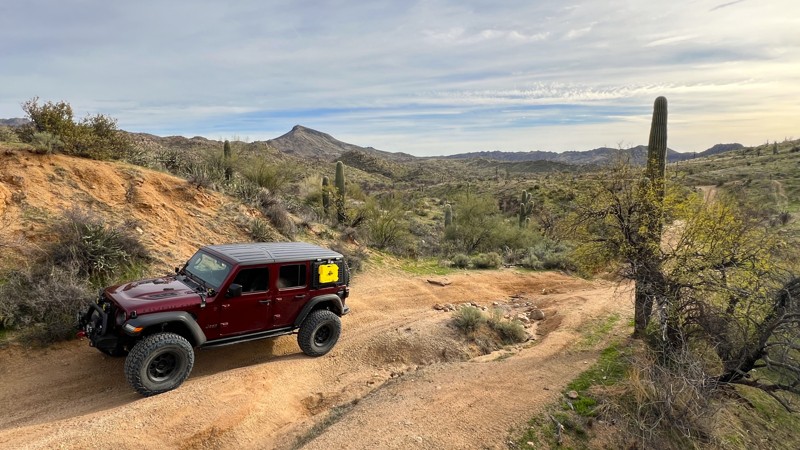
Nestled within the Tonto National Forest lies a paradise for offroad enthusiasts seeking a challenging trail run. The area is known for its rocky terrain, stunning vistas, and untamed wilderness.
However, if you're looking for a more leisurely experience, a shorter and easier trail is available. FR 11 allows you to explore the area without navigating the more difficult trails.
For those interested in historical experiences, FR 11 is an excellent option. This trail takes you back to when Highway 87 had not yet been constructed, offering a glimpse into the past of what it would have been like to travel through the desert mountain wilderness. The first trail marker is labeled "Old Highway 87," which further adds to the intrigue of the journey.
The area has a rich native American history. The Yavapai and Tonto Apache tribes left their mark on the land. American trappers and miners also frequented the area during the 19th and 20th centuries, leaving remnants of their presence behind. Today, the area is teeming with Arizona's signature flora and fauna, including the palo verde bush, prickly pear cacti, roadrunners, quail, and coyotes. The area's sights, sounds, and smells will leave you feeling invigorated and connected to nature.
Updated: 02/05/2024
Cedar Flat Road
Camp Verde, Arizona
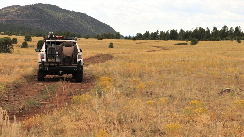
Cedar Flat Road is a tale of two trails. On its southern end, the well-behaved road climbs out of the desert to offer camping with views, driving with views and hiking with views. Looking west, the sacred red rocks of Sedona are below you. Mingus Mountain tents horizon due west. Farther south the rugged Bradshaws stand out above the haze. North you catch glimpses of the San Francisco Peaks towering above Flagstaff. Closer in you get a look deep into the canyon of West Clear Creek and Blodgett Basin. The tall stalks of century plants stand sentinel over prickly pears with their crimson fruits. Ocotillo spread their firesticks skyward along the roadside. The daggers of the agaves make you watch your step. And then Cedar Flat Road throws a temper tantrum, all be it a beautiful outburst. The finely graded road becomes a rock-strewn two-track weaving among junipers, testing your tires, your suspension, your kidneys, and your ability to pick a good line. But the rugged beauty of the place, the sudden openings onto wide tree-dotted savannah grasslands, and a short stretch through a pristine pine forest make you forget to keep your eyes on the trail. Apache Maid Mountain begins to appear larger and larger until it looms over the mesa. Too soon, it seems you reach the junction with Apache Maid. You'll want to stop and catch your breath. Nice is good. Naughty is fun. Why not have a little of both?
Updated: 07/06/2024
Fry Canyon Trail
Kachina Village, Arizona
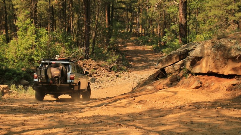
Situated in the vast ponderosa pine woodlands of the Coconino National Forest, Fry Canyon Trail offers peaceful serenity only minutes from downtown Flagstaff. The numerous designated shady campsites on the western end of the trail make excellent base camps for exploring the area while still providing easy access to all the services found in Flagstaff. The high country abounds with elk, deer, and wild turkey, often seen when hiking one of the many area trails. The road's namesake, Fry Canyon, is a favorite with the canyoneering and climbing crowd. Beautiful red rock Sedona is just a 30-minute drive south through the scenic Oak Creek Canyon. There are plenty of forest roads to explore through the high country pinelands and wide-open prairies. There are even a few gnarly trails to provide offroading challenges for those so inclined. Whatever you are looking for, it isn't far away from the Fry Canyon Trail.
Updated: 09/15/2026
Walnut Canyon
Ray, Arizona
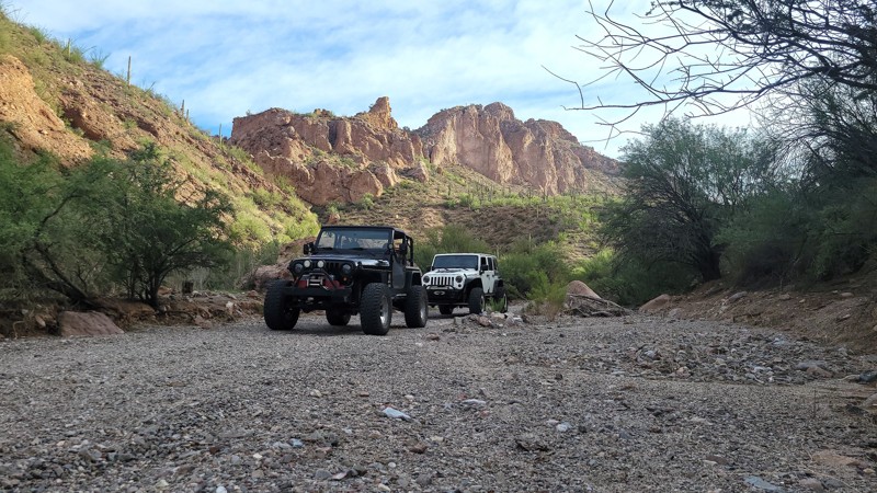
The Walnut Canyon area is one of Arizona's most well-preserved and scenic regions, still easily accessible by 4x4 vehicle. The scenery includes towering canyon walls, some as high as 800 feet, and numerous narrow canyons you can hike for days. There are sporadic willows and saguaros that line the trail. Wildlife includes released bighorn sheep, black bear, and even mountain lions. The trail ends at the Rincon Road starting point and the entryway to incredible backcountry scenery.

Updated: 06/10/2026
Bulldog Canyon 3554
Apache Junction, Arizona
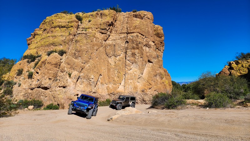
Located within the Bulldog Canyon OHV Recreation area in Tonto National Forest, 3554 is an almost beach-like oasis in the desert. This scenic drive connects FR 10 and Bulldog Canyon to Usery Pass by traveling along a dry creek bed filled with coarse sand. The sand is well-traveled and thus very packed but can quickly become a deep sand pit outside the main tracks. The wash passes several towering rock faces that make great photo backdrops. There are numerous areas along the wash used for dispersed camping. However, those campsites could flood during a moderate rain event. As the road exits the wash and treks westward towards the Usery entrance, it becomes a mix of hard granite and packed dirt. Due to Forest Order 03-12-03-22-34, camping is prohibited within 1 mile from the Usery steel gate until at least January 12, 2026.
Most of this road can be completed with a high clearance 2WD vehicle, but 4WD drive is highly recommended for the sandy wash section.
A Tonto National Forest Off-Highway Vehicle Permit is required to travel this road.
Updated: 06/05/2022
Ruby Wash
Wickenburg, Arizona
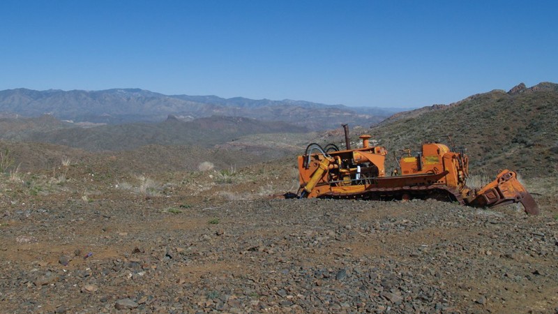
The solitude and a rock-crawling adventure within an hour of Phoenix, Arizona, make Ruby Wash a great place to explore and spend the day. Located in the Buckhorn Mountains, this trail offers a gateway into an entire network of trails with various difficulty levels and optional routes. The area is filled with old mining activity, with the most prominent being the Independence Mine which started its operations nearly 100 years ago in 1919. The entire off-road trail is interesting and challenging, even for modified vehicles. The route has a little bit of everything from sandy washes, rocks, boulders, canyons, and hill climbs.
Updated: 07/02/2026
Boriana Mine
Yucca, Arizona
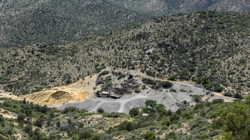
A short drive from the sometimes hot bleak desert floor, Boriana Mine Trail is a part of the Arizona Peace Trail. Boriana Mine Trail will lead to higher ground with cooler temps, juniper, and pine trees swooshing in the breeze. The concrete foundations and ruins of Boriana Mine are interesting to walk around and explore, plus there's a year-round spring with a pond of crystal clear water, goldfish, and a beautiful view over the valley floor over a half-mile mile below. Boriana Mine was the second-largest tungsten mine in the US operating intermittently from 1915 to 1980. The underground workings consisted of 12 levels and nearly 3 miles of drifts! Secondary minerals from this tungsten mine included gold, silver, and copper. An article with photos of this mine in operation and more detailed history can be found here.
Updated: 12/12/2023
Moss Wash Trail
Kingman, Arizona
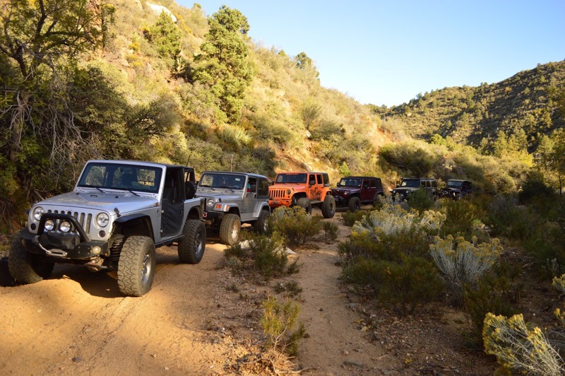
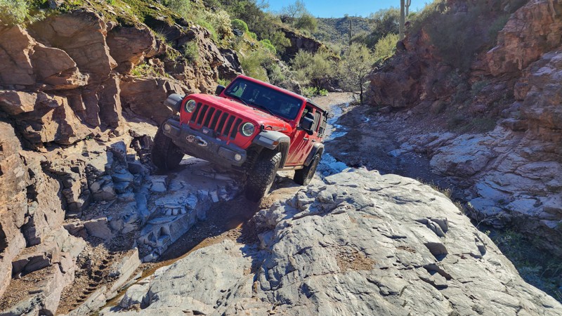
Situated one hour from Kingman, Arizona, the Moss Wash off-road trail offers just about everything anyone could want in a southwestern trail: waterfall obstacles, whoop dee doos, hill climbs, shelf roads, Mohave Desert landscape, a high mountain forest and American mining history. In addition to the Moss Wash trail, there are hundreds of miles of nearby trails that offer days of exploring and camping opportunities.
The trail gets its name from the wash it follows, but it could easily be called the Gold King Mansion Trail. The Gold King Mansion is directly on the trail and is a historic, two-story concrete building that looks like it should be on South Beach in Miami. It was built in the late 1920’s by the Gold King Corporation which used the ornate structure to entertain wealthy investors and to house the mine foreman. Gold, silver, copper, and lead were all found in the area. The great stock market crash of 1929 was the demise of the mine and mansion, however, with an aggressive four-wheel drive vehicle you can explore its remnants.
Updated: 06/05/2022
Orville's Loop
Florence, Arizona
Twisting its way through a rocky and narrow canyon, Orville's Loop is an exhilarating and scenic roller coaster ride through the Sonoran desert. Dense desert vegetation hangs overhead off the tall canyon walls. During winter, water often trickles down the canyon's walls, pooling at the base of the rocky waterfall you will have to climb. The waterfall is Orville's Loop's standout obstacle, a favorite with local crawlers. The climb up the steep and super narrow ledge road provides spectacular panoramas before the trail merges with Jack Handle.

Updated: 03/01/2024
McPherson Pass
Quartzsite, Arizona
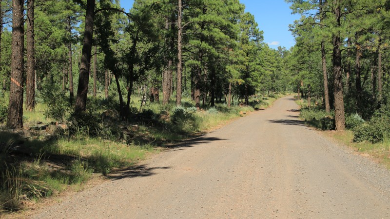
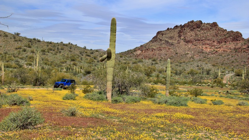
McPherson Pass connects the broad King Valley with the very flat Castle Dome Plain by crossing the low but ruggedly beautiful Castle Dome Mountains. The entire trail is inside the remote and sparsely visited Kofa National Wildlife Refuge, the second-largest wilderness area in Arizona. The trail crosses broad scenic valleys, pushes through a sandy wash, and climbs through a majestic mountain pass. The best part of all that is that along the way, you are likely to encounter more desert bighorn sheep than people. The Lower Sonoran Desert of this part of southwestern Arizona receives very little rainfall. That doesn't mean life is not abundant here. Both plants and animals have adapted to the harsh environment. Cacti include the stately saguaros and spindly ocotillo called fire sticks by natives for their bright red flowers, which seem to pop out purely randomly. Several species of cholla cactus call this area home. The teddy bear cholla looks cute, but the spines stick like velcro on steroids and hurt like Hades. Owls, various hawks, doves, and hummingbirds abound. Small mule deer hang close to the few available water sources. Coyote serenades at night are common. But the reclusive desert bighorn sheep reign supreme here. The entire purpose of the Kofa NWR was to preserve habitat for the surefooted mountain denizens. Keep your eyes on the slopes, and you might catch a glimpse of a few of them near McPherson Pass.
Updated: 05/20/2026
Rim Road East
Forest Lakes, Arizona
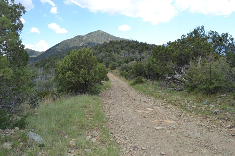
Rim Road East runs over 55 miles along the edge of the Mogollon Rim from Forest Lakes to Showlow. The trail's western end is a popular camping destination and is busy on summer and fall weekends. There are scattered dispersed campsites along the trail and connecting forest roads. Rim Road East passes the Black Canyon Rim Campground, the Gentry and Deer Springs Lookout towers before ending ingloriously at a gate where the trail enters the Fort Apache Tribal Lands. Much of the road skirts the northern edge of the tribal lands.
The trail shows evidence of the 2002 Rodeo-Chediski Wildfire, at the time Arizona's worst recorded wildfire. Starting as two man-caused fires, the merger caused an enormous fire fed by dry conditions and strong winds. Most of the communities along the Mogollon Rim were evacuated, with over 400 homes destroyed. The fire was largely responsible for changing forest management with an emphasis on prescribed burns and forest thinning.
The western end of the trail is mellow with a packed dirt surface. The central portion of the trail is bumpy with embedded rock. And the trail's eastern section has extremely deep ruts and should not be attempted after heavy rain.
Updated: 05/02/2023
Rice Peak FR 29
Oracle, Arizona
Nestled in the northern foothills of the Santa Catalina Mountains is one of the truly outstanding and challenging trails near Tucson. The trail begins in a lush riparian area and slowly climbs up and out of the canyon onto a ridge, increasing altitude until you reach the hair-raising steep hill climb leading to the summit. The serious obstacles have been removed by trail maintenance, rendering the trail less challenging. You should be able to complete this trail in under two hours. If you love Arizona scenery and don't mind a little effort to get to it, this is the trail for you!

Updated: 03/02/2024
Engesser Pass
Quartzsite, Arizona
Engesser Pass is likely the most remote trail in Arizona based on travel distance to the nearest human habitation. Engesser Pass traverses the midsection of the beautifully rugged Kofa National Wildlife Refuge, which covers over 1,000 square miles with not a single human inhabitant. The 2,000 square miles of the Yuma Proving Grounds cradle the bottom of the refuge. No one lives there either since the Proving Ground is where the Marines test things that explode. Approximately 3,000 square miles of uninhabited BLM land lie east of the refuge. That is 6,000 square miles. Four states, Hawaii, Rhode Island, Delaware, and Connecticut, are smaller. In all that space, no human resides full-time. No light bulb burns at night. Very few roads exist. And in the middle of all that splendid remoteness is Engesser Pass. When traveled east to west, Engesser Pass begins as an easy two-track on a ridgeline above the vast saguaro-studded Palomas Plain to the east. Mountain ranges sawtooth the horizon in every direction, near and far. Ocotillos reach skyward, flaming red flowers on the ends of their long tendril shafts. Thickets of thorny silver cholla scatter their pin cushion droppings to painfully attach to the unwary. To the west looms the multi-hued sawtoothed Kofa Mountains. Before long, Engesser begins its slow rise to the mountain pass that gives the trail its name. Cutting through the ruggedly beautiful Kofa Mountains, the view westward from the pass is unsurpassed. The trail dives steeply to join Engesser Wash, brushy and sandy, as it slolams down and out of the mountains. Turning northward, Engesser parallels the colorful west side of the ancient volcanic Kofas. To the west across the broad King Valley lies the Castle Dome Mountains, the round spire of Castle Dome clearly identifiable. Engesser Pass ends near the King of Arizona mine, whose initials gave became the name of the area. It is far more likely that you will see a desert bighorn sheep, the reason for the refuge's existence, or perhaps a tiny kit fox than it is you'll see another human on your traverse of Engesser Pass. Solitude. Beauty. Good wheeling. All fine reasons to explore one of Arizona's most remote trails.

Updated: 06/23/2024
Behind the Peaks
Flagstaff, Arizona
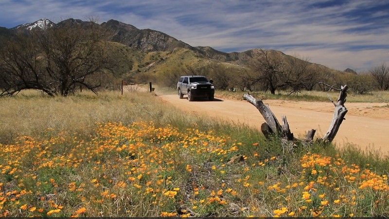
Behind the Peaks is a scenic gem accessible by all kinds of vehicles! In the Spring, there are alpine meadows and wildflowers aplenty. The Fall brings glorious golden aspen on the slopes of the San Francisco Peaks, which dominate the skyline. You’ll have better views of the San Francisco Peaks along this route than anywhere else in the Flagstaff area and without the crowds. This route also provides access to major hiking trails like Bear Jaw, Abineau, Alto Spring, and the Arizona Trail. Like most of Flagstaff, this area is also great for mountain biking.
Updated: 04/29/2024
Box Canyon Road
Sonoita, Arizona
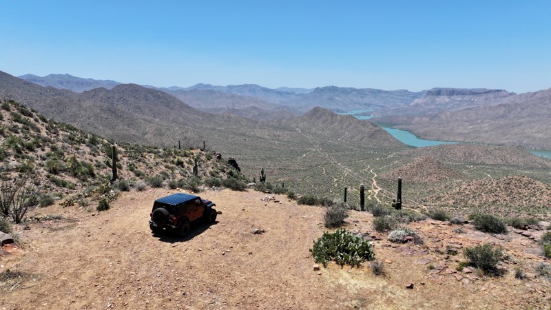
Box Canyon is a visual delight, assuming you like shelf roads, mountain views, and distant vistas. The road cuts across the ruggedly handsome Santa Rita Mountains via Box Canyon's deep pass before breaking out with long views across Green Valley and the distant Twin Buttes Copper Mine. The slopes in the pass are thick with spindly ocotillo cacti. Called "fire sticks" by natives, the long branches of the ocotillo lay gray and dormant much of the time before quickly and randomly growing small green leaves on the branches and firey red blossoms at the top. Much of the trail is in the vast Coronado National Forest, with the eastern end on Arizona State Trust Land set aside as the Santa Rita Experimental Range and Wildlife Area.
The trail ends on the paved Madera Canyon Road, a lovely drive and a bird-watcher's favorite.
Updated: 06/16/2026
Two Bar Ridge Trail
Roosevelt, Arizona
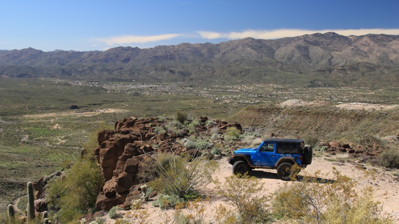
Within a stone's throw of the Phoenix Valley, the Superstition Mountains are full of opportunities for adventure. The mountains are rugged and unforgiving while still having a strong and mysterious draw on the adventurous type. While traveling along the historic Apache Trail, you will be able to access different regions that offer a variety of desert experiences. There are sky-high, sheer cliff canyons that you can explore for years. Three wonderful lakes are traversing through the Salt River region. During the scorching hot summer months, Canyon, Apache, and Roosevelt lakes offer a wonderful reprieve from the desert heat. Two Bar Ridge Trail is an old power line access road that eventually connects to a beautiful ridgeline trail, high above the Burnt Corral region. The trail will challenge some stock-type vehicles with its steep and loose hill climbs, but it rewards you with of the best vistas of all the trails in the region. You'll pass a few points along the trail where you can see for miles. Once at the end, you are in a very secluded area that offers unforgettable nighttime interstellar views.
Updated: 06/04/2026
Moores Gulch
Black Canyon City, Arizona
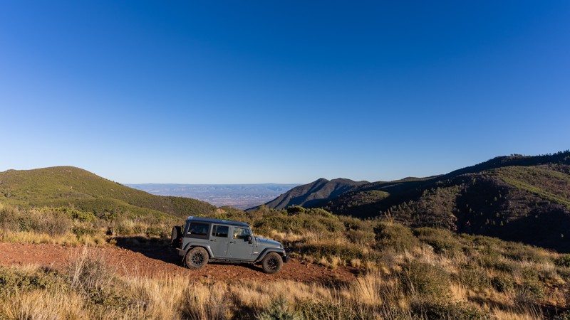
Moores Gulch runs from AZCO Mine Road in the BLM's Table Mesa Recreation Area through Arizona State Trust Land into the Tonto National Forest, ending at a scenic overlook above Black Canyon City. The trail drops into the ordinarily dry Moores Gulch and crosses under Interstate 17. Stately saguaro and thickets of mesquite line the Moores Gulch drainage. The trail turns northeast climbing steeply out of the drainage following ridgelines along the western slopes of the rugged and nearly impenetrable New River Mountains. A gate and signage mark the trail's entry into the Tonto National Forest. Cattle graze almost the entire length of the trail. Please close the gates along the trail.
The trail is rocky, with numerous significant climbs and descents approaching 20 degrees. Low-range gearing is helpful. Several deep washes are prone to flash flooding after significant precipitation.
There are three campsites along the trail in the Table Mesa Recreation Area. Small campsites are scattered along the remainder of the trail. Camping in the Arizona State Trust Land segment requires a permit.
Updated: 09/09/2026
Allen Spring - Mingus Mountain
Jerome, Arizona
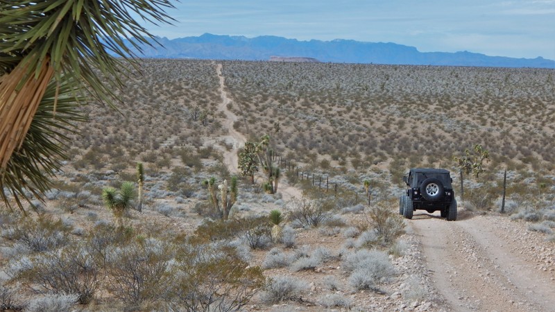
Allen Spring, FS 413, runs through the Prescott National Forest from near the top of Mingus Mountain along its southwestern slope to connect with will take you around the mountain and connect with Copper Chief, FS 493, near the historic Copper Chief Mine. Approximately one-half mile before the intersection, the Copper Chief Spring trickles down the hillside. The trail is primarily forested but occasionally opens to epic views of Sedona, Flagstaff, and Cottonwood. The trail crosses a small water crossing at 34.67079, -112.14124. The trail is mostly dirt but does have manageable rocky sections. Parts of the trail are along narrow shelves. There are several dispersed campsites, a few large enough for groups.
Please note: Maps show FR 413 continuing toward Jerome after the FR 493 intersection. However, this section of the trail is been gated and closed indefinitely.
Updated: 06/05/2022
Thelma and Louise Overlook
Littlefield, Arizona
Who remembers that iconic scene from that famous movie? The one where they jumped off the cliff in the old Thunderbird. Well, this isn't that spot; but it sure is a neat place to check out anyway. The local wheelers and community have made this overlook very unique. It offers spectacular views of the surrounding landscape, Beaver Dam Wash far below, and a fence full of old bras. Yep, you read that right; old bras stretch for 50 yards, all hanging along the fence line. Adding this side loop off of Sand Hollow Wash Road makes for a fun little detour and a memory you're sure not to forget.
Updated: 03/04/2024
Copper Bottom Pass
Quartzsite, Arizona
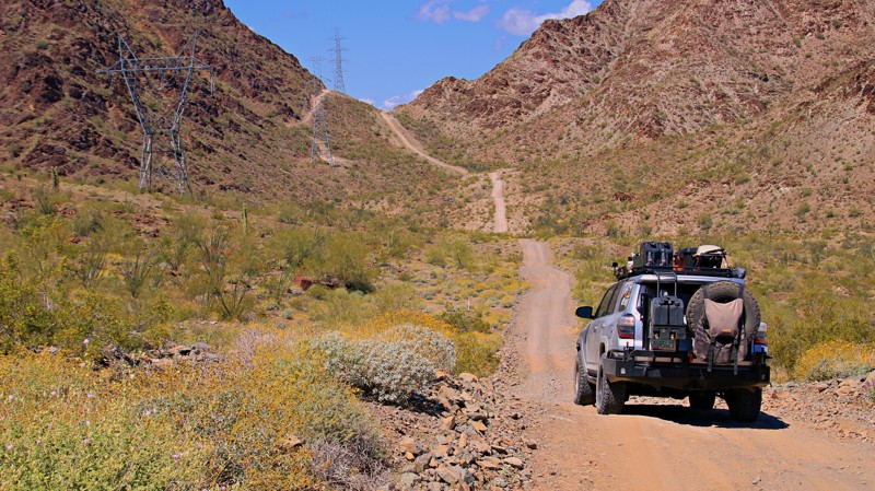
Trails that distantly wind out in front for miles disappearing briefly into gullies or hiding on the backsides of hills only to emerge even farther away, snaking seductively up the side of a distant ridgeline until it blends into the far horizon always seem to beckon me more urgently than those hidden away in deep forests or on land so flat that no detail beyond a stone's throw is evident. That type of trail is a seductress, offering you a distant glimpse of her charms, a hint of adventure and treasure if you will devotedly follow her labyrinthine path. Copper Bottom Pass sings that siren song of adventure. From the start, you see the thin white ribbon of trail winding and coiling up the slopes of the Dome Rock Mountains. Cunningham Mountain sits near the high pass with a crown of antennae, a beacon to guide you, staring down as you climb toward the trail's summit. A desert floor of hard igneous gravel cast off the mountain slopes in the erosion of a few million years is covered with ocotillo, cholla, ironwood, and brittlebush cover. They enthusiastically ignore your passing. Copper Bottom sits between two passes of near equal elevation, a bowl atop a mountain range. Copper Bottom Mine on the north side of the bowl is gated off, but the shaft entrances and old structures are easily visible. The two passes offer long views, east over La Paz Valley and into Kofa, west to the green belt of the Colorado River and California. The only wart on this beauty is the powerline that climbs into the pass alongside you. Ignore it and enjoy the plentiful charms and adventure on this winding seductress of a trail.
Updated: 08/18/2026
Maggie Mine Road
Black Canyon City, Arizona
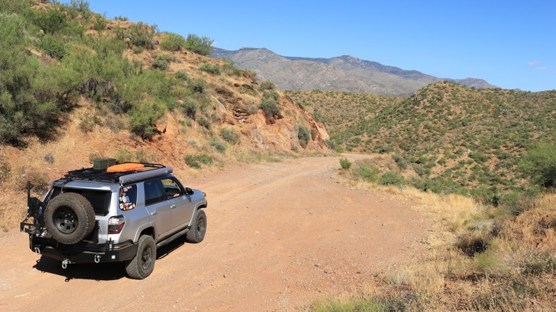
With more curves than a 1940s-era pinup model, Maggie Mine Road snakes upwards into the foothills of the Bradshaw Mountains. Along the way, it passes its namesake, the Maggie Mine, a small gold operation first prospected in the 1870s. Today it sits on private land and is not open to visitors. The rutted and rocky trail skirts gardens of prickly pear with their red fruits and the very thorny silver cholla. Forests of stately saguaros stand like so many sentinels, always on watch over their desert. To the west, the handsome Bradshaw Mountains dominate the jagged horizon. Glance east now and then, and you will see traffic on the interstate. Smile. They aren't having as much fun as you.
Updated: 09/16/2023
House Mountain Trail
Sedona, Arizona
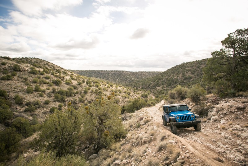
This 12 mile out & back trail is a fantastic route to take during the busy traffic months, it is just south of Sedona and a bit of a locals secret! After heading 6 miles up to the top of House Mountain, you will drive right up to an amazing view of the Sedona red rocks from a very unique "back side" perspective, this is one of the few trails in the area that features an incredible 360 degree view of the surrounding towns. This is a great starter trail before heading into Sedona and tackling some of the tighter, more advanced trails. It is fairly smooth for the first section then becomes rocky with small shelves and ups and downs through many wash crossings.
Updated: 06/05/2022
The Desert Bar
Parker, Arizona
Leave it to Arizona to have what could easily be the coolest desert destination in the U.S. The Desert Bar, aka "Nellie E Saloon," is just what it sounds like, a bar in the middle of the desert. But this isn't any old bar.
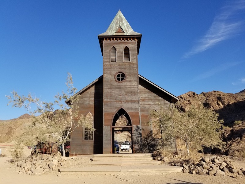
In 1975, Ken, a self-described hippy and societal dropout, bought an old mining claim with a few dilapidated buildings. He soon noticed numerous ATVs and Jeeps driving past on weekends. Acquiring a liquor license from a defunct local establishment, Ken began selling beer from a small three-walled trailside shack out of a cooler. Being an industrious hippy, Ken began building outlandish structures on the old mine claim, including a church. Solar power and batteries replaced the ice cooler, and the rest, as they say, is history. Today the mining claim looks a lot like Thunderdome from the Mad Max movies and draws huge weekend crowds. There's usually a band, food, and various libations. And it is still completely off-grid.
The surrounding desert boasts great wheeling and rock crawling. And then there's this totally crazy place to kick back and enjoy. Who offroader could ask for more?
Updated: 08/05/2026
Vulture Mine Road
Tonopah, Arizona
While the actual Vulture Mine is well north, the unpaved remainder of that road runs through the heart of the ruggedly beautiful Belmont Mountains, a seldom visited portion of south-central Arizona. The trail starts in the north as a nicely maintained dirt road that services the Belmont Pit, a rock quarry. Between the quarry and the intersection with Belmont Mine Road, the road is easily traveled rough dirt, crossing numerous sandy washes. The northern trailhead has two large staging areas.
The road deteriorates south of the intersection with Belmont Mine Road as it crosses a rough pass through the mountains. There are several steep climbs with loose rock and a narrow off-camber shelf road obstacle. The trail precariously tilts 28 degrees down the side slope crossing the obstacle. This section of trail is not suitable for full-width vehicles. Use Belmont Mine Road and W. W. Enterprize Mine to bypass this challenging section of trail. Vulture Mine ends in the south at Canal Road.
Abundant spring rains bring colorful wildflowers to the austere Belmonts. Look for the rock window on the west side of the trail just south of the intersection with Belmont Mine Road.
The northern 6 miles of the trail host abundant large flat campsites suitable for groups, large rigs, and toy haulers.

Upgrade your Membership
Unlock all of the details on every Trail Guide and Scout Route.
Start a 7-day Free TrialCommunity
Partners

