







By clicking "ACCEPT", you agree to be the terms and conditions of each policy linked to above. You also agree to the storing of cookies on your device to facilitate the operation and functionality of our site, enhance and customize your user experience, and to analyze how our site is used.
Arizona Off-Road Trails
373
Total Trail Guides 359

4679
Detailed Waypoints 676
Try a Free 7-Day Trial and unlock it all
Start a Free Trial Most Recent Trail Reviews
No Rating
Open
Visited: 09/23/2026
Gets a little technical at the end but the difficulty is spot on.

KR
Keith Ringiesen
Rated 4/5
Open
Visited: 09/22/2026
Hard pack, easy forest service road that is a great back way to the North Rim of the Grand Canyon.

Tyler D’Hulst
Rated 4/5
Open
Visited: 09/22/2026
Spring Canyon is a beautiful drive. We didn’t go out to the cabin but used this western section of road coming back from Crazy Jug

Tyler D’Hulst
Rated 4/5
Open
Visited: 09/22/2026
We took this out to Crazy Jug. The northern section is hard packed forest service road. Not difficult. Very scenic drive through the ponderosas.

Tyler D’Hulst
Rated 5/5
Open
Visited: 09/22/2026
View point is spectacular! Trail was easy going out, no obstacles at all. Saw a Toyota Camery at the viewpoint.


Tyler D’Hulst
Rated 3/5
Open
Visited: 09/22/2026
An alternative route out to Crazy Jug Point. It’s easy and can be scenic in areas. I’d recommend West Ryan out to Crazy Jug though.
Tyler D’Hulst
Rated 3/5
Open
Visited: 09/22/2026
A quick connector trail through the burn patch.
Tyler D’Hulst
Rated 5/5
Open
Visited: 09/20/2026
Leviathan Mine trail is a full day trip. Though it is only 20 miles in length the travel is slow and rough. Majority of the trail you will be going between 5-10 MPH. Then once at the end it connects w...



Eric Gartin
Official Crew
Rated 4/5
Open
Visited: 09/19/2026
Simple road, well graded today. Many mountain bikers coming down from the West out of Breezy Pines. Not too many people out until approaching Senator Hiway. We went East to West as I think thats a bet...



Jeff Burnett
Rated 3/5
Open
Visited: 09/19/2026
The trail itself is not spectacular, it's pretty flat across the plains. However, driving up to the overlook and seeing a huge gaping hole in the ground is a great juxtaposition to the flat trail. The...
Tyler D’Hulst
Rated 3/5
Open
Visited: 09/19/2026
A nice trail ride from the main road down off the plateau. It's graded forest service road until the switchbacks. The switchbacks themselves are not difficult, road is not graded. This section has bee...
Tyler D’Hulst
Rated 3/5
Open
Visited: 09/18/2026
The end of the trail is not well marked, and can cause confusion. Also, vehicle passes are required for all backcountry routes within the Lake Mead National Recreation Area.
Eric Gartin
Official Crew

Ted Whisler
No Rating
Open
Visited: 09/17/2026
Nice ride west side a little rocky but rating is true to #2


Ted Whisler
Rated 3/5
Open
Visited: 09/15/2026
A nice drop off the plateau heading towards Marble Canyon. Not a difficult road. Road is weathered but not challenging.
Tyler D’Hulst
No Rating
Temporary Closure
Visited: 09/15/2026
Road closed due to multiple washed out wash crossings after the turn off to go up the mountain. "Road Closed" sign put out by BLM on trail.
Tyler D’Hulst
No Rating
Temporary Closure
Visited: 09/15/2026
After the turn off to head up the mountain there are multiple washed out wash crossings. A "Road Closed" sign has been put out by the BLM.
Tyler D’Hulst

Ben Ruddell
Official Crew
Rated 4/5
Open
Visited: 09/14/2026
Bogles Ranch Road is a great Sunday afternoon drive type of dirt road that climbs up in elevation and gives some spectacular views of the surrounding area. The first half passes through State and Priv...


Eric Gartin
Official Crew
Ben Ruddell
Official Crew
Rated 3/5
Open
Visited: 09/14/2026
Antares Road is an excellent way to travel from Route 66 to the eastern portion of the Lake Mead National Recreation Area. This wide county road is well maintained with minor washboarding, most of whi...


Eric Gartin
Official Crew
Rated 3/5
Open
Visited: 09/14/2026
Hackberry road is a wide dirt road with minimal erosion damage and washboarding. There are a couple of larger washes that cross Hackberry road creating wide stretches of loose sand which can cause iss...


Eric Gartin
Official Crew
Rated 3/5
Open
Visited: 09/13/2026
This is a very rough, rocky, & slow going trail. Expect around 4+ hours for the trail & another hour to get the highway. One of those trails I'm happy I did but I wont be back personally. High clearan...

Brandon W
No Rating
Open
Visited: 09/12/2026
I think the rating is spot on. The ruts and washouts at the beginning are not as bad and if you hug the inside of the shelf road they can be avoided. The middle part is same general sandy wash with ov...



Greg Page
Rated 4/5
Open
Visited: 09/11/2026
Ran this trail as part of a larger loop. Trail is in great shape. Easy for standard 4x4 with no lift. Passengers can do it until maybe the very end by the lake where the road gets rocky and washed out...


Jeff Burnett
Rated 5/5
Open
Visited: 09/10/2026
This is one of my favorite scenic trails in the area. The trail is easy to travel, but does have some optional short trails that will test your vehicle. The views from the Grand Wash Cliffs of the Hua...


Eric Gartin
Official Crew
Rated 3/5
Open
Visited: 09/07/2026
This trail by itself is nothing special. It is mostly used as an access road to get to the more technical trail such as Homecourt, Twister, and Waynes World. This is a great trail for the beginner to ...


Eric Gartin
Official Crew
Rated 3/5
Open
Visited: 09/07/2026
This trail is an enjoyable alternate route when traveling on Blake Ranch Road (7163). The trail is easy with only a handful of spots with erosion damage. The few established camping sites appear to n...


Eric Gartin
Official Crew
Rated 5/5
Open
Visited: 09/07/2026
Ran this trail from Boynton Pass Road to Loy Butte Road (opposite direction from what is listed). Ran into a few rental ATVs and a couple of Jeeps heading the opposite way. This was a fun trail wit...



Daniel Macioce
Rated 5/5
Open
Visited: 09/07/2026
This trail was a lot of fun, plus the views were amazing. I ran the trail in the order posted, starting at the south trailhead and finishing at the heritage site. Past a motorcycle, a few jeeps and a...


Daniel Macioce
Rated 4/5
Open
Visited: 09/07/2026
Nice trail, ran West to East. For some reason the map shows this a a one-way trial, East to West. That is not the case, it is a two way trail. Was pretty washed out starting around mile 12. Plenty roc...


Jeff Burnett
No Rating
Open
Visited: 09/06/2026
New trail for me. You didn’t know what it would throw at you around every corner which is why you try to find new trails or old forgotten ones
KB
Kory Burden
Rated 5/5
Open
Visited: 09/06/2026
The trail is no joke—steep, narrow, and technical enough that you’ll want to be comfortable with off-camber shelf roads, rocky terrain, and washouts that will test your vehicles articulation. The rew...



Bobby Rumbaugh
Official Crew
Rated 5/5
Open
Visited: 09/06/2026
Fun trail if you don't want to do pyeatt draw itself. Ran this trail 3yrs ago and definitely a little more erosion but, still any truck or suv with good factory ground clearance can do it. From previo...
JM
James m
Rated 4/5
Open
Visited: 09/06/2026
Ran this trail from I-17 to Sedona. Extraordinary views descending into Sedona. As others have noted, there are lots of rock on the trail, making it slow going. Passed a large number of Pink Jeeps ...


Daniel Macioce
Rated 4/5
Open
Visited: 09/05/2026
This one definitely changed over the last few years. The southern section has some legit, steep, off-camber sections. YOU NEED experience, backup, and a capable vehicle on this one now. It's not supe...


.jpg)
Bobby Nelson
Official Crew
Rated 4/5
Open
Visited: 09/05/2026
Another amazing time on this scenic crossover. We came in from Walnut Canyon and finished out on Price Road after about 6 hours. A challenging and hot day for the old TJ. Rincon Road has evolved into ...


Bobby Nelson
Official Crew
Rated 4/5
Open
Visited: 09/05/2026
We started exactly at sunrise to try and beat the heat. We planned to crossover to Box Canyon and out on Price Road. It ended up taking us 6 hours, even with all the photos and filming we did. A chall...


Bobby Nelson
Official Crew
Rated 5/5
Open
Visited: 09/04/2026
We recently ran Four Peaks after the monsoon rains. Here’s what we found and what to expect if you’re planning to run it. Have a GR8 day!

Jeep 4 Dirt
Rated 5/5
Open
Visited: 09/04/2026
Breathtaking views. Definitely don't rush through the trail. Devil's staircase was a bit slippery but awesome. A few tight stops here and there, but a trail that's a must on anyone's to do list.



Christopher Bradley
Rated 4/5
Open
Visited: 08/30/2026
Id say this is a 3.5 to 4 trail. There are some obstacles, but nothing you really need to think hard about how to approach. If you send your vehicle at it in 4 low you'll get through everything.



Justin Holsinger
Rated 4/5
Open
Visited: 08/28/2026
Rim Road (FS300) West to East. Very well groomed gravel forest road. Accessible by just about any vehicle thats not been lowered. Who does that anyway? Scenic views the whole route. Hard to believe on...


Jeff Burnett
Rated 4/5
Open
Visited: 08/28/2026
Not a bad road but it was crowded with sxs and vehicles towing campers. Hard to rate 5 stars for a busy road. Super easy any vehicle can do this. Part is paved near the freeway but the rest is gravel.

Tony Rockwell
Rated 4/5
Open
Visited: 08/28/2026
I rated 4 stars just due to the volume of sxs & camper trailers on the road.
Easy drive, any car can do this.
Ran from sheep springs to munds park, see other reviews for full route.

Tony Rockwell
Rated 4/5
Open
Visited: 08/28/2026
I ran Bar M in reverse to get to this trail. Then headed toward Casner Park Road. (See reviews I did on each of those)
Nice easy trail that is less rough than Bar M.
Nice drive through trees.


Tony Rockwell
Rated 5/5
Open
Visited: 08/28/2026
Very bumpy due to rock infused trail. A few larger rocks, 8-12” tall in places but most stock 4x4’s should be able to navigate around or over them. I would say any 4x4 with all terrain tires could nav...


Tony Rockwell
Rated 3/5
Open
Visited: 08/27/2026
Overall decent little trail; camped out near Committee Tank (not suitable for tent camping - too rocky). Nothing too technical but enough to keep things interesting. High clearance and good line choi...


Bill Ferguson
Rated 3/5
Open
Visited: 08/27/2026
Connector from FS801 (Rock Garden Loop) to FS09494F (Committee Tank Trail); yeah, it lives up to its namesake. Very rocky. High clearance and picking good lines are an absolute must. Car camped at...

Bill Ferguson
Rated 5/5
Open
Visited: 08/27/2026
Nice trail saw some deer it’s a little rough but overall was easy


M
Maddox
Rated 5/5
Open
Visited: 08/23/2026
Great little adventure for the day. Dirt road is pretty rutted up due to monsoons, but easily drivable. Lake itself is extremely low.
LL
Larry Lapp
Most Popular

Updated: 10/15/2024
Barnhardt
Deer Creek, Arizona
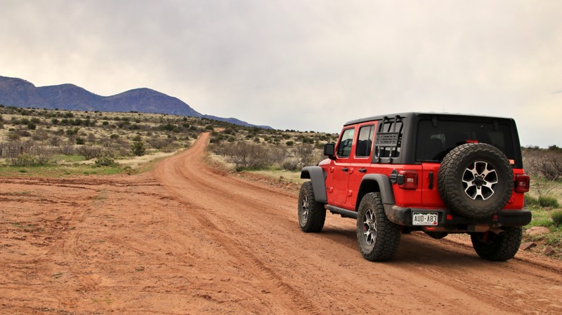
Barnhardt is an easy track crossing the Barnhardt Mesa from the Beeline Highway to a hiking trailhead leading to the eastern base of the rugged and austere Mazatzal Mountains. There are numerous campsites along the road, the best being closer to the mountains and offering better views. Most of the dispersed campsites have stone fire rings and ample level ground for any type of camping setup. Camping at the hiking trailhead is possible.
Updated: 04/10/2026
Superstition Twenty Six Hill
Gold Canyon, Arizona
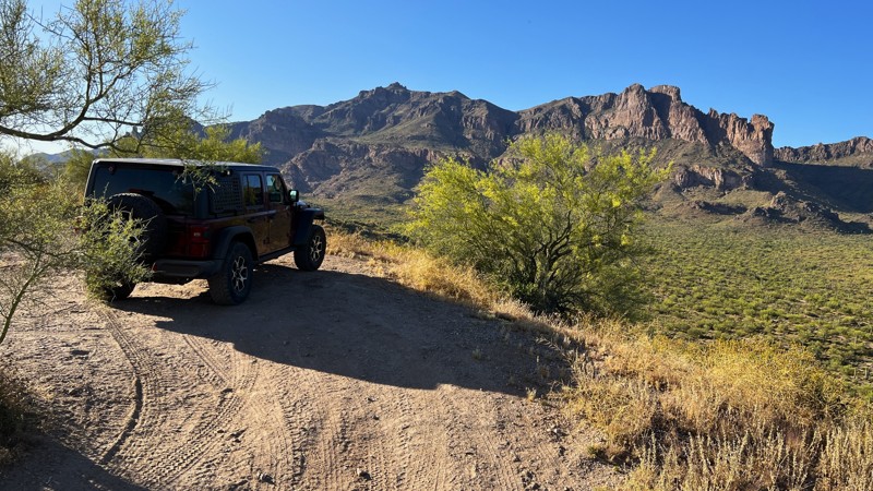
A steep hill climb to an amazing viewpoint waits for you on the north end of this trail. Picking the right line as you climb over several ledges and navigate the ruts in the road is an important task. A spotter could be helpful, along with low gear and a rear locker. Once at the top, take in the views of the Superstition Mountains. Golden hour is a great time to visit with your camera to capture images of the mountains and Saguaro-filled valley below.
This route also provides a few established, larger campsites. Bring your friends, as these have space for multiple vehicles and rock fire rings ready for your campfire.
This is Arizona State Trust Land. A recreational permit is required.
Updated: 05/20/2024
Blacksmith Canyon
Yucca, Arizona
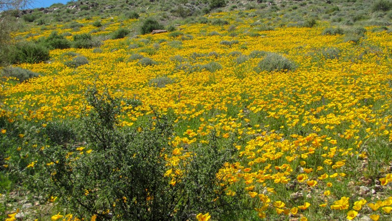
This short backcountry 4WD trail is located just over the mountains northeast of Lake Havasu City and runs up Blacksmith Canyon to an old corral and water tanks, and by some maps, Blacksmith Canyon Well. This is also the best spot on the northeast side of the Mohave Mountains to view the amazing wildflower blooms in the spring. During the seasonal bloom, you can expect to see Desert Poppies, Lupine, Desert Chickory, and Desert Globemallow. When in bloom, this is an excellent spot to gather the family, grab the camera and capture those amazing family pictures that will be happily displayed for years to come!
Updated: 01/19/2026
Secundino Loop
Arivaca, Arizona
Buenos Aires National Wildlife Refuge in southern Arizona was established in 1985 for the reintroduction of masked bobwhite quail and the restoration of natural landscapes and their native wildlife, including the Sonoran Pronghorn. The 118,000-acre refuge lies in a broad Altar Valley between the Baboquivari Mountains, with their prominent main peak in the west, and the lower San Luis Mountains to the east. In the 1850s, Pedro Aguirre, Jr. built a homestead here in 1864 and named it Buenos Ayres, or "good air," because of the constant winds. His ranch changed hands several times before being purchased to form today's wildlife refuge. The refuge's visitor center is located in the adobe ranch house.
The refuge has over 80 designated campsites identified by a numbered sign. Camping is free and allowed for 14 days in a 30-day period, but only in the designated campsites. Most campsites have a fire ring/grill. Site sizes vary from a single vehicle to large enough for multiple RVs and trailers. Most are suitable for tents.
Fuel and limited supplies are available in the nearby small towns of Sasabe and Arivaca.
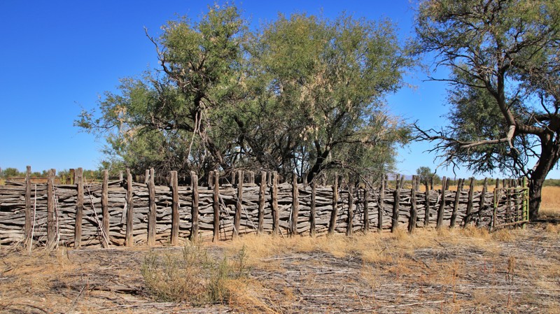
Secundino means second born in Spanish. Secundino Loop runs deep into the refuge to connect two outliers of the original ranch. The horseshoe-shaped route begins and ends on Highway 286. On the southern end, the trail passes an old corral made of mesquite logs. The northern end passes an abandoned bunkhouse. Both locations are far from the main ranch headquarters, today's visitor center.
The western ends of the horseshoe are graded dirt roads. The center of the trail is a weedy, rocky two-track that is heavily overgrown. Expect heavy pinstriping. A deep wash may require 4Low.
Campsite 16 sits along the southern leg of the horseshoe. The small lollipop site could host two vehicles. The site has level ground for tents and a fire ring.
Updated: 02/08/2026
Indian Springs
Camp Creek, Arizona
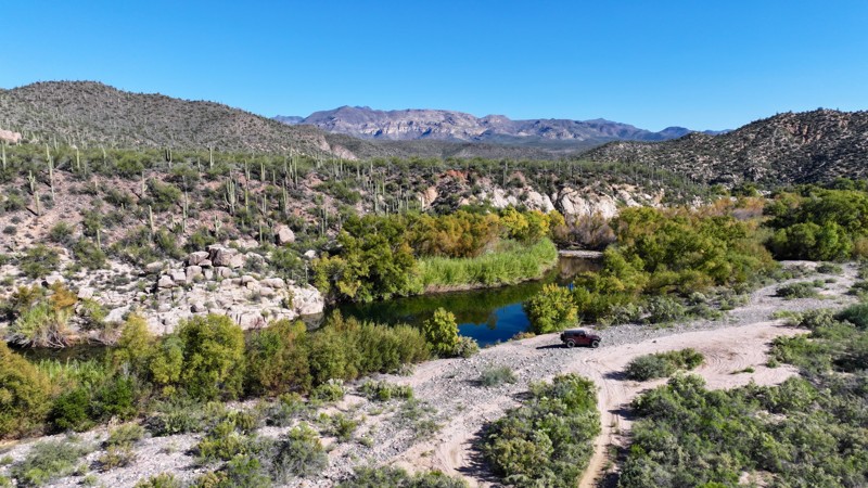
Located directly off Bartlett Dam Road, the Indian Springs Trail begins with a generous staging area able to accommodate 10–15 vehicles with trailers. An informational board provides permit requirement details and area context, making this a convenient starting point for groups. Indian Springs serves as a direct route to the Devil’s Hole area on the Verde River, a popular destination for outdoor exploration.
The trail starts out in a loose sand wash, gradually transitioning into hard-packed sand as elevation is gained. Just beyond the intersection with the St. Clair Corral Trail, drivers encounter the route’s most challenging section. This stretch features mild off-camber moments, small gulch crossings, and a series of whoops that will articulate your suspension and keep the ride engaging.
As the trail continues east, the terrain shifts back into smoother hard-packed sand, making for an easier cruise toward the river. Near its eastern end, the trail intersects with the well-traveled Telegraph Line Trail before descending to its terminus at the Verde River.
This riverside area is an excellent place to stop for lunch, cool off in the water, or set up camp for the night. Camping here is best suited for vehicle-based camping, as the majority of the ground consists of river rock. While there are a few small dirt patches suitable for tents, space is limited and fills quickly during busy seasons.
This trail is part of the Tonto National Forest St. Clair OHV permit area. A permit is required. Use the permit link above for more information.
Updated: 10/15/2024
Pinedale Ridge
Pinedale, Arizona
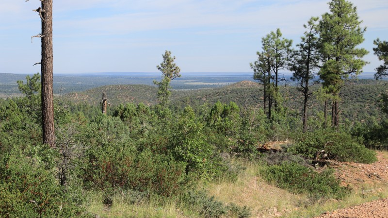
Pinedale Ridge runs south from Highway 260 to East Rim Road. The trail passes through pine forests. However, there are only limited existing dispersed campsites. The southern two miles of the trail are extremely rutted and very slick when wet.
Updated: 10/15/2024
Rogers Reservoir
Nutrioso, Arizona
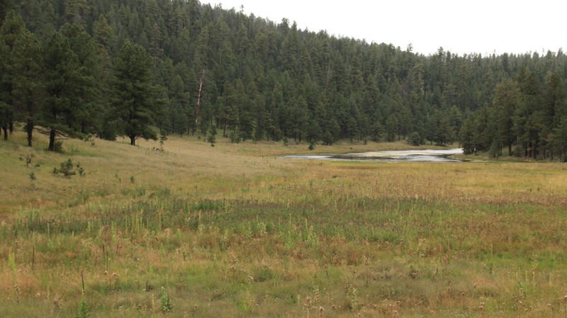
Rogers Reservoir begins near Nutrioso and runs 11.5 miles westward to Water Canyon Road. The road passes through several miles of a private residential area before entering the national forest. Besides traversing forests and open meadows, the trail passes by its namesake, Rogers Reservoir. It's more of a marsh than a reservoir. The easy, graded trail has some switchbacks with significant climbs and descents. The most challenging part of the road is the cows. This is open range, and cows are prone to run across the road right in front of you. Slow down when you see them roadside. The road appears to have no dispersed camping.
Updated: 06/29/2026
Promontory Butte
Christopher Creek, Arizona
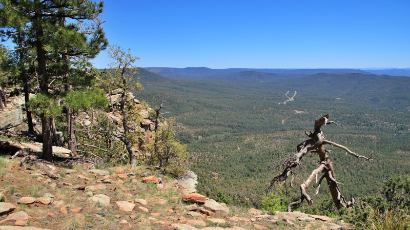
Promontory Butte, FR 76, is a lollipop off Rim Road with superb dispersed camping. Campers must remain within 300 feet of the road. Several sites on the lollipop portion offer the unique opportunity to camp right on the edge of the Mogollon Rim with unparalleled views. The trail is narrow, with deep ruts and loose fist-sized rocks. RVs and trailers are not recommended. The trail may be impassable when wet.
Updated: 04/24/2026
Turkey Creek
Sunizona, Arizona
History. Camping. Babbling mountain brook. Turkey Creek combines all three into a nice, drivable package.
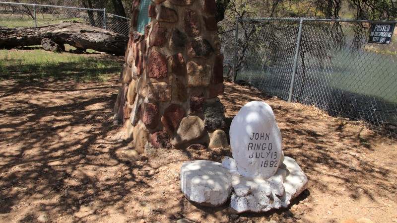
Contrary to the movies, Doc Holiday didn't shoot Johnny Ringo. Neither did Wyatt Earp. Possibly, Ringo shot himself. But we will never know. Johnny Ringo was found sitting in the fork of an oak tree, shoeless, with a bullet hole in his right temple. The coroner ruled it a suicide, but locals doubted that. But Ringo had too many enemies to narrow it down, so the mystery remains. Ringo was buried where he fell. Today, anyone can visit Johnny Ringo's grave, even though it is on private property. The owner has fenced a walkway to the site. Just be courteous. Look for the pullout after a sharp curve in the road. The oak tree still stands.
Turkey Creek begins as a wide washboarded dirt road climbing into the Chiricahua Mountains up the canyon alongside its namesake creek. Private property, mostly ranches, lines the road until it crosses into the Coronado National Forest. The trail narrows and gets slightly rougher before ending at a lollipop turnaround. The trail climbs from open grasslands to oaks, junipers, and eventually pines. One of the numerous creek crossings has a nonnative weeping willow overhanging the road.
A handful of dispersed campsites, often close to the rocky babbling creek, line the road. Sycamore Campground has approximately ten shaded campsites with fire rings, grills, and picnic tables. There is a vault toilet, but no water. Reservations are not accepted, and there is a camp fee.
Updated: 10/15/2024
Bear Canyon Lake
Wiggins Crossing, Arizona
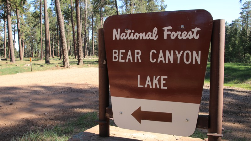
Bear Canyon Lake provides access to the alpine lake of the same name. The easy trail passes through a pine, fir, and aspen forest while crossing Willow Creek at Mule Crossing. The lake is only partially visible from the parking areas and accessible only by a steep hike, but it is very popular with fishermen.
Camping in the vicinity of the lake is in numbered designated sites only. The sites near the lake share two vault toilets. Outside the lake area, there are nice dispersed campsites. RV, camper trailers, and tent campers can all find suitable sites.
Updated: 10/15/2024
Dry Ridge Park
Ryan, Arizona
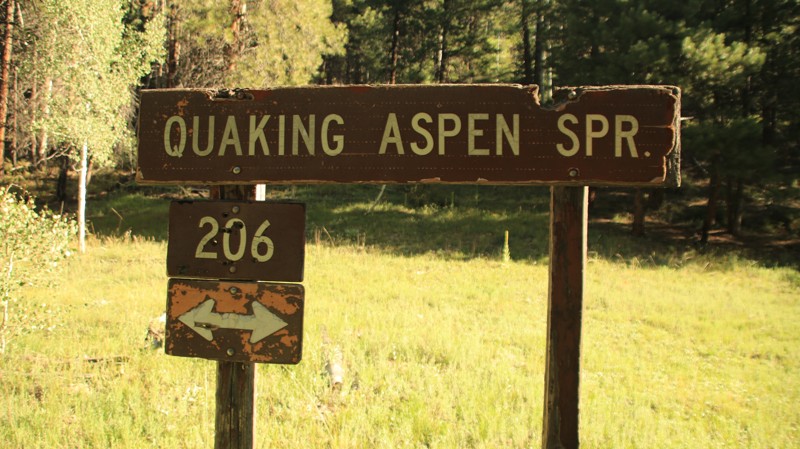
Dry Ridge Park begins on West Side Ryan, FR 22, and serves as a connector to most of the "point roads". Along the way, it passes Quaking Aspen Spring, many small grassy glades, and an old-growth pine forest. There's plenty of camping along the spur roads, but none on this major travel artery.
Updated: 10/15/2024
Territorial Road/McLaws Road
Joseph City, Arizona
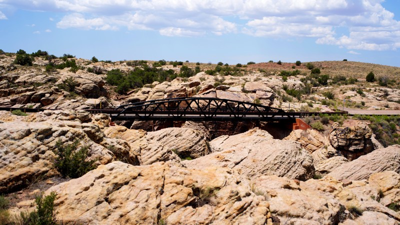
Territorial Road/McLaws Road (the name changes throughout the route) offers a taste of Arizona's high desert and history, particularly the Chevelon Creek Bridge, one of Arizona's first road projects undertaken after statehood in 1912.
Although signed as a road not regularly maintained, Territorial/McLaws Road is smooth gravel/dirt along its entire length, with small portions of old pavement appearing sporadically. It is not difficult to exceed the posted 35mph speed limit on such a wide-open, straight road. Washboard sections and those with small rocks are limited.
No camping or dispersed campsites were observed, and the checkerboard nature of land ownership complicates camping. On the bridge's western side, that checkerboard is primarily the Aja Ranch portions of the Hopi Three Canyon Ranch, interspersed with Arizona State Trust Lands. A State Trust Lands recreational permit allows overnight camping limited to a total of 14 cumulative days per calendar year, but camping may not be allowed on the Hopi tribal lands along this route.
On the eastern side of the bridge, State Trust Lands are intermingled with some BLM land and a good deal of private ownership. Potential campers should also consider the very open nature of this landscape with regard to shade (limited) and wind potential, as well as the possibility of quite the starscape at night.
Updated: 08/09/2023
FR 747
Williams, Arizona
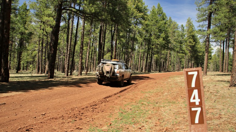
The Kaibab National Forest is best known for its two districts north and south of the Grand Canyon. However, the third district, centered around the town of Williams, should not be overlooked. Filled with abundant camping opportunities, numerous lakes with fish and migratory waterfowl, lots of wildlife, scenic views, and historic cabins, the Williams District has much to offer. Set deep in the heart of the Williams District is a short loop offering numerous campsites and plenty of wildlife viewing opportunities. FR 747 loops off Sycamore Point, FR 110, a main forest thoroughfare. The nearby Sunflower Flat Wildlife area draws elk into its open prairie mornings and evenings. The small tank there often hosts migrating waterfowl. Nearby historic JD Cabin sits on an open meadow, the barn and fenced corral slowly fading back into the wild. The wind singing softly in the tops of tall pine trees is a sound to be savored. And it is best savored in a high country camp. Come on out to the Kaibab and FR 747 and do some savoring.
Updated: 10/15/2024
Escudilla Loop
Nutrioso, Arizona
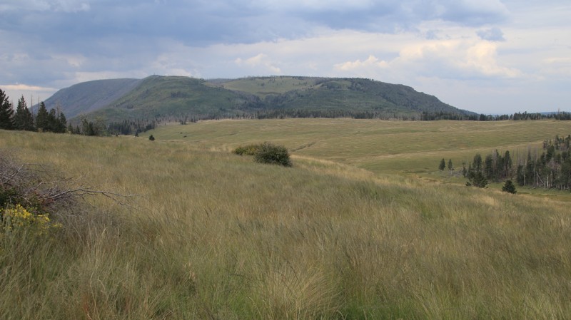
Escudilla Loop runs under the southern slopes of Escudilla Mountain before looping around the alpine meadows of Terry Flat. The beginning of the trail offers nice dispersed campsites. Hulsey Lake is stocked with trout seasonally. The day-use area at the lake has a vault toilet. A hiking trailhead is just after the split for the loop around Terry Flat. The 7.16 mile (round trip) Escudilla Trail climbs to the remnants of a fire lookout tower scorched in the massive 2011 Wallow Fire. The effects of the fire are very evident along the road. Terry Flat is a massive alpine meadow with numerous springs and a small creek. The meadow is a favorite grazing area for elk. Escudilla Mountain was also a site for the reintroduction of the endangered Mexican Gray Wolf. The pack that ranges on the Escudilla can occasionally be heard at night. There are numerous campsites scattered along the loop around Terry Flat.
Updated: 10/15/2024
8219
Papago, Arizona
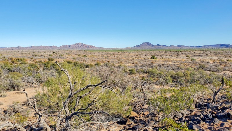
Connecting Lower Sonoran 8219 and Rocky Point Road, BLM 8219 provides a southern entry into a vast uninhabited area crisscrossed with remote trails. Even with views of nearby Oatman Mountain, 8219 is not a very interesting trail. However, this dirt trail does have a good variety of washes, soccerball-sized boulders, and off-camber sections to navigate.
Although you could camp in certain areas along this trail, there are better camping opportunities along Woolsey Peak and Signal Mountain Wilderness Trail or Agua Caliente Road.
This trail travels through State Trust Land and requires a permit.
Updated: 06/05/2022
Red Tank
Redington, Arizona
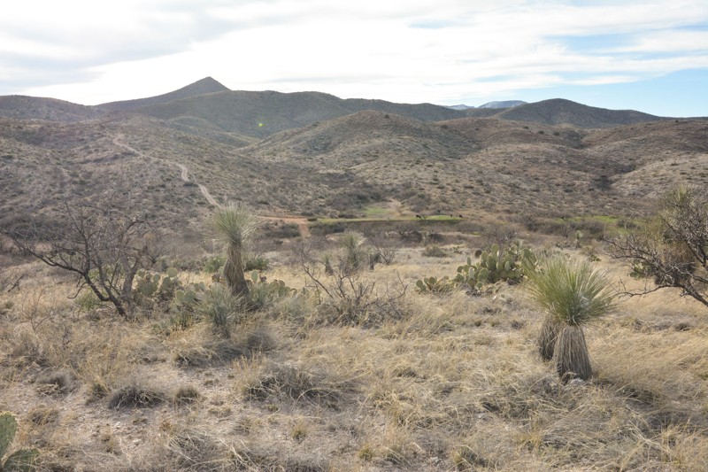
If you are looking for a quick, fun test for your four-wheel drive, this little descent/ascent into the canyon is a small diversion off of the Redington Road. There is a lot of nice scenery as you descend into the riparian area, drive along the sandy wash, and finally end up at a major cattle operation corral.
Don't be surprised to run into wildlife here, including mule deer, javelina, and perhaps even a mountain lion that is looking to make a meal of them.
Don't be surprised to run into wildlife here, including mule deer, javelina, and perhaps even a mountain lion that is looking to make a meal of them.
Updated: 10/15/2024
Walker Big Bug
Potato Patch, Arizona
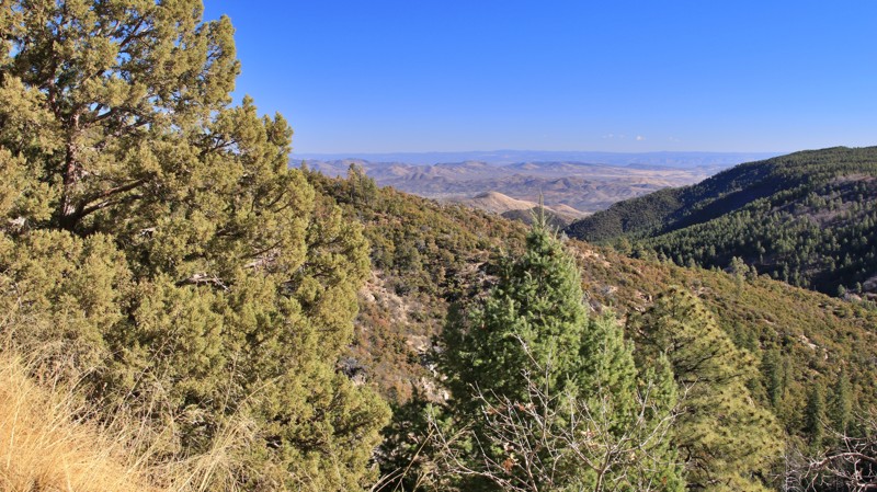
Running between the small mountain hamlet of Walker and Poland Road, Walker Big Bug is a graded and lightly graveled winding track with superb views north across the foothills of the Bradshaw Mountains. The trail is a quick connector to the paved portion of Walker Road, with easy access to Prescott and Prescott Valley.
Two dispersed campsites sit on the trail's eastern end with fire rings and room for two vehicles. A large sign about midway along the trail limits camping to designated sites on the western end. However, there are no designated campsites between the misleading sign and Walker.
Updated: 03/09/2026
Rolls 1808
Fort McDowell, Arizona
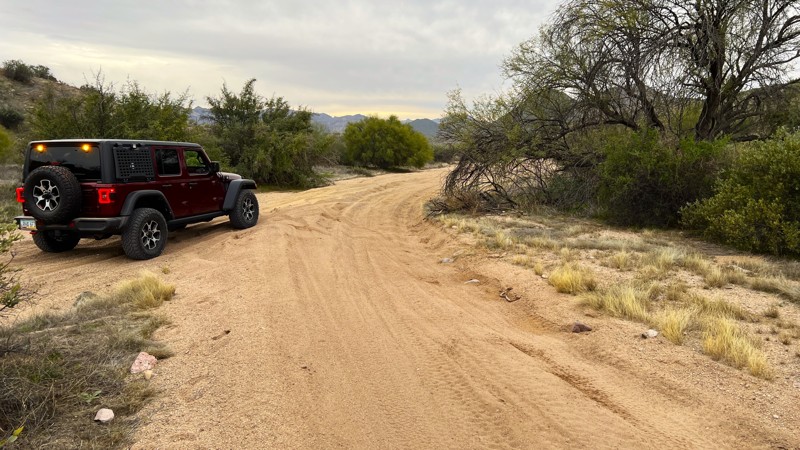
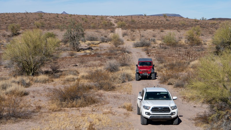
Rolls 1808 is a very easy sandy trail. It connects Rolls 13 on the north to 1863 on the south. This trail has high-banked turns with blind corners. Be cautious during busier times, as this area sees a lot of traffic from different types of off-road vehicles. There are areas to pull off the trail and use as a campsite. However, there are sites available in other areas of the Rolls with better views.
Please note that an OHV permit is now required on this trail.
Updated: 03/06/2023
Saddle Road to Woolsey Peak and Signal Mountain Cutoff
Dateland, Arizona
There are hundreds, if not thousands, of roads in the Lower Sonoran Desert. Finding maps and knowing where these roads go is always a problem. This trail, however, is simple in that it is a significant connector trail allowing you to make a big loop trip utilizing Woolsey Peak and Signal Mountain Wilderness Trail and Agua Caliente Road. Further, these roads can be used to create a route all the way to Blythe, California. While this one is short, its hill climbs and views of the surrounding mountains are impressive.
Updated: 09/22/2026
Warm Springs Canyon
Jacob Lake, Arizona
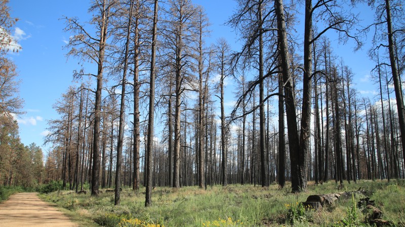
Beginning near Jacob Lake, Warm Spring Canyon goes westward to connect with Fracus Canyon. The road is a popular route for accessing the scenic vistas of the "point" roads deeper in the Kaibab National Forest. The well-maintained road passes a commercial campground, the Kaibab Camper Village, and a historic ranger cabin built in 1910. The trail soon enters a burned area from the 2020 Magnum Wildfire, severely limiting the availability or desirability of dispersed campsites. The road steeply descends along a shelf at its western end before joining Fracus Canyon.
Updated: 02/17/2025
East Buzzard Ridge
Oak Creek Canyon, Arizona
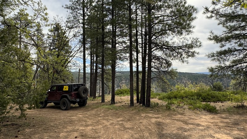
The trail's name alone is enough to pique interest. This out-and-back trail, consisting of hard-packed dirt and small rocks, leads to several excellent campsites at East Buzzard Point. The views overlooking Barney Spring Canyon in the Red Rock Secret Mountain Wilderness are truly stunning. From here, you can stand on the edge of the ridge and see the rugged canyon walls as they rise from nearly 1,000 feet below, where the West Fork of Oak Creek winds its way toward Sedona.
The Forest Service has designated approximately 2/3 of a mile of the trail, starting 1/3 of a mile north of Woody Mountain Road, as a designated dispersed camping area on both sides of the trail. This means that limited cross-country motor vehicle use is allowed within 300 feet of the edge of the trail, specifically for dispersed camping. Following these rules, there are several options for campsites.
Updated: 10/15/2024
Woodruff Road
Holbrook, Arizona
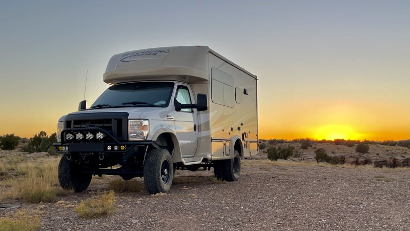
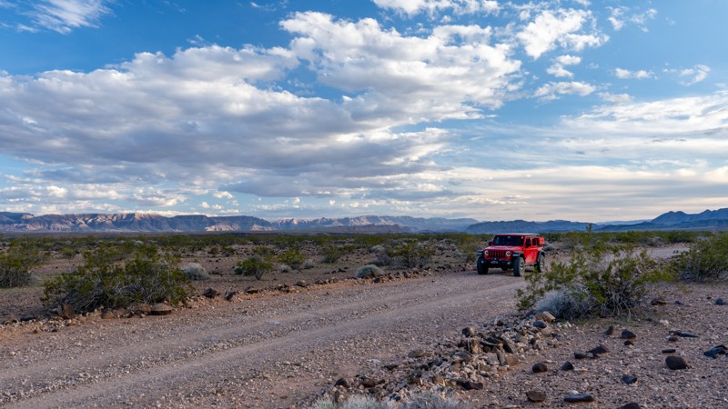
Woodruff Road is an easy, wide-open, point-to-point trail that follows the Little Colorado River. It is open range. Watch for cattle. Dispersed camping opportunities are plentiful at the north end of the trail. Most spur roads are two-wheel drive-friendly and don't venture far into the desert. Those spur roads leading to the top of the canyon overlooking the Little Colorado River require four-wheel drive. Watch the weather. The mud looks like it can get deep here.
Updated: 02/09/2026
Pakoon Springs Road
South Cove, Arizona
In the Grand Canyon-Parashant National Monument, traveling north/south along the Nevada and Arizona state lines, Pakoon Springs is a straight-through dirt road connecting Mud Mountain Road and Grand Wash Bay Road. Pakoon Springs is nearly 18 miles long and travels down a fairly wide, graded gravel road that crosses several desert washes. The road can be rough and washboarded at times and gradually climbs and descends several slopes as it wanders through the Pakoon Basin, past the Pakoon Spring, and into several joshua tree forests. At Pakoon Springs, there's a clean restroom and plenty of parking to explore the green desert oasis. Pakoon Springs was once owned by Charles Simons, who raised Osteriches on the property in the 80s. He also had an alligator named Clem, who lived in the ponds on site. The gator was relocated in 2002, and the area has been restored to its natural conditions.
This road is suitable for any high clearance vehicle with rugged offroad tires, such as all-terrain tires. Although the road can be traveled in 2WD, a 4WD or AWD vehicle is highly recommended due to the rigorous strain the rough terrain puts on your suspension components and the drastic conditions that can happen with any weather event. Low-profile tires are not recommended, and all users should carry at least one full-size spare.
Updated: 10/15/2024
FR 609
North Rim, Arizona
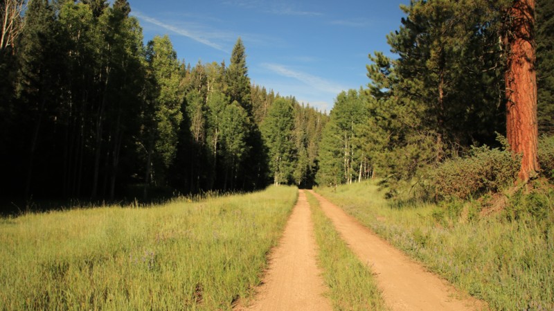
FR 609 is a short connector between the roads to Fire Point and the Timp Points. The road runs through a pine, fir, spruce, and aspen forest as it descends and then climbs out of Browns Canyon. There are minor washouts from rain runoffs. There are no campsites along the road.

Upgrade your Membership
Unlock all of the details on every Trail Guide and Scout Route.
Start a 7-day Free TrialBrowse Trails in Arizona by City
Browse every Arizona city with offroad trail guides.
Community
Partners

