







By clicking "ACCEPT", you agree to be the terms and conditions of each policy linked to above. You also agree to the storing of cookies on your device to facilitate the operation and functionality of our site, enhance and customize your user experience, and to analyze how our site is used.
Arizona Off-Road Trails
373
Total Trail Guides 359

4679
Detailed Waypoints 676
Try a Free 7-Day Trial and unlock it all
Start a Free Trial Most Recent Trail Reviews
Rated 4/5
Open
Visited: 09/22/2026
Hard pack, easy forest service road that is a great back way to the North Rim of the Grand Canyon.


Tyler D’Hulst
Rated 4/5
Open
Visited: 09/22/2026
Spring Canyon is a beautiful drive. We didn’t go out to the cabin but used this western section of road coming back from Crazy Jug

Tyler D’Hulst
Rated 4/5
Open
Visited: 09/22/2026
We took this out to Crazy Jug. The northern section is hard packed forest service road. Not difficult. Very scenic drive through the ponderosas.

Tyler D’Hulst
Rated 5/5
Open
Visited: 09/22/2026
View point is spectacular! Trail was easy going out, no obstacles at all. Saw a Toyota Camery at the viewpoint.


Tyler D’Hulst
Rated 3/5
Open
Visited: 09/22/2026
An alternative route out to Crazy Jug Point. It’s easy and can be scenic in areas. I’d recommend West Ryan out to Crazy Jug though.
Tyler D’Hulst
Rated 3/5
Open
Visited: 09/22/2026
A quick connector trail through the burn patch.
Tyler D’Hulst
Rated 5/5
Open
Visited: 09/20/2026
Leviathan Mine trail is a full day trip. Though it is only 20 miles in length the travel is slow and rough. Majority of the trail you will be going between 5-10 MPH. Then once at the end it connects w...



Eric Gartin
Official Crew
Rated 4/5
Open
Visited: 09/19/2026
Simple road, well graded today. Many mountain bikers coming down from the West out of Breezy Pines. Not too many people out until approaching Senator Hiway. We went East to West as I think thats a bet...



Jeff Burnett
Rated 3/5
Open
Visited: 09/19/2026
The trail itself is not spectacular, it's pretty flat across the plains. However, driving up to the overlook and seeing a huge gaping hole in the ground is a great juxtaposition to the flat trail. The...
Tyler D’Hulst
Rated 3/5
Open
Visited: 09/19/2026
A nice trail ride from the main road down off the plateau. It's graded forest service road until the switchbacks. The switchbacks themselves are not difficult, road is not graded. This section has bee...
Tyler D’Hulst
Rated 3/5
Open
Visited: 09/18/2026
The end of the trail is not well marked, and can cause confusion. Also, vehicle passes are required for all backcountry routes within the Lake Mead National Recreation Area.
Eric Gartin
Official Crew

Ted Whisler
No Rating
Open
Visited: 09/17/2026
Nice ride west side a little rocky but rating is true to #2


Ted Whisler
Rated 3/5
Open
Visited: 09/15/2026
A nice drop off the plateau heading towards Marble Canyon. Not a difficult road. Road is weathered but not challenging.
Tyler D’Hulst
No Rating
Temporary Closure
Visited: 09/15/2026
Road closed due to multiple washed out wash crossings after the turn off to go up the mountain. "Road Closed" sign put out by BLM on trail.
Tyler D’Hulst
No Rating
Temporary Closure
Visited: 09/15/2026
After the turn off to head up the mountain there are multiple washed out wash crossings. A "Road Closed" sign has been put out by the BLM.
Tyler D’Hulst

Ben Ruddell
Official Crew
Rated 4/5
Open
Visited: 09/14/2026
Bogles Ranch Road is a great Sunday afternoon drive type of dirt road that climbs up in elevation and gives some spectacular views of the surrounding area. The first half passes through State and Priv...


Eric Gartin
Official Crew
Ben Ruddell
Official Crew
Rated 3/5
Open
Visited: 09/14/2026
Antares Road is an excellent way to travel from Route 66 to the eastern portion of the Lake Mead National Recreation Area. This wide county road is well maintained with minor washboarding, most of whi...


Eric Gartin
Official Crew
Rated 3/5
Open
Visited: 09/14/2026
Hackberry road is a wide dirt road with minimal erosion damage and washboarding. There are a couple of larger washes that cross Hackberry road creating wide stretches of loose sand which can cause iss...


Eric Gartin
Official Crew
Rated 3/5
Open
Visited: 09/13/2026
This is a very rough, rocky, & slow going trail. Expect around 4+ hours for the trail & another hour to get the highway. One of those trails I'm happy I did but I wont be back personally. High clearan...

Brandon W
No Rating
Open
Visited: 09/12/2026
I think the rating is spot on. The ruts and washouts at the beginning are not as bad and if you hug the inside of the shelf road they can be avoided. The middle part is same general sandy wash with ov...



Greg Page
Rated 4/5
Open
Visited: 09/11/2026
Ran this trail as part of a larger loop. Trail is in great shape. Easy for standard 4x4 with no lift. Passengers can do it until maybe the very end by the lake where the road gets rocky and washed out...


Jeff Burnett
Rated 5/5
Open
Visited: 09/10/2026
This is one of my favorite scenic trails in the area. The trail is easy to travel, but does have some optional short trails that will test your vehicle. The views from the Grand Wash Cliffs of the Hua...


Eric Gartin
Official Crew
Rated 3/5
Open
Visited: 09/07/2026
This trail by itself is nothing special. It is mostly used as an access road to get to the more technical trail such as Homecourt, Twister, and Waynes World. This is a great trail for the beginner to ...


Eric Gartin
Official Crew
Rated 3/5
Open
Visited: 09/07/2026
This trail is an enjoyable alternate route when traveling on Blake Ranch Road (7163). The trail is easy with only a handful of spots with erosion damage. The few established camping sites appear to n...


Eric Gartin
Official Crew
Rated 5/5
Open
Visited: 09/07/2026
Ran this trail from Boynton Pass Road to Loy Butte Road (opposite direction from what is listed). Ran into a few rental ATVs and a couple of Jeeps heading the opposite way. This was a fun trail wit...



Daniel Macioce
Rated 5/5
Open
Visited: 09/07/2026
This trail was a lot of fun, plus the views were amazing. I ran the trail in the order posted, starting at the south trailhead and finishing at the heritage site. Past a motorcycle, a few jeeps and a...


Daniel Macioce
Rated 4/5
Open
Visited: 09/07/2026
Nice trail, ran West to East. For some reason the map shows this a a one-way trial, East to West. That is not the case, it is a two way trail. Was pretty washed out starting around mile 12. Plenty roc...


Jeff Burnett
No Rating
Open
Visited: 09/06/2026
New trail for me. You didn’t know what it would throw at you around every corner which is why you try to find new trails or old forgotten ones
KB
Kory Burden
Rated 5/5
Open
Visited: 09/06/2026
The trail is no joke—steep, narrow, and technical enough that you’ll want to be comfortable with off-camber shelf roads, rocky terrain, and washouts that will test your vehicles articulation. The rew...



Bobby Rumbaugh
Official Crew
Rated 5/5
Open
Visited: 09/06/2026
Fun trail if you don't want to do pyeatt draw itself. Ran this trail 3yrs ago and definitely a little more erosion but, still any truck or suv with good factory ground clearance can do it. From previo...
JM
James m
Rated 4/5
Open
Visited: 09/06/2026
Ran this trail from I-17 to Sedona. Extraordinary views descending into Sedona. As others have noted, there are lots of rock on the trail, making it slow going. Passed a large number of Pink Jeeps ...


Daniel Macioce
Rated 4/5
Open
Visited: 09/05/2026
This one definitely changed over the last few years. The southern section has some legit, steep, off-camber sections. YOU NEED experience, backup, and a capable vehicle on this one now. It's not supe...


.jpg)
Bobby Nelson
Official Crew
Rated 4/5
Open
Visited: 09/05/2026
Another amazing time on this scenic crossover. We came in from Walnut Canyon and finished out on Price Road after about 6 hours. A challenging and hot day for the old TJ. Rincon Road has evolved into ...


Bobby Nelson
Official Crew
Rated 4/5
Open
Visited: 09/05/2026
We started exactly at sunrise to try and beat the heat. We planned to crossover to Box Canyon and out on Price Road. It ended up taking us 6 hours, even with all the photos and filming we did. A chall...


Bobby Nelson
Official Crew
Rated 5/5
Open
Visited: 09/04/2026
We recently ran Four Peaks after the monsoon rains. Here’s what we found and what to expect if you’re planning to run it. Have a GR8 day!

Jeep 4 Dirt
Rated 5/5
Open
Visited: 09/04/2026
Breathtaking views. Definitely don't rush through the trail. Devil's staircase was a bit slippery but awesome. A few tight stops here and there, but a trail that's a must on anyone's to do list.



Christopher Bradley
Rated 4/5
Open
Visited: 08/30/2026
Id say this is a 3.5 to 4 trail. There are some obstacles, but nothing you really need to think hard about how to approach. If you send your vehicle at it in 4 low you'll get through everything.



Justin Holsinger
Rated 4/5
Open
Visited: 08/28/2026
Rim Road (FS300) West to East. Very well groomed gravel forest road. Accessible by just about any vehicle thats not been lowered. Who does that anyway? Scenic views the whole route. Hard to believe on...


Jeff Burnett
Rated 4/5
Open
Visited: 08/28/2026
Not a bad road but it was crowded with sxs and vehicles towing campers. Hard to rate 5 stars for a busy road. Super easy any vehicle can do this. Part is paved near the freeway but the rest is gravel.

Tony Rockwell
Rated 4/5
Open
Visited: 08/28/2026
I rated 4 stars just due to the volume of sxs & camper trailers on the road.
Easy drive, any car can do this.
Ran from sheep springs to munds park, see other reviews for full route.

Tony Rockwell
Rated 4/5
Open
Visited: 08/28/2026
I ran Bar M in reverse to get to this trail. Then headed toward Casner Park Road. (See reviews I did on each of those)
Nice easy trail that is less rough than Bar M.
Nice drive through trees.


Tony Rockwell
Rated 5/5
Open
Visited: 08/28/2026
Very bumpy due to rock infused trail. A few larger rocks, 8-12” tall in places but most stock 4x4’s should be able to navigate around or over them. I would say any 4x4 with all terrain tires could nav...


Tony Rockwell
Rated 3/5
Open
Visited: 08/27/2026
Overall decent little trail; camped out near Committee Tank (not suitable for tent camping - too rocky). Nothing too technical but enough to keep things interesting. High clearance and good line choi...


Bill Ferguson
Rated 3/5
Open
Visited: 08/27/2026
Connector from FS801 (Rock Garden Loop) to FS09494F (Committee Tank Trail); yeah, it lives up to its namesake. Very rocky. High clearance and picking good lines are an absolute must. Car camped at...

Bill Ferguson
Rated 5/5
Open
Visited: 08/27/2026
Nice trail saw some deer it’s a little rough but overall was easy


M
Maddox
Rated 5/5
Open
Visited: 08/23/2026
Great little adventure for the day. Dirt road is pretty rutted up due to monsoons, but easily drivable. Lake itself is extremely low.
LL
Larry Lapp
Rated 4/5
Open
Visited: 08/22/2026
A fun side trip that has a steep hill climb. Due to recent rains, the wildflowers were blooming.


Bobby Rumbaugh
Official Crew
Most Popular

Updated: 10/15/2024
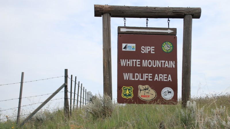
Sipe White Mountain Wildlife Refuge
Eagar, Arizona
FR 57 runs through Sipe White Mountain Wildlife Area, operated by the Arizona Game and Fish. The area has an interesting visitor center with a shady picnic area, numerous hiking trails, and plenty of informative signage. There are numerous wildlife viewing areas. The southern portion of the road is closed between January 1 and May 31. Various habitats, including riparian areas, open meadows, and pinion and pine forests, lie inside the preserve. Offroading and camping are not permitted inside the Sipe White Mountain Wildlife Refuge.
Updated: 10/15/2024
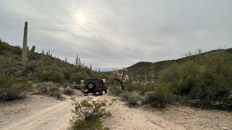
96 Ranch Middle Mountain Crosscut
Cactus Forest, Arizona
96 Ranch Middle Mountain Crosscut begins at the Highway 79 powerline trail intersection. The trail is a journey into the lush desert of the old 96 Ranch. Initially a wide dirt trail, it becomes rocky and narrow with encroaching brush as you crosscut through Middle Mountain. The saddle provides great views of distant Mount Lemon. Many connecting trails in this area can provide a full day of exploring and camping opportunities.
Most of the trail is 2WD friendly. The most difficult section of trail is a sandy wash exit on the eastern end of the trail that may require 4WD.
The only campsite along this trail is at the very eastern end. This spot can accommodate multiple vehicles and has a large fire ring.
This is Arizona State Trust land and requires a permit.
Updated: 10/15/2024
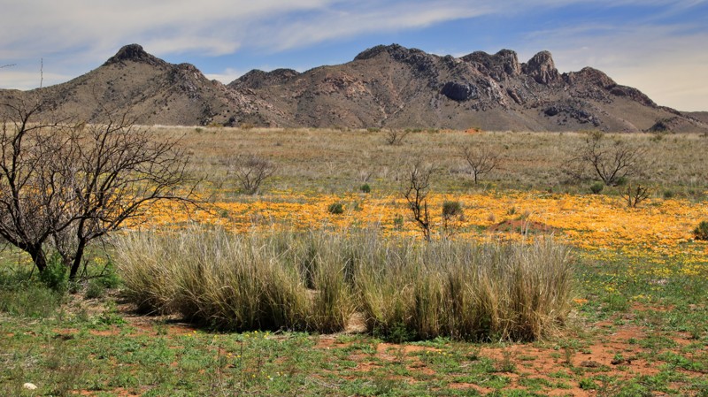
Apache Pass
Bowie, Arizona
Apache Pass is the foundation for every old western stagecoach movie you've ever seen. The pass separates the rugged Chiricahua Mountains to the south and the nearly impenetrable Dos Cabezas to the north. In the early 1800s, it was a critical route for expansion into California and became the most dangerous and difficult section of the Butterfield Overland Stage Route, which carried mail and passengers between St Louis and San Francisco. It also passed through the middle of the Apache Nation.
Today, the washboard graded dirt road hosts a hiking trailhead with informational signage and a 1.5-mile trail to explore historic Fort Bowie. The trailhead also has vault toilets and a shaded picnic table. The mountain views along the trail are vast. The trail's western end drops into a grassy valley bordered by cattle ranches. Low spots along the trail get slick and rutted after heavy rains.
Two campsites are west of the hiking trailhead, one roadside and another at the end of a short northern spur trail.
Updated: 06/05/2022
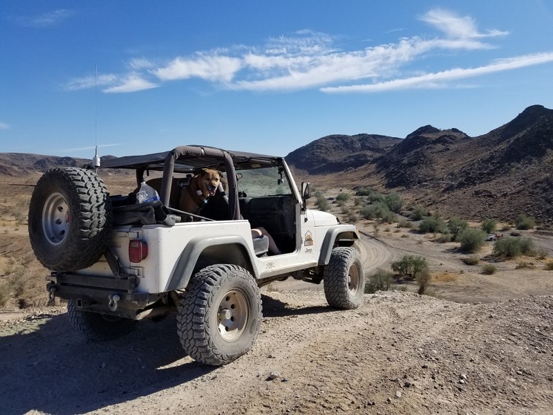
HS315 - Parker
Parker, Arizona
Who doesn't love a hill climb, even better is when it is an bonus route on the way to somewhere. HS315 is just that, this desert side route changes up the drive of a dirt road by adding a couple moderate hill climbs. But once on top of the hill, you are introduced to a 360 view of the surround desert seeing all the way from Presidents Choice to nearly The Duke. Thus the next time you are taking Cienega Springs Road or on your way out to The Duke, Launch Pad, or The Desert Bar, make sure you take this little side trip and enjoy what it has to offer.
Updated: 06/05/2022
Rocky Gulch Ridge
Mormon Lake, Arizona
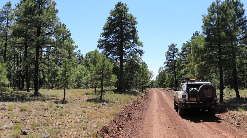
Rocky Gulch Ridge offers expansive alpine meadows, called parks by the locals, old-growth ponderosa pines, alligator juniper (the oldest tree species in Arizona), and quiet serenity to those who traverse its 8 miles of beauty. Cattle graze roadside and sometimes right in your camp. It isn't unusual to see a turkey, elk cow and calf, or a few mule deer run across the road in front of you. The trail gently drops in elevation when driven southwesterly. The vegetation changes slowly as pines get smaller, juniper appears, century plants bloom, views open southward, and Apache Maid Mountain suddenly looms ahead.
Updated: 06/05/2022
Telephone Ridge
Pine, Arizona
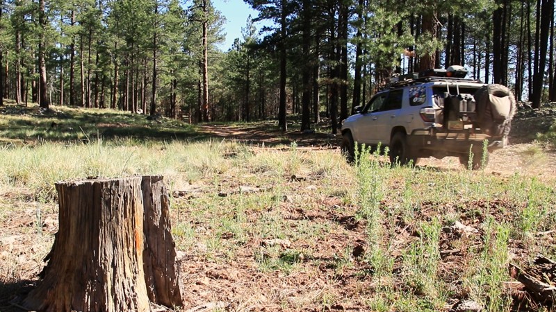
Telephone Ridge, or FR 139A, runs north along the spine of the ridge of the same name. It splits off of Dick Hart Ridge, the two ridges and roads separated by the green and grassy Houston Draw. While never exceedingly wide, at points, the ridgeline becomes very narrow. As you drive, you can look down the steep side slopes into Houston Draw on the east and the deep drainage of Bear Canyon on the west. The view gives you a definite appreciation for the ruggedness of this amazing land. Hiking is a favorite activity atop the Mogollon Rim. The Cabin Loop is one of Arizona’s premier backpacking routes. Telephone Ridge crosses two of the five hiking trails that make up the Cabin Loop. Near the trailhead, the Houston Brothers Trail crosses on its way south to the Mogollon Rim. Further up the road, the Fred Haught Trail cuts across the track on its way to both the Fred Haught Cabin and the General Springs Cabin. Telephone Ridge ends at the start of the Rock Crossing Trail. This rugged hiking trail goes north to the beautiful Blue Ridge Reservoir.
Updated: 10/15/2024
JD Dam
Parks, Arizona
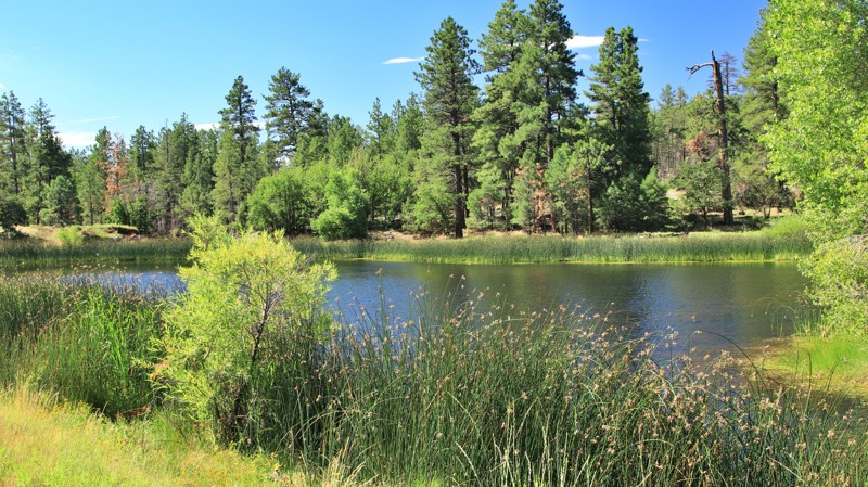
Imagine a small lake with geese, ducks, and coots. Heron wade in the shallows spearing small fish and frogs. Osprey dive into the water catching tonight’s fish dinner. It doesn’t sound like Arizona, does it? Reed-lined JD Dam Lake seems out of place amid the tall pines of the Kaibab National Forest. The lake has a parking lot and vault toilet for anglers and surprised visitors.
The road is easy, graded dirt with gravel mixed in. While camping isn’t allowed at the lake, there are four small campsites nearby.
Updated: 05/20/2026
Superstition Sideburn
Gold Canyon, Arizona
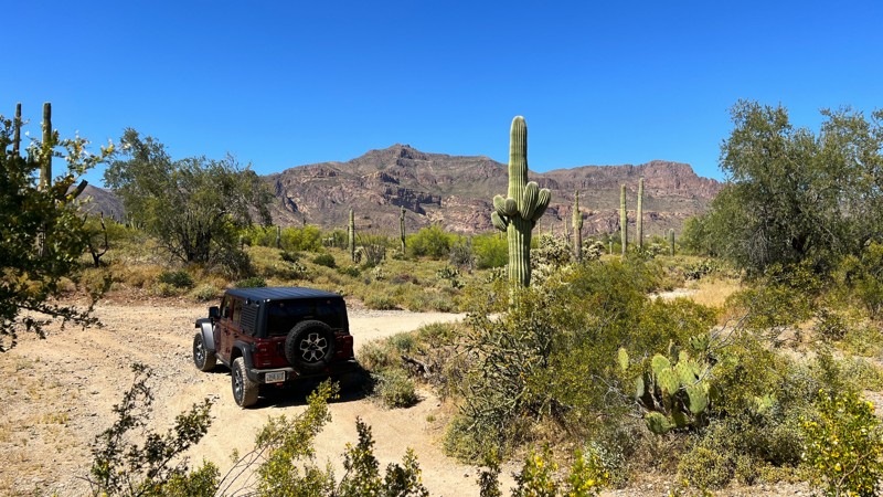
The Superstition Sideburn Trail provides off-road enthusiasts access to a wide network of trails. This trail intersects with the popular Superstition Loop Trail in two different places. Once about halfway through and again at the north end of the trail. Primarily packed dirt with loose rock, this trail can be run in 2WD in a higher clearance vehicle.
Like other trails, there is a large camping spot at the Peralta Road intersection. These spots are frequently used by folks boondocking. Treat yourself to less road noise and better views of the mountains with a dispersed site further along the trail.
This is Arizona State Trust Land. A recreational permit is required.
Updated: 10/15/2024
CR 1325
Greer, Arizona
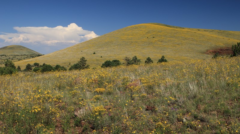
County Road 1325 runs between Highways 260 and 60 through the Apache - Sitgreaves National Forest and a brief stretch of Arizona State Trust Land on its northern end. The road number also mysteriously changes to 3123 somewhere along the way. While an easy drive, there are sections of shelf road.
The road passes through dense forests before breaking into wide-open prairies covered in wildflowers in late Summer and early Fall. The trail also offers some nice views. There are a few dispersed campsites on the southern end of the road.
Updated: 09/10/2026
Puerto Blanco Road (North)
Lukeville, Arizona
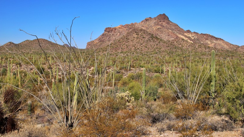
The northern portion of the Puerto Blanco scenic loop begins just west of the Organ Pipe Cactus National Monument visitor center. The road is well-maintained gravel for the first 5 miles, with paved sections where erosion once required constant maintenance. This section allows two-way traffic and ends at a picnic area with a vault toilet. The remainder of the trail is narrow, rough dirt, and one-way counterclockwise. The last two miles of the trail are very sandy. The trail ends at the intersection of Pozo Nuevo Road and Puerto Blanco Road (South).
The rugged Puerto Blanco Mountains provide a backdrop to massive forests of saguaro and clusters of rare organ pipe cacti. Chain fruit cholla, ocotillo, palo verde, ironwood, and creosote bush finish out the iconic Sonoran Desert landscape. There are numerous hiking trailheads spread along the trail. The track also passes several closed mines. Informational signage with pullouts is scattered along the trail.
There is no camping on the trail. Organ Pipe Cactus National Monument has two campgrounds. Commercial campgrounds are available in Ajo and Why. Fuel is available in Why and nearby Lukeville.
This area is very close to the Mexican border. Smuggling and human trafficking activities are common. Be vigilant when visiting this area.
Updated: 10/15/2024
Portland Mine Road
Dolan Springs, Arizona
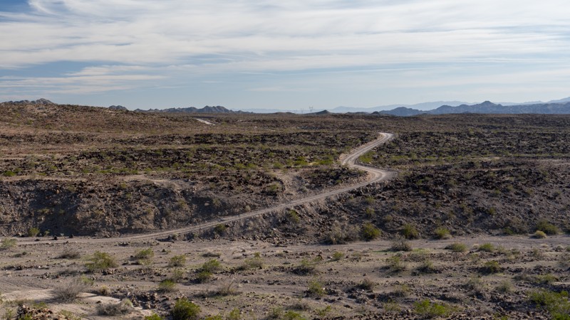
Portland Mine Road travels nearly 25 miles through the Black Mountains. It is a straight-through trail connecting Cottonwood Cove Road and Katherine Landing, creating an all-dirt route from Dolan Springs to Bullhead City. Different maps label this road with names such as Jones Road or Lost Cabin Wash Road.
The trail is multiple vehicles wide and traverses in or across many coarse, sandy desert washes. The northern portion of the road, until reaching Jeep Cove, is a well-maintained, relatively smooth BLM road. South of this point, the road transitions to a Lake Mead National Recreation road and becomes extremely rough, loose, exposed rocks up to grapefruit and football-sized. The road surface hardens a bit but also presents long sections of washboard. Heavy rains can easily damage the road, but it is generally repaired quickly by NPS staff, BLM staff, or cattle ranchers who often use the road. The road can be traveled in either direction, but users should be aware that beginning the road from the south requires passing through an NPS Entrance Station, which requires a pass. Traveling the road from north to south does not require a pass.
Portland Mine Road provides scenic views of the Black Mountains, Spirit Mountains, and desert vegetation such as Spanish Dagger. The road also travels past its namesake large open pit of the 1920s gold mine.
Although there are many open desert areas along the road to camp on, far better campsites are found along intersecting roads such as Jeep Cove and Cottonwood Cove Road.
This road can be extremely rough and bumpy, but it is still suitable for any high clearance vehicle and can easily be traveled in 2WD during dry conditions. Due to the remoteness and harsh terrain, 4WD and rugged offroad tires are highly recommended. Airing down, although not necessary, greatly improves the ride quality.
Updated: 12/13/2024
Sycamore FR1847
Fort McDowell, Arizona
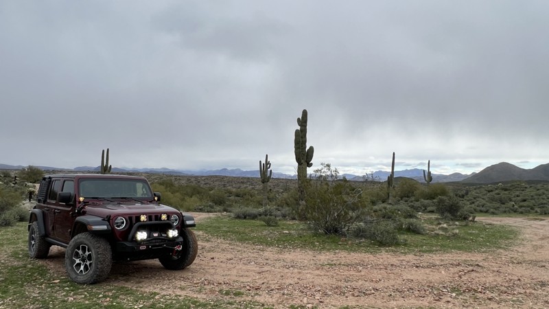
FR1847 begins at the intersection of FR403 and MT1854. There is a large staging area and information board here as well. The initial section of this trail is a main access road to the Lower Sycamore Creek area. It then branches off and becomes a more narrow dirt trail. 1847 provides access to trails MT1848 and P1007, both of which will take you down to the creek bed. There are multiple camping locations along this trail. Some can accommodate multiple vehicles, while others are smaller. These all provide nice views of the Sycamore Creek valley below and Four Peaks to the east.
The trail's official end occurs at trail marker 1872 on the right and the end of the GPX track. 1847 past this point is for “Administrative Use Only" on the new travel management plan.
Updated: 05/27/2025
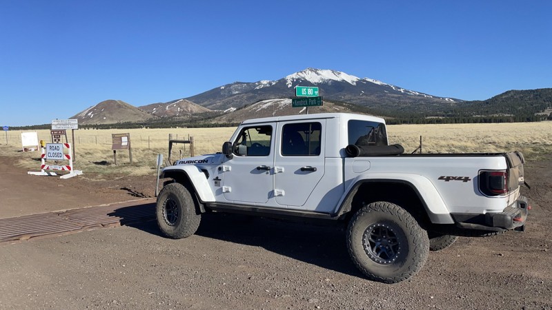
Kendrick Park
Fort Valley, Arizona
Kendrick Park Road connects US-180 to US-89 and features very nice dispersed campsites along the road, excellent peak views, and direct access to the AZT. The campsites are on two tracks along the road and won't be accessible to RV's.
Updated: 07/06/2026
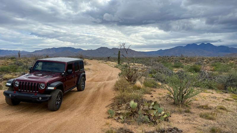
Rolls 1832
Fort McDowell, Arizona
Trail 1832 is a great place to get to know your new off-road vehicle. The trail is a hard-pack dirt trail that will work your suspension 1832 through large puddle holes and moguls. Many people will use this trail to make their way from the Palo Fiero staging area to connect with Trail 13, a main cross trail. 1832 is a highly used trail by Jeeps, trucks, SxS, UTVs, dirt bikes, and four-wheelers. Be ready for oncoming traffic, as the UTV rental groups use this trail as part of a loop from the Four Peaks staging area on weekends. A couple of campsites right along the trail have nice views of Four Peaks.
Please note that an OHV permit is now required on this trail.
Updated: 06/03/2025
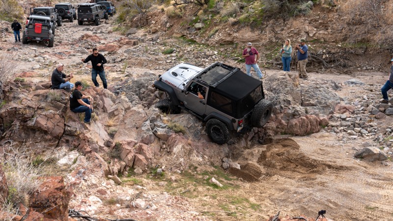
Lower Home Court
Harris, Arizona
Lower Home Court is the first half of the Home Court trail and utilizes the bailout before the non-optional waterfall. The trail starts on State Trust Land and travels down a steep and rough road, passing through fields of cholla cactus before entering a wide, sandy, and boulder-strung wash. Lower Home Court slowly moves up the canyon, offering drivers many optional rock obstacles with easy to complex lines. Several of the obstacles push your vehicle through narrow rock carvings or v-notches, where one tire will travel higher than the other side, flexing out suspensions and tipping vehicles into uncomfortable situations. Traction is superb on the rocks in this canyon, and most of the obstacles have well-planted rocks that do not move much. Any high clearance 4-wheel drive vehicle would be suitable for this trail, but undercarriage damage is possible due to the rocky terrain.
The bailout takes you through BLM land and back to the main road you came in on. Upper Home Court continues in the wash, traversing several larger obstacles with no bypasses.
Updated: 10/15/2024
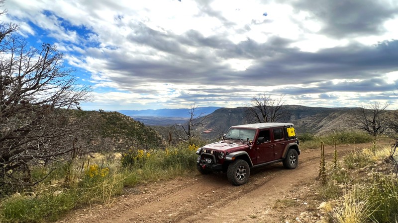
Bunker Ridge
Sedona, Arizona
Bunker Ridge runs between Secret Mountain Trail and Casner Mountain Trail. It ends on the south end just north of the Casner Mountain gate. The 2021 Rafael and 2009 Taylor wildfires affected the area along this trail, which resulted in large open areas with potential water washouts. The trail is mostly made of packed dirt with sections of rock. After storms, large mud puddles may be present. This area is a great place to explore within the Coconino National Forest.
There are no established campsites along this trail, and it mainly follows the powerlines.
Updated: 10/15/2024
Desert to Tall Pines Scenic Byway (North)
Young, Arizona
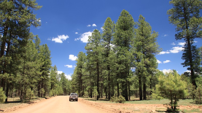
The Desert to Tall Pines Scenic Byway begins near the southern end of Roosevelt Lake with its many saguaro cacti, passes through the remote hamlet of Young, and ends atop the Mogollon Rim with old-growth Ponderosa pines. The byway has short paved sections at each end and the middle section through Pleasant Valley and Young. The remainder of the trail is dirt road. Young is the only significant city in Arizona that must be accessed by a dirt road. Young is famous for the 10-year Pleasant Valley War between the feuding Tewksbury and Graham ranch families. The feud resulted in nearly 50 deaths and is said to have delayed Arizona's bid for statehood by several years.
This Scout Route describes the dirt section north of Young. The wide dirt trail climbs steadily out of Plesant Valley. The pines grow taller with additional elevation and decreased temperatures. Any curve in the trail may present the paradox of meeting an 18-wheeler delivering supplies to Young via a dirt road. Spur trails shoot off into the Tonto National Forest and beg for exploration.
Several dispersed campsites are along the road. The best camping is at the free Colcord Ridge Campground, where the dirt meets pavement again on the northern end. Young has fuel, groceries, and the well-regarded Antlers Cafe.
Updated: 10/15/2024
Middle Mountain Road
Hannagan Meadow, Arizona
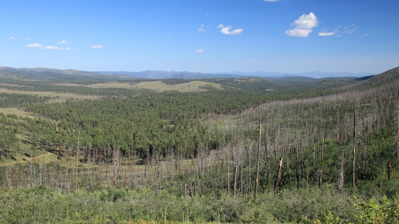
Middle Mountain snakes contours just below the top of a very long ridgeline whose high point is named Middle Mountain. The trail offers excellent views of the area's rugged landscape as it alternates between pine forests and burned areas from the 2011 Wallow Fire. There are several large dispersed campsites near the eastern end of the trail near Highway 91 and a single large site on the western end.
Updated: 10/15/2024
Walk Ranch Road
Wymola, Arizona
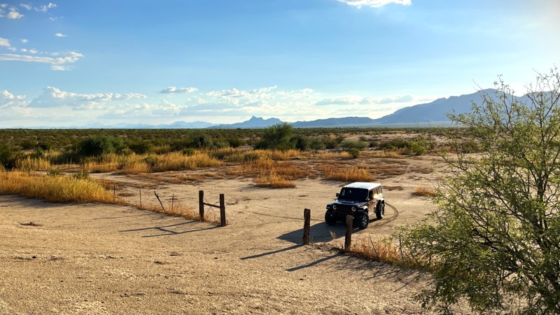
A side trail that branches off South Pecan Road, Walk Ranch Road is an out-and-back trail that takes you into the scrub desert just southeast of the Picacho Mountains. This is a less traveled area that will give you that in-the-middle-of-nowhere feeling. There's little scenery other than large cattle tanks. While there were no established camping spots along the trail, there are plenty of flat places to set up camp. The terrain is soft dirt and prone to flooding and erosion during monsoon storms. This is Arizona State Trust Land, and a permit is required.
Updated: 03/11/2025
Horse Tanks
Yuma Proving Ground, Arizona
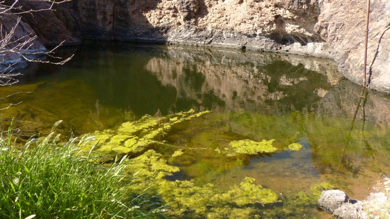
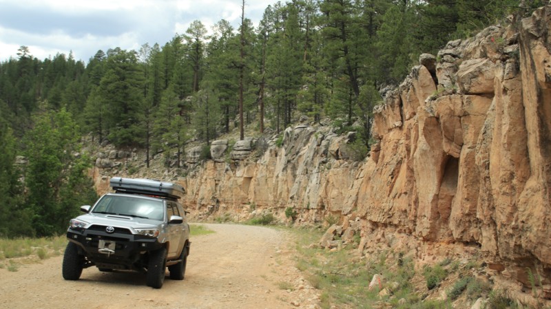
The rarity of water in the desert has always drawn us. In the arid Sonoran Desert, runoff from steep rocky hillsides can erode swimming pool-sized tanks into the bedrock, thus storing water from the infrequent rains. One collection of these pools is named Horse Tanks. Mountain bighorn sheep living in the Kofa National Wildlife Refuge often water here. There are even grind holes and a few petroglyphs from ancient native American tribes that once inhabited this area. Today, there are no permanent inhabitants, but campers inhabit the numerous campsites along the road leading to the Horse Tanks during the area's mild winters. Besides camping and the lure of the tanks, the geology on display near Horse Tanks and the nearby Gray Tanks will keep you wondering just how those rocks got that way.
Updated: 10/15/2024
Heber Wildcat
Forest Lakes, Arizona
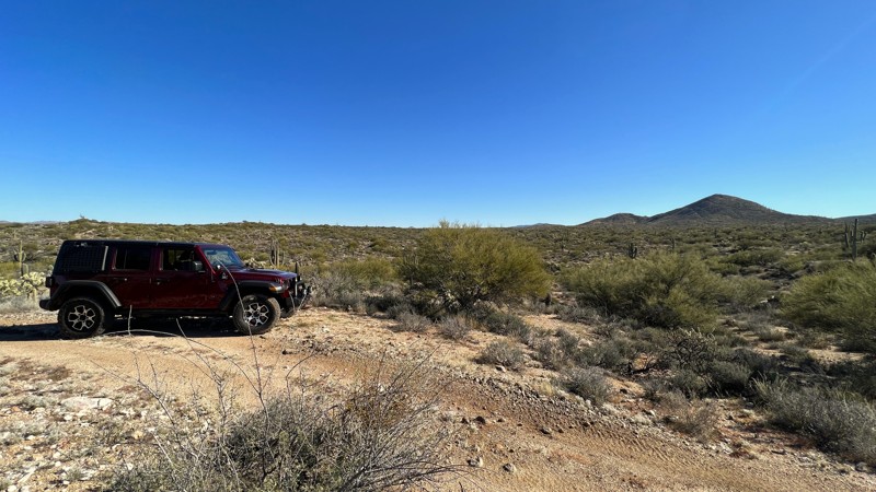
Heber Wildcat runs north off Highway 260 near the little hamlet of Forest Lakes to connect with Heber Mormon Crossing near Wildcat Canyon. The easy trail passed through a pine forest with loads of dispersed camping large enough for numerous rigs of all sizes, tent camping, and hammocks. The section through Wildcat Canyon has nice sandstone cliffs on display.
Updated: 10/15/2024
96 Ranch East Boundary
Cactus Forest, Arizona
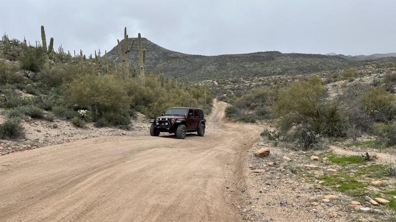
East Boundary takes you further into the remote area of the old 96 Ranch. There are many great camp spots on this trail's east and west ends. Most can accommodate multiple vehicles. The middle section of trail is narrow, and you may question if you are on the right path as you add to your collection of Arizona pinstripes.
There are multiple wildlife water catchment facilities in this area. Ensure your camp spot is at least 1/4 mile from them.
The trail runs through Arizona State Trust Land. A recreation permit is required.
Updated: 10/15/2024
Sycamore MT1851
Rio Verde, Arizona
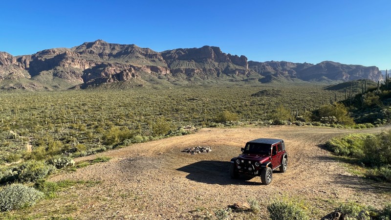
MT1851 is a connector route between FR 402 and Sycamore Creek. Additional trails branch off from MT1851 and provide a large area to explore. This trail is primarily dirt/rocks on the Eastern end, which later transitions to sand. Following the GPX track from east to west takes you down a steep rockface hill. This is shown in the “Hardest Part” picture.
Several campsites with rock fire rings can accommodate multiple vehicles.
Updated: 05/20/2026
Superstition Crosscut Pass
Gold Canyon, Arizona
Superstition Crosscut Pass begins off Peralta Road and ends on Superstition Loop. It is a popular area for boondocking with several camping spots suitable for multiple vehicles with easy access for RVs, 5th wheels, and large campers. Further north, several dispersed campsites with rock fire rings have outstanding views of the Superstition Mountains.
While a short trail, the one nail-biter obstacle near the north end is a steep, loose rock, narrow, washed-out hillclimb that takes you to the Saguaro-lined valley below. Use caution on this hill. A spotter would be helpful.
This trail is on Arizona State Trust Land. A permit is required to recreate in this area.

Upgrade your Membership
Unlock all of the details on every Trail Guide and Scout Route.
Start a 7-day Free TrialBrowse Trails in Arizona by City
Browse every Arizona city with offroad trail guides.
Community
Partners

