






By clicking "ACCEPT", you agree to be the terms and conditions of each policy linked to above. You also agree to the storing of cookies on your device to facilitate the operation and functionality of our site, enhance and customize your user experience, and to analyze how our site is used.
Arizona Off-Road Trails
373
Total Trail Guides 359

4679
Detailed Waypoints 676
Try a Free 7-Day Trial and unlock it all
Start a Free Trial Most Recent Trail Reviews
Rated 4/5
Open
Visited: 09/22/2026
Hard pack, easy forest service road that is a great back way to the North Rim of the Grand Canyon.


Tyler D’Hulst
Rated 4/5
Open
Visited: 09/22/2026
Spring Canyon is a beautiful drive. We didn’t go out to the cabin but used this western section of road coming back from Crazy Jug

Tyler D’Hulst
Rated 4/5
Open
Visited: 09/22/2026
We took this out to Crazy Jug. The northern section is hard packed forest service road. Not difficult. Very scenic drive through the ponderosas.

Tyler D’Hulst
Rated 5/5
Open
Visited: 09/22/2026
View point is spectacular! Trail was easy going out, no obstacles at all. Saw a Toyota Camery at the viewpoint.


Tyler D’Hulst
Rated 3/5
Open
Visited: 09/22/2026
An alternative route out to Crazy Jug Point. It’s easy and can be scenic in areas. I’d recommend West Ryan out to Crazy Jug though.
Tyler D’Hulst
Rated 3/5
Open
Visited: 09/22/2026
A quick connector trail through the burn patch.
Tyler D’Hulst
Rated 5/5
Open
Visited: 09/20/2026
Leviathan Mine trail is a full day trip. Though it is only 20 miles in length the travel is slow and rough. Majority of the trail you will be going between 5-10 MPH. Then once at the end it connects w...



Eric Gartin
Official Crew
Rated 4/5
Open
Visited: 09/19/2026
Simple road, well graded today. Many mountain bikers coming down from the West out of Breezy Pines. Not too many people out until approaching Senator Hiway. We went East to West as I think thats a bet...



Jeff Burnett
Rated 3/5
Open
Visited: 09/19/2026
The trail itself is not spectacular, it's pretty flat across the plains. However, driving up to the overlook and seeing a huge gaping hole in the ground is a great juxtaposition to the flat trail. The...
Tyler D’Hulst
Rated 3/5
Open
Visited: 09/19/2026
A nice trail ride from the main road down off the plateau. It's graded forest service road until the switchbacks. The switchbacks themselves are not difficult, road is not graded. This section has bee...
Tyler D’Hulst
Rated 3/5
Open
Visited: 09/18/2026
The end of the trail is not well marked, and can cause confusion. Also, vehicle passes are required for all backcountry routes within the Lake Mead National Recreation Area.
Eric Gartin
Official Crew

Ted Whisler
No Rating
Open
Visited: 09/17/2026
Nice ride west side a little rocky but rating is true to #2


Ted Whisler
Rated 3/5
Open
Visited: 09/15/2026
A nice drop off the plateau heading towards Marble Canyon. Not a difficult road. Road is weathered but not challenging.
Tyler D’Hulst
No Rating
Temporary Closure
Visited: 09/15/2026
Road closed due to multiple washed out wash crossings after the turn off to go up the mountain. "Road Closed" sign put out by BLM on trail.
Tyler D’Hulst
No Rating
Temporary Closure
Visited: 09/15/2026
After the turn off to head up the mountain there are multiple washed out wash crossings. A "Road Closed" sign has been put out by the BLM.
Tyler D’Hulst

Ben Ruddell
Official Crew
Rated 4/5
Open
Visited: 09/14/2026
Bogles Ranch Road is a great Sunday afternoon drive type of dirt road that climbs up in elevation and gives some spectacular views of the surrounding area. The first half passes through State and Priv...


Eric Gartin
Official Crew
Ben Ruddell
Official Crew
Rated 3/5
Open
Visited: 09/14/2026
Antares Road is an excellent way to travel from Route 66 to the eastern portion of the Lake Mead National Recreation Area. This wide county road is well maintained with minor washboarding, most of whi...


Eric Gartin
Official Crew
Rated 3/5
Open
Visited: 09/14/2026
Hackberry road is a wide dirt road with minimal erosion damage and washboarding. There are a couple of larger washes that cross Hackberry road creating wide stretches of loose sand which can cause iss...


Eric Gartin
Official Crew
Rated 3/5
Open
Visited: 09/13/2026
This is a very rough, rocky, & slow going trail. Expect around 4+ hours for the trail & another hour to get the highway. One of those trails I'm happy I did but I wont be back personally. High clearan...

Brandon W
No Rating
Open
Visited: 09/12/2026
I think the rating is spot on. The ruts and washouts at the beginning are not as bad and if you hug the inside of the shelf road they can be avoided. The middle part is same general sandy wash with ov...



Greg Page
Rated 4/5
Open
Visited: 09/11/2026
Ran this trail as part of a larger loop. Trail is in great shape. Easy for standard 4x4 with no lift. Passengers can do it until maybe the very end by the lake where the road gets rocky and washed out...


Jeff Burnett
Rated 5/5
Open
Visited: 09/10/2026
This is one of my favorite scenic trails in the area. The trail is easy to travel, but does have some optional short trails that will test your vehicle. The views from the Grand Wash Cliffs of the Hua...


Eric Gartin
Official Crew
Rated 3/5
Open
Visited: 09/07/2026
This trail by itself is nothing special. It is mostly used as an access road to get to the more technical trail such as Homecourt, Twister, and Waynes World. This is a great trail for the beginner to ...


Eric Gartin
Official Crew
Rated 3/5
Open
Visited: 09/07/2026
This trail is an enjoyable alternate route when traveling on Blake Ranch Road (7163). The trail is easy with only a handful of spots with erosion damage. The few established camping sites appear to n...


Eric Gartin
Official Crew
Rated 5/5
Open
Visited: 09/07/2026
Ran this trail from Boynton Pass Road to Loy Butte Road (opposite direction from what is listed). Ran into a few rental ATVs and a couple of Jeeps heading the opposite way. This was a fun trail wit...



Daniel Macioce
Rated 5/5
Open
Visited: 09/07/2026
This trail was a lot of fun, plus the views were amazing. I ran the trail in the order posted, starting at the south trailhead and finishing at the heritage site. Past a motorcycle, a few jeeps and a...


Daniel Macioce
Rated 4/5
Open
Visited: 09/07/2026
Nice trail, ran West to East. For some reason the map shows this a a one-way trial, East to West. That is not the case, it is a two way trail. Was pretty washed out starting around mile 12. Plenty roc...


Jeff Burnett
No Rating
Open
Visited: 09/06/2026
New trail for me. You didn’t know what it would throw at you around every corner which is why you try to find new trails or old forgotten ones
KB
Kory Burden
Rated 5/5
Open
Visited: 09/06/2026
The trail is no joke—steep, narrow, and technical enough that you’ll want to be comfortable with off-camber shelf roads, rocky terrain, and washouts that will test your vehicles articulation. The rew...



Bobby Rumbaugh
Official Crew
Rated 5/5
Open
Visited: 09/06/2026
Fun trail if you don't want to do pyeatt draw itself. Ran this trail 3yrs ago and definitely a little more erosion but, still any truck or suv with good factory ground clearance can do it. From previo...
JM
James m
Rated 4/5
Open
Visited: 09/06/2026
Ran this trail from I-17 to Sedona. Extraordinary views descending into Sedona. As others have noted, there are lots of rock on the trail, making it slow going. Passed a large number of Pink Jeeps ...


Daniel Macioce
Rated 4/5
Open
Visited: 09/05/2026
This one definitely changed over the last few years. The southern section has some legit, steep, off-camber sections. YOU NEED experience, backup, and a capable vehicle on this one now. It's not supe...


.jpg)
Bobby Nelson
Official Crew
Rated 4/5
Open
Visited: 09/05/2026
Another amazing time on this scenic crossover. We came in from Walnut Canyon and finished out on Price Road after about 6 hours. A challenging and hot day for the old TJ. Rincon Road has evolved into ...


Bobby Nelson
Official Crew
Rated 4/5
Open
Visited: 09/05/2026
We started exactly at sunrise to try and beat the heat. We planned to crossover to Box Canyon and out on Price Road. It ended up taking us 6 hours, even with all the photos and filming we did. A chall...


Bobby Nelson
Official Crew
Rated 5/5
Open
Visited: 09/04/2026
We recently ran Four Peaks after the monsoon rains. Here’s what we found and what to expect if you’re planning to run it. Have a GR8 day!

Jeep 4 Dirt
Rated 5/5
Open
Visited: 09/04/2026
Breathtaking views. Definitely don't rush through the trail. Devil's staircase was a bit slippery but awesome. A few tight stops here and there, but a trail that's a must on anyone's to do list.



Christopher Bradley
Rated 4/5
Open
Visited: 08/30/2026
Id say this is a 3.5 to 4 trail. There are some obstacles, but nothing you really need to think hard about how to approach. If you send your vehicle at it in 4 low you'll get through everything.



Justin Holsinger
Rated 4/5
Open
Visited: 08/28/2026
Rim Road (FS300) West to East. Very well groomed gravel forest road. Accessible by just about any vehicle thats not been lowered. Who does that anyway? Scenic views the whole route. Hard to believe on...


Jeff Burnett
Rated 4/5
Open
Visited: 08/28/2026
Not a bad road but it was crowded with sxs and vehicles towing campers. Hard to rate 5 stars for a busy road. Super easy any vehicle can do this. Part is paved near the freeway but the rest is gravel.

Tony Rockwell
Rated 4/5
Open
Visited: 08/28/2026
I rated 4 stars just due to the volume of sxs & camper trailers on the road.
Easy drive, any car can do this.
Ran from sheep springs to munds park, see other reviews for full route.

Tony Rockwell
Rated 4/5
Open
Visited: 08/28/2026
I ran Bar M in reverse to get to this trail. Then headed toward Casner Park Road. (See reviews I did on each of those)
Nice easy trail that is less rough than Bar M.
Nice drive through trees.


Tony Rockwell
Rated 5/5
Open
Visited: 08/28/2026
Very bumpy due to rock infused trail. A few larger rocks, 8-12” tall in places but most stock 4x4’s should be able to navigate around or over them. I would say any 4x4 with all terrain tires could nav...


Tony Rockwell
Rated 3/5
Open
Visited: 08/27/2026
Overall decent little trail; camped out near Committee Tank (not suitable for tent camping - too rocky). Nothing too technical but enough to keep things interesting. High clearance and good line choi...


Bill Ferguson
Rated 3/5
Open
Visited: 08/27/2026
Connector from FS801 (Rock Garden Loop) to FS09494F (Committee Tank Trail); yeah, it lives up to its namesake. Very rocky. High clearance and picking good lines are an absolute must. Car camped at...

Bill Ferguson
Rated 5/5
Open
Visited: 08/27/2026
Nice trail saw some deer it’s a little rough but overall was easy


M
Maddox
Rated 5/5
Open
Visited: 08/23/2026
Great little adventure for the day. Dirt road is pretty rutted up due to monsoons, but easily drivable. Lake itself is extremely low.
LL
Larry Lapp
Rated 4/5
Open
Visited: 08/22/2026
A fun side trip that has a steep hill climb. Due to recent rains, the wildflowers were blooming.


Bobby Rumbaugh
Official Crew
Most Popular

Updated: 06/10/2026
Bumble Bee Falls
Bumble Bee, Arizona
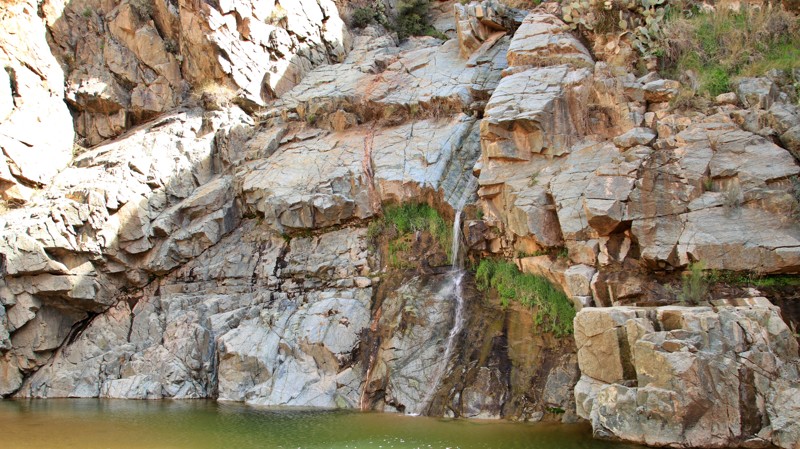
Eons ago, volcanic basalt flowed from a shield volcano east of the present-day Agua Fria River. The lava flows created what is now known as Perry Mesa. Later Perry Mesa became part of the Hohokam Culture's homeland. And more recently, European immigrants traveled from the gold fields of California to the slopes of the nearby Bradshaw Mountains, spawning a small village named Bumble Bee. On the western flank of Perry Mesa, these geological, archeological, and historical facts meet at a rare Sonoran Desert waterfall along the course of Bumble Bee Creek.
Bumble Bee Creek begins along Perry Mesa's eastern slope, gathering water percolating down the basalt from infrequent rainfall and rare snowfall. The creek's course leads southwest to the Mesa's edge, where it tumbles down to the Precambrian granite below, creating a small oasis. Hohokam residents knew this little respite from the normally dry desert. Faint petroglyphs at the bottom of the falls mark their passing. Today cattle graze below the falls, and the Bumble Bee dude ranch sits downstream.
The trail to Bumble Bee Falls is a lollipop beginning off Crown King Road. The northern side of the lollipop offers the most challenging terrain with a steep rutted hill climb, a ridge run, and a steep off-camber descent. The southern side of the lollipop has easy driving in Bumble Bee's sandy creek bed at the cost of pinstriping from the overgrown mesquite trees. Choose your flavor.
Several small campsites just off Crown King Road can accommodate four to five vehicles. The sites are sandy and level with a fire ring.
Updated: 04/26/2024
Little Turkey Creek
Young, Arizona
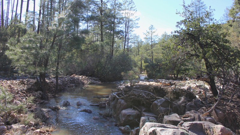
Turkey Creek is an offroad experience in the Tonto National Forest. Once the hair-raising obstacles are overcome, this trail treats you with views of deep canyons and waterfalls laying smack dab in the middle of the typical beauty that Arizona has to offer. Speaking of water, which is a rare thing in Arizona, you will have the opportunity (at least in the rainy season) to ford both the Turkey Creek and Little Turkey Creek on this trail. Don't think that just because you made it through the obstacles that you are home-free. The brush is so tight to the trail that you may feel like you are going through a car wash! This is a great trail for a driver looking for something a little harder than the typical dirt road.
Updated: 04/01/2025
Rolls 1811
Tortilla Flat, Arizona
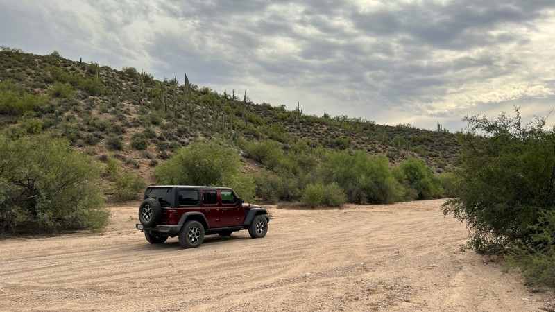
Rolls 1811 is one of the easiest trails in this OHV area. The trail begins at the intersection of trail 13 and travels south to intersect trail 1813. It is a sandy wash the entire way. The most challenging part of this trail is maneuvering the blind, high-banked corners. Be cautious of oncoming traffic as this area is shared with many types of off-road vehicles going at various speeds. You will take some Arizona pinstripes along the way through the narrow brush. A few sandy pull-off areas could be used as good camping spots. These lower-elevation camp spots would get you out of the wind but would lack any type of scenic view.
Please note that an OHV permit is now required on this trail.
Updated: 03/09/2023
Desert Springs
Littlefield, Arizona
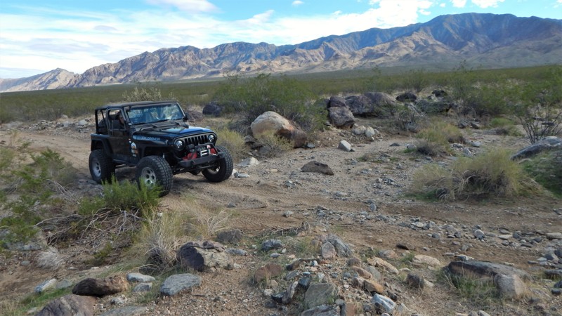
Desert Springs is an easy crossover trail connecting with the popular Elbow Canyon trail that leads into the Grand Parashant National Monument region of the Arizona Strip. The sunsets are also a wonderful reason for traveling and camping along this route. They are spectacular and happen every single day of the year. The trail allows you to easily travel from the Eagles Landing truck stop between Mount Bangs to the east and within the Pauite Wilderness and the Virgin River valley off to the west.
Updated: 10/15/2024
Fracus Canyon
Ryan, Arizona
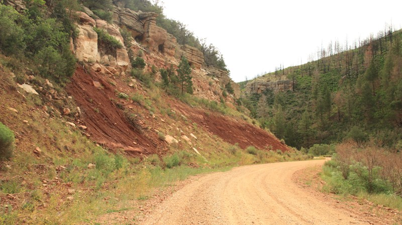
Fracus Canyon, named for the winding canyon on its northern end, is a major north/south arterial road in the Kaibab National Forest. The northern portion of the trail was burned in the 2020 Mangum Wildfire. The blackened trunks of massive Ponderosa pines stand stark against the white backdrop of the canyon walls. The burned section gives way to a beautiful pine forest with campsites scattered along the central portion of the trail and its many spurs. The road intersects with West Side Ryan, close to Highway 67 and the DeMotte Campground.
Updated: 11/19/2022
Old Happy Valley Road
Mescal, Arizona
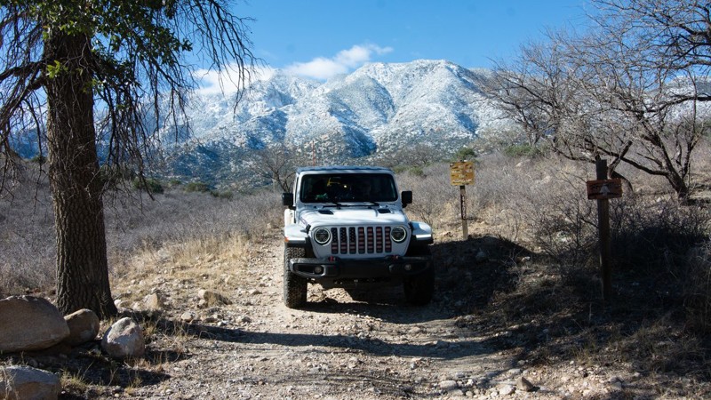
If you are looking for some amazing scenery, and an alternative more challenging way to Happy Valley, this is your route. Formerly the main road to Happy Valley, this small track was bypassed at one point to smooth out the ascent over the pass at Paige Creek. Today the trail follows the powerline to the ranches in Miller Flat and in Turkey Creek.
This road provides perhaps the finest view of the beautiful Happy Valley, Turkey Creek Trail, Galiuro, Rincon and Pinaleno Mountain Ranges.
Updated: 06/05/2022
Mormon Well Road
Mesquite, Arizona
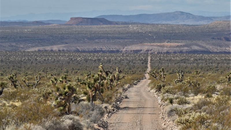
Mormon Wells Road is considered the gateway to a unique desert adventure within the Beaver Dam Wash Wilderness Region. The trail can be used to either access or exit the Three Corners region that marks the point where the Nevada, Arizona and Utah state lines meet. It's one of the easiest most direct routes into a vast remote desert region, which includes multiple Wilderness & Conservation areas. This easy route is ideal for stock four-wheel drive vehicles and large overland type expedition rigs. Early in the route, there are multiple opportunities to set up camp among the abundant Joshua Trees. You'll be treated to massive panoramas of the Beaver Dam Mountains and at night, there are seemingly endless starry skies.
Updated: 02/20/2024
Mineral Wash Slot Canyon
Parker, Arizona
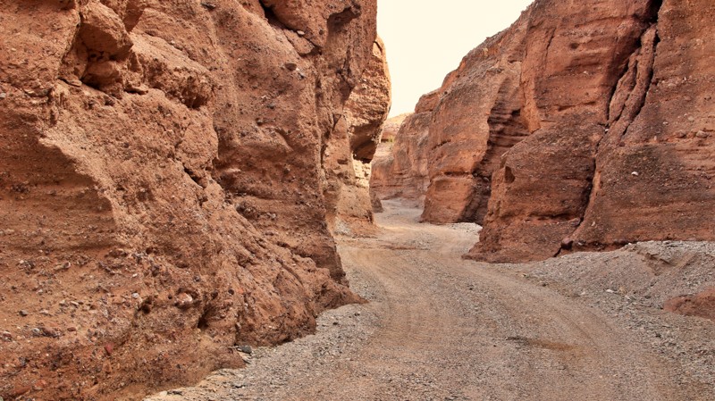
While Utah is known for its beautiful slot canyons, Arizona also has a few. Mineral Wash Slot Canyon is unique because you can drive through it, winding between the high brown mudstone walls with randomly embedded boulders. A small side canyon offers a tight, narrow slot for a fun hiking experience.
Updated: 02/05/2023
FR 126
Flagstaff, Arizona
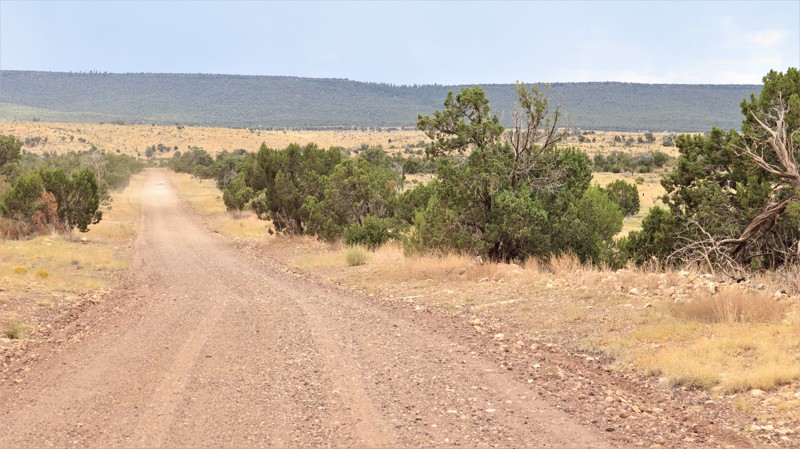
Route 66 aficionados immediately grin from ear to ear if you mention Twin Arrows. The quirky gas station and trading post with its two massive arrows made of steel pipes and sheet metal is a mainstay of old Route 66 lore. Today the ruined remains sit across the Interstate from the new Twin Arrows Resort and Casino but still draw many to stop by, look around, take the obligatory photos, checking off yet another piece of bygone Americana. Few, if any, take note of the wide dirt road going south towards the long line of a mesa top far away. FR 126 flies straight as an arrow for a few miles, with nothing but sparse grass and a few scrub trees on either side. A sign informs you the Flying M Ranch is 18 miles ahead. To the uninformed, the road seems boring. But others know the possibilities ahead. The dark line of Anderson Mesa dominates the horizon. It isn't dramatic. The mesa is only 400 feet above the surrounding terrain on its northern side. But that slight elevation gain is critical, leading to a completely different ecosystem. Slowly the junipers begin to thicken and get larger. Hopi and Navajo come here to harvest wood for the winter, their trucks laden beyond capacity for the drive back north. Hidden along spur roads are campsites favored by hunters. A few narrow bridges span almost never wet drainages. Cattle guards shake the pebbles out of your tires. At the intersection with Kinnikinnick Road, the adventurer turns south for the short climb onto the mesa. The cowhands of the Flying M stay left towards ranch headquarters and the official end of FR 126. Out of courtesy, take the adventurer's route and leave the ranch in peace.
Updated: 06/05/2022
FR 141
Payson, Arizona
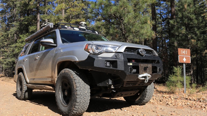
FR 141 is a beautiful drive that cuts through the heart of the Mogollon Rim high country. Located in the vast Coconino National Forest, the trail provides easy access to Rim Road with its stunning views atop the massive geologic uplift that forms the boundary between the Colorado Plateau and the Sonoran Desert. The trail crosses grassy prairies, deep Ponderosa pine forests, and several canyons. With an elevation above 7,000 feet, FR 141 is in one of the few areas of Arizona that experiences a true four seasons. Summers are mild, and the trail offers lots of camping opportunities for those fleeing the scorching desert heat below. Fall brings scattered color with aspens, oaks, and maples on the canyon floors. It is also the season that attracts hunters to the largest elk herd in the U.S. Deer and wild turkey are also plentiful and often seen as you drive the trail. Winter can deliver a thick carpet of snow to the area, ensuring a wonderfully green Spring. Enjoy the beauty of the area as FR 141 transports you from pavement to a myriad of opportunities to explore the Arizona high country.
Updated: 08/02/2022
Vampire Mine
Parker, Arizona
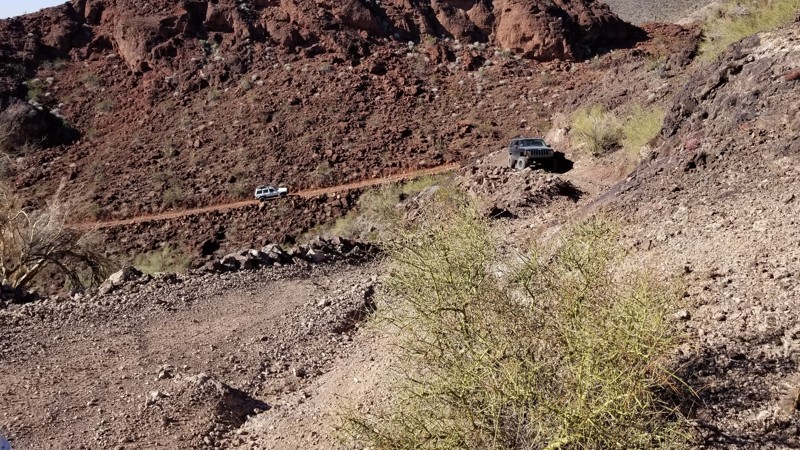
A trail lost in time, The Vampire Mine off-road trail takes you on a unique scenic route through the deserts of Parker, Arizona. The trail twists and winds its way up the side of the hills on narrow shelf roads as it eventually reaches its final destination, the Vampire Mine. With stunning views, you ascend the mountain into a scenic wonderland of the desert and the historic mining remnants of days gone by.
Updated: 10/15/2024
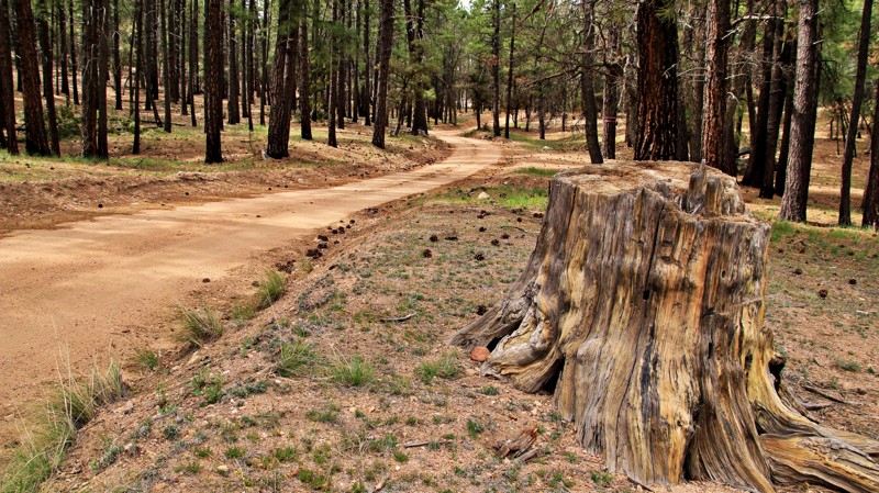
Diamond Point
Mead Ranch, Arizona
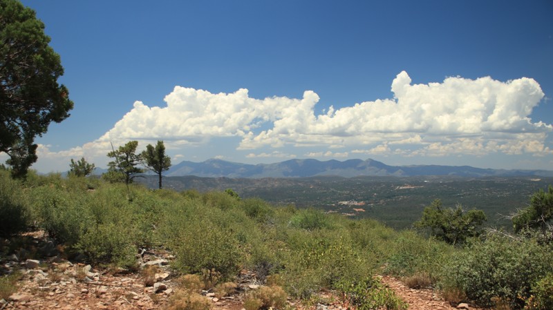
Diamond Point goes south off Control Road towards a hill with a fire watch tower and numerous antennae. A gate before the fire tower stops you from driving up, but you can walk the short distance. The views down into Payson and the Matzatazal Mountains to the southwest from the gate are very nice, though.
A unique geological area exists along Along Diamond. Watch on the west side of the road for signage marking the Diamond Point Recreational Quarts Crystal Collection Area. While not much to look at from the road, this area is known for hollow rocks with quartz crystals inside. They are also called geodes. This is also one of the few areas where the Great Unconformity reaches the surface. The Great Unconformity is a geological aberration where over a billion years of geologic rock formations are simply missing. Much newer rock deposits top Precambrian rock layers. Geologists are at a loss to thoroughly explain what happened to the other layers.
Diamond Point has quite a few dispersed roadside campsites.
Updated: 06/05/2022
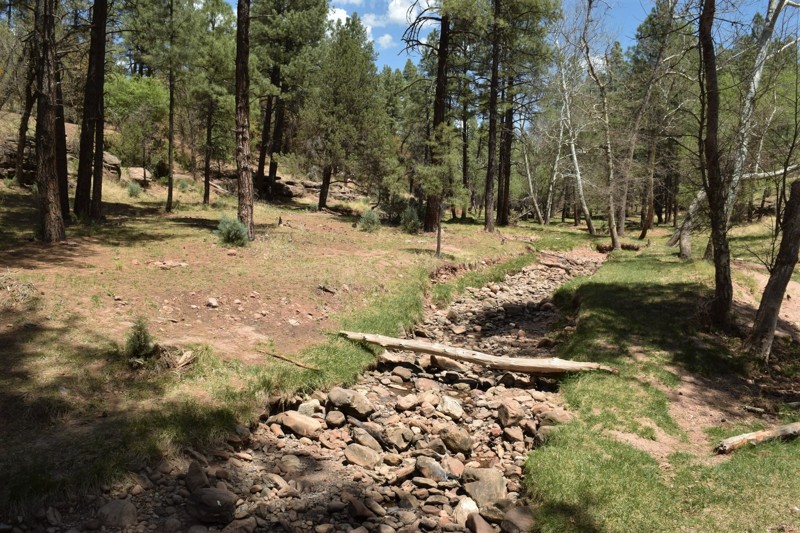
Walnut Creek
Chino Valley, Arizona
Walnut Creek gets its name from the small but reliable tributary at its northern terminus which has numerous old walnut trees along its banks. The trail begins in the tall Ponderosa pines common to the Arizona high country, where the wind sings a relaxing song as it slips through the needles of the highest branches. The sound is guaranteed to soothe even the most frayed nerves. Aberts squirrels dart across the trail in front of you. Deer look warily from the shadows as you pass. Stream crossings offer opportunities for making a splash. The road descends slowly and enters the high chaparral biome with juniper, Gambel oak, and manzanita replacing the pines. The trail is a bit rockier here. The views of Juniper Mesa north of the Walnut Creek valley more than makeup for the increased jostling. All too soon the drive is over, but perhaps one of the many nice campsites along the way would make a good place to set up camp and enjoy an evening under the stars in the Prescott National Forest.
Updated: 06/05/2022
Dry Dude Creek
Payson, Arizona
If camping and exploring trails in the pines with your 4x4 sounds like a great time, then this would be the spot to start. Camping in this area makes for a great starting point for exploring the Arizona Mogollon Rim country near Payson, Arizona. The trail is easily accessible from FR64, Control Road, and located near the East Verde Creek at Verde Glen. All within an easy trail ride from camp, you can hunt geodes at Brody Hill, rock crawl Pyeatt Draw, or go for a hike on the Highline Trail #31.
Updated: 04/28/2025
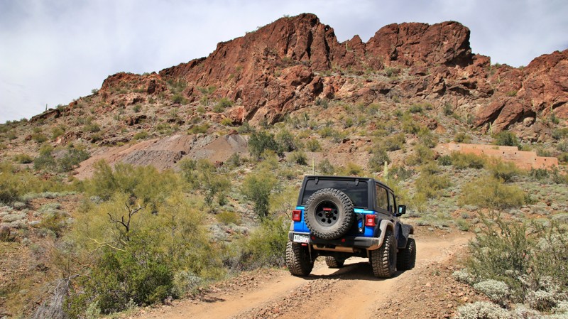
Belmont Mine Road
Tonopah, Arizona
Running through the ruggedly scenic Belmont Mountains, the trail's highlight is the Tonopah-Belmont Mine. The large mine operated around the turn of the 20th century, mainly producing silver and lead and employing approximately 50 men. Today there are numerous mine ruins still at the site. Explore with caution.
A tragic mine fire in 1911 resulted in 17 deaths, including William A. "Big Bill" Murphy. The 28-year-old operated the cage elevator that took men up and down the mine's vertical shaft. Murphy successfully took the cage down twice to rescue miners. He did not return from his third try. Nearby Tonopah erected a monument to honor the hero.
The trail is relatively easy, with a few off-camber spots and wash crossings. The northern half of the trail is on Arizona State Trust Land. A permit is required to camp. The southern half of the trail is BLM land. There's limited camping along the trail but abundant campsites north along Vulture Mine Road.
Updated: 04/24/2025
Vernon McNary Road
McNary, Arizona
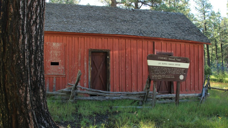
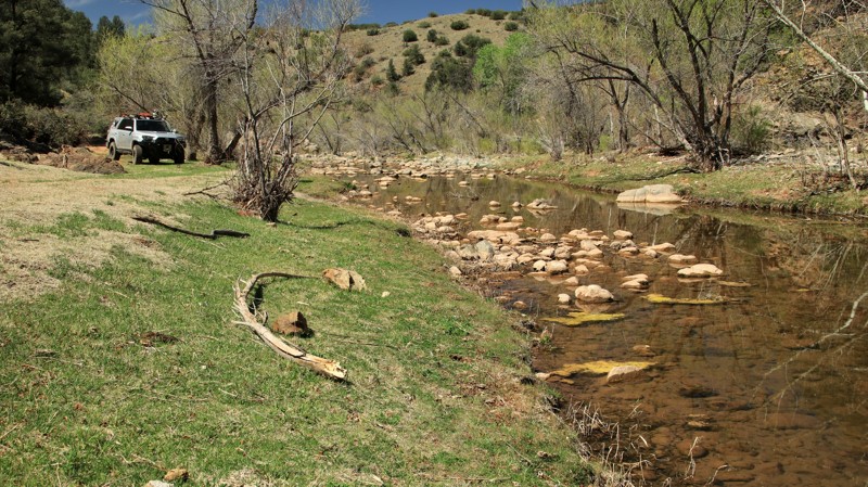
The Vernon McNary Road connects the small Fort Apache Native Lands hamlet of McNary on Highway 260 with the small village of Vernon near Highway 60. The southern five miles of the road are on Fort Apache Tribal Lands. Please stay on the road through this area. The road then traverses the Sitgreaves National Forest before crossing private land towards its northern end. The road starts in a dense pine forest, transitions to a juniper and pinion forest, and eventually crosses open grasslands. Los Burros Campground lies approximately 7 miles from the southern end of the road on the edge of an alpine meadow. The free campground has numerous sites and a vault toilet. The campground is on the site of the historic Los Burros Ranger Cabin, still standing proudly today. There are plenty of dispersed campsites along the road's many spur trails.
This road will close in the winter during periods of snow. No set dates exist, but you can always call the Apache County Maintenance Yard to verify the road status if snow has recently been in the forecast.
Updated: 06/05/2022
FR 502
Payson, Arizona
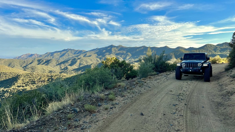
If you like working for your reward, then this may be the little trail you've been searching for. An inauspicious beginning leads to a few challenges that will call upon your skills and the capabilities of your rig. Your passengers may be a bit nervous when the off-camber sections of the narrow shelf road tilt them towards the abyss below. The cattle you pass by look sympathetically at you before resuming their foraging. It's a hard land out here for everyone, after all. But then the East Verde River appears. The East Verde is a delightfully noisy little waterway with smoothed boulders to sit on while dangling your feet in the cool, rushing waters. The deeper pools invite you to take a refreshing dip in the hotter months. A riverside campsite at the end is just large enough for one rig, maybe two, but a night by a mountain watercourse is never a bad thing. Relax by the river for a while. But don't forget, the challenges of getting out are still there.
Updated: 10/15/2024
Oro Belle
Bradshaw City, Arizona
Oro Belle (FR 192) connects Wagoner Road (FR 362) to the upper portion of the Backway to Crown King at the junction of FR711 and FR 192. It's mostly an easy one-lane shelf road with a nice camping spot at each end. On the west end is Minnehaha, off the main trail enough to afford some camping privacy, and on the east end is a sheltered spot nestled just outside a crook of the trail, perched slightly above a dry wash. Along Oro Belle are numerous opportunities for photography.
Because Oro Belle is mostly narrow one-lane, you need to keep track of the occasional pull-outs in case you need to back up to allow oncoming traffic to pass.
Updated: 04/24/2026
FR1820
Tortilla Flat, Arizona
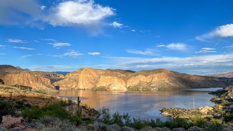
FR1820 begins on the east side of the Apache Trail just before a Canyon Lake historic marker pull-out. FR1820 is a
short trail with an even better view than from the pull-out. The trail gets a little tippy with a camber of 15-20 on one section and a pitch of 15-20 on another. If you are not fond of heights, you might want to skip this one.
Updated: 10/15/2024
Carr Canyon Trail
Sierra Vista Southeast, Arizona
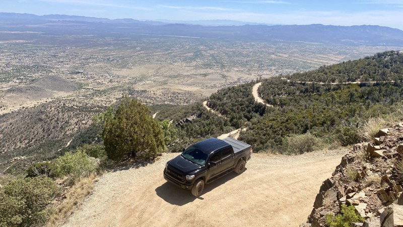
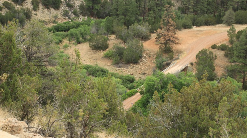
If steep ledges, narrow switchback roads, and sheer drops get your blood pumping, this trail is for you! The Carr Canyon Road was built in the late 1800s to support the Reef Townsite and several gold and silver mines in the area. The road was reconstructed in the 1930s to support vehicle traffic and remains a popular attraction.
Follow Forest Road 386 for approximately seven miles of winding switchbacks to reach the turnaround point. Driving Forest Road 386 is relatively mild, but a few rough sections are not well maintained. The trail climbs for 2,244 feet and tops out at 7,419 feet above sea level. The drive rewards travelers with spectacular views of the San Pedro Valley.
There are several dispersed campsites along the route that are first-come, first-serve. Two National Forest Service campgrounds are also located at the top of Carr Canyon. These are the Reef Townsite Campground and the Ramsey Vista Campground. Reservations are not required for these campsites, but they cost $15 per night.
Updated: 10/15/2024
Heber Mormon Crossing
Heber-Overgaard, Arizona
Heber Mormon Crossing runs 25 miles north from the town of Heber-Overgaard to Highway 99, which goes to Winslow. The trail starts off Highway 260 with a brief paved segment. The portion of the trail in Navajo County is a well-maintained graded road. The maintenance level goes down a bit as you travel north, ending with a short section of unmaintained two-track after the trail departs the Sitgreaves National Forest. A tight hairpin switchback on the north side of the Chevlon Crossing forced a 35-foot restriction on vehicle length. Towing anything beyond a short teardrop-style trailer would be problematic on the hairpin turn.
The trail passes through a pine forest before giving way to junipers and grasslands to the north. Effects of the 2021 Wyrick and 2009 Durfee wildfires are evident along the trail. Though the Durfee fire helped bring back the original grassland habitat needed by larger wildlife.
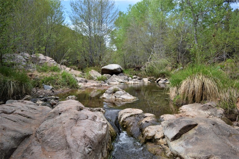
The Chevlon Crossing is quite scenic. There free Chevlon Canyon Campground has a pit toilet, tables, and fire rings with grates. Dispersed camping is available via man of the spur trails.
Updated: 06/04/2024
First Water
Payson, Arizona
In Arizona, 4x4 access and camping along a flowing creek is a pretty rare opportunity. This particular camping area has recently opened, allowing users easy access to the Mogollon Rim Country around Payson, Arizona. The nearby First Crossing recreation site is often a starting point for hikers beginning their trek up to the Waterwheel Park, that's found just to the north. With the creek flowing year-round and an abundance of large shade trees, it's a wonderful reprieve from the Arizona heat. Using this area as a base camp allows visitors easy access to all kinds of trails and adventures while still being close enough to all the conveniences of Payson just 7 miles away.
Updated: 09/03/2023
Corner Spring Trail
Wickenburg, Arizona
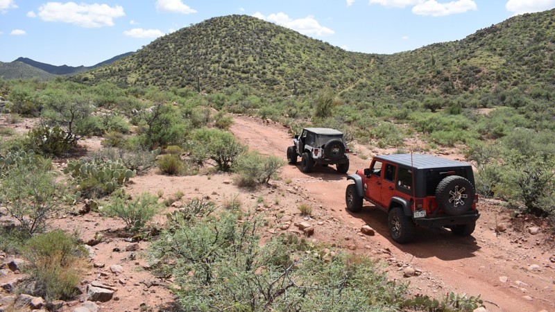
The Wickenburg, Arizona region has a rich history in mining and cattle ranching. Corner Spring is a short connector trail that allows users to connect two popular trails, creating what is often called Constellation Loop. This offroad trail, or the entire Constellation Loop, makes for a great day with a wonderful feeling of being remote and far away from it all.
Updated: 10/15/2024
Stone Creek
Alpine, Arizona
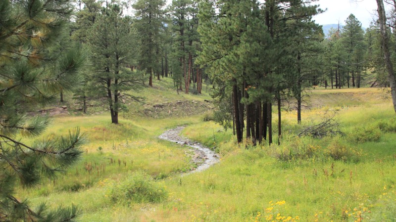
Stone Creek loops north from Highway 180 just east of Alpine to rejoin 180 north of Nutrioso. The scenic drive follows its namesake creek for a portion of the trail winding through a pine forest on the east side of Escudilla Mountain. Dispersed campsites are scattered along the trail, the better ones being north of the intersection with FR 851, Jenkins Creek. The trail is easy with one water crossing that could be problematic after heavy rains.

Upgrade your Membership
Unlock all of the details on every Trail Guide and Scout Route.
Start a 7-day Free TrialCommunity
Partners

