






By clicking "ACCEPT", you agree to be the terms and conditions of each policy linked to above. You also agree to the storing of cookies on your device to facilitate the operation and functionality of our site, enhance and customize your user experience, and to analyze how our site is used.
Arizona Off-Road Trails
373
Total Trail Guides 359

4679
Detailed Waypoints 676
Try a Free 7-Day Trial and unlock it all
Start a Free Trial Most Recent Trail Reviews
Rated 4/5
Open
Visited: 09/22/2026
Hard pack, easy forest service road that is a great back way to the North Rim of the Grand Canyon.


Tyler D’Hulst
Rated 4/5
Open
Visited: 09/22/2026
Spring Canyon is a beautiful drive. We didn’t go out to the cabin but used this western section of road coming back from Crazy Jug

Tyler D’Hulst
Rated 4/5
Open
Visited: 09/22/2026
We took this out to Crazy Jug. The northern section is hard packed forest service road. Not difficult. Very scenic drive through the ponderosas.

Tyler D’Hulst
Rated 5/5
Open
Visited: 09/22/2026
View point is spectacular! Trail was easy going out, no obstacles at all. Saw a Toyota Camery at the viewpoint.


Tyler D’Hulst
Rated 3/5
Open
Visited: 09/22/2026
An alternative route out to Crazy Jug Point. It’s easy and can be scenic in areas. I’d recommend West Ryan out to Crazy Jug though.
Tyler D’Hulst
Rated 3/5
Open
Visited: 09/22/2026
A quick connector trail through the burn patch.
Tyler D’Hulst
Rated 5/5
Open
Visited: 09/20/2026
Leviathan Mine trail is a full day trip. Though it is only 20 miles in length the travel is slow and rough. Majority of the trail you will be going between 5-10 MPH. Then once at the end it connects w...



Eric Gartin
Official Crew
Rated 4/5
Open
Visited: 09/19/2026
Simple road, well graded today. Many mountain bikers coming down from the West out of Breezy Pines. Not too many people out until approaching Senator Hiway. We went East to West as I think thats a bet...



Jeff Burnett
Rated 3/5
Open
Visited: 09/19/2026
The trail itself is not spectacular, it's pretty flat across the plains. However, driving up to the overlook and seeing a huge gaping hole in the ground is a great juxtaposition to the flat trail. The...
Tyler D’Hulst
Rated 3/5
Open
Visited: 09/19/2026
A nice trail ride from the main road down off the plateau. It's graded forest service road until the switchbacks. The switchbacks themselves are not difficult, road is not graded. This section has bee...
Tyler D’Hulst
Rated 3/5
Open
Visited: 09/18/2026
The end of the trail is not well marked, and can cause confusion. Also, vehicle passes are required for all backcountry routes within the Lake Mead National Recreation Area.
Eric Gartin
Official Crew

Ted Whisler
No Rating
Open
Visited: 09/17/2026
Nice ride west side a little rocky but rating is true to #2


Ted Whisler
Rated 3/5
Open
Visited: 09/15/2026
A nice drop off the plateau heading towards Marble Canyon. Not a difficult road. Road is weathered but not challenging.
Tyler D’Hulst
No Rating
Temporary Closure
Visited: 09/15/2026
Road closed due to multiple washed out wash crossings after the turn off to go up the mountain. "Road Closed" sign put out by BLM on trail.
Tyler D’Hulst
No Rating
Temporary Closure
Visited: 09/15/2026
After the turn off to head up the mountain there are multiple washed out wash crossings. A "Road Closed" sign has been put out by the BLM.
Tyler D’Hulst

Ben Ruddell
Official Crew
Rated 4/5
Open
Visited: 09/14/2026
Bogles Ranch Road is a great Sunday afternoon drive type of dirt road that climbs up in elevation and gives some spectacular views of the surrounding area. The first half passes through State and Priv...


Eric Gartin
Official Crew
Ben Ruddell
Official Crew
Rated 3/5
Open
Visited: 09/14/2026
Antares Road is an excellent way to travel from Route 66 to the eastern portion of the Lake Mead National Recreation Area. This wide county road is well maintained with minor washboarding, most of whi...


Eric Gartin
Official Crew
Rated 3/5
Open
Visited: 09/14/2026
Hackberry road is a wide dirt road with minimal erosion damage and washboarding. There are a couple of larger washes that cross Hackberry road creating wide stretches of loose sand which can cause iss...


Eric Gartin
Official Crew
Rated 3/5
Open
Visited: 09/13/2026
This is a very rough, rocky, & slow going trail. Expect around 4+ hours for the trail & another hour to get the highway. One of those trails I'm happy I did but I wont be back personally. High clearan...

Brandon W
No Rating
Open
Visited: 09/12/2026
I think the rating is spot on. The ruts and washouts at the beginning are not as bad and if you hug the inside of the shelf road they can be avoided. The middle part is same general sandy wash with ov...



Greg Page
Rated 4/5
Open
Visited: 09/11/2026
Ran this trail as part of a larger loop. Trail is in great shape. Easy for standard 4x4 with no lift. Passengers can do it until maybe the very end by the lake where the road gets rocky and washed out...


Jeff Burnett
Rated 5/5
Open
Visited: 09/10/2026
This is one of my favorite scenic trails in the area. The trail is easy to travel, but does have some optional short trails that will test your vehicle. The views from the Grand Wash Cliffs of the Hua...


Eric Gartin
Official Crew
Rated 3/5
Open
Visited: 09/07/2026
This trail by itself is nothing special. It is mostly used as an access road to get to the more technical trail such as Homecourt, Twister, and Waynes World. This is a great trail for the beginner to ...


Eric Gartin
Official Crew
Rated 3/5
Open
Visited: 09/07/2026
This trail is an enjoyable alternate route when traveling on Blake Ranch Road (7163). The trail is easy with only a handful of spots with erosion damage. The few established camping sites appear to n...


Eric Gartin
Official Crew
Rated 5/5
Open
Visited: 09/07/2026
Ran this trail from Boynton Pass Road to Loy Butte Road (opposite direction from what is listed). Ran into a few rental ATVs and a couple of Jeeps heading the opposite way. This was a fun trail wit...



Daniel Macioce
Rated 5/5
Open
Visited: 09/07/2026
This trail was a lot of fun, plus the views were amazing. I ran the trail in the order posted, starting at the south trailhead and finishing at the heritage site. Past a motorcycle, a few jeeps and a...


Daniel Macioce
Rated 4/5
Open
Visited: 09/07/2026
Nice trail, ran West to East. For some reason the map shows this a a one-way trial, East to West. That is not the case, it is a two way trail. Was pretty washed out starting around mile 12. Plenty roc...


Jeff Burnett
No Rating
Open
Visited: 09/06/2026
New trail for me. You didn’t know what it would throw at you around every corner which is why you try to find new trails or old forgotten ones
KB
Kory Burden
Rated 5/5
Open
Visited: 09/06/2026
The trail is no joke—steep, narrow, and technical enough that you’ll want to be comfortable with off-camber shelf roads, rocky terrain, and washouts that will test your vehicles articulation. The rew...



Bobby Rumbaugh
Official Crew
Rated 5/5
Open
Visited: 09/06/2026
Fun trail if you don't want to do pyeatt draw itself. Ran this trail 3yrs ago and definitely a little more erosion but, still any truck or suv with good factory ground clearance can do it. From previo...
JM
James m
Rated 4/5
Open
Visited: 09/06/2026
Ran this trail from I-17 to Sedona. Extraordinary views descending into Sedona. As others have noted, there are lots of rock on the trail, making it slow going. Passed a large number of Pink Jeeps ...


Daniel Macioce
Rated 4/5
Open
Visited: 09/05/2026
This one definitely changed over the last few years. The southern section has some legit, steep, off-camber sections. YOU NEED experience, backup, and a capable vehicle on this one now. It's not supe...


.jpg)
Bobby Nelson
Official Crew
Rated 4/5
Open
Visited: 09/05/2026
Another amazing time on this scenic crossover. We came in from Walnut Canyon and finished out on Price Road after about 6 hours. A challenging and hot day for the old TJ. Rincon Road has evolved into ...


Bobby Nelson
Official Crew
Rated 4/5
Open
Visited: 09/05/2026
We started exactly at sunrise to try and beat the heat. We planned to crossover to Box Canyon and out on Price Road. It ended up taking us 6 hours, even with all the photos and filming we did. A chall...


Bobby Nelson
Official Crew
Rated 5/5
Open
Visited: 09/04/2026
We recently ran Four Peaks after the monsoon rains. Here’s what we found and what to expect if you’re planning to run it. Have a GR8 day!

Jeep 4 Dirt
Rated 5/5
Open
Visited: 09/04/2026
Breathtaking views. Definitely don't rush through the trail. Devil's staircase was a bit slippery but awesome. A few tight stops here and there, but a trail that's a must on anyone's to do list.



Christopher Bradley
Rated 4/5
Open
Visited: 08/30/2026
Id say this is a 3.5 to 4 trail. There are some obstacles, but nothing you really need to think hard about how to approach. If you send your vehicle at it in 4 low you'll get through everything.



Justin Holsinger
Rated 4/5
Open
Visited: 08/28/2026
Rim Road (FS300) West to East. Very well groomed gravel forest road. Accessible by just about any vehicle thats not been lowered. Who does that anyway? Scenic views the whole route. Hard to believe on...


Jeff Burnett
Rated 4/5
Open
Visited: 08/28/2026
Not a bad road but it was crowded with sxs and vehicles towing campers. Hard to rate 5 stars for a busy road. Super easy any vehicle can do this. Part is paved near the freeway but the rest is gravel.

Tony Rockwell
Rated 4/5
Open
Visited: 08/28/2026
I rated 4 stars just due to the volume of sxs & camper trailers on the road.
Easy drive, any car can do this.
Ran from sheep springs to munds park, see other reviews for full route.

Tony Rockwell
Rated 4/5
Open
Visited: 08/28/2026
I ran Bar M in reverse to get to this trail. Then headed toward Casner Park Road. (See reviews I did on each of those)
Nice easy trail that is less rough than Bar M.
Nice drive through trees.


Tony Rockwell
Rated 5/5
Open
Visited: 08/28/2026
Very bumpy due to rock infused trail. A few larger rocks, 8-12” tall in places but most stock 4x4’s should be able to navigate around or over them. I would say any 4x4 with all terrain tires could nav...


Tony Rockwell
Rated 3/5
Open
Visited: 08/27/2026
Overall decent little trail; camped out near Committee Tank (not suitable for tent camping - too rocky). Nothing too technical but enough to keep things interesting. High clearance and good line choi...


Bill Ferguson
Rated 3/5
Open
Visited: 08/27/2026
Connector from FS801 (Rock Garden Loop) to FS09494F (Committee Tank Trail); yeah, it lives up to its namesake. Very rocky. High clearance and picking good lines are an absolute must. Car camped at...

Bill Ferguson
Rated 5/5
Open
Visited: 08/27/2026
Nice trail saw some deer it’s a little rough but overall was easy


M
Maddox
Rated 5/5
Open
Visited: 08/23/2026
Great little adventure for the day. Dirt road is pretty rutted up due to monsoons, but easily drivable. Lake itself is extremely low.
LL
Larry Lapp
Rated 4/5
Open
Visited: 08/22/2026
A fun side trip that has a steep hill climb. Due to recent rains, the wildflowers were blooming.


Bobby Rumbaugh
Official Crew
Most Popular
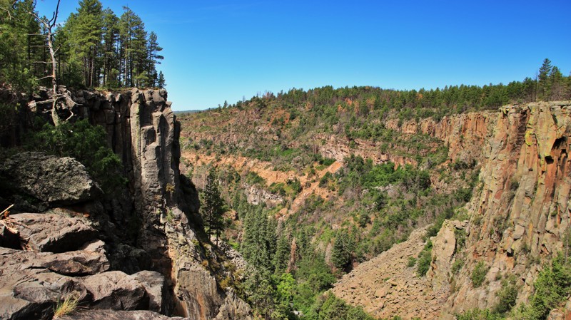

Updated: 10/15/2024
FR 527
Parks, Arizona
FR 527 runs from Garland Prairie through the Kaibab National Forest to intersect Secret Mountain (FR 538). The trail's western end is paved for a short stretch through private land. The trail jogs to the east at the Boy Scout Camp entrance, intermittently crossing private land and portions of the Coconino National Forest. The trail's only major obstacle emerges near Railroad Spring, a marshy area that is perpetually wet and muddy. Bogging here is highly likely. Mud terrain tires, 4WD, and momentum might get you through.
The trail's highlight is Volunteer Canyon, a side tributary of Sycamore Canyon. Just a short walk from the road is an ordinarily dry waterfall topped by volcanic basalt. The drop is several hundred feet. The multihued walls of Volunteer Canyon dramatically drop away. Only the Ponderosa pines on the canyon wall give scale to this dramatic geological display.
The trail east of Volunteer Canyon is well-maintained and suitable for 2WD.
There is minimal camping on this trail. One site near the eastern end was a well-laid-out hunter's camp.
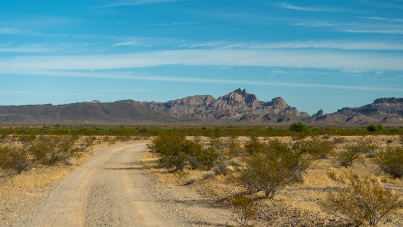
Updated: 04/19/2024
Arlington Clanton Well Road
Tonopah, Arizona
Situated in the Lower Sonoran Desert of Arizona, Arlington Clanton Well Road is remote and lays within a relatively unexplored and wild area. Splitting the Eagletail Mountains Wilderness Area and Cemetary Ridge, Arlington Clanton Well Road provides unparalleled views of ancient and mysterious looking volcanic rock formations rising from the wide-open valley floor. The vast and dramatic landscape will leave you with a feeling of wonderment. This road is a destination in itself but can be combined with Palomas Harquahala Road or Turtleback Mountain for a weekend of exploration or you can use this as your gateway for a long multi-day trip into Kofa National Wildlife Refuge.
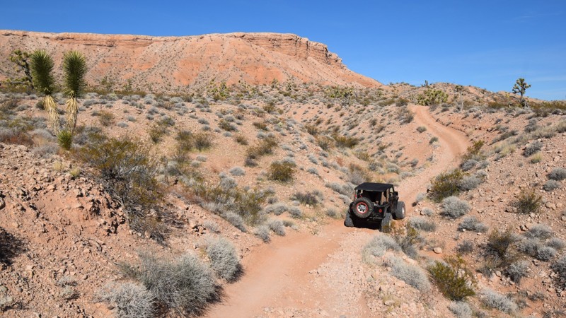
Updated: 06/05/2022
Three Corners
Mesquite, Arizona
Have you ever wanted to stand in three states at once? Well, pack up your 4x4 and head out into the Arizona desert to plant your feet at the state line junction for Arizona, Nevada, and Utah. In November 2016 there was an updated marker installed, way out in the desert to signify their meeting point. This short trail will take you right to the point where you'll find a decorative placard and flags from all three states. While there are a couple of ways to get to the monument, combining this trail with Mormon Well Road is one of the easiest ways to get there. When you're winding your way through the sand washes the views of the surrounding mesas are quite beautiful, especially during the spring desert bloom.
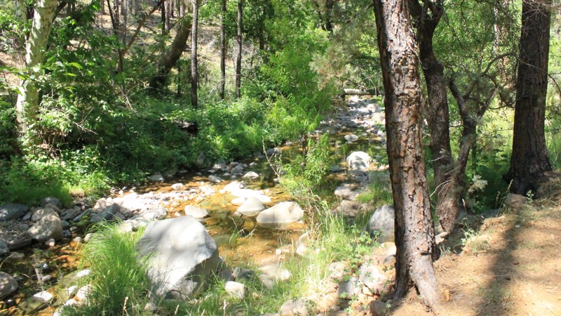
Updated: 05/26/2024
Reynolds Creek
Roosevelt, Arizona
This is a great trail for those new to offroading, or those looking for a beautiful drive in the forest. The trail is in Tonto National Forest about an hour north of Globe. Reynolds Creek Trail is down in the valley, and you can feel the cooling effect as you drive deeper in. It can feel somewhat ominous with all the burned trees, however, there are still lots of tall trees that provide a great forest canopy and a shaded floor.
During the early summer months, you might be fortunate to have a snack of blackberries growing wild next to the road. There are also lots of deer and turkeys in this area. Early in the year, you will enjoy the cool creek flowing across your feet. If you are brave enough, you can find some pools to submerge in. Go for it!
Updated: 04/29/2024
Hot Well Dunes Recreation Area
Bowie, Arizona
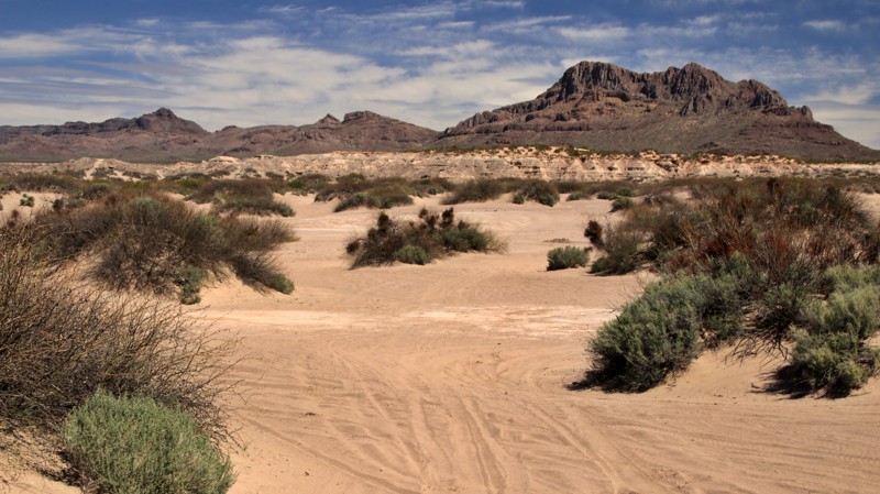
While hoping to find oil under improbable sand dunes in southeastern Arizona, geologists instead struck hot water with their exploratory drilling. Today, Hot Well Dunes Recreation Area has 2,000 acres of free-play sand dunes and two hot tubs replenished from the unlikely water discovery. Sitting far away from any sizable city, you may be the only one enjoying the sand and water on a weekday. The remoteness also means a very dark sky for star gazing at the end of a day playing in the sand.
Updated: 12/02/2025
San Mateo Castro
Queen Valley, Arizona
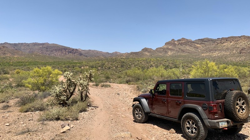
The San Mateo Castro Trail is a great connecting option from the Apache Land Trail. It runs north and ends at East Gold Rush Road near the Peralta hiking trailhead. The terrain is a mix of dirt and rock that crosses a sandy wash several times. Approaching the northern end of the trail, the views of the Superstition Mountains are just amazing. There are multiple spots where you could set up camp for the night all along the trail, with larger, well-established sites towards the northern end.
This trail is on Arizona State Trust Land. A recreation permit is required.
Updated: 04/26/2024
Roosevelt Vista
Globe, Arizona
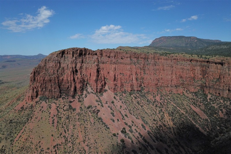
The Roosevelt Lake region within the Tonto National Forest is an outdoor enthusiasts paradise. There are countless trails leading you to scenic vistas but FR140 leads you quickly and easily to one of the best views in the region. This trail is an easy out and back scenic stop or an excellent camping location for exploring the other trails in this area. Roosevelt Vista leads you to a couple of different side trails, each with incredible vistas and campsites. Along the canyon rim, 800 feet above the Tonto Basin, you will find a couple campfire rings and several vantage points for photographs.
Updated: 03/28/2024
Seven Up
Chino Valley, Arizona
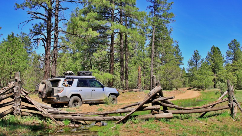
Ranchers in the deep Southwest summer their cattle in the cool high-elevation pine country, driving them to lower elevations for winter. The grazing lands are a mix of private property and leased public lands from the Forest Service, BLM, and the State. Working cattle in the rugged mountains of the Prescott National Forest is demanding on both cowboys and their horses. A good cowboy will use three horses in a day pushing through the scrub brush on loose rock hillsides looking for scattered cows and calves in deep in shaded canyons. The 7UP Ranch is one of those rough-and-tumble cattle operations that evokes the storied history of a harsh land and the sturdy people that struggled to tame it just enough to exist here. And a road runs to it and beyond. Starting on Camp Wood Road, Seven Up runs north through deep Ponderosa Pine forests beside buff and gray granite outcroppings that look as if a leviathan stacked stones in a monumental cairn. A bit over 3 miles into the drive, you arrive at the picturesque ranch headquarters, its pastures dotted with cow ponies, and a myriad of cottages, barns, and outbuildings. Seven Up continues past the ranch, offering shaded flat campsites and possible glimpses of deer, turkey, and javelina if you keep your eyes peeled into the shadows of the pines. Just past the high point of the trail is a hairpin turn to a steep switchback. Just make sure you turn to avoid a Thelma and Louise moment. The view from the top of the switchback is definitely worth a quick stop. Soon enough, Seven Up deposits you into a lush valley where the North and South Forks of Walnut Creek converge. Seven Up's a good ride. Mount up and give it a try.
Updated: 04/29/2024
Scott’s Well
Yucca, Arizona
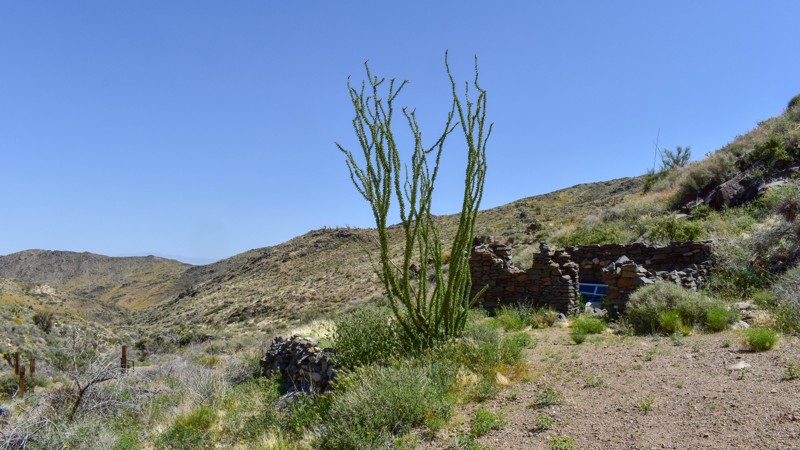
Off the beaten path and surrounded by nature's beauty best describes this backcountry road. Located near Lake Havasu City, Scott's Well is a beautiful narrow wash trail that runs into the foothills northeast of the Mohave Mountains. If you've ever looked up at the mountains to the east of Lake Havasu and wondered what lay on the other side, this is the trail to take. There are numerous mine shafts, Scott's Well stone cabin ruins, other cabin sites, and many relics of days gone by throughout the area to explore. From the dusty, nearly desolate lowlands to the green grass and blooming vegetation, complete with Joshua trees and Saguaro cacti high up on the hillside, this trail is a must-see for anyone in the area.
Updated: 01/03/2026
Christmas Pass
5 de Mayo, Arizona
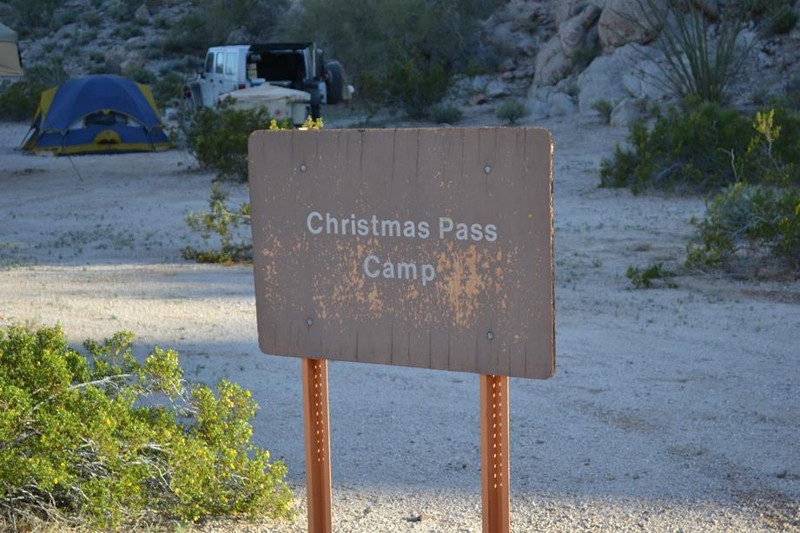
This route runs from Tule Well on the famous El Camino Del Diablo up and over Christmas Pass Cabeza Prieta National Wildlife Refuge and enters the Barry Goldwater Gunnery Range. Tule Well is an amazing collection of sights, smells, historical artifacts, and nice camping. This iconic camping spot is a famous stop along the El Camino Del Diablo and offers extraordinary solitude and scenery. The Christmas Pass camping area is set against a stunning backdrop of rock formations. Along Christmas Pass, rock piles mark possible old graves just off the road. At Christmas Pass sits an old border patrol station site and an opportunity for a little easy rock scrambling. You might catch a glimpse of fighter jets practicing dogfighting over the desert floor, strange lights out in the desert at night, and the most amazing starscape you can find. Don't forget that you need a permit for this area. The Border Patrol, military, and Cabeza Wildlife Refuge take those permits, or lack thereof, very seriously.
Updated: 06/01/2024
Dick Hart Ridge
Pine, Arizona
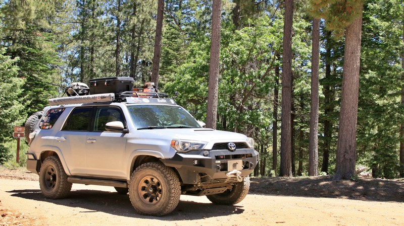
Dick Hart Ridge, also called FR 139, is set in the Ponderosa pine forest atop the Mogollon Rim in the vast 1.856-million acres Coconino National Forest. The road crosses three of the five hiking trails that constitute the Cabin Loop, one of Arizona's preeminent backpacking destinations. Dick Hart Ridge ends at the Mogollon Rim and Rim Road, one of the most scenic and storied offroad drives in Arizona. The views from the Rim's 3000-foot escarpment are simply breathtaking. The road is set on a prominent ridge named after a stockman who operated a sheep shearing facility on the east side of the spine, thus becoming Dick Hart Ridge. A separate trail ran east/west to the shearing shed set by a spring in a small canyon. One of the men at the shearing plant was so accomplished with his scissors that locals came to him for a haircut, earning the canyon and trail the moniker Barbershop which still is used today. The southern end of Dick Hart Ridge climbs above 7000' and receives a good deal of rainfall. The forest here is still primarily pines, but stands of fir and spruce mix in as well. Elk, deer, bear, turkeys, and a few million squirrels call this primordial forest home. You will definitely see the squirrels, and likely see some elk. Keep your eyes open, and who knows what else you might see along Dick Hart Ridge.
Updated: 04/05/2022
Sand Hollow Wash Road
Littlefield, Arizona
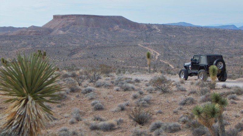
Sand Hollow Wash Road has been the standard go-to route for easily reaching two popular 4x4 trails in the Arizona Strip, Thelma & Louise and Three Corners Monument. The trail begins with a large staging area for those towing trailers or to stage a group run. You'll quickly begin bouncing along this very rocky and wide-open desert landscape. The trail soon connects to the popular Thelma and Louise Overlook loop. You can take this looping trail for an overlook of Beaver Dam Wash and connect back with this trail. Along the route, there's an opportunity to walk among joshua trees. There are numerous swatches of "thick" forests spread across this seemingly inhospitable terrain. At the end, the trail connects with Three Corners monument trail and many others that crisscross a vast region of remote Nevada desert.
Updated: 06/05/2022
Rock Creek
Payson, Arizona
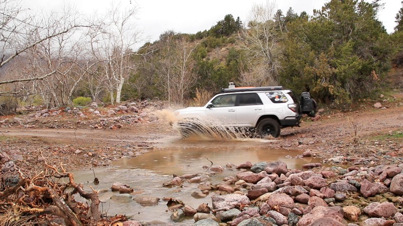
A hit television show decades ago had a character that would often scream, "serenity now." Obviously, he didn't know about Rock Creek. Located in the Tonto National Forest, at 2,873,200 acres, the largest of Arizona's National Forests and seventh largest in the nation, Rock Creek, FR 442, ends at the base of the jagged Mazatzal Mountains. The name Mazatzal is difficult to pronounce. Locals often just refer to the Mazatzal Mountains as the Mazzies. The name is attributed to an obscure native language now only spoken in central Mexico. It means "place of the deer." As difficult as the name may be, traversing the Mazzies is infinitely harder. The rugged and nearly impenetrable mountains, encased in the Mazatzal Wilderness Area, form a north/south spine in central Arizona crossed by no roads and very few foot trails. Rock Creek, which parallels and twice crosses its namesake water feature, is the essence of serenity now. It is peaceful, scenic, seldom traveled, and has three babbling brooks along the way. The end of the road is a trailhead that serves the famed Arizona Trail, a National Scenic Trail that traverses the entirety of Arizona from Mexico to Utah. The trailhead, nestled in a grove of ancient oak trees, sees little use, however, and makes an excellent well-sheltered campsite beside Center Creek, one of those aforementioned babbling brooks. Frankly, if you can't find serenity on Rock Creek, just stay home and watch old sitcoms.
Updated: 09/22/2025
Old Rye Creek
Jakes Corner, Arizona
Old Rye Creek connects the tiny hamlets of Rye and Jakes Corner. The northwestern half of the trail parallels the often dry Rye Creek with various private ranches set in the creek's wide canyon. After crossing Rye Creek, the southeastern half of trail winds across a hillside via shelf roads and switchbacks.
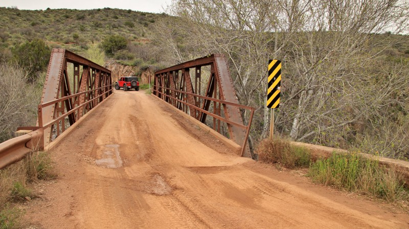
The most interesting part of this road lies in the middle. A steel pony bridge with a history straddles Rye Creek. Built in 1900, the bridge predates welding, so it's bolted and riveted together. The bridge was one of six spans of a bridge across the Gila River in Winkleman, AZ. That bridge was damaged in a 1909 flood. The Winkleman bridge was wholly replaced, and one of the six spans was repurposed to cross Rye Creek. Two other segments are still used to cross the Verde River near Perkinsville on the Jerome-Perkinsville Road.
There are a few small dispersed campsites on the southeastern end of the trail with level ground and stone fire rings.
Updated: 10/15/2024
Ryan Jumpup Divide
Ryan, Arizona
This trail has everything from a well-graded road to a two-track with weeds higher than your hood and a shelf section. There are wide grassy valleys with cattle and deer. And at the end is a historic cabin you can rent.
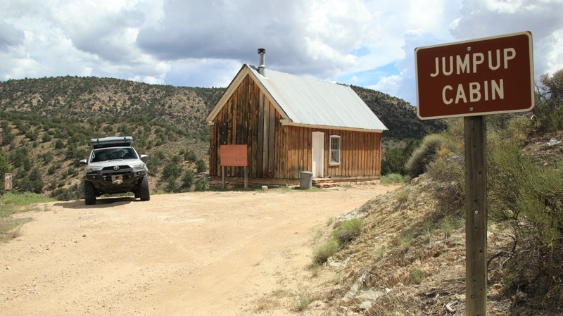
Ryan Jumpup Divide begins at its intersection with West Side Ryan, the major north-south artery through the Kaibab National Forest. The initial parts of the road traverse and then steeply wind out of a pretty canyon. The switchbacks are so tight that the turns are totally blind to oncoming traffic. Take care. The road makes an abrupt 90-degree turn to the west and radically changes. There's plenty of evidence of the 2007 Slide Fire. The trail becomes a weedy, overgrown two-track for several miles. You'll be tempted to mistake which way to go at the intersection with FR 235 near a cattle tank. Stay left because the road changes again as it passes through picturesque grassy hills. Go straight ahead at the confusing intersection with FR 236. Again go straight ahead at the junction with the pleasantly graded Ranger Pass, FR 234. Ryan Jumpup Divide changes again to a shelf road until it reaches its destination, the Jumpup Cabin.
The Jumpup Cabin was one of the first ranger stations built in the Kaibab in the early 1900s. It can be reserved for adventurous visitors but is locked otherwise. The cabin is also located at the trailhead for Ranger Trail.
A few dispersed campsites are located along the northern part of the trail amongst junipers and pinion pines.
Updated: 03/26/2024
Mohawk Mine
Patagonia, Arizona
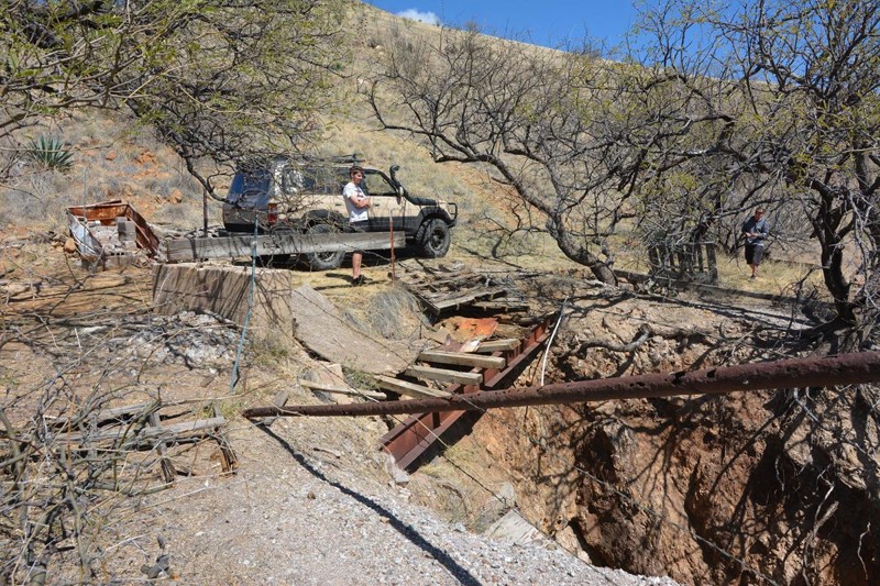
A short but thrilling ride in the foothills of the Santa Rita mountains in Santa Cruz County Arizona, the Mohawk Mine Trail is a spur off the Solero Road (FR143) and a must see when driving along that road. The Mohawk Mine is a former small underground, Lead, Copper, Gold, Silver, Zinc mine which produced ore from 1928-1929. Owned at times, or in part, by the Squaw Gulch Mining & Milling Company, and finally worked as marked on the cabin, by James Marcum in 1937. This is still an active claim, with taxes paid in 2018. The best part of this trail is the cabin at the end of the road which seems to have been built last week. As a final fun challenge, there is a steep hill climb that you can take that loops above the cabin with stunning views of Mexico.
Updated: 06/05/2022
3 Slabs - Parker
Parker, Arizona
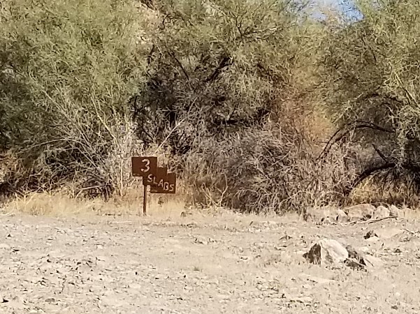
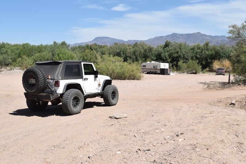
Another one of those, "not really a shortcut 4x4 trails," 3 Slabs may have been named after early residents named this trail due to the finding of 3 head stones found along the trail. Near Parker, Arizona, this fun little off-road trail is packed with rock crawling and wash driving while the trail cuts the corner on Cienega Springs Road. The trail is hard enough that it could pose a challenge to a lightly modified vehicle thus this is a fun little side trail for people who love rock crawling when heading out to some of the other trails like The Duke, The Duchess, or The Desert Bar. The next time you are with a group and want to spice up your boring drive down Cienega Springs Road, take the "not so shortcut" down 3 Slabs and have a little fun.
Updated: 06/05/2022
Poison Springs
Globe, Arizona
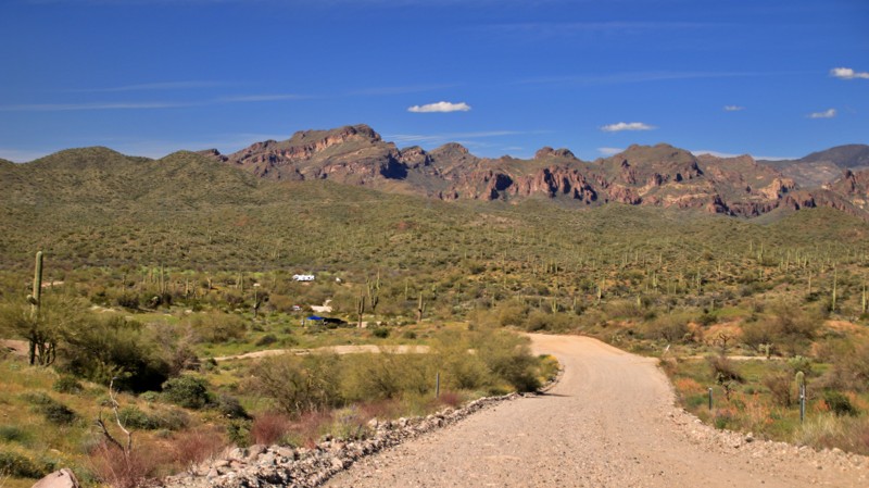
At the far eastern end of the Roosevelt Lake region, you can find great camping and fishing along the Salt River. Poison Springs drops you under Highway 288 and winds its way through a sandy cliff-lined canyon leading right to a wonderful recreation area at Meddler Point. There is an abundance of dispersed campsites located along several unmarked trails along the river. The migratory birds that visit the area are also a frequent sight while fishing along the river.
The area is an ideal place to set up camp for a few days to explore some of the local trails or just set up a chair in the shade along the river. You can also plan a visit to the historic Diversion Dam located along Highway 288, just after the one-lane bridge crossing the river.
Updated: 05/29/2025
Hewitt Station West
Queen Valley, Arizona
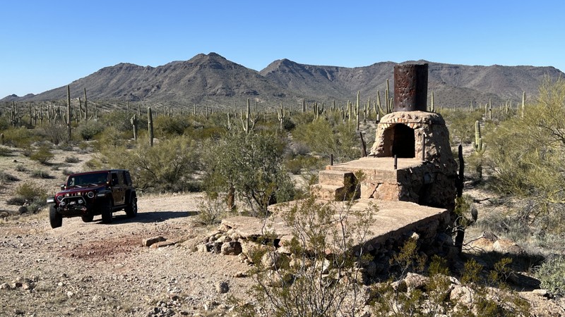
Set in the Tonto National Forest, Hewitt Station runs along the southern edge of the Superstition Mountains. A section of private property cuts the road in half. The western portion of the trail is described here.
Hewitt Station, FR 357, is an easy, well-maintained dirt track. After rain, large puddles form on the road. The puddles have hard bottoms. The trail deadends at private property and has little room to turn around. The trail connects to Hewitt Canyon Road and Bomboy Mine. Shooting is popular along this trail, with numerous established ranges on the north side of the track.
Camping is abundant along Hewitt Station. FR 3493 spurs off the trail into a warren of tracks between Comet Peak and the Whitlow Ranch Flood Control Basin. The spur has a plethora of dispersed campsites of all sizes, many with fire rings. A large campsite sits under massive salt cedars towards the trail's east end. The site has several fire rings, shade, and room for up to five vehicles.
Updated: 10/15/2024
SDNM 8011
Big Horn, Arizona
Sonoran Desert National Monument (SDNM) Trail 8011 provides several opportunities to jump back in time and explore the history of this area. Right at the trailhead sits the remnants of Big Horn Station and the Bender family ranch. The station was a stopping point for those traveling on Highway 84 long before Interstate 8 existed. At the very end of trail 8011, if you proceed about half a mile further west on trail 8008, is the Papago Indian Chief Mine.
SDNM 8011 is primarily gravel. One drop-off into a wash could prevent 2WD vehicles from proceeding along the trail. Several areas on this trail can be used for camping with multiple vehicles.
Proceeding on SDNM 8011 past the Unit 40A gate requires a Barry M. Goldwater Range permit. See the permit required link above. The permit is only available online and requires viewing a mandatory safety video. A printed copy of your permit must be carried with you while on this trail past the gate. SDNM 8011 runs through a very remote area of the Sonoran Desert. Please take all necessary precautions.
Updated: 08/24/2026
Mattie's Grave
Superior, Arizona
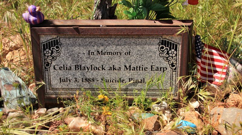
Mattie Earp, born Celia Blaylock, died in the short-lived mining boom town of Pinal after her famous husband, Wyatt Earp, left her for an actress at the end of their tumultuous time in Tombstone, Arizona. The stay in Tombstone became history with the shoot-out at the OK Corral, where Wyatt, his two brothers, and Doc Holiday tangled with members of the Cowboys, a loose band of outlaws who rustled cattle in Mexico and drove then north to sell in Arizona. Morgan Earp was killed after the OK Corral. Wyatt went on to be successful in several ventures and a favorite among the stars of early Western movies. Mattie turned to prostitution, alcohol, and drugs in Pinal and committed suicide on July 3, 1888. Pinal didn’t last long, suffering the fate of many mining towns. There’s virtually nothing left of Pinal today except for the Historic Pinal Pioneer Cemetary and Mattie’s grave.
To reach the grave, travel FR 8, which runs east/west to the north of Pickett Mountain, to a sign for the spur FR 2402. Turn south at the marked intersection with FR 2402, but bear right/west instead of following FR 2402, which goes off to a ridge overlooking Superior. The spur ends at the cemetery gate. Mattie’s grave is just inside the gate.
The trail is easy dirt with small embedded and loose rocks. There are a few ruts on the way to the grave.
A handful of large and level campsites with rock fire rings sit alongside the spur to the cemetery. The campsites make an excellent base for visiting the Boyce Thompson Arboretum, a massive collection of desert plants from all over the globe.
Updated: 10/15/2024
Timp Points
North Rim, Arizona
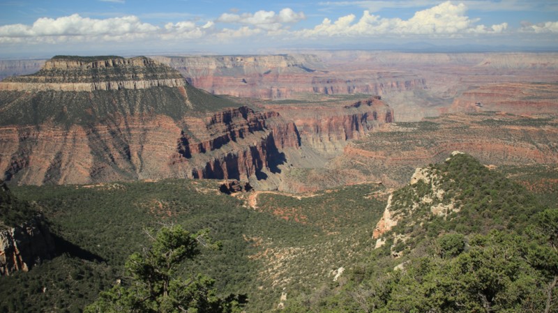
Timp Points goes west to two outstanding viewpoints. The well-maintained road goes through an old-growth pine forest. The trail splits to go to Timp Point and North Timp Point. Both points serve as hiking trailheads for the Rainbow Rim Trail. Both points have amazing views and campsites.
Updated: 01/29/2023
Saddle Road
Dateland, Arizona
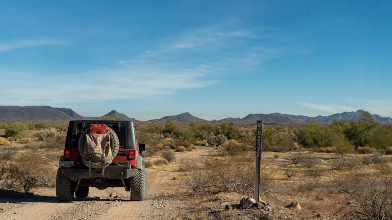
Following powerlines and the more interesting Roll to Arlington rail line, Saddle Road is a route through a lesser-known off-road destination outside of Phoenix, Arizona. It provides a connection allowing for a loop to made between Agua Caliente and Woolsey Peak and Signal Mountain Wilderness Trail or to be used in creating a much longer overland route extending from Phoenix all the way to the Salton Sea in California.
Updated: 08/18/2025
Badger Creek
Greer, Arizona
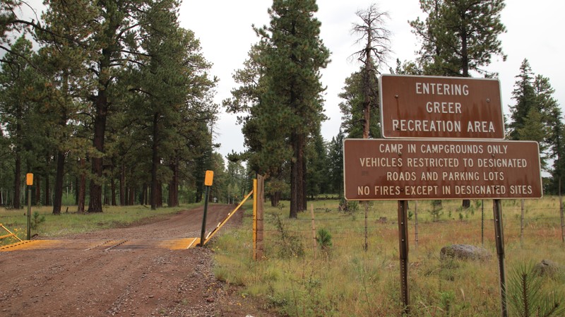
Badger Creek, a well-maintained dirt road, runs from the picturesque hamlet of Greer to Highway 273, providing an easy connection between Greer and the Big Lake area. The trail climbs steeply out of Greer onto a ridgeline that parallels the village. The first 1.5 miles of the trail lie in the Greer Recreation area, and camping is only permitted in established campgrounds. Signs clearly mark the boundaries of the recreation area. Hoyer Campground is located just north of the trailhead. There are also lodges and cabins for rent in Greer. Several dispersed campsites lie just outside the recreation area boundary.

Upgrade your Membership
Unlock all of the details on every Trail Guide and Scout Route.
Start a 7-day Free TrialCommunity
Partners

