







By clicking "ACCEPT", you agree to be the terms and conditions of each policy linked to above. You also agree to the storing of cookies on your device to facilitate the operation and functionality of our site, enhance and customize your user experience, and to analyze how our site is used.
Arizona Off-Road Trails
373
Total Trail Guides 359

4679
Detailed Waypoints 676
Try a Free 7-Day Trial and unlock it all
Start a Free Trial Most Recent Trail Reviews
No Rating
Open
Visited: 09/23/2026
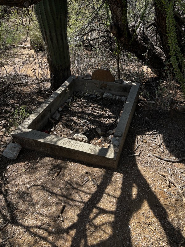
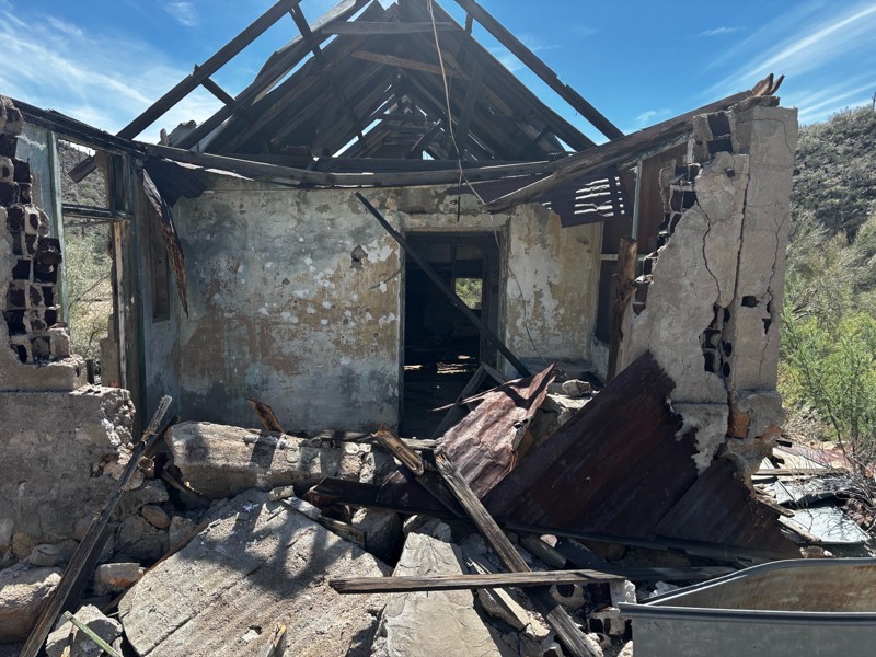
Gets a little technical at the end but the difficulty is spot on.

KR
Keith Ringiesen
No Rating
Open
Visited: 09/22/2026
The road was very smooth with the normal views running through the pines. Reminded us of many of the trails in the White Mountains.
T
Tom
No Rating
Open
Visited: 09/22/2026
Even with all of the recent rain, this trail was mostly dry ... a few ruts had water in them. Looks like there was a bad washout at the northern end of the trail on Apache Maid between waypoints 7 an...
T
Tom
No Rating
Open
Visited: 09/22/2026
Still an easy trail ... even after all of the rain.
T
Tom
Rated 4/5
Open
Visited: 09/22/2026
Hard pack, easy forest service road that is a great back way to the North Rim of the Grand Canyon.

Tyler D’Hulst
Rated 4/5
Open
Visited: 09/22/2026
Spring Canyon is a beautiful drive. We didn’t go out to the cabin but used this western section of road coming back from Crazy Jug

Tyler D’Hulst
Rated 4/5
Open
Visited: 09/22/2026
We took this out to Crazy Jug. The northern section is hard packed forest service road. Not difficult. Very scenic drive through the ponderosas.

Tyler D’Hulst
Rated 5/5
Open
Visited: 09/22/2026
View point is spectacular! Trail was easy going out, no obstacles at all. Saw a Toyota Camery at the viewpoint.


Tyler D’Hulst
Rated 3/5
Open
Visited: 09/22/2026
An alternative route out to Crazy Jug Point. It’s easy and can be scenic in areas. I’d recommend West Ryan out to Crazy Jug though.
Tyler D’Hulst
Rated 3/5
Open
Visited: 09/22/2026
A quick connector trail through the burn patch.
Tyler D’Hulst
Rated 5/5
Open
Visited: 09/20/2026
Leviathan Mine trail is a full day trip. Though it is only 20 miles in length the travel is slow and rough. Majority of the trail you will be going between 5-10 MPH. Then once at the end it connects w...



Eric Gartin
Official Crew
Rated 5/5
Open
Visited: 09/19/2026
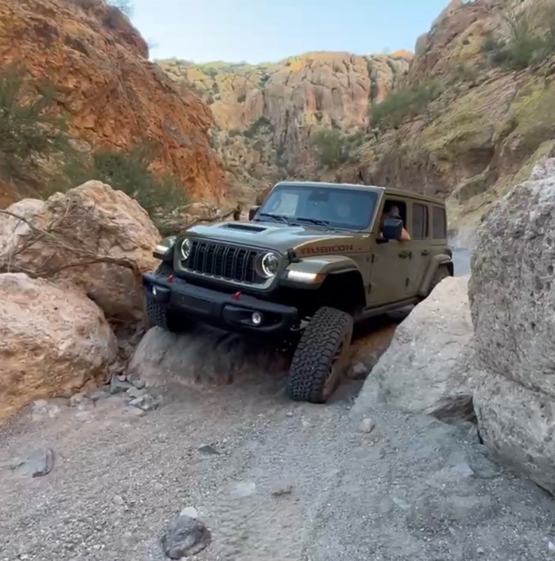
The harder obstacles aren’t that bad anymore. With the amount of sand and gravel that has washed into the canyon. The main constraint is the wedge between the 2 rocks; but I found it easy if you stick...
BC
Brian C
Rated 4/5
Open
Visited: 09/19/2026
Simple road, well graded today. Many mountain bikers coming down from the West out of Breezy Pines. Not too many people out until approaching Senator Hiway. We went East to West as I think thats a bet...



Jeff Burnett
Rated 3/5
Open
Visited: 09/19/2026
The trail itself is not spectacular, it's pretty flat across the plains. However, driving up to the overlook and seeing a huge gaping hole in the ground is a great juxtaposition to the flat trail. The...
Tyler D’Hulst
Rated 3/5
Open
Visited: 09/19/2026
A nice trail ride from the main road down off the plateau. It's graded forest service road until the switchbacks. The switchbacks themselves are not difficult, road is not graded. This section has bee...
Tyler D’Hulst
Rated 3/5
Open
Visited: 09/18/2026
The end of the trail is not well marked, and can cause confusion. Also, vehicle passes are required for all backcountry routes within the Lake Mead National Recreation Area.
Eric Gartin
Official Crew

Ted Whisler
No Rating
Open
Visited: 09/17/2026
Nice ride west side a little rocky but rating is true to #2


Ted Whisler
Rated 3/5
Open
Visited: 09/15/2026
A nice drop off the plateau heading towards Marble Canyon. Not a difficult road. Road is weathered but not challenging.
Tyler D’Hulst
No Rating
Temporary Closure
Visited: 09/15/2026
Road closed due to multiple washed out wash crossings after the turn off to go up the mountain. "Road Closed" sign put out by BLM on trail.
Tyler D’Hulst
No Rating
Temporary Closure
Visited: 09/15/2026
After the turn off to head up the mountain there are multiple washed out wash crossings. A "Road Closed" sign has been put out by the BLM.
Tyler D’Hulst

Ben Ruddell
Official Crew
Rated 4/5
Open
Visited: 09/14/2026
Bogles Ranch Road is a great Sunday afternoon drive type of dirt road that climbs up in elevation and gives some spectacular views of the surrounding area. The first half passes through State and Priv...


Eric Gartin
Official Crew
Ben Ruddell
Official Crew
Rated 3/5
Open
Visited: 09/14/2026
Antares Road is an excellent way to travel from Route 66 to the eastern portion of the Lake Mead National Recreation Area. This wide county road is well maintained with minor washboarding, most of whi...


Eric Gartin
Official Crew
Rated 3/5
Open
Visited: 09/14/2026
Hackberry road is a wide dirt road with minimal erosion damage and washboarding. There are a couple of larger washes that cross Hackberry road creating wide stretches of loose sand which can cause iss...


Eric Gartin
Official Crew
Rated 3/5
Open
Visited: 09/13/2026
This is a very rough, rocky, & slow going trail. Expect around 4+ hours for the trail & another hour to get the highway. One of those trails I'm happy I did but I wont be back personally. High clearan...

Brandon W
No Rating
Open
Visited: 09/12/2026
I think the rating is spot on. The ruts and washouts at the beginning are not as bad and if you hug the inside of the shelf road they can be avoided. The middle part is same general sandy wash with ov...



Greg Page
Rated 4/5
Open
Visited: 09/11/2026
Ran this trail as part of a larger loop. Trail is in great shape. Easy for standard 4x4 with no lift. Passengers can do it until maybe the very end by the lake where the road gets rocky and washed out...


Jeff Burnett
Rated 5/5
Open
Visited: 09/10/2026
This is one of my favorite scenic trails in the area. The trail is easy to travel, but does have some optional short trails that will test your vehicle. The views from the Grand Wash Cliffs of the Hua...


Eric Gartin
Official Crew
Rated 3/5
Open
Visited: 09/07/2026
This trail by itself is nothing special. It is mostly used as an access road to get to the more technical trail such as Homecourt, Twister, and Waynes World. This is a great trail for the beginner to ...


Eric Gartin
Official Crew
Rated 3/5
Open
Visited: 09/07/2026
This trail is an enjoyable alternate route when traveling on Blake Ranch Road (7163). The trail is easy with only a handful of spots with erosion damage. The few established camping sites appear to n...


Eric Gartin
Official Crew
Rated 5/5
Open
Visited: 09/07/2026
Ran this trail from Boynton Pass Road to Loy Butte Road (opposite direction from what is listed). Ran into a few rental ATVs and a couple of Jeeps heading the opposite way. This was a fun trail wit...



Daniel Macioce
Rated 5/5
Open
Visited: 09/07/2026
This trail was a lot of fun, plus the views were amazing. I ran the trail in the order posted, starting at the south trailhead and finishing at the heritage site. Past a motorcycle, a few jeeps and a...


Daniel Macioce
Rated 4/5
Open
Visited: 09/07/2026
Nice trail, ran West to East. For some reason the map shows this a a one-way trial, East to West. That is not the case, it is a two way trail. Was pretty washed out starting around mile 12. Plenty roc...


Jeff Burnett
No Rating
Open
Visited: 09/06/2026
New trail for me. You didn’t know what it would throw at you around every corner which is why you try to find new trails or old forgotten ones
KB
Kory Burden
Rated 5/5
Open
Visited: 09/06/2026
The trail is no joke—steep, narrow, and technical enough that you’ll want to be comfortable with off-camber shelf roads, rocky terrain, and washouts that will test your vehicles articulation. The rew...



Bobby Rumbaugh
Official Crew
Rated 5/5
Open
Visited: 09/06/2026
Fun trail if you don't want to do pyeatt draw itself. Ran this trail 3yrs ago and definitely a little more erosion but, still any truck or suv with good factory ground clearance can do it. From previo...
JM
James m
Rated 4/5
Open
Visited: 09/06/2026
Ran this trail from I-17 to Sedona. Extraordinary views descending into Sedona. As others have noted, there are lots of rock on the trail, making it slow going. Passed a large number of Pink Jeeps ...


Daniel Macioce
Rated 4/5
Open
Visited: 09/05/2026
This one definitely changed over the last few years. The southern section has some legit, steep, off-camber sections. YOU NEED experience, backup, and a capable vehicle on this one now. It's not supe...


.jpg)
Bobby Nelson
Official Crew
Rated 4/5
Open
Visited: 09/05/2026
Another amazing time on this scenic crossover. We came in from Walnut Canyon and finished out on Price Road after about 6 hours. A challenging and hot day for the old TJ. Rincon Road has evolved into ...


Bobby Nelson
Official Crew
Rated 4/5
Open
Visited: 09/05/2026
We started exactly at sunrise to try and beat the heat. We planned to crossover to Box Canyon and out on Price Road. It ended up taking us 6 hours, even with all the photos and filming we did. A chall...


Bobby Nelson
Official Crew
Rated 5/5
Open
Visited: 09/04/2026
We recently ran Four Peaks after the monsoon rains. Here’s what we found and what to expect if you’re planning to run it. Have a GR8 day!

Jeep 4 Dirt
Rated 5/5
Open
Visited: 09/04/2026
Breathtaking views. Definitely don't rush through the trail. Devil's staircase was a bit slippery but awesome. A few tight stops here and there, but a trail that's a must on anyone's to do list.



Christopher Bradley
Rated 4/5
Open
Visited: 08/30/2026
Id say this is a 3.5 to 4 trail. There are some obstacles, but nothing you really need to think hard about how to approach. If you send your vehicle at it in 4 low you'll get through everything.



Justin Holsinger
Rated 4/5
Open
Visited: 08/28/2026
Rim Road (FS300) West to East. Very well groomed gravel forest road. Accessible by just about any vehicle thats not been lowered. Who does that anyway? Scenic views the whole route. Hard to believe on...


Jeff Burnett
Rated 4/5
Open
Visited: 08/28/2026
Not a bad road but it was crowded with sxs and vehicles towing campers. Hard to rate 5 stars for a busy road. Super easy any vehicle can do this. Part is paved near the freeway but the rest is gravel.

Tony Rockwell
Rated 4/5
Open
Visited: 08/28/2026
I rated 4 stars just due to the volume of sxs & camper trailers on the road.
Easy drive, any car can do this.
Ran from sheep springs to munds park, see other reviews for full route.

Tony Rockwell
Rated 4/5
Open
Visited: 08/28/2026
I ran Bar M in reverse to get to this trail. Then headed toward Casner Park Road. (See reviews I did on each of those)
Nice easy trail that is less rough than Bar M.
Nice drive through trees.


Tony Rockwell
Most Popular

Updated: 10/15/2024
Greens Peak Lookout
Greer, Arizona
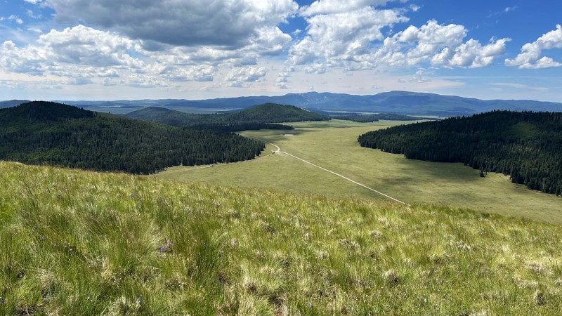
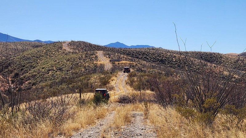
Greens Peak Lookout (FR61C) is a short road climbing to the 10,135-foot summit of Greens Peak, where a fire lookout and multiple communication towers are clustered. The dirt road is in generally good condition to the top, where the road then has some rocky sections around the towers. The hardest part of the drive is that the road from almost the very bottom until reaching the top constantly dips and rises, as though one is driving over large waves. The dips are widely spaced, but they make the drive both to the top and back down slow and deliberate.
Parking space is limited and most readily available either near the fire lookout or near a turnaround at the last tower. The parking area around each of the towers is small and should be left available for maintenance vehicles.
The views from the top are magnificent, with over 180° of unobstructed views over miles of the White Mountains. At the right time, fall views could include meadows covered with wildflowers and gold-leaved aspen interspersed with pine forest.
There is no place for camping along the road to the top, and the nature of the summit does not really lend itself to camping.
Updated: 03/20/2025
The Narrows
Santa Rita Foothills, Arizona
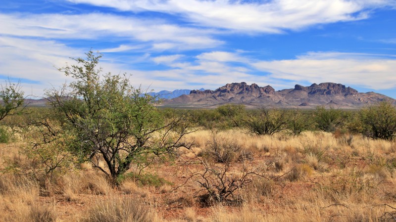
Located within State Trust Land south of the I-10, The Narrows is a connector trail that offers a great mix of technical terrain and narrow sections. This trail includes rutted areas and hill climbs leading to Cienega Creek. At the start of the trail, you'll encounter ridgelines, but the real challenges occur closer to the creek. Here, you'll face a moderately steep descent into the creek, where having at least a rear locker is advantageous. The trail has many sections of narrow vegetation, so expect some desert pinstriping on your vehicle. Depending on the time of year and recent weather, the creek could have significant water flowing through it.
Connect this trail with Lower Wakefield Canyon to create a nearly 20-mile loop.
There are no obvious camping spots along the trail, but if you decide to disperse camp in the area, a State Trust Permit is required.
Updated: 10/15/2024
Puertocito Wash Road
Chiuli Shaik, Arizona
Buenos Aires National Wildlife Refuge in southern Arizona was established in 1985 for the reintroduction of masked bobwhite quail and the restoration of natural landscapes and their native wildlife, including the Sonoran Pronghorn. The 118,000-acre refuge lies in a broad Altar Valley between the Baboquivari Mountains, with their prominent main peak in the west, and the lower San Luis Mountains to the east. In the 1850s, Pedro Aguirre, Jr. built a homestead here in 1864 and named it Buenos Ayres, or "good air," because of the constant winds. His ranch changed hands several times before being purchased to form today's wildlife refuge. The refuge's visitor center is located in the adobe ranch house.
The refuge has over 80 designated campsites identified by a numbered sign. Camping is free and allowed for 14 days in a 30-day period, but only in the designated campsites. Most campsites have a fire ring/grill. Site sizes vary from a single vehicle to large enough for multiple RVs and trailers. Most are suitable for tents.
Fuel and limited supplies are available in the nearby small towns of Sasabe and Arivaca.
Running parallel to its wide namesake wash, Puertocito Wash Road is an enjoyable, leisurely drive through the northwest portion of the refuge. Likely impassable when wet, the trail crosses numerous washes and low areas. The trail passes the Secondino ranch site. Campsites 58 and 59, near the trail's south end, are a double site capable of supporting six or more RVs or trailers. There are two fire rings, flat ground for tents, and a bit of shade.
Updated: 05/20/2026
Lost Cabin Ridge
Mohave Crossing, Arizona
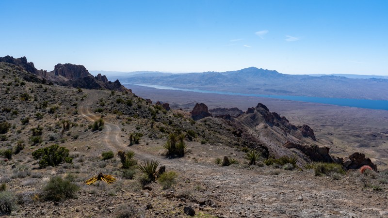
Passing through the Black Mountains at a continuous 4,000-foot elevation, Lost Cabin Ridge is a straight-through trail connecting Cottonwood Road and Portland Mine Road. This breathtaking panoramic trail starts in the desert valley and quickly climbs several steep grades to the top of the ridge. Traveling north to south, Lost Cabin Ridge snakes along the crest and offers spectacular views in every direction. To the north and south, the jagged peaks of the Black Mountains are peppered with Spanish Dagger, a type of Yucca tree. To the west is the deep blue of Lake Mohave and the Colorado River, as well as the rolling vistas of the Cerbat Mountains. This trail is exceptionally rough and continuously bumpy, with exposed rocks smaller than 10 inches. However, the trail descends several steep grades across shallow washes and quickly ascends another grade, making it best suited for stock high clearance 4WD vehicles with short overhangs, such as Jeeps. Pickup trucks are likely to scrape significantly while crossing the washes.
There are several pullouts along the ridgeline suitable for camping if the wind doesn't pick up and campsites on each end of the trail closer to the valley floor.
Updated: 08/24/2026
9512E
Forest Lakes, Arizona
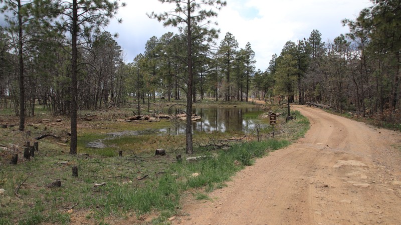
Running parallel to the steep dropoff of the Mogollon Rim, 9512E has dozens of campsites for those seeking escape from the desert’s summer heat among the shady Ponderosa pines. The views southward across central Arizona are inspiring. The largest sites sit at the eastern end near the Young Highway. This area can support very large RV and trailer groups. The sites westward grow smaller but more private, with several still large enough for an RV or full-size camping trailer. The trail ends at a lollipop turnaround with several small rocky campsites with unbeatable views.
The existing trail is poorly depicted on maps but very obvious when driving. The trail is rutted with minor potholes. Be prepared to clear downed pines blocking the trail early in the season.
Updated: 10/09/2025
FR 406
Three Forks, Arizona
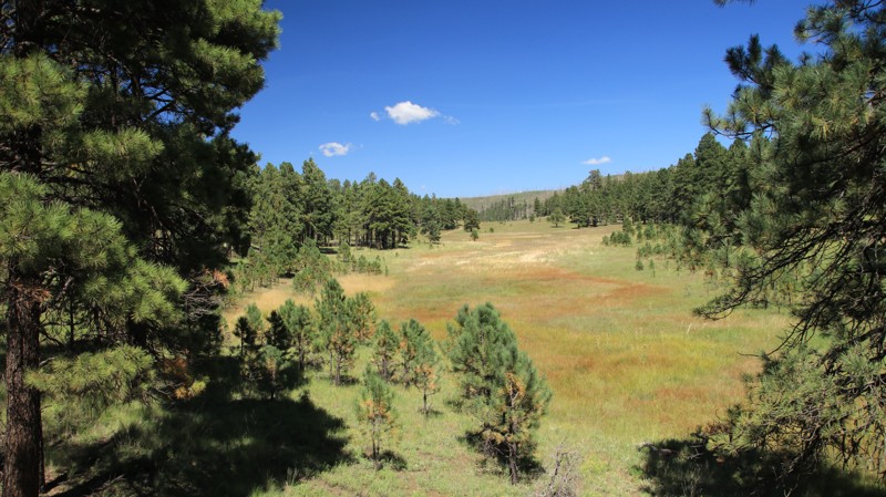
FR 406 has nice views as it travels through a pine forest with a few open meadows. There are several large dispersed campsites on the northern section of the trail.
Updated: 10/15/2024
Pot Cove Road
Mohave Crossing, Arizona
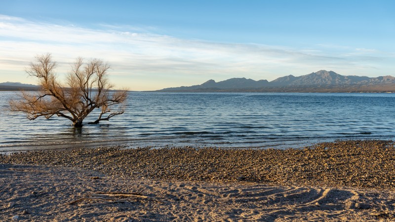
Pot Cove is a short spur off Cottonwood Cove East that ends at a beachside camping area overlooking Lake Mohave and the Newberry Mountains. Pot Cove is a very popular beach because it is the first beach access point off Cottonwood and the only cove with bathrooms and trash cans. The road is an easy gravel road that is generally well-maintained and graded. The road is 1.5-2 vehicles wide the entire way, with plenty of passing opportunities. There are 4-5 possible campsites before the beach, with an additional 3-4 spots along the shoreline.
Although this road is within the Lake Mead National Recreation Area fee area, there are no entrance stations along the way to obtain a pass.
Updated: 10/15/2024
FR 250
Ryan, Arizona
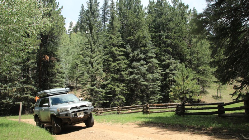
FR 250 runs north/south, bisecting most of the "point" roads. It climbs and descends five separate ridgelines through four canyons. The ridges are dominated by stately Ponerdeosa pines, while the canyons have aspen and open glades. The seldom traveled trail is easy with a few steeper loose rock sections. A single dispersed campsite was noted along the trail.
Updated: 10/15/2024
Hidden Cabin
Sedona, Arizona
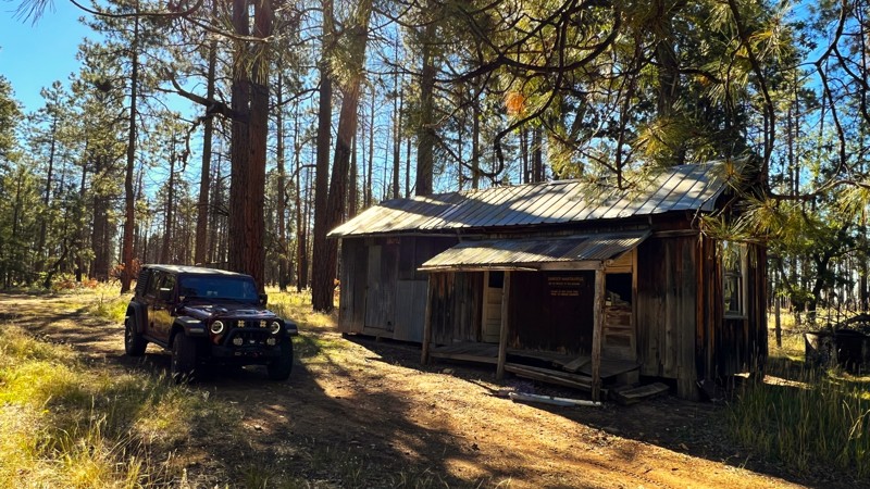
A short trail leads to an old cabin and remnants of a homestead. The cabin is a glimpse into the past and is made up of sleeping quarters, a kitchen, and a storage area. Additionally, there are ranching relics, an outhouse, and a water tank. However, the cabin has a warning sign, as it may contain hantavirus due to the significant amount of rodent droppings present.
The trail is easy to follow and is made up of packed dirt. Although older maps show the trail extending further, the current GPX track shows the legal trail, which ends at fallen trees that block the road. This makes the cabin a great place to turn around.
There are no established campsites on this short trail.
Updated: 09/10/2026
Pronghorn Loop
Sasabe, Arizona
Buenos Aires National Wildlife Refuge in southern Arizona was established in 1985 for the reintroduction of masked bobwhite quail and the restoration of natural landscapes and their native wildlife, including the Sonoran Pronghorn. The 118,000-acre refuge lies in a broad Altar Valley between the Baboquivari Mountains, with their prominent main peak in the west, and the lower San Luis Mountains to the east. In the 1850s, Pedro Aguirre, Jr. built a homestead here in 1864 and named it Buenos Ayres, or "good air," because of the constant winds. His ranch changed hands several times before being purchased to form today's wildlife refuge. The refuge's visitor center is located in the adobe ranch house.
The refuge has over 80 designated campsites identified by a numbered sign. Camping is free and allowed for 14 days in a 30-day period, but only in the designated campsites. Most campsites have a fire ring/grill. Site sizes vary from a single vehicle to large enough for multiple RVs and trailers. Most are suitable for tents.
Fuel and limited supplies are available in the nearby small towns of Sasabe and Arivaca.
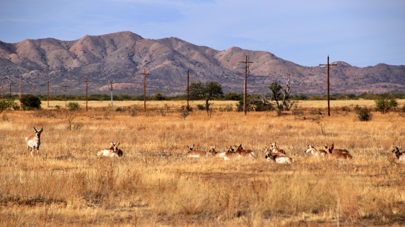
The refuge's main scenic drive is the Pronghorn Loop. It starts near the visitor center, runs through a no-hunting area, and is a favorite feeding area for deer and the Sonoran pronghorn. The landscape is grasslands dotted with mesquite trees. The well-maintained and graveled road is easily passable by any vehicle. There is no camping along Pronghorn Loop. However, several side trails have designated campsites.
Updated: 10/15/2024
Grahams Well Road
Bouse, Arizona
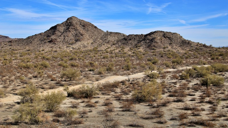
Grahams Well Road runs from Swansea Road to North McVay Road across the vast Cactus Plain, ending at its namesake well. The plain is covered with creosote brush with shallow washes lined with palo verde and ironwood trees. The Central Arizona Canal, an aqueduct providing Colorado River water to metropolitan areas, crosses the trail. It is common to see ducks paddling down the canal in the winter. The trail briefly climbs across the Bouse Hills.
The western end of the trail is wide and graded. The washes are very sandy, with ruts and minor moguls. A 2WD vehicle is usually adequate to drive the trail. In January each year, the trail is part of the route for the Parker 400 ATV Race. After the race, the sandy sections have deep ruts and moguls, which might require 4WD, especially where the route turns north on North McVay Road. The county grades the roads as quickly as it can after the race.
Several large staging and camping areas are at the trail's west end. Numerous open graveled playas west of the Bouse Hills offer additional camping opportunities.
Updated: 10/15/2024
FR 133
Munds Park, Arizona
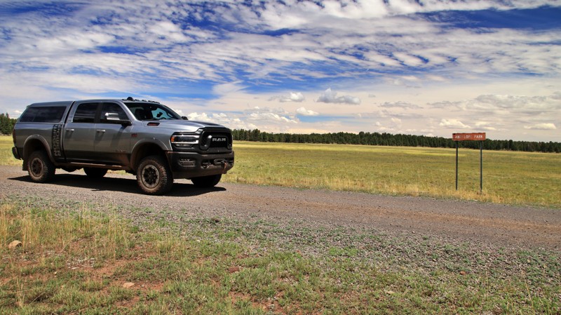
FR 133 runs between Horse Park and Crimson Roads. While most of the trail winds through heavily forested slopes, the northeastern end crosses the wide-open Antelope Park. Here open meadows are called parks. There are several campsites along the western side of the park.
The trail is easy, with no obstacles.
Updated: 04/10/2026
Superstition Short Leg
Gold Canyon, Arizona
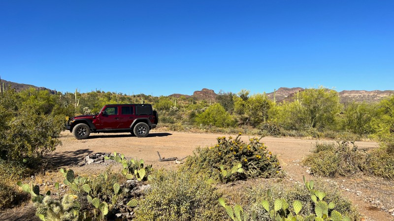
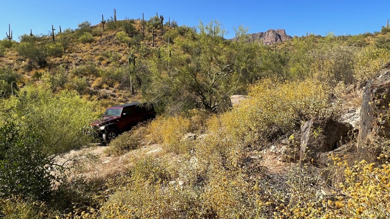
A short trail that provides a few dispersed campsites. These sites are each suitable for a few vehicles. One great spot is at the top of a hill. You will drive right by it on the way in. It is tucked away in the trees.
This is an easy trail of packed dirt and rock that most stock vehicles with high clearance will be able to manage.
This is Arizona State Trust Land. It requires a recreational permit.
Updated: 10/15/2024
Vinegarroon Road
Salome, Arizona
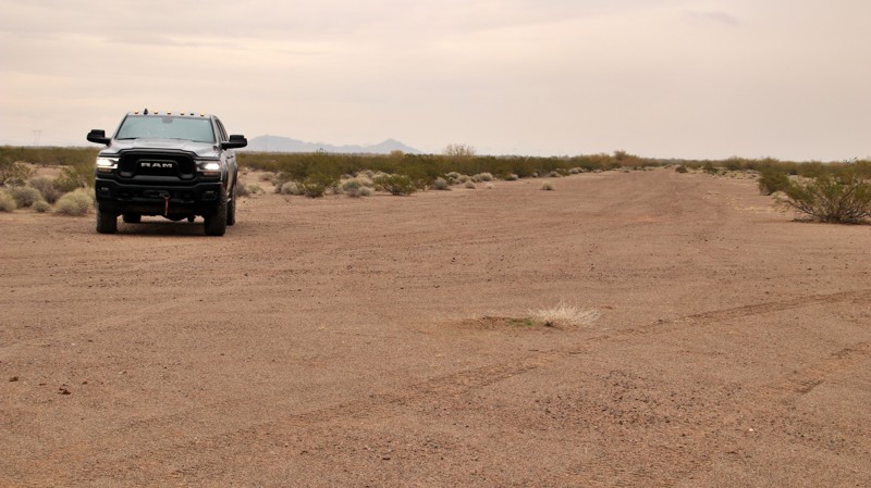
The giant North American vinegaroon scorpion, Mastigoproctus giganteus, was first described in 1835 and has been known to live across various habitats in Florida, Texas, Arizona, and central and northern Mexico. And there is a Vinegarroon Road in Arizona. The well-graded road travels south from I-10's Exit 55, past the abandoned Salome Emergency Airfield. Built in the 1930s, the dirt airstrip with two runways set in a cross pattern oriented north/south and east/west was available for early commercial airliners flying between Los Angeles and Phoenix. Closed in 1956, nothing but the hard-packed dirt runways remain. They make decent campsites, though thoughts of a vinegaroon slipping into your sleeping blanket might not make for the most restful night.
Updated: 04/10/2026
Superstition Campers Cove
Gold Canyon, Arizona
This is a great trail if you are looking for a solid dispersed campsite off of the busy Peralta Road. Go back in a way, and you will be treated to nice camping that can support a few vehicles at each site. Several are tucked away off the trail behind shrubs and Palo Verde trees.
This is Arizona State Trust Land and requires a recreational permit.
Updated: 09/10/2026
Senita Basin
Morelia, Arizona
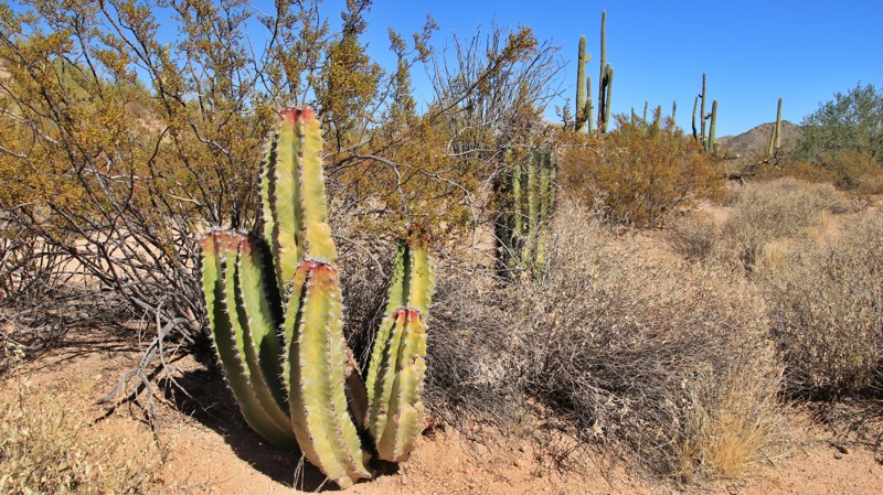
Senita Basin runs north off Puerto Blanco Road (South), ending at a hiking trailhead into the namesake Senita Basin, the only location in the United States where the senita cactus grows naturally. The hiking trailhead has a picnic table and vault toilet.
The senita is common in the Sonoran Desert south of the US/Mexico border. The senita looks similar to the organ pipe but has 5 to 7 external ridges, much fewer than the organ pipe. Thus the valleys between the ridges are more pronounced on the senita. A mature senita's thorns turn gray near the top of the plant, resembling a beard.
The trail is graded but sandy. Several deeper sand sections require momentum or 4WD.
There is no camping on the trail. Organ Pipe Cactus National Monument has two campgrounds. Commercial campgrounds are available in Ajo and Why. Fuel is available in Why and nearby Lukeville.
This area is very close to the Mexican border. Smuggling and human trafficking activities are common. Be vigilant when visiting this area.
Updated: 10/15/2024
Nelson
Forest Lakes, Arizona
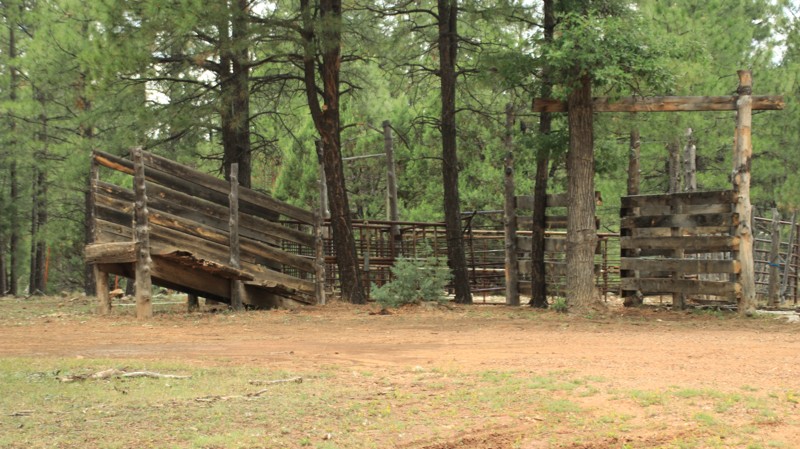
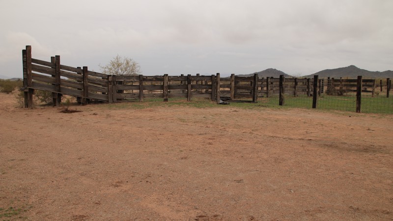
Set in the Sitgreaves National Forest, Nelson runs north off Highway 260 to join Heber Wildcat. The road is well-maintained dirt until the last two miles, when it becomes narrow, a bit rocky, and has a few mud holes. Two-wheel drive is adequate for the rougher section if it hasn't rained a great deal. There is abundant dispersed camping. Most campsites can accommodate multiple rigs of any size, tent camping, and hammocks. There is a game water catchment along the trail. Never camp within a quarter-mile of game water sources. An old corral reminds you that area is the setting for most of Zane Grey's old western novels.
Updated: 10/15/2024
FR 200
Jacob Lake, Arizona
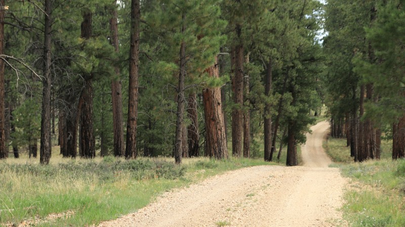
FR 200 runs through a pine and aspen forest between Highway 67 and FR 205. Numerous campsites on the southern end of the trail could support large rigs or a larger group. The forest is very open along the road, and deer often graze.
Updated: 10/15/2024
Winter Cabin
Oak Creek Canyon, Arizona
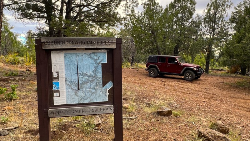
This easy, short 4x4 trail leads to the Winter Cabin hiking trailhead. It is mostly dirt with embedded rocks, which can make it muddy after rainstorms. The most challenging section of the trail will likely fill with water. Camping is limited due to the trail's short distance, but you can find spots closer to FR 538 that can accommodate 2-3 vehicles. The ground at these sites is relatively flat, with a dirt and rock base.
Once you start hiking, you'll encounter the historic Winter Cabin and a primitive campsite approximately 1.5 miles down the Winter Cabin Hiking Trail. If you continue, the trail will take you 1,500 feet into the Sycamore Canyon Wilderness area. The hiking trail also connects to Hog Hill Trail and Kelsey Trail. This area is quite remote, so please take all necessary safety precautions.
Updated: 10/15/2024
Willow Wash
Aripine, Arizona
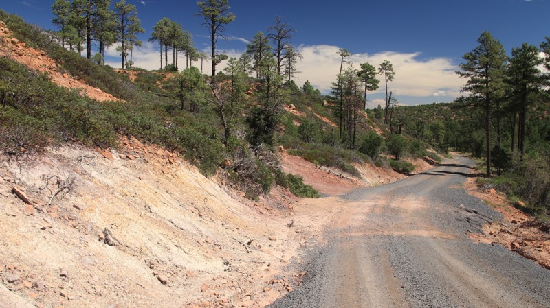
Willow Wash is an easy 4.7-mile trail from Highway 260 to East Rim Road. The road's surface is well maintained since it is the primary access route for the Deer Springs Fire Tower. The trail runs through a pine forest with several nice views. Only one dispersed campsite was noted directly along the road. Spur trails likely lead to additional campsites.
Updated: 10/15/2024
Connector Road
Sunwest, Arizona
Connector is aptly named. It offers connections to a variety of area trails and not much else. While graded, the sand is extremely deep, making 4WD highly advisable. The trail does pass the extreme southern end of the long-abandoned Salome Emergency Airfield. The end of the runway provides a unique campsite and one of the very few along the trail.
Updated: 10/15/2024
FR 9354
Christopher Creek, Arizona
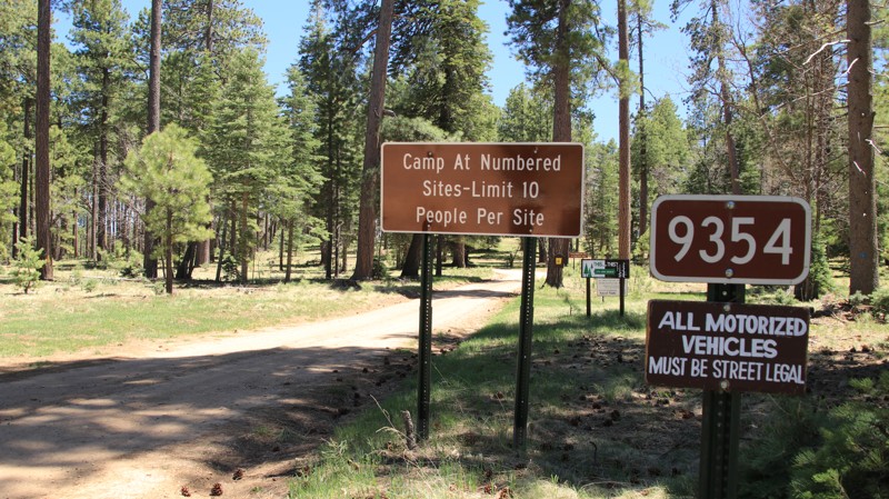
Looping off Rim Road, FR 9354 offers one and a half miles of outstanding camping in a Ponderosa Pine forest. Twenty-seven well-spaced numbered sites offer quiet, shaded campsites with stone fire rings. The narrow forest road has two large mudholes, but otherwise, it is very easy for most rigs, including midsized RVs, campers, and trailers. The ground is suitable for tent camping as well.
Updated: 05/20/2026
Superstition Turk's Head Connector
Gold Canyon, Arizona
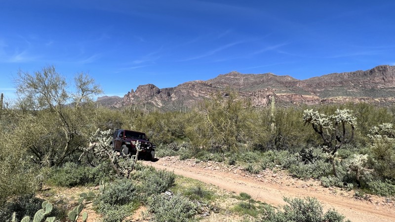
Turk’s Head Connector is a short trail connecting the Turk’s Head Trail and the Superstition Loop. The trail is hard-packed dirt with sharp-edged rock. There are a few sharp corners and wash crossings. Pinstripes from the overhanging brush are likely. Overall, this is a moderately difficult trail.
There is no camping available on this trail. However, many camping opportunities are nearby.
This area is Arizona State Trust Land. A recreational permit is required.
Updated: 10/15/2024
Aqueduct Road
San Jose, Arizona
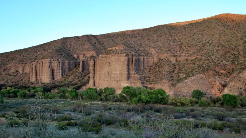
Set on BLM land in the Gila Box Riparian Conservation Area, Aquaduct Road hosts a campground, multiple day-use areas, a historic stone cabin, a wildlife viewing area, and superb views of the Gila River, near its confluence with Bonita Creek.
The track is graded dirt with loose and embedded rocks ranging from lemon to apple-sized. One steep descent to the Historic Serna Cabin pales to the steep grades and shelf roads of the paved East Bonita Creek Road you took to get here.
The day-use areas sit alongside the Gila River, a ribbon of muddy water and bright cottonwood trees that snaked through this dry land. Serna Cabin sits near the confluence of Bonita Creek and the Gila, evidence of the first European settlers in an area inhabited for centuries. A walkway leads to a wildlife observation area overlooking Bonita Creek. The area boasts a wide variety of animal life. Bring your binoculars. Viewing is best done early and late in the day.
Riverview Campground has 13 well-spaced campsites on a bluff over a river bend. The campground is first come, first served and is only $3.00 per night, before any discount for passes. Each site has a shelter, picnic table, and grill. Most have a view of the river below. Water is available, and there is a pit toilet. A variety of cacti dot the bluff. Very large prickly pear cacti sit beside spindly ocotillo, who often nestle with a barrel cactus.

Upgrade your Membership
Unlock all of the details on every Trail Guide and Scout Route.
Start a 7-day Free TrialBrowse Trails in Arizona by City
Browse every Arizona city with offroad trail guides.
Community
Partners

