






By clicking "ACCEPT", you agree to be the terms and conditions of each policy linked to above. You also agree to the storing of cookies on your device to facilitate the operation and functionality of our site, enhance and customize your user experience, and to analyze how our site is used.
Arizona Off-Road Trails
373
Total Trail Guides 359

4679
Detailed Waypoints 676
Try a Free 7-Day Trial and unlock it all
Start a Free Trial Most Recent Trail Reviews
Rated 4/5
Open
Visited: 09/22/2026
Hard pack, easy forest service road that is a great back way to the North Rim of the Grand Canyon.


Tyler D’Hulst
Rated 4/5
Open
Visited: 09/22/2026
Spring Canyon is a beautiful drive. We didn’t go out to the cabin but used this western section of road coming back from Crazy Jug

Tyler D’Hulst
Rated 4/5
Open
Visited: 09/22/2026
We took this out to Crazy Jug. The northern section is hard packed forest service road. Not difficult. Very scenic drive through the ponderosas.

Tyler D’Hulst
Rated 5/5
Open
Visited: 09/22/2026
View point is spectacular! Trail was easy going out, no obstacles at all. Saw a Toyota Camery at the viewpoint.


Tyler D’Hulst
Rated 3/5
Open
Visited: 09/22/2026
An alternative route out to Crazy Jug Point. It’s easy and can be scenic in areas. I’d recommend West Ryan out to Crazy Jug though.
Tyler D’Hulst
Rated 3/5
Open
Visited: 09/22/2026
A quick connector trail through the burn patch.
Tyler D’Hulst
Rated 5/5
Open
Visited: 09/20/2026
Leviathan Mine trail is a full day trip. Though it is only 20 miles in length the travel is slow and rough. Majority of the trail you will be going between 5-10 MPH. Then once at the end it connects w...



Eric Gartin
Official Crew
Rated 4/5
Open
Visited: 09/19/2026
Simple road, well graded today. Many mountain bikers coming down from the West out of Breezy Pines. Not too many people out until approaching Senator Hiway. We went East to West as I think thats a bet...



Jeff Burnett
Rated 3/5
Open
Visited: 09/19/2026
The trail itself is not spectacular, it's pretty flat across the plains. However, driving up to the overlook and seeing a huge gaping hole in the ground is a great juxtaposition to the flat trail. The...
Tyler D’Hulst
Rated 3/5
Open
Visited: 09/19/2026
A nice trail ride from the main road down off the plateau. It's graded forest service road until the switchbacks. The switchbacks themselves are not difficult, road is not graded. This section has bee...
Tyler D’Hulst
Rated 3/5
Open
Visited: 09/18/2026
The end of the trail is not well marked, and can cause confusion. Also, vehicle passes are required for all backcountry routes within the Lake Mead National Recreation Area.
Eric Gartin
Official Crew

Ted Whisler
No Rating
Open
Visited: 09/17/2026
Nice ride west side a little rocky but rating is true to #2


Ted Whisler
Rated 3/5
Open
Visited: 09/15/2026
A nice drop off the plateau heading towards Marble Canyon. Not a difficult road. Road is weathered but not challenging.
Tyler D’Hulst
No Rating
Temporary Closure
Visited: 09/15/2026
Road closed due to multiple washed out wash crossings after the turn off to go up the mountain. "Road Closed" sign put out by BLM on trail.
Tyler D’Hulst
No Rating
Temporary Closure
Visited: 09/15/2026
After the turn off to head up the mountain there are multiple washed out wash crossings. A "Road Closed" sign has been put out by the BLM.
Tyler D’Hulst

Ben Ruddell
Official Crew
Rated 4/5
Open
Visited: 09/14/2026
Bogles Ranch Road is a great Sunday afternoon drive type of dirt road that climbs up in elevation and gives some spectacular views of the surrounding area. The first half passes through State and Priv...


Eric Gartin
Official Crew
Ben Ruddell
Official Crew
Rated 3/5
Open
Visited: 09/14/2026
Antares Road is an excellent way to travel from Route 66 to the eastern portion of the Lake Mead National Recreation Area. This wide county road is well maintained with minor washboarding, most of whi...


Eric Gartin
Official Crew
Rated 3/5
Open
Visited: 09/14/2026
Hackberry road is a wide dirt road with minimal erosion damage and washboarding. There are a couple of larger washes that cross Hackberry road creating wide stretches of loose sand which can cause iss...


Eric Gartin
Official Crew
Rated 3/5
Open
Visited: 09/13/2026
This is a very rough, rocky, & slow going trail. Expect around 4+ hours for the trail & another hour to get the highway. One of those trails I'm happy I did but I wont be back personally. High clearan...

Brandon W
No Rating
Open
Visited: 09/12/2026
I think the rating is spot on. The ruts and washouts at the beginning are not as bad and if you hug the inside of the shelf road they can be avoided. The middle part is same general sandy wash with ov...



Greg Page
Rated 4/5
Open
Visited: 09/11/2026
Ran this trail as part of a larger loop. Trail is in great shape. Easy for standard 4x4 with no lift. Passengers can do it until maybe the very end by the lake where the road gets rocky and washed out...


Jeff Burnett
Rated 5/5
Open
Visited: 09/10/2026
This is one of my favorite scenic trails in the area. The trail is easy to travel, but does have some optional short trails that will test your vehicle. The views from the Grand Wash Cliffs of the Hua...


Eric Gartin
Official Crew
Rated 3/5
Open
Visited: 09/07/2026
This trail by itself is nothing special. It is mostly used as an access road to get to the more technical trail such as Homecourt, Twister, and Waynes World. This is a great trail for the beginner to ...


Eric Gartin
Official Crew
Rated 3/5
Open
Visited: 09/07/2026
This trail is an enjoyable alternate route when traveling on Blake Ranch Road (7163). The trail is easy with only a handful of spots with erosion damage. The few established camping sites appear to n...


Eric Gartin
Official Crew
Rated 5/5
Open
Visited: 09/07/2026
Ran this trail from Boynton Pass Road to Loy Butte Road (opposite direction from what is listed). Ran into a few rental ATVs and a couple of Jeeps heading the opposite way. This was a fun trail wit...



Daniel Macioce
Rated 5/5
Open
Visited: 09/07/2026
This trail was a lot of fun, plus the views were amazing. I ran the trail in the order posted, starting at the south trailhead and finishing at the heritage site. Past a motorcycle, a few jeeps and a...


Daniel Macioce
Rated 4/5
Open
Visited: 09/07/2026
Nice trail, ran West to East. For some reason the map shows this a a one-way trial, East to West. That is not the case, it is a two way trail. Was pretty washed out starting around mile 12. Plenty roc...


Jeff Burnett
No Rating
Open
Visited: 09/06/2026
New trail for me. You didn’t know what it would throw at you around every corner which is why you try to find new trails or old forgotten ones
KB
Kory Burden
Rated 5/5
Open
Visited: 09/06/2026
The trail is no joke—steep, narrow, and technical enough that you’ll want to be comfortable with off-camber shelf roads, rocky terrain, and washouts that will test your vehicles articulation. The rew...



Bobby Rumbaugh
Official Crew
Rated 5/5
Open
Visited: 09/06/2026
Fun trail if you don't want to do pyeatt draw itself. Ran this trail 3yrs ago and definitely a little more erosion but, still any truck or suv with good factory ground clearance can do it. From previo...
JM
James m
Rated 4/5
Open
Visited: 09/06/2026
Ran this trail from I-17 to Sedona. Extraordinary views descending into Sedona. As others have noted, there are lots of rock on the trail, making it slow going. Passed a large number of Pink Jeeps ...


Daniel Macioce
Rated 4/5
Open
Visited: 09/05/2026
This one definitely changed over the last few years. The southern section has some legit, steep, off-camber sections. YOU NEED experience, backup, and a capable vehicle on this one now. It's not supe...


.jpg)
Bobby Nelson
Official Crew
Rated 4/5
Open
Visited: 09/05/2026
Another amazing time on this scenic crossover. We came in from Walnut Canyon and finished out on Price Road after about 6 hours. A challenging and hot day for the old TJ. Rincon Road has evolved into ...


Bobby Nelson
Official Crew
Rated 4/5
Open
Visited: 09/05/2026
We started exactly at sunrise to try and beat the heat. We planned to crossover to Box Canyon and out on Price Road. It ended up taking us 6 hours, even with all the photos and filming we did. A chall...


Bobby Nelson
Official Crew
Rated 5/5
Open
Visited: 09/04/2026
We recently ran Four Peaks after the monsoon rains. Here’s what we found and what to expect if you’re planning to run it. Have a GR8 day!

Jeep 4 Dirt
Rated 5/5
Open
Visited: 09/04/2026
Breathtaking views. Definitely don't rush through the trail. Devil's staircase was a bit slippery but awesome. A few tight stops here and there, but a trail that's a must on anyone's to do list.



Christopher Bradley
Rated 4/5
Open
Visited: 08/30/2026
Id say this is a 3.5 to 4 trail. There are some obstacles, but nothing you really need to think hard about how to approach. If you send your vehicle at it in 4 low you'll get through everything.



Justin Holsinger
Rated 4/5
Open
Visited: 08/28/2026
Rim Road (FS300) West to East. Very well groomed gravel forest road. Accessible by just about any vehicle thats not been lowered. Who does that anyway? Scenic views the whole route. Hard to believe on...


Jeff Burnett
Rated 4/5
Open
Visited: 08/28/2026
Not a bad road but it was crowded with sxs and vehicles towing campers. Hard to rate 5 stars for a busy road. Super easy any vehicle can do this. Part is paved near the freeway but the rest is gravel.

Tony Rockwell
Rated 4/5
Open
Visited: 08/28/2026
I rated 4 stars just due to the volume of sxs & camper trailers on the road.
Easy drive, any car can do this.
Ran from sheep springs to munds park, see other reviews for full route.

Tony Rockwell
Rated 4/5
Open
Visited: 08/28/2026
I ran Bar M in reverse to get to this trail. Then headed toward Casner Park Road. (See reviews I did on each of those)
Nice easy trail that is less rough than Bar M.
Nice drive through trees.


Tony Rockwell
Rated 5/5
Open
Visited: 08/28/2026
Very bumpy due to rock infused trail. A few larger rocks, 8-12” tall in places but most stock 4x4’s should be able to navigate around or over them. I would say any 4x4 with all terrain tires could nav...


Tony Rockwell
Rated 3/5
Open
Visited: 08/27/2026
Overall decent little trail; camped out near Committee Tank (not suitable for tent camping - too rocky). Nothing too technical but enough to keep things interesting. High clearance and good line choi...


Bill Ferguson
Rated 3/5
Open
Visited: 08/27/2026
Connector from FS801 (Rock Garden Loop) to FS09494F (Committee Tank Trail); yeah, it lives up to its namesake. Very rocky. High clearance and picking good lines are an absolute must. Car camped at...

Bill Ferguson
Rated 5/5
Open
Visited: 08/27/2026
Nice trail saw some deer it’s a little rough but overall was easy


M
Maddox
Rated 5/5
Open
Visited: 08/23/2026
Great little adventure for the day. Dirt road is pretty rutted up due to monsoons, but easily drivable. Lake itself is extremely low.
LL
Larry Lapp
Rated 4/5
Open
Visited: 08/22/2026
A fun side trip that has a steep hill climb. Due to recent rains, the wildflowers were blooming.


Bobby Rumbaugh
Official Crew
Most Popular

Updated: 04/22/2026
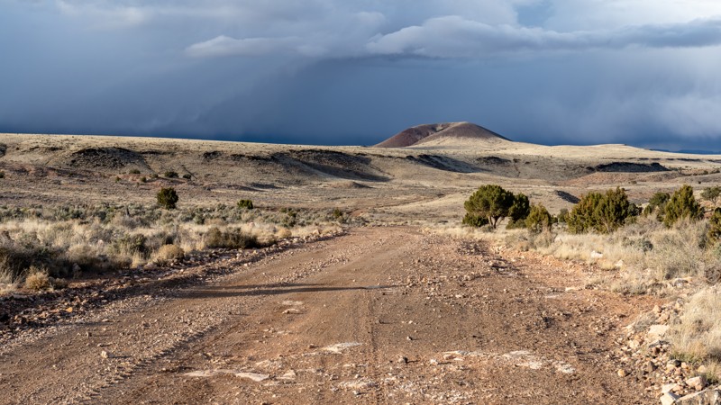
Mount Trumbull Loop - Clay Hole Section
Tuweep, Arizona
Located in northern Arizona, within an area known as the Arizona Strip, the Mount Trumbull Scenic Loop is a picturesque drive through the Grand Canyon-Parashant National Monument that takes drivers through nearly every aspect of terrain the monument offers. Cutting through the desert, shrubland, and montane habitats, drivers are rewarded with picturesque views of deep canyons, vast valleys, lonely buttes, and 8,000-foot mountains.
Clayhole is the eastern section of the CR 5, Mount Trumbull Loop, and connects Colorado City to Tuweep. This is a primary access road for those visiting the Toroweap Overlook. The road winds through Clayhole Valley, traversing a scenic volcanic field and the dramatic Hat Knoll cinder cone. The road surface is generally very easy, with hardpacked clay mixed with sections of gravel and small protruding rocks. However, the clay quickly turns to a peanut butter consistency after any rain, making the road totally impassable and very dangerous until it dries. Users should always check recent and future weather forecasts before traveling on this road. In dry conditions, this is a 2WD road that is suitable for any vehicle with good ground clearance and rugged tires, such as all-terrain tires.
Updated: 03/22/2026
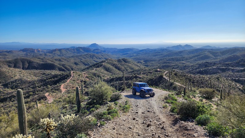
Rollercoaster
Cochran, Arizona
Unlike the many canyon and wash-type trails in the Florence OHV area, Rollercoaster weaves up and down along the ridgelines high above the canyon floors providing unobstructed, 360-degree views in all directions. This trail leaves you open-mouthed and white-knuckled as it traverses consistent 20-25 degree slopes and reaches brief moments as high as 32 degrees.
The eastern half of the trail starts near the Orville Waterfall obstacle and passes one campsite near the valley floor, which is suitable for a few vehicles. After traveling up a series of ridgelines, the trail crosses the intersection of Box Canyon, North Box Canyon, and Mineral Mountain before sharply climbing to the top of the ridgelines again. The trail's western half is the most difficult, with the steepest climbs and descents. Several sections of deep erosion ruts will also need to be navigated. The western edge of the trail drops down to intersect with Mineral Mountain at the Sunset Mine.
A reliable 4x4 with low gearing, high clearance, and aggressive off-road tires will be needed to traverse the entire trail. Traction aids are highly recommended, as losing traction and momentum in the middle of a steep climb could result in losing control of your vehicle. The trail is generally only one vehicle wide. Tight sections between cacti make this trail unsuitable for full-width vehicles. Rollercoaster is good for novice wheelers looking to push their mental abilities and their vehicle's physical abilities.

Updated: 06/05/2022
Vulcan's Throne
Fredonia, Arizona
Vulcan's Throne, a cinder cone volcano, erupted 72,000 years ago, sending a 1200-foot-high wall of lava into the Grand Canyon. One of at least 17 in the Grand Canyon's history, the resulting lava dam created a lake that ran as far back as the present-day Phantom Ranch. The silt-filled Colorado eventually overcame the dam, grinding away the basalt and returning the river to its present state. Today Lava Falls, one of the largest rapids on the Colorado River, marks the existence of this massive volcanic dam. A sandy trail leads to the western slopes of Vulcan's Throne and then on to a hiking trail that leads down into the Grand Canyon. The geological history of the region is written largely along the trail. A part of the six million-year-old Uinkaret Volcanic Field, Vulcan's Throne's dark volcanic cinders stand in dramatic contrast to the red and orange Toroweap Formation sedimentary sandstone through which the volcano rose. Both were tectonic forces instrumental in shaping the Grand Canyon. In the quiet of the area, you can pause and contemplate the wonder of the ever-evolving earth on which we reside.
In an effort to manage the number of visitors to the area, all motor vehicles entering the Toroweap area of the Grand Canyon National Park require a backcountry permit or a day-use ticket available through Recreation.gov.
Updated: 05/26/2026
Woodcutters Pass
Fortuna Foothills, Arizona
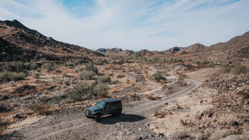
Woodcutters Pass is primarily moderate with a few challenging sections—for that reason, it's rated difficult. Multiple deep washes are filled with soft sand, large rocks, and deep ruts. There are steep, short inclines/declines and off-camber sections. The most difficult parts include rocks and boulders that are unavoidable. Most of the trail is unmarked. Driving in the washes can make it confusing to follow the trail, so pay close attention to the GPS. The trail also passes by several old mines and abandoned vehicles.
Don't forget your permit before driving in the Barry M. Goldwater Range.
Updated: 04/26/2024
Turkey Creek
Young, Arizona
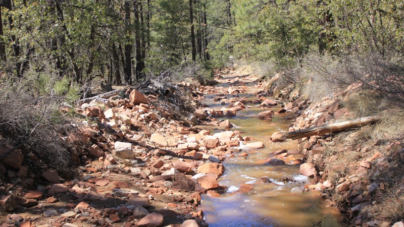
Turkey Creek is a wonderful trail passing in and out of stream beds for most of the journey, and throughout it is in constant change and putting forth a new challenge. At 1/2 mile into the trail, there is a rocky stream bed to traverse which can be very technical. It is great to creep through and splash in the water!
Soon after the creek bed, there is a small waterfall that is worth a stop and is a great place for a scenic picnic. It's a good place to take a break after the rocky creek bottom.
In the early stages of the trail, the forest is a mix of new growth with sunlight pouring through and tall pines shading the forest floor. Later on, the trail climbs to a higher elevation and the vegetation becomes less dense opening up to the sky.
The end of the trail for Turkey Creek is the beginning of Little Turkey Creek, and the fun continues!
Updated: 11/27/2023
Champie Road
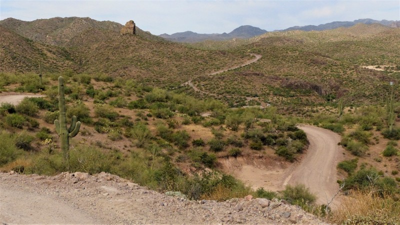
Peoria, Arizona
Located north of Lake Pleasant in the southern foothills of the Bradshaw Mountains, Champie Road is an easily traveled winding trail connecting Cow Camp Road (aka the iconic Backway to Crown King) and scenic Castle Hot Springs Road. Named for Charles Edward Champie, an early pioneer in the area, the trail traverses a rugged landscape of striking geology, stately saguaro cacti, palo verde, and creosote bushes before dropping into the lush green riparian French Creek. The craggy Bradshaw Mountains provide visual treats while the pinnacle of Eagle Rock lords over the trail.
Updated: 02/06/2026
Big Eye Mine Trail
Yuma Proving Ground, Arizona
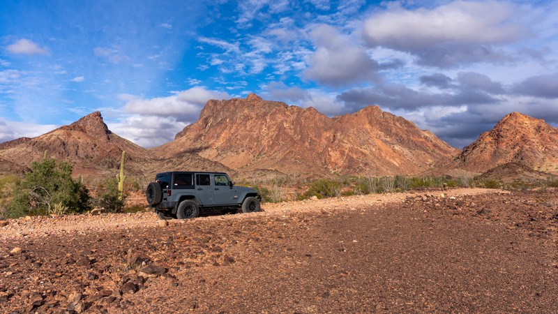
The Big Eye Mine trail is an out-and-back two-track road that winds through the rugged Kofa National Wildlife Refuge. Most of the trail is relatively easy, but there are sections where high clearance would be helpful but unnecessary. This trail has multiple sandy or loose gravel wash crossings and some driving in a wash bottom. There are some sections with exposed rocks. Heavy rain could easily affect the trail's condition, and several areas show erosion and ruts from recent weather.
There are multiple flat camping spots along the entire trail.
The Kofa NWR has beautiful scenery, endless Teddy Bear Cholla, Saguaro cacti, and 360-degree mountain views, including Thumb Butte. At the trail's end is a 1/2-mile hike to a cabin and other structures associated with the Big Eye Mine.
Updated: 08/23/2022
FR 518
Flagstaff, Arizona
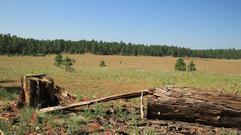
Located just outside Flagstaff in the Coconino National Forest, FR 518 provides easy access to fantastic camping and scenic forest trails. Travelers en route to the Grand Canyon or just passing through on I-40 or the old Route 66 will appreciate the peaceful campsites afforded by this well-maintained forest road. The sound of the wind in the tall Ponderosa Pines will quickly erase the stress of a day on the road. Listen carefully, and you might hear a bull elk bugling from somewhere deep in the forest. While Flagstaff is only a few minutes away, you'll feel like you are a million miles from the hustle and bustle of city life. Whether spending one night or staying for the 14-day camping limit, this trail is a great place to unwind.
Updated: 06/15/2026
Rolls 1830
Tortilla Flat, Arizona
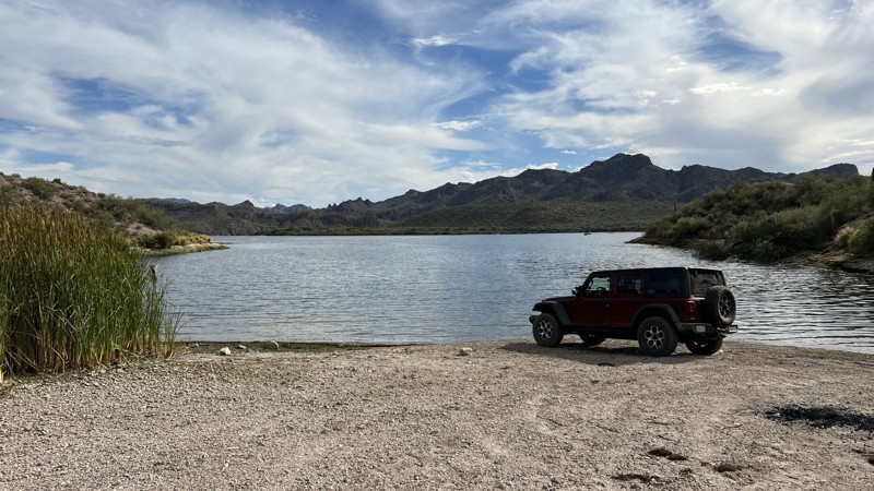
Rolls 1830 provides access from 1813 to Saguaro Cove #2. The beginning of the trail is rocky, very similar to 1813. It has one aggressive hill descent on the way to the lake. Getting out and walking this obstacle is recommended to find the proper line. A spotter would be helpful. After the downhill obstacle, you will have a blind hill climb that peaks and immediately descends into a sandy wash. The remaining section of the trail to the lake is very easy. Just be cautious on the blind corners, as you may have oncoming traffic. The beach area is large and can be used for camping. In the summertime, arrive early to get the best spot on the beach since it will get crowded.
Please note that an OHV permit is now required on this trail.
Updated: 10/15/2024
10 Mile Rock
Marble Canyon, Arizona
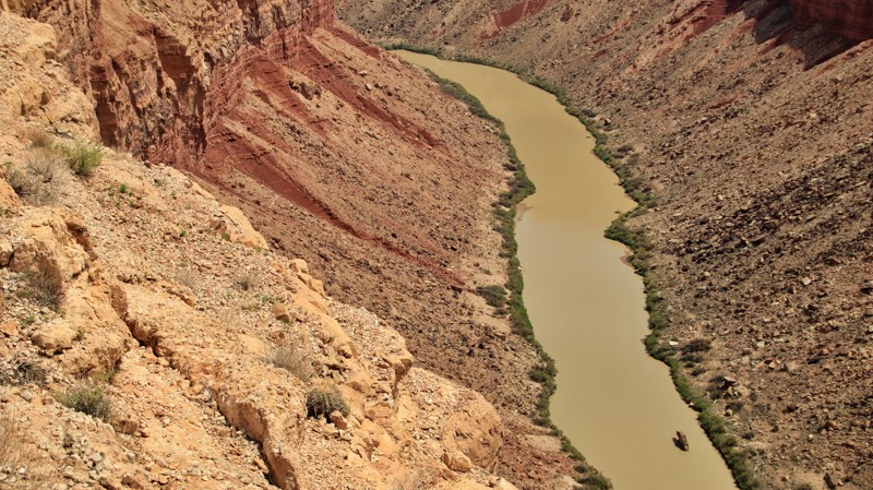
For white water rafters going down the Colorado through the Grand Canyon, the launch point at Lee's Ferry is River Mile 0. A reliable landmark is a massive boulder sitting tall in the river at 10 miles. Thus the name 10 Mile Rock.
This relatively easy trail brings you to a nice overlook of 10 Mile Rock and a few canyon-side campsites overlooking Marble Canyon and the Colorado River. 10 Mile Rock is located at the first point the trail turns east to run along the canyon's edge. Just be careful around the edge. It's a long way down.
There are also dispersed campsites at .35 and .63 miles off Highway 89A for those just looking for a convenient place to spend the night.
Updated: 02/10/2025
Robbins Butte
Palo Verde, Arizona
Robbins Butte, named for the prominent 807-foot hill near the eastern end, is a moderate trail only minutes from Buckeye. The trail runs between Highway 85 and Old US 80. There is an abundance of large saguaro cacti and other Sonoran Desert plant life. The best time to do this trail is mid-October through April.
The eastern end of the trail is easygoing for approximately eight miles. At 8.19 miles, the trail crosses an open cattle crossing and turns south. The trail degrades after this point. Several areas with significant washouts require attention to good tire placement and four-wheel drive to navigate. There are bypasses for the worst washouts, but these may worsen after a good rain. The hardest obstacle on this route is at mile 12.5 (33.245899°N 112.749176°W). There is a bypass just to the west of this obstacle. The final ascent at the 13.3-mile mark contains a couple of small rocky ledges.
The trail passes through a patchwork of BLM land, AZ State Trust, and private property and passes just south of the Powers Butte Wildlife Area.
The best camping on the trail is on the eastern end from the 0.80-mile mark to the 1.80-mile mark. This is BLM land and open for camping. There are numerous camping spots. The area is generally populated with RVs.
Robbins Butte is approximately 3.2 miles from State Route 85. It borders Robbins Butte Wildlife Area to the east and is part of the Gila River Waterfowl Management Area. Gila River is on the north side of the Butte. There is no camping or target shooting allowed in this area.
Updated: 02/21/2024
Gerald Wash
Globe, Arizona
The Tonto National Forest offers users the chance to experience desert four wheeling without having to travel too far outside the Phoenix valley. Gerald Wash trail is a remote area outside the Roosevelt Lake Recreation region. The trail winds up and above the region offering panoramic views of the surrounding desert. This trail is a great addition to other trails in the area, such as, Apache Trail and Two Bar Ridge. The trail offers a mild challenge for stock type vehicles while providing a relaxing scenic drive through the desert. You can choose to explore the local trails and end with a dip in nearby Roosevelt Lake. Be sure to pick up a Tonto Pass or a NPS America the Beautiful Pass if you plan on visiting any of the lakes recreation sites.
Updated: 10/28/2023
East Clear Creek
Pine, Arizona
East Clear Creek serves as the gateway to the heart of the wild and wonderful Mogollon Rim area of the vast Coconino National Forest. The road draws its name from its crossing of the picturesque mountain stream of the same name. The stream's deep canyon, with its soaring sandstone cliffs, is a perfect natural barrier and only one road crosses it. The East Clear Creek crossing offers a chance for the kids to splash in the shallow water and chase crayfish under rocks. Anglers hike along the stream locating deeper pools in search of trout. Beyond the crossing, a variety of fantastic adventure opportunities await. The Cabin Loop, a series of interconnected trails, is one of the top backpacking destinations in Arizona because of its beauty and the sheer number of reliable springs along the route. Campsites set among the pines, fir, and spruce provide a basecamp for exploring down into canyons or driving the seemingly endless maze of forested trails. It's almost a certainty you will see elk and lots of them during your time along this trail and all the smaller roads and trails that branch from it. Finally, the road drops you off near the vertical precipice of the Mogollon Rim, 3000 feet above the northernmost reaches of the Sonoran Desert below. The views from atop the Rim are truly inspirational. Snagging a campsite right on the edge of the Rim is a highly unique experience. East Clear Creek is indeed the gateway to this amazing section of the Mogollon Rim, a virtual magic carpet to adventure. Take a ride on it and see what adventure you can find.
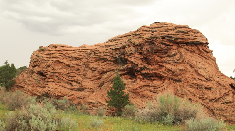
Updated: 05/28/2026
Pine Tree Pocket
One Mile, Arizona
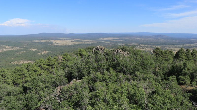
BLM 1017 is the first leg of the southern route into White Pocket. There are several dispersed campsites along the first 3 miles of the trail. The road passes Pine Tree Pocket Ranch. Please be respectful and don't stop within a quarter mile of the ranch. BLM 1017 is well maintained, though it may have a few mudholes. The mudholes have hard bottoms, so don't widen the road to go around them. 2WD vehicles are fine on BLM 1017, but the next leg going to White Pocket requires 4WD.
Updated: 07/15/2023
Apache Maid Lookout
Camp Verde, Arizona
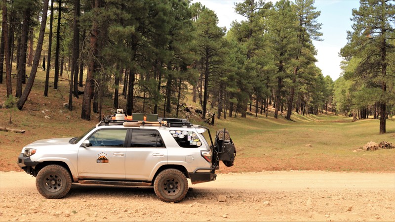
The Apache Maid fire tower arguably has the best views in central Arizona. Be kind to the fire watch in the tower, and you will likely receive an invitation to the top. Getting there requires climbing the 30-foot scaffold holding up the tower's cab, and negotiating over 2 miles of narrow shelf road. The views are definitely worth the effort. From the summit of Apache Maid Mountain at 7301 feet, the entire topography of the heartland of Arizona surrounds you. Vistas of pine forests, open grassland meadows, the San Francisco Peaks north of Flagstaff, the red rocks of Sedona, the Mogollon Rim, and Mingus Mountain all lay at your feet. Both the road and the tower were completed in 1961. The drive up switchbacks along the southern side of the mountain provide stunning views at each turn. A picnic table at the summit makes for a sweet place to grab a bite. Enjoy!
Updated: 06/18/2022
Lost Eden
Payson, Arizona
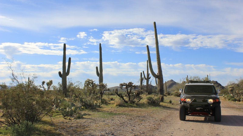
With a name like Lost Eden, you know the area has to be something special. The name is derived from an old homestead and ranch of the same name near Todds Draw, south of the current Lost Eden road. The remains of the ranch still exist but are on a small plot of private land. Today, far more visitors roam the area than in the old ranching days. Lost Eden is a popular playground for the outdoorsy. Summer weekends find the road lined with campers, often in large impromptu villages. ATVs full of happy smiling faces parade the main road. If the exuberant crowds aren't your thing, blissful solitude can be quickly found along some of the more challenging side trails. The stately Ponderosa pines and occasional open grassy valleys offer lots of chances to see elk and other area wildlife. No matter what your idea of Eden might be, you can find it on Lost Eden.
Updated: 09/24/2022
Whitlow Canyon
Queen Valley, Arizona
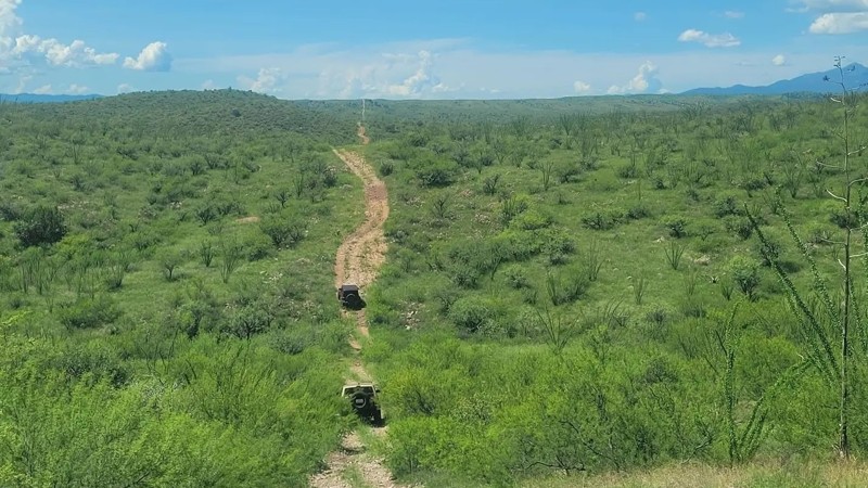
This trail is a great day trip away from Phoenix. As the trail rises gently up and away from Queen Valley and into the desert landscape, it opens up scenic vistas over the neighboring valleys. Traveling during the late winter and spring rains is a beautiful experience to see as the desert bloom and open up its colors. There are vast expanses of clover fields which attract the buzzing bees as well.
Updated: 05/02/2025
Total Wreck Mine Trail
Santa Rita Foothills, Arizona
The Total Wreck Mine Trail is a prime spot for all offroad enthusiasts seeking an adrenaline-pumping adventure near Tucson, AZ. The trail offers very challenging terrain, with rocky, rutted, off-camber areas and several steep, rocky inclines that will test your skills and your vehicle's capabilities. Additionally, this trail features several wash crossings and medium to large ruts that may have water present depending on the recent rainfall. Rain or snow could affect the road, so definitely check the weather conditions before you head out. Be aware of open-range cattle that line and occasionally block the trail.
This trail is best suited for modified vehicles with at least a rear locker and a lift. A spare tire is also highly recommended. Having a good and experienced spotter should be considered essential along this trail.
Riders looking to start this trail can either begin on the Power Line Trail to the north or ride in what is typically considered backward, by starting at East Yucca Farm Road or East Empire Ranch Road.
The Total Wreck Mine has a rich historical significance in the mining industry. It was initially discovered in 1879 by a cowboy named John Dilden, who also is credited with naming the Empire Mountains, and his boss, Walter L. Vail, owner of the Empire Ranch and the namesake (along with his brother Edward) for the town of Vail. In 1883, with the mine in full swing, there were about 50 homes, four saloons, three hotels and a bank and brewery. Around 1884 or 1885, the mining operation lessened and eventually stopped. In 1890, with just a small population remaining, the post office closed, and most of the residents slowly moved away in search of work elsewhere in Arizona’s thriving mining districts.
Updated: 03/09/2026
Ghost Town Trail
Gleeson, Arizona
Tombstone is known as the town that is too tough to die. The same can’t be said about the neighboring communities of Gleeson, Courtland, and Pearce. Unlike Tombstone, these towns experienced their heyday in the early 20th century but died out as rapidly as they rose to prominence.
This trail starts just outside Tombstone and follows a smooth graded dirt path throughout its duration. There are no challenging parts of this trail, and any vehicle will be able to make the drive.
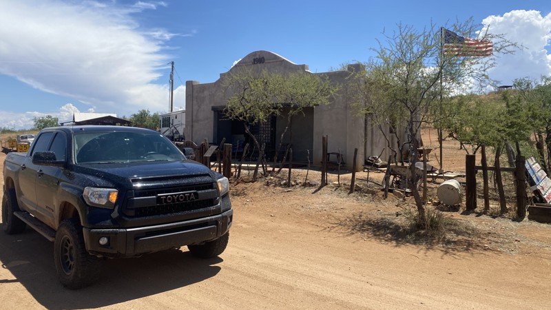
The trail starts near the town of Gleeson. This area is known for rich turquoise deposits. The area around Gleeson was initially inhabited by the Chiricahua Apache, who mined the turquoise for trade. After the Apache were either killed or relocated to the Dragoon Mountains, a prospector named John Gleeson discovered a rich copper deposit in the area. This discovery led to an explosion of growth in the local populace. Like the other towns along this trail, Gleeson rapidly rose to prominence yet fell after mining operations ceased. The most famous building still standing in Gleeson is the Gleeson Jail. This building was constructed in 1910 and remains well preserved to this day.
The next town on the Ghost Town Trail is Courtland. Courtland is largely closed to the public, but private tours can be arranged in advance. A few buildings are accessible to the the public along the Ghost Town Trail. The most prominent of these is the Courtland Jail. This building is an unrestored twin of the jail located in Gleeson.
The final town along the Ghost Town Trail is Pearce. This town replaced Tombstone as the local Wild West town when gold was discovered in the area in the late 19th century. Pearce continued to prosper until just before World War 2. Pearce retains several historic buildings and provides a great connecting route to Middlemarch Trail.
There are no camping locations along this route.
Updated: 05/20/2026
Gunsight Point
Ryan, Arizona
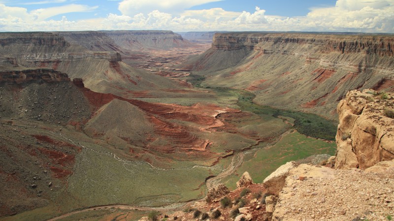
This long BLM road traverses a landscape of plains of Mormon Tea and other desert scrub dotted with a few islands of pinion pines and juniper before arriving at Gunsight Point, an amazing overlook of the Kanab Creek Canyon. The views along the way aren't shabby either. Grand Staircase Escalante rises in bright red steps to the north. The bulking uplift of the Kaibab Plateau looms southward. The trail is easy except for a few deep mudholes during the wet late summer. The trail's end has a small campsite right on the edge of the canyon, suitable for two vehicles at the most. Other campsites are nestled where ever there is shade from the pinions and junipers.
The BLM signs along the road are numbered 1048. Many maps label the road as 164. Follow the gpx track.
Updated: 04/29/2024
National Old Trails Road
Yucca, Arizona
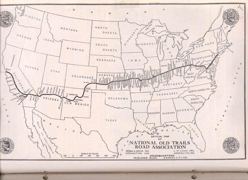
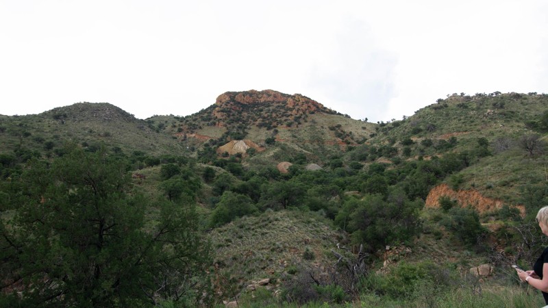
Step back in time following the footsteps of pioneers and adventurers along this short section of the National Old Trails Road in Arizona, part of a 3096-mile road that once connected the Atlantic and Pacific coasts. Established in 1912 as part of the Ocean to Ocean Highway, this iconic road passes through the starkly beautiful desert landscape south of Yucca. Along the route, you'll encounter a fascinating chapter in American history. This area played an important role in World War II. During the war, the Army used a radar gap filler station along the National Old Trails Road, while nearby Bell P-39 and P-63 fighters routinely flew overhead, practicing in the Yucca Air to Air Gunnery Range. Today, visitors can still see evidence of this activity, with bullets and casings from the fighter planes scattered across the rugged desert landscape.
Updated: 12/26/2023
Guajalote Flat
Patagonia, Arizona
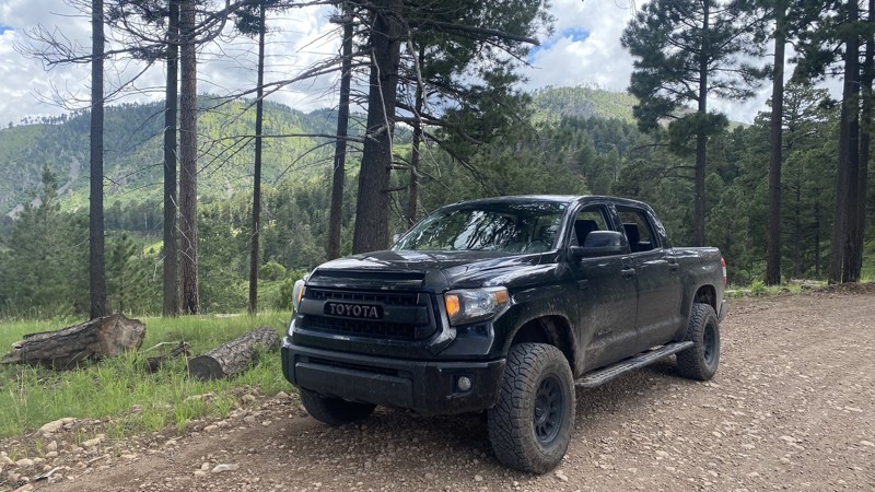
If you are up for a small challenge, fantastic scenery, and bragging rights, head to Guajalote Flat. You travel through juniper, oak, and pine forests on your way to the top of the mountain and Guajalote Flat. The terrain is stunning. This large, shade tree-sprinkled flat area abounds with good camping spots. Although you may feel apprehensive about camping here, being just 4 1/2 miles from the US/Mexico international border! Guajalote means Turkey in Spanish. You may wish you had feathers for the 24-degree-grade "Insane Downhill" section that drops 1,000 feet in less than a mile.
Updated: 05/01/2026
Pinery Canyon Pass
Portal, Arizona
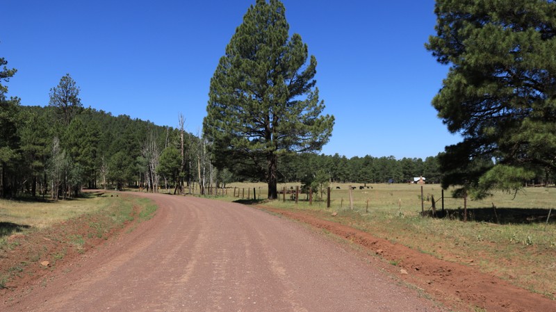
The Pinery Canyon Trail offers beautiful vistas, great campgrounds, and a plethora of hiking trails. Starting at the town of Portal, AZ, the Pinery Canyon Trail winds its way up through the Chiricahua Mountains, gaining 2764 feet over the first ten miles.
Both dispersed camping and established campgrounds are found in the area. At the halfway point, you can drive up the mountain to Rustler Park, a lush mountain meadow with panoramic views of the surrounding Sulphur Springs Valley and other "Sky Islands." Campsites at Rustler Park cost $8 per day.
The Chiricahua National Monument, with spectacular vistas of stacked rock formations, is approximately 10-15 minutes from the end of this trail.
This trail is easy and can be completed in most vehicles. During the monsoon season, there are multiple low water crossing points. These are shallow and are typically traversed by any vehicle with moderate clearance.
Updated: 02/07/2024
Stoneman Lake Road
Camp Verde, Arizona
Located in the beautiful Coconino National Forest, Stoneman Lake Road begins in a juniper and scrub pine forest on the west end and climbs steadily into towering Ponderosa pine forests, Gambel oaks, and grassy alpine meadows. Elk, deer, turkeys, coyotes, and the occasional black bear all reside in the area and are often spotted along the drive. Stoneman Lake is an 8 million-year-old geological oddity, a large bowl-shaped depression that holds rainwater and snowmelt. More a marsh than a lake, geologists disagree on whether it is the caldera of a small volcano or a sinkhole. KT Ranch is a highlight of this trail. Its bucolic pastoral setting evokes every kid's dream of being a cowboy. An active ranch, its cattle graze on the expansive open meadows and laze under in the shade of old-growth pines. Stoneman Lake Road is a wonderful place to escape the desert's summer heat for some relaxed camping and enjoy all this beautiful area has to offer.

Upgrade your Membership
Unlock all of the details on every Trail Guide and Scout Route.
Start a 7-day Free TrialCommunity
Partners

