






By clicking "ACCEPT", you agree to be the terms and conditions of each policy linked to above. You also agree to the storing of cookies on your device to facilitate the operation and functionality of our site, enhance and customize your user experience, and to analyze how our site is used.
Arizona Off-Road Trails
373
Total Trail Guides 359

4679
Detailed Waypoints 676
Try a Free 7-Day Trial and unlock it all
Start a Free Trial Most Recent Trail Reviews
Rated 4/5
Open
Visited: 09/22/2026
Hard pack, easy forest service road that is a great back way to the North Rim of the Grand Canyon.


Tyler D’Hulst
Rated 4/5
Open
Visited: 09/22/2026
Spring Canyon is a beautiful drive. We didn’t go out to the cabin but used this western section of road coming back from Crazy Jug

Tyler D’Hulst
Rated 4/5
Open
Visited: 09/22/2026
We took this out to Crazy Jug. The northern section is hard packed forest service road. Not difficult. Very scenic drive through the ponderosas.

Tyler D’Hulst
Rated 5/5
Open
Visited: 09/22/2026
View point is spectacular! Trail was easy going out, no obstacles at all. Saw a Toyota Camery at the viewpoint.


Tyler D’Hulst
Rated 3/5
Open
Visited: 09/22/2026
An alternative route out to Crazy Jug Point. It’s easy and can be scenic in areas. I’d recommend West Ryan out to Crazy Jug though.
Tyler D’Hulst
Rated 3/5
Open
Visited: 09/22/2026
A quick connector trail through the burn patch.
Tyler D’Hulst
Rated 5/5
Open
Visited: 09/20/2026
Leviathan Mine trail is a full day trip. Though it is only 20 miles in length the travel is slow and rough. Majority of the trail you will be going between 5-10 MPH. Then once at the end it connects w...



Eric Gartin
Official Crew
Rated 4/5
Open
Visited: 09/19/2026
Simple road, well graded today. Many mountain bikers coming down from the West out of Breezy Pines. Not too many people out until approaching Senator Hiway. We went East to West as I think thats a bet...



Jeff Burnett
Rated 3/5
Open
Visited: 09/19/2026
The trail itself is not spectacular, it's pretty flat across the plains. However, driving up to the overlook and seeing a huge gaping hole in the ground is a great juxtaposition to the flat trail. The...
Tyler D’Hulst
Rated 3/5
Open
Visited: 09/19/2026
A nice trail ride from the main road down off the plateau. It's graded forest service road until the switchbacks. The switchbacks themselves are not difficult, road is not graded. This section has bee...
Tyler D’Hulst
Rated 3/5
Open
Visited: 09/18/2026
The end of the trail is not well marked, and can cause confusion. Also, vehicle passes are required for all backcountry routes within the Lake Mead National Recreation Area.
Eric Gartin
Official Crew

Ted Whisler
No Rating
Open
Visited: 09/17/2026
Nice ride west side a little rocky but rating is true to #2


Ted Whisler
Rated 3/5
Open
Visited: 09/15/2026
A nice drop off the plateau heading towards Marble Canyon. Not a difficult road. Road is weathered but not challenging.
Tyler D’Hulst
No Rating
Temporary Closure
Visited: 09/15/2026
Road closed due to multiple washed out wash crossings after the turn off to go up the mountain. "Road Closed" sign put out by BLM on trail.
Tyler D’Hulst
No Rating
Temporary Closure
Visited: 09/15/2026
After the turn off to head up the mountain there are multiple washed out wash crossings. A "Road Closed" sign has been put out by the BLM.
Tyler D’Hulst

Ben Ruddell
Official Crew
Rated 4/5
Open
Visited: 09/14/2026
Bogles Ranch Road is a great Sunday afternoon drive type of dirt road that climbs up in elevation and gives some spectacular views of the surrounding area. The first half passes through State and Priv...


Eric Gartin
Official Crew
Ben Ruddell
Official Crew
Rated 3/5
Open
Visited: 09/14/2026
Antares Road is an excellent way to travel from Route 66 to the eastern portion of the Lake Mead National Recreation Area. This wide county road is well maintained with minor washboarding, most of whi...


Eric Gartin
Official Crew
Rated 3/5
Open
Visited: 09/14/2026
Hackberry road is a wide dirt road with minimal erosion damage and washboarding. There are a couple of larger washes that cross Hackberry road creating wide stretches of loose sand which can cause iss...


Eric Gartin
Official Crew
Rated 3/5
Open
Visited: 09/13/2026
This is a very rough, rocky, & slow going trail. Expect around 4+ hours for the trail & another hour to get the highway. One of those trails I'm happy I did but I wont be back personally. High clearan...

Brandon W
No Rating
Open
Visited: 09/12/2026
I think the rating is spot on. The ruts and washouts at the beginning are not as bad and if you hug the inside of the shelf road they can be avoided. The middle part is same general sandy wash with ov...



Greg Page
Rated 4/5
Open
Visited: 09/11/2026
Ran this trail as part of a larger loop. Trail is in great shape. Easy for standard 4x4 with no lift. Passengers can do it until maybe the very end by the lake where the road gets rocky and washed out...


Jeff Burnett
Rated 5/5
Open
Visited: 09/10/2026
This is one of my favorite scenic trails in the area. The trail is easy to travel, but does have some optional short trails that will test your vehicle. The views from the Grand Wash Cliffs of the Hua...


Eric Gartin
Official Crew
Rated 3/5
Open
Visited: 09/07/2026
This trail by itself is nothing special. It is mostly used as an access road to get to the more technical trail such as Homecourt, Twister, and Waynes World. This is a great trail for the beginner to ...


Eric Gartin
Official Crew
Rated 3/5
Open
Visited: 09/07/2026
This trail is an enjoyable alternate route when traveling on Blake Ranch Road (7163). The trail is easy with only a handful of spots with erosion damage. The few established camping sites appear to n...


Eric Gartin
Official Crew
Rated 5/5
Open
Visited: 09/07/2026
Ran this trail from Boynton Pass Road to Loy Butte Road (opposite direction from what is listed). Ran into a few rental ATVs and a couple of Jeeps heading the opposite way. This was a fun trail wit...



Daniel Macioce
Rated 5/5
Open
Visited: 09/07/2026
This trail was a lot of fun, plus the views were amazing. I ran the trail in the order posted, starting at the south trailhead and finishing at the heritage site. Past a motorcycle, a few jeeps and a...


Daniel Macioce
Rated 4/5
Open
Visited: 09/07/2026
Nice trail, ran West to East. For some reason the map shows this a a one-way trial, East to West. That is not the case, it is a two way trail. Was pretty washed out starting around mile 12. Plenty roc...


Jeff Burnett
No Rating
Open
Visited: 09/06/2026
New trail for me. You didn’t know what it would throw at you around every corner which is why you try to find new trails or old forgotten ones
KB
Kory Burden
Rated 5/5
Open
Visited: 09/06/2026
The trail is no joke—steep, narrow, and technical enough that you’ll want to be comfortable with off-camber shelf roads, rocky terrain, and washouts that will test your vehicles articulation. The rew...



Bobby Rumbaugh
Official Crew
Rated 5/5
Open
Visited: 09/06/2026
Fun trail if you don't want to do pyeatt draw itself. Ran this trail 3yrs ago and definitely a little more erosion but, still any truck or suv with good factory ground clearance can do it. From previo...
JM
James m
Rated 4/5
Open
Visited: 09/06/2026
Ran this trail from I-17 to Sedona. Extraordinary views descending into Sedona. As others have noted, there are lots of rock on the trail, making it slow going. Passed a large number of Pink Jeeps ...


Daniel Macioce
Rated 4/5
Open
Visited: 09/05/2026
This one definitely changed over the last few years. The southern section has some legit, steep, off-camber sections. YOU NEED experience, backup, and a capable vehicle on this one now. It's not supe...


.jpg)
Bobby Nelson
Official Crew
Rated 4/5
Open
Visited: 09/05/2026
Another amazing time on this scenic crossover. We came in from Walnut Canyon and finished out on Price Road after about 6 hours. A challenging and hot day for the old TJ. Rincon Road has evolved into ...


Bobby Nelson
Official Crew
Rated 4/5
Open
Visited: 09/05/2026
We started exactly at sunrise to try and beat the heat. We planned to crossover to Box Canyon and out on Price Road. It ended up taking us 6 hours, even with all the photos and filming we did. A chall...


Bobby Nelson
Official Crew
Rated 5/5
Open
Visited: 09/04/2026
We recently ran Four Peaks after the monsoon rains. Here’s what we found and what to expect if you’re planning to run it. Have a GR8 day!

Jeep 4 Dirt
Rated 5/5
Open
Visited: 09/04/2026
Breathtaking views. Definitely don't rush through the trail. Devil's staircase was a bit slippery but awesome. A few tight stops here and there, but a trail that's a must on anyone's to do list.



Christopher Bradley
Rated 4/5
Open
Visited: 08/30/2026
Id say this is a 3.5 to 4 trail. There are some obstacles, but nothing you really need to think hard about how to approach. If you send your vehicle at it in 4 low you'll get through everything.



Justin Holsinger
Rated 4/5
Open
Visited: 08/28/2026
Rim Road (FS300) West to East. Very well groomed gravel forest road. Accessible by just about any vehicle thats not been lowered. Who does that anyway? Scenic views the whole route. Hard to believe on...


Jeff Burnett
Rated 4/5
Open
Visited: 08/28/2026
Not a bad road but it was crowded with sxs and vehicles towing campers. Hard to rate 5 stars for a busy road. Super easy any vehicle can do this. Part is paved near the freeway but the rest is gravel.

Tony Rockwell
Rated 4/5
Open
Visited: 08/28/2026
I rated 4 stars just due to the volume of sxs & camper trailers on the road.
Easy drive, any car can do this.
Ran from sheep springs to munds park, see other reviews for full route.

Tony Rockwell
Rated 4/5
Open
Visited: 08/28/2026
I ran Bar M in reverse to get to this trail. Then headed toward Casner Park Road. (See reviews I did on each of those)
Nice easy trail that is less rough than Bar M.
Nice drive through trees.


Tony Rockwell
Rated 5/5
Open
Visited: 08/28/2026
Very bumpy due to rock infused trail. A few larger rocks, 8-12” tall in places but most stock 4x4’s should be able to navigate around or over them. I would say any 4x4 with all terrain tires could nav...


Tony Rockwell
Rated 3/5
Open
Visited: 08/27/2026
Overall decent little trail; camped out near Committee Tank (not suitable for tent camping - too rocky). Nothing too technical but enough to keep things interesting. High clearance and good line choi...


Bill Ferguson
Rated 3/5
Open
Visited: 08/27/2026
Connector from FS801 (Rock Garden Loop) to FS09494F (Committee Tank Trail); yeah, it lives up to its namesake. Very rocky. High clearance and picking good lines are an absolute must. Car camped at...

Bill Ferguson
Rated 5/5
Open
Visited: 08/27/2026
Nice trail saw some deer it’s a little rough but overall was easy


M
Maddox
Rated 5/5
Open
Visited: 08/23/2026
Great little adventure for the day. Dirt road is pretty rutted up due to monsoons, but easily drivable. Lake itself is extremely low.
LL
Larry Lapp
Rated 4/5
Open
Visited: 08/22/2026
A fun side trip that has a steep hill climb. Due to recent rains, the wildflowers were blooming.


Bobby Rumbaugh
Official Crew
Most Popular


Updated: 07/09/2024
Schnebly Hill Road
Open
/
Sedona, Arizona/
11.14 miles/
About 3 hours
“The finest workers in stone are not copper or steel tools, but the gentle touches of air and water working at their leisure with a liberal allowance of time,” said Thoreau in his 1854 book Walden. Sadly, he never saw Sedona. Sand dunes and seabed sediments were laid and then covered by more of the same over 300 million years ago. Under unimaginable compression, they became the sandstone we see today. A massive 3000-foot uplift 13 million years ago created the Mogollon Rim, running from central New Mexico to western Arizona, exposing the ancient sandstone layers. Walden’s gentle erosion took over. The ethereal beauty of Sedona’s many sandstone formations emerged. Today, tourists from all over the world flock to charming and captivatingly scenic Sedona. Offroaders come, too, running the many famous rocky trails in the area. Schnebly Hill Road is both a road and a rite of passage. The road is crowded and annoyingly bumpy on the descent from the Rim into Sedona. But the views always delight, all that red and buff sandstone formed into monuments ranging from massive to whimsical. Despite being a Jeep Badge of Honor Trail, Schnebly Hill Road is a once-and-done for many. But it is one that you need to do and will always remember, a touchstone of the community, if you will. Thoreau never did Schnebly Hill Road. You should.

Updated: 06/01/2024
Backway to Crown King
Open
/
Crown King, Arizona/
24.87 miles/
About 5 hours
Located northwest of Lake Pleasant and traversing through three different life zones and multiple biomes, Backway to Crown King is a thrilling off-road adventure that offers a unique perspective on Arizona's rugged and beautiful landscape. This extremely popular 4-wheel drive trail is known for its challenging terrain, steep inclines, and narrow shelf roads. Obstacles, mines, and great views await as you climb from the Sonora Desert into the Prescott National Forest.

Updated: 06/09/2026
Box Canyon - Florence
Open
/
Florence, Arizona/
5.85 miles/
About 2 hours
Located northeast of Florence, Box Canyon is a scenic trail that passes through a spectacular, narrow canyon with geological features and bright, colorful vegetation you wouldn't commonly associate with the desert, such as acarosporaceae fungi. Beyond the sheer, towering canyon walls, drivers can find petroglyphs, and historical stagecoach stops making this trail a truly unique Arizona offroad experience. A favorite amongst many offroad enthusiasts, this trail is a popular access point to many other trails within the Florence Junction area.

Updated: 04/20/2026
Broken Arrow
Open
/
Sedona, Arizona/
3.12 miles/
About 2 hours
Situated in picturesque Sedona, Arizona, Broken Arrow is one of the most popular and iconic off-road trails around- for good reasons! With amazing red rock formations towering into the sky, this off-road trail is full of awe-inspiring beauty and moderate challenges for your vehicle and driving skill. If you arrive early in the morning, you can watch the sun's spectacular rise over the high Mogollon Rim cliffs to the north and east. Later in the evening, you can see more dramatic highlights of the natural features as shadows become more pronounced.

Updated: 06/16/2025
Bulldog Canyon 10
Mesa, Arizona
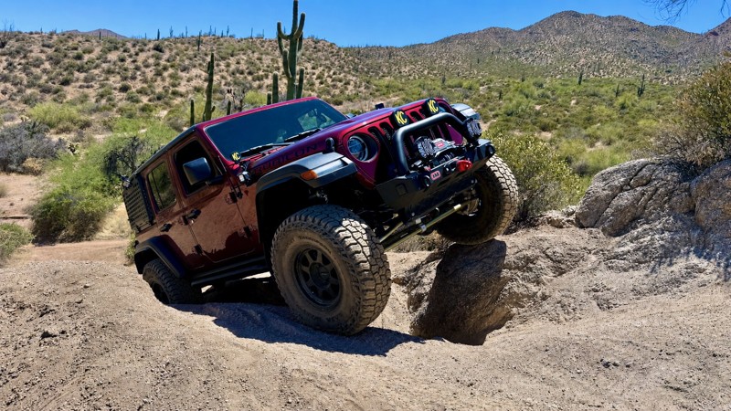
Located within the Bulldog Canyon OHV Recreation Area, FR 10 travels through the Tonto National Forest, offering incredible views of the towering cliffs and rugged canyons that make up the Goldfield Mountains. This area is home to one of Arizona's most infamous legends, the Lost Dutchman's Gold. Countless treasure hunters have explored the countless Sonoran Desert canyons in hopes that one might be hiding that mythical treasure.
Updated: 07/15/2026
Telegraph Line Trail
Open
/
Rio Verde, Arizona/
11.4 miles/
About 5 hours
Scattered along the trail are the weathered stumps of what was once a telegraph line, a silent reminder of Arizona's early history. Whether the line carried military communications, supported Horseshoe and Bartlett dams, or connected the Childs Power Plant, its exact history remains uncertain. What is certain is that these remnants gave Telegraph Line Trail its name and continue to add a unique historical element to one of Arizona's premier four-wheel-drive adventures.
Local history suggests the original telegraph line was constructed during the 1880s when Prescott served as the capital of the Arizona Territory, providing communications between Fort Whipple and Fort McDowell. After Fort McDowell became a reservation in 1890 and military operations changed, the telegraph line was no longer needed and was eventually cut down, leaving only the stumps that can still be seen along portions of the trail today.
Beginning in 2005, a series of major wildfires—including the Bart Fire, the Cave Creek Complex Fire, and later the Mountain and Clair fires—forced the closure of the St. Clair area for many years. Restoration efforts were repeatedly delayed, leaving Telegraph Line Trail overgrown and largely forgotten.
In 2014, volunteers from the Tonto Recreation Alliance (TRAL) began the enormous task of reclaiming the historic route. Over the following years, countless volunteer hours were dedicated to clearing vegetation, rebuilding damaged sections, repairing major obstacles, and restoring the trail while carefully preserving its historic alignment. Despite additional setbacks from subsequent wildfires, TRAL volunteers persevered alongside the Tonto National Forest, culminating in the reopening of Telegraph Line Trail in 2024.
Today, Telegraph Line Trail stands as a testament to both Arizona's rich history and the dedication of volunteers who refused to let this iconic route disappear. As you navigate its technical obstacles and pass the remaining telegraph stumps, you're not only driving one of central Arizona's most rewarding off-road trails—you're experiencing a piece of Arizona history that was nearly lost forever.

Updated: 08/19/2025
New River Canyon
New River, Arizona
When you think of rugged off-road trails, you typically conjure up images of a trail in a land far away and not right near a major metro area such as just Phoenix, Arizona. New River is rugged and will have you feeling like you are in a remote part of the world rather than a quick drive from the Valley of the Sun. Stretching over 19 miles long across the New River Mountains and Mesa, you will feel enveloped inside the mountains and surrounded by saguaro and other cacti of the area. On a good day, you can cross the New River several times when it is flowing.

Updated: 07/04/2024
Bloody Basin Road
Open
/
Black Canyon City, Arizona/
36.53 miles/
About 5 hours
Arizona has its share of historical monuments, but few have such a checkered past as the Aqua Fria National Monument. Bloody Basin Road offers visitors a chance to access this very unique region where Native American ruins are found right next to old stone cabins of the early settlers. With a name like Bloody Basin, you would expect it to have a conflict-filled past. One of the most familiar conflicts occurred in 1873 when a group of Apaches was suspected of killing three men. Army Captain George Randall tracked them to Turret Peak, where the army stormed the camp at night. In the panic, some Indians jumped from the cliffs to their deaths. When the battle was over, 26 Apaches were dead.
Bloody Basin is also home to the Horseshoe Ranch, founded in 1882 by William Mitchell. It would eventually become one of the largest cattle ranches in Arizona. At one time, the ranch’s cattle ranged over 30 square miles. Cattle grazing still takes place in the area, but most of the original property is now part of Aqua Fria National Monument. The area is large. Give yourself the entire day to explore this unique part of the southwest. The numerous side trails offer countless points to walk among the ruins and search the nearby rocks for petroglyphs. There are hundreds of examples of this ancient artwork littering the monument region. Look along cliffs or even on stray rocks in the meadows. Please do not disturb or alter these precious artifacts to ensure they remain for future generations.
Sheep Bridge at the end of Bloody Basin Road, built in 1944 from surplus mine material, allowed local sheep herders to move their flocks safely across the Verde River. The Forest Service demolished the original bridge in 1987 and replaced it with a replica to provide access to the Mazatzal Wilderness. The bridge supports foot traffic only.

Updated: 04/01/2025
Four Peaks Trail
Fountain Hills, Arizona
The Four Peaks trail in the Tonto National Forest is an iconic offroad adventure near Phoenix. The trail delivers breathtaking views of the Mazatzal Mountains and Roosevelt Lake, taking you through a diverse desert landscape. The Four Peaks area is a paradise for outdoor enthusiasts with an extensive range of adventure activities and historical sites.
The trail is an easy offroad drive with several scenic vistas and campsites. The area is popular for shooting activities, with numerous designated sites where you can legally shoot approved targets. Please be responsible and clean up all the target debris and discharged shells.
Four Peaks comes from the four prominent peaks forming the massif's summit. Brown's Peak is the tallest of the four at 7,659 feet. It's the northernmost peak and the only named one. It is also the highest point in Maricopa County.

Updated: 07/16/2024
Table Mesa Road - West
Open
/
New River, Arizona/
4.5 miles/
About 30 minutes
Table Mesa Road West runs through a verdant portion of central Arizona's Sonoran Desert with cacti, including saguaro, prickly pear, and various cholla species. Numerous hills and mesas create a jagged scenic horizon. The trail's namesake mesa, with a lone tower astride its flat top, sits on the east side of I-17 near the trailhead.
Mild-mannered Table Mesa Road provides access to a broad area packed with trails ranging from mild to wild. Little Pan Mine Road crosses the seasonably variable Agua Fria River. The wickedly difficult Terminator trails result in a lot of bent metal. Scattered campsites make for great nights under the stars.

Updated: 08/19/2025
El Camino del Diablo
Open
/
Ajo, Arizona/
127.04 miles/
About 2 days
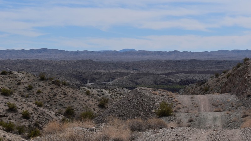
Serving as the southern route to California for hundreds of years, the El Camino Del Diablo (or sometimes called Camino Muerte - Road of Death and also as the Devil's Highway) has carried travelers from the days of the Spanish conquistadors across the sweltering desert from water source to water source until they reached Yuma. The road saw heavy use by the gold rush pioneers in 1849 as it was the only route that even the Apache's wouldn't travel in the summer, which drastically reduced the number of ambushes the pioneers suffered. Today, the original route (which started in Caborca Mexico) has been modified to pass through the Organ Pipe Cactus National Monument, the Cabeza Prieta Wildlife Refuge, and the Barry Goldwater Gunnery Range to exit on the Yuma side of the Tijinas Altas Mountains. This road is iconic and should provide some of the finest views of the Sonoran Desert you can find. The sense of self-reliance only surpasses the scenery you will experience as you must carry everything you will need with you. There's no gas, phones, electricity to rely on here. However, there is a sprinkling of watering holes, wells, and rock water tanks that you could depend on just like the pioneers did. Many of these unfortunate travelers did not make it across the El Camino Del Diablo alive; You may encounter some of the hundreds of graves that are rumored to line the road during your trip. (About 50 are marked). For more interesting detail about El Camino Del Diablo -
You can read about
Raphael Pumpelly's trek across Arizona Here.
(pp. 31-98 in particular)

Updated: 10/15/2024
7387
Haviland, Arizona
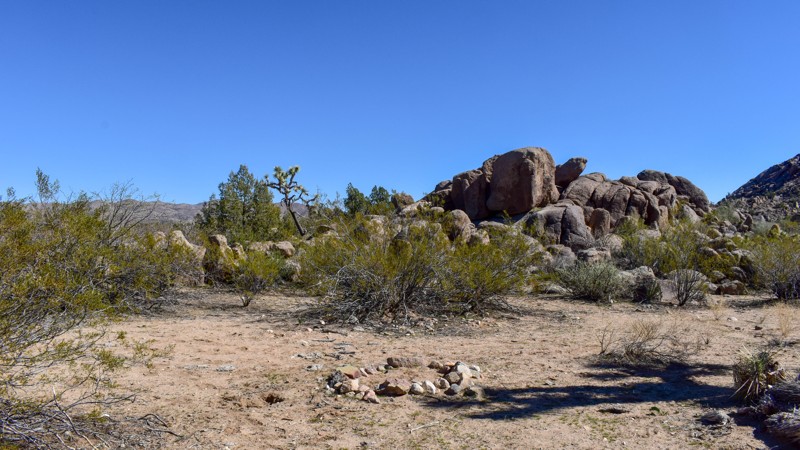
7387 is a natural gas pipeline road and, at times, a powerline road. It also provides access to many trails and a crossing of Bill Williams River connecting an otherwise mostly isolated and seldom traveled section of the Mohave Desert with Johnson Ranch Road, and with a couple of connectors, Swansea Townsite. Drivers of this trail will traverse many different terrains from the low-lying sandy washes to the rock-hard caliche paths over and around the mountains, with scenic views and skirting the western boundary of Aubrey Peak Wilderness. This trail checks the box for those looking for the road less traveled.
Updated: 05/21/2024
7366
Wikieup, Arizona
Less than two hours from Wickenberg or Lake Havasu, this trail is a scaled version of Joshua Tree National Park, without the crowds, or people for that matter. This trail is quiet, with beautiful Joshua, juniper, and palo verde trees with various cacti and the occasional saguaro. There are boulders to climb on, some quite large if willing to hike a bit. The distance isn't there to call this an overlanding trail, but if you're planning one, this trail should be part of the adventure.

Updated: 06/20/2024
Log Corral Trail
Open
/
Fountain Hills, Arizona/
9.03 miles/
About 5 hours
Log Corral Trail is a very challenging off road trail that leads you to the very remote eastern shore of Lake Bartlett. This beautiful trail has something for everyone, hard technical rocky obstacles, water crossings, hill climbs and opportunities to test your flex. The trail follows a very picturesque small creek, climbing up to a high ridge that overlooks Lake Bartlett the ultimate destination. The end of the trail offers a very remote access to camping, fishing and enjoying a great sunset along the lake.

Updated: 07/03/2024
Soldier's Pass Trail
Sedona, Arizona
Located just outside of downtown Sedona, in the Coconino National Forest, Soldiers Pass Trail is one of only a few offroad trails that gets your vehicle on top of the famous red rocks. Photo opportunities abound on this iconic trail named after General George Crook's army scouts, who used this trail to travel through the territory.
In addition to the red rock scenery, there are other amazing sites along the trail. The first is Devil's Kitchen Sinkhole. It is the largest sinkhole in Arizona. Initially formed in the late 1880s, it collapsed again in 1989. Based on current surface cracks, geologists believe more sections could collapse. The second awesome site is the Seven Sacred Pools. These are naturally formed pools in the sandstone and are considered sacred by the Apache and Yavapai Native Americans. If you catch the trail at the right time, you may see water running into the pools.
While short for an offroad trail, this one isn't about the number of miles but the quality of the trail, and its otherworldly surrounding. Plan ahead, a permit is required, and you don't want to miss this one!

Updated: 06/15/2026
Apache Trail
Apache Junction, Arizona
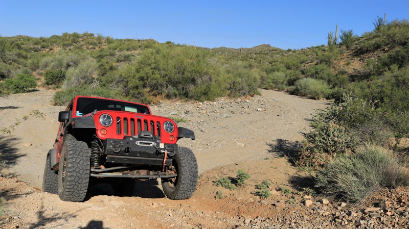
Just outside of Phoenix, Arizona, lies the historic Apache Trail, which winds through the Superstition Mountains region of the Tonto National Forest. The mountains are rugged and unforgiving but have a strong and mysterious draw for the adventurous type. The Apache Trail was originally a wagon haul road used to transport supplies from Mesa to the construction site of the Roosevelt Dam, which created Roosevelt Lake. Construction of the trail began in 1903 and was finished in 1905. It is believed that the route follows an ancient footpath that was used by Native Americans as a trade route. Traveling along the Apache Trail allows access to different regions that offer various desert experiences.
President Theodore Roosevelt once said, "The Apache Trail combines the grandeur of the Alps, the glory of the Rockies, the magnificence of the Grand Canyon, and then adds an indefinable something none of the others have".
Updated: 05/17/2024
Morgan City Wash
Peoria, Arizona
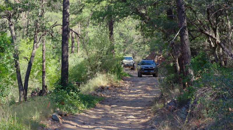
Before heavy equipment made road-building easy, wide desert washes served as semi-reliable substitutes in the Sonoran Desert. Ranchers, miners, and travelers of all sorts used the smooth sandy bottoms to traverse the rugged landscape. Morgan City Wash is named for a small mining community near Pikes Peak, one of the many mines and towns that sprung up in the mid and late 1800s in the Hieroglyphic Mountains only to quickly disappeared back into the landscape. The wash was the only thoroughfare to the tiny community. Today the offroad community still uses the wash to travel deep into this rough and beautiful area. The southern part of the trail follows the meandering sandy bottom of the broad wash. Summer monsoon floods continually reshape the trail. Springs create lush riparian areas populated with coveys of Gambel quail that flush noisily when you approach. Classic cactus-laden desert landscapes rule above the rim of the canyon. The jagged peaks of the Hieroglyphic Mountains dominate the horizon. A narrow rocky section of the wash between high walls of granite makes for fun wheeling. Several springs and seeps normally keep this section wet. Thus the sand is well-packed. The trail exits the wash after about nine miles. From there, it rides along the crest of a winding ridge offering fantastic 360-degree views. Pikes Peak looms to the east, Garfias Mountain rising to the north, both in the seldom visited Hells Canyon Wilderness. The Horse Creek Trailhead and Garfias Wash offer intrepid hikers an opportunity to delve deep into this remote wilderness. Pack a lunch. Bring the kids. Air down. Enjoy the Morgan City Wash.
Updated: 07/21/2026
Senator Highway
Groom Creek, Arizona
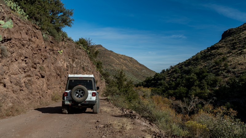
Established in 1866 as Arizona’s first toll road, Senator Highway was built to service the highly productive gold and mineral mines of the Bradshaw Mountains. The historic route between Prescott, AZ, and the mountain community of Crown King winds through dense ponderosa pine, across sprawling ridgelines, and includes a stop at the oldest pioneer house in Arizona. Palace Station was built in 1875 by Alfred Spence, his wife, and father-in-law, and served as a popular stagecoach station a couple of years later.
Updated: 04/27/2024
Cave Creek
Cave Creek, Arizona
Following along the Great Western Trail, Cave Creek will take you through several canyons and up and over several mesas and mountains. The further you drive north, the more interesting the road gets. It's a true gateway to the desert mountain landscapes or, even more so, a gateway for a multi-day overland trip not far from Phoenix, Arizona, following the same route that the pioneers before us drove with horses and buggies.

Updated: 07/13/2024
Crown King Road
Open
/
Black Canyon City, Arizona/
26.23 miles/
About 3 hours
In 1863 the Bradshaw brothers, William and Isaac, came to Arizona from the declining goldfields of California. By 1864 they found gold in the forbidding mountains that would eventually bear their family name. Miners and prospectors flocked to the area despite the ruggedness of the mountains and the fierceness of the Yavapai natives, that still claimed the lands as their home. William, more an entrepreneur than a miner, laid out the Bradshaw Trail and started a ferry across the Colorado River at Ehrenburg, charging unsuccessful California miners a nice fee for access to the new goldfields of Arizona. Mines like Senator, Tip Top, Blue Bell, Tiger, and Ora Belle began highly profitable operations. Rod McKinnon located gold in July 1875 deeper into the Bradshaws than any find to date. The resulting Crowned King Mine became the largest operation in the Bradshaws and spawned the bustling town of Crown King. Crown King got its post office in 1888. Electricity and the telephone arrived in 1897, both still a rarity in Arizona. The Saloon was moved from Oro Belle board by board in 1906 and reassembled on the present site, which was at the time beside two Chinese Restaurants and the feed store. The upstairs featured seven cribs where the town's soiled doves practiced the world's oldest profession. It is now Arizona's longest-operating saloon. The historic photos lining the walls of the bar serve as a museum of sorts. The Bradshaw Mountain Railroad, a true feat of engineering, reached Crown King in 1904 via switchbacks and tall trestles. The railroad ceased operation in 1926 after the mines played out and most of the population left. The rail bed was converted into the scenic Crown King Road with its dual ghost towns of Bumble Bee and Cleator. Today there's only sporadic mining in the Bradshaws. But Crown King has become its jewel. With roughly a hundred full-time residents and perhaps a thousand that have cabins and summer homes atop the mountains, Crown King's population swells every weekend as offroaders and adventurers come to the mountaintop town for a taste of Arizona history. The Magic Bridge transports visitors from the desert below to the towering pines and cool breezes of Crown King. The saloon has live music most weekends. The general store sells a lot more t-shirts than mining pans these days. Campsites near town are filled with happy campers. Even with most of the gold gone, the mountains of the Bradshaw brothers remain full of treasures. Drive on up the iconic Crown King Road and see what you can discover.
Updated: 10/15/2024
Sycamore Creek Loop
Fountain Hills, Arizona
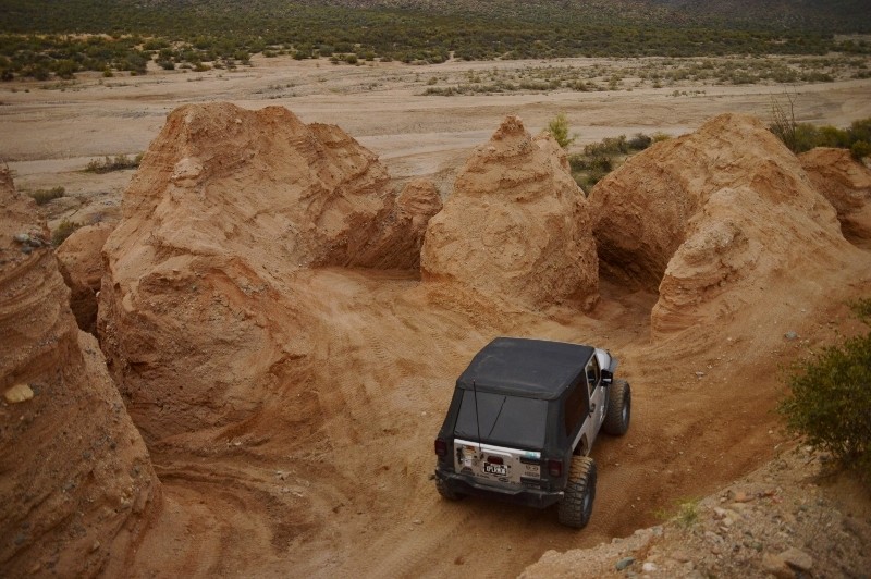
This route is a wonderful get away from the Phoenix congestion and is a VERY popular place for the locals. The area is comprised of many different trails connecting for an incredibly beautiful, yet challenging tour of the desert. The large Sycamore Wash has the challenging Widowmaker hill climb as well as sweeping panoramas of the Four Peaks Region in Tonto National Forest. The Sycamore Creek and Four Peaks region combined, create an incredible place to play at any time of the year. The region has many double and single track trails to explore for days. The trails in the area wind through sandy wash canyons, up steep hill climbs and over rock strewn mountain tops, all while being within an hours drive of the Phoenix valley. The entire area has limitless free camping, but please try to reduce your impact by using an existing campsite area. The area is popular for target shooting and can become crowded on holiday weekends. Please be very cautious when traveling the trails, all trails are TWO WAY and collisions do occur, resulting in deaths, please slow down!

Updated: 11/11/2023
Vultee Arch
Sedona, Arizona
The Vultee Arch trail in Sedona is the perfect place for your next offroad adventure. The trail runs through the beautiful red rocks, leading to a vast network of hiking trails in the Coconino National Forest and the Red Rock Secret Mountain Wilderness. The area is home to many natural wonders, including stone arches, natural bridges, pinnacles, cliffs, and slot canyons, all waiting to be explored.
If you have a high-clearance vehicle, you can easily drive to the hiking trailheads of Devil's Bridge, Brin's Mesa, Secret Canyon, and Vultee Arch. Even if hiking is your main attraction, off-roaders can take unique photos of their vehicle against the beautiful red rock backdrop along the Vultee Arch Trail. For the best photos, you should take the trail in the afternoon when the sun casts its warm light on Capital Butte and the surrounding ridgelines.
If you want to explore the area's history, head down the trail and take a short side trip on Forest Road 9917 to the nearly century-old Van Deran Cabins. These cabins were used in two movies back in the 1940s: "Riders of the Purple Sage" and "Blood on the Moon." A plaque at the site provides additional history of the previous owners and building materials used.

Updated: 03/01/2024
Mineral Mountain Road
Florence, Arizona
Mineral Mountain Road is the northern entrance to the famous Florence, AZ, OHV area. From Mineral Mountain Road, offroad enthusiasts can plan a full day's adventure with any number of the local trails. This expansive area is littered with mining claims, petroglyphs, wagon stops, and beautiful scenic views. Occasionally, there are deer, big horn sheep, Gila monsters, and endangered desert tortoise sightings. Mineral Mountain Road can access several of Arizona's most famous rock crawling trails. Ajax Mine, Axle Alley, and Highway to Hell are just a few of the area's legendary trails. If you're looking for a great scenic 4x4 tour, Box Canyon and Price Road make for a fantastic and moderate day.
The route was once a maintained gravel road connecting several mines and the old town of Reymert. After the mining years ended, the land was used for military artillery training. The local Arizona National Guard would notify the public when the firing was live by raising a red flag at the trailhead. Over the years, the military stopped firing into the mountains, and this rugged Sonoran desert landscape found a new purpose.
Updated: 04/08/2024
Castle Hot Springs
Surprise, Arizona
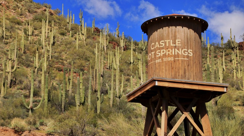
Confusion between indigenous petroglyphs and Egyptian hieroglyphs led to the name of a sprawl of rugged Hieroglyphic Mountains west of present-day Phoenix. In 1865, Army Colonel Charles Craig led a troop of soldiers pursuing Yavapai Indians through the misnomered mountains and remarked that the peaks looked like castles. The troop stumbled upon hot springs that flowed into a desert wash and named them Castle Hot Springs and Castle Creek. The wash became a road, and the hot springs became a resort.
An underground reservoir pushes out 200,000 gallons of 122-degree water daily. Indigenous peoples had long frequented the hot spring for its supposed healing powers. In 1896, the enterprising Arizonan Frank Murphy began luring people to the Castle Hot Springs, and they've been coming ever since. Eastern dandies wintered at the remote hot springs resort, including Theodore Roosevelt, the Wrigleys, Rockefellers, Cabots, and Carnegies. During World War II, the Defense Department commandeered the spa to serve as a recuperation facility for wounded servicemen. Its most famous patient was future President John F Kennedy, who spent the winter of 1945 recovering from injuries suffered when his boat, PT109, was destroyed. A 1976 fire destroyed much of the resort, but it has reopened. The palm trees around the resort are not native to Arizona.
The resort is not the only feature of this highly scenic drive. Castle Hot Spring Road passes the scenic Lake Pleasant Reservoir before dropping into Castle Creek. Feral burros roam the rugged landscape and are often seen from the trail. The center of the trail follows a colorful canyon formed by Bitter Creek. Remnants of present and past mining operations and cattle ranches dot the surrounding hills and mountains. Each switchback reveals another vast vista of a rugged mountainous landscape, and connecting trails beg for further exploration.

Upgrade your Membership
Unlock all of the details on every Trail Guide and Scout Route.
Start a 7-day Free TrialCommunity
Partners

