By clicking "ACCEPT", you agree to be the terms and conditions of each policy linked to above. You also agree to the storing of cookies on your device to facilitate the operation and functionality of our site, enhance and customize your user experience, and to analyze how our site is used.
Tennessee Trails


Most Recent Trail Reviews
Most Popular
Windrock 51: Panther Rock
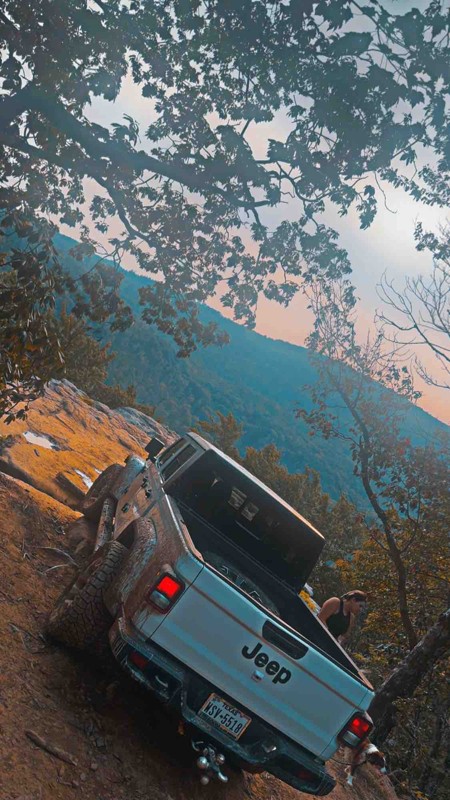
Located in the northeast part of Windrock Park, Trail 51 takes you to a breathtaking overlook named Panther Rock. This namesake rock feature overlooking the surrounding mountains and Three Forks Hollow is the perfect offroad trail for a lunch picnic or a romantic dinner at sunset. Whether you visit for the views or the Jeep Badge of Honor designation, Panther Rock is a "must-do" Tennessee offroad trail.
Windrock 26
Located on the far west end of Windrock Park, Windrock 26 is a rocky and bouldery trek up the scenic Bletchers Creek. With close proximity to Brushy Mountain State Penitentiary, this trail cries out to the adventurous driver seeking heart-pounding thrills. Whether attempting to check off your Jeep Badge of Honor or just hoping to further your offroad skills, Windrock 26 is a must-do trail.
Windrock 16
Windrock 16 is one of Windrock's longest trails and is a continuous onslaught of varying obstacles that will test your driving abilities, your nerves, and your group's attrition. This punishing trail offers deep off-camber trenches, big rocks, and slippery hill climbs that await those with the courage to take on a lengthy adventure. This trail rewards the battle-weary with a spectacular waterfall and scenic views to top off an adrenaline-filled trail ride.
Windrock 22
Located within Windrock Park, Windrock 22 is one of the first trails you will encounter as you leave the parking area. This is a great trail to get your feet wet right away and tackle a variety of obstacles, including steep climbs, creek crossings, mud holes, rock climbs, and boulder fields. If you want to skip the boring greens and start your day right away with great 4-wheel action, don't blink, or you might drive right by this gem.
Old Cataloochee Turnpike
Windrock G1
Winding its way along the southern ridge of Windrock Mountain, G1 is the perfect access road to allow you to choose your adventure. With numerous options, drivers can keep to a 2WD adventure or take one of the many, much more challenging trails in Windrock Park or anything in between. A few vantage points break through the trees occasionally, allowing you to enjoy the expansive views of the countless ridges and valleys that make up this part of Tennessee. Whether you use G1 for access or adventure, this will be a great addition to any itinerary.
Tharpe Road
Peavine Sheed Creek Road
One wouldn't think that only 27 miles in the same forest would warrant much of a chance of scenery, but this trail is a rarity. The beginning along the Conasauga River is lush green with Beech and Maple trees towering over the Flame Azaleas and Chinese Bush Clovers. As you begin to climb, Eastern White Pine start to take over with the floor opening up. Just like that, you enter into a forest of Rhododendrons with no view in either direction. Along the eastern side toward Chestnut Ridge, large vines swing from tree to tree, giving the feel of being in a true rainforest. Throughout its entirety, you will find incredible camping opportunities as well. Not enough can be said for trail that will take you by surprise.
15 - The Gatekeeper
Citico Creek Road
Citico Creek Road is a well-maintained gravel road that follows along the beautiful crystal-clear waters of Citico Creek through the heavily wooded Cherokee National Forest. There are multiple designated primitive campsites and a couple of established campgrounds along this road.
Windrock G50
Running along the southeastern ridge of Redoak Mountain, G50 is a mild 4WD trail providing access to the eastern side of Windrock Park and trails such as Windrock 89 and the famous Jeep Badge of Honor trail Panther Rock. G50 also offers impressive views over Walden Ridge, Pine Ridge, and Dutch Valley, among many other hills and valleys in the distance. Whether you are running G50 as access or for pleasure, stop at the viewpoint and enjoy the greenery that Tennessee is known for.
Unaka Mountain Road
Cold Springs Creek
Cold Springs Road is your quick access from I-40 and the Harmon Den Area into the Cherokee National Forest. It is a main connector road that gives access to several other trails and routes. It runs almost entirely along the beautiful Cold Springs Creek and is plentiful for dispersed camping locations. It is suitable for any vehicle.
Windrock 2 and G10
Windrock Park is full of trails for all skill levels. Trails 2 and 10 make for a good intro into moderate trails, with all obstacles providing opportunities for the beginner driver to gain experience. Winding down from Windrock Mountain to Horseshoe Ridge, users only glimpse a tiny bit of what Windrock Park offers. Once the journey is complete, it is simple to return to the park and continue on an epic adventure.
Windrock 89 and G66
Windrock Park is full of trails from easy to difficult to please any user. Trail 89 and G66 make for a relatively easy way to exit the park, with a few minor obstacles to keep your attention. The canopy of trees breaks occasionally, giving you glimpses of the sky while you wind your way down the lush forested mountainside that is Windrock Mountain.
Conasauga Creek
Conasauga Creek is a beautiful drive along and through the stream just south of Tellico Plains. Set in the dense woodlands of the Cherokee National Forest, the trail runs from near Watertrough Hollow to Epperson crossing just below Bakers Grave Mountain. The trail has multiple water crossings. Keep a lookout for the waterfalls. There aren't any campsites along this route.
Doublecamp-Jake Best
Set in the heavily wooded Cherokee National Forest, Doublecamp-Jake Best road winds through the deep hollow of Doublecamp Creek until you reach the ridge along Salt Spring Mountain. It then descends back down along Jake Best Creek. The trail begins and ends on Citico Creek Road. There are multiple dispersed camping sites along this route.
Big Frog
Leading into the Big Frog Wilderness of the Cherokee National Forest, Big Frog Road is an unmaintained trail guiding users in over 1,000 feet of elevation gain nearly to the top of Chestnut Mountain. This is a great trail to access many hiking opportunities that are offered in the area, including the impressive Hemp Top Trail with a 2,000-foot elevation gain to the top of Big Frog Mountain at over 4,000 feet! Although nothing technically difficult, it is worth noting that there are scattered rocky patches requiring drivers' attention. There are a few quaint camping options along this trail as well, and you will likely encounter fewer people than the more popular trails nearby.
Bald River Road
Bald River Road is an easily traveled gravel road in the Cherokee National Forest that heads west from the Tellico River. Crossing Basin Gap, you can turn left onto Waucheesi Mountain Road to an amazing viewpoint. Continuing west over the gap will take you to the Sixmile Creek area. The only camping available on this road is the Holly Flats Campground.
Hall Top Spur
Hall Top Spur is a main thru road for the area. It is well-maintained and has a good amount of incline/decline, but any vehicle can drive this road without issue. Incidentally, the family name "Hall" dates back to the area in the 1700s. There are no camping opportunities on this road.
Windrock G39
Rich Mountain Road
This is a straight-through, one-way trail near Townsend, Tennessee. To get to this trail, you must enter the Great Smoky Mountain National Park and take the Cades Cove Loop Road. Vehicle access to this trail is closed on Wednesdays. This trail is a gentle drive through the mountain forest with very nice overlooks that can be traversed by any 2WD vehicle.
Byrd Hughes Road (A)
Waucheesi Mountain
Waucheesi Mountain Road is an out-and-back route in the Cherokee National Forest that climbs to an open mountaintop meadow with an incredible 360-degree view of the surrounding mountains. There are dispersed campsites along the trail, but the weather conditions can drastically differ at the top and bottom of the mountain. Choose wisely.
Hall Top
Fire towers in the area were typically built in the early 1930s to mid-1930s, and many of them no longer exist. Still existing, however, is the Hall Top Fire Tower. However, you would risk your well-being by trying to take the dilapidated stairs to the top. The road leading up is uneventful, with a few rocky sections. Turning the corner to the tower, you are more inclined to see the modern-day cell array before you get your eyes on the tower. From the base of the tower, there are no views. There's no camping along the road.
Windrock G53
Windrock Connector Trail
Hurricane Gap Road (TN)
This Hurricane Gap Road (31) resides in Tennessee in the Cherokee National Forest and joins its counterpart in North Carolina. Gap is another word for a pass or an opening through the mountains. Hurricane Gap is wider than most in the area, offering a rhododendron-covered floor, creeks, and a small number of dispersed camping sites. If dispersed camping is not what you are after, the improved Painted Creek Campground resides at the northern trailhead. It is suitable for any vehicle.
Chestnut Ridge
When starting on the trail's western end in the Martha Sundquist State Forest, Chestnut Ridge treats you with designated and dispersed camping and a picturesque Gulf Fork Big Creek crossing. Six campsites in this area are numbered, and by the creek crossing, there is a rough but short loop with other dispersed camping opportunities. The road gains elevation in the Cherokee National Forest as you make your way to Max Patch through a forest that is a little less dense than the surrounding area. Although the road is easy, rain could make the creek crossing impassable, so use caution. Suitable for any high-clearance vehicle.
Brown Gap
Brown Gap is typical of the forest service roads in this area, rough in spots, narrow, and tree-lined. Brown Gap closes the loop in the area by connecting Gulf Road, Chestnut Ridge, and Middle Road. The only camping opportunity on the trail is near its eastern terminus, but it is very close to private property. Camping is best found where Gulf Road and Chestnut Ridge join. Minor erosion ruts and rocks exist, but the road is considered easy and suitable for any high-clearance vehicle.
Windrock 35
Traveling south to north, this trail starts mild but gets interesting quickly after crossing the creek at the 180-degree turn. You will be challenged by continuously climbing loose rocks that get very slick with a little bit of moisture. There are optional lines through the climb to challenge big rigs, but with a steady pedal and good decision-making, you can reach the top in a stock 4x4 with high clearance.
Spring Creek
Spring Creek is a quaint road in South Eastern Tennessee running along its namesake, Spring Creek, down to the Hiwassee River. It is maintained and has no obstacles, making it suitable for all vehicles, and it shows with its popularity. You will likely not be alone if you choose to visit on a weekend. Camping is abundant, with many dispersed campsites along the trail. If dispersed camping isn't your thing, the Hiwassee/Ocoee State Park Gee Creek Campground lies at the western end of the trail.
114 Spur Trail
Welcome to the Natchez Trace State Forest! This scenic, easy out-and-back trail looks like it could get muddy if it rains hard. There is a small ridge to get up to the camping area, so a four-wheel drive is a must here. The road is wide enough for larger rigs. There is a spacious campsite as well.
Neville Bay Road
Indian Creek
Winding its way along Parksville Lake, Indian Ridge will delight drivers with its lush vegetation, smoothly graded road, and active wildlife. You will be treated to towering Tulip Poplars, Mountain Ash, and Mountain Maple trees above, while the forest floor is littered with flowers such as the Indian Pink, Flame Azalea, and Turks-cap Lily. Birds and snakes are plentiful, and you may even be lucky enough to see a black bear! But be sure to keep one eye on the road, as there are hardly any straight sections. Camping can also be found in a few select locations along this trail.
Windrock G7
Windrock Trail 4
Windrock 27: Kener Gap Hollow
Windrock 27 is a two-way trail accessed from G6 or Trail 26. Offroaders can expect steep inclines or declines depending on which way this trail is driven. There's a rut large enough to swallow a Jeep. Depending on your rig, it may result in off-camber moments with the potential for light body damage if not careful.
One item of interest is if drivers access 27 from G6 and exit via G26, they could leave Windrock Park and access attractions such as the Historic Brushy Mountain State Penitentiary.
Bullet Creek
Bullet Creek is a peaceful gravel road through the Cherokee National Forest. It can be used for a simple sightseeing drive or added to other roads in the area for a long weekend of overlanding. There was one camp on the southern end, but it sits just around the corner of a private residence.
Windrock 75
This trail is a double black diamond on Windrock's rating system, and numerous obstacles certainly warrant that rating. With large rock fins, steep climbs and descents, and ridge-top views, this trail has it all for a seasoned driver with a capable rig. Many obstacles have bypasses, making this a good place for people looking to try something out of their comfort zone without committing to winching all day. The obstacle in the "Hardest Part" photo has a bypass.
Windrock G40
Cane Creek Mountain Road
Cane Creek Mountain Road is a sparsely used dirt road that winds down off of the Cherohala Skyway into the vast wilderness. While the trail begins and ends in the Cherokee National Forest, it does cross private land. Please be respectful of the private properties. There are not any camping spots along this route.
Windrock G5
Windrock G6
G6 is a relatively easy road providing access to other trails within Windrock Park, such as Windrock 26. It is a packed dirt trail that is prone to ruts. However, proper tire placement should make quick work of them. Access to Knoxville Highway is also possible with the addition of Windrock 39.
Round Mountain
Round Mountain Road travels mainly through the Cherokee National Forest but is not a forest service road. Comprised of maintained gravel, it climbs up, twists, and turns through forest stands to its high point. At the high point resides Round Mountain Campground, typically open from May through the end of October. It is suitable for any vehicle.
Windrock 82
This trail is almost entirely smooth gravel two-track with a few shallow puddles and small rocks strewn around. The exception is the large rock ledge at the eastern entrance. As if the ledge itself wasn't enough of a challenge, the approach is steep and covered in loose gravel. To the driver's side, there is a large tree that could easily rearrange sheet metal or remove a mirror. That risk forces vehicles into an off-camber climb attempt to the passenger side. The top of the ledge is likely to have holes from drivers trying to scramble their way to the top, making traction even trickier. Running west to east to descend the ledge, vehicles may still risk hitting their bumper and rear-mounted spare tires.
White Cliff Road
White Cliff Road is a beautiful mountain road that twists you from the Tellico Plains area of the Cherokee National Forest. The trail runs between Starr Mountain and Bullet Creek roads along Hogback Ridge, skirting the northern slopes of Black Mountain. This trail has fantastic fall colors. There aren't any campsites along this road.
Windrock 30
Running Windrock 30 from south to north is a steady climb with a mix of obstacles, including deep ruts, v-notches, and small boulder fields. Even in dry conditions, rocks may be slick as water tends to run down this trail. Bypasses are limited, and there are several obstacles where vehicles with limited articulation will struggle.
Sina Branch
Running down the western edge of the Cherokee National Forest, Sina Branch Road is a maintained road traveling from the Baker Creek Inlet of Parksville Lake to the Conasauga River. As with many others in the area, this trail is ripe with lush foliage from tall Poplar and Beech trees down to the ferns covering the forest floor. Be on the lookout for wildlife, too, as this area is never quiet!
Windrock G2
Big Clifty
Big Clifty is a winding trail leading you up 1,600 feet on the north side of the Meadow Creek Mountains. This mostly maintained trail has no major challenges, making it a pleasant short journey for any high clearance vehicle. This trail also provides access to the Meadow Creek lookout tower overlooking quite a distance in every direction. Camping is sparse, but a couple of locations are adequate for small groups.
East Sylco Ridge Road
Pulling away from Parksville Lake is the unmaintained East Sylco Ridge trail. Although it is not a graded dirt road, don't let this deter you from exploring this wonderful ridgeline trail. You will often have sights to the east through the smokey hills beneath Hogback Mountain. Lush vegetation lends itself well to a shady cover for wild raspberries lining the trail in many spots. Small and scattered mud pits keep traffic low on this treat of a trail in the Cherokee National Forest.
Windrock 11
Trail 11 is a mostly graded route with a few low spots that often hold shallow standing water when run clockwise. Occasionally, heavy rains will cause small washouts in areas as well. Along the trail, you pass old mining operations identifiable by clearly sculpted features in the hillside, and you can still find natural pieces of coal on the ground. Near the end of the trail, to the northeast, two uphill rock gardens represent the only real challenges. The first has larger rocks and is wide enough for drivers to pick from several lines. The upper garden is essentially one lane, but with smaller rocks, it is easily traversed with steady momentum and throttle control.
Windrock G52
Windrock Trail 19
Gulf Road
Residing in the Martha Sundquist State Forest, this easy gravel road provides glimpses of the Gulf Fork Big Creek and two designated campsites beside it. Three other designated camps are further south along the road. Additionally, it is a gateway into other US Forest Service roads in the area and other hiking opportunities, such as the Tennessee Gulf Trail. The road is suitable for any vehicle.
Baker Creek Road
Baker Creek Road is a well-maintained road running through the Cherokee National Forest south of Parksville Lake. Meandering through the Beech, Maple, and Poplar trees, you will also be treated to Baker Creek, lined with Rhododendrons. Camping is also available along this trail on the eastern portion once you pass all the cute homes in the open meadows.
Blue Ridge
Blue Ridge is mostly gravel, with mixed patches of hard-packed dirt. The trail climbs when traveling from north to south with mellow curves. It is primarily tree-covered in the warmer months with few views but is particularly inspiring during the soft morning sun. Black bears habitat the area, and if you move slowly and quietly enough, you may see one on the road. Only limited dispersed camping opportunities are found. Closed roughly from January through the end of March.
Linton Ferry Road
Windrock G3
Brush Creek
Don't let the ease of this road deter you. While the northern half of the trail is actually paved, the southern portion is graded gravel. Along the trail you will find plenty of wildflowers. If you choose to sit or walk around Allen Branch Pond long enough, you are sure to see wildlife. There is no silence here! At the southern end, you will be treated to the French Broad River. Camping is not available on this trail, but the nearby Weavers Bend Road should satisfy.
Fed Fork
Ascending from Wolf Creek, Fed Fork climbs 1,500 feet on an unmaintained road, with the brush encroaching tighter and tighter into the path of your vehicle. The only obstacles are the occasional mud puddle and fallen tree. Be sure to pay attention to where you are driving, as sections of this trail are very close to the edge! Camping is limited with only one dispersed location at the end of the trail and another small roadside camp in the middle section.
Herndon Cemetery Road
Windrock G9
Panther Bay 396
Windrock 83
Windrock 83 is a two-way trail. It can be entered via G33 or G6. It can also be used to access Windrock 82, a difficult trail. While 83 is a relatively short trail, it offers great views down the mountainside and into the valley below. It also has several interesting rock features and waterfalls. The trail is known for its entrance to a mine system. While the mine entrance looks tempting to explore, exercise caution due to potentially dangerous gases that may have collected. Windrock discourages guests from entering. However, on a hot day, 83 can be a refreshing oasis due to the cold air coming out of the mine shafts. The trail exhibits mostly rough dirt and, depending on recent weather, several mid to large muddy puddles. The hardest part is the incline from entering the trail via G6.
Windrock 36
Windrock 36 is a short, unmaintained trail taking users to the southern trailhead for G6. The only obstacles on this trail are moderate ruts. The trail is under a mile long but takes a little time to get through. The shade keeps the trail wet longer, and when this trail is wet, it is significantly more challenging. 4WD is necessary in all but optimal conditions, but no lift is needed unless the trail sees severe damage.
Charlies Run
Tucked away behind Tumbling Creek Campground lies a short but sweet trail known as Charlie's Run. This trail is not maintained but is relatively easy and only offers a small challenge in the form of small and shallow mud pits. The reward of this trail is the water. All along its half-mile length, you are treated to pullouts allowing camping and access to Tumbling Creek, and at the end, you reach an inlet for the Ocoee Number Three Lake. Be sure to spend some time enjoying the quiet peace of the water!
Meadow Creek Tower
What appears to be an easy and bland road sure gives you a nice treat at the end. The Meadow Creek Road is groomed gravel and accessible by most any vehicle. Once at the top, there is a large parking area and trailhead for the Meadow Creek Ridge Mountain Trail and the short trail to the lookout tower sitting at 2,800 feet. There is no camping directly on the trail but the nearby Big Clifty has a couple of spots.
Wildcat Hollow Road
Ginger Creek Road
Windrock G20
Middle Road
Middle Road is a well-maintained gravel road suitable for almost any vehicle. It connects Brown Gap and Gulf Road and provides access to the Tennesee Gulf Trail, a 9.5-mile hiking trail connecting to the Appalachian Trail. Camping opportunities do not exist on this road.
Windrock 5
Crutcher Hollow
Wallace Cemetery Road
Dry Fork Bay
Windrock G37
Tinker Branch
Tinker Branch is a short out-and-back trail that spurs off of Spring Creek. The road is a bit rougher than Spring Creek but suitable for any vehicle. It quickly ends at private property and can only provide a short side excursion if you drive Spring Creek. No camping.
Byrd Hughes Road
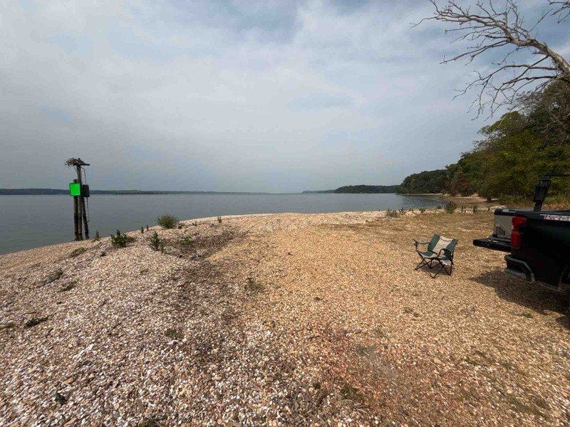
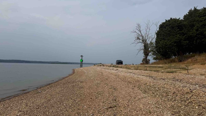
Land Between the Lakes is a 40-mile long peninsula that offers hiking trails, horse trails, 300 miles of undeveloped shoreline, mountain biking, 400+ miles of scenic roads, and 1400 campsites, including camping within Turkey Bay OHV park. Byrd Bay is one of the enjoyable scenic roads with camping along Kentucky Lake. This is an easy trail, so any vehicle with decent clearance will be fine.

Unlock all of the details on every Trail Guide and Scout Route.
Start a 7-day Free Trial


