



By clicking "ACCEPT", you agree to be the terms and conditions of each policy linked to above. You also agree to the storing of cookies on your device to facilitate the operation and functionality of our site, enhance and customize your user experience, and to analyze how our site is used.
West Virginia Off-Road Trails
20
Total Trail Guides 12

175
Detailed Waypoints 83
Try a Free 7-Day Trial and unlock it all
Start a Free Trial Most Recent Trail Reviews
Rated 5/5
Open
Visited: 09/18/2026
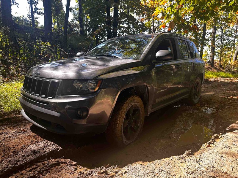
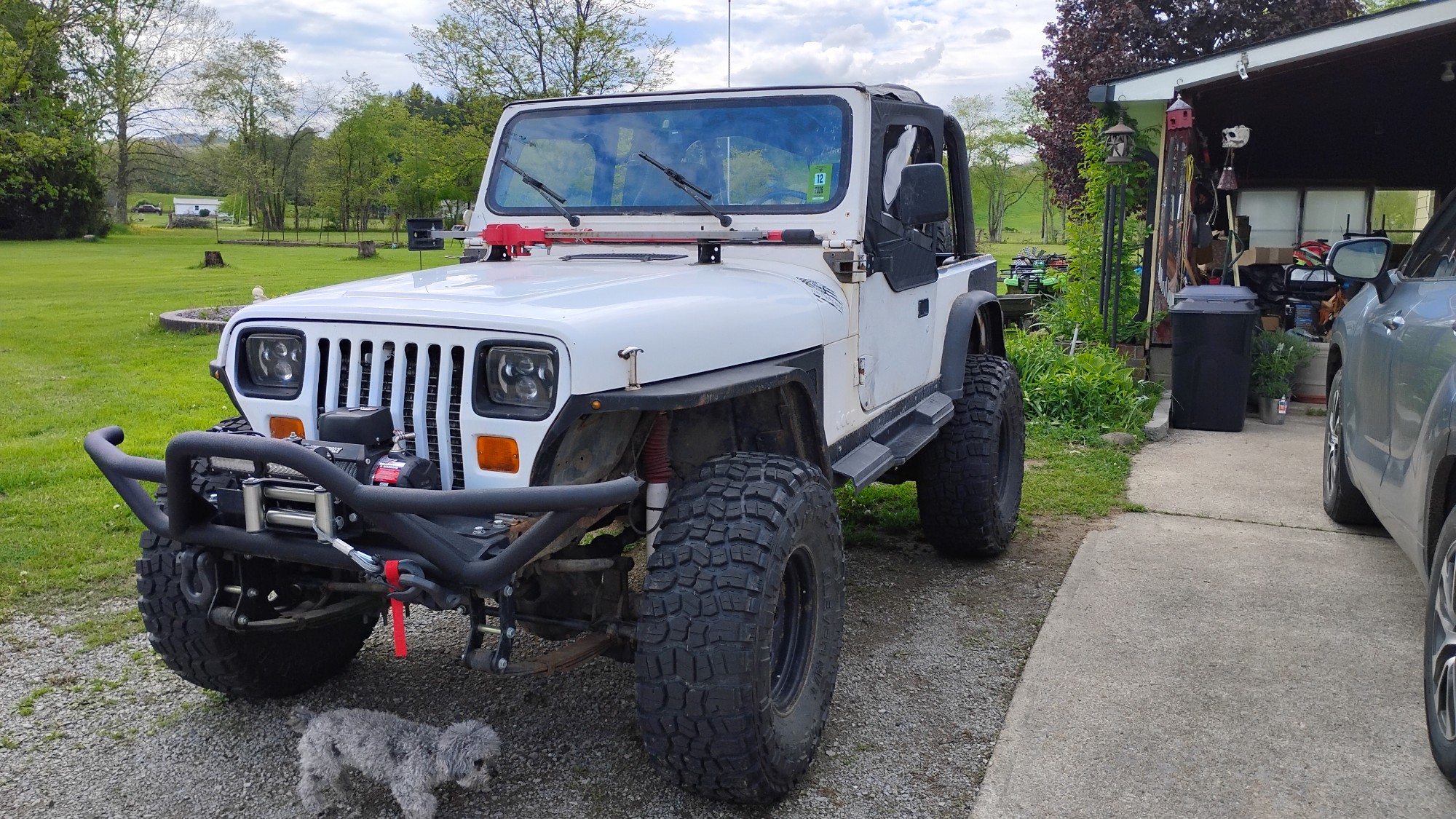
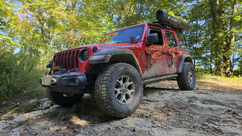
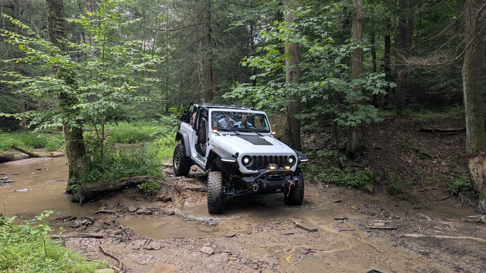
Trail is wet but fully passable, the Jeep pic shows the Jeep immediately after clearing the trail. No downed trees, washouts, or other blockages encountered. Water crossings are active, but nothing un...

Kenny Gall
No Rating
Open
Visited: 08/11/2026
Per the MVUM, the trail is seasonally open. As always, check current fire restrictions/closures before venturing out.

Trails Offroad
Official Crew
No Rating
Open
Visited: 08/06/2026
My wife bought me my first jeep for Christmas of 2025. This was our first trail we got to go on since we have had it. We had a blast in a stock 2025 Willys just took out time with it the trail looked ...
EL
Eddie L Dickens
Rated 5/5
Open
Visited: 08/02/2026
Great skill and confidence booster for stock Rubicon JL with self rescue gear
JM
James Means
Rated 5/5
Open
Visited: 07/14/2026
The new rating is spot on. I love running this trail in conjunction with Canyon Rim Road, makes for a good day of wheeling with beautiful sights and wildlife. Trail is OPEN as of now. State road is st...
Joseph Sandy
No Rating
Open
Visited: 03/20/2026
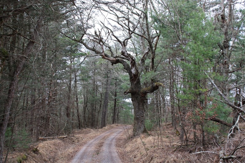
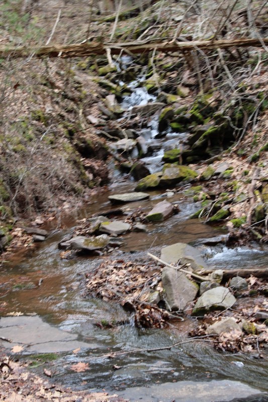
Mostly easy. Some snow still in spots but you can easily pass . Very scenic.
NJ
Neil Johnson
Rated 4/5
Open
Visited: 02/20/2026
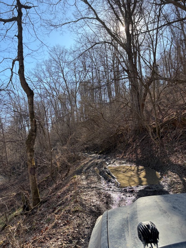
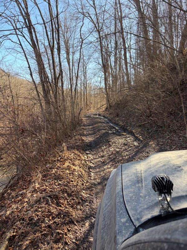
The first half of the trail was super well maintained and a lot of fun! Got to the bridge and turned around (in very poor shape). Apparently the gate no longer opens, so you have to turn around half w...
BS
Billy Smith
No Rating
Seasonal Closure
Visited: 02/15/2026
According to this trails management agency, the trail is likely closed for the season.
You can reach out to the agency for more details.
Be sure to leave us a report and let us know ...
Trails Offroad
Official Crew
No Rating
Temporary Closure
Visited: 11/19/2025
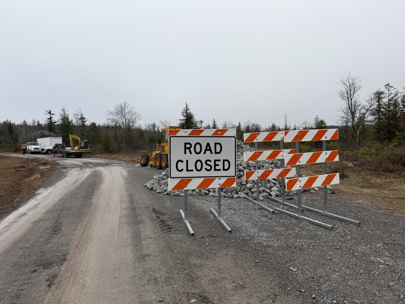
Missed the first sign at the entrance and came across a barrier and grading crew, stopped and spoke with them and they confirmed it is closed while they regrade and install fresh gravel. No ETA for co...
TT
Tripp Tapp
No Rating
Open
Visited: 11/16/2025
awesome trail. very new to offroading so this one made me a little nervous. my jeep is stock still. no lift on 33's. large ruts and a few deep mud holes but the jeep handled it like a champ. you'l...
WM
William Mitchell
No Rating
Open
Visited: 11/16/2025
so im very new to offroading. did not see a mudhole. got past the forst house that says to leave. right past it on the left is another little shanty. still on gravel. get to top of hill. can go ri...
WM
William Mitchell
Rated 5/5
Open
Visited: 11/06/2025
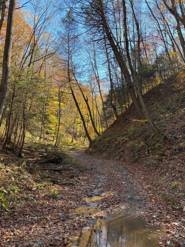
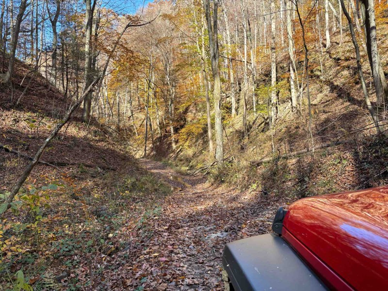
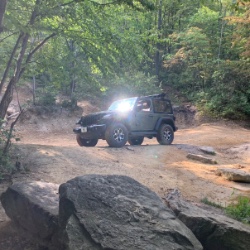
Took this down from the river overlook. Started off easy, but once you start going downhill in earnest, you gotta start paying more attention. It was easy today under dry conditions, but I could see i...
Chris Warner
Rated 5/5
Open
Visited: 11/06/2025
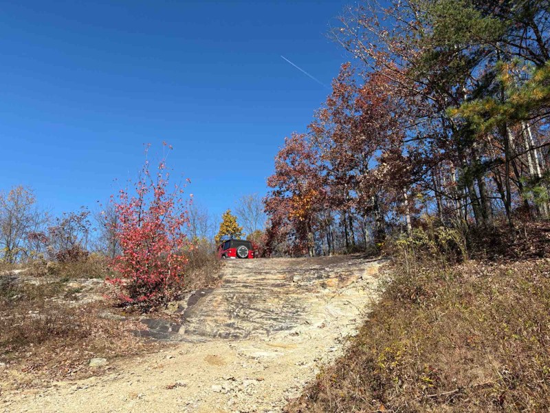
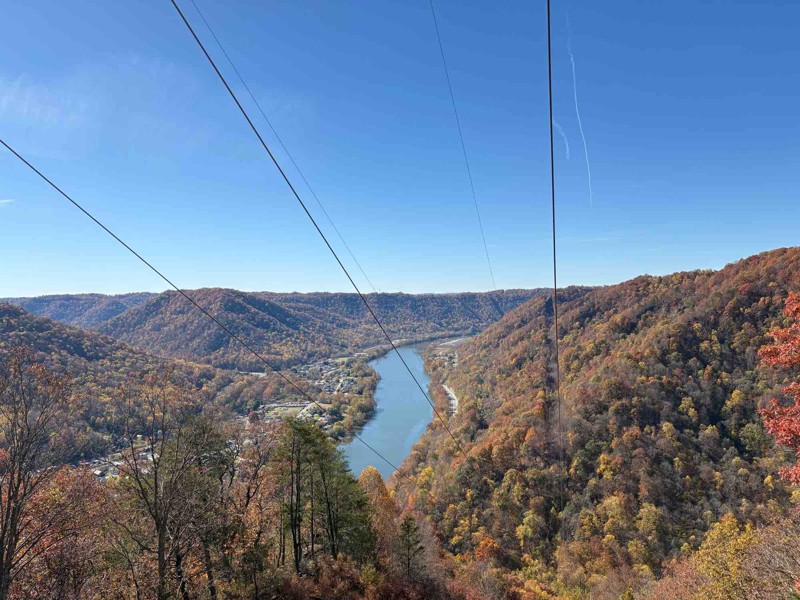
Fantastic trail! Had a great time. Most of it is pretty easy, but it gets a little more difficult towards the end at the overlook as already described. Went in my stock JLU, had no problems at all, ev...
Chris Warner
Rated 5/5
Open
Visited: 11/06/2025
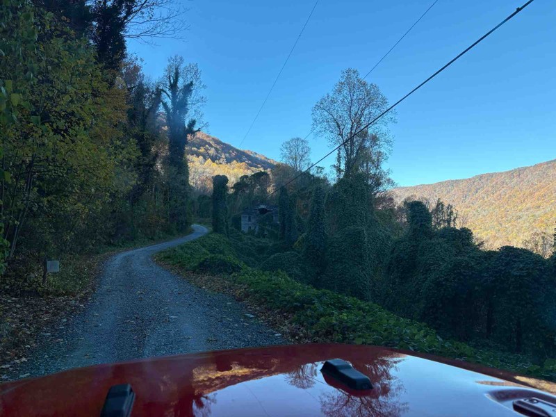
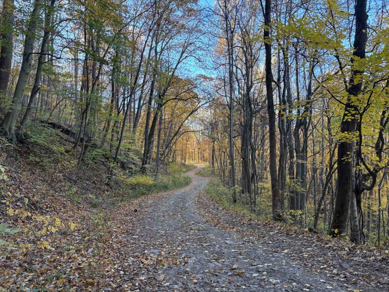
Biggest comment to make - the boulder is gone! Went to this trail expecting it, but they’ve obviously cleared it out (I think I took a pic of where it used to be). Otherwise, it was a nice, easy trail...
Chris Warner
No Rating
Open
Visited: 11/03/2025
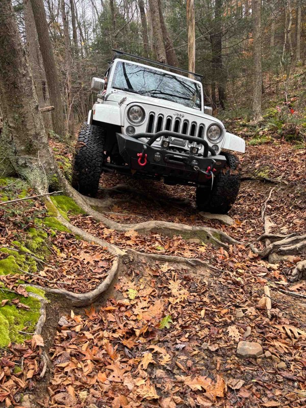
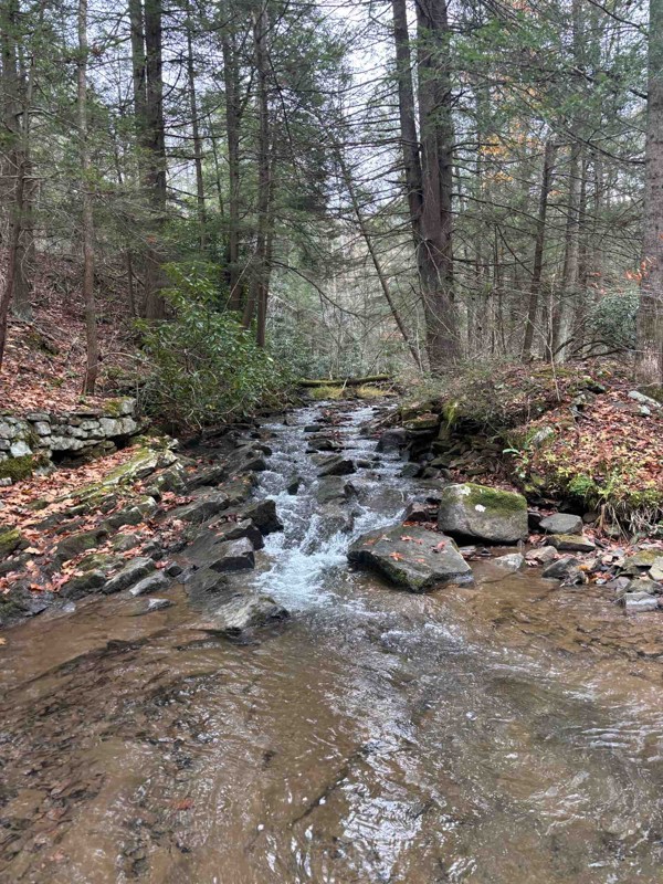
Amazing trail. A bit technical and rough, but overall a super fun trail. We had to remove a large tree from the trail, but no big deal.
JB
jason best
AE
Aaron E Lasure
Rated 4/5
Open
Visited: 09/11/2025
I ran this clockwise, coming in just south of Davis, WV. Most of the trail is just a gravel road with a handful of dispersed campsites. The difficult section is about 2/3 the way around if doing it th...
Peter Dougherty
Rated 5/5
Open
Visited: 09/11/2025
Very easy but enjoyable trail combo. The easy climbs necessary to get to it are even more fun. Not listed here is trail #29, which was more challenging than these two and definitely earning the blue r...
Peter Dougherty
Rated 4/5
Open
Visited: 09/11/2025
I ran this east to west, and as of September 2025 there is a second washout a bit further west, at 39.11227, -79.57259. Nothing extreme, but care is needed. The main washout further east isn't particu...
Peter Dougherty
No Rating
Open
Visited: 08/18/2025
Did the trail starting from Blackwater Falls State Park. Went about 4.7 miles at which point there is a turn around area and the trail turns into an easy graded dirt road. Reversed course at that poin...
MS
Marvin Smith
Rated 5/5
Open
Visited: 08/01/2025
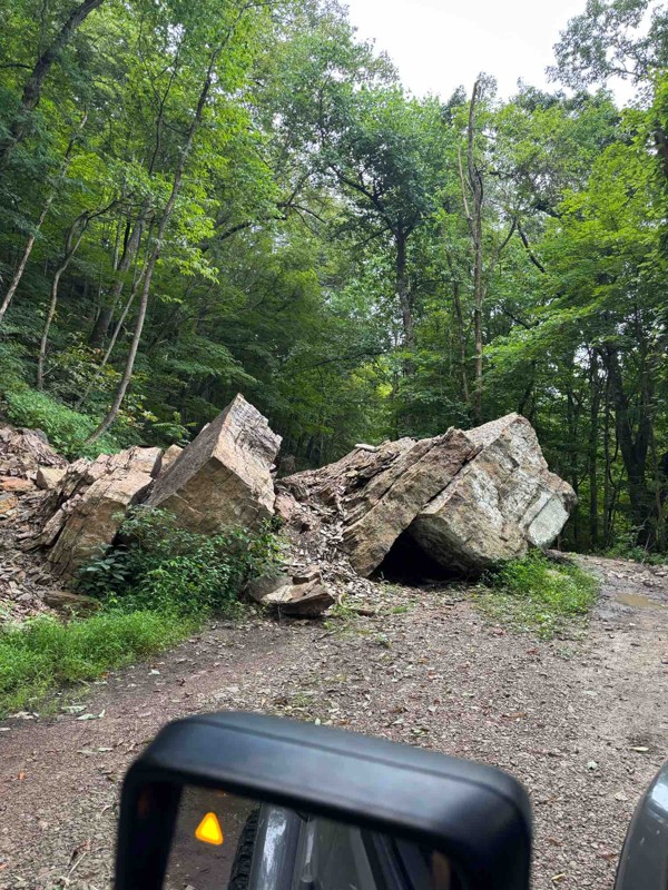
Fun, relaxing trail. It had recently rained so the ruts had standing water, but nothing that came close to requiring 4WD. The fallen boulder was easy to navigate around. The tree canopy, rock faces, a...
RS
Ryan Spitznagel
No Rating
Open
Visited: 06/28/2025
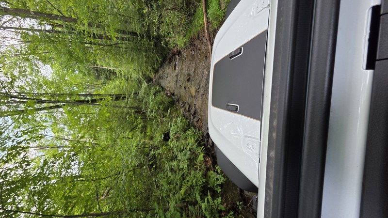
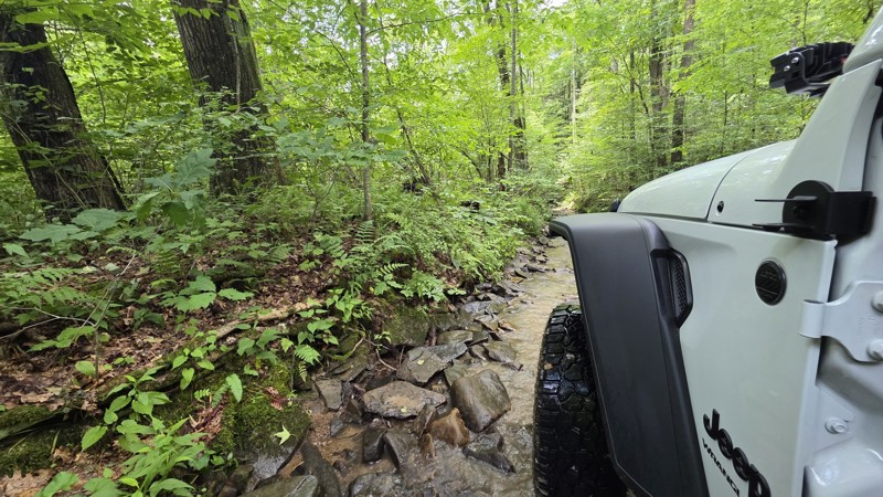
This is Peddler's Glory Rd (not Pedlar's Run). Beautiful trail. The description is accurate. Lots of rocky creekbed to crawl along. I had to use 3 of the bypasses due to large drops that I might have ...
Robert Barnett
Rated 4/5
Partially Open
Visited: 06/15/2025
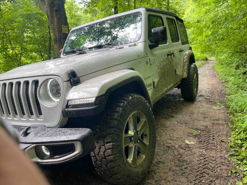
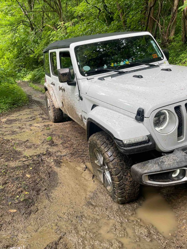
Part of the trail is closed which leaves the bridge as the only way across. I definitely wouldn’t try the bridge as the beams are rusted through and the slats are essentially rotted.
I did come at t...
SF
Spencer Flanagan
Rated 5/5
Open
Visited: 06/05/2025
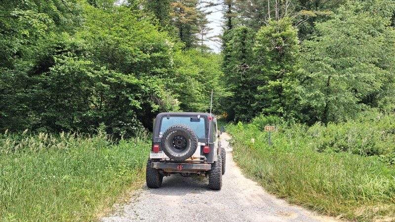
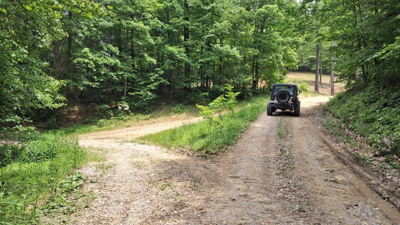
It is a short Trail. It does offer beautiful views of the landscape as well as local wildlife. It's a nice spot to take the kids for a little nature hike. And offers a few spots for picnics along th...
Joseph Sandy
No Rating
Open
Visited: 05/04/2025
No joke about the pinstriping, but the trail is super cool. Quite rocky in the second half. There was a lot rain this morning and the puddles were full and the streams were rushing. Stock Ranger Rapt...
PN
Paul Neureiter
Rated 4/5
Open
Visited: 04/21/2025
Very peaceful drive along the West Fork Greenbrier. Lots of fishing spots, but only a few of the campsites looked very desirable. I enjoyed it!
JJ
Justin J
Rated 3/5
Partially Open
Visited: 04/18/2025
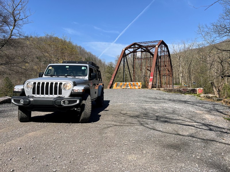
Trail is in good shape coming from the bull run side, but the scenic Bridge over the cheat river is permanently closed as of recent. Concrete barriers block off the bridge to vehicle traffic after its...
N
Nathan
Rated 2/5
Open
Visited: 04/17/2025
Family friendly gravel road with one rock stepper section. Stock vehicles can make the whole drive.

Andrew Spade
Rated 3/5
Partially Open
Visited: 04/17/2025
Not terrible. A lot of gates preventing any wheeling other than straight through. A nice smooth ride on a back road.
Andrew Spade
Rated 5/5
Open
Visited: 03/28/2025
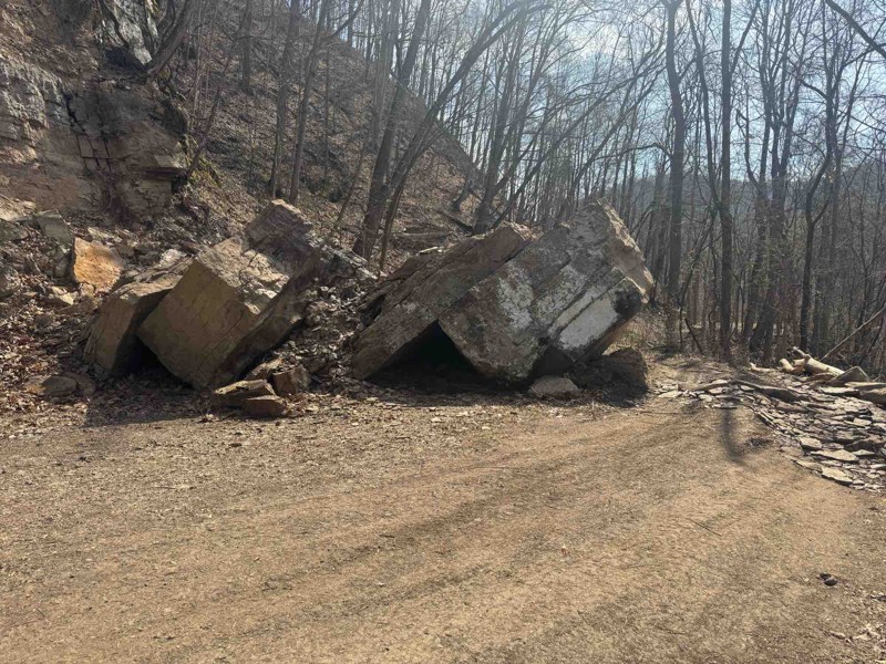
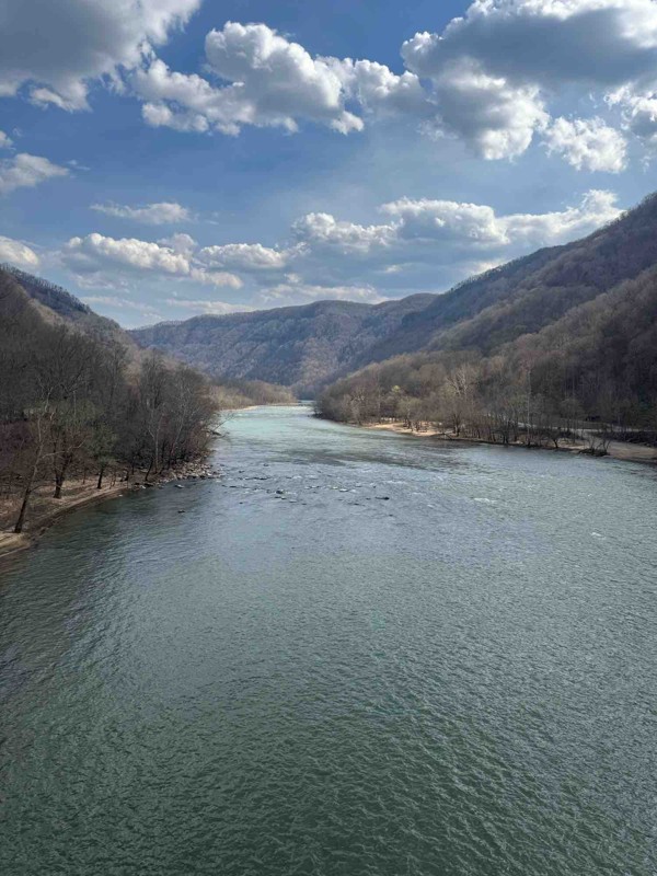
Easy trail fallen rocks in middle is only difficult part. Tree company was out there cutting back trees. Great trail to enjoy nature
Shark Bait Jeep
Rated 5/5
Open
Visited: 03/26/2025
Trail is a good 4. there's another wash out where they put a culvert in. Not real bad to maneuver around. I went through with ease on the whole trail. But it is rougher than it was before winter. Awes...
Joseph Sandy
Rated 5/5
Open
Visited: 03/08/2025
I agree with the rating. Right now the trail is ROUGH and freshly snow covered. There are some big holes and some pretty good washouts you have to be mindful of. I suspect the heavy rain last month in...

Ryan Boudreau
Official Crew
Rated 5/5
Open
Visited: 03/08/2025
Great scenic trail to connect with a whole series of other trails
Ryan Boudreau
Official Crew
Rated 5/5
Open
Visited: 03/08/2025
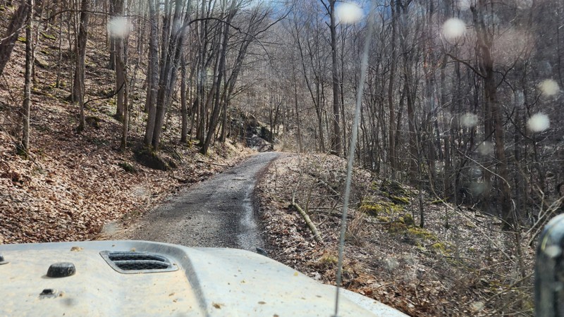
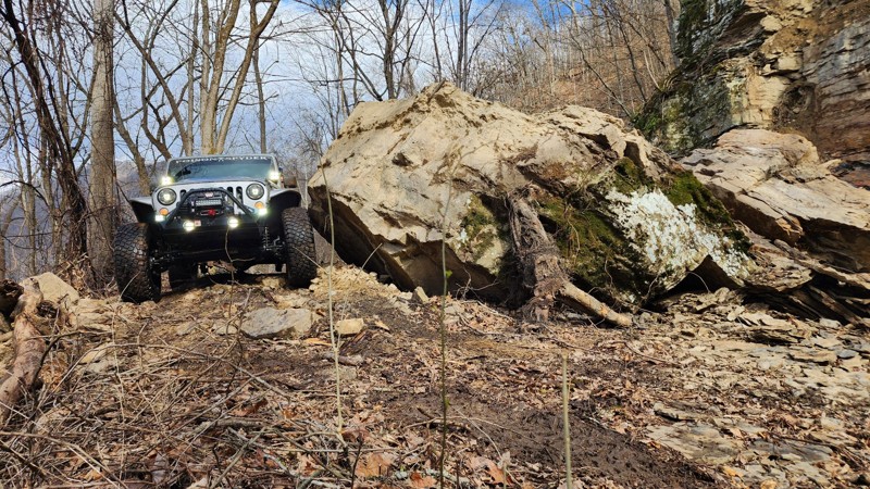
There is a brand new rock slide on the southern end of the trail which almost completely blocks the road. To get around, you are forced right up to the edge of the road. It's not hard, but could be sk...
Ryan Boudreau
Official Crew
Rated 3/5
Open
Visited: 03/08/2025
Fine road, nothing too special. Just a simple connector.
Ryan Boudreau
Official Crew
Rated 4/5
Open
Visited: 03/08/2025
Easy road. It is open with a little bit of snow currently on the ground. Should melt fast with Temps this week.
Ryan Boudreau
Official Crew
Rated 5/5
Open
Visited: 03/08/2025
This road is SO cool! Great scenic cruise along the creek with some cool rock walls to drive next to. it is a bit tight in so areas if you run into oncoming traffic.
Ryan Boudreau
Official Crew
Rated 5/5
Open
Visited: 03/08/2025
Cool scenic stretch of trail to stitch together with others.
Ryan Boudreau
Official Crew
Rated 5/5
Open
Visited: 03/08/2025
This trail is far harder than the 2 rating. And we were in a highly capable jeep on 40s. It is extremely rough with deep holes and rocks that most stock high clearance vehicles are going to have issue...
Ryan Boudreau
Official Crew
No Rating
Seasonal Closure
Visited: 02/15/2025
According to this trails management agency, the trail is likely closed for the season.
You can reach out to the agency for more details.
Be sure to leave us a report and let us know ...
Trails Offroad
Official Crew
Rated 1/5
Temporary Closure
Visited: 10/27/2024
Sadly, this trail didn´t last very long, We went east to west and quickly found it turned into a gravel road and a short distance later, it was posted ¨Road Closed.¨ It appears a logging company has...
Dan Wilson
Rated 4/5
Open
Visited: 10/26/2024
I did this east to west. The washed out section looks challenging but it really isn't. Its a fun trail though.
CS
Charles Saftner
Rated 5/5
Open
Visited: 10/26/2024
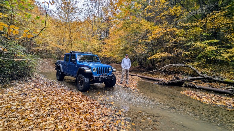
The trail was in excellent shape with gorgeous fall colors on full display. There wasn´t as much water as should be normal due to recent drought conditions, but there still were plenty of crossings t...
Dan Wilson
Rated 4/5
Open
Visited: 10/12/2024
I did this west to east, or CCW. Its a fun trail but a little tight in spots. The end, or eastern section, is just a gravel road so this is a lot shorter than it looks on the map.
CS
Charles Saftner
No Rating
Open
Visited: 09/21/2024
Did the trail for the second time this year. Started at the Blackwater Falls State Park drove the trail and then turned around and drove it again coming from the other end. Surprisingly for a Saturday...
MS
Marvin Smith
C
Colin
No Rating
Open
Visited: 08/18/2024
Trail is open. Notify the office if any tree clearing needs to take place. They are not great at patrolling all the trails for tree clearing.
Ryan Boudreau
Official Crew
Rated 5/5
Open
Visited: 08/17/2024
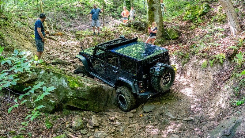
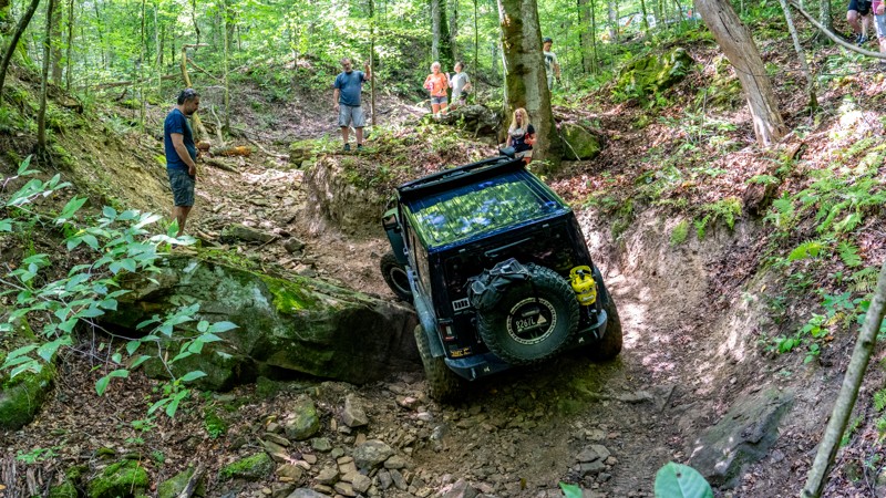
Trail was extremely rough on our group today. 7 rigs attempted it. First one on 40s made it through after some struggles. 2nd had a rear locker failure and couldn't make it past the first major obstac...
Ryan Boudreau
Official Crew
Rated 3/5
Open
Visited: 08/17/2024
Trail is in good condition. Very smooth, but yes steep in a few spots. It was dry and only needed 2wd. I don't doubt it would be more slippery if it was wet. But in regular conditions, easy.
Ryan Boudreau
Official Crew
Rated 3/5
Open
Visited: 08/17/2024
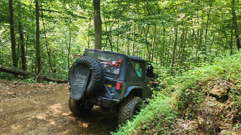
No different than the last time I was here. This trail is still an easy loop for any trail, but be aware that if you are in a group, there are not a lot of areas to pull out of the way for oncoming tr...
Ryan Boudreau
Official Crew
Most Popular


Updated: 07/08/2025
Shavers Fork Road
Canfield, West Virginia
Shavers Fork Road mostly follows its namesake, the Shavers Fork of the Cheat River. You can include this scenic route in a more extended overland trip, but the road weaves in and out of public land, and dispersed camping is very limited. A good swath where it goes through public land is listed as day use only. The road is almost entirely gravel with a few potholes and narrow sections, suitable for any street-legal vehicle.

Updated: 04/21/2025
Propps Ridge
Lookout, West Virginia
County Road 60/12, located just west of Babcock, is an easy and short gravel road to a stunning waterfall and an old railroad bridge. You could drive along the bridge at one time, but it has been recently closed to motorized traffic. You can still walk along the bridge and get spectacular views of the waterfall. Hike down a short distance to the water for a nice reprieve from the summer heat. The road can be combined with County Road 41/3 to make an easy loop connecting Highway 60 and Highway 41.
The road is well-maintained and suitable for any passenger vehicle.

Updated: 11/07/2025
Cob Hollow to Kanawha River Overlook
Hugheston, West Virginia
If you are looking for the Charleston version of "Top of the World," this is it! Starting at Hughes Creek, on the north side of the Kanawha River, Cob Hollow runs northwest past numerous gas wells. The road is hard-packed dirt with a few gravel and muddy sections. The trail twists and turn for nearly 7 miles, following the ridgelines to the southwest and passing Rubes Hollow. After a large steel tank, you'll come to a large parking area at the base of a chewed-up, rocky hill climb. This hill is not as challenging as it may appear from the bottom, and any high-clearance 4-wheel drive vehicle should not have any problems. After the hill, the trail shoots west, following the power lines leading to a wide section of the ridgeline booby-trapped with deep, bottomless mud holes. Sneaking between the mud holes is extremely tight and very dangerous if the soil is wet in any way. Full-size vehicles should consider stopping at this point. Thirty yards beyond the mud, the ridge drops off at a fantastic overlook known as the Devil's Tea Table. This overlook provides astonishing views of the Kanawha River and US 60 below. Return the way you came, or take Rubes Hollow down to Kelly's Creek Road.

Updated: 04/10/2026
Fort Seybert
Fort Seybert, West Virginia
Fort Seybert, also known as Rough Run Road, is a mountain road that crosses the George Washington National Forest and connects West Virginia to Virginia. The road climbs 1700 feet to the state line and then descends 1500 feet to Little Dry River Road. It is suitable for any high-clearance vehicle, is comprised of dirt, and has minor water crossings. There is one campsite on the West Virginia side.

Updated: 10/15/2024
MIddle Mountain
Wymer, West Virginia
Middle Mountain is a longer north-south running gravel road suitable for any vehicle. It can be combined with other areas' roads for an overland-style trip. Most of the road is under tree canopy, but there are a few distinct areas where logging has taken place, opening up unparalleled views. There are four designated dispersed campsites and a dozen dispersed sites on Little River Road. Alternately, the Middle Mountain Cabins are popular, and the Laurel Fork Campground is not far from the road.

Updated: 10/15/2024
Ivy Branch 10
Altman, West Virginia
Ivy Branch 10 is the main access road from the trailhead office into the heart of the Ivy Branch Trail System. Starting at the iconic Ivy Branch Hatfield-McCoy sign, the trail makes its way uphill quickly over large water bars, past the Sunset Overlook, and eventually crosses a couple of small streams. The trail is steep in spots, fairly wide, and generally graded smooth. The trail is good for any vehicle.
There is no camping onsite, but many cabin rentals nearby.
Hatfield-McCoy Trails are open 365 days a year, from sunup to sundown. Permits are required for all operators and passengers. Additionally, all drivers and passengers must wear a helmet on the trails. This includes full-size vehicles such as Jeeps.
Hatfield-McCoy Trails are open 365 days a year, from sunup to sundown. Permits are required for all operators and passengers. Additionally, all drivers and passengers must wear a helmet on the trails. This includes full-size vehicles such as Jeeps.

Updated: 12/05/2025
Old Mine
Cheat Bridge, West Virginia
When you drive Old Mine, you will quickly forget you are in West Virginia. Built on an old mine site and logging area, the road offers expansive views reminiscent of the western United States. Directly from its northern start, the road begins to tell a story of mining and logging activity from years ago and the subsequent restoration of the area in recent years. It offers over 20 plus well-spaced dispersed campsites, all with variety, from ones with ponds to others with 360-degree views or even a handful nestled in the pines
As you drive the road, there are two forks. The first fork in the north takes you sharply uphill to an overlook. The second fork towards the southern end takes you to several wooded and non-wooded campsites and hiking trails. Both forks are worth taking simply for the views.
There is no trash service, and as always, please pack out more than you packed in.

Updated: 10/15/2024
Mill Creek Road
Pinch, West Virginia
Mill Creek Road is an easy dirt road used mainly to access hunting grounds between Mill Creek and Fivemile Fork. The road connects Campbells Creek to Indian Creek and passes several gas and oil pads. The road is generally 1-1.5 vehicles wide and is graded dirt/gravel nearly the entire way. There is one short, 30-yard-long incline out of Right Fork Mill Creek with several loose rocks that could present a traction challenge to a slow-moving vehicle, but otherwise, this road is suitable for any stock SUV or pickup truck.

Updated: 04/21/2025
Glady Durbin
Glady, West Virginia
At each end of the road, a sign greets you and offers you a choice. It reads, "Two historic pathways await you — it's your choice! You are about to travel through a forest landscape steeped in logging and railroad history. Over a century ago, the West Fork was unspoiled and inaccessible. Thick forests of spruce and hemlock reigned supreme. The coming of the railroad and the woodsman's axe in the early 1900s transformed and reshaped this now-tranquil land."
Glady Durbin, Forest Road 44, was built by the Civilian Conservation Corps and US Forest Service in the 1930s and 1950s. It is a 20-mile scenic mountain drive that parallels areas of the West Fork Rail Trail. The road is entirely gravel and suitable for any high-clearance vehicle. It crosses Lynn Divide, which is a natural dividing line between the headwaters of two major water systems in the Monongahela National Forest. Precipitation falling a few feet to the north, towards Glady, Is destined for the Cheat River. Precipitation falling to the south, towards Durbin, flows into the Greenbrier River.
Due to the route's historical significance, a few ghost townsites remain following logging and rail activity, although no original buildings can be seen. In these townsite areas, interpretive signs will be visible for those curious about what became of the towns. These areas are also filled with summer wildflowers.
The road has 15 designated dispersed campsites, with sites 7-10 being the premier locations.

Updated: 10/15/2024
Little River Dispersed Camping Area
Burner, West Virginia
The Little River dispersed camping area offers 14 designated dispersed campsites and a group area with five sites. Most sites, minus the group sites and site 13, are directly on the road. Caution: Due to mud, site 13 will require 4WD access in wet weather. Sites 7-9 are near or next to the Little River. Due to size limitations, travel trailers and camper trucks can fit into about half of the sites.
The road is gravel and suitable for high-clearance vehicles, but it can flood during heavy rain. It is a great road to include when overlanding around the area for camping and a quick crossover between Glady Durbin and Middle Mountain.

Updated: 10/15/2024
Big Ten Mile Road
Annfred, West Virginia
Big Ten Mile Road is an easy, hard-packed dirt road that connects Campbell's Creek and Kelly's Creek. The road is two vehicles wide most of the way and offers no challenges. There is one short section along the road where small protruding rocks will cause you to reduce your speed, but the rocks are not large enough to damage a vehicle. Various maps label this road as Big Hollow Bench Road as it approaches Kelly's Creek. Views are minimal due to thick tree coverage. There is no camping along this road, but it is a popular OHV riding area for locals. Cell service is very spotty along this trail, so come prepared with pre-downloaded maps since utility companies own many spur roads, and it is very easy to get lost in this area. This road is suitable for any high-clearance SUV or pickup truck.

Updated: 10/15/2024
Cabwaylingo 11
Missouri Branch, West Virginia
Located within the Cabwaylingo State Forest and part of the Hatfield-McCoy Trail System, trail 11 is best described as two sections. The first section is an easy, wide, and casual gravel road starting at the trailhead office and weaving its way up the hill to the Tick Ridge Campground. Along the way, you will pass the Indian Trail and a stunning picnic shelter next to a wooden bridge. Follow Tick Ridge a short distance past the campground, where the trail makes a hard turn and transitions to graded dirt. This starts the second section of the trail. Along this section, the trail sometimes narrows to only one vehicle wide and descends moderately steep hills and several steep and tight switchbacks. The trail crosses Wiley Branch and ends at an intersection with trails 74 and 25. This is a great trail for any stock SUV or pickup truck.
Cabwaylingo has two campgrounds and multiple cabins located on-site. In addition, many home rentals can be found nearby.
Hatfield-McCoy Trails are open 365 days a year, from sunup to sundown. Permits are required for all operators and passengers. Additionally, all drivers and passengers must wear a helmet on the trails. This includes full-size vehicles such as Jeeps.

Updated: 10/15/2024
Bearwallow 88
Stollings, West Virginia
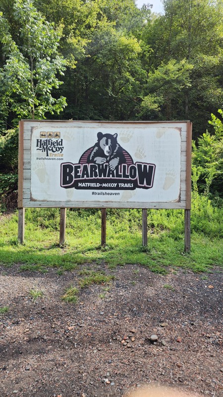
Part of the Hatfield-McCoy Trails System, Bearwallow 88 is one of the best rock crawling trails in the Bearwallow system for newer drivers ready to attempt more challenging trails or for someone needing to give their new rig a shake-down run. The trail provides a constant stream of large boulders from beginning to end as you make your way up the hillside. Differential catching rocks, small ledges, and a tricky v-notch or two will have you debating on the perfect line around just about every corner. This trail is an excellent connector between trails 69 and 59.
Hatfield-McCoy Trails are open 365 days a year, from sunup to sundown. Permits are required for all operators and passengers. Additionally, all drivers and passengers must wear a helmet on the trails. This includes full-size vehicles such as Jeeps.

Updated: 10/15/2024
Bearwallow 15
Logan, West Virginia
Bearwallow 15 is part of the Hatfield-McCoy Trails system and is a community connector trail from the City of Logan into the main Bearwallow system. The tight winding trail starts at a small neighborhood on Cole Street, climbing steeply out of city limits. The track pushes through three switchbacks on its way to the top of the ridge. The trail provides several fantastic birdseye views of Logan. The trail is 1 to 1.5 vehicles wide and can be done with any high-clearance vehicle. While bumpy in spots, the majority of the trail is well-maintained by dozers.
Hatfield-McCoy Trails are open 365 days a year, from sunup to sundown. Permits are required for all operators and passengers. Additionally, all drivers and passengers must wear a helmet on the trails. This includes full-size vehicles such as Jeeps.

Updated: 10/15/2024
Spruce Knob
Simoda, West Virginia
Spruce Knob and the highest point of "The Mountain State" stands at an elevation of 4,863 feet. The portion of the road to the north of the knob is paved, and everything else is gravel and suitable for any vehicle. At the top, you can walk to the Spruce Knob Tower; the hiking trail is approximately 1/2 mile long. The only camping is just off the main road and on Forest Road 1, at the Spruce Knob Lake Campground. Many of the sites in the campground are first-come, first-served, while others require a reservation.

Updated: 10/15/2024
Ivy Branch 13
Adams, West Virginia
Ivy Branch 13 is an easy access road that cuts through the middle of the Ivy Branch Trail System, connecting the beginning of the trail system with the river access. This trail is hard-packed gravel with a couple of small creek crossings, with an occasional pothole or shallow erosion rut. Combining this trail with 18 and 10 creates a large green loop through the trail system. The trail is good for any vehicle.
There is no camping onsite, but there are many cabin rentals nearby.
Hatfield-McCoy Trails are open 365 days a year, from sunup to sundown. Permits are required for all operators and passengers. Additionally, all drivers and passengers must wear a helmet on the trails. This includes full-size vehicles such as Jeeps.
Hatfield-McCoy Trails are open 365 days a year, from sunup to sundown. Permits are required for all operators and passengers. Additionally, all drivers and passengers must wear a helmet on the trails. This includes full-size vehicles such as Jeeps.

Updated: 04/21/2025
Chestnut Grove Road
Nallen, West Virginia
County Road 41/3 is an easy, short gravel trail just west of Russellville and Babcock. The road passes several ranches and churches and makes for a nice country drive. The road can be combined with County Road 60/12 to make an easy loop connecting Highway 60 and Highway 41.
The road is well-maintained, with occasional potholes and very narrow erosion ruts. It is suitable for any passenger vehicle.

Updated: 10/15/2024
Peters Creek Ridge
Lockwood, West Virginia
Peters Creek Ridge is an easy dirt road that travels a ridgeline along the northern boundary of the Gauley River National Recreation Area. The road starts at Laurel Creek and runs nearly 5 miles before reaching a closed gate at a private property near Stillhouse Branch. The landowners of this property do allow public access through their property, but you must call or visit them for egress. The gate has a waiver you must sign and contact information for the landowners. If you receive permission to travel the remaining 0.6 miles, the road ends at Peters Creek, directly across from Panther Mountain Road. This road provides several viewpoints of the Gauley River and is generally one to one and a half vehicles wide. It is suitable for any high clearance vehicle, but 4-wheel drive might be needed during wet conditions.

Updated: 03/14/2025
Cheat Mountain
East Dailey, West Virginia
A gentle road crosses the Cheat Wildlife Management Area. Cheat Mountain provides lush forested views and, in select spots, views off into the distance. The road surface is entirely gravel and suitable for any high clearance vehicle. The non-gated side roads lead to Shavers Fork and fishing opportunities. The road does cross a few patches of private land, and there are no pre-disturbed dispersed campsites along the way. However, if you are looking for spectacular camping, combine this road with Old Mine Road, which is a continuation of this route on its southern end. It would make for a good overland-style trip.

Updated: 10/15/2024
Stoney Run
Sugar Grove, West Virginia
Stoney Run parallels Reddish Knob as it meanders its way past a half dozen or more sizeable dispersed campsites. It is primarily a gravel road with sections of baseball-sized rocks, a few ruts, and minor water crossings. During wet weather, many of the side runs could be quite scenic as they begin to flow with water. There is evidence of a forest fire or two, so pay attention to local restrictions. This trail is suitable for any high-clearance vehicle, but airing down will aid in comfort.

Updated: 10/15/2024
Cabwaylingo 74
Wilsondale, West Virginia
Located within the Cabwaylingo State Forest and part of the Hatfield-McCoy Trail System, trail 74 is a short and challenging straight-through trail with a single steep hill and two rock-ledge obstacles along the hill. Starting at the intersection of 11 and 25 and traveling towards trail 74, you will traverse this hill in the easier downhill direction. For more difficulty, travel the trail uphill, in the reverse direction, starting from trail 79. A high clearance 4-wheel drive vehicle with low gearing and aggressive tires will be needed to traverse this trail.
Cabwaylingo has two campgrounds and multiple cabins located on-site. In addition, many home rentals can be found nearby.
Hatfield-McCoy Trails are open 365 days a year, from sunup to sundown. Permits are required for all operators and passengers. Additionally, all drivers and passengers must wear a helmet on the trails. This includes full-size vehicles such as Jeeps.

Updated: 10/15/2024
Ivy Branch 18
Altman, West Virginia
Trekking along the northern boundary of the Ivy Branch Trail System, 18 is an easy dirt road that is generally one to one and a half vehicles wide. The road surface is hard-packed dirt with occasional potholes. Halfway through the trail is an optional mud pit with extremely deep ruts. The trail passes a unique overhang rock formation and foundational remains of a coal tipple. The trail is good for any vehicle.
There is no camping onsite, but many cabin rentals nearby.
Hatfield-McCoy Trails are open 365 days a year, from sunup to sundown. Permits are required for all operators and passengers. Additionally, all drivers and passengers must wear a helmet on the trails. This includes full-size vehicles such as Jeeps.
Hatfield-McCoy Trails are open 365 days a year, from sunup to sundown. Permits are required for all operators and passengers. Additionally, all drivers and passengers must wear a helmet on the trails. This includes full-size vehicles such as Jeeps.

Updated: 10/15/2024
Mountaineer Drive
Pinch, West Virginia
Mountaineer Drive is a short and scenic forest road through the hills of Kanawha County, north of Charleston. The road is one vehicle wide and travels through thick foliage as it parallels a small creek. There are numerous slippery mud holes along the road, many of which never dry out. The mud is shallow in most cases, and a stock high clearance 4x4 will do just fine traversing these obstacles.

Updated: 10/15/2024
Cabwaylingo 25
Wilsondale, West Virginia
Located along the western edge of Cabwaylingo State Forest and running along Tick Ridge, trail 25 is an easy, graded dirt road that passes a few timber harvesting piles consisting of large oak trees. This trail is a nice drive along the ridgeline for any stock SUV or pickup truck.
Cabwaylingo has two campgrounds and multiple cabins located on-site. In addition, many home rentals can be found nearby.
Hatfield-McCoy Trails are open 365 days a year, from sunup to sundown. Permits are required for all operators and passengers. Additionally, all drivers and passengers must wear a helmet on the trails. This includes full-size vehicles such as Jeeps.

Upgrade your Membership
Unlock all of the details on every Trail Guide and Scout Route.
Start a 7-day Free TrialBrowse Trails in West Virginia by City
Browse every West Virginia city with offroad trail guides.
Community
Partners

