


By clicking "ACCEPT", you agree to be the terms and conditions of each policy linked to above. You also agree to the storing of cookies on your device to facilitate the operation and functionality of our site, enhance and customize your user experience, and to analyze how our site is used.
Oregon Off-Road Trails
52
Total Trail Guides 48

409
Detailed Waypoints 127
Try a Free 7-Day Trial and unlock it all
Start a Free Trial Most Recent Trail Reviews
Rated 2/5
Open
Visited: 09/13/2026
I figured this would be boring and it was. This trail has convinced me to stop going for BoH trails.


Francis whitney
Rated 5/5
Open
Visited: 09/06/2026
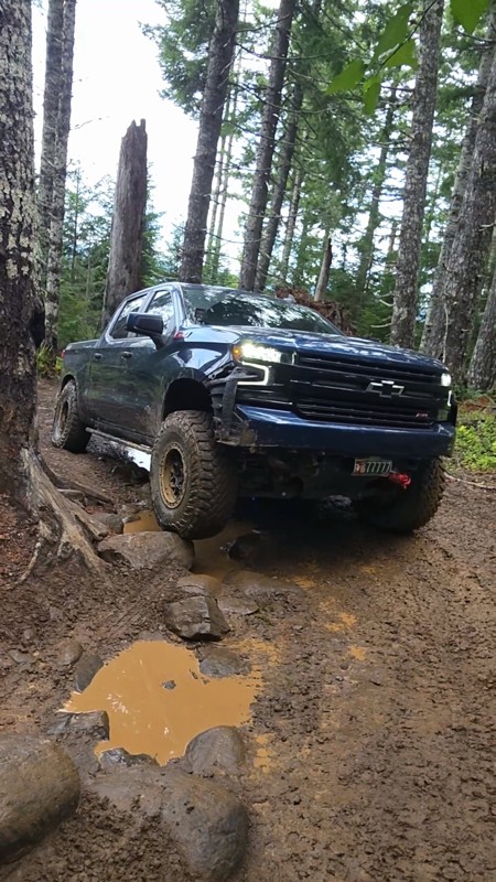
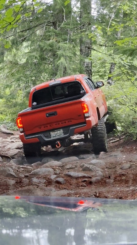
Ran this today. Ground was slick but makes it more dunk I’m in a full-size 1500 on 37s, my buddy is in a Tacoma on 35s, and our other buddy was in a TJ on 33.
Yes it’s tight but we all made it thru ...

Everett Vangsnes
No Rating
Open
Visited: 08/11/2026
Per the MVUM, the trail is seasonally open. As always, check current fire restrictions/closures before venturing out.

Trails Offroad
Official Crew
No Rating
Open
Visited: 08/11/2026
Per the MVUM, the trail is seasonally open. As always, check current fire restrictions/closures before venturing out.

Todd
Official Crew
Todd
Official Crew
No Rating
Open
Visited: 08/11/2026
Per the MVUM, the trail is seasonally open. As always, check current fire restrictions/closures before venturing out.
Trails Offroad
Official Crew
No Rating
Temporary Closure
Visited: 08/07/2026
Closed due to the Fox Fire. https://www.blm.gov/sites/default/files/docs/2026-07/orwa-fpo-val-072626.pdf

Rose Meirs
Official Crew
No Rating
Temporary Closure
Visited: 08/07/2026
Closed due to the Crosswhite Fire. https://www.blm.gov/sites/default/files/docs/2026-08/orwa-fpo-pri-080526.pdf
Rose Meirs
Official Crew
No Rating
Temporary Closure
Visited: 08/07/2026
Closed due to the Crosswhite Fire. https://www.blm.gov/sites/default/files/docs/2026-08/orwa-fpo-pri-080526.pdf
Rose Meirs
Official Crew
No Rating
Temporary Closure
Visited: 08/07/2026
Closed due to the Crosswhite Fire. https://www.blm.gov/sites/default/files/docs/2026-08/orwa-fpo-pri-080526.pdf
Rose Meirs
Official Crew
No Rating
Temporary Closure
Visited: 08/07/2026
Closed due to the Crosswhite Fire. https://www.blm.gov/sites/default/files/docs/2026-08/orwa-fpo-pri-080526.pdf
Rose Meirs
Official Crew
No Rating
Temporary Closure
Visited: 08/07/2026
Closed due to the Big Grass Fire. https://www.blm.gov/sites/default/files/docs/2026-07/orwa-fpo-val-072826.pdf
Rose Meirs
Official Crew
No Rating
Temporary Closure
Visited: 08/07/2026
Closed due to the Big Grass Fire. https://www.blm.gov/sites/default/files/docs/2026-07/orwa-fpo-val-072826.pdf
Rose Meirs
Official Crew
No Rating
Temporary Closure
Visited: 08/07/2026
Closed due to the Big Grassy Fire. https://www.blm.gov/sites/default/files/docs/2026-07/orwa-fpo-val-072826.pdf
Rose Meirs
Official Crew
No Rating
Temporary Closure
Visited: 08/07/2026
Temporary due to the Hat Wildfire. https://www.blm.gov/sites/default/files/docs/2026-07/orwa-fpo-val-072826.pdf
Rose Meirs
Official Crew
No Rating
Temporary Closure
Visited: 08/03/2026
The area is currently closed due to the Grasshopper Fire. More info is available here: https://inciweb.wildfire.gov/incident-information/ormhf-grasshopper

Douglas Van Bossuyt
Official Crew
No Rating
Temporary Closure
Visited: 08/03/2026
The area is currently closed due to the Grasshopper Fire. More info is available here: https://inciweb.wildfire.gov/incident-information/ormhf-grasshopper
Douglas Van Bossuyt
Official Crew
No Rating
Temporary Closure
Visited: 08/03/2026
The area is currently closed due to the Grasshopper Fire. More info is available here: https://inciweb.wildfire.gov/incident-information/ormhf-grasshopper
Douglas Van Bossuyt
Official Crew
No Rating
Temporary Closure
Visited: 08/03/2026
The area is currently closed due to the Grasshopper Fire. More info is available here: https://inciweb.wildfire.gov/incident-information/ormhf-grasshopper
Douglas Van Bossuyt
Official Crew
No Rating
Temporary Closure
Visited: 08/03/2026
The area is currently closed due to the Grasshopper Fire. More info is available here: https://inciweb.wildfire.gov/incident-information/ormhf-grasshopper
Douglas Van Bossuyt
Official Crew
No Rating
Temporary Closure
Visited: 08/03/2026
The area is currently closed due to the Grasshopper Fire. More info is available here: https://inciweb.wildfire.gov/incident-information/ormhf-grasshopper
Douglas Van Bossuyt
Official Crew
No Rating
Temporary Closure
Visited: 08/03/2026
The area is currently closed due to the Grasshopper Fire. More info is available here: https://inciweb.wildfire.gov/incident-information/ormhf-grasshopper
Douglas Van Bossuyt
Official Crew
No Rating
Temporary Closure
Visited: 08/03/2026
The area is currently closed due to the Grasshopper Fire. More info is available here: https://inciweb.wildfire.gov/incident-information/ormhf-grasshopper
Douglas Van Bossuyt
Official Crew
No Rating
Temporary Closure
Visited: 08/03/2026
The area is currently closed due to the Grasshopper Fire. More info is available here: https://inciweb.wildfire.gov/incident-information/ormhf-grasshopper
Douglas Van Bossuyt
Official Crew
No Rating
Temporary Closure
Visited: 08/03/2026
The Grasshopper fire unfortunately burned over the Flag Point Lookout and destroyed the lookout tower. The area is closed for the foreseeable future.
General fire info with links to the specific clo...
Douglas Van Bossuyt
Official Crew
No Rating
Temporary Closure
Visited: 08/01/2026
Trail was closed due to wildfire activity. I was unable to find this out online but maybe try calling Hood River Ranger District at 541-352-6002 before making the drive to confirm if it is open?
MM
Mike Mueller
Open
Visited: 07/12/2026
I ran this backwards (rock quarry entrance to saddle mtn entrance) in my full-size pickup and it was a good time. I didn’t realize I’d taken the rocky bypass until i got to the other side of it (the s...
Everett Vangsnes
No Rating
Open
Visited: 06/26/2026
According to MVUM data, this trail should be open for the season.
Trails Offroad
Official Crew
No Rating
Open
Visited: 06/26/2026
According to MVUM data, this trail should be open for the season.
Trails Offroad
Official Crew
No Rating
Open
Visited: 06/26/2026
According to MVUM data, this trail should be open for the season.
Trails Offroad
Official Crew
No Rating
Open
Visited: 06/26/2026
According to MVUM data, this trail should be open for the season.
Trails Offroad
Official Crew
No Rating
Open
Visited: 06/26/2026
According to MVUM data, this trail should be open for the season.
Trails Offroad
Official Crew
No Rating
Open
Visited: 06/26/2026
According to MVUM data, this trail should be open for the season.
Trails Offroad
Official Crew
No Rating
Open
Visited: 06/26/2026
According to MVUM data, this trail should be open for the season.
Trails Offroad
Official Crew
No Rating
Open
Visited: 06/26/2026
According to MVUM data, this trail should be open for the season.
Trails Offroad
Official Crew
No Rating
Open
Visited: 06/26/2026
According to MVUM data, this trail should be open for the season.
Trails Offroad
Official Crew
Rated 5/5
Open
Visited: 06/19/2026
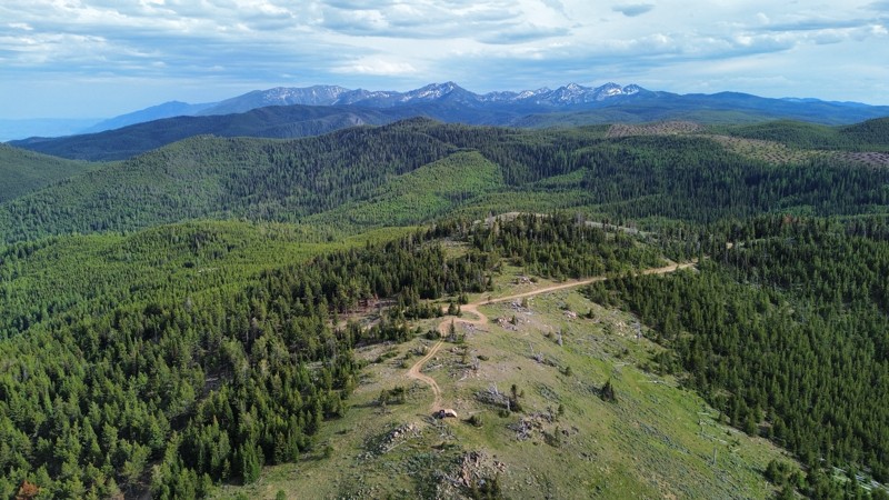
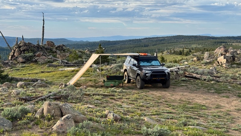
This was an easy dirt road with some logging traffic up until it intersects National Forest Development Road 5125/4350 at 45.06718, -118.21474. After this it becomes noticeably bumpier with larger di...

Andrew T
Open
Visited: 06/05/2026
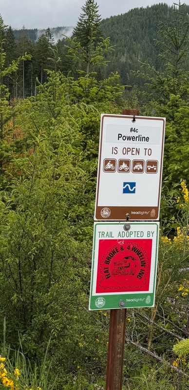
Trail is marked wrong on the map, 4C starts at the end of powerline 4B.
MS
Michael Strange
Rated 5/5
Open
Visited: 05/08/2026
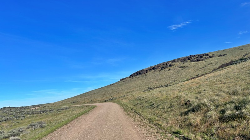
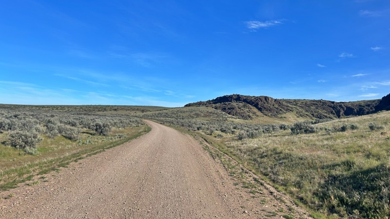
Having visited in May, I can confidently say this is one of the best times to experience the Cow Lakes Recreation Area. The lakes are full, migratory birds fill the marshes, and wildflowers blanket th...
Rose Meirs
Official Crew
Rated 4/5
Open
Visited: 05/07/2026
We tackled Board Corral Trail in our EarthRoamer and found it to be a fun and engaging drive, but one that took considerably longer than we expected. While the trail itself isn't exceptionally difficu...

Wide Open Roams
Official Crew
Rated 5/5
Open
Visited: 05/06/2026
We drove Succor Creek Road as part of our travels through the Owyhee Canyonlands and found it to be one of the easier yet more scenic routes in the region. If you're looking for a relaxing drive that ...
Wide Open Roams
Official Crew
Rated 5/5
Open
Visited: 05/04/2026
Leslie Gulch Road ended up being one of our favorite drives in the Owyhee Canyonlands. The route winds its way down toward Owyhee Lake, passing through some truly unique scenery that feels completely ...
Wide Open Roams
Official Crew
Rated 4/5
Open
Visited: 05/04/2026
We drove Mahogany Gap while exploring the Owyhee region and found it to be a scenic, easy-going route that offers a great introduction to the area. This isn't a trail that challenges your vehicle, but...
Wide Open Roams
Official Crew
Rated 5/5
Open
Visited: 05/03/2026
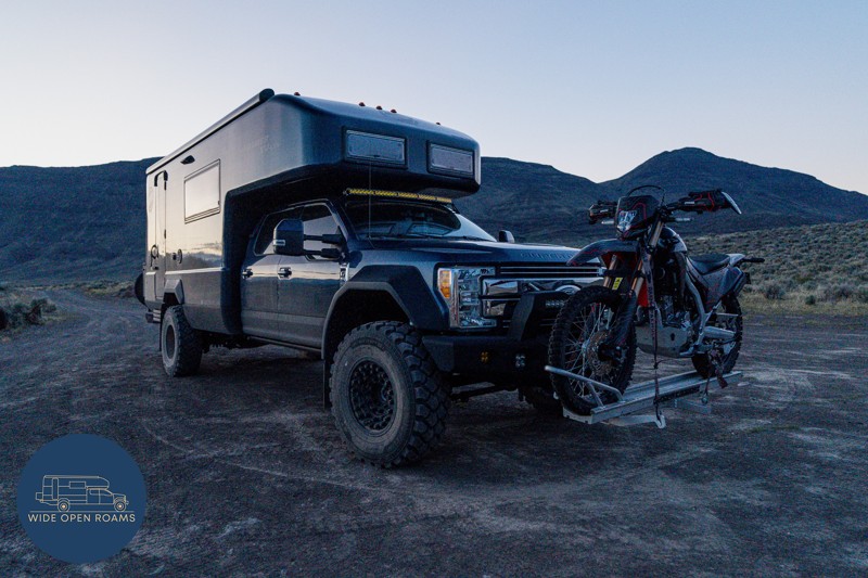
We took the trail out to Mickey Hot Springs while exploring the East Steens area, and it ended up being one of our favorite stops in southeastern Oregon. The drive itself was straightforward and easy ...
Wide Open Roams
Official Crew
Rated 5/5
Open
Visited: 05/03/2026
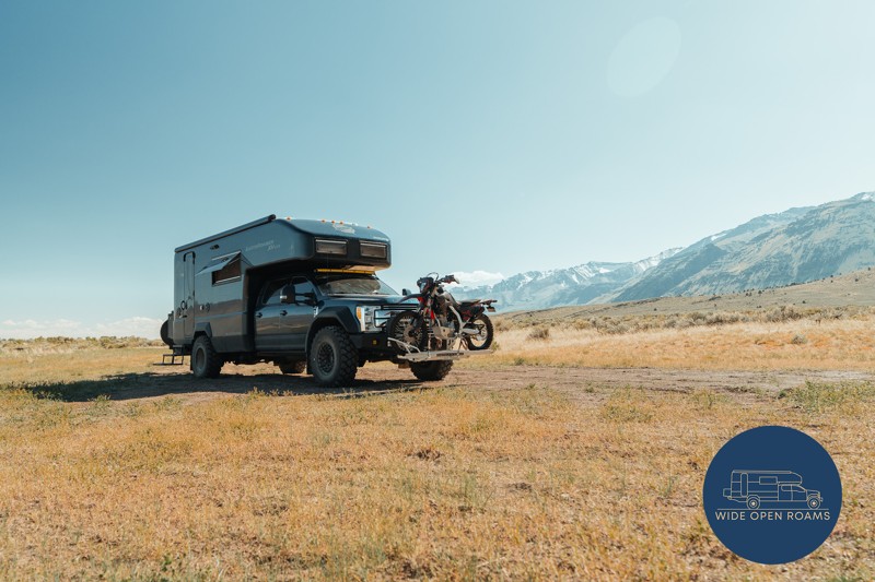
We drove the East Steens Road while making our way through southeastern Oregon and ended up really enjoying this route. Before starting the main stretch along the Steens, we stopped at Borax Lake Hot ...
Wide Open Roams
Official Crew
Rated 4/5
Partially Open
Visited: 04/26/2026
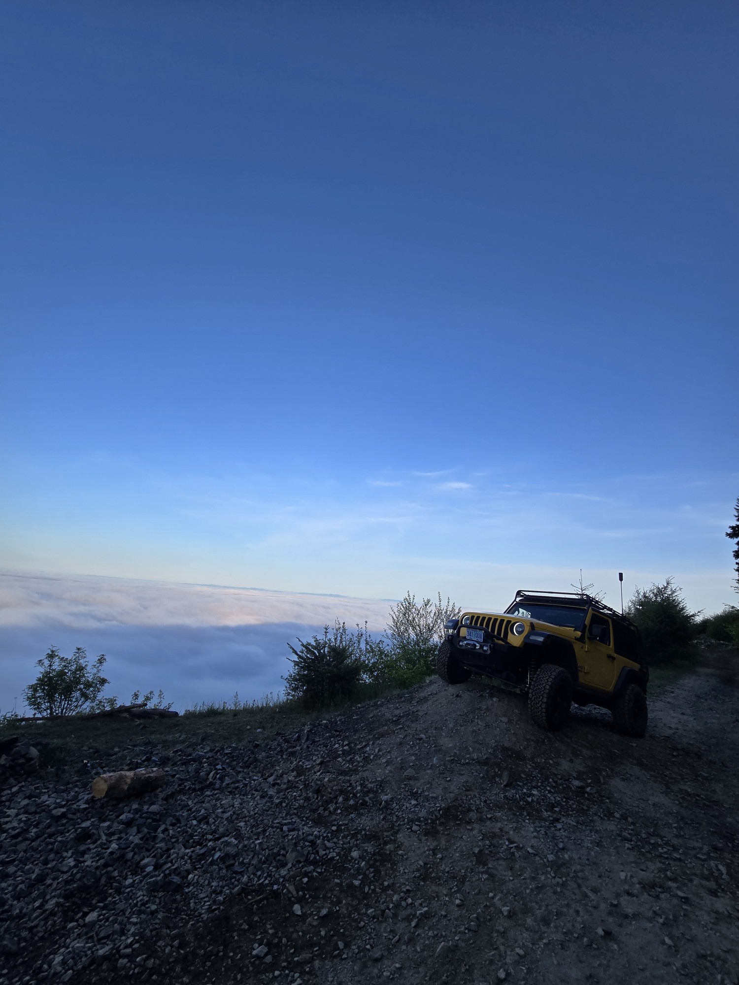
Was a fun and beautiful trail, though not very technical trail from East to West, was only able to get to marker 20? before I had to turn around due to downed trees that would require chainsaw and mor...
Ryan Green
Richard Goins
Rated 4/5
Open
Visited: 01/15/2026
I can see this being an easy trail in good conditions and most of it was pretty tame, but the last big left hand turn near the top is deeply rutted and slick wet clay. Took careful line choice and a l...
A
alhounos
No Rating
Seasonal Closure
Visited: 12/31/2025
According to this trails management agency, the trail is likely closed for the season.
You can reach out to the agency for more details.
Be sure to leave us a report and let us know ...
Trails Offroad
Official Crew
Rated 4/5
Partially Open
Visited: 12/18/2025
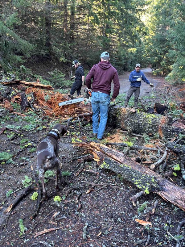
Dozens of trees down on the roads!
My guys and I cleared a dozen or so trees and actually had a good time with our chain saws. Just started running out of daylight. I’m

Steven Ritchie
Most Popular


Updated: 06/04/2026
East Steens
Princeton, Oregon
East Steens Road is the main access road into the surreal Alvord Desert Playa. East Steen's skirts along the eastern escarpment of Steens Mountain and the vast expanses of the Alvord Desert provide a scenic study in dramatic contrasts. Bighorn sheep and pronghorn antelope can be seen adjacent to the road with binoculars. East Steens is also the access to Mickey Alvord Wells that goes to Mickey Hot Springs. There is no camping along East Steens Road, but spurs and access roads from the road offer great camping sites.

Updated: 04/01/2024
Bonney Meadows Road
Government Camp, Oregon
Starting at the notch between the Hood River drainage, the White River drainage, and Boulder Creek Basin, Bonney Meadows Road wanders through the forest and across a fun shelf road on its way down to the paved forest roads in the Barlow Road corridor. Huge meadows full of wildflowers peak through the forest to the east of the road. A fun side trail to an aerial raptor highway is just a mile from a great Forest Service campground. Down at lower elevations, old clear cuts are thick with young trees and dispersed camping.

Updated: 06/16/2023
Knob Loop
Clatskanie, Oregon
Knob Loop is one of five 4x4 trails and part of the Nicolai Mountain ORV Park located in the Clatsop State Forest, just 8 miles west of Clatskanie, Oregon. The trail winds about 2 miles through old-growth forest and can be a challenge with all the tree root systems especially when visiting in the spring or late fall when standing mud and water can really be expected. During this write-up, the author did have to winch out of one obstacle but for the most part, this trail was very fun and challenging in June. Please do not attempt to bypass any part of the trail and be ready for recovery if attempted.

Updated: 01/18/2026
Upper Tunnel Road
Owyhee Heights, Oregon
Upper Tunnel Road splits off from the popular Succor Creek Road, which takes sightseers and campers into the Owyhee range and the incredible Leslie Gulch area. Upper Tunnel is a shortcut from this route to the Owyhee Reservoir and multiple campgrounds and fishing spots. Sharp and uneven rocks dominate the first two-thirds of the route on a seldom-used two-track with steep inclines on loose gravel. Airing down is highly recommended, as these rocks can lead to tire punctures. There are numerous beautiful sights, including a spectacular reservoir overlook and surrounding canyons. This portion of the route is difficult and rough but doable for most 4x4s with clearance.
The last third of the trail becomes severe, with a very steep descent and multiple tight switchbacks on a dangerously loose rock-laden trail. This portion is not for the faint of heart and inexperienced offroaders. Please note that pictured in this review is a trailer. This is not advised on this trail and only increases the difficulty and risk level on this expert-level descent.
The beautiful reservoir includes three campgrounds, top-tier fishing opportunities, and water-based recreation.

Updated: 09/22/2025
Blowout Reservoir Road
Sheaville, Oregon
Blowout Reservoir Road is the main access road to Jordan Craters, Coffeepot Crater, and the historic Birch Creek Ranch. It begins at the junction of Jordan Craters Road and Lodge Ranch Road, and ends at the junction of Morcum Road and Crater Lake Road. The landscape first begins as a high rolling desert, with free-ranging cattle, and then finally, to the left, the lava fields of Jordan Craters become visible as the road winds along the edge of the lava. The road is mainly flat with occasionally wet weather creek crossings. It is best suited for four-wheel-drive vehicles or vigilant AWD drivers with clearance. This road can easily become impassable after even a quarter-inch of rain.

Updated: 10/15/2024
Beaverdam Road
Glenwood, Oregon
Beaverdam Road is a forest service road located in the Tillamook State Forest. This is a major access road with access to many 4x4 Jeep trails including: "University Firepower", "Cedar Tree" and "Firebreak Five". There is a detour where you turn off onto "University Falls Road" for about a half mile due to bridge work. There are many side roads with dispersed camping spots and really awesome views of the surrounding hills. There is a campground called "Browns Camp ORV Campground." This is also a staging area for parking tow rigs and trailers. This campground is designated only for OHV camping.

Updated: 06/05/2022
Can Opener #28B / Tillamook State Forest
Tillamook, Oregon
The challenging obstacle at the end of Can Opener gives the trail its name and makes this a fun trail for rock crawlers. After crossing a gatekeeper boulder field, the trail heads up a steep hill to a boulder pile at the top of the hill. Many big, built rigs spend hours playing around on the boulders and trying the more challenging lines through the obstacle. The shaded forest setting and ample parking make this a great spot to spend a little time watching 4x4s crawl through the forest.

Updated: 09/27/2025
North Paulina Road
Deschutes River Woods, Oregon
This is a point-to-point route connecting Highway 97 and Paulina Lake Road. Driving is much more challenging than most of the surrounding roads and trails.
It starts like most of the forest service roads in the area. After about 10 miles, though, it starts to climb and traverse several buttes and mountains. You will experience narrow and off-camber sections, 12" ledges, lots of rocky and rutted tracks, and a lot of great wheeling that will give a beginning wheeler a good experience. Experienced drivers will find the route easier.
Several areas along the route allow dispersed camping. The road it connects to, FS21, also leads to numerous improved camping areas by Paulina and East Lake.

Updated: 06/05/2022
Firebreak One / Tillamook State Forest
Banks, Oregon
Firebreak One is a great introduction to the Tillamook State Forest and the Brown's Camp Area. As soon as the trail plunges into the moss-covered, dripping wet forest of the Oregon Coast Range, the adventure begins. The trail winds through second growth timber on the way to the top of the ridge where it suddenly bursts through the trees into a vast clear-cut with sweeping views to the west. The trail turns into a gravel road on top of the ridge and continues through a mix of second and third growth forest, and clear-cuts on its way down to one of the main roads through the forest.

Updated: 12/19/2025
Cold Springs Road
Government Camp, Oregon
The alpine meadow section of Cold Springs Road runs through lush meadows full of wildflowers and butterflies. Small wet springs in the forest produce vibrant bursts of wildflowers under the shade of the forest canopy. The ample dispersed camping along Cold Springs Road never fills up even on the busiest of weekends. At the beginning of Cold Springs Road, peaks of Mount Hood looming large round out this trail to be a very scenic drive.

Updated: 04/01/2024
Clark Mill Road and Tygh Valley Road
Tygh Valley, Oregon
The combined trail of Clark Mill Road and Tygh Creek Road begins at the old two room schoolhouse in the community of Friend, Oregon in the middle of rolling fields of wheat and hay. Mount Hood looms on the horizon to the west where the mountain's snow-pack helps to provide water to the entire region. The trail passes through oak savanna and grasslands with big views to the south of Central Oregon before plunging into the beginning of the canyon that hides Jordan Creek. A hidden waterfall waits to be discovered at Waypoint 5 where an old mill once stood before the trail continues down along the rim of the canyon. Near where Jordan Creek and Tygh Creek meet, the trail plunges into the canyon where fallow farm fields are tucked away between gnarled old cottonwood trees. A shallow stream crossing just before the end of the trail at Waypoint 6 helps to wash the dirt off of tires before the Clark Mill Road and Tygh Creek Road trail comes to an end at the blacktop outside of Tygh Valley, Oregon.

Updated: 06/05/2022
Antelope Springs Road
Adrian, Oregon
Antelope Springs Road is a wonderful trail that winds thru the Owyhee grasslands and overlooks the steep gorges of the Succor Creek State Natural Area. Located in eastern Oregon, this trail is just over the border of Idaho and a part of the Bureau of Land Management. Coming from Succor Creek, the trail begins at the Succor Creek Campground. It includes a couple of wet weather creek crossings. This is a favorite area for rockhounds to find thundereggs and fossils. This is also part of a popular route that combines Jump Creek Falls in Marsing, Idaho, and the Succor Creek State Natural Area. The best time to visit is late spring, early summer, and fall.

Updated: 06/05/2022
7 Up (Easy Way) / Tillamook State Forest
Banks, Oregon
The 7 Up (Easy Way) trail is a challenging but manageable adventure through the forest to the top of the hill where the iconic 7 Up (Hard Way) trail connects. There are three legs to 7 Up which include two legs that are passable by normal 4x4s (detailed in this trail description) and one leg that is a challenge for even the most built buggies (detailed as the 7 Up (Hard Way) trail). On warm summer afternoons, rock buggies can often be found battling up the 7 Up (Hard Way) trail where they often break axles, drive lines, and occasionally flip over and crash down the hill. The 7 Up (Easy Way) trail is a popular trail that many overlanders enjoy throughout the year. The trail winds up and down through a deep, dark forest where night time comes hours ahead of schedule. Thick moss hangs from the trees in some areas and lends a magical, enchanted aura to the trail especially in the late afternoon and early evening.

Updated: 10/15/2024
Shingle Mill Road
Bradwood, Oregon
Shingle Mill Road provides access to the Nicolai OHV area. It is a well-graded gravel road that rises in elevation to about 2200 feet. There are many beautiful views of the surrounding valleys and a few waterfalls along this road.

Updated: 10/15/2024
Coldsprings Road / FS-3651
Rocky Point, Oregon
Coldsprings Road is a 10-mile drive through a mature pine forest ending at the Coldsprings hiking trail. Coldsprings Road connects to FS-3652-980, which takes you up to the top of Pelican Peak and a Fire-watch observation tower. The road is in excellent condition and will probably be an awesome snow-wheeling road. Multiple camping spots along this road with views of the surrounding hills make this a great road to explore.

Updated: 09/17/2023
Hogs Back / Tillamook State Forest
Banks, Oregon
Hog's Back is a fun trail that follows the spine of a ridge and hides a few surprises. On the top of the ridge, a rock garden has been installed for anyone wishing to test their skills. The descent into the dense forest on the north end of the trail becomes tricky as the trees close in on the road. Full size vehicles are not recommended but most SUVs and light pickups can make it through by executing three point turns as needed. A big view to the north peeks through the trees as the road hugs the edge of a cliff overlooking a quarry. Hog's Back has a little of everything and is a worthwhile trail to explore in the Tillamook State Forest.

Updated: 06/05/2022
Stick in the Nose #37 / Tillamook State Forest
Tillamook, Oregon
Stick in the Nose is an apt name for this tight trail where brush encroaches on both sides of the dirt track and tree branches hang low. Gatekeeper obstacles and a challenging rocky obstacle halfway along the trail make for a challenging but achievable adventure through third growth forest on the way up to the top of Fox Creek Ridge. On clear days, Archer's Ridge across the Jordan Creek drainage can be seen to the north. On rainy, cloudy days, driving on Stick in the Nose feels like going to another planet where it is highly unlikely any other vehicles or people will be encountered.

Updated: 03/11/2025
South Fork Road
Jordan Creek, Oregon
South Fork Road is located in the Tillamook State Forest. The road intersects with US Highway 6 and climbs up into the western end of the forest. This major access road connects to many 4x4 Jeep trails, including Hoodraiser, Archers Firebreak #28, Can Opener #28B, 7 Up, and Waldo's Way. When explored, there are many side roads where you will find dispersed camping spots and some really awesome views of the surrounding hills.

Updated: 06/05/2022
Archers Firebreak #28H / Tillamook State Forest
Tillamook, Oregon
Archers Firebreak #28H starts out and ends mild but in between the trail can get pretty wild. The trail is a continuation of the Archers Firebreak series of trails that march west along Archers Ridge. On days with decent weather, a huge view of the Oregon Coast Range await along the trail. Adding to the excitement, a challenging dug-out section of trail with a deeply cut center rut that is eager suck unwary vehicles into its hold. Along the way, the trail passes through second growth forest and recent clearcuts offering up scenic views of the Jordan Creek drainage and great memories.

Updated: 09/22/2025
Jordan Craters Road
Sheaville, Oregon
Jordan Craters Road is the main access road to Jordan Craters, an extinct volcanic field, and the historic Birch Creek Ranch. This road is flat gravel that travels through a high plain desert landscape comprised of sagebrush, ranging cattle and ranch buildings in the distance. Jordan Craters Road begins at the intersection of ION-95 and ends at the junction of Blowout Reservoir Road and Lodge Ranch Road. There are no dispersed campsites along this road. Several jeep trails connect to this road, but it is overall an out and back connector for the primary traffic. Please be mindful of the free-ranging cattle, and remember that they have the right of way.

Updated: 10/29/2024
Powerline #4D / Tillamook State Forest
Banks, Oregon
Powerline #4D combines some interesting, tight segments of trail through the forest with a stretch of gravel access road as it follows the high tension power lines toward the coast. A fun and challenging optional section is available for those who want to attempt a reasonably difficult stretch of trail with few significant risks. There are good views near Waypoint 4 looking back to the east along the power lines.

Updated: 10/15/2024
Morcum Road
Danner, Oregon
Morcum Road is a gorgeous scenic drive descending from rolling high desert outback to a challenging grade headed to the Owyhee River with 180-degree breathtaking views of buttes, cliffs, mountains, and rock formations. As you reach the Owyhee River, you can find petroglyphs, an old homestead called Hole in the Ground, and the old Owyhee rock dam remnants. 4WD with high clearance is highly recommended for this trail due to the steepness of the grade and rocky terrain. Do not attempt the trail when it is wet. There are some flat spots by the river for dispersed camping, but be sure to abide by the signs showing Wilderness Study Areas where motorized vehicles are prohibited. You can access Morcum Road from Blowout Reservoir Road and Crater Lake Road.

Updated: 02/07/2026
Iron Mountain
Owyhee Heights, Oregon
The highlight of this trail is Iron Mountain which resembles blocks of Legos or Lincoln Logs that have fallen and have tumbled from the peak. This is an in and out one track trail that begins at Board Corral Loop. Due to grades, the road is done in 4HI, and some places are more washed out that will need more concentrated tire placement. It is advisable to avoid this trail when it is muddy and tread lightly. Two fence gates will require opening and closing if they are standing. You will likely see wild horses from time to time. There are no visible campsites on this trail.

Updated: 09/22/2025
Birch Creek
Danner, Oregon
The historic Birch Creek Ranch is a fantastic reflection of the hard work of early 1900s pioneers to make a living in very remote but gorgeous Owyhee Canyonlands. Birch Creek Road begins at Blowout Reservoir Road and ends along the Owyhee River with overhanging cliffs and high desert meadows. The ingenuity and determination of a Basque sheepherder and a west Virginia cattle rancher are still evident at the site today. Stone walls built in the Basque tradition still ascend the mesa. Remnants of a waterwheel hint at the lush alfalfa fields fed through the gravity irrigation system. Nineteen buildings and structures at the ranch contribute to the property's designation as a historical rural landscape on the Department of the Interior's National Register of Historic Places. This road is best accessible by a high clearance vehicle or, better yet, a 4-wheel drive. Don't attempt this trail when the road is wet or snow-covered.

Upgrade your Membership
Unlock all of the details on every Trail Guide and Scout Route.
Start a 7-day Free TrialCommunity
Partners

