


By clicking "ACCEPT", you agree to be the terms and conditions of each policy linked to above. You also agree to the storing of cookies on your device to facilitate the operation and functionality of our site, enhance and customize your user experience, and to analyze how our site is used.
Oregon Off-Road Trails
52
Total Trail Guides 48

409
Detailed Waypoints 127
Try a Free 7-Day Trial and unlock it all
Start a Free Trial Most Recent Trail Reviews
Rated 2/5
Open
Visited: 09/13/2026
I figured this would be boring and it was. This trail has convinced me to stop going for BoH trails.

Francis whitney
Rated 5/5
Open
Visited: 09/06/2026
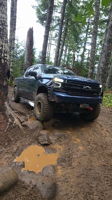
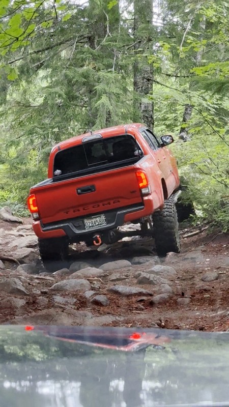
Ran this today. Ground was slick but makes it more dunk I’m in a full-size 1500 on 37s, my buddy is in a Tacoma on 35s, and our other buddy was in a TJ on 33.
Yes it’s tight but we all made it thru ...

Everett Vangsnes
No Rating
Open
Visited: 08/11/2026
Per the MVUM, the trail is seasonally open. As always, check current fire restrictions/closures before venturing out.

Trails Offroad
Official Crew
No Rating
Open
Visited: 08/11/2026
Per the MVUM, the trail is seasonally open. As always, check current fire restrictions/closures before venturing out.

Todd
Official Crew
Todd
Official Crew
No Rating
Open
Visited: 08/11/2026
Per the MVUM, the trail is seasonally open. As always, check current fire restrictions/closures before venturing out.
Trails Offroad
Official Crew
No Rating
Temporary Closure
Visited: 08/07/2026
Closed due to the Fox Fire. https://www.blm.gov/sites/default/files/docs/2026-07/orwa-fpo-val-072626.pdf

Rose Meirs
Official Crew
No Rating
Temporary Closure
Visited: 08/07/2026
Closed due to the Crosswhite Fire. https://www.blm.gov/sites/default/files/docs/2026-08/orwa-fpo-pri-080526.pdf
Rose Meirs
Official Crew
No Rating
Temporary Closure
Visited: 08/07/2026
Closed due to the Crosswhite Fire. https://www.blm.gov/sites/default/files/docs/2026-08/orwa-fpo-pri-080526.pdf
Rose Meirs
Official Crew
No Rating
Temporary Closure
Visited: 08/07/2026
Closed due to the Crosswhite Fire. https://www.blm.gov/sites/default/files/docs/2026-08/orwa-fpo-pri-080526.pdf
Rose Meirs
Official Crew
No Rating
Temporary Closure
Visited: 08/07/2026
Closed due to the Crosswhite Fire. https://www.blm.gov/sites/default/files/docs/2026-08/orwa-fpo-pri-080526.pdf
Rose Meirs
Official Crew
No Rating
Temporary Closure
Visited: 08/07/2026
Closed due to the Big Grass Fire. https://www.blm.gov/sites/default/files/docs/2026-07/orwa-fpo-val-072826.pdf
Rose Meirs
Official Crew
No Rating
Temporary Closure
Visited: 08/07/2026
Closed due to the Big Grass Fire. https://www.blm.gov/sites/default/files/docs/2026-07/orwa-fpo-val-072826.pdf
Rose Meirs
Official Crew
No Rating
Temporary Closure
Visited: 08/07/2026
Closed due to the Big Grassy Fire. https://www.blm.gov/sites/default/files/docs/2026-07/orwa-fpo-val-072826.pdf
Rose Meirs
Official Crew
No Rating
Temporary Closure
Visited: 08/07/2026
Temporary due to the Hat Wildfire. https://www.blm.gov/sites/default/files/docs/2026-07/orwa-fpo-val-072826.pdf
Rose Meirs
Official Crew
No Rating
Temporary Closure
Visited: 08/03/2026
The area is currently closed due to the Grasshopper Fire. More info is available here: https://inciweb.wildfire.gov/incident-information/ormhf-grasshopper

Douglas Van Bossuyt
Official Crew
No Rating
Temporary Closure
Visited: 08/03/2026
The area is currently closed due to the Grasshopper Fire. More info is available here: https://inciweb.wildfire.gov/incident-information/ormhf-grasshopper
Douglas Van Bossuyt
Official Crew
No Rating
Temporary Closure
Visited: 08/03/2026
The area is currently closed due to the Grasshopper Fire. More info is available here: https://inciweb.wildfire.gov/incident-information/ormhf-grasshopper
Douglas Van Bossuyt
Official Crew
No Rating
Temporary Closure
Visited: 08/03/2026
The area is currently closed due to the Grasshopper Fire. More info is available here: https://inciweb.wildfire.gov/incident-information/ormhf-grasshopper
Douglas Van Bossuyt
Official Crew
No Rating
Temporary Closure
Visited: 08/03/2026
The area is currently closed due to the Grasshopper Fire. More info is available here: https://inciweb.wildfire.gov/incident-information/ormhf-grasshopper
Douglas Van Bossuyt
Official Crew
No Rating
Temporary Closure
Visited: 08/03/2026
The area is currently closed due to the Grasshopper Fire. More info is available here: https://inciweb.wildfire.gov/incident-information/ormhf-grasshopper
Douglas Van Bossuyt
Official Crew
No Rating
Temporary Closure
Visited: 08/03/2026
The area is currently closed due to the Grasshopper Fire. More info is available here: https://inciweb.wildfire.gov/incident-information/ormhf-grasshopper
Douglas Van Bossuyt
Official Crew
No Rating
Temporary Closure
Visited: 08/03/2026
The area is currently closed due to the Grasshopper Fire. More info is available here: https://inciweb.wildfire.gov/incident-information/ormhf-grasshopper
Douglas Van Bossuyt
Official Crew
No Rating
Temporary Closure
Visited: 08/03/2026
The area is currently closed due to the Grasshopper Fire. More info is available here: https://inciweb.wildfire.gov/incident-information/ormhf-grasshopper
Douglas Van Bossuyt
Official Crew
No Rating
Temporary Closure
Visited: 08/03/2026
The Grasshopper fire unfortunately burned over the Flag Point Lookout and destroyed the lookout tower. The area is closed for the foreseeable future.
General fire info with links to the specific clo...
Douglas Van Bossuyt
Official Crew
No Rating
Temporary Closure
Visited: 08/01/2026
Trail was closed due to wildfire activity. I was unable to find this out online but maybe try calling Hood River Ranger District at 541-352-6002 before making the drive to confirm if it is open?
MM
Mike Mueller
Open
Visited: 07/12/2026
I ran this backwards (rock quarry entrance to saddle mtn entrance) in my full-size pickup and it was a good time. I didn’t realize I’d taken the rocky bypass until i got to the other side of it (the s...
Everett Vangsnes
No Rating
Open
Visited: 06/26/2026
According to MVUM data, this trail should be open for the season.
Trails Offroad
Official Crew
No Rating
Open
Visited: 06/26/2026
According to MVUM data, this trail should be open for the season.
Trails Offroad
Official Crew
No Rating
Open
Visited: 06/26/2026
According to MVUM data, this trail should be open for the season.
Trails Offroad
Official Crew
No Rating
Open
Visited: 06/26/2026
According to MVUM data, this trail should be open for the season.
Trails Offroad
Official Crew
No Rating
Open
Visited: 06/26/2026
According to MVUM data, this trail should be open for the season.
Trails Offroad
Official Crew
No Rating
Open
Visited: 06/26/2026
According to MVUM data, this trail should be open for the season.
Trails Offroad
Official Crew
No Rating
Open
Visited: 06/26/2026
According to MVUM data, this trail should be open for the season.
Trails Offroad
Official Crew
No Rating
Open
Visited: 06/26/2026
According to MVUM data, this trail should be open for the season.
Trails Offroad
Official Crew
No Rating
Open
Visited: 06/26/2026
According to MVUM data, this trail should be open for the season.
Trails Offroad
Official Crew
Rated 5/5
Open
Visited: 06/19/2026
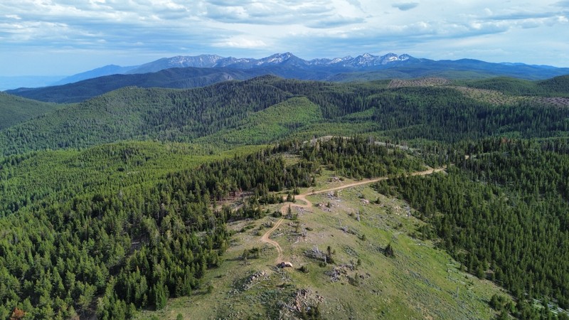
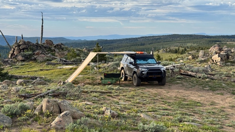
This was an easy dirt road with some logging traffic up until it intersects National Forest Development Road 5125/4350 at 45.06718, -118.21474. After this it becomes noticeably bumpier with larger di...

Andrew T
Open
Visited: 06/05/2026
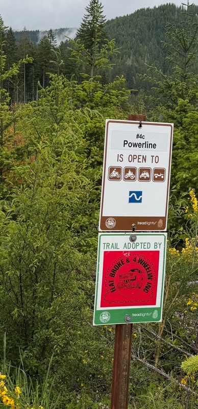
Trail is marked wrong on the map, 4C starts at the end of powerline 4B.
MS
Michael Strange
Rated 5/5
Open
Visited: 05/08/2026
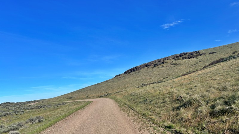
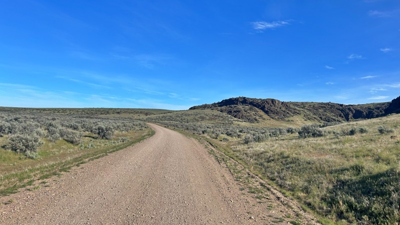
Having visited in May, I can confidently say this is one of the best times to experience the Cow Lakes Recreation Area. The lakes are full, migratory birds fill the marshes, and wildflowers blanket th...
Rose Meirs
Official Crew
Rated 4/5
Open
Visited: 05/07/2026
We tackled Board Corral Trail in our EarthRoamer and found it to be a fun and engaging drive, but one that took considerably longer than we expected. While the trail itself isn't exceptionally difficu...

Wide Open Roams
Official Crew
Rated 5/5
Open
Visited: 05/06/2026
We drove Succor Creek Road as part of our travels through the Owyhee Canyonlands and found it to be one of the easier yet more scenic routes in the region. If you're looking for a relaxing drive that ...
Wide Open Roams
Official Crew
Rated 5/5
Open
Visited: 05/04/2026
Leslie Gulch Road ended up being one of our favorite drives in the Owyhee Canyonlands. The route winds its way down toward Owyhee Lake, passing through some truly unique scenery that feels completely ...
Wide Open Roams
Official Crew
Rated 4/5
Open
Visited: 05/04/2026
We drove Mahogany Gap while exploring the Owyhee region and found it to be a scenic, easy-going route that offers a great introduction to the area. This isn't a trail that challenges your vehicle, but...
Wide Open Roams
Official Crew
Rated 5/5
Open
Visited: 05/03/2026
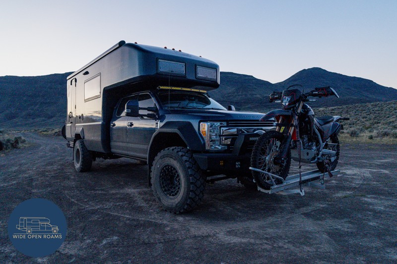
We took the trail out to Mickey Hot Springs while exploring the East Steens area, and it ended up being one of our favorite stops in southeastern Oregon. The drive itself was straightforward and easy ...
Wide Open Roams
Official Crew
Rated 5/5
Open
Visited: 05/03/2026
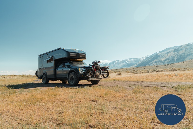
We drove the East Steens Road while making our way through southeastern Oregon and ended up really enjoying this route. Before starting the main stretch along the Steens, we stopped at Borax Lake Hot ...
Wide Open Roams
Official Crew
Rated 4/5
Partially Open
Visited: 04/26/2026
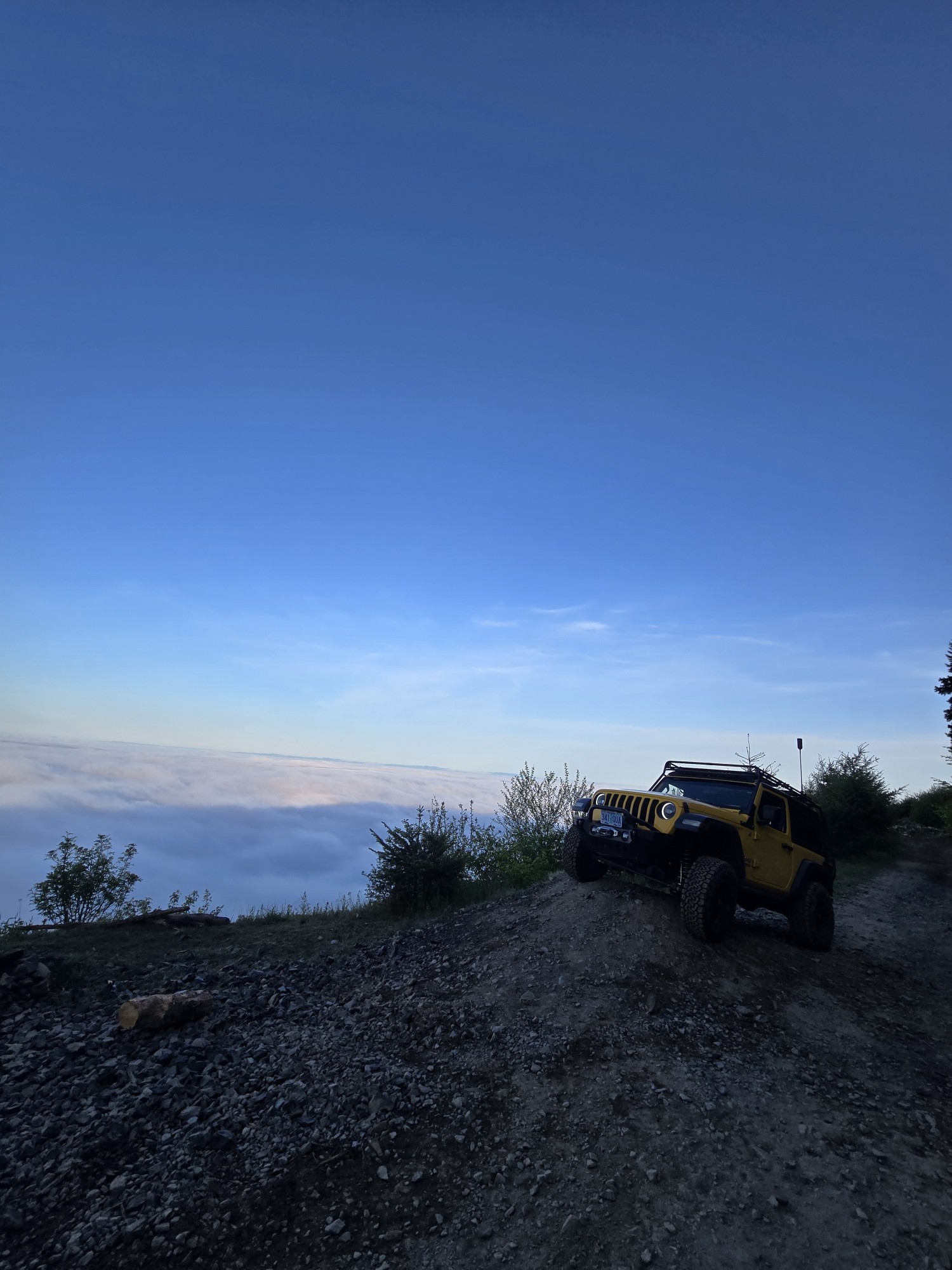
Was a fun and beautiful trail, though not very technical trail from East to West, was only able to get to marker 20? before I had to turn around due to downed trees that would require chainsaw and mor...
Ryan Green
Richard Goins
Rated 4/5
Open
Visited: 01/15/2026
I can see this being an easy trail in good conditions and most of it was pretty tame, but the last big left hand turn near the top is deeply rutted and slick wet clay. Took careful line choice and a l...
A
alhounos
No Rating
Seasonal Closure
Visited: 12/31/2025
According to this trails management agency, the trail is likely closed for the season.
You can reach out to the agency for more details.
Be sure to leave us a report and let us know ...
Trails Offroad
Official Crew
Rated 4/5
Partially Open
Visited: 12/18/2025
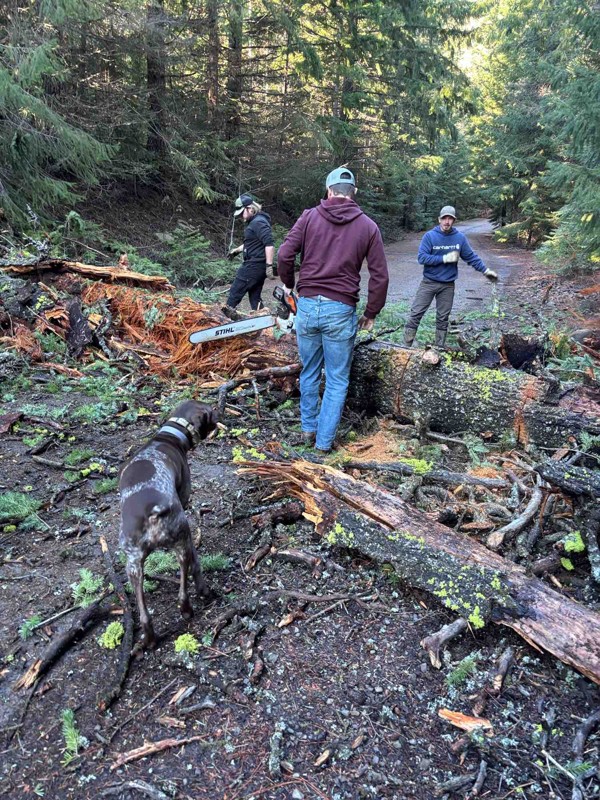
Dozens of trees down on the roads!
My guys and I cleared a dozen or so trees and actually had a good time with our chain saws. Just started running out of daylight. I’m
Steven Ritchie
Most Popular


Updated: 02/06/2026
Simonsen Road
Birkenfeld, Oregon
Simonsen Road is a well-maintained gravel road providing access to the Nicolai OHV recreation area from the south. The road starts near Fishhawk Lake and rises to 1500 feet in elevation, following a series of ridgelines with amazing views of the surrounding hills and valleys. While there is no camping along Simonsen Road, the many smaller dirt spurs might provide even more scenic views and some hidden campsites. Feel free to explore.

Updated: 12/23/2023
Powerline #4B / Tillamook State Forest
Banks, Oregon
The Powerline #4B trail immediately plunges into a dense second growth forest thick with maples and fir trees dripping with moss and ferns. Depending on how recently the last rains passed through the Tillamook State Forest, visitors may be quite literally greeted with dripping moss and branches hanging low over the trail. A tight switchback points the trail southward toward the high tension power lines. After emerging from the dark and wet forest, the trail turns into a gravel access road that follows under the power lines on their march westward to bring electricity to the communities of the northern Oregon Coast. At the top of the ridge, 4x4ers are greeted with big views to the west across the patchwork of second and third growth timber, and clear cuts. Nine days out of ten, the distant ridges and mountains are veiled in clouds, rain, and mist, but on rare sunny blue sky days, the entire Devil's Lake Branch of the Wilson River Basin is on full display.

Updated: 10/15/2024
University Falls Road
Glenwood, Oregon
University Falls Road is a forest service road located in the Tillamook State Forest. This road does a lower-level loop through the forest and reconnects with US Highway 6. This forest service road is a major access road with access to many 4x4 Jeep trails including: "Powerline #4B", "Powerline #4C" and "Powerline #4D". There are many side roads with dispersed camping and really awesome views of the surrounding hills. Browns Camp ORV Campground is located on Scroggins Creed Road. This is also a staging area for parking tow rigs and trailers. This campground is designated only for OHV camping.

Updated: 06/05/2022
Saddle Up Part Two / Tillamook State Forest
Banks, Oregon
Saddle Up Part Two starts with a big gatekeeper boulder field guarding the entrance to a lovely little stretch of dirt track that switchbacks down through a stand of young fir trees. A second boulder field guards the exit to the first segment of Saddle Up Part Two before the trail allows vehicles to continue onto the final segment that wraps around a small knoll popular with hunters for camping. The trail emerges onto a gravel road at the perfect spot to continue on to explore the Dog Leg trail.

Updated: 04/01/2024
Bonney Butte Road
Government Camp, Oregon
At the top of Bonney Butte Road in good weather on a clear day, Mount Hood looms large to the northwest while the snow-capped peaks of Mount Jefferson and the Three Sisters glisten in the distance to the south. Even though Bonney Butte Road is less than a mile long, it packs in some amazing views and a fun trail with good restroom facilities. The remnants of the old fire lookout, removed in the 1960s, and the interpretive information signs about the annual raptor migration are interesting in their own rights but people keep coming back to Bonney Butte for the views.
The road up Bonney Butte is closed to motorized traffic August 15 - November 1 to protect migrating raptors. However, if you are in the area, the half mile hike from the trailhead parking area to the summit is worthwhile to watch HawkWatch International capture and tag raptors. More information about the migration can be found here: https://hawkwatch.org/migration/item/81-bonney-butte-hawkwatch

Updated: 10/15/2024
Foster Mainline
Taylorville, Oregon
Foster Mainline road is a well-maintained gravel road that is part of a network of dirt roads created for the logging industry. This road provides easy access to the Nicolai OHV recreation area. The road dips in and out of lush valleys. Highpoints along the trail reveal amazing views. While there is no camping along this road, the many side trails provide hours of exploration and access to nice dispersed campsites.

Updated: 10/15/2024
C-Line Road
Glenwood, Oregon
C-Line Road starts at Beaver Dam Road and Saddle Mountain Road intersection. This 8.9-mile road goes over to the west side of the forest and connects with South Fork Road, giving you access to some of the more difficult trails in the area. There are many pull-outs with beautiful views and numerous camping spots from which to choose.

Updated: 01/21/2023
Powerline #4C / Tillamook State Forest
Banks, Oregon
Powerline #4C is a fun jaunt through thickets of alder, maple, and other deciduous trees on the way down to the bottom of the Elliot Creek Drainage. The trail almost immediately narrows to a tight single lane of travel where full-size vehicles might not have the most fun navigating through narrow spots. Depending on when the last maintenance was done on the trail, 4x4s may end up with some pinstriping from brush and trees but that is all part of the charm of Powerline #4C. During the fall, the leaves on the trees turn vivid shades of yellow, orange, and red, making for some very pretty trail segments that are excellent for taking glamour shots of overlanding rigs.

Updated: 10/15/2024
Miller Lane
Arock, Oregon
Miller Lane, the access road to the overlooks for Chalk Basin, offers a breathtaking view of chalk-looking cliffs across the Owyhee River and Iron Point, the deepest part of the Owyhee Canyonlands. Miller can begin at Biscuit Butte Road and Crater Lake Road or at Mud Lake Reservoir Road in the south. The landscape is relatively flat, with free-ranging cattle and winds along the top of the canyon bordering the Owyhee River. This trail is mostly rough and rocky dirt and should not be driven after even a quarter-inch of rain. Do not attempt this trail if wet. There is a dispersed campsite at the overlook spur at Iron Point.

Updated: 06/05/2022
Lyda Hill #100 / Tillamook State Forest
Tillamook, Oregon
Lyda Hill trail is a short but exciting trail that gets progressively more challenging with a deeply rutted section waiting to challenge the nerves of 4x4ers willing to risk potential body damage from laying a vehicle on its side. The trail climbs up the steep, wooded flank of Lyda Hill but never quite reaches the summit before turning back around on itself and pointing adventurers back down the hill.

Updated: 06/05/2022
Truck Dent
Tillamook, Oregon
Truck Dent is a very short, but scenic trail along the top of a ridge, with just enough challenges to keep the driver on his/her "toes". On a clear day, you will be treated to beautiful 360-degree panoramic views. As a great connector trail combined with other roads in the area - Truck Dent can be experienced from either direction, but going uphill from west to east can make the trail a bit more challenging. The beautiful forest scenery and panoramic views are what makes this trail so fun.

Updated: 10/15/2024
Whitehorse Ranch
Basque, Oregon
Whitehorse Ranch Road is a well-maintained 50-mile gravel road that is easy to access. It starts from U.S. Route 95 and extends to Oregon Route 205, 8 miles south of Fields. It is named for the historic cattle ranch Whitehorse Ranch, founded in 1869 by John S. Devine, a well-known 19th-century cattle baron. There are no noticeable campsites off this road, but this road also provides access to the iconic Willow Creek Hot Springs off Whitehorse Fifteen Mile, which offers excellent dispersed camping choices.

Updated: 04/01/2024
2730-230 and 2730 Roads
Tygh Valley, Oregon
One can be forgiven for feeling as if an exciting adventure is close at hand while charging down the 2730-230 Road. A rough dirt track snakes through mixed stands of second growth, old growth, and clearcut timber. In the dry summer months, clouds of billowing dust give the distinct impression that this road leads to somewhere important and special. Alas, the end of 2730-230 comes in the form of the smooth blacktop ribbon of 2730. The 2730 Road continues through big stands of timber as it curls around the ridge below Flag Point Lookout on the way to the small village of Friend.

Updated: 06/05/2022
Archers Firebreak #28 / Tillamook State Forest
Tillamook, Oregon
Archers Firebreak #28 is a fun and easy trail that curls down through a recent clear cut from the top of the ridge down to the saddle between Lyda Hill and Archers Ridge. A couple switchbacks on the first part of the trail are a great place to take video of an overlanding rig going on an adventure. This is a popular trail to connect between the trail network in the Browns Camp area (eastern third) of the Tillamook State Forest and the trails that are accessible from the Jordan Creek campground.

Updated: 08/11/2025
Paulina Lake Road
Millican, Oregon
This is a point-to-point route starting at FR18, going up and over "The Dome," and ending at East Lake Campground. Along the way, you drive on the rim of a volcanic dome and go through the Newberry Wildlife Refuge. The views and scenery are amazing, and this is a great drive whether you have a destination in mind or not! There are also some pretty epic primitive camping options in addition to all of the camping areas around East and Paulina Lakes.
There are rocky areas with steep inclines. High clearance and all or 4WD may be necessary, depending on your vehicle.

Updated: 10/15/2024
Crater Lake Road
Danner, Oregon
Crater Lake Road can begin in the north at Blowout Reservoir Road and Morcum Road, or at Biscuit Butte Road from the south. The landscape is a gently rolling high desert from the north with free-ranging cattle. It then winds along the lava field. The trail is best suited for four-wheel-drive vehicles with clearance. This trail is not good enough to be traveling after even a quarter-inch of rain: Do not attempt if this is the case. There are no visible dispersed or established campsites along this trail, but camping can be done on the flat surfaces of the lava field.

Updated: 06/05/2022
Smock Road
Wamic, Oregon
Smock Road is a scenic way to access the Barlow Trail further to the west. The road winds through farm and ranch country, through a creek bottom choked with scrub oak, and across a prairie. When you reach the end of Smock Road, continue on along the Barlow Trail to retrace the wagon ruts of the pioneers on the way to the Willamette Valley during the days of the Oregon Trail.

Updated: 08/11/2025
FR2308
Beaver Marsh, Oregon
Traveling from north to south, 2308 starts off Highway 70. Look for the "Desert Forest Journey" sign. Most of the route meanders along the eastern boundary of Crater Lake National Park. In several areas, fallen trees block the path, and fallen trees are prevalent in this region. A few areas of the trail are narrow, slightly off-camber, and washed out, warranting the moderate rating. Numerous opportunities for dispersed camping abound. The improved Scott Creek Campground, located on FR2010, is also available.

Updated: 08/07/2025
Sun Mountain Road
Fort Klamath, Oregon
Sun Mountain Road connects at the south end where the Jackson F. Kimbell State Recreation Area sits. This area has great campsites with direct access to the headwaters of Sun Creek. This campground is a great way to start or end your day's journey! Sun Mountain Road quickly climbs up the mountainside from the campground and levels off after Sun Pass. From there, it is basically a straight shot to the road's terminus, where it meets with The Dalles-California Highway. You need to be careful on the majority of this road. While it is straight and seemingly well-maintained, there are numerous dips and trees that can catch you off guard if you don't slow down. There are endless opportunities for dispersed camping in the area. Just be ready for mosquitoes!

Updated: 06/05/2022
Archers Firebreak #28G / Tillamook State Forest
Tillamook, Oregon
Archers Firebreak #28G is a fun continuation of the Archers Firebreak series of trails in the Tillamook State Forest. The trail romps along the top of Archers Ridge through stands of second growth timber. If it has been raining recently, the big puddles between Waypoints 2 and 3 should be full of water and a fun place to splash through.

Updated: 09/02/2026
Ladd Canyon
Little Alps, Oregon
Ladd Canyon Road, also known as National Forest Development Road 43, is a scenic route in Oregon that winds through the stunning Wallowa Whitman National Forest. This picturesque road takes travelers through dense forests, offering breathtaking views of towering trees and rolling hills. Crossing the summit of Anthony Butte, the road provides stunning vistas of the Pilcher Creek Reservoir and the Wallowa Mountains to the east.
Nature enthusiasts will find this route a haven, with access to hiking, camping, and wildlife observation. The road is rough and not recommended for passenger vehicles or trailers. Along the way, there are opportunities for dispersed camping and the designated campground at Grande Ronde Lake, which has a nightly fee.

Updated: 06/05/2022
Springer Ridge Road
Tygh Valley, Oregon
The story of Springer Mountain Road is one of transition and transformation, of rain and sun, and of the many varied ecosystems of the eastern slope of the Oregon Cascades. The metamorphosis from alpine forest to scrub oak and savanna that started on the 2730-190 road continues in earnest on Springer Mountain Road culminating in wide open oak savanna at the end of the trail. The first tendrils of deep powdery dust reminiscent of the famed Australian Outback bulldust begin on the lower reaches of Springer Mountain Road and continue onto the connecting Shell Rock Road. Rumors of a hidden waterfall lurking on private land and a rock climbing paradise in the Mount Hood National Recreation Area Fifteenmile Unit bring many adventurers to Springer Mountain Road; the adventure of heading east from the crest of the Cascades to the deserts of Central Oregon lures in many off-road enthusiasts to explore this trail.

Updated: 06/05/2022
Ample and Alluring #26 / Tillamook State Forest
Tillamook, Oregon
Ample and Alluring lives up to its name with an ample forest loaded with big ferns, dripping moss, and a tight trail. The trail is alluring to those who like to thread their way through tight spots and challenge themselves with potential exposure to rolling off the trail if a vehicle wanders too close to the edge. After a great romp through the forest and up the mountain, Ample and Alluring pops out of the woods and onto a gravel road that leads to more adventures in the Tillamook State Forest.

Updated: 06/05/2022
Bug Road
Tygh Valley, Oregon
Bug Road is a tale of two seasons: the wet and the dry. During the dry season, the road is a fun, easy path to get from the main road (NF-48 also known as Barlow Road) to Barlow Trail (NF-3530) where pioneer wagons once rolled and where overlanders now drive their trucks to recreate the pioneer days. During the wet season, Bug Road becomes a muddy morass of deep water-filled holes and mud pits that can swallow up a stock vehicle. Only the adventurous with built rigs, relocated air intakes, sealed electrical systems, and a pioneer's spirit attempt Bug Road when the holes are full of water.
Those who explore Bug Road will find the trail winding its way through mixed pine and scrub oak forest, and patchy grasslands away from the busy pavement of NF-48 nearby. Hunters often come to this area to hunt for deer and elk while birders use Bug Road to access the White River Wildlife Refuge to hunt rare birds with their cameras. In the spring, the sweet young grass toward the end of the trail blows in great swirls the afternoon breeze. In the fall, the oak leaves turn brilliant shades of red and orange before the onslaught of winter snows. While the road is short, it is fun regardless of the season and well worth the time to visit.

Upgrade your Membership
Unlock all of the details on every Trail Guide and Scout Route.
Start a 7-day Free TrialCommunity
Partners

