


By clicking "ACCEPT", you agree to be the terms and conditions of each policy linked to above. You also agree to the storing of cookies on your device to facilitate the operation and functionality of our site, enhance and customize your user experience, and to analyze how our site is used.
Oregon Off-Road Trails
52
Total Trail Guides 48

409
Detailed Waypoints 127
Try a Free 7-Day Trial and unlock it all
Start a Free Trial Most Recent Trail Reviews
Rated 2/5
Open
Visited: 09/13/2026
I figured this would be boring and it was. This trail has convinced me to stop going for BoH trails.


Francis whitney
Rated 5/5
Open
Visited: 09/06/2026
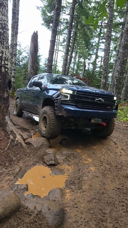
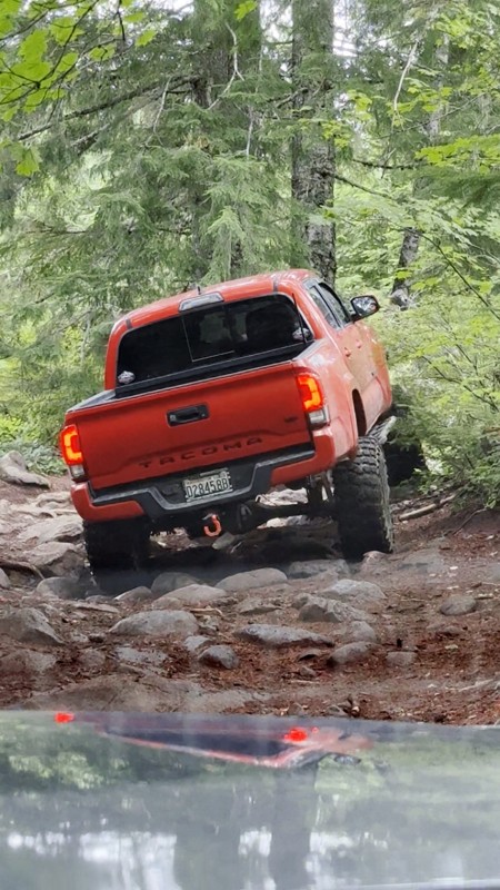
Ran this today. Ground was slick but makes it more dunk I’m in a full-size 1500 on 37s, my buddy is in a Tacoma on 35s, and our other buddy was in a TJ on 33.
Yes it’s tight but we all made it thru ...

Everett Vangsnes
No Rating
Open
Visited: 08/11/2026
Per the MVUM, the trail is seasonally open. As always, check current fire restrictions/closures before venturing out.

Trails Offroad
Official Crew
No Rating
Open
Visited: 08/11/2026
Per the MVUM, the trail is seasonally open. As always, check current fire restrictions/closures before venturing out.

Todd
Official Crew
Todd
Official Crew
No Rating
Open
Visited: 08/11/2026
Per the MVUM, the trail is seasonally open. As always, check current fire restrictions/closures before venturing out.
Trails Offroad
Official Crew
No Rating
Temporary Closure
Visited: 08/07/2026
Closed due to the Fox Fire. https://www.blm.gov/sites/default/files/docs/2026-07/orwa-fpo-val-072626.pdf

Rose Meirs
Official Crew
No Rating
Temporary Closure
Visited: 08/07/2026
Closed due to the Crosswhite Fire. https://www.blm.gov/sites/default/files/docs/2026-08/orwa-fpo-pri-080526.pdf
Rose Meirs
Official Crew
No Rating
Temporary Closure
Visited: 08/07/2026
Closed due to the Crosswhite Fire. https://www.blm.gov/sites/default/files/docs/2026-08/orwa-fpo-pri-080526.pdf
Rose Meirs
Official Crew
No Rating
Temporary Closure
Visited: 08/07/2026
Closed due to the Crosswhite Fire. https://www.blm.gov/sites/default/files/docs/2026-08/orwa-fpo-pri-080526.pdf
Rose Meirs
Official Crew
No Rating
Temporary Closure
Visited: 08/07/2026
Closed due to the Crosswhite Fire. https://www.blm.gov/sites/default/files/docs/2026-08/orwa-fpo-pri-080526.pdf
Rose Meirs
Official Crew
No Rating
Temporary Closure
Visited: 08/07/2026
Closed due to the Big Grass Fire. https://www.blm.gov/sites/default/files/docs/2026-07/orwa-fpo-val-072826.pdf
Rose Meirs
Official Crew
No Rating
Temporary Closure
Visited: 08/07/2026
Closed due to the Big Grass Fire. https://www.blm.gov/sites/default/files/docs/2026-07/orwa-fpo-val-072826.pdf
Rose Meirs
Official Crew
No Rating
Temporary Closure
Visited: 08/07/2026
Closed due to the Big Grassy Fire. https://www.blm.gov/sites/default/files/docs/2026-07/orwa-fpo-val-072826.pdf
Rose Meirs
Official Crew
No Rating
Temporary Closure
Visited: 08/07/2026
Temporary due to the Hat Wildfire. https://www.blm.gov/sites/default/files/docs/2026-07/orwa-fpo-val-072826.pdf
Rose Meirs
Official Crew
No Rating
Temporary Closure
Visited: 08/03/2026
The area is currently closed due to the Grasshopper Fire. More info is available here: https://inciweb.wildfire.gov/incident-information/ormhf-grasshopper

Douglas Van Bossuyt
Official Crew
No Rating
Temporary Closure
Visited: 08/03/2026
The area is currently closed due to the Grasshopper Fire. More info is available here: https://inciweb.wildfire.gov/incident-information/ormhf-grasshopper
Douglas Van Bossuyt
Official Crew
No Rating
Temporary Closure
Visited: 08/03/2026
The area is currently closed due to the Grasshopper Fire. More info is available here: https://inciweb.wildfire.gov/incident-information/ormhf-grasshopper
Douglas Van Bossuyt
Official Crew
No Rating
Temporary Closure
Visited: 08/03/2026
The area is currently closed due to the Grasshopper Fire. More info is available here: https://inciweb.wildfire.gov/incident-information/ormhf-grasshopper
Douglas Van Bossuyt
Official Crew
No Rating
Temporary Closure
Visited: 08/03/2026
The area is currently closed due to the Grasshopper Fire. More info is available here: https://inciweb.wildfire.gov/incident-information/ormhf-grasshopper
Douglas Van Bossuyt
Official Crew
No Rating
Temporary Closure
Visited: 08/03/2026
The area is currently closed due to the Grasshopper Fire. More info is available here: https://inciweb.wildfire.gov/incident-information/ormhf-grasshopper
Douglas Van Bossuyt
Official Crew
No Rating
Temporary Closure
Visited: 08/03/2026
The area is currently closed due to the Grasshopper Fire. More info is available here: https://inciweb.wildfire.gov/incident-information/ormhf-grasshopper
Douglas Van Bossuyt
Official Crew
No Rating
Temporary Closure
Visited: 08/03/2026
The area is currently closed due to the Grasshopper Fire. More info is available here: https://inciweb.wildfire.gov/incident-information/ormhf-grasshopper
Douglas Van Bossuyt
Official Crew
No Rating
Temporary Closure
Visited: 08/03/2026
The area is currently closed due to the Grasshopper Fire. More info is available here: https://inciweb.wildfire.gov/incident-information/ormhf-grasshopper
Douglas Van Bossuyt
Official Crew
No Rating
Temporary Closure
Visited: 08/03/2026
The Grasshopper fire unfortunately burned over the Flag Point Lookout and destroyed the lookout tower. The area is closed for the foreseeable future.
General fire info with links to the specific clo...
Douglas Van Bossuyt
Official Crew
No Rating
Temporary Closure
Visited: 08/01/2026
Trail was closed due to wildfire activity. I was unable to find this out online but maybe try calling Hood River Ranger District at 541-352-6002 before making the drive to confirm if it is open?
MM
Mike Mueller
Open
Visited: 07/12/2026
I ran this backwards (rock quarry entrance to saddle mtn entrance) in my full-size pickup and it was a good time. I didn’t realize I’d taken the rocky bypass until i got to the other side of it (the s...
Everett Vangsnes
No Rating
Open
Visited: 06/26/2026
According to MVUM data, this trail should be open for the season.
Trails Offroad
Official Crew
No Rating
Open
Visited: 06/26/2026
According to MVUM data, this trail should be open for the season.
Trails Offroad
Official Crew
No Rating
Open
Visited: 06/26/2026
According to MVUM data, this trail should be open for the season.
Trails Offroad
Official Crew
No Rating
Open
Visited: 06/26/2026
According to MVUM data, this trail should be open for the season.
Trails Offroad
Official Crew
No Rating
Open
Visited: 06/26/2026
According to MVUM data, this trail should be open for the season.
Trails Offroad
Official Crew
No Rating
Open
Visited: 06/26/2026
According to MVUM data, this trail should be open for the season.
Trails Offroad
Official Crew
No Rating
Open
Visited: 06/26/2026
According to MVUM data, this trail should be open for the season.
Trails Offroad
Official Crew
No Rating
Open
Visited: 06/26/2026
According to MVUM data, this trail should be open for the season.
Trails Offroad
Official Crew
No Rating
Open
Visited: 06/26/2026
According to MVUM data, this trail should be open for the season.
Trails Offroad
Official Crew
Rated 5/5
Open
Visited: 06/19/2026
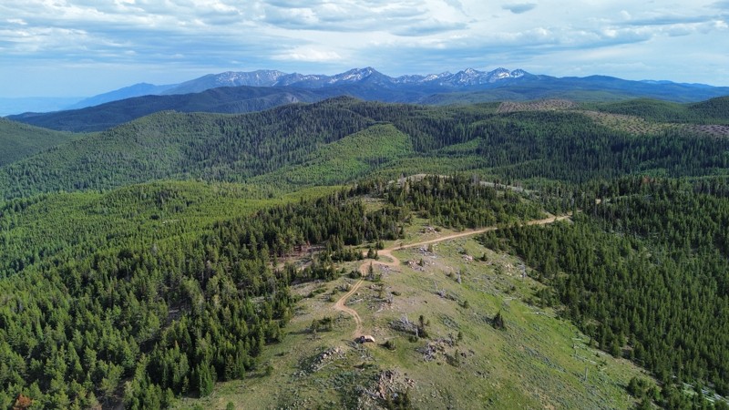
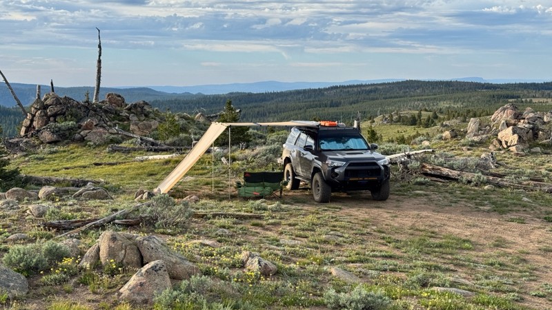
This was an easy dirt road with some logging traffic up until it intersects National Forest Development Road 5125/4350 at 45.06718, -118.21474. After this it becomes noticeably bumpier with larger di...

Andrew T
Open
Visited: 06/05/2026
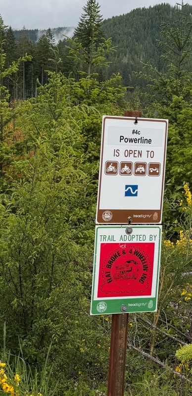
Trail is marked wrong on the map, 4C starts at the end of powerline 4B.
MS
Michael Strange
Rated 5/5
Open
Visited: 05/08/2026
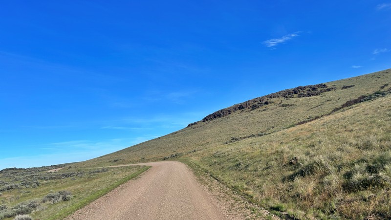
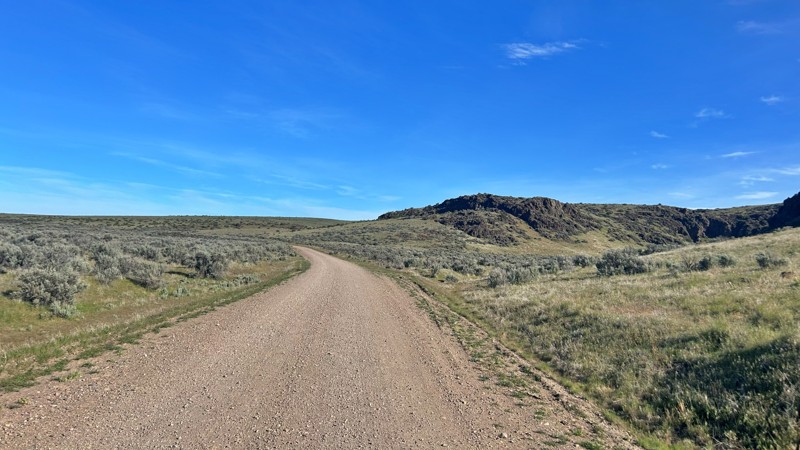
Having visited in May, I can confidently say this is one of the best times to experience the Cow Lakes Recreation Area. The lakes are full, migratory birds fill the marshes, and wildflowers blanket th...
Rose Meirs
Official Crew
Rated 4/5
Open
Visited: 05/07/2026
We tackled Board Corral Trail in our EarthRoamer and found it to be a fun and engaging drive, but one that took considerably longer than we expected. While the trail itself isn't exceptionally difficu...

Wide Open Roams
Official Crew
Rated 5/5
Open
Visited: 05/06/2026
We drove Succor Creek Road as part of our travels through the Owyhee Canyonlands and found it to be one of the easier yet more scenic routes in the region. If you're looking for a relaxing drive that ...
Wide Open Roams
Official Crew
Rated 5/5
Open
Visited: 05/04/2026
Leslie Gulch Road ended up being one of our favorite drives in the Owyhee Canyonlands. The route winds its way down toward Owyhee Lake, passing through some truly unique scenery that feels completely ...
Wide Open Roams
Official Crew
Rated 4/5
Open
Visited: 05/04/2026
We drove Mahogany Gap while exploring the Owyhee region and found it to be a scenic, easy-going route that offers a great introduction to the area. This isn't a trail that challenges your vehicle, but...
Wide Open Roams
Official Crew
Rated 5/5
Open
Visited: 05/03/2026
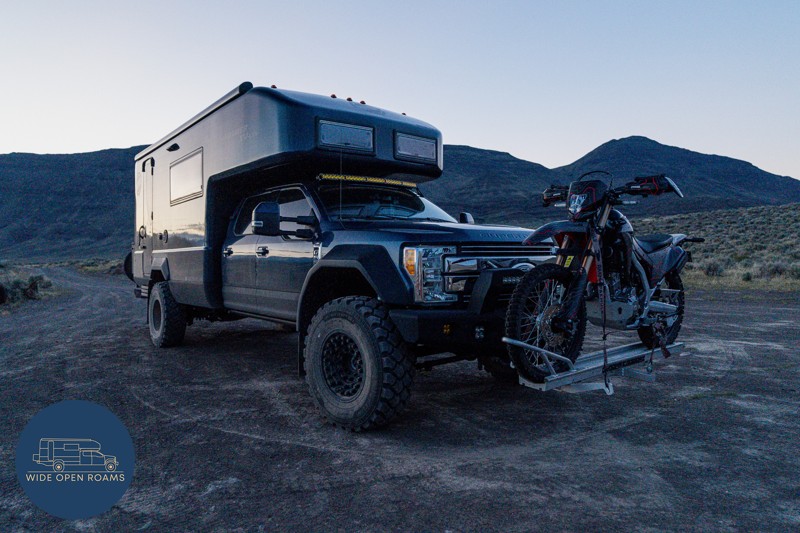
We took the trail out to Mickey Hot Springs while exploring the East Steens area, and it ended up being one of our favorite stops in southeastern Oregon. The drive itself was straightforward and easy ...
Wide Open Roams
Official Crew
Rated 5/5
Open
Visited: 05/03/2026
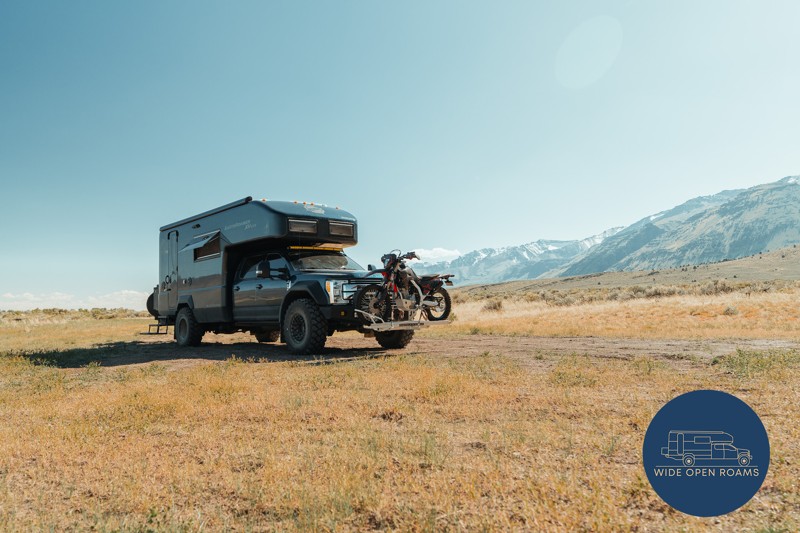
We drove the East Steens Road while making our way through southeastern Oregon and ended up really enjoying this route. Before starting the main stretch along the Steens, we stopped at Borax Lake Hot ...
Wide Open Roams
Official Crew
Rated 4/5
Partially Open
Visited: 04/26/2026
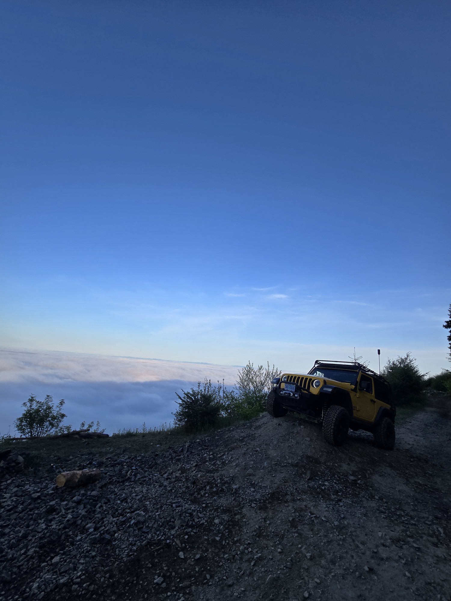
Was a fun and beautiful trail, though not very technical trail from East to West, was only able to get to marker 20? before I had to turn around due to downed trees that would require chainsaw and mor...
Ryan Green
Richard Goins
Rated 4/5
Open
Visited: 01/15/2026
I can see this being an easy trail in good conditions and most of it was pretty tame, but the last big left hand turn near the top is deeply rutted and slick wet clay. Took careful line choice and a l...
A
alhounos
No Rating
Seasonal Closure
Visited: 12/31/2025
According to this trails management agency, the trail is likely closed for the season.
You can reach out to the agency for more details.
Be sure to leave us a report and let us know ...
Trails Offroad
Official Crew
Rated 4/5
Partially Open
Visited: 12/18/2025
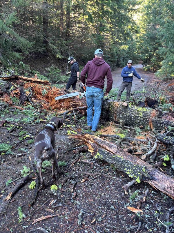
Dozens of trees down on the roads!
My guys and I cleared a dozen or so trees and actually had a good time with our chain saws. Just started running out of daylight. I’m

Steven Ritchie
Most Popular


Updated: 07/30/2025
Horsfall Beach
North Bend, Oregon
Horsfall Beach is a go-to spot for offroad enthusiasts craving a relaxed coastal adventure with a side of adrenaline. Tucked within the Oregon Dunes National Recreation Area, this sprawling sand spit between Coos Bay and the Pacific Ocean offers stunning views, silky-soft sand, and endless opportunities for outdoor fun. It’s a hotspot for OHV (Off-Highway Vehicle) riders, thanks to its designated trails and wide-open dune riding areas. Just be sure to air down before hitting the soft sand.
Access the action from the south at Horsfall Beach Campground and OHV Staging Area, or from the north via Spinreel Campground and OHV Staging Area. While beach camping isn’t allowed, you’ll find plenty of options nearby—from ocean-view campsites nestled in the dunes to public and private OHV campgrounds with direct dune access. Whether you're carving tracks across the beach or simply soaking in the coastal beauty, Horsfall Beach promises a memorable ride.

Updated: 06/05/2022
Old Tractor Road
Wamic, Oregon
Old Tractor Road connects from NF-48 (Barlow Road) down to the Barlow Trail where pioneer wagons once plodded along on their way west toward the promise land of the Willamette Valley during the Oregon Trail days. A mixed scrub oak and pine forest gives way to the open prairies of Central Oregon just after adventurous travelers pass an old abandoned tractor that gives this trail its name. While there are other more extreme trails in the immediate area to connect to the Barlow Trail, Old Tractor Road is a mellow, scenic, and fun way to follow in the footsteps of the wagon trains of the 1840s through 1880s.

Updated: 06/05/2022
Shell Rock Road
Tygh Valley, Oregon
The oak savanna on the eastern ramparts of the Oregon Cascades at the edge of the Central Oregon desert marks the final transition from the wet, fertile valleys and lush, dense forests of the western third of the state into the arid interior; Shell Rock Road bisects the oak savanna on its way to the desert further to the east. The often parched condition of the land along Shell Rock Road creates the right environment for thick, powdery dust reminiscent of the famed Australian "bulldust" to form along long swaths of the road where billowing clouds of dust are the norm during the long dry summer. During the spring when the ground is moist and the grass is green, the thick dust can turn to thick mud. In the winter, the area can be blanketed with snow making Shell Rock Road difficult to find and potentially impossible to pass. The dynamic and changing landscape along Shell Rock Road is a wonderful place to experience a small slice of Central Oregon.

Updated: 09/22/2025
Coffeepot Crater Road
Danner, Oregon
Coffeepot Crater Road can be accessed from Blowout Reservoir Road and will take you directly to Coffee Pot Crater. This crater is the only feature in Jordan Craters that has vehicle access. The crater is steep-sided and well-preserved. The road into the crater is best suited for four-wheel-drive vehicles or vigilant AWD drivers with clearance and wherewithal. This road is not good enough to be traveling after even a quarter-inch of rain: Do not leave the road if this is the case. Camping is allowed at the parking area with limited days posted on signage. Please be mindful that the temperature in the lava fields can be over 120 degrees in the summer. Lava rocks can be sharp, so be mindful of possible falls while hiking.

Updated: 08/11/2026
Burnt Ranch
Twickenham, Oregon
Burnt Ranch Road in Mitchell, Oregon, meanders through a picturesque landscape, offering a gateway to some of the region's most stunning natural attractions. Nestled near the vibrant hues of the Painted Hills, this road goes by Byrd's Point, where panoramic views captivate travelers, and the winding John Day River, a serene and scenic waterway. The road is in good condition and maintained to ensure a smooth journey for visitors. While the area's beauty might entice adventurers to camp along the roadside, it is essential to note that camping is only permitted within designated areas. These include the Burnt Ranch Recreation Site and the Lower Burnt Ranch Campground, both situated by the John Day River, providing well-equipped spots to enjoy the tranquility of the surroundings.

Updated: 04/15/2026
McPhillips Beach
Tierra Del Mar, Oregon
Nestled within the Cape Kiwanda State Natural Area, McPhillips Beach is a picturesque two-mile stretch of sandy coastline that remains one of Oregon Coast's best-kept secrets. Just three miles north of the vibrant Cape Kiwanda and Pacific City, this serene beach offers dramatic scenery defined by colorful sandstone formations, towering cliffs, and steep bluffs. Its peaceful setting makes it a delightful alternative to its busier southern counterparts, though it does attract more visitors during peak seasons.
McPhillips Beach provides the perfect backdrop for your coastal adventures. It’s also uniquely vehicle-accessible, allowing you to drive right onto the beach for a closer view of the rolling Pacific waves—just be cautious of the soft sand to avoid getting stuck!
Accessing McPhillips Beach is straightforward, though the routes are unmarked: choose the subtle access road just south of the charming community of Tierra Del Mar, or find another route approximately 1.3 miles north of the Cape Kiwanda parking lot. Vehicles can be parked at the convenient gravel parking area or driven further downhill towards the shore.
While camping isn't permitted directly on McPhillips Beach, nearby Pacific City offers a variety of accommodation options catering to all tastes and budgets, ensuring visitors can comfortably extend their coastal escape.

Updated: 06/05/2022
Archers Firebreak #28D / Tillamook State Forest
Tillamook, Oregon
Archers Firebreak #28D is a little romp through the forest on top of Archers Ridge. The trail has sections of smooth gravel, sections of dirt track, and a section of muddy trail sunken four feet below the forest floor. This trail is a small part of the larger Archers Firebreak collection of trails that can make for a fun afternoon of exploring in the Tillamook State Forest.

Updated: 10/15/2024
Hess Road
Homestead, Oregon
Hess is one of those trails that makes you gasp at its steepness, but the climb rewards you with jaw-dropping views of the Snake River and Hells Canyon. As you ascend from the arid lower reaches, the landscape transforms dramatically. Sparse grasses and sagebrush give way to dense forests of Ponderosa pines, and as you climb higher, Douglas firs begin to appear. The Wallowa Mountains, cradling the canyon, present a picturesque ensemble of high peaks, alpine meadows, and valleys sculpted by ancient glaciers. This area is teeming with biodiversity; spotting bighorn sheep, deer, eagles, and other wildlife is common.
While no discernible campsites are directly off this road, spurs lead to primitive camping spots. This single-lane trail is unmaintained, and a high-clearance vehicle is advised to navigate the washouts and gullies. Hess can be accessed from the north at Wallowa Mountain Loop or the south at Homestead Road.

Updated: 03/11/2025
Tub Springs Road
Rome, Oregon
Tub Springs Road is a rocky dirt road that offers amazing views of Lower Owyhee River Canyon. The spur towards the trail's southern end is the best part; it's a rocky road that'll take you to an epic view of a horseshoe-shaped bend in the Owyhee River.
This is mostly easy to navigate, but there are occasional steep rocky hills to climb, so 4WD is nice to have but not necessary. However, high clearance is a must for this trek.
Tub Springs Road intersects Kiger Road in the south, which will take you to the Pillars of Rome, a cool rock formation worth checking out. It intersects Rinehart Ranch Road in the north.

Updated: 06/05/2022
#28D Connector / Tillamook State Forest
Tillamook, Oregon
This trail, part of the Archers Firebreak series of trails in the Tillamook State Forest, is not the monster trail it once was. Trail maintenance several years ago returned the trail to something that can be enjoyed by almost any 4x4er exploring the forest. Spectacular views through the trees into the Jordan Creek area are especially rewarding near sunset when the valley below fills with mist and fog and the sky burns pink and yellow to the west.

Updated: 06/05/2022
Archers Firebreak #28I / Tillamook State Forest
Tillamook, Oregon
Archers Firebreak #28I cuts across the top of Archers Ridge on its way west in the series of Archers Firebreak trails. The trail goes through several areas that were recently logged and include some good views of the Jordan Creek Basin. The trail also cuts through healthy second growth forests before ending in a logging landing at the start of the next trail. Stock 4x4s will enjoy this relatively mild trail.

Updated: 10/15/2024
Cow Creek Ridge Road
Vesper, Oregon
Cow Creek Ridge Road is a well-maintained road providing access to the Nicolai OHV area from the south. The road rises quickly to 1200 feet and runs along a ridgeline connecting to Simonsen Road. There is a lot of logging activity in the area, so be aware of the big logging trucks along these narrow roads. There are many side trails leading to beautiful lookouts that would make for fantastic campsites.

Updated: 10/15/2024
Cedar Road
Jordan Creek, Oregon
Cedar Road climbs through a nice forest. Starting at C-Line Road, it dead-ends at a gate after 3.3 miles. There are majestic views of the hills and valleys looking to the south. 4x4 Jeep trails that are accessible via Cedar Road include "7 Up", "Waldo's Way" and "Dog Leg". A few side roads offer limited camping.

Updated: 08/11/2026
Snake River Road
Huntington, Oregon
Snake River Road meanders through lush riparian vegetation along the waterways by the river, showcasing high, velvety green hills, striking basaltic rock outcrops, and sagebrush plateaus. Picturesque campsites dot the water's edge, perfect for casting a line and soaking in the serenity. As part of the Snake River Mormon Basin Back Country Byway, this route welcomes two-wheel and four-wheel drive vehicles, linking the town of Huntington with the charming village of Richlands. While the drive is generally easy, caution is essential on the narrow, shelf-like sections that lack guardrails.

Updated: 10/15/2024
Nicolai Ridge Road
Taylorville, Oregon
Nicolai Ridge Road connects Simonsen Road and Shingle Mill Road while providing the Nicolai OHV Recreation area access. This well-maintained dirt road offers really nice views of the surrounding hills and valleys.

Updated: 10/15/2024
Horse Creek and Joseph Creek Road
Lewis, Oregon
This continuous road has several name changes as you drive it, including FS 4680, Horse Creek Road, and Joseph Creek Road. It begins a gravel road with many potholes at Forest Service Road 46 and runs along the top of Hell’s Canyon. After six miles, the gravel road descends to the river level and, on the way down, becomes a very rough dirt and rock road for about twelve miles. It then becomes a nice gravel road down to the Grande Ronde River. The first and last sections are suitable for driving in any vehicle. The middle section is very rough and slow, requiring ground clearance and durable tires, and four-wheel drive is recommended for going up. This road offers views of the river canyon from the top and bottom, making it a very interesting drive.
No campgrounds are along the road, but dispersed camping is allowed, although only a few pre-disturbed locations exist.

Updated: 10/15/2024
FR2230
Millican, Oregon
This is a point-to-point route that starts at the intersection with FR18 on the east end and ends at the intersection with FR22 on the west end. It is a gravel road subject to significant washboarding. The majority of this route is in the East Fort Rock OHV trail system, so be on the lookout for ATVs and UTVs! There are no suitable camping opportunities along this trail.

Updated: 10/15/2024
Willow Creek Hot Springs
Fields, Oregon
Nestled miles away in the middle of southeast Oregon’s high desert, Willow Creek Hot Springs features a solitary soaking pool. Accessible by an all-season gravel and dirt road, Whitehorse Fifteen Mile, the final stretch, traverses soft dirt that becomes impassable during rain, so timing your visit is crucial.
This unique high desert oasis boasts a pool that remains nearly 102 degrees year-round. Deep and wide, it offers a rare, unspoiled retreat, with only a simple hot/cold water mortar dam marking any improvement.
There are a few dispersed campsites with pit toilets near the springs, picnic tables, and fire rings.

Updated: 09/10/2026
Crooked Meadow
Fort Rock, Oregon
Starting at Highway 31, this route goes west up and alongside Corral Butte and many others! It is a scenic drive that gets pretty steep, with significant ruts and rocks in areas. 4WD and high clearance are highly recommended. Camping areas are plentiful along this route. Please note that you can continue onto Crooked Meadow, numbered 94 on the west end.

Updated: 10/15/2024
Stage Coach Road
Glenwood, Oregon
Stage Coach Road connects "University Falls Road" and "South Fork Road". The road follows a small creek completely shaded, providing a neat rainforest effect with moss growing on the trees. There are a few camping spots on a couple of side roads.

Updated: 10/15/2024
Looking Glass
Tollgate, Oregon
Looking Glass Road is a well-maintained gravel road suitable for any vehicle; it runs from near Troy to FR 63, where it is 18 more miles to Elgin, where fuel, services, and supplies are available. Different sections of 62 follow along the edge of big canyons or cross the Elgin Flat away from the canyons. Almost the entire road is forested, with some sections offering spectacular panoramic views while other sections are more closed. There are no campgrounds along the road, but dispersed camping is allowed, and there are a few established dispersed sites available. The major hazards are dust, minor potholes, and blind curves.

Updated: 10/15/2024
FR94
Chemult, Oregon
Starting at The Dalles-California Highway, this route traverses the Pumice Flats area. True to that name, the pumice dust on this route is plentiful! The road is very dusty, narrow, and steep at times. Also, beware of freshly fallen trees. Overall, pretty much any vehicle with a bit of ground clearance should be fine. There are several side roads that lead to great dispersed camping options.

Updated: 08/11/2026
Three Forks Road
Danner, Oregon
Three Forks Road is a great drive near the Owhyee Canyon Wilderness of Eastern Oregon. This route offers truly amazing views of the Owyhee River Canyon, the best one being the turnout about halfway down the road. There are signs for it; make sure you stop and see it right off the main road.
The gravel road is well-maintained and wide. However, you must watch your speed because there are potholes along the way that can come out of nowhere. And it is an open range, so watch out for livestock on the road.

Updated: 10/15/2024
Lord Flat
Imnaha, Oregon
Lord Flat Road, constructed in 1960 to combat the Pony Bar Fire, is the only access route still open, as the Forest Service closed all other roads in 1985. Though this track is relatively bumpy, it is manageable for a standard 4x4 vehicle. The section of the track leading to Lord Flat offers some of the best and most remote camping in Hells Canyon, as it offers stunning views of canyons, the Wallowa Mountains, and the Seven Devils Mountains.
Historically known as Buckaroo Flat, this area is named after hunter and stockman James Lord. The Lord Flat Airstrip, constructed in 1943 by Tom Willett and Joe Connor under a Forest Service contract, primarily serves hunters during the season. The airstrip, marked by a windsock and white-painted rocks, undergoes occasional volunteer maintenance but remains rough.
If you visit Lord Flat, stop by the historic Dorrance Cow Camp and Cabin. Keep your vehicle clear of the operational airstrip, which has been used since 1943 for both commercial and private aviators. Note that the Forest Service closes this road to vehicle travel from late August through November.

Upgrade your Membership
Unlock all of the details on every Trail Guide and Scout Route.
Start a 7-day Free TrialCommunity
Partners

