


By clicking "ACCEPT", you agree to be the terms and conditions of each policy linked to above. You also agree to the storing of cookies on your device to facilitate the operation and functionality of our site, enhance and customize your user experience, and to analyze how our site is used.
Oregon Off-Road Trails
52
Total Trail Guides 48

409
Detailed Waypoints 127
Try a Free 7-Day Trial and unlock it all
Start a Free Trial Most Recent Trail Reviews
Rated 2/5
Open
Visited: 09/13/2026
I figured this would be boring and it was. This trail has convinced me to stop going for BoH trails.


Francis whitney
Rated 5/5
Open
Visited: 09/06/2026
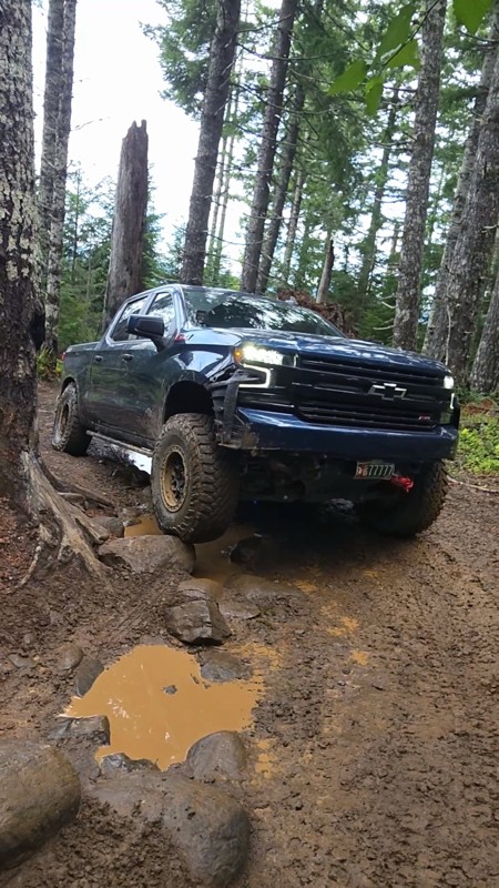
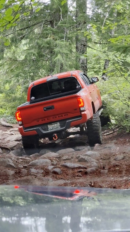
Ran this today. Ground was slick but makes it more dunk I’m in a full-size 1500 on 37s, my buddy is in a Tacoma on 35s, and our other buddy was in a TJ on 33.
Yes it’s tight but we all made it thru ...

Everett Vangsnes
No Rating
Open
Visited: 08/11/2026
Per the MVUM, the trail is seasonally open. As always, check current fire restrictions/closures before venturing out.

Trails Offroad
Official Crew
No Rating
Open
Visited: 08/11/2026
Per the MVUM, the trail is seasonally open. As always, check current fire restrictions/closures before venturing out.

Todd
Official Crew
Todd
Official Crew
No Rating
Open
Visited: 08/11/2026
Per the MVUM, the trail is seasonally open. As always, check current fire restrictions/closures before venturing out.
Trails Offroad
Official Crew
No Rating
Temporary Closure
Visited: 08/07/2026
Closed due to the Fox Fire. https://www.blm.gov/sites/default/files/docs/2026-07/orwa-fpo-val-072626.pdf

Rose Meirs
Official Crew
No Rating
Temporary Closure
Visited: 08/07/2026
Closed due to the Crosswhite Fire. https://www.blm.gov/sites/default/files/docs/2026-08/orwa-fpo-pri-080526.pdf
Rose Meirs
Official Crew
No Rating
Temporary Closure
Visited: 08/07/2026
Closed due to the Crosswhite Fire. https://www.blm.gov/sites/default/files/docs/2026-08/orwa-fpo-pri-080526.pdf
Rose Meirs
Official Crew
No Rating
Temporary Closure
Visited: 08/07/2026
Closed due to the Crosswhite Fire. https://www.blm.gov/sites/default/files/docs/2026-08/orwa-fpo-pri-080526.pdf
Rose Meirs
Official Crew
No Rating
Temporary Closure
Visited: 08/07/2026
Closed due to the Crosswhite Fire. https://www.blm.gov/sites/default/files/docs/2026-08/orwa-fpo-pri-080526.pdf
Rose Meirs
Official Crew
No Rating
Temporary Closure
Visited: 08/07/2026
Closed due to the Big Grass Fire. https://www.blm.gov/sites/default/files/docs/2026-07/orwa-fpo-val-072826.pdf
Rose Meirs
Official Crew
No Rating
Temporary Closure
Visited: 08/07/2026
Closed due to the Big Grass Fire. https://www.blm.gov/sites/default/files/docs/2026-07/orwa-fpo-val-072826.pdf
Rose Meirs
Official Crew
No Rating
Temporary Closure
Visited: 08/07/2026
Closed due to the Big Grassy Fire. https://www.blm.gov/sites/default/files/docs/2026-07/orwa-fpo-val-072826.pdf
Rose Meirs
Official Crew
No Rating
Temporary Closure
Visited: 08/07/2026
Temporary due to the Hat Wildfire. https://www.blm.gov/sites/default/files/docs/2026-07/orwa-fpo-val-072826.pdf
Rose Meirs
Official Crew
No Rating
Temporary Closure
Visited: 08/03/2026
The area is currently closed due to the Grasshopper Fire. More info is available here: https://inciweb.wildfire.gov/incident-information/ormhf-grasshopper

Douglas Van Bossuyt
Official Crew
No Rating
Temporary Closure
Visited: 08/03/2026
The area is currently closed due to the Grasshopper Fire. More info is available here: https://inciweb.wildfire.gov/incident-information/ormhf-grasshopper
Douglas Van Bossuyt
Official Crew
No Rating
Temporary Closure
Visited: 08/03/2026
The area is currently closed due to the Grasshopper Fire. More info is available here: https://inciweb.wildfire.gov/incident-information/ormhf-grasshopper
Douglas Van Bossuyt
Official Crew
No Rating
Temporary Closure
Visited: 08/03/2026
The area is currently closed due to the Grasshopper Fire. More info is available here: https://inciweb.wildfire.gov/incident-information/ormhf-grasshopper
Douglas Van Bossuyt
Official Crew
No Rating
Temporary Closure
Visited: 08/03/2026
The area is currently closed due to the Grasshopper Fire. More info is available here: https://inciweb.wildfire.gov/incident-information/ormhf-grasshopper
Douglas Van Bossuyt
Official Crew
No Rating
Temporary Closure
Visited: 08/03/2026
The area is currently closed due to the Grasshopper Fire. More info is available here: https://inciweb.wildfire.gov/incident-information/ormhf-grasshopper
Douglas Van Bossuyt
Official Crew
No Rating
Temporary Closure
Visited: 08/03/2026
The area is currently closed due to the Grasshopper Fire. More info is available here: https://inciweb.wildfire.gov/incident-information/ormhf-grasshopper
Douglas Van Bossuyt
Official Crew
No Rating
Temporary Closure
Visited: 08/03/2026
The area is currently closed due to the Grasshopper Fire. More info is available here: https://inciweb.wildfire.gov/incident-information/ormhf-grasshopper
Douglas Van Bossuyt
Official Crew
No Rating
Temporary Closure
Visited: 08/03/2026
The area is currently closed due to the Grasshopper Fire. More info is available here: https://inciweb.wildfire.gov/incident-information/ormhf-grasshopper
Douglas Van Bossuyt
Official Crew
No Rating
Temporary Closure
Visited: 08/03/2026
The Grasshopper fire unfortunately burned over the Flag Point Lookout and destroyed the lookout tower. The area is closed for the foreseeable future.
General fire info with links to the specific clo...
Douglas Van Bossuyt
Official Crew
No Rating
Temporary Closure
Visited: 08/01/2026
Trail was closed due to wildfire activity. I was unable to find this out online but maybe try calling Hood River Ranger District at 541-352-6002 before making the drive to confirm if it is open?
MM
Mike Mueller
Open
Visited: 07/12/2026
I ran this backwards (rock quarry entrance to saddle mtn entrance) in my full-size pickup and it was a good time. I didn’t realize I’d taken the rocky bypass until i got to the other side of it (the s...
Everett Vangsnes
No Rating
Open
Visited: 06/26/2026
According to MVUM data, this trail should be open for the season.
Trails Offroad
Official Crew
No Rating
Open
Visited: 06/26/2026
According to MVUM data, this trail should be open for the season.
Trails Offroad
Official Crew
No Rating
Open
Visited: 06/26/2026
According to MVUM data, this trail should be open for the season.
Trails Offroad
Official Crew
No Rating
Open
Visited: 06/26/2026
According to MVUM data, this trail should be open for the season.
Trails Offroad
Official Crew
No Rating
Open
Visited: 06/26/2026
According to MVUM data, this trail should be open for the season.
Trails Offroad
Official Crew
No Rating
Open
Visited: 06/26/2026
According to MVUM data, this trail should be open for the season.
Trails Offroad
Official Crew
No Rating
Open
Visited: 06/26/2026
According to MVUM data, this trail should be open for the season.
Trails Offroad
Official Crew
No Rating
Open
Visited: 06/26/2026
According to MVUM data, this trail should be open for the season.
Trails Offroad
Official Crew
No Rating
Open
Visited: 06/26/2026
According to MVUM data, this trail should be open for the season.
Trails Offroad
Official Crew
Rated 5/5
Open
Visited: 06/19/2026
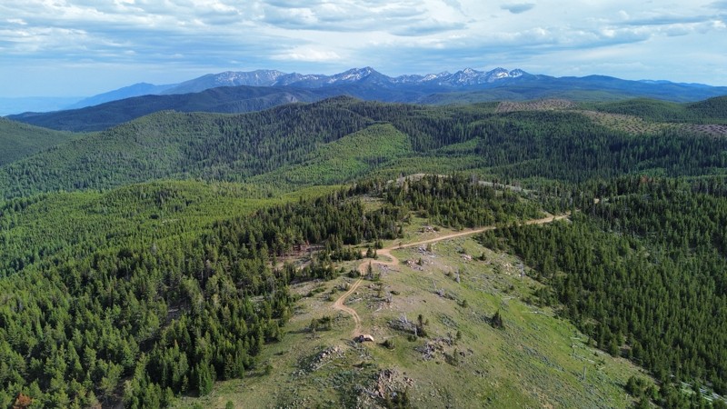
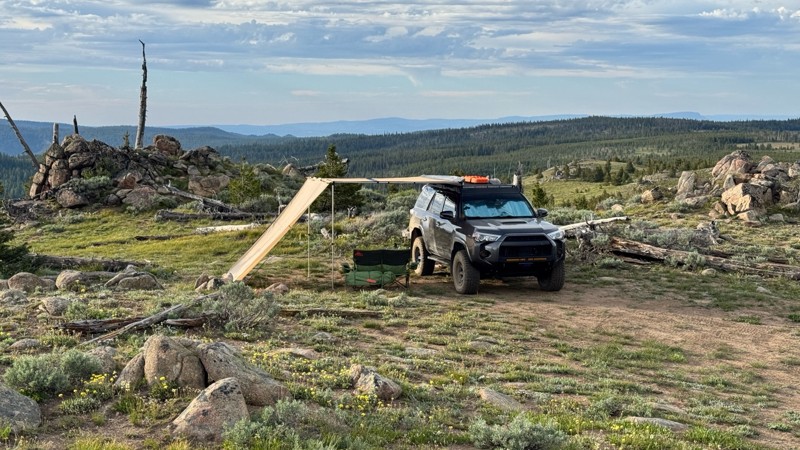
This was an easy dirt road with some logging traffic up until it intersects National Forest Development Road 5125/4350 at 45.06718, -118.21474. After this it becomes noticeably bumpier with larger di...

Andrew T
Open
Visited: 06/05/2026
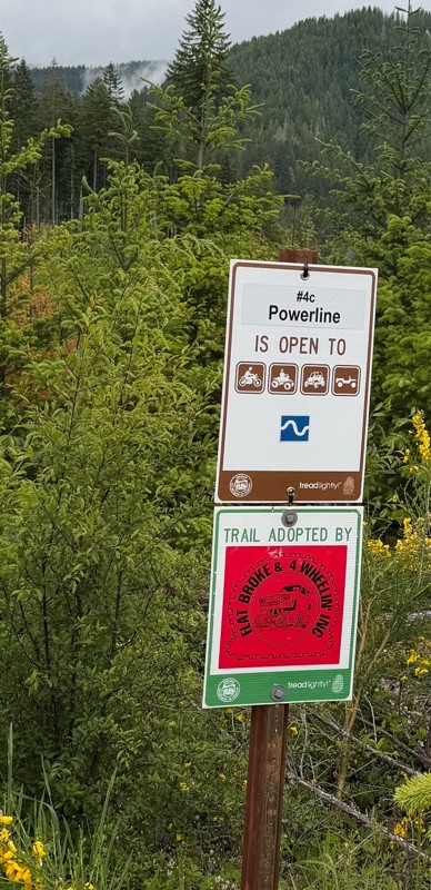
Trail is marked wrong on the map, 4C starts at the end of powerline 4B.
MS
Michael Strange
Rated 5/5
Open
Visited: 05/08/2026
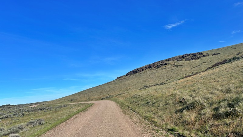
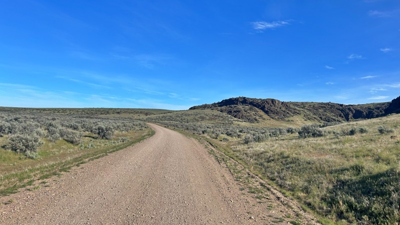
Having visited in May, I can confidently say this is one of the best times to experience the Cow Lakes Recreation Area. The lakes are full, migratory birds fill the marshes, and wildflowers blanket th...
Rose Meirs
Official Crew
Rated 4/5
Open
Visited: 05/07/2026
We tackled Board Corral Trail in our EarthRoamer and found it to be a fun and engaging drive, but one that took considerably longer than we expected. While the trail itself isn't exceptionally difficu...

Wide Open Roams
Official Crew
Rated 5/5
Open
Visited: 05/06/2026
We drove Succor Creek Road as part of our travels through the Owyhee Canyonlands and found it to be one of the easier yet more scenic routes in the region. If you're looking for a relaxing drive that ...
Wide Open Roams
Official Crew
Rated 5/5
Open
Visited: 05/04/2026
Leslie Gulch Road ended up being one of our favorite drives in the Owyhee Canyonlands. The route winds its way down toward Owyhee Lake, passing through some truly unique scenery that feels completely ...
Wide Open Roams
Official Crew
Rated 4/5
Open
Visited: 05/04/2026
We drove Mahogany Gap while exploring the Owyhee region and found it to be a scenic, easy-going route that offers a great introduction to the area. This isn't a trail that challenges your vehicle, but...
Wide Open Roams
Official Crew
Rated 5/5
Open
Visited: 05/03/2026
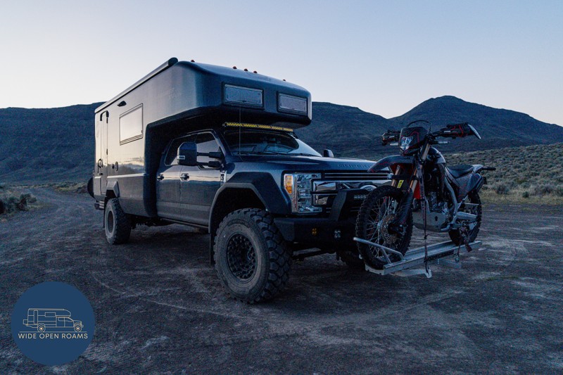
We took the trail out to Mickey Hot Springs while exploring the East Steens area, and it ended up being one of our favorite stops in southeastern Oregon. The drive itself was straightforward and easy ...
Wide Open Roams
Official Crew
Rated 5/5
Open
Visited: 05/03/2026
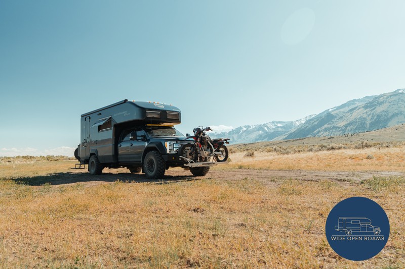
We drove the East Steens Road while making our way through southeastern Oregon and ended up really enjoying this route. Before starting the main stretch along the Steens, we stopped at Borax Lake Hot ...
Wide Open Roams
Official Crew
Rated 4/5
Partially Open
Visited: 04/26/2026
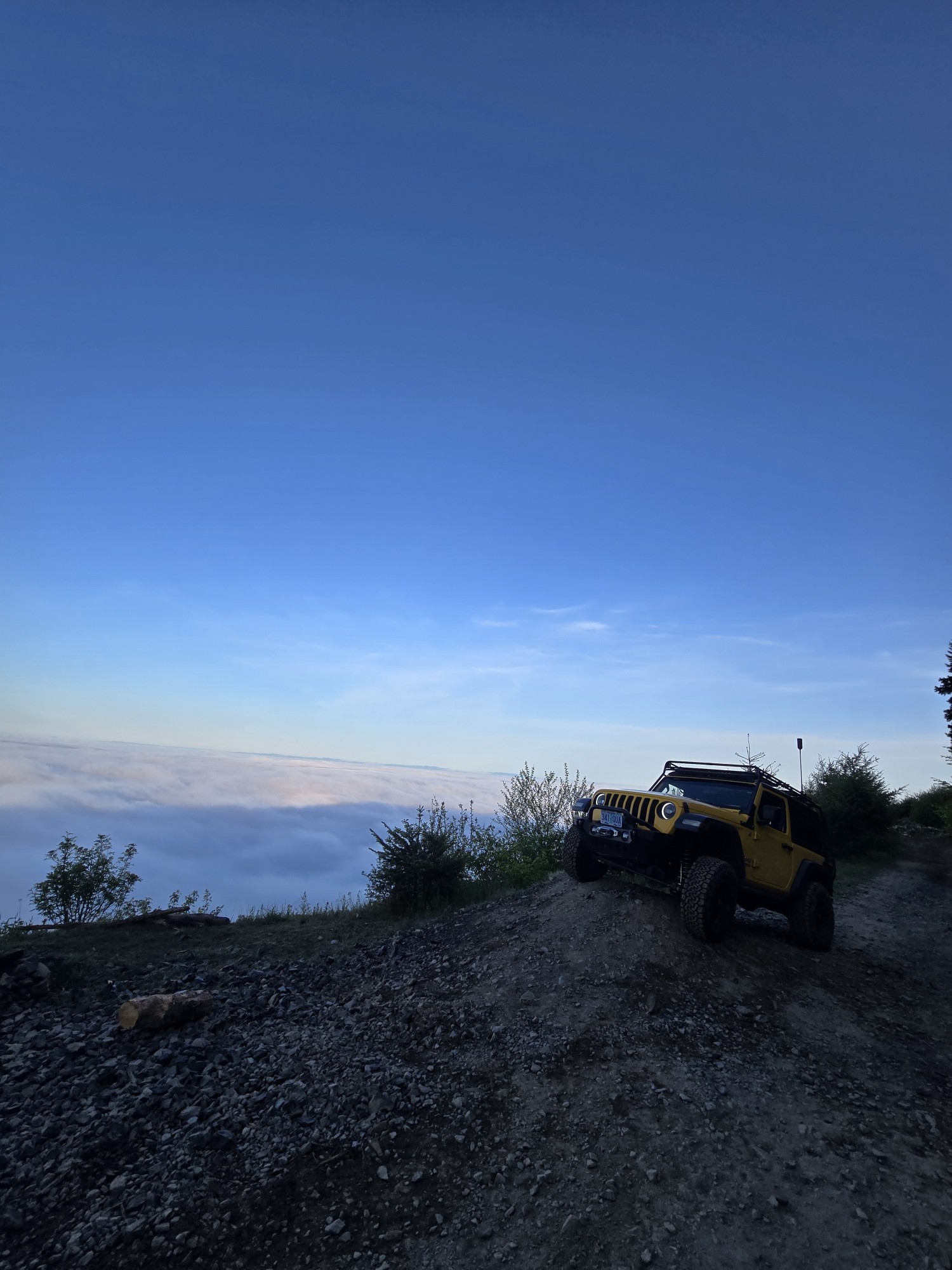
Was a fun and beautiful trail, though not very technical trail from East to West, was only able to get to marker 20? before I had to turn around due to downed trees that would require chainsaw and mor...
Ryan Green
Richard Goins
Rated 4/5
Open
Visited: 01/15/2026
I can see this being an easy trail in good conditions and most of it was pretty tame, but the last big left hand turn near the top is deeply rutted and slick wet clay. Took careful line choice and a l...
A
alhounos
No Rating
Seasonal Closure
Visited: 12/31/2025
According to this trails management agency, the trail is likely closed for the season.
You can reach out to the agency for more details.
Be sure to leave us a report and let us know ...
Trails Offroad
Official Crew
Rated 4/5
Partially Open
Visited: 12/18/2025
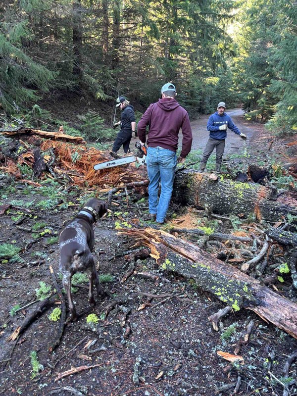
Dozens of trees down on the roads!
My guys and I cleared a dozen or so trees and actually had a good time with our chain saws. Just started running out of daylight. I’m

Steven Ritchie
Most Popular


Updated: 08/11/2026
Bear Creek
Mitchell, Oregon
Bear Creek is the access road to the iconic Painted Hills in the John Day Fossil Beds National Monument. This road follows hills distinguished by varied red, tan, orange, and black stripes.
The yellows, golds, blacks, and reds of the Painted Hills are stunning at all times of the day but are best lit for photography in the late afternoon. Changing light and moisture levels significantly affect the tones and hues visible in the hills. The seasons also radically transform their appearance. Spring brings yellow wildflowers that grow in open areas and even in the ripples of the hills. In winter, the hills can be blanketed in snow, concealing the vibrant hues until the snow melts, revealing interspersed stripes of gold and red.
The road is drivable for passenger cars and provides access to designated trails for a closer view of the hills. Camping is not allowed on this road.

Updated: 10/15/2024
Northrup Creek Road
Vesper, Oregon
Northrup Creek Road follows the Northrup Creek back into a valley and ends at the Northrup Creek Horse Camp. This camp has numerous maintained campsites and is seldom used for equestrian pursuits. The views of this creek and surrounding horse trails make this an excellent place for exploration.

Updated: 04/21/2024
Archers Firebreak #28C / Tillamook State Forest
Tillamook, Oregon
Archers Firebreak #28C is a short segment of the Archers Firebreak complex of trails along the top of Archers Ridge in the Tillamook State Forest. A fun hill climb can be challenging but manageable for stock vehicles. The trail meanders through a young stand of timber on its way west along Archers Ridge.

Updated: 06/03/2025
Siltcoos Beach
Dunes City, Oregon
Just 7 miles south of Florence, Siltcoos Beach sits within the heart of the Oregon Dunes National Recreation Area, offering a unique blend of coastal beauty and offroad adventure. This stretch of shoreline is perfect for beachcombing, birdwatching, and wildlife sightings. Seals are a common sight, and you might even catch a glimpse of whales just offshore.
The access trails to the beach are short but steep, so come ready for a quick descent or climb. Once on the sand, the fun begins. You can cruise north along miles of open shoreline, but don’t forget to air down; this is soft sand territory, and traction is key.
Siltcoos is a well-loved spot for OHV enthusiasts, especially during the high season. Beyond the beach, the adjacent dunes feature a mix of designated trails and open play areas, making it an exciting landscape for experienced 4x4 drivers. While camping directly on the beach isn’t allowed, primitive sites tucked into the dunes are available by reservation, offering a raw and immersive coastal camping experience.
From adrenaline-fueled rides to peaceful sunset views, Siltcoos Beach delivers a bit of everything. Just be mindful of seasonal restrictions during the Snowy Plover nesting season (May 1–September 15), when parts of the beach and some trails are closed to protect these vulnerable birds. Respect the signs, tread lightly, and enjoy the untamed spirit of this unforgettable coastal destination.

Updated: 10/15/2024
Vinegar Hill
Austin, Oregon
Vinegar Hill, also known as Forest Road 2010, is one of the highest-drivable trails in Oregon. Situated in the northeast part of the Malheur National Forest, this elevated area offers spectacular vistas of the North Fork John Day Wilderness, the Middle and North Fork drainages of the John Day River, and the peaks of the Strawberry Mountain Wilderness to the south.
The area is rich in history, with active and decaying remains of mines visible. It offers unparalleled opportunities for solitude and isolation, except during big-game hunting seasons. Vinegar Hill, the highest point in the Greenhorn Mountains, was a significant site during the Gold Rush of the early 1860s. Formerly known as Greenhorn Peak, it began appearing on maps as Vinegar Hill sometime in the 20th century. A pinnacle of green serpentine on the east ridge, referred to as the "Greenhorn," attracted miners to the area, leading to the establishment of many mining sites that can still be explored today.
Forest Service Road 2010 leads to the summit of Vinegar Hill. The road is maintained for roughly 7 miles before becoming a rough 4x4 trail, often blocked by fallen trees and snowdrifts during winter and spring. If following the road, it is almost 6 miles from the end of the maintained road to the summit. Black Butte Camp, located 10 miles up, is entirely unmaintained and serves as a dispersed camping area along this trail.

Updated: 09/10/2026
Stage Station Road
Fort Rock, Oregon
This point-to-point route starts at Highway 31 and ends at Highway 22. The route has some washboarding but is in overall good shape. The whole area is open for dispersed camping, but it is not as appealing as the higher-elevation surrounding areas.

Updated: 06/05/2022
2730-190 Road
Tygh Valley, Oregon
As the 2730-190 Road descends through the forest, the trees begin their slow transformation from alpine species into scrub oak and ponderosa pine. This trail marks the transition from the Cascades full of lush, dense coniferous forests into the dry, open savanna and grasslands of Central Oregon. The road skirts along the south side of the Mount Hood National Recreation Area Fifteen Mile Unit where a deep canyon lays waiting to be discovered by those who hike beyond the trees. An abandoned campground at the terminus of the 2730-190 Road gives the whole route an eerie, forgotten feeling that adds to the mystery of the transition of ecosystems on the way to the Central Oregon desert.

Updated: 11/23/2025
Mt. Defiance
Dee, Oregon
Mount Defiance is a peak near the Columbia River Gorge region of northwestern Oregon. It rises to an elevation of 4,984 feet in the Mark O. Hatfield Wilderness in the Mount Hood National Forest. The peak is in Hood River County, Oregon. If you love amazing, expansive views, then the steep, bumpy crawl to the top of Mt. Defiance is ALL about that. From the summit, look to the south to see Mt Hood, and to the east is Hood River Valley. To the west is Mt. St Helens in Washington, and to the north is the Columbia River and Mt Adams. Apparently, this is an ideal mountain for communication equipment - as there are several buildings and antenna towers at the summit. Please be mindful of this equipment and stay well clear of it all. A perfect picnic spot is along the south side near some large rocks. This spot gives you a great view of the valley and Mt. Hood. The 1.6 miles and 1,165ft elevation gain to the top is all steep, very "bumpy," and requires a slow crawl. This is why solitude is found at the top of Mt Defiance - only the strongest of hikers and high-clearance 4X4 vehicles should attempt this road.

Updated: 10/15/2024
Moores Hollow
Willowcreek, Oregon
Moores Hollow Road is a well-maintained gravel road; any high-clearance vehicle can make it. The arid, barren landscape allows for great views of the surrounding rolling hills and gulches. Tub Mountain is to the south of the trail, and Pine Tree Ridge is on the north side.
This trail travels through BLM land, so camping is allowed off the road. However, there aren't many places to camp, and the ones that exist are not too far off the road.
The trail is located just northwest of Ontario, Oregon, and intersects with other great trails, such as The Old Oregon Trail and Dry Gulch.

Updated: 10/15/2024
FR5825
Crescent Lake Junction, Oregon
This route goes through the Three Trails OHV system. Travel in this area is mainly for ATV use and is required to be on designated trails only. So beware, there may be ATVs cruising on this road as well! The route starts at Highway 58 and stops at the paved portion at the intersection with Two Rivers Road. Overall, the road is in decent shape. There are areas where it is narrow, dusty, and rocky, but pretty much any vehicle with a little ground clearance will be fine.

Updated: 10/15/2024
Upper Imnaha
Fruita, Oregon
Upper Imnaha Road, National Forest Route 3955, and County Road 727 veer off from the Wallowa Mountain Loop just a few miles north of the Hells Canyon Overlook. Curiously, Upper Imnaha Road lies south of town, while Lower Imnaha Road stretches north. This road meanders through some of the most breathtaking countryside of eastern Oregon. As you drive, be ready to stop not only for photos but also for the wildlife that roams freely in this area. Free-range cattle often create impromptu traffic jams, adding a touch of rustic charm to your journey.
Imnaha Road is a well-traveled route, serving as a vital connector for numerous farms and remote homesteads. Imnaha, Oregon, marks the literal end of the pavement—beyond the town's major intersection, the road becomes gravel. Nestled at the terminus of Imnaha Highway and Upper Imnaha Road, this quaint town sits in northeastern Oregon, just west of Hell's Canyon and the Idaho state line.
Legend states that the name "Imnaha" comes from a Native American leader named Imna, with the suffix "ha" added to denote his territory. The Imnaha River, designated a "Wild and Scenic" river, flows through the region, eventually joining the mighty Snake River. No camping is available along this trail as most of the land is privately owned and posted.

Updated: 09/10/2026
Mowich Spring
Silver Lake, Oregon
This is a point-to-point route that starts at the intersection with Bear Flat Road and climbs up and alongside several buttes. The route is in pretty good shape, with little washboarding. There are numerous camping options along the way!

Updated: 10/15/2024
Burnt River Canyon Lane
Bridgeport, Oregon
Burnt Creek Canyon Road is a well-maintained gravel road that follows its namesake creek through a deep and steep canyon. Be prepared for lots of dust, some moderate washboards, and occasional blind curves. It is easy to drive in most any vehicle. There are several dispersed campsites along the road, but be careful to avoid private property and mining claims.
Burnt Creek has active mining areas and, particularly on the western end, piles of rocky mine tailings indicating active mining in the past, possibly with a small dredge or similar equipment. Watch the canyon walls for a possible sighting of big horn sheep!

Updated: 10/15/2024
Two Rivers Road
Chemult, Oregon
This route starts at the unpaved portion of the Two Rivers Road. The first mile or so of the route is in a residential area, so be mindful of your speed to keep the dust down. After leaving the residential area, the road gets narrow and is extremely rutted. As this is a route through the Three Trails OHV area, the maintenance on it seems to be lacking. Also, be aware of ATVs cruising the road! It is a loop road that ends up back on FR5825, just a couple of miles from where you started. While there are dispersed camping options, they may not be the best since the ATV traffic can be high.

Updated: 10/15/2024
East Fork Beech Creek
Mount Vernon, Oregon
East Fork Beech Creek Road, also known as Forest Road 36, is a picturesque route in Oregon that winds through the lush landscapes of the Malheur National Forest. This scenic road offers travelers stunning views of dense forests, tranquil creeks, and abundant wildlife, attracting nature enthusiasts, hikers, and photographers to its serene beauty.
East Fork Beech Creek Road provides access to various outdoor activities such as camping, fishing, and birdwatching, as well as Magone Lake, a popular fishing alpine lake. The gravel road is well-maintained from Highway 395 to Middle Fork Road, making it suitable for RVs and passenger vehicles. Along the route are spurs for dispersed camping and one designated campground, Lower Camp Creek Campground, which has a nightly fee.

Updated: 10/15/2024
FR 7015
Diamond Lake, Oregon
This wooded point-to-point two-track is within reach of Crater Lake National Park's North Entrance Road! Ample dispersed camping opportunities for both large and small setups dot this area. If you have a larger vehicle (motorhome or towing a trailer), accessing this trail from the southern end is recommended. The road at that point is a little larger and can better accommodate larger rigs.

Updated: 10/15/2024
Eagle Creek Road
Pine, Oregon
Eagle Creek, also called Forest Road 77, is a 50-mile-long gravel road that is suitable for any vehicle, ranging from one to two lanes wide. It runs from Highway 86 in the southeast to Oregon 203 in the northwest. Eagle Creek Road begins in a dry, grassy desert area with excellent panoramic views and ascends into the National Forest, where it becomes FS 77. Once in the forest, the trees line the road and limit the expansive views. As you approach the northwest end of the road, the trees open up again, providing great vistas. There are two campgrounds and numerous opportunities for dispersed camping.
Flagstaff Butte is a must-see attraction along the route. The road to the butte is rocky and rutted, requiring good ground clearance. While four-wheel drive is not necessary, good tires are recommended. The views from the top are incredible, with rugged peaks nearby and distant valleys on the other side. There are countless other side roads suitable for exploration in an appropriate vehicle.
The main hazards include thick dust, moderate washboards, and some blind curves. Additionally, there are private land in-holdings along the route that must be respected at all times.

Updated: 07/30/2025
Umpqua Dunes
Tenmile, Oregon
The Umpqua Dunes, nestled within the Oregon Dunes National Recreation Area, are one of the most striking features along the Oregon coast and one of the largest coastal sand dune systems in North America. These towering dunes, the tallest in the recreation area, rise dramatically above a patchwork of marshes, tree islands, and lakes, creating a truly unique and ever-shifting landscape.
While there’s no direct OHV access to the beach from this section, the dunes themselves are a playground for offroad enthusiasts. Riders can climb the soft, silty peaks for breathtaking views of the Pacific Ocean. It can be a workout for your rig, but making the effort is well worth it. Be sure to air down before you hit the sand! The area boasts two large day-use OHV staging areas, reservable sand camping sites, and nearby OHV-friendly facilities managed by Douglas County Parks, making Umpqua a must-visit for anyone looking to experience the thrill of the dunes.

Updated: 10/15/2024
Old Oregon Trail
Eaton, Oregon
The Old Oregon Trail is a historic trail through the Snake River Valley and the golden rolling hills and gulches of Eastern Oregon. This route was actually part of the trail that the settlers used on the Oregon Trail with their wagons, although we recommend using a motorized vehicle. 4WD is unnecessary for this trail; any high-clearance vehicle can make it.
Near the north of the trail is Love Reservoir. There is a spur that will take you down the eastern shore of the lake; however, there is no lake access from the road.
Most of the trail is dirt, with non-technical rocky patches. Additionally, this trail is part of a great trail system, and you can do a loop with the Dry Gulch Road in the south. The middle section also intersects Moores Hollow.

Updated: 06/04/2026
Mahogany Gap
Rockville, Oregon
Mahogany Gap Road is a wonderful drive through the Jordan Valley region of Eastern Oregon. The views of Spring Mountain and the rest of the Owhyee Mountain Range are spectacular! Chevally Reservoir is a nice little lake towards the south end of the trail.
The road itself is a rocky dirt road with a couple of small dry creek crossings. Although they could present a hazard after a storm, we do not advise driving this trail after a storm. High clearance is needed, but not 4WD unless it's muddy.
This trail intersects with Highway 95 in the southeast and Succor Creek Road in the north and runs through BLM land. There are a few camping options but no designated campgrounds.

Updated: 10/15/2024
Whitehorse Fifteen Mile
Andrews, Oregon
Whitehorse Fifteen Mile, or Trout Creek Road, is an access trail into the Trout Creek Mountains running between the Willow Creek Wilderness Study Area and Fifteen Mile Wilderness Study Area. Accessing this rugged terrain depends on the season, requiring a high-clearance vehicle and dry conditions, typically after mid-May when the snow has melted. There are no noticeable campsites off this road, but this road also provides primary access to the iconic Willow Creek Hot Springs Campground, which offers excellent dispersed camping choices.

Updated: 10/15/2024
FR2415
Silver Lake, Oregon
This section of FR 2415 connects Silver Lake Road at the south end to Highway 31 at the north end. The area is very picturesque. The road is dusty but in relatively good condition. Beware of flying Turkeys! There are several small side roads that lead to dispersed camping areas

Updated: 11/12/2025
Wolf Creek
Hot Lake, Oregon
Wolf Creek Lane, also known as Forest Road 4315, is a well-maintained route that begins in the Wallowa-Whitman National Forest and winds its way to the Wolf Creek Reservoir, nestled in the foothills of the Elkhorn Mountains. The road offers picturesque scenery with stunning views of the Elkhorn Mountains. There are spurs for dispersed camping and a boat launch along the lake. This trail is suitable for both passenger and recreational vehicles.

Updated: 10/15/2024
Olive Lake
Granite, Oregon
Olive Lake Drive, also known as Forest Road 10, is a picturesque route in the heart of Oregon. This road meanders through the Umatilla National Forest, offering travelers a scenic drive through lush forests, diverse wildlife, and tranquil landscapes. Olive Lake, a key highlight of the route, provides fishing, camping, and hiking opportunities, making it a popular destination for outdoor enthusiasts. The road is primarily gravel, so visitors should be prepared for a rustic driving experience.
There are three separate campgrounds along the route: Olive Lake Campground, Welch Creek Campground, and Tollbridge Campground. Each offers designated camping areas for RVs and tents for a fee. Additionally, dispersed primitive camping can be found on various spurs, turnoffs, and trailheads along the trail.
The area around Olive Lake is rich in history. The dam and gates on the north side of the lake were constructed as part of a hydroelectric system to support gold mining activities in the northern Blue Mountain Region. Historically, water from the lake flowed through a wooden pipeline to the historic Fremont Powerhouse, which produced electricity for mines and towns in the area. The Fremont Powerhouse is located approximately 7 miles east of Olive Lake, and the historic mining town of Granite is 12 miles east of Olive Lake along Forest Road 73.

Upgrade your Membership
Unlock all of the details on every Trail Guide and Scout Route.
Start a 7-day Free TrialCommunity
Partners

