


By clicking "ACCEPT", you agree to be the terms and conditions of each policy linked to above. You also agree to the storing of cookies on your device to facilitate the operation and functionality of our site, enhance and customize your user experience, and to analyze how our site is used.
Oregon Off-Road Trails
52
Total Trail Guides 48

409
Detailed Waypoints 127
Try a Free 7-Day Trial and unlock it all
Start a Free Trial Most Recent Trail Reviews
Rated 2/5
Open
Visited: 09/13/2026
I figured this would be boring and it was. This trail has convinced me to stop going for BoH trails.


Francis whitney
Rated 5/5
Open
Visited: 09/06/2026
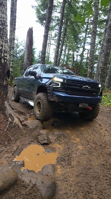
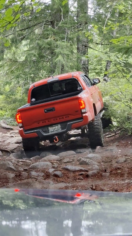
Ran this today. Ground was slick but makes it more dunk I’m in a full-size 1500 on 37s, my buddy is in a Tacoma on 35s, and our other buddy was in a TJ on 33.
Yes it’s tight but we all made it thru ...

Everett Vangsnes
No Rating
Open
Visited: 08/11/2026
Per the MVUM, the trail is seasonally open. As always, check current fire restrictions/closures before venturing out.

Trails Offroad
Official Crew
No Rating
Open
Visited: 08/11/2026
Per the MVUM, the trail is seasonally open. As always, check current fire restrictions/closures before venturing out.

Todd
Official Crew
Todd
Official Crew
No Rating
Open
Visited: 08/11/2026
Per the MVUM, the trail is seasonally open. As always, check current fire restrictions/closures before venturing out.
Trails Offroad
Official Crew
No Rating
Temporary Closure
Visited: 08/07/2026
Closed due to the Fox Fire. https://www.blm.gov/sites/default/files/docs/2026-07/orwa-fpo-val-072626.pdf

Rose Meirs
Official Crew
No Rating
Temporary Closure
Visited: 08/07/2026
Closed due to the Crosswhite Fire. https://www.blm.gov/sites/default/files/docs/2026-08/orwa-fpo-pri-080526.pdf
Rose Meirs
Official Crew
No Rating
Temporary Closure
Visited: 08/07/2026
Closed due to the Crosswhite Fire. https://www.blm.gov/sites/default/files/docs/2026-08/orwa-fpo-pri-080526.pdf
Rose Meirs
Official Crew
No Rating
Temporary Closure
Visited: 08/07/2026
Closed due to the Crosswhite Fire. https://www.blm.gov/sites/default/files/docs/2026-08/orwa-fpo-pri-080526.pdf
Rose Meirs
Official Crew
No Rating
Temporary Closure
Visited: 08/07/2026
Closed due to the Crosswhite Fire. https://www.blm.gov/sites/default/files/docs/2026-08/orwa-fpo-pri-080526.pdf
Rose Meirs
Official Crew
No Rating
Temporary Closure
Visited: 08/07/2026
Closed due to the Big Grass Fire. https://www.blm.gov/sites/default/files/docs/2026-07/orwa-fpo-val-072826.pdf
Rose Meirs
Official Crew
No Rating
Temporary Closure
Visited: 08/07/2026
Closed due to the Big Grass Fire. https://www.blm.gov/sites/default/files/docs/2026-07/orwa-fpo-val-072826.pdf
Rose Meirs
Official Crew
No Rating
Temporary Closure
Visited: 08/07/2026
Closed due to the Big Grassy Fire. https://www.blm.gov/sites/default/files/docs/2026-07/orwa-fpo-val-072826.pdf
Rose Meirs
Official Crew
No Rating
Temporary Closure
Visited: 08/07/2026
Temporary due to the Hat Wildfire. https://www.blm.gov/sites/default/files/docs/2026-07/orwa-fpo-val-072826.pdf
Rose Meirs
Official Crew
No Rating
Temporary Closure
Visited: 08/03/2026
The area is currently closed due to the Grasshopper Fire. More info is available here: https://inciweb.wildfire.gov/incident-information/ormhf-grasshopper

Douglas Van Bossuyt
Official Crew
No Rating
Temporary Closure
Visited: 08/03/2026
The area is currently closed due to the Grasshopper Fire. More info is available here: https://inciweb.wildfire.gov/incident-information/ormhf-grasshopper
Douglas Van Bossuyt
Official Crew
No Rating
Temporary Closure
Visited: 08/03/2026
The area is currently closed due to the Grasshopper Fire. More info is available here: https://inciweb.wildfire.gov/incident-information/ormhf-grasshopper
Douglas Van Bossuyt
Official Crew
No Rating
Temporary Closure
Visited: 08/03/2026
The area is currently closed due to the Grasshopper Fire. More info is available here: https://inciweb.wildfire.gov/incident-information/ormhf-grasshopper
Douglas Van Bossuyt
Official Crew
No Rating
Temporary Closure
Visited: 08/03/2026
The area is currently closed due to the Grasshopper Fire. More info is available here: https://inciweb.wildfire.gov/incident-information/ormhf-grasshopper
Douglas Van Bossuyt
Official Crew
No Rating
Temporary Closure
Visited: 08/03/2026
The area is currently closed due to the Grasshopper Fire. More info is available here: https://inciweb.wildfire.gov/incident-information/ormhf-grasshopper
Douglas Van Bossuyt
Official Crew
No Rating
Temporary Closure
Visited: 08/03/2026
The area is currently closed due to the Grasshopper Fire. More info is available here: https://inciweb.wildfire.gov/incident-information/ormhf-grasshopper
Douglas Van Bossuyt
Official Crew
No Rating
Temporary Closure
Visited: 08/03/2026
The area is currently closed due to the Grasshopper Fire. More info is available here: https://inciweb.wildfire.gov/incident-information/ormhf-grasshopper
Douglas Van Bossuyt
Official Crew
No Rating
Temporary Closure
Visited: 08/03/2026
The area is currently closed due to the Grasshopper Fire. More info is available here: https://inciweb.wildfire.gov/incident-information/ormhf-grasshopper
Douglas Van Bossuyt
Official Crew
No Rating
Temporary Closure
Visited: 08/03/2026
The Grasshopper fire unfortunately burned over the Flag Point Lookout and destroyed the lookout tower. The area is closed for the foreseeable future.
General fire info with links to the specific clo...
Douglas Van Bossuyt
Official Crew
No Rating
Temporary Closure
Visited: 08/01/2026
Trail was closed due to wildfire activity. I was unable to find this out online but maybe try calling Hood River Ranger District at 541-352-6002 before making the drive to confirm if it is open?
MM
Mike Mueller
Open
Visited: 07/12/2026
I ran this backwards (rock quarry entrance to saddle mtn entrance) in my full-size pickup and it was a good time. I didn’t realize I’d taken the rocky bypass until i got to the other side of it (the s...
Everett Vangsnes
No Rating
Open
Visited: 06/26/2026
According to MVUM data, this trail should be open for the season.
Trails Offroad
Official Crew
No Rating
Open
Visited: 06/26/2026
According to MVUM data, this trail should be open for the season.
Trails Offroad
Official Crew
No Rating
Open
Visited: 06/26/2026
According to MVUM data, this trail should be open for the season.
Trails Offroad
Official Crew
No Rating
Open
Visited: 06/26/2026
According to MVUM data, this trail should be open for the season.
Trails Offroad
Official Crew
No Rating
Open
Visited: 06/26/2026
According to MVUM data, this trail should be open for the season.
Trails Offroad
Official Crew
No Rating
Open
Visited: 06/26/2026
According to MVUM data, this trail should be open for the season.
Trails Offroad
Official Crew
No Rating
Open
Visited: 06/26/2026
According to MVUM data, this trail should be open for the season.
Trails Offroad
Official Crew
No Rating
Open
Visited: 06/26/2026
According to MVUM data, this trail should be open for the season.
Trails Offroad
Official Crew
No Rating
Open
Visited: 06/26/2026
According to MVUM data, this trail should be open for the season.
Trails Offroad
Official Crew
Rated 5/5
Open
Visited: 06/19/2026
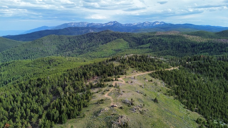
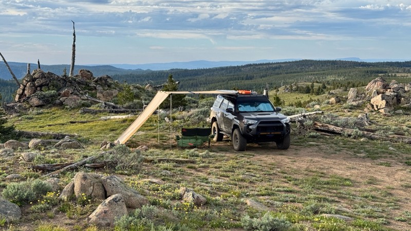
This was an easy dirt road with some logging traffic up until it intersects National Forest Development Road 5125/4350 at 45.06718, -118.21474. After this it becomes noticeably bumpier with larger di...

Andrew T
Open
Visited: 06/05/2026
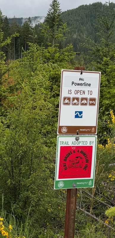
Trail is marked wrong on the map, 4C starts at the end of powerline 4B.
MS
Michael Strange
Rated 5/5
Open
Visited: 05/08/2026
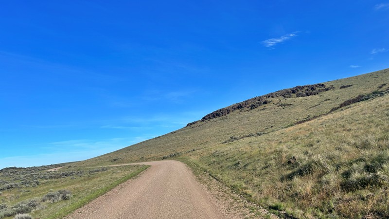
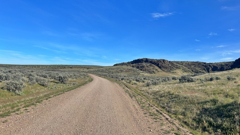
Having visited in May, I can confidently say this is one of the best times to experience the Cow Lakes Recreation Area. The lakes are full, migratory birds fill the marshes, and wildflowers blanket th...
Rose Meirs
Official Crew
Rated 4/5
Open
Visited: 05/07/2026
We tackled Board Corral Trail in our EarthRoamer and found it to be a fun and engaging drive, but one that took considerably longer than we expected. While the trail itself isn't exceptionally difficu...

Wide Open Roams
Official Crew
Rated 5/5
Open
Visited: 05/06/2026
We drove Succor Creek Road as part of our travels through the Owyhee Canyonlands and found it to be one of the easier yet more scenic routes in the region. If you're looking for a relaxing drive that ...
Wide Open Roams
Official Crew
Rated 5/5
Open
Visited: 05/04/2026
Leslie Gulch Road ended up being one of our favorite drives in the Owyhee Canyonlands. The route winds its way down toward Owyhee Lake, passing through some truly unique scenery that feels completely ...
Wide Open Roams
Official Crew
Rated 4/5
Open
Visited: 05/04/2026
We drove Mahogany Gap while exploring the Owyhee region and found it to be a scenic, easy-going route that offers a great introduction to the area. This isn't a trail that challenges your vehicle, but...
Wide Open Roams
Official Crew
Rated 5/5
Open
Visited: 05/03/2026
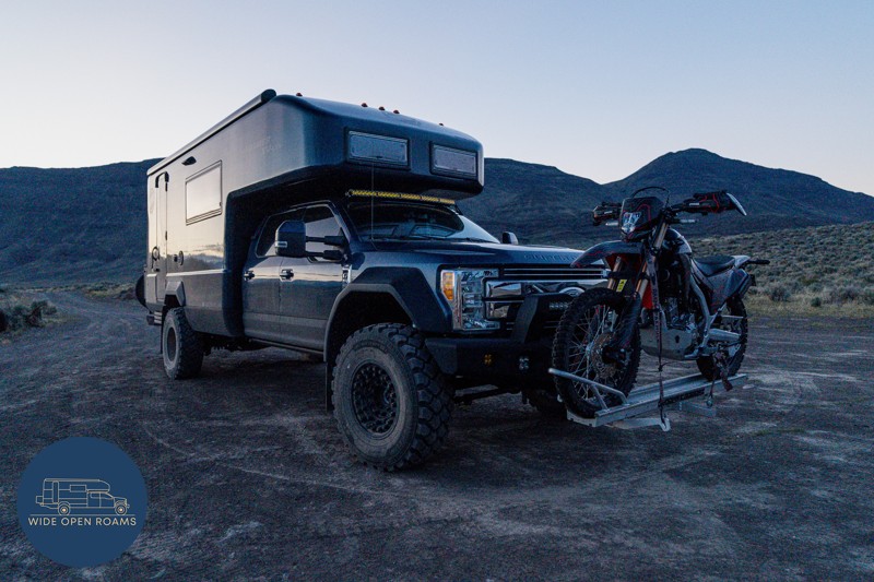
We took the trail out to Mickey Hot Springs while exploring the East Steens area, and it ended up being one of our favorite stops in southeastern Oregon. The drive itself was straightforward and easy ...
Wide Open Roams
Official Crew
Rated 5/5
Open
Visited: 05/03/2026
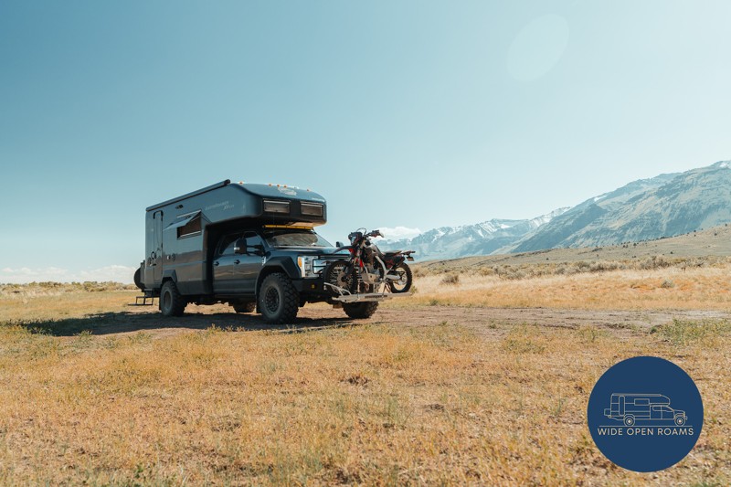
We drove the East Steens Road while making our way through southeastern Oregon and ended up really enjoying this route. Before starting the main stretch along the Steens, we stopped at Borax Lake Hot ...
Wide Open Roams
Official Crew
Rated 4/5
Partially Open
Visited: 04/26/2026
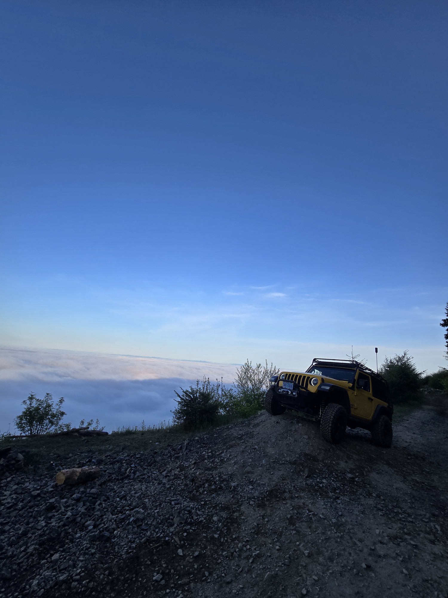
Was a fun and beautiful trail, though not very technical trail from East to West, was only able to get to marker 20? before I had to turn around due to downed trees that would require chainsaw and mor...
Ryan Green
Richard Goins
Rated 4/5
Open
Visited: 01/15/2026
I can see this being an easy trail in good conditions and most of it was pretty tame, but the last big left hand turn near the top is deeply rutted and slick wet clay. Took careful line choice and a l...
A
alhounos
No Rating
Seasonal Closure
Visited: 12/31/2025
According to this trails management agency, the trail is likely closed for the season.
You can reach out to the agency for more details.
Be sure to leave us a report and let us know ...
Trails Offroad
Official Crew
Rated 4/5
Partially Open
Visited: 12/18/2025
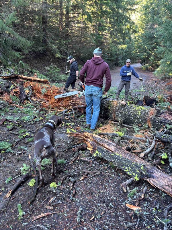
Dozens of trees down on the roads!
My guys and I cleared a dozen or so trees and actually had a good time with our chain saws. Just started running out of daylight. I’m

Steven Ritchie
Most Popular


Updated: 10/15/2024
Zumwalt Road
Joseph, Oregon
Zumwalt Road is a gravel road located in NE Oregon, near Joseph. It is suitable for all vehicles and passes through the open prairie leading to the Wallowa-Whitman National Forest. The road also goes through the Zumwalt Prairie Preserve, which is managed by the Nature Conservancy. The Preserve features several marked hiking trails and an information kiosk not far from the main road. From many points along the road, you can see the rugged mountain peaks south of Joseph. To the east, towards the north end, you can also see the deep, rocky canyons of the Hell's Canyon region.
Camping is not allowed on the road because it is bordered by private land or the Preserve. The main hazards on the road are dust and moderate washboards.

Updated: 10/15/2024
Basin Gulch Road
Harper, Oregon
Basin Gulch Road is a great drive through canyons, buttes, rolling hills, and gulches, offering amazing views of the surrounding arid and rugged terrain. This trail has a few creek crossings that are normally dry but pretty rocky. After it rains, beware of flash floods and avoid this trail. A couple of sections of this rocky trail require 4WD and high clearance. During the drive, you travel through an open range where livestock might be present.
The Basin Gulch trail runs from Highway 20 in the north and connects to Rock Canyon Road in the southeast, making for a great loop.

Updated: 10/15/2024
FS 1663/Otis Valley Road
Frost Mill, Oregon
Starting off labeled as FS 1663, the road will join Otis Valley Road. It is a well-maintained gravel road going south from FS 16 and is suitable for almost any vehicle. When it leaves the National Forest, the name is changed to Otis Valley Road. While in the forest the views along 1663 are limited by trees with only a few places to get a longer view, however, the views are magnificent from the Antelope Lookout! The road to Antelope Lookout is about 100 yards east of the intersection of 1663 and FS14 on the right. This short stretch of road does not require 4WD but does need good ground clearance and good tires. After leaving the forest, the landscape opens up into range land and pastures.
Dispersed camping is allowed, but there are very few established sites. There are no campgrounds along 1663.
In the northern part of 1663, prior to the intersection with FS 14, the forest understory and most of the mature trees are being cleared back about 150 feet from the road to make a fire defense zone in the event of a wildfire in the area.
Please note that maps show this road name changing several different times. It could be referred to as NF-1663, Otis Valley, Prarie-Dewsey Road, and even NF-16.

Updated: 10/15/2024
East End
Encina, Oregon
East End Road, also known as Forest Road 11, is a scenic route in Oregon. It winds through the lush landscapes of the Wallowa-Whitman National Forest. This picturesque drive is surrounded by towering trees and diverse wildlife, providing a tranquil escape for outdoor enthusiasts. Along the way, the road offers access to various recreational activities such as hiking, camping, and bird watching.
The section between Eberle Creek on the east side to 245 at Dooley Summit is relatively easy to navigate. However, once you cross 245, the trail becomes more challenging and is not recommended for passenger vehicles due to numerous washouts and gullies. While no designated campsites exist, spurs and turnoffs along the route offer secluded areas for primitive and dispersed camping. Remember that some sections of the trail pass through private property, so staying on the designated path and respecting posted signs is essential. East End Road truly showcases Oregon's beauty and tranquility.

Updated: 10/15/2024
Hat Point
Imnaha, Oregon
Nestled within the Wallowa-Whitman National Forest, the journey to the summit follows Hat Point Road, a narrow, bumpy gravel road typically open from June through October. Although passenger cars with decent clearance can navigate this route, a 4x4 vehicle is recommended. The road's initial six miles feature a challenging 16% grade, making it steep and difficult for RVs to maneuver and turn around. The absence of guardrails and the narrow path can be unnerving, especially if you encounter oncoming traffic. Low-clearance vehicles, RVs, and trailers should exercise caution on the lower sections, especially in wet or frozen conditions, which make the route challenging in late fall and winter.
The summit rewards visitors with breathtaking views of Hells Canyon and the Snake River. Legend says that Hat Point was named after a cowboy who lost his hat in the brush while riding an unruly horse. The road is long, dusty, and riddled with washboards, but the spectacular scenery makes the journey worthwhile.
Perched high above Hells Canyon, the Hat Point Overlook and Day Use Area provides stunning vistas of the canyon and the Wild and Scenic Snake River. Interpretive panels along the site offer rich insights into the canyon's history, while a climb up the 82-foot tall fire lookout tower enhances the panoramic views of the river and rugged landscape below. This tower, built in 1948, is one of Oregon's highest. While there are areas along the trail to pull off and set up dispersed camping, a designated campground is near the Hat Point Overlook and Day Use Area on Sacajawea Road.

Updated: 10/15/2024
Summit Ridge
Homestead, Oregon
Summit Ridge winds through a tapestry of stunning landscapes, offering an unforgettable journey into the heart of nature. This trail begins just past the Hells Canyon Overlook entrance, where the earth seems to fall away, revealing the awe-inspiring depths of Hells Canyon, the deepest river gorge in North America. The panoramic views stretch endlessly, with the Snake River carving a path far below, offering a humbling reminder of nature's grandeur.
Continuing along the road, your adventure leads you to the historic McGraw Ridge Lookout. Perched high above the treetops, this lookout provides a bird's-eye view of the sprawling wilderness, a testament to the forest's untamed beauty. The lookout, a sentinel of the past, stands as a tribute to the forest rangers who once kept watch over these lands.
As you navigate this trail, the blend of natural beauty and historical significance makes National Forest Developed Road 3965 a gateway to the region's most spectacular and serene places. Whether you're an avid hiker, a wildlife enthusiast, or simply seeking a peaceful retreat, this road offers a journey of discovery and wonder.
The section from PO Saddle Trailhead to Western Rim National Recreation Trail past Saulsberry Saddle is closed from late September to June 15th every year due to deer and elk archery season. This trail is an unmaintained forest road, but it is manageable for a high-clearance vehicle in either two or all-wheel drive. There are several camping opportunities, whether at a trailhead with pit toilets or primitive camping in a secluded meadow with mountain views.

Updated: 08/11/2026
Castro Ridge Road
Danner, Oregon
4WD and high clearance are necessary on Castro Ridge Road, a rocky road with off-camber sections. As you travel along Castro Ridge just south of Jordan Valley, you can enjoy great views of the Owyhee Mountains.
This is a good connector trail if you want to reach Soldier Creek Road in the east, Three Forks Road in the west, or Gulch Place Road in the middle of this trail. You travel through an open range, so beware of cattle on the road.
There is a small creek crossing that is about a foot or two deep. Do not travel on this trail after a storm, as there could be several water hazards.

Updated: 08/11/2026
Twickenham-Burnt Ranch
Twickenham, Oregon
Twickenham-Burnt Ranch Road is a primary access route to the Priest Hole Recreation Site. This well-maintained gravel road offers travelers picturesque views of the scenic John Day River as it winds its way alongside the Sutton Mountain Wilderness Study Area. Suitable for passenger and recreational vehicles, the road provides a smooth journey through this captivating landscape. Though there are no campsites along the trail, and the land on both sides is mostly privately owned, the drive is a visual delight, showcasing the natural beauty of central Oregon.

Updated: 10/15/2024
Fish Lake Loop
Homestead, Oregon
Nestled in the heart of the Wallowa Mountains, the picturesque Fish Lake Loop offers a delightful escape into nature's splendor. With stunning views and thrilling trout fishing, it's the perfect antidote to summer heat. Adjacent to Fish Lake, Fish Lake Campground beckons as a high-elevation retreat where campers can fish, boat, hike, and swim to their heart's content.
The Fish Lake Loop is a gateway to hiking trails and serene lakes, including Duck, Twin, and Fish Lakes. Whether you prefer primitive camping or designated campsites, there are plenty of options to suit your style. This straightforward loop can be accessed from Wallowa Mountain Road in the north or the south through Halfway. The gravel road is easy to navigate and welcoming to all vehicles, making your journey to this natural haven a breeze.

Updated: 10/15/2024
Homestead Road
Copperfield, Oregon
Homestead railbed, once destined to be a bustling railway line for the Northwest Railway Company, has found new life as an off-road fit for two- and four-wheel drive vehicles. Nestled within the legendary Hell Canyon—the deepest canyon in the United States, surpassing even the Grand Canyon—this trail promises some of the most breathtaking scenery imaginable. Homestead offers campsites that range from primitive retreats to more developed spots with pit toilets, fire rings, and picnic tables with choices along the river or roadside. Winding alongside the Snake River, anglers can find perfect places to cast their lines, all while immersed in nature's splendor. This trail is an in-and-out and the southern access to Hess Road, which ascends into the Wallowa - Whitman National Forest.

Updated: 08/11/2026
Priest Hole
Twickenham, Oregon
For a rustic overnight stay deep in central Oregon, drive past the Painted Hills, one of Oregon’s Seven Wonders, and continue into John Day River Territory to the Priest Hole Recreation Site. This primitive camping spot places you in the heart of the Wild and Scenic John Day River, celebrated for its breathtaking scenery, abundant wildlife, and unique geological features. Camping is allowed throughout the area, including on the gravel bar northeast of Priest Hole, where you can fall asleep to the gurgle of the river and step out of your tent or trailer with your feet in the water. Always be mindful of rattlesnakes!
The site is open year-round, but the rough road can make access challenging in winter. Amenities are minimal, with just one toilet and no potable water, trash cans, or campsite facilities. Fire restrictions are in place from June 1 to September 30, allowing only liquid gas or propane.
Camping or floating the one-mile section around Priest Hole is free, though hunting and fishing licenses are required.

Updated: 10/15/2024
Ackerman
Sheaville, Oregon
Ackerman Road is a tricky drive to navigate, but the surrounding buttes and Oywhee Mountains provide some great views. There are several gates that you have to pass through, and most of them are BLM gates. However, near the trail's south end, you’ll come to a locked gate for private farmland on the main road and have to take the turnoff onto Downey Canyon, which leads to Highway 95.
Some off-camber sections of this rocky dirt road require 4WD and high clearance. Segments of the trail have overgrown vegetation down the middle of the road, and there is one part where the trail disappears, but you can see the other side.

Updated: 10/15/2024
Dixie Butte Lookout
Austin, Oregon
Perched at the eastern end of the John Day Valley and overlooking Prairie City, Dixie Butte, also known as Forest Road 2610, offers an unparalleled viewpoint of the Blue Mountains. One can enjoy a grand view of the Elkhorn, Strawberry, Aldrich, and Greenhorn Mountains from the summit, with the Monument Rock Wilderness and Castle Rock also visible to the southeast. When the lighting is correct, the Ochoco's flat-topped Lookout Mountain silhouette can be seen in the distant west. The area is also known for its summer wildflower displays.
Dixie Butte was named by Civil War veterans who settled Dixie Creek, establishing gold mining claims during the gold rush of the 1860s and 1870s. Historically, over 20,000 ounces of gold were extracted from Dixie Creek. Local rumor suggests a donkey engine, an immobile steam engine used for pulling logs early in the 20th century, is located somewhere on Dixie Butte.
Established as a fire detection site as early as 1911, Dixie Butte initially featured a lookout connected by telephone line. 1921, a D-6 cupola lookout house was built, and a wood frame garage was added in 1934. The lookout house was replaced in 1935 by a 14'x14 ′ L-4 ground cab, referenced in the Malheur National Forest Archive as an Aladdin plan 14'x14 ′ lookout house. In the fall of 1967, a windstorm damaged the structure, leading to the construction of a new lookout in 1968. This 15'x15 ′ R-6 flat-top ground house-style lookout still stands today and remains one of the few staffed lookouts in Oregon.
The road to Dixie Butte is rough, and high-clearance vehicles are recommended due to washouts and gullies. The only visible camping area is at the beginning of the trail.

Updated: 10/15/2024
Clark's Creek Road
Elgin, Oregon
Clark Creek Road starts as a good gravel road outside of Elgin, Oregon. It ends as FS 470 when it meets FS 62 as a rough two-track. The center section of the road goes through some commercial timberland managed by Hancock Forest Management Company, where the road is gravel and dirt and fairly well maintained. Due to sections of significant rutting, this road requires a high clearance vehicle. Four-wheel drive is not required when the road is dry. To protect the road surface, it should not be driven when wet.
There are a few views along parts of Clark Creek Road. However, once it enters the national forest and becomes FS 470, the views are limited due to the thick forest. Dispersed camping is allowed in the national forest, but no pre-disturbed locations exist.

Updated: 08/11/2026
Crowley Riverside Road
Crowley, Oregon
Crowley Riverside Road runs alongside a dried-up riverbed and provides great views of the Northern Steens Mountain Range. The road is mainly gravel with some small rocky sections. 4WD is not needed; any vehicle can handle this road.
The north end of the trail will hit a private locked gate, but you can take Rinehart Ranch Road and come down Tub Springs Road for a really nice loop with awesome scenery. No camping is found along this trail.

Updated: 10/15/2024
2310
Kirk, Oregon
This trail goes from FS2308 on the west end to Sun Mountain Road on the east end. It is the main access to residential areas close to Sun Mountain Road in addition to the Scott Creek campground. This is truly a hidden gem campground. Scott Creek runs right by the campground, which is non-reservable and free. Yes, it's still free. While it does have a vault toilet, it is not cleaned or maintained regularly, so bring your own toilet paper. That aside, there is room for probably 6-8 campsites. If you find an opening, enjoy your stay in the cool shade next to the creek. Make sure to bring bug spray to combat the tiny flying velociraptors.
The trail continues up the mountain, connecting with 2308. The upper part of the trail is steep, narrow, rocky, and dusty. High clearance and 4WD are recommended. However, any vehicle can easily get to the campground.

Updated: 10/15/2024
Shell Rock Road
Adrian, Oregon
Shell Rock Road is an incredible drive through the scenic eastern Oregon countryside on BLM land. The long rolling hills and majestic buttes and mountains are not to be missed. Deer Butte, located at the southern end of the trail, is the highlight; the views of the butte and North Fork Rock Spring Canyon are amazing!
4WD and high clearance are a must, as there are some off-camber sections where the sandy tracks are very deep and worn. The northern section has some vegetation in the middle of the road, which can reach several feet in height. The plants on the trail can be thick at times, and you will need to go slow to plow through them. This can be challenging and teeth-clenching at times.
The trail goes through an open range, so beware of livestock on the road. There are many other great trails in the area. Twin Buttes Road and Cow Hollow Road are two that this trail intersects with.

Updated: 10/15/2024
Willow Creek Road
Ironside, Oregon
Willow Creek Road is a delightful off-pavement workaround for a section of Highway 26. It is a well-maintained gravel road easily driven by almost any vehicle; however, washboard sections exist. The southwest end starts on Highway 26 and follows the Malheur River for about 8 miles along the bottom of a deep, steep canyon. About halfway along the road is the Malheur Reservoir, and there are several opportunities for camping near the water.

Updated: 07/24/2025
Grassy Mountain Road
Danner, Oregon
Grassy Mountain Road is a scenic drive through the golden rolling hills of Eastern Oregon. About seven miles from the northwest end of the trail, there is a turnoff that leads to spectacular views of the Owyhee River Canyon. It is a short detour, but not to be missed. There is an area to camp here, but it isn’t very big, and it’s on BLM land.
4WD is not needed, but high clearance is, and good all-terrain tires are recommended, as the road has many jagged rocks. The trail goes through an open range, so beware of livestock on the road. This trail intersects Three Forks Road, a great drive with amazing views of the Owyhee River Canyon.

Updated: 10/15/2024
Black Mountain
Salisbury, Oregon
Black Mountain Road, or National Forest 1145/2220, is a scenic route within the Wallowa-Whitman National Forest in Oregon, near the serene Phillips Lake.
As you travel along Black Mountain Road, you'll be immersed in the region's natural beauty. The road meanders through dense forests of towering Douglas fir, western hemlock, and various pine species. Occasional clearings reveal breathtaking views of Phillips Lake and the surrounding valleys and streams. Wide enough to accommodate recreation vehicles and trailers, the road is a well-maintained gravel path.
Rich in wildlife, the area along Black Mountain Road is ideal for observing deer, elk, black bears, and various bird species. The nearby Phillips Lake enhances the experience, offering additional opportunities for fishing, boating, and camping.

Updated: 02/04/2026
Desolation Butte Lookout
Susanville, Oregon
Lookout Road, also known as Forest Road 10103, leads to the summit of Desolation Butte and its historic lookout in the Umatilla National Forest with unequaled views of the Blue Mountains. Initially established in 1918, the current Desolation Butte lookout was built in 1961, replacing a 7x7 cabin from 1923 that stood on a 50-foot open steel tower. The present lookout features a USFS R6 Flat Top cabin design atop a 67-foot open timber tower actively staffed each summer. The trail is accessible by a high-clearance vehicle, though no designated camping areas are along the route. For camping near the lookout tower, seeking permission from the staffed lookout is necessary.

Updated: 10/15/2024
FR-3940
Fox, Oregon
Forest Road 3940 provides a charming detour off Highway 395, starting at the peak of Long Creek Mountain Summit. It meanders through the picturesque Malheur National Forest, eventually reconnecting with Highway 395 near Mountain Rest. Along this trail, travelers are treated to expansive views of the Long Creek Valley and distant glimpses of Strawberry Mountain. The road is generally manageable for passenger vehicles, though it is a single lane, requiring caution, especially when pulling a camping trailer. Numerous spurs and pull-offs along the way offer opportunities for dispersed camping.

Updated: 07/08/2025
Wellamotkin Drive
Zumwalt, Oregon
Wellamotkin Drive (Forest Road 46) is an easy gravel road suitable for any vehicle, running from near Zumwalt Road to FS 4625, Chesnimnus Road. It mostly follows the top of a ridge, offering spectacular views along the way. The eastern section runs parallel to Hell's Canyon, with magnificent views from Buckhorn Overlook near Buckhorn campground. On the western side, you'll find Red Hill Lookout (which is closed), with great views of the rolling forests. The road to Buckhorn Overlook is a bit rough, but it should be navigable for any high clearance vehicle.
Camping is available at multiple campgrounds along FS 46. Dispersed camping is allowed, but there are no obvious pre-disturbed sites.

Updated: 10/15/2024
Boundary Butte
Kirk, Oregon
This road goes from the Dalles-California Highway on the east to the Sun Mountain Road on the west. It has steep and narrow spots, but overall, it is in pretty decent shape. Like all routes in this area, there is a lot of dust and potential for fallen trees.

Upgrade your Membership
Unlock all of the details on every Trail Guide and Scout Route.
Start a 7-day Free TrialCommunity
Partners

