


By clicking "ACCEPT", you agree to be the terms and conditions of each policy linked to above. You also agree to the storing of cookies on your device to facilitate the operation and functionality of our site, enhance and customize your user experience, and to analyze how our site is used.
Oregon Off-Road Trails
52
Total Trail Guides 48

409
Detailed Waypoints 127
Try a Free 7-Day Trial and unlock it all
Start a Free Trial Most Recent Trail Reviews
Rated 2/5
Open
Visited: 09/13/2026
I figured this would be boring and it was. This trail has convinced me to stop going for BoH trails.

Francis whitney
Rated 5/5
Open
Visited: 09/06/2026
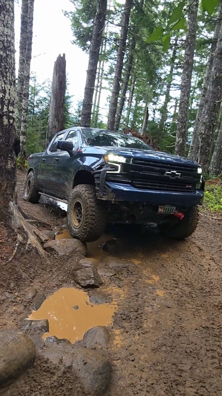
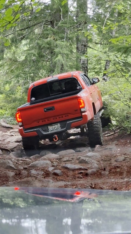
Ran this today. Ground was slick but makes it more dunk I’m in a full-size 1500 on 37s, my buddy is in a Tacoma on 35s, and our other buddy was in a TJ on 33.
Yes it’s tight but we all made it thru ...

Everett Vangsnes
No Rating
Open
Visited: 08/11/2026
Per the MVUM, the trail is seasonally open. As always, check current fire restrictions/closures before venturing out.

Trails Offroad
Official Crew
No Rating
Open
Visited: 08/11/2026
Per the MVUM, the trail is seasonally open. As always, check current fire restrictions/closures before venturing out.

Todd
Official Crew
Todd
Official Crew
No Rating
Open
Visited: 08/11/2026
Per the MVUM, the trail is seasonally open. As always, check current fire restrictions/closures before venturing out.
Trails Offroad
Official Crew
No Rating
Temporary Closure
Visited: 08/07/2026
Closed due to the Fox Fire. https://www.blm.gov/sites/default/files/docs/2026-07/orwa-fpo-val-072626.pdf

Rose Meirs
Official Crew
No Rating
Temporary Closure
Visited: 08/07/2026
Closed due to the Crosswhite Fire. https://www.blm.gov/sites/default/files/docs/2026-08/orwa-fpo-pri-080526.pdf
Rose Meirs
Official Crew
No Rating
Temporary Closure
Visited: 08/07/2026
Closed due to the Crosswhite Fire. https://www.blm.gov/sites/default/files/docs/2026-08/orwa-fpo-pri-080526.pdf
Rose Meirs
Official Crew
No Rating
Temporary Closure
Visited: 08/07/2026
Closed due to the Crosswhite Fire. https://www.blm.gov/sites/default/files/docs/2026-08/orwa-fpo-pri-080526.pdf
Rose Meirs
Official Crew
No Rating
Temporary Closure
Visited: 08/07/2026
Closed due to the Crosswhite Fire. https://www.blm.gov/sites/default/files/docs/2026-08/orwa-fpo-pri-080526.pdf
Rose Meirs
Official Crew
No Rating
Temporary Closure
Visited: 08/07/2026
Closed due to the Big Grass Fire. https://www.blm.gov/sites/default/files/docs/2026-07/orwa-fpo-val-072826.pdf
Rose Meirs
Official Crew
No Rating
Temporary Closure
Visited: 08/07/2026
Closed due to the Big Grass Fire. https://www.blm.gov/sites/default/files/docs/2026-07/orwa-fpo-val-072826.pdf
Rose Meirs
Official Crew
No Rating
Temporary Closure
Visited: 08/07/2026
Closed due to the Big Grassy Fire. https://www.blm.gov/sites/default/files/docs/2026-07/orwa-fpo-val-072826.pdf
Rose Meirs
Official Crew
No Rating
Temporary Closure
Visited: 08/07/2026
Temporary due to the Hat Wildfire. https://www.blm.gov/sites/default/files/docs/2026-07/orwa-fpo-val-072826.pdf
Rose Meirs
Official Crew
No Rating
Temporary Closure
Visited: 08/03/2026
The area is currently closed due to the Grasshopper Fire. More info is available here: https://inciweb.wildfire.gov/incident-information/ormhf-grasshopper

Douglas Van Bossuyt
Official Crew
No Rating
Temporary Closure
Visited: 08/03/2026
The area is currently closed due to the Grasshopper Fire. More info is available here: https://inciweb.wildfire.gov/incident-information/ormhf-grasshopper
Douglas Van Bossuyt
Official Crew
No Rating
Temporary Closure
Visited: 08/03/2026
The area is currently closed due to the Grasshopper Fire. More info is available here: https://inciweb.wildfire.gov/incident-information/ormhf-grasshopper
Douglas Van Bossuyt
Official Crew
No Rating
Temporary Closure
Visited: 08/03/2026
The area is currently closed due to the Grasshopper Fire. More info is available here: https://inciweb.wildfire.gov/incident-information/ormhf-grasshopper
Douglas Van Bossuyt
Official Crew
No Rating
Temporary Closure
Visited: 08/03/2026
The area is currently closed due to the Grasshopper Fire. More info is available here: https://inciweb.wildfire.gov/incident-information/ormhf-grasshopper
Douglas Van Bossuyt
Official Crew
No Rating
Temporary Closure
Visited: 08/03/2026
The area is currently closed due to the Grasshopper Fire. More info is available here: https://inciweb.wildfire.gov/incident-information/ormhf-grasshopper
Douglas Van Bossuyt
Official Crew
No Rating
Temporary Closure
Visited: 08/03/2026
The area is currently closed due to the Grasshopper Fire. More info is available here: https://inciweb.wildfire.gov/incident-information/ormhf-grasshopper
Douglas Van Bossuyt
Official Crew
No Rating
Temporary Closure
Visited: 08/03/2026
The area is currently closed due to the Grasshopper Fire. More info is available here: https://inciweb.wildfire.gov/incident-information/ormhf-grasshopper
Douglas Van Bossuyt
Official Crew
No Rating
Temporary Closure
Visited: 08/03/2026
The area is currently closed due to the Grasshopper Fire. More info is available here: https://inciweb.wildfire.gov/incident-information/ormhf-grasshopper
Douglas Van Bossuyt
Official Crew
No Rating
Temporary Closure
Visited: 08/03/2026
The Grasshopper fire unfortunately burned over the Flag Point Lookout and destroyed the lookout tower. The area is closed for the foreseeable future.
General fire info with links to the specific clo...
Douglas Van Bossuyt
Official Crew
No Rating
Temporary Closure
Visited: 08/01/2026
Trail was closed due to wildfire activity. I was unable to find this out online but maybe try calling Hood River Ranger District at 541-352-6002 before making the drive to confirm if it is open?
MM
Mike Mueller
Open
Visited: 07/12/2026
I ran this backwards (rock quarry entrance to saddle mtn entrance) in my full-size pickup and it was a good time. I didn’t realize I’d taken the rocky bypass until i got to the other side of it (the s...
Everett Vangsnes
No Rating
Open
Visited: 06/26/2026
According to MVUM data, this trail should be open for the season.
Trails Offroad
Official Crew
No Rating
Open
Visited: 06/26/2026
According to MVUM data, this trail should be open for the season.
Trails Offroad
Official Crew
No Rating
Open
Visited: 06/26/2026
According to MVUM data, this trail should be open for the season.
Trails Offroad
Official Crew
No Rating
Open
Visited: 06/26/2026
According to MVUM data, this trail should be open for the season.
Trails Offroad
Official Crew
No Rating
Open
Visited: 06/26/2026
According to MVUM data, this trail should be open for the season.
Trails Offroad
Official Crew
No Rating
Open
Visited: 06/26/2026
According to MVUM data, this trail should be open for the season.
Trails Offroad
Official Crew
No Rating
Open
Visited: 06/26/2026
According to MVUM data, this trail should be open for the season.
Trails Offroad
Official Crew
No Rating
Open
Visited: 06/26/2026
According to MVUM data, this trail should be open for the season.
Trails Offroad
Official Crew
No Rating
Open
Visited: 06/26/2026
According to MVUM data, this trail should be open for the season.
Trails Offroad
Official Crew
Rated 5/5
Open
Visited: 06/19/2026
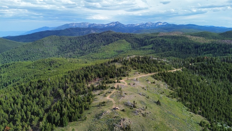
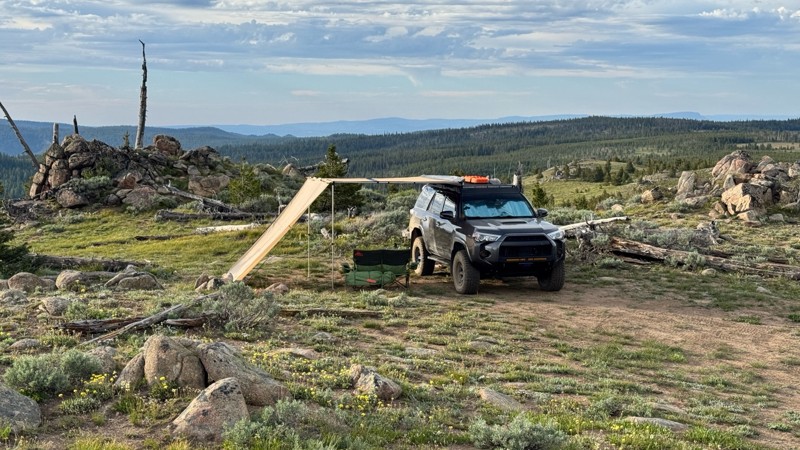
This was an easy dirt road with some logging traffic up until it intersects National Forest Development Road 5125/4350 at 45.06718, -118.21474. After this it becomes noticeably bumpier with larger di...

Andrew T
Open
Visited: 06/05/2026
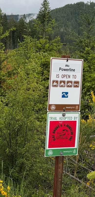
Trail is marked wrong on the map, 4C starts at the end of powerline 4B.
MS
Michael Strange
Rated 5/5
Open
Visited: 05/08/2026
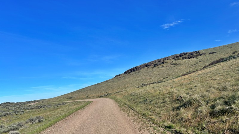
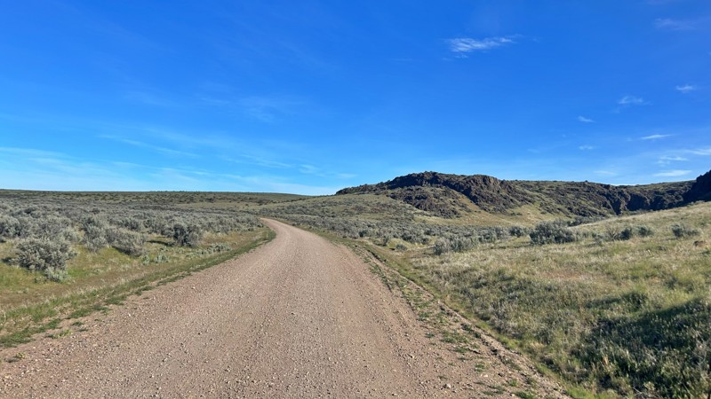
Having visited in May, I can confidently say this is one of the best times to experience the Cow Lakes Recreation Area. The lakes are full, migratory birds fill the marshes, and wildflowers blanket th...
Rose Meirs
Official Crew
Rated 4/5
Open
Visited: 05/07/2026
We tackled Board Corral Trail in our EarthRoamer and found it to be a fun and engaging drive, but one that took considerably longer than we expected. While the trail itself isn't exceptionally difficu...

Wide Open Roams
Official Crew
Rated 5/5
Open
Visited: 05/06/2026
We drove Succor Creek Road as part of our travels through the Owyhee Canyonlands and found it to be one of the easier yet more scenic routes in the region. If you're looking for a relaxing drive that ...
Wide Open Roams
Official Crew
Rated 5/5
Open
Visited: 05/04/2026
Leslie Gulch Road ended up being one of our favorite drives in the Owyhee Canyonlands. The route winds its way down toward Owyhee Lake, passing through some truly unique scenery that feels completely ...
Wide Open Roams
Official Crew
Rated 4/5
Open
Visited: 05/04/2026
We drove Mahogany Gap while exploring the Owyhee region and found it to be a scenic, easy-going route that offers a great introduction to the area. This isn't a trail that challenges your vehicle, but...
Wide Open Roams
Official Crew
Rated 5/5
Open
Visited: 05/03/2026
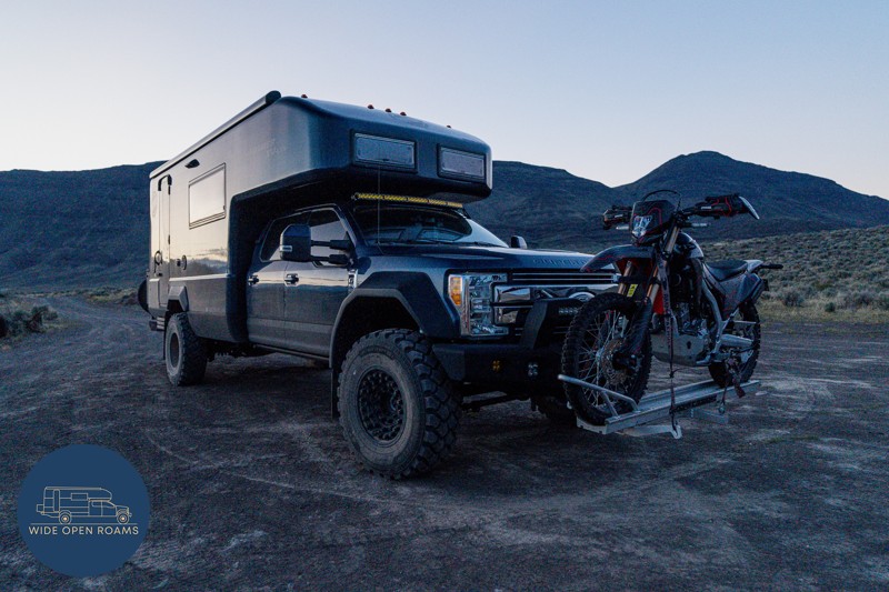
We took the trail out to Mickey Hot Springs while exploring the East Steens area, and it ended up being one of our favorite stops in southeastern Oregon. The drive itself was straightforward and easy ...
Wide Open Roams
Official Crew
Rated 5/5
Open
Visited: 05/03/2026
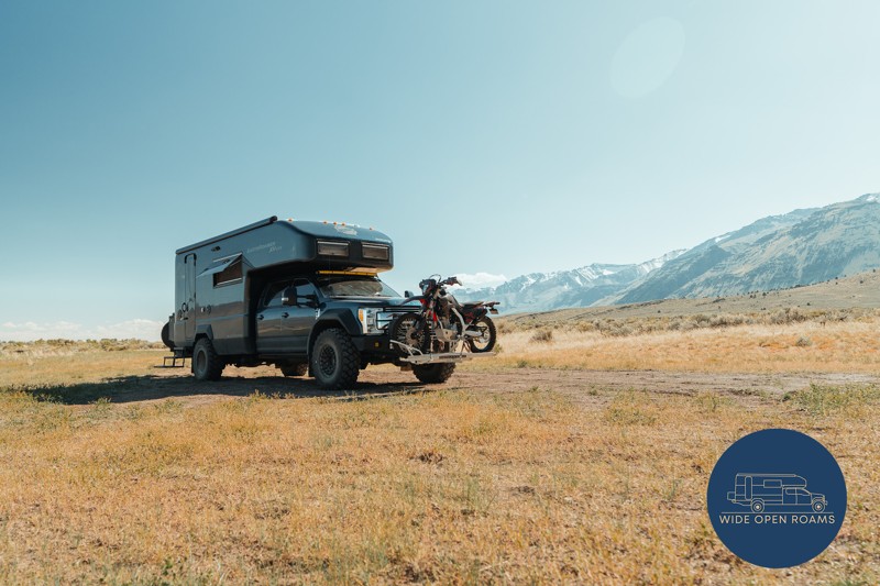
We drove the East Steens Road while making our way through southeastern Oregon and ended up really enjoying this route. Before starting the main stretch along the Steens, we stopped at Borax Lake Hot ...
Wide Open Roams
Official Crew
Rated 4/5
Partially Open
Visited: 04/26/2026
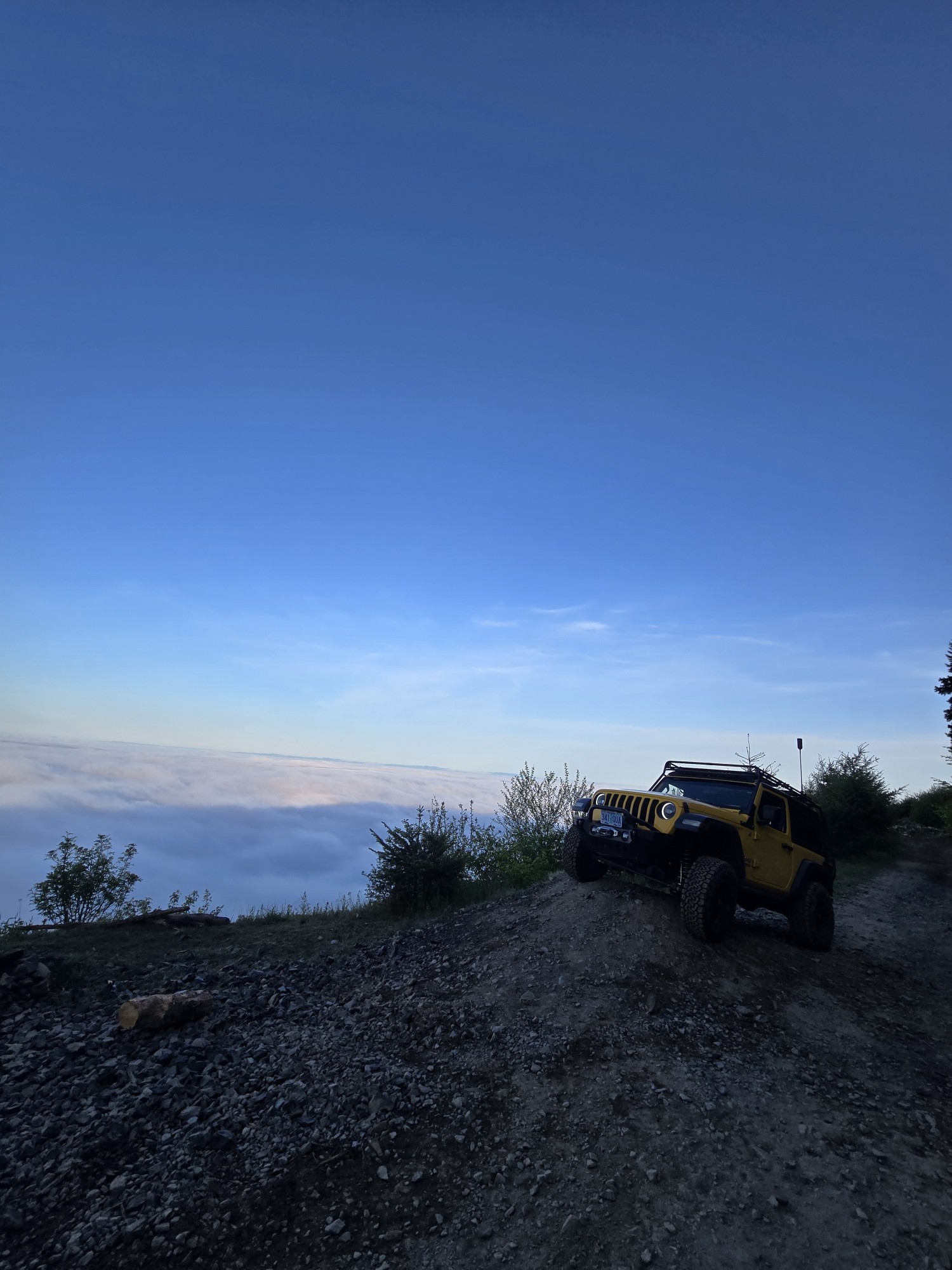
Was a fun and beautiful trail, though not very technical trail from East to West, was only able to get to marker 20? before I had to turn around due to downed trees that would require chainsaw and mor...
Ryan Green
Richard Goins
Rated 4/5
Open
Visited: 01/15/2026
I can see this being an easy trail in good conditions and most of it was pretty tame, but the last big left hand turn near the top is deeply rutted and slick wet clay. Took careful line choice and a l...
A
alhounos
No Rating
Seasonal Closure
Visited: 12/31/2025
According to this trails management agency, the trail is likely closed for the season.
You can reach out to the agency for more details.
Be sure to leave us a report and let us know ...
Trails Offroad
Official Crew
Rated 4/5
Partially Open
Visited: 12/18/2025
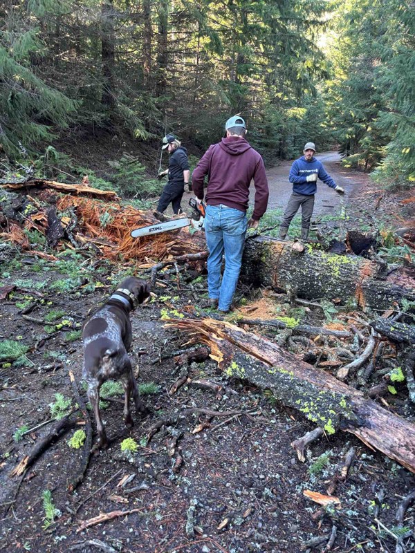
Dozens of trees down on the roads!
My guys and I cleared a dozen or so trees and actually had a good time with our chain saws. Just started running out of daylight. I’m
Steven Ritchie
Most Popular


Updated: 10/15/2024
Hamilton to Courtrock
Courtrock, Oregon
Hamilton to Courtrock Road, near Hamilton, Oregon, is a journey through a landscape rich with striking rock formations and vibrant, colorful hills reminiscent of the Painted Hills. This well-maintained gravel road weaves through an area where time seems to stand still, marked by abandoned homesteads that tell stories of days gone by. As you travel this scenic route, you'll find that private land borders both sides of the road, ensuring that the view remains untouched and pristine. However, this also means no access to public land along the way. The unique geological features and the nostalgic remnants of the past make this drive a visually captivating experience.

Updated: 10/15/2024
Gulch Place Road
Jordan Valley, Oregon
Gulch Place Road is an easy drive through the scenic Owyhee Mountains. Parsnip Peak, to the southeast of the trail, highlights the landscape of the surrounding mountains. You can catch a glimpse of Antelope Reservoir, and there are roads that will take you down to the campsite on the lake.
This rocky dirt road requires high clearance but not 4WD unless you go after a storm, which is not advisable as the trail will get very muddy, and the dried-up creek beds could present a challenge.

Updated: 08/11/2026
Fenwick Ranch Road
Fairylawn, Oregon
Fenwick Ranch Road is a well-maintained gravel road that provides great views of the surrounding Owhyee River Canyon and the mountains. The farmland gives way to the arid desert landscape of Eastern Oregon.
This trail connects with Three Forks Road in the west and Juniper Mountain Road in the east. It’s a great way to avoid the highway.
The trail goes through an open range, so watch out for livestock on the road.

Updated: 10/15/2024
Rinehart Ranch Road
Crowley, Oregon
Rinehart Ranch Road is a nice drive through the foothills of the Owyhee Mountains. It provides incredible views of the Owyhee River Canyon. The arid landscape offers a unique contrast with the rolling golden hills.
The road itself can get rocky at points, and you must go slow to avoid some medium-sized rocks. 4WD is not necessary, but you need high-clearance.
You must open and close a few cattle gates as you travel through an open range, so beware of livestock. You can intersect Tub Springs Road in the middle of the trail and Crowley Riverside Road on the western side. No camping was observed along the trail.

Updated: 08/11/2026
Daly Creek
Richland, Oregon
Daly Creek Road is nestled in the serene foothills between Lookout Mountain and the quaint town of Richland. The open terrain offers breathtaking views of the nearby hills and distant mountains, creating a picturesque backdrop.
This trail is rugged, with unmaintained rock and dirt, and is a straight-through via Manning Creek or from the town of Richland. There is no camping as the land on each side of the road is private. Although “No Trespassing” signs posted by the rancher may seem intimidating, remember that Daly Creek Road is a state road. If you stay on the road, you can explore without worry. Don’t let the signs deter you from experiencing this beautiful, secluded ride amidst rolling mountains—a slice of paradise in the middle of nowhere!

Updated: 10/15/2024
FR2450
Fort Rock, Oregon
This point-to-point route starts at the north end with the intersection with FR24 and goes south to FR2435. It is a short route, but there are some good campsites in the area. The road is a bit rocky, but nothing too technical. If you make it to one of the starting points, most anything should be able to get in there!

Updated: 10/15/2024
Rock Canyon Road
Vale, Oregon
Rock Canyon Road is a dirt and gravel road traversing through BLM land in eastern Oregon's scenic arid landscape. The trip through Sagebrush Gulch offers incredible views of the surrounding canyons and rock formations. Be sure to stop and look around in all directions. You can see the Twin Buttes to the east and the rolling golden hills all around you.
Depending on the time of year, there may be a small water crossing through Hoodo Creek. The crossing lasts about 20 feet through the sandy bottom, foot-deep water. 4WD is nice to have through this crossing, and it's the only part of the trail where you'll need it. High clearance is a must. The trail goes through an open range, so watch out for livestock.
Rock Canyon Road is part of a large trail system with many great trails. This trail intersects Basin Gulth Road in the southern part and Cow Hollow in the northeast.

Updated: 10/15/2024
Painted Cove
Twickenham, Oregon
Painted Cove Road offers access to one of the five enchanting Painted Hills Hiking Trails off Bear Creek Road. This route leads to the Painted Cove hiking trail, an awe-inspiring display of nature's artistry with its vibrant rocks. A level boardwalk winds through hills ablaze with vivid yellow, lavender, and crimson hues. Staying on the boardwalk and avoiding stepping off the trail is essential to protect these fragile formations.
The road to the trailhead is a well-maintained gravel trail that ends at the parking lot. From there, a short walk to the top of the walking trail rewards you with breathtaking views of the Painted Hill Reservoir. Although the reservoir is private and closed to the public, its beauty can be appreciated from this vantage point. No designated camping areas are available along this trail, ensuring the preservation of this natural wonder.

Updated: 10/15/2024
Huntington/Malheur Line Road
Brogan, Oregon
Maps depict Huntington Road joining Malheur Line Road. As shown here, it is an easy two-lane gravel road through the sagebrush steppe and range land. Parts of the steppe appear to have been overgrazed and are not in very good condition, with significant areas of cheatgrass and other annuals. Where there is water, the desert landscape comes to life in a vibrant green oasis. Due to the abundance of private and fenced land along the road, no obvious places exist to camp.

Updated: 10/15/2024
McGraw Ridge
Fruita, Oregon
In 1934, McGraw Ridge became home to the first McGraw Lookout, featuring a 10-foot tower with a 14x14 cab. This early lookout was crucial for spotting fires in Hells Canyon, Payette National Forest, and the Wallowa-Whitman National Forest. In 1964, it was replaced by the current 82-foot tower with an R6 cab, situated half a mile from the original site. Unstaffed since the 1970s, this solitary trail remains an in-and-out adventure. While designated campsites are absent, the surrounding meadows offer ample space for a serene camping experience near the historic lookout tower.

Updated: 10/15/2024
Danner Road
Jordan Valley, Oregon
Danner Road is an easy trail through the Oregon farm country. 4WD or high clearance is not needed; any vehicle can traverse it. This road was part of the Lewis and Clark Historical Trail.
The surrounding farmlands give way to the barren and arid climate of the Eastern Oregon foothills. The road does travel through an open range, so beware of livestock on the road. No camping was observed on this trail.

Updated: 10/15/2024
2313
Kirk, Oregon
This trail starts at Sun Mountain Road and ends at 2308. The road is standard for the area- dusty, narrow, sometimes overgrown, and some washboarding. Dispersed camping opportunities are plentiful.

Updated: 09/04/2025
Clear Lake
Government Camp, Oregon
Located south of Government Camp, Clear Lake is a beloved recreation area around a man-made reservoir that irrigates agricultural fields east of the forest. The lake is popular for swimming, fishing, sailing, and boating; however, motorized boats are limited to 10 MPH. The road around the lake is easy but rough, with plenty of ruts, potholes, crumbling pavement, and a few exposed rocks that keep speeds slow. While nothing is technical, expect a bumpy ride until you drop down toward the lake, where the trail smooths out under shady trees and bursts of wildflowers in summer. The drive is simple with only a few mild rocky patches near the shoreline. The real draw is the scenery and camping. Dispersed sites along the north side of the lake range from tucked-away tree cover to open spots right at the water’s edge, with even more quiet camps further around the lake for those willing to explore. Along the eastern shore, you can find Clear Lake Campground, a 26-site improved Forest Service campground that charges a nightly fee and offers bathrooms, water, camp tables, and fire rings. Whether setting camp or just enjoying a lakeside day, Clear Lake delivers an easygoing escape.

Updated: 10/15/2024
Cow Hollow
Vale, Oregon
Cow Hollow Road is a nice drive through the golden rolling hills of eastern Oregon. The tall grass surrounding you allows for great views of the surrounding terrain, such as Chalk Butte. This trail traverses through an open range, so beware of livestock on this dirt road. 4WD is not necessary, but make sure you have high clearance.
Near the trail's eastern section, as the terrain becomes more rugged, you'll start to lose sight of the tracks. Eventually, you'll come to a gate that you can open, but the tracks disappear. This is the end of the trail; although some mapping software shows the trail goes through, it does not.
The area has many other great trails to explore; this trail intersects with Twin Buttes and Shell Rock Road.

Updated: 09/10/2026
NFDR-1010
Susanville, Oregon
National Forest Development Road 1010, running along the western edge of the North Fork John Day Wilderness, is a gateway to multiple trailheads leading into the wilderness. This hidden gem in Oregon's vast Umatilla National Forest invites adventurers to explore its remote and rugged terrain.
Travelers can also access the manned Desolation Butte Fire Lookout and enjoy various outdoor activities such as hiking and birdwatching. The road offers spots for dispersed camping, providing peaceful retreats into nature. Known for its tranquility and seclusion, it is perfect for those seeking solitude. However, the road can be rough and is best suited for high-clearance vehicles. National Forest Development Road 1010 showcases the unspoiled beauty of Oregon's forests, offering a serene and adventurous escape into the wild.

Updated: 10/15/2024
Manning Creek
Durkee, Oregon
Manning Creek Road connects Daly Creek Road from Richland to Durkee by Interstate 84. This narrow, single-lane trail winds through private properties on either side, so camping is prohibited. As you travel, be mindful of the cattle that often wander along the path—they always have the right of way. Enjoy this easy drive along Manning Creek with the Blue Mountains in the backdrop through this secluded stretch of land.

Updated: 10/15/2024
Mormon Basin Cutoff Road
Rye Valley, Oregon
Mormon Basin Cutoff Road is a well-maintained dirt and gravel road, mostly one lane wide with pullouts. It is a shelf road with blind curves and considerable dust. The north end of the road is in an old mining area with some present-day active mining activity. Due to the shelf nature of the road and some private property, there are no obvious places to camp. The road traverses down a long draw with excellent panoramic views of the valley below. Since it is open range, there could be cattle on the road.
Near the north end of the road, there is what appears to be a large drum-style placer mining cradle. Although rusted and probably frozen in place, it still has the rollers on which the drum turned.

Updated: 10/15/2024
FS 14/Blue Bucket Road
Frost Mill, Oregon
FS 14/Blue Bucket Road goes from FS 16 in the north down towards Drewsy in the south. When the road leaves the national forest, its name changes from FS 14 to Blue Bucket Road. The road is a well-maintained gravel road suitable for most any vehicle; the primary hazards are significant washboards in places, dust, and blind curves.
North of the intersection with FS 1663, the Forest Service is clearing the understory and most mature trees in a roughly 150-foot swath along the road to provide a fire defensive line for future wildfires. The immediate result is an opening of the forest along the road, making for a more scenic, almost park-like area.
There are no campgrounds along NF 14/Blue Bucket Road, and while dispersed camping is allowed, there are no obvious places where people have set up dispersed camps.

Updated: 10/15/2024
Collins Road
Medical Springs, Oregon
Collins Road is a well-maintained gravel road that travels through dense forest and is suitable for any vehicle. It starts as Collins Road at State Road 203, becomes FS 70 within the National Forest, and finally turns into E. Eagle Creek Road at Sparta Lane. It's all one continuous road and may have different names on various mapping packages.
Due to the dense forest, there are limited panoramic views while traveling through the National Forest. As the road exits the forest on the south end, the trees clear, and there are plentiful open views. There are no campgrounds along FS 70, but some nice dispersed camping sites are near Balm Creek Reservoir, located near the road's midpoint.
The main hazards on this road are dust, blind turns, and cattle. This area is an open-range country, so encountering cattle on the road is common.

Updated: 10/15/2024
Chesnimnus Creek Road
Lewis, Oregon
Chesnimnus Creek Road is a well-maintained gravel road suitable for any vehicle. It starts at the west end of FS46, loops back to FS46 near Cold Springs Road, and follows a delightful meandering brook up a long canyon for most of its length. It begins by private property and enters the national forest about ten miles in, where the canyon starts a slow climb. At about 17 miles, the road turns sharply north and quickly climbs to FS46.
There are no campgrounds along 4625, but dispersed camping is allowed. However, there are no obvious pre-disturbed sites where one can set up camp.

Updated: 09/10/2026
7003
Beaver Marsh, Oregon
This trail runs from Highway 70 to FS2308. It is typical for the area with some narrow spots, possible fallen trees, and lots of loose dust! Overall, this road is in better shape than most in the area and seems to be a main access route to FS2308 and all of the views and dispersed camping it has to offer!

Updated: 10/15/2024
Sparta Lane
New Bridge, Oregon
Sparta Lane is a well-maintained gravel road suitable for any vehicle, providing an off-pavement alternative to a section of Highway 82. Both ends of Sparta Lane connect with 82; the west end connects directly, and the south end connects through the little town of New Bridge. The road is easy to drive, with no major hazards other than dust and a short section of tight switchbacks on the east end. Since Sparta Lane is bordered by private property, no places exist to camp.
An interesting old rock cabin is located along the road near the west end, and there are several places with nice views of distant mountains or valleys.

Updated: 10/15/2024
NFR-1940
Sumpter, Oregon
Forest Road 1940 winds through the picturesque Patrick Creek Area and can be accessed from Route 26 John Day Highway or the North Fork Burnt River Road. The historic Antlers Guard Station is at the junction of Forest Road 1940, and the North Fork Burnt River Road is available for rental reservations. Built in 1935 by the Civilian Conservation Corps, the Antlers Guard Station originally housed fire crews patrolling the Wallowa-Whitman National Forest when daily travel between remote forest areas and the ranger station was impractical due to underdeveloped forest roads. Listed on the National Register of Historic Places in 1991, the Antlers Guard Station is 4,107 feet in elevation on the west bank of the scenic North Fork of the Burnt River, surrounded by ponderosa pine forest.
Forest Road 1940 is subject to motorized vehicle regulations and is closed three days before the opening of rifle deer season until the end of the last elk season and from May 1st to July 1st. When heading southwest, it is essential to take a right at the fork and reach Forest Road 2622 before getting on Route 26 John Day Highway; otherwise, if going straight, the road, also named 1940, dead-ends just a few thousand feet past the fork. The trail is relatively easy to drive, with a few bumpy spots due to washouts. Along this trail, there are several pull-outs suitable for dispersed camping.

Updated: 10/15/2024
Drewsey Market Road
Drewsey, Oregon
Drewsey Market Road, aka Market Road, starts in the little town of Drewsy, Oregon, and runs up a scenic valley through farming and ranching country to Pine Creek Road. It is an easy drive, suitable for most any vehicle. Much of the road follows a stream that adds vibrant greens to counter the grays and browns of the surrounding desert areas.
Most of the land on both sides of the road is private, and there are no places to camp.

Upgrade your Membership
Unlock all of the details on every Trail Guide and Scout Route.
Start a 7-day Free TrialCommunity
Partners

