


By clicking "ACCEPT", you agree to be the terms and conditions of each policy linked to above. You also agree to the storing of cookies on your device to facilitate the operation and functionality of our site, enhance and customize your user experience, and to analyze how our site is used.
Oregon Off-Road Trails
52
Total Trail Guides 48

409
Detailed Waypoints 127
Try a Free 7-Day Trial and unlock it all
Start a Free Trial Most Recent Trail Reviews
Rated 2/5
Open
Visited: 09/13/2026
I figured this would be boring and it was. This trail has convinced me to stop going for BoH trails.

Francis whitney
Rated 5/5
Open
Visited: 09/06/2026
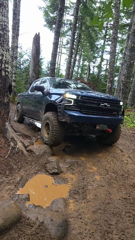
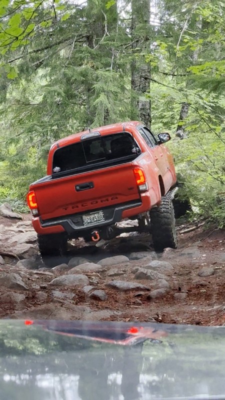
Ran this today. Ground was slick but makes it more dunk I’m in a full-size 1500 on 37s, my buddy is in a Tacoma on 35s, and our other buddy was in a TJ on 33.
Yes it’s tight but we all made it thru ...

Everett Vangsnes
No Rating
Open
Visited: 08/11/2026
Per the MVUM, the trail is seasonally open. As always, check current fire restrictions/closures before venturing out.

Trails Offroad
Official Crew
No Rating
Open
Visited: 08/11/2026
Per the MVUM, the trail is seasonally open. As always, check current fire restrictions/closures before venturing out.

Todd
Official Crew
Todd
Official Crew
No Rating
Open
Visited: 08/11/2026
Per the MVUM, the trail is seasonally open. As always, check current fire restrictions/closures before venturing out.
Trails Offroad
Official Crew
No Rating
Temporary Closure
Visited: 08/07/2026
Closed due to the Fox Fire. https://www.blm.gov/sites/default/files/docs/2026-07/orwa-fpo-val-072626.pdf

Rose Meirs
Official Crew
No Rating
Temporary Closure
Visited: 08/07/2026
Closed due to the Crosswhite Fire. https://www.blm.gov/sites/default/files/docs/2026-08/orwa-fpo-pri-080526.pdf
Rose Meirs
Official Crew
No Rating
Temporary Closure
Visited: 08/07/2026
Closed due to the Crosswhite Fire. https://www.blm.gov/sites/default/files/docs/2026-08/orwa-fpo-pri-080526.pdf
Rose Meirs
Official Crew
No Rating
Temporary Closure
Visited: 08/07/2026
Closed due to the Crosswhite Fire. https://www.blm.gov/sites/default/files/docs/2026-08/orwa-fpo-pri-080526.pdf
Rose Meirs
Official Crew
No Rating
Temporary Closure
Visited: 08/07/2026
Closed due to the Crosswhite Fire. https://www.blm.gov/sites/default/files/docs/2026-08/orwa-fpo-pri-080526.pdf
Rose Meirs
Official Crew
No Rating
Temporary Closure
Visited: 08/07/2026
Closed due to the Big Grass Fire. https://www.blm.gov/sites/default/files/docs/2026-07/orwa-fpo-val-072826.pdf
Rose Meirs
Official Crew
No Rating
Temporary Closure
Visited: 08/07/2026
Closed due to the Big Grass Fire. https://www.blm.gov/sites/default/files/docs/2026-07/orwa-fpo-val-072826.pdf
Rose Meirs
Official Crew
No Rating
Temporary Closure
Visited: 08/07/2026
Closed due to the Big Grassy Fire. https://www.blm.gov/sites/default/files/docs/2026-07/orwa-fpo-val-072826.pdf
Rose Meirs
Official Crew
No Rating
Temporary Closure
Visited: 08/07/2026
Temporary due to the Hat Wildfire. https://www.blm.gov/sites/default/files/docs/2026-07/orwa-fpo-val-072826.pdf
Rose Meirs
Official Crew
No Rating
Temporary Closure
Visited: 08/03/2026
The area is currently closed due to the Grasshopper Fire. More info is available here: https://inciweb.wildfire.gov/incident-information/ormhf-grasshopper

Douglas Van Bossuyt
Official Crew
No Rating
Temporary Closure
Visited: 08/03/2026
The area is currently closed due to the Grasshopper Fire. More info is available here: https://inciweb.wildfire.gov/incident-information/ormhf-grasshopper
Douglas Van Bossuyt
Official Crew
No Rating
Temporary Closure
Visited: 08/03/2026
The area is currently closed due to the Grasshopper Fire. More info is available here: https://inciweb.wildfire.gov/incident-information/ormhf-grasshopper
Douglas Van Bossuyt
Official Crew
No Rating
Temporary Closure
Visited: 08/03/2026
The area is currently closed due to the Grasshopper Fire. More info is available here: https://inciweb.wildfire.gov/incident-information/ormhf-grasshopper
Douglas Van Bossuyt
Official Crew
No Rating
Temporary Closure
Visited: 08/03/2026
The area is currently closed due to the Grasshopper Fire. More info is available here: https://inciweb.wildfire.gov/incident-information/ormhf-grasshopper
Douglas Van Bossuyt
Official Crew
No Rating
Temporary Closure
Visited: 08/03/2026
The area is currently closed due to the Grasshopper Fire. More info is available here: https://inciweb.wildfire.gov/incident-information/ormhf-grasshopper
Douglas Van Bossuyt
Official Crew
No Rating
Temporary Closure
Visited: 08/03/2026
The area is currently closed due to the Grasshopper Fire. More info is available here: https://inciweb.wildfire.gov/incident-information/ormhf-grasshopper
Douglas Van Bossuyt
Official Crew
No Rating
Temporary Closure
Visited: 08/03/2026
The area is currently closed due to the Grasshopper Fire. More info is available here: https://inciweb.wildfire.gov/incident-information/ormhf-grasshopper
Douglas Van Bossuyt
Official Crew
No Rating
Temporary Closure
Visited: 08/03/2026
The area is currently closed due to the Grasshopper Fire. More info is available here: https://inciweb.wildfire.gov/incident-information/ormhf-grasshopper
Douglas Van Bossuyt
Official Crew
No Rating
Temporary Closure
Visited: 08/03/2026
The Grasshopper fire unfortunately burned over the Flag Point Lookout and destroyed the lookout tower. The area is closed for the foreseeable future.
General fire info with links to the specific clo...
Douglas Van Bossuyt
Official Crew
No Rating
Temporary Closure
Visited: 08/01/2026
Trail was closed due to wildfire activity. I was unable to find this out online but maybe try calling Hood River Ranger District at 541-352-6002 before making the drive to confirm if it is open?
MM
Mike Mueller
Open
Visited: 07/12/2026
I ran this backwards (rock quarry entrance to saddle mtn entrance) in my full-size pickup and it was a good time. I didn’t realize I’d taken the rocky bypass until i got to the other side of it (the s...
Everett Vangsnes
No Rating
Open
Visited: 06/26/2026
According to MVUM data, this trail should be open for the season.
Trails Offroad
Official Crew
No Rating
Open
Visited: 06/26/2026
According to MVUM data, this trail should be open for the season.
Trails Offroad
Official Crew
No Rating
Open
Visited: 06/26/2026
According to MVUM data, this trail should be open for the season.
Trails Offroad
Official Crew
No Rating
Open
Visited: 06/26/2026
According to MVUM data, this trail should be open for the season.
Trails Offroad
Official Crew
No Rating
Open
Visited: 06/26/2026
According to MVUM data, this trail should be open for the season.
Trails Offroad
Official Crew
No Rating
Open
Visited: 06/26/2026
According to MVUM data, this trail should be open for the season.
Trails Offroad
Official Crew
No Rating
Open
Visited: 06/26/2026
According to MVUM data, this trail should be open for the season.
Trails Offroad
Official Crew
No Rating
Open
Visited: 06/26/2026
According to MVUM data, this trail should be open for the season.
Trails Offroad
Official Crew
No Rating
Open
Visited: 06/26/2026
According to MVUM data, this trail should be open for the season.
Trails Offroad
Official Crew
Rated 5/5
Open
Visited: 06/19/2026
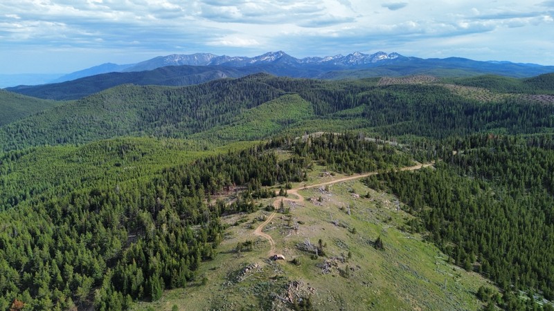
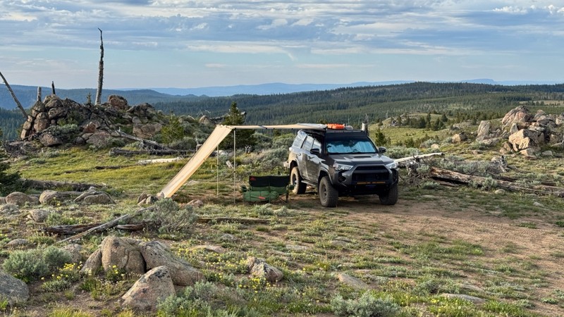
This was an easy dirt road with some logging traffic up until it intersects National Forest Development Road 5125/4350 at 45.06718, -118.21474. After this it becomes noticeably bumpier with larger di...

Andrew T
Open
Visited: 06/05/2026
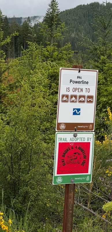
Trail is marked wrong on the map, 4C starts at the end of powerline 4B.
MS
Michael Strange
Rated 5/5
Open
Visited: 05/08/2026
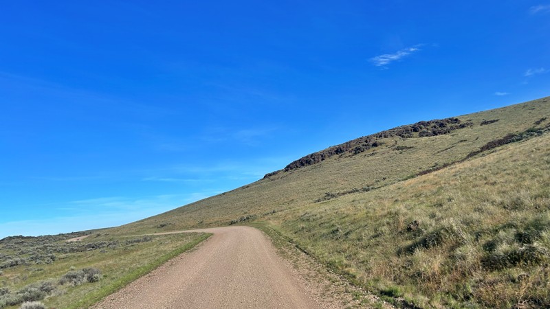
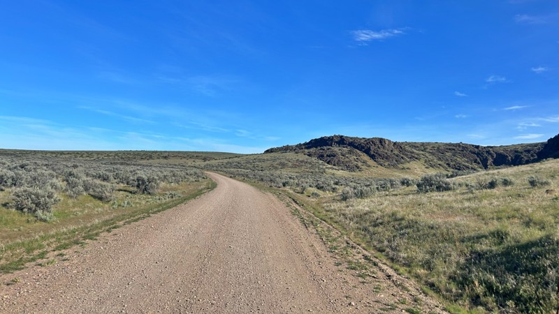
Having visited in May, I can confidently say this is one of the best times to experience the Cow Lakes Recreation Area. The lakes are full, migratory birds fill the marshes, and wildflowers blanket th...
Rose Meirs
Official Crew
Rated 4/5
Open
Visited: 05/07/2026
We tackled Board Corral Trail in our EarthRoamer and found it to be a fun and engaging drive, but one that took considerably longer than we expected. While the trail itself isn't exceptionally difficu...

Wide Open Roams
Official Crew
Rated 5/5
Open
Visited: 05/06/2026
We drove Succor Creek Road as part of our travels through the Owyhee Canyonlands and found it to be one of the easier yet more scenic routes in the region. If you're looking for a relaxing drive that ...
Wide Open Roams
Official Crew
Rated 5/5
Open
Visited: 05/04/2026
Leslie Gulch Road ended up being one of our favorite drives in the Owyhee Canyonlands. The route winds its way down toward Owyhee Lake, passing through some truly unique scenery that feels completely ...
Wide Open Roams
Official Crew
Rated 4/5
Open
Visited: 05/04/2026
We drove Mahogany Gap while exploring the Owyhee region and found it to be a scenic, easy-going route that offers a great introduction to the area. This isn't a trail that challenges your vehicle, but...
Wide Open Roams
Official Crew
Rated 5/5
Open
Visited: 05/03/2026
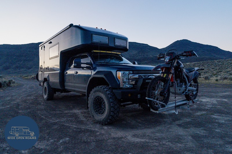
We took the trail out to Mickey Hot Springs while exploring the East Steens area, and it ended up being one of our favorite stops in southeastern Oregon. The drive itself was straightforward and easy ...
Wide Open Roams
Official Crew
Rated 5/5
Open
Visited: 05/03/2026
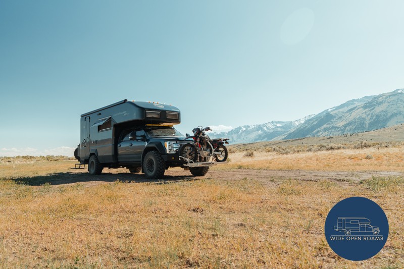
We drove the East Steens Road while making our way through southeastern Oregon and ended up really enjoying this route. Before starting the main stretch along the Steens, we stopped at Borax Lake Hot ...
Wide Open Roams
Official Crew
Rated 4/5
Partially Open
Visited: 04/26/2026
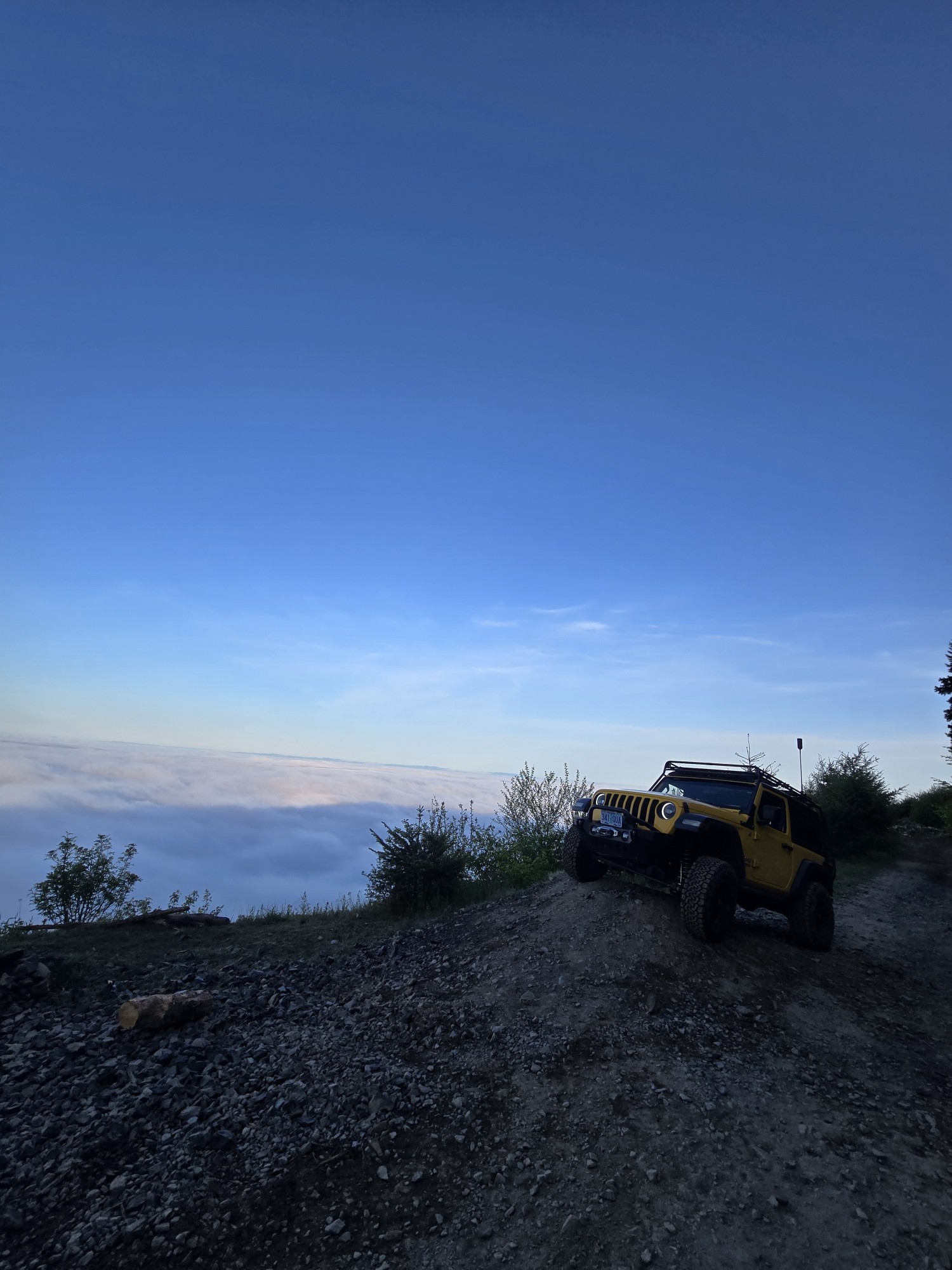
Was a fun and beautiful trail, though not very technical trail from East to West, was only able to get to marker 20? before I had to turn around due to downed trees that would require chainsaw and mor...
Ryan Green
Richard Goins
Rated 4/5
Open
Visited: 01/15/2026
I can see this being an easy trail in good conditions and most of it was pretty tame, but the last big left hand turn near the top is deeply rutted and slick wet clay. Took careful line choice and a l...
A
alhounos
No Rating
Seasonal Closure
Visited: 12/31/2025
According to this trails management agency, the trail is likely closed for the season.
You can reach out to the agency for more details.
Be sure to leave us a report and let us know ...
Trails Offroad
Official Crew
Rated 4/5
Partially Open
Visited: 12/18/2025
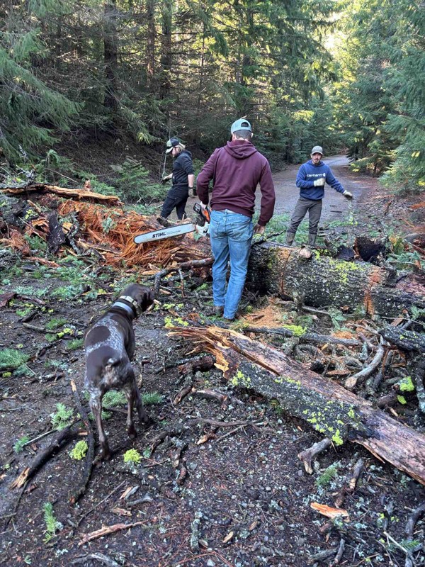
Dozens of trees down on the roads!
My guys and I cleared a dozen or so trees and actually had a good time with our chain saws. Just started running out of daylight. I’m
Steven Ritchie
Most Popular


Updated: 10/15/2024
Bartell Road
Bartlett, Oregon
Bartlett Road is an easy gravel road suitable for all vehicles. It is accessed in the north off of Grouse Creek Road and in the south at the little town of Troy, Oregon. Bartlett Road follows along the edge of a tributary canyon off of the Grand Ronde River, crosses Bartlett Bench, and then drops down the grade into Troy. The road resides in canyon country, and the primary views are of canyons—some wooded, some agricultural, some desert-mountain. In all cases, the views are spectacular and well worth the drive!
Because of the abundance of private property along the road, there are no good camping opportunities; however, there is a small RV camp in Troy. The major hazards are dust, occasional blind curves, and mild washboards.

Updated: 10/15/2024
Twin Buttes Road
Vale, Oregon
Twin Buttes Road is an awesome drive through the rolling foothills of eastern Oregon. The contrast between the tall green and golden grass with the blue sky is spectacular! The mighty Twin Buttes are on the western side of the trail, and several other marvelous buttes and canyons are visible alongside the road.
The dirt road is in good shape, and 4WD is unnecessary, but you will need high clearance. The trail goes through an open range, so beware of cattle on the road. There are many other great trails in the area. This trail intersects Cow Hollow Road in the north and Shell Rock Road in the south-east.

Updated: 10/15/2024
Clarks Creek Road
Bridgeport, Oregon
Clarks Creek Road starts as an easy two-lane gravel road and degrades into a single-lane, minimal-maintenance track. Four-wheel drive is not needed, but moderate clearance is recommended. Since this is mostly open range country there may be cattle on the road. There are several sites for dispersed camping, but care must be taken to avoid private property.
Both ends of the road have been mined in the past and there is still some mining activity on the northwest section where the road is good gravel.

Updated: 11/20/2025
Lockett Road
Huntington, Oregon
Lockett Road is a nice drive through the rolling hills of The Snake River Valley, with a glimpse of the river near the southern trailhead. Private land is on both sides of the road, so you must stay on the trail, and there is no camping along this route. No 4WD is needed; any high-clearance vehicle can make it.
You reach a cattle gate that you can pass through and then come to a fork in the road; if you take the southwest fork, you’ll hit a locked gate right away. But you can go through the gate to the northwest that says “Public Lands” to complete the loop back to Highway 84.

Updated: 10/15/2024
North Fork Dry Creek
Fruita, Oregon
North Fork Dry Creek is a straightforward connector trail from Summit Ridge to the Wallowa Mountain Loop. It begins by tracing the ridge, offering stunning vistas of the Wallowa Mountains, before descending to follow the creek. Although established campsites are scarce along the trail, offshoots may lead to picturesque dispersed camping spots.

Updated: 10/15/2024
Dry Gulch
Dennis, Oregon
Dry Gulch Road is a dirt road that traverses through the golden rolling hills of Eastern Oregon near the Columbia Plateau just northwest of Ontario, Oregon.
High clearance is needed, but not 4WD, as some mild off-camber sections exist. In parts of the trail, the vegetation is overgrown in the middle of the road, and plants stick up about a foot high, but they’re not very thick and easy to go through.
Several other great trails in the area are worth checking out. The Old Oregon Trail and Moores Hollow both intersect Dry Gulch Road.

Updated: 10/15/2024
Dean Creek
McEwen, Oregon
Dean Creek Road, also known as Forest Road 1160, is a well-maintained trail that stretches from East End Road to South Shore Road. This trail offers several access points to camping areas around Phillips Lake, but Dean Creek does not have campsites along its route.

Updated: 10/15/2024
Haas Ridge
Imnaha, Oregon
Haas Ridge Road winds along the ridge from Lord Flat to Monument Ridge, serving as a gateway to numerous hiking trails. This enchanting trail meanders through bubbling creeks, lush green meadows, and shady forests. Though unmaintained and rugged, it beckons only to high-clearance or four-wheel-drive vehicles, especially avoiding wet weather when it can turn impassable. While no pre-established campsites can be found, the meadows offer tranquil spots for those seeking to immerse themselves in nature's serene embrace.

Updated: 10/15/2024
South Shore
McEwen, Oregon
South Shores, also known as Forest Road 2220, is a trail that runs along the southern side of Phillips Lake. It provides access to camping areas with forest and water views. This well-maintained gravel road is suitable for RVs and passenger cars.

Updated: 10/15/2024
Sacajawea
Imnaha, Oregon
Sacajawea is the nearest camping spot to the Hat Point Overlook and Day Use Area. This site features a few picnic tables, fire rings, and flat areas perfect for camping. This is an unmaintained packed-dirt road, so driving during wet weather or road conditions is not advised. Under normal conditions, this trail would be suitable for off-road-style RVs and high-clearance vehicles pulling offroading trailers.
Updated: 05/28/2026
Lower Cow Creek
Jordan Valley, Oregon
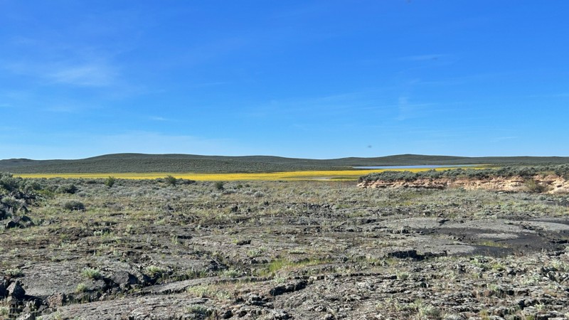
Lower Cow Creek Road cuts through a rugged and remote corner of southeastern Oregon, where endless sagebrush plains, volcanic landscapes, and wide-open cattle country stretch to the horizon. The farther north you travel, the more the outside world fades away, replaced by vast basin views, silence, and the feeling of true backcountry isolation. Pronghorn antelope are frequently seen darting across the open desert, while spring and early summer transform the normally dry landscape with colorful wildflowers scattered across the high desert floor.
The Cow Lakes Recreation Area offers a unique mix of remote desert camping and wetland scenery, unlike almost anywhere else in Oregon. A chain of shallow lakes, marshes, and seasonal mudflats creates an ever-changing landscape that draws thousands of migratory birds and wildlife throughout the year. Primitive campsites and roadside pull-offs provide excellent opportunities for dispersed camping with massive sunrise and sunset views, dark night skies, and peaceful solitude far from developed campgrounds. A small boat ramp and a couple of pit toilets provide minimal services while preserving the area’s rugged, undeveloped feel.
One of the most fascinating features of Cow Lakes is the dramatic boundary where ancient black lava flows meet the surrounding high desert basin. Lava from the nearby Jordan Craters eruption blocked historic waterways thousands of years ago, helping create the shallow playa lakes and marsh systems that visitors now explore by fishing, birdwatching, paddleboarding, kayaking, and photography.
The route itself is mostly flat, with a mix of gravel and hard-packed dirt, making it manageable for most high-clearance vehicles in dry conditions. However, this is still remote desert country, and conditions can change quickly after storms or extended rain. Muddy and boggy sections can develop fast, so travelers should come prepared with recovery gear, extra supplies, and the mindset for true overland travel.

Upgrade your Membership
Unlock all of the details on every Trail Guide and Scout Route.
Start a 7-day Free TrialCommunity
Partners

