Region

Logandale Trail Network

Nevada

Offroad Trails in Logandale Trail Network

A Region within Nevada
3.9/5 (64)

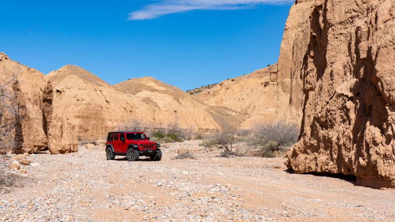
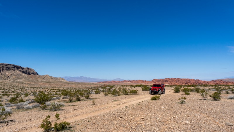
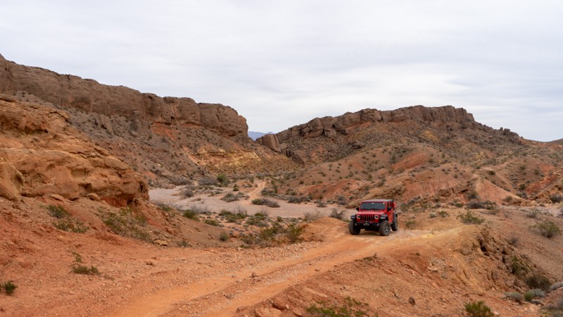
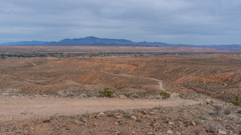
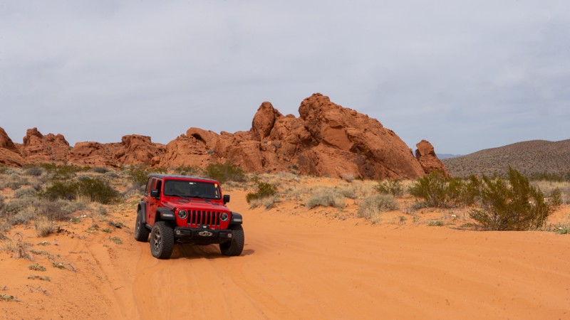
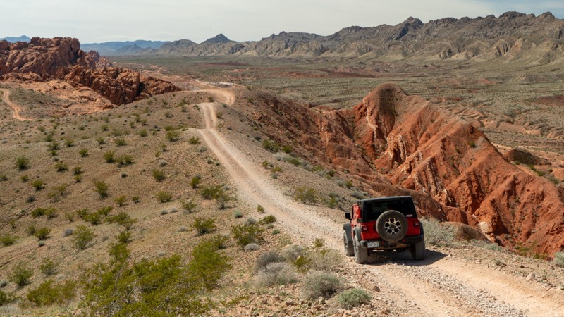
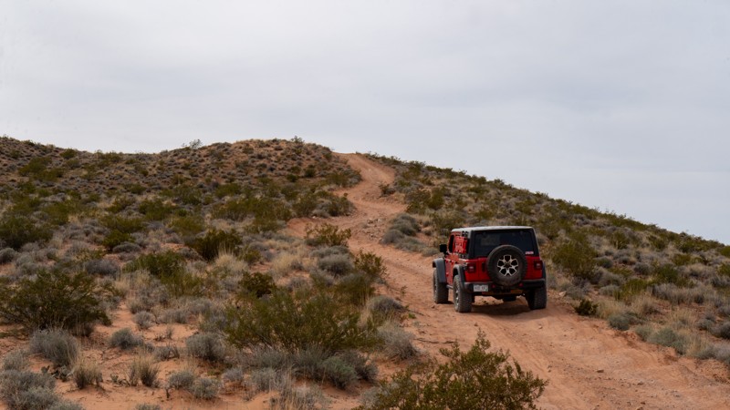
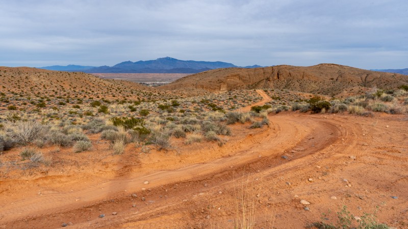
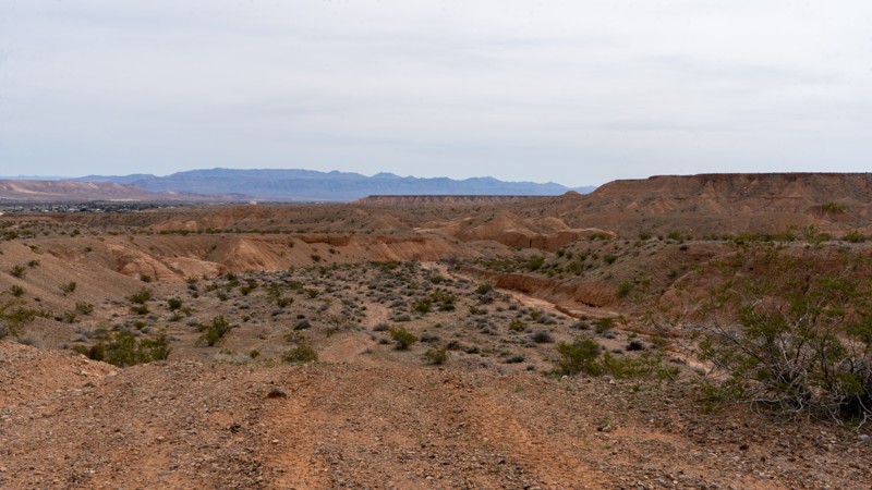
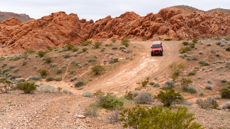
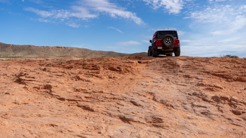
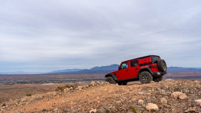
Tucked away in the southeastern corner of Nevada is a red rock haven for off-road enthusiasts. Comprised of over 45,000 acres and 200 miles of trails, this desert landscape will surely thrill any motorized recreation user, no matter what kind of trail they are after.

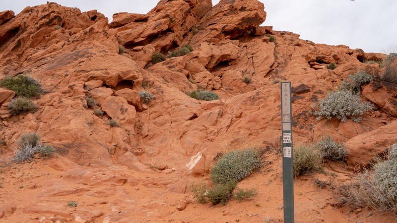
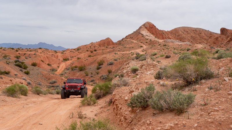
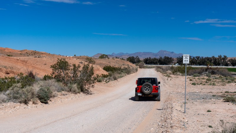
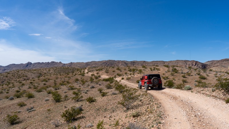
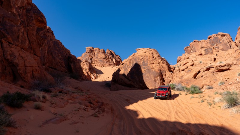
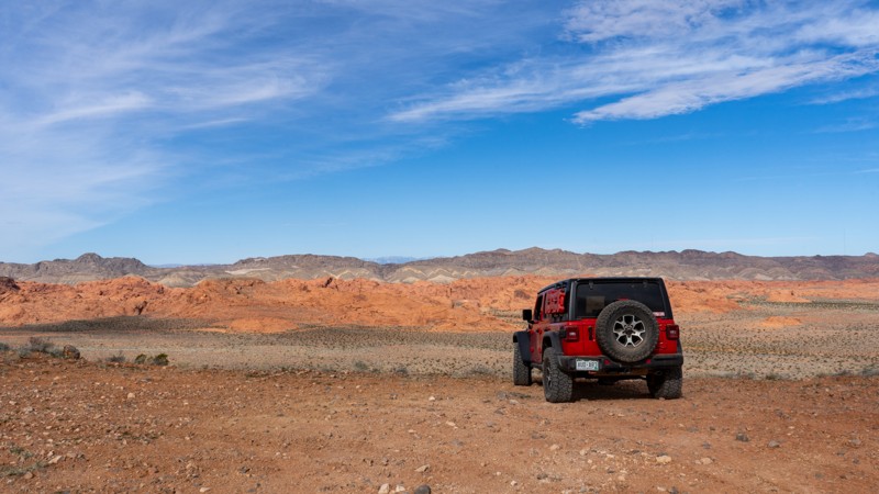
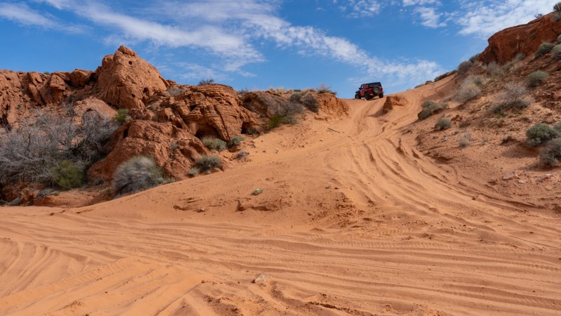
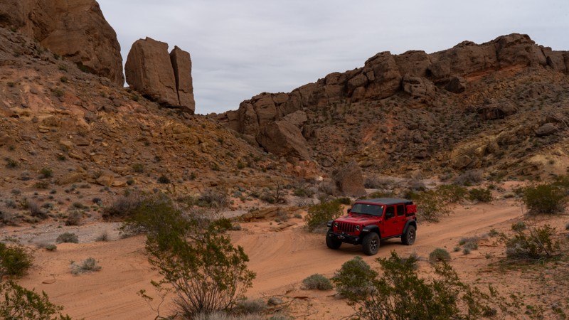
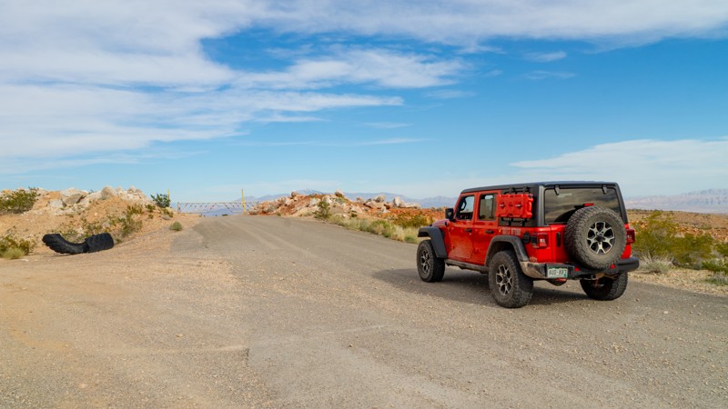
The northern end of this region is home to the proper entrance and the trailhead, where users can air down and prepare for the journey ahead. Looping around the heart of this network is the Logandale Main Loop, an easy scenic drive jogging between towering fins, past ancient petroglyphs, and over soft golden sand dunes.

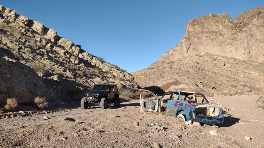
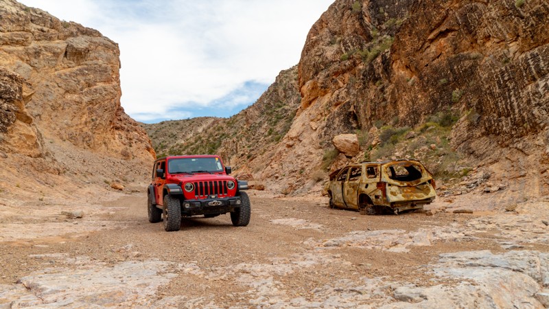
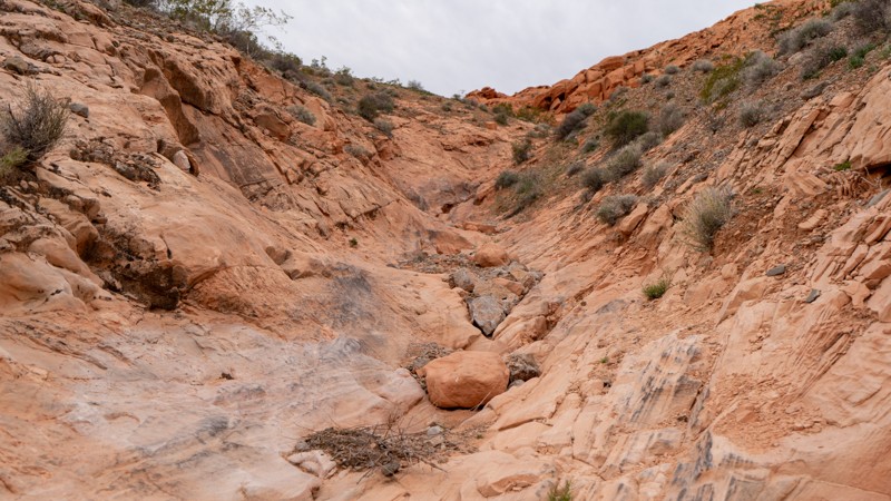
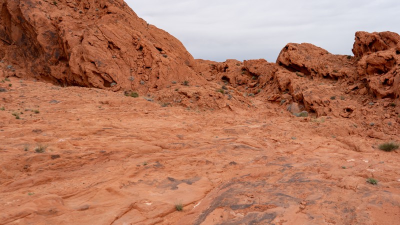
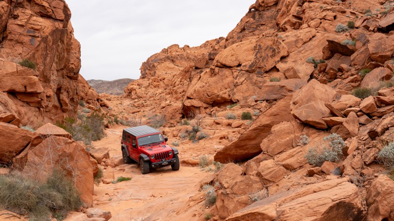
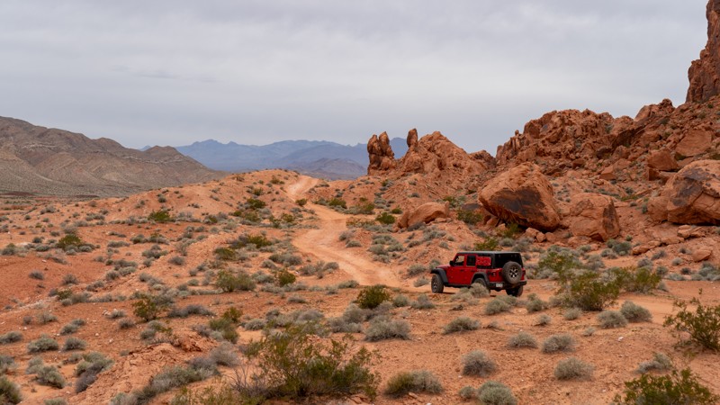
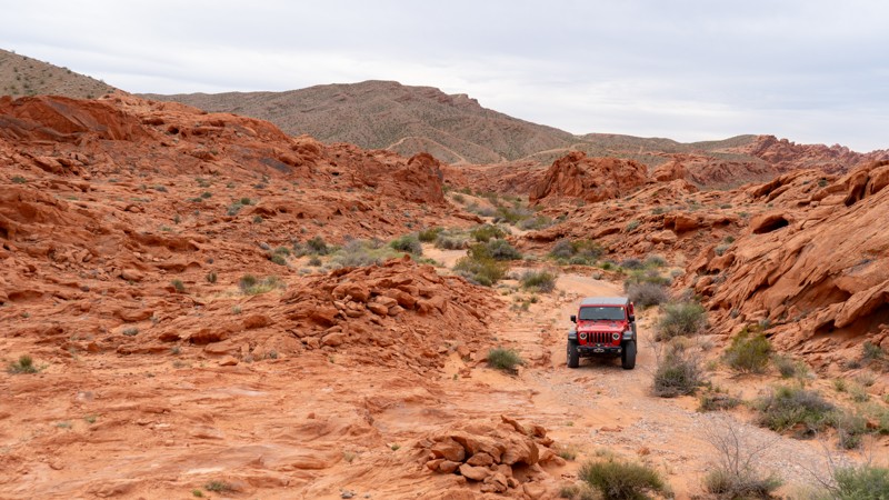
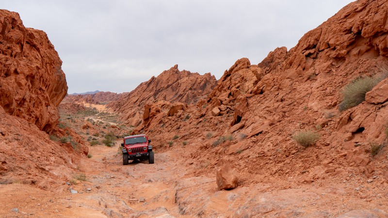
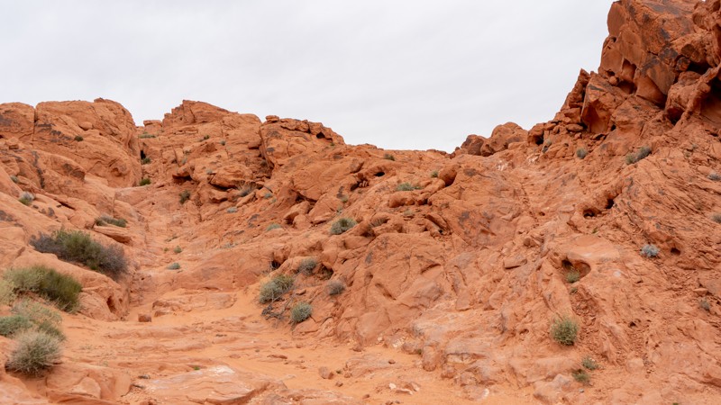
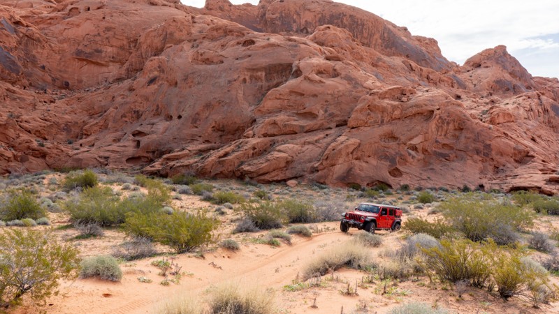
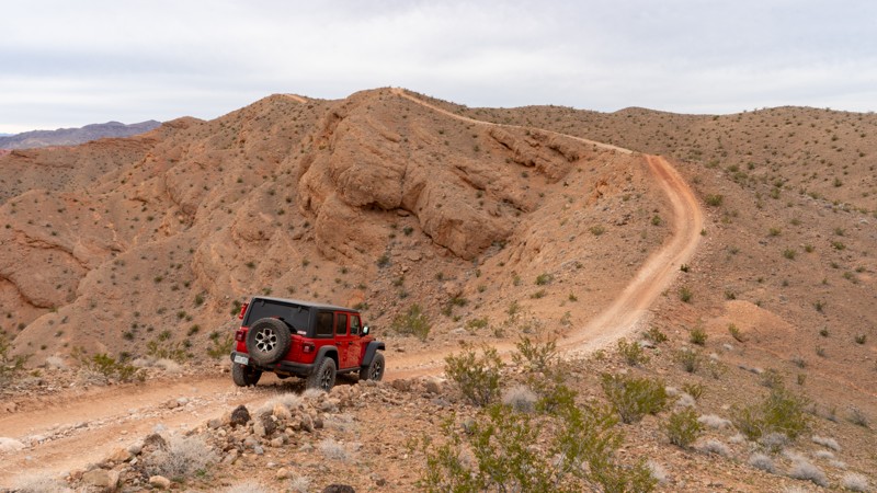
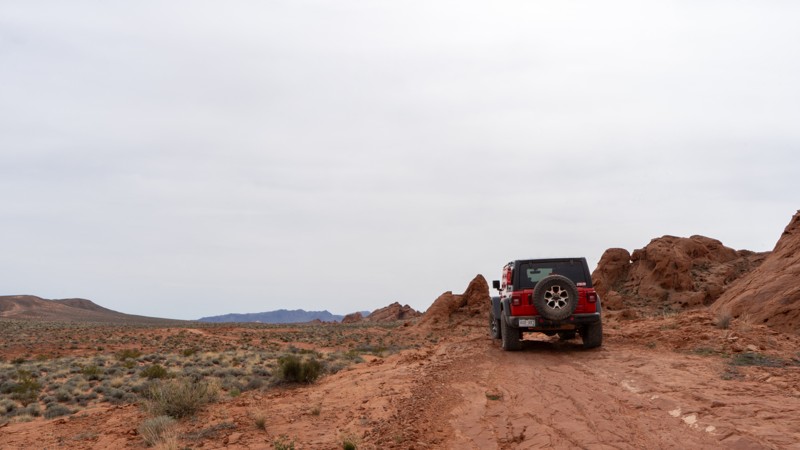
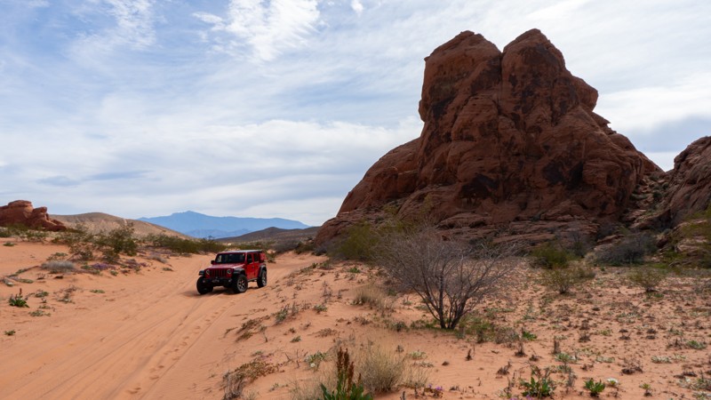
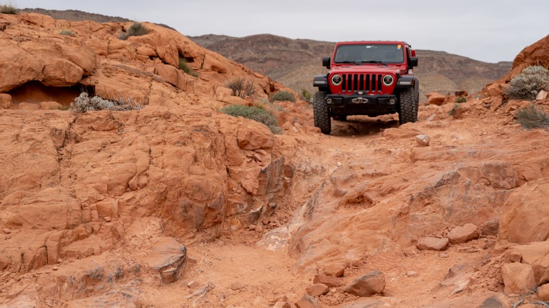
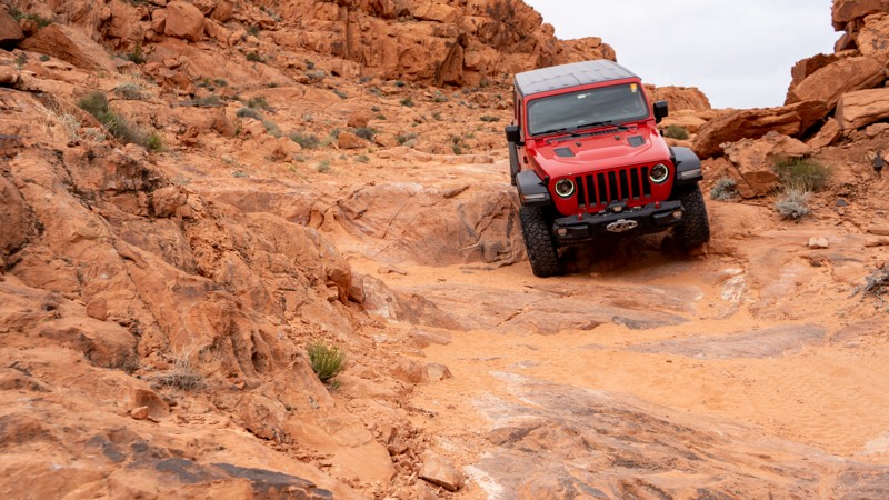
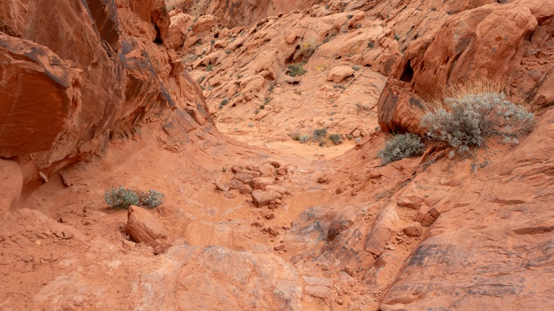
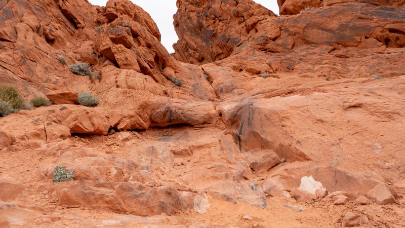
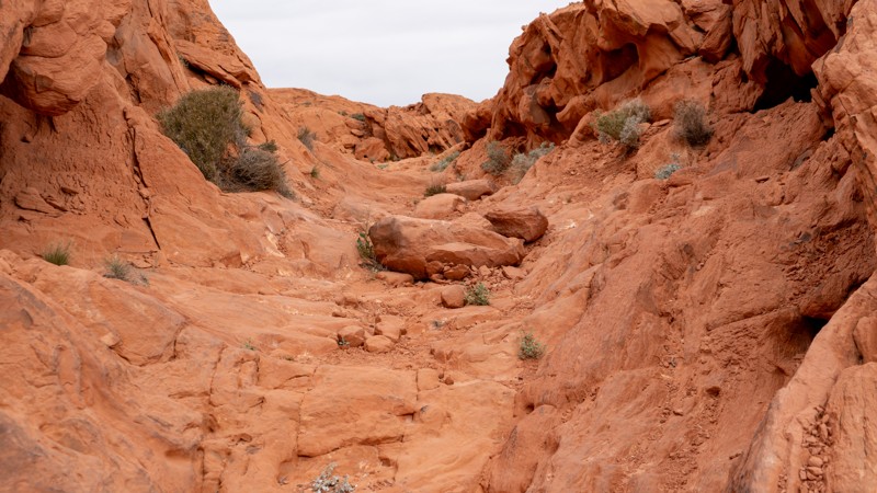
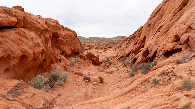
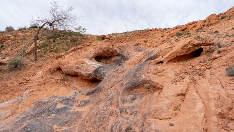
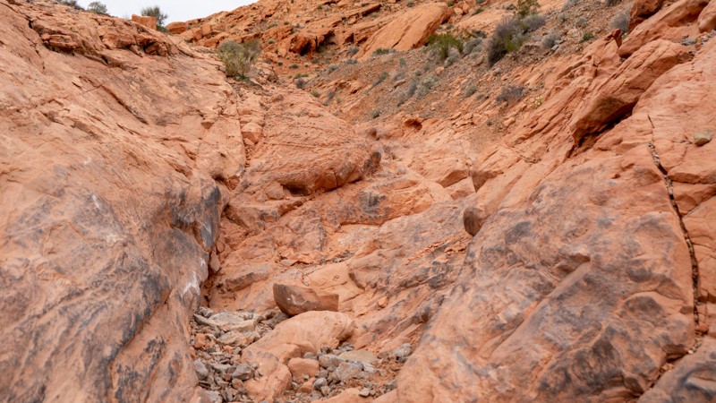
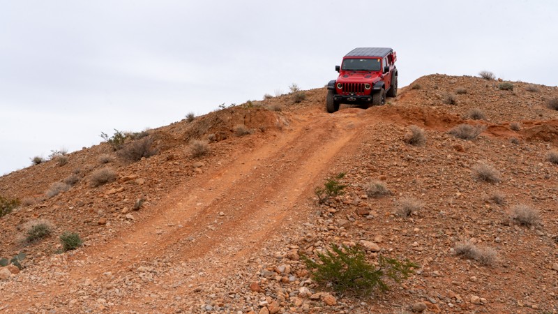
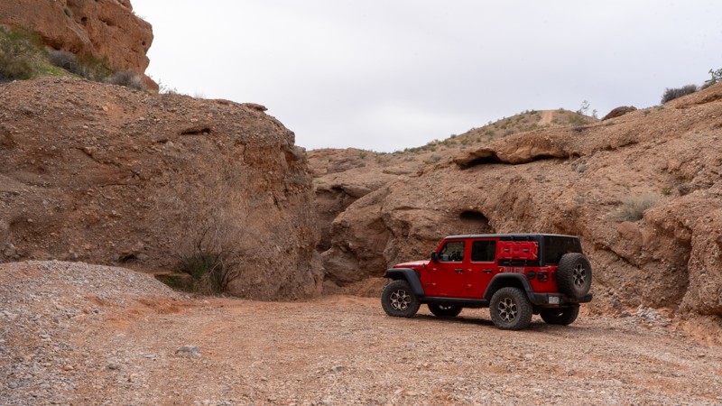
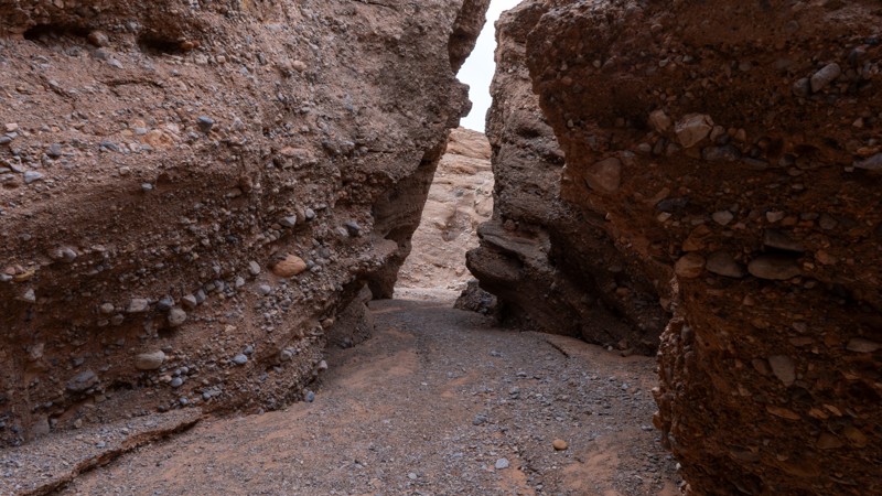
If rock crawling is your thing, you have not been left out! Located right near the trailhead is a network of difficult trails to challenge any well built rig. Reminiscent of the rocks of Moab, challenges include slickrock waterfalls, severely undercut ledges, and general holes and off-camber situations. Some ledges, although optional, reach over 5 feet tall!

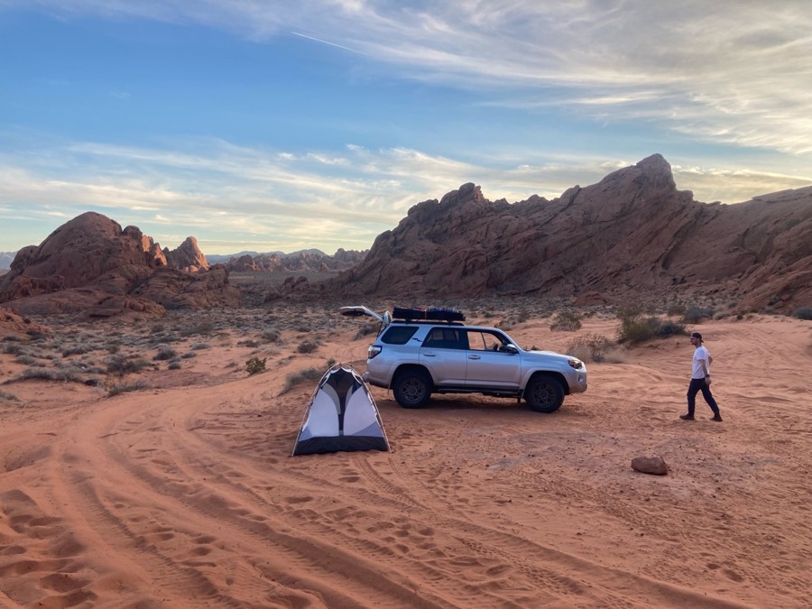
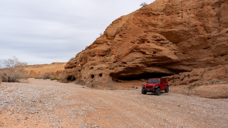
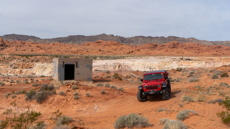
Camping is a big draw to the area, with many options for dispersed camping. There are two bathrooms located in the area, with sandy campsites strewn throughout the main loop, easily accessible by just about any high clearance vehicle, and even large camp trailers. If isolation is more your style, consider heading to the south end of the loop, where small and more private sites are tucked away into the red rock fins.

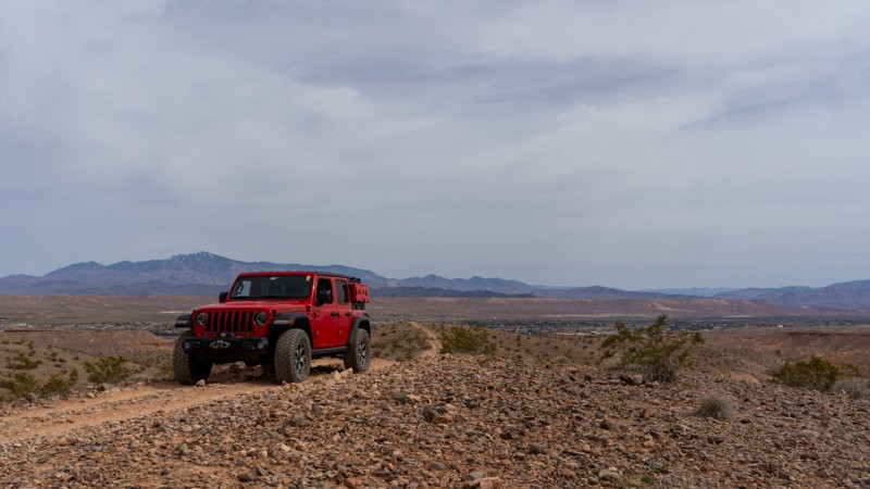
Although Logandale is primarily popular with locals, it is worthy of a broader audience. With its wide array of trails and conditions, combined with nearby activities such as Valley of Fire State Park and Lake Mead, this is an amazing central location for days of thrilling adventure. Pack up your rigs and head to the red rock paradise known as Logandale!
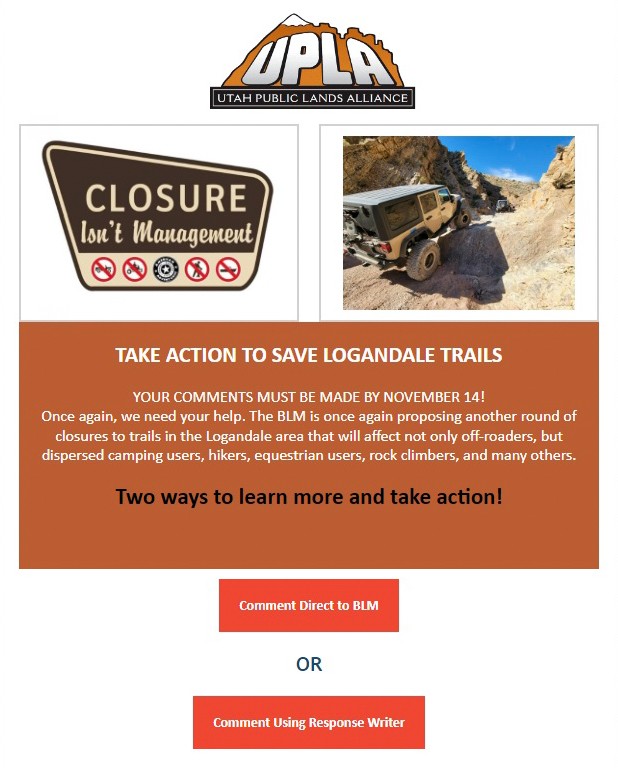
Top Reasons to Explore Here
Beginner Category IconBeginner
Camping Category IconCamping
Desert Category IconDesert
Iconic Category IconIconic
Mine Category IconMine
Mud Category IconMud
Overland Category IconOverland
Rock Category IconRock
Sand Category IconSand
Scenic Category IconScenic
Wash Category IconWash
Trail Types
Scout Route
Full Trail Guide

Preview Trail Icon
Preview Trails
easy
moderate
difficult
severe
extreme

All-Access
Scout Route
Start a 7-day Free Trial

Most Recent Trail Reviews

Most Popular

Search for Trails
Nevada: Logandale Main Loop 01 Hero Photo
All-Access Icon
4.3/5 (18 reviews)
Updated: 04/22/2024
Logandale Main Loop 01
Logandale, Nevada

Similar to the red rocks of Moab and Sand Hollow, Logandale Trails is a four-wheeler paradise on a smaller scale. Logandale is located in the Moapa Valley of Nevada, about an hour northeast of Las Vegas. The 21,000-acre trail system is a multi-use park with numerous diverse trails and exceptional interpretive sites, all maintained by local volunteers. While easily traveling through towering red rock canyons, you'll have endless options for a truly epic campsite. The southern boundary is The Valley of Fire State Park, so the natural red Aztec sandstone rock formations are found throughout the OHV park, beginning right at the trailhead. The main loop presented here is an effective way to experience this unique region, view numerous petroglyphs, or connect with just about every trail within the park.

Nevada: Old Spanish Trail North Hero Photo
All-Access Icon
4.2/5 (7 reviews)
Updated: 07/10/2024
Old Spanish Trail North
Moapa Valley, Nevada

The Old Spanish Trail in southern Nevada was the main trade route in the region from 1826 to 1848. The settlers and traders of the time had to travel through these harsh desert conditions to reach settlements to the north. This northern section follows a portion of the historic trail that borders the Valley of Fire State Park. The route is easy enough for stock 4x4s and an excellent way to connect Las Vegas with many other regional trails. The early section of the trail is a vast open desert, but it eventually works its way into a very scenic canyon with spectacular views of the surrounding mountains. The entire area is also great for those interested in geology and rockhounding.

Nevada: Weiser Valley Hero Photo
All-Access Icon
4.8/5 (5 reviews)
Updated: 07/10/2024
Weiser Valley
Moapa Valley, Nevada

Weiser Valley, located within the Logandale OHV area, is an excellent and easy way to catch a glimpse of the unique landscape that this region of Nevada is known for. The trail travels through a picturesque canyon with unique and colorful rock formations, including a natural arch high up along a rocky ridgeline. Weiser Valley can be used to access Logandale OHV Trails such as The Bowl, Matterhorn, and Hawkins Trails, as well as the remnants of the Silver Queen Gypsum mine. A large group camping area at the trailhead makes for an ideal base camp while you explore the area for days. Connecting this trail with others makes for a long and scenic overland route.

Nevada: Double Powerline Hero Photo
All-Access Icon
3.5/5 (4 reviews)
Updated: 03/07/2023
Double Powerline
Moapa Valley, Nevada

Double Powerlinel, located near Moapa Valley, is an excellent alternative for off-road users looking to access other trails without traveling on the highway. The route easily and quickly connects two popular OHV regions. The trail crosses underneath large power lines while traveling through sections of private property. The route can be combined with other published trails to make for a long and memorable overland route. The terrain in the area varies from rolling sand hills and jagged ridgelines. Sections of the route offer a glimpse into the Muddy River basin, where the ribbon of dense vegetation stands in stark contrast.

Nevada: Virgin Wash Hero Photo
Scout Route Icon
5/5 (1 reviews)
Updated: 10/15/2024
Virgin Wash
Amber, Nevada

Bridging the gap between Logandale Main Loop and the town of Logandale, Virgin Wash is a fun route up a sandy wash with a few rock obstacles. Although most of the trail is relatively easy, one rock obstacle halfway through the route will cause stock and lightly modified 4WD vehicles to stop and think for a second. Longer wheelbase or lower vehicles may struggle to climb over without scraping. This trail is an excellent option if you want more adventure than just a few hill climbs. No campsites exist on this trail, but many dispersed sites exist in the Logandale Trails network.

Nevada: Ute Road Hero Photo
Scout Route Icon
4/5 (1 reviews)
Updated: 10/15/2024
Ute Road
Ute, Nevada

Ute Road was once paved, but after severe flash flooding and washouts, it has become a patchwork of pavement, dirt, embedded rock, and ledges serving as a gatekeeper to accessing the Weiser Valley trail system. The only option to avoid Ute Road is to use Old Spanish Trail North.

Ute Road's excitement is located within the rock canyon that cuts through California Ridge. In the canyon, you will find plenty of opportunities to test the articulation of your suspension and your line-choice ability. You will even be greeted by the remains of what is perhaps an early 2000s mid-sized SUV. Dispersed campsites can be found on the west end of the canyon, making them accessible from I-15 without entering the canyon. Additional camping is available at the trailhead area of Weiser Valley.

At its eastern end, Ute Road dead ends at a management gate, making it purely a road for the excitement of the obstacles and to access Weiser Valley.

Nevada: Rock Bottom Hero Photo
Scout Route Icon
5/5 (1 reviews)
Updated: 10/15/2024
Rock Bottom
Amber, Nevada

Hitting Rock Bottom has a different meaning in Logandale. This severe trail follows a narrow rocky wash lined with obstacles. A gatekeeper guards the entrance of the wash. If this obstacle proves to be too much, you may as well turn around now. Heavily modified vehicles are put to the test on this twisty and narrow trail. Camping is not an option. There are many opportunities along the nearby Logandale Main Loop.

Nevada: Bronco Falls Hero Photo
Scout Route Icon
5/5 (1 reviews)
Updated: 10/15/2024
Bronco Falls
Amber, Nevada

Bronco Falls lies next to Shredder Trail but offers a bit more punch. This rocky trail is well suited for modified rigs and experienced drivers wanting a little more challenge. Numerous obstacles lie along its short span. Camping is not an option directly on this trail, but the nearby Logandale Main Loop has plenty of options.

Nevada: Shredder Trail Hero Photo
Scout Route Icon
5/5 (1 reviews)
Updated: 10/15/2024
Shredder Trail
Amber, Nevada

Lying near the entrance to Logandale, this challenging rocky trail winds through a small, tight canyon. Several small obstacles challenge lightly modified rigs, providing a short bit of fun, assuming everything goes well. Combine this trail with one of the others in the area for a half or full-day adventure! Camping is not an option directly on this trail, but the nearby Logandale Main Loop has plenty of options.

Nevada: Hidden Canyon Hero Photo
Scout Route Icon
5/5 (1 reviews)
Updated: 10/15/2024
Hidden Canyon
Amber, Nevada

Hidden Canyon is a neat trail running through a tight canyon from Logandale Main Loop to West Rim Alternate. This rocky trail has numerous obstacles suited for modified vehicles and experienced drivers. Although most obstacles are easier than nearby Shredder Trail and Bronco Falls, one waterfall requires attention and a slight lift at a minimum. Running this trail from east to west will make the waterfall an uphill challenge and significantly harder. Downhill (west to east) is recommended if you have any concerns. There is one campsite on the eastern side, right where it meets with Logandale Main Loop.

Nevada: Trail H Hero Photo
Scout Route Icon
3/5 (2 reviews)
Updated: 03/19/2025
Trail H
Moapa Valley, Nevada

One of the longer trails in the area, Trail H connects Logandale Main Loop to Weiser Valley. This trail is relatively easy, including a rather flat and calm section that allows an increase in speed. On the western portion, you will enter a wash where the trail gets bumpier. Expect washouts since this is an active wash. 4WD may be necessary depending on the conditions of this side of the trail. No campsites exist on this trail, but Logandale Main Loop has plenty of dispersed campsites.

Nevada: West Rim Hero Photo
Scout Route Icon
3/5 (1 reviews)
Updated: 10/15/2024
West Rim
Amber, Nevada

West Rim runs parallel to Logandale Main Loop on the outside of the rocks. This moderate trail provides small rocky patches, loose climbs and descents, and minor washouts. Full-width vehicles may struggle with the narrowness of this trail, especially if a storm has rolled through and washed out the northern portions in the dirt hills. This is an excellent trail to bypass the more popular route through the canyon, as you will likely be alone out there. Camping is not an option directly on this trail, but the nearby Logandale Main Loop has plenty of options.

Nevada: Overton Wash Hero Photo
Scout Route Icon
3/5 (1 reviews)
Updated: 10/15/2024
Overton Wash
Moapa Valley, Nevada

Overton Wash is a great access point to quickly get into the Logandale Trails network directly from the town of Overton. The trail begins in the wash before quickly climbing in elevation with a great view of the town below. The trail transitions from the sandy wash bottom to loose dirt with rough rocks. 4WD is necessary to climb the steeper grades. Camping and shooting are quite popular along this route, so you will likely not be alone on this short trail.

Nevada: Railroad Frontage Road Hero Photo
Scout Route Icon
1/5 (1 reviews)
Updated: 10/15/2024
Railroad Frontage Road
Moapa Valley, Nevada

Railroad Frontage Road is the dirt bridge from Moapa Valley to the Logandale Trails network. If you don't want to jump on Moapa Valley Boulevard, this is the trail. This trail is also a neighborhood street passing by houses, so the speed limit is 25. Please be very respectful of the residents in the area, as this trail is often very dusty. 2WD is more than sufficient for this maintained dirt road. No camping is available due to it being within city limits.

Nevada: West Rim Alternate Hero Photo
Scout Route Icon
4/5 (1 reviews)
Updated: 10/15/2024
West Rim Alternate
Amber, Nevada

Another option along the west side of the rocks is West Rim Alternate. This is a slightly rockier version of West Rim but also provides access to Hidden Canyon. Due to a few rocky patches and a small V notch, 4WD is required. Although it may not be overly difficult or exciting, it is a great alternative to the Logandale Main Loop to get away from the crowds. Camping is not an option directly on this trail, but the nearby Logandale Main Loop has plenty of options.

Nevada: Overton Wash Escape Hero Photo
Scout Route Icon
5/5 (1 reviews)
Updated: 10/15/2024
Overton Wash Escape
Moapa Valley, Nevada

Overton Wash Escape runs briefly in the western part of Overton Wash before exiting and climbing the hills north of the wash as the canyon narrows. The trail is typical sandy and rocky wash bottom until you reach the packed dirt portion that climbs, guiding you around the wash bottleneck and back down into town. This trail is heavily prone to washouts and rapid changes with passing storms. The dirt portion is narrow and can become impassable. Before exiting the wash, there is an old car that you cannot miss. Camping opportunities were not found on this trail, but there are many options in the nearby Logandale Trails network.

Nevada: Logandale Loop to Rapotor Eater Hill Hero Photo
Scout Route Icon
4/5 (1 reviews)
Updated: 10/15/2024
Logandale Loop to Rapotor Eater Hill
Amber, Nevada

This beginner-friendly trail is a great introduction to the Logandale Area's rocky trails. A few moderate rock obstacles appear as the trail winds through the red rock fins, requiring 4WD and high clearance. The track is an excellent trail to test both vehicles and new drivers before taking on the challenge of the harder trails nearby. Camping is not an option directly on this trail, but the nearby Logandale Main Loop has plenty of options.

Nevada: Warm Up Canyon Hero Photo
Scout Route Icon
4/5 (1 reviews)
Updated: 10/15/2024
Warm Up Canyon
Amber, Nevada

Warm Up Canyon is an alternate way into the rocky portions of the Logandale Trails network. Although short, this rocky and tight canyon has a few different line options to get you through the one long obstacle. Be sure to get out and walk it if you are new to off-roading, as it can get rather tippy if you are not careful. Camping is available on the south end, where it meets up with Logandale Main Loop.

Nevada: Logandale Alternate Access Hero Photo
Scout Route Icon
2/5 (1 reviews)
Updated: 10/15/2024
Logandale Alternate Access
Amber, Nevada

Acting as an alternate entrance, this trail is packed dirt and loose rock with a few inclines and declines. Due to the angle of the hills and the loose rocks, 4WD is advisable. However, there are no obstacles that require any attention. Valley of Fire State Park does not allow camping along this trail.

Nevada: Trail Q Hero Photo
Scout Route Icon
5/5 (1 reviews)
Updated: 10/15/2024
Trail Q
Moapa Valley, Nevada

Trail Q runs parallel to Logandale Main Loop and provides one fun and challenging obstacle at the end. Although most of the trail is sandy, the obstacle is a waterfall over protruding rock. High clearance is mandatory, and a small lift helps protect your underside. Running the trail north to south makes this obstacle uphill and much more challenging due to the light dusting of sand on its surface. Camping is also an option along this spur, although it is right off the trail, so traffic may be a problem on a busy weekend.

Nevada: Lower Bronco Falls Hero Photo
Scout Route Icon
5/5 (1 reviews)
Updated: 10/15/2024
Lower Bronco Falls
Amber, Nevada

Lower Bronco Falls is the southern and slightly easier trail before conquering Bronco Falls. Although still difficult, this trail offers numerous rock obstacles, including a chunky hill to climb. Lightly modified rigs will have a fun time exploring these obstacles with multiple optional lines to choose from. Camping is not an option directly on this trail, but the nearby Logandale Main Loop has plenty of options.

Nevada: Wieber Wash East Hero Photo
Scout Route Icon
4/5 (1 reviews)
Updated: 10/15/2024
Wieber Wash East
Moapa Valley, Nevada

Wieber Wash East is a sandy and rocky trail that guides users from the small towns of Logandale and Overton uphill toward the Logandale Trails network. An overlook at its west end provides excellent views in all directions, including the Valley of Fire State Park. The rocky uphill climb at the trail's west end requires 4WD and possibly a spotter if you do not have much experience, as a heavy right foot on the loose rock could cause problems. Although camping was not observed directly along this trail, the nearby Logandale Trails network has plenty of options.

Nevada: Wieber Wash to Overton Wash Hero Photo
Scout Route Icon
4/5 (1 reviews)
Updated: 10/15/2024
Wieber Wash to Overton Wash
Moapa Valley, Nevada

This valley trail is a fun sandy option to bypass the more heavily used Logandale Main Loop. Although not technical, the deep sand and small rock obstacle on the south end make 4WD advisable. This is a great beginner trail before you head to the more challenging obstacles and deeper sand this area offers. Camping was not found directly on this trail, but many nearby trails have dispersed sites to choose from.

Nevada: Overton Ridge Hero Photo
Scout Route Icon
4/5 (1 reviews)
Updated: 10/15/2024
Overton Ridge
Moapa Valley, Nevada

Venturing farther from Overton Wash, Overton Ridge bridges the gap into the Logandale Trails network while providing great views over the town to the east and the web of trails to the west. Constantly climbing and descending small but steep hills, this trail is not 2WD friendly. The loose and sharp rocks will be a challenge for anything other than 4WD and all-terrain tires at a minimum. Camping was not found along this trail, as there was very little flat or soft ground.

Nevada: Camp and Dune Spur Hero Photo
Scout Route Icon
5/5 (1 reviews)
Updated: 10/15/2024
Camp and Dune Spur
Moapa Valley, Nevada

Hidden away in the rocks of the Logandale Trails, this neat little spur trail takes you back to a bit of fun and relaxation. Apart from the first rock obstacle, this trail is smooth and sandy. 4WD may be necessary to get back to the camping. If you plan on driving up the steep and skinny dune, 4WD is required. The western side of the trail has isolated camping areas away from the crowds. If you are not camping, the dune is worth the short journey back here, as it seems somewhat out of place.

Nevada: Mine to Main Loop Hero Photo
Scout Route Icon
4/5 (1 reviews)
Updated: 10/15/2024
Mine to Main Loop
Moapa Valley, Nevada

Mine to Main Loop is a rocky and sandy trail in the foothills of the Logandale Trails network. This short but sweet jumper takes users from the Mine Spur to the Logandale Main Loop. Small rock obstacles line portions of the trail. Neat views of the valley to the west provide the opportunity to see many other trails among the rolling hills. If you are working your way over from town, this is a good transition to get a feel of the Logandale Trails network's terrain. No camping was observed along this route, although many options are on nearby Logandale Main Loop.

Nevada: Access Loop Hero Photo
Scout Route Icon
4/5 (1 reviews)
Updated: 10/15/2024
Access Loop
Amber, Nevada

Access Loop does just as it suggests, providing access to several routes through the rocks right from the staging area for the Logandale Trails network. This short loop joins with many more challenging trails, like Shredder Trail, Bronco Falls, and Raptor Eater Hill. Portions of this trail enter the rocks, so 4WD and high clearance are required. Be sure to hang out here on a busy weekend and watch everyone playing in the rocks. There are no campsites on this trail, but many people camp at the staging area near the bathrooms and picnic tables.

Nevada: Overton Ridge to Wieber Wash Hero Photo
Scout Route Icon
4/5 (1 reviews)
Updated: 10/15/2024
Overton Ridge to Wieber Wash
Moapa Valley, Nevada

Quick and relatively easy, this packed dirt and loose rock trail guides users from the Logandale Main Loop up and over Overton Ridge and back down to Wieber Wash, providing a great viewpoint of the valley below. 4WD may be necessary as the western side of this trail can be rather steep and loose. This trail crosses smaller wash channels, so it is prone to washouts. Camping was not found directly on this trail, but the nearby Logandale Trails network has plenty of options for dispersed camping.

Nevada: Mine Spur Hero Photo
Scout Route Icon
2/5 (1 reviews)
Updated: 10/15/2024
Mine Spur
Moapa Valley, Nevada

Jogging up a small unnamed wash, this trail leads to a small mine. Although there is nothing significant at the mine, shy of a small crater and a single building, users will enjoy the moderate tour through the rocky wash. Running this trail in the springtime provides the opportunity to see abundant desert wildflowers in bloom. Although no camping was observed directly on this trail, the nearby Logandale Trails network has plenty to choose from.

Nevada: Wieber Wash to Unnamed Wash Hero Photo
Scout Route Icon
1/5 (1 reviews)
Updated: 10/15/2024
Wieber Wash to Unnamed Wash
Moapa Valley, Nevada

Acting as an access point, this trail links the Moapa Valley to Virgin Wash and into the Logandale Trails network. It is a typical rocky and sandy wash bottom for the eastern portion before transitioning to packed dirt and loose rock typical of the area. The trail is relatively uneventful; however, due to the sandy nature, 4WD may be necessary. There are no campsites on this trail.

Nevada: Wieber Wash North Cutoff Hero Photo
Scout Route Icon
1/5 (1 reviews)
Updated: 10/15/2024
Wieber Wash North Cutoff
Moapa Valley, Nevada

Acting as a jumper, this 1.3-mile-long trail runs north to south along the valley's edge, giving you decent views across the Logandale Trails network. The trail is mostly packed dirt with loose rocks, making 4WD necessary to climb the hill on the south end. Traveling the trail from north to south allows you to descend the hill. Although no camping was observed along this trail, the nearby Logandale Trails network has plenty of options.

Nevada: Wieber Wash Escape Hero Photo
Scout Route Icon
4/5 (1 reviews)
Updated: 10/15/2024
Wieber Wash Escape
Moapa Valley, Nevada

This fun escape begins in the wash before quickly rising up and over a sandy hill. Although it is not as steep as other nearby trails, 4WD is necessary due to the deep, soft sand. Desert flora lines this trail and really puts on a show in the springtime before the temperatures get too hot. No camping was observed along this route.

Nevada: Wieber Wash West Hero Photo
Scout Route Icon
5/5 (1 reviews)
Updated: 10/15/2024
Wieber Wash West
Moapa Valley, Nevada

Wieber Wash West is a fun, sandy trail serving as an alternate way around a group of rocks along Logandale Main Loop. Although not a destination trail, it is a good addition to an itinerary where you can pick up speed and bank around the curves. 4WD will likely be necessary due to the soft and deep sand. One small campsite sits on the western end in the northern shadow of the rocks.

Nevada: Access Loop Cutoff Hero Photo
Scout Route Icon
1/5 (1 reviews)
Updated: 10/15/2024
Access Loop Cutoff
Amber, Nevada

Access Loop Cutoff acts as a quick and easy exit from the rockier trails or the easier way out if you jogged down the Access Loop and don't want to tackle the small rock obstacles near its eastern end. There is one small rocky patch, but this trail poses no problems for high clearance vehicles. Camping is not an option directly on this trail, but the nearby Logandale Main Loop has plenty of options.

Nevada: Wieber Wash Jumper Hero Photo
Scout Route Icon
1/5 (1 reviews)
Updated: 10/15/2024
Wieber Wash Jumper
Moapa Valley, Nevada

Wieber Wash Jumper is an alternate way north out of Wieber Wash. It winds its way up a smaller and more narrow wash until it rises up and joins a more prominent trail, Wieber Wash to Unnamed Wash. Although it is no harder than surrounding trails, washout can happen quickly and cause the wash exit to increase in size quickly. The majority of this trail is in a sandy and rocky wash bottom, so it is anything but smooth. No camping was observed along this short route.