Region

Death Valley National Park

California

Offroad Trails in Death Valley National Park

A Region within California
4.6/5 (189)

Exploring Backcountry Roads in Death Valley

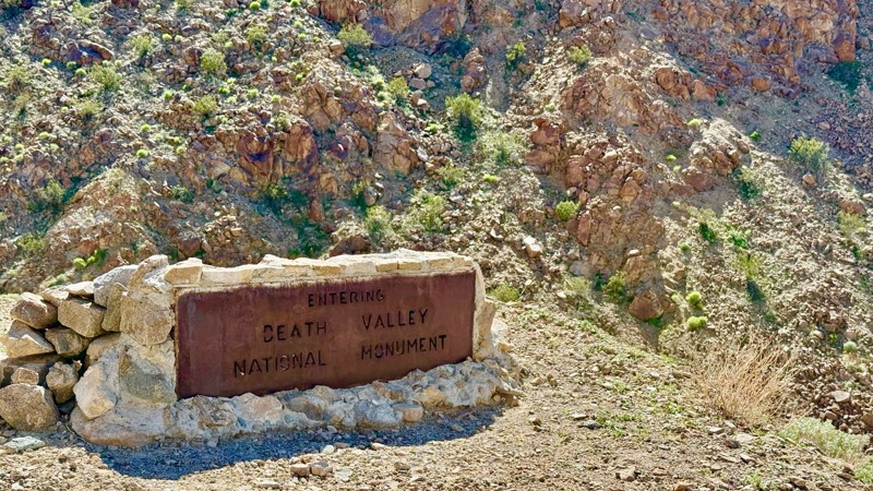
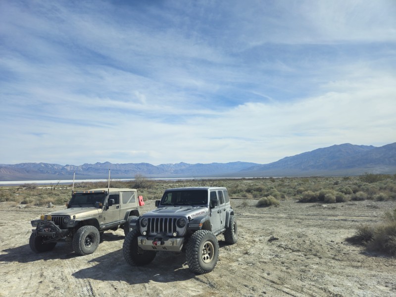
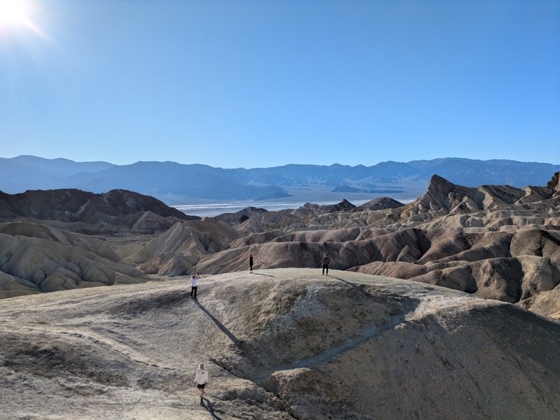
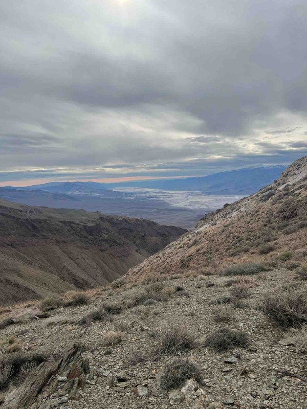
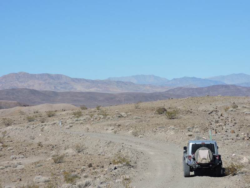
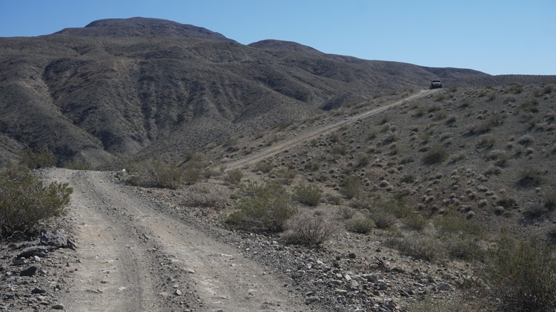
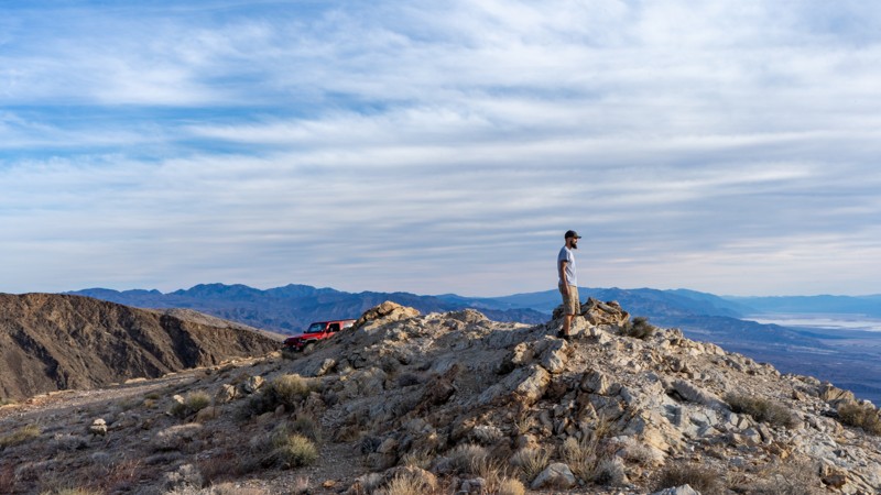
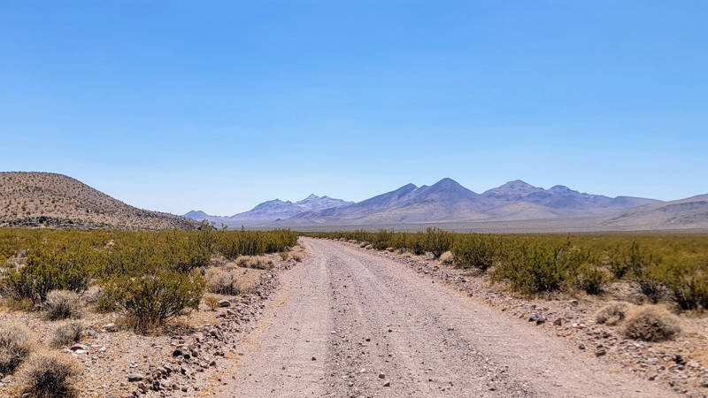
Death Valley National Park is home to one of the most extreme and remote offroad destinations in the U.S. While the paved roads lead to iconic overlooks, the real adventure starts where the asphalt ends—on rugged, unmaintained backcountry roads that carve through canyons, salt flats, and desolate mountain ranges.

With routes ranging from scenic to highly technical, Death Valley rewards offroaders with solitude, history, and surreal desert views. But it also demands respect—road conditions change quickly, and being unprepared can have serious consequences.

Must-Explore Backcountry Routes

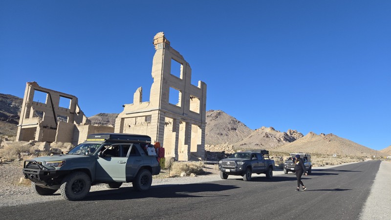
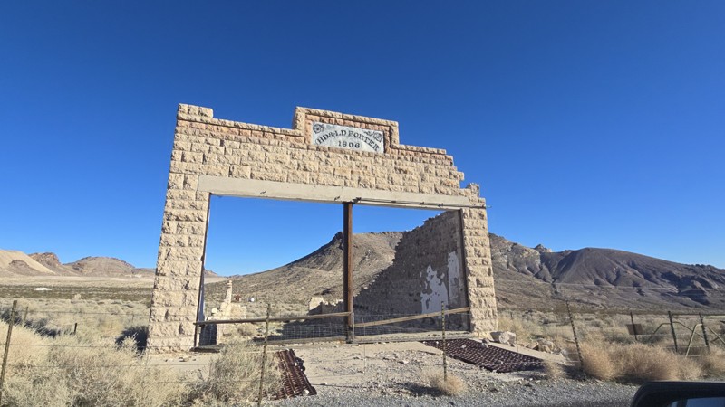
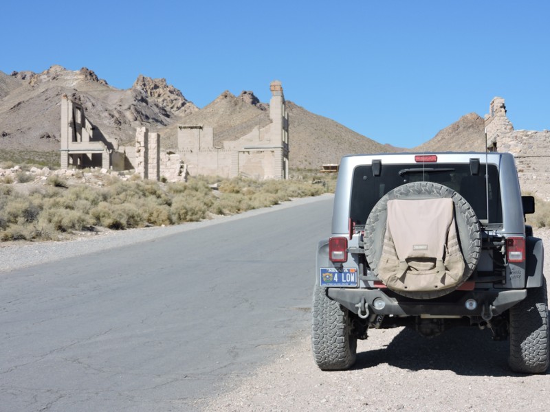
Titus Canyon Road (Closed until 2026)

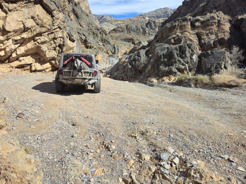
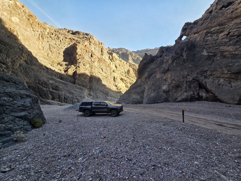
This famous one-way route starts near Beatty, NV, and winds through the Grapevine Mountains before dropping into Death Valley. Expect narrow canyon walls, petroglyphs, and the ghost town of Leadfield. It’s a favorite for a reason—but it’s closed for now.

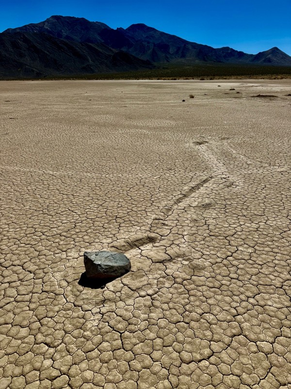
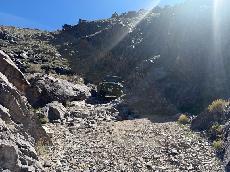
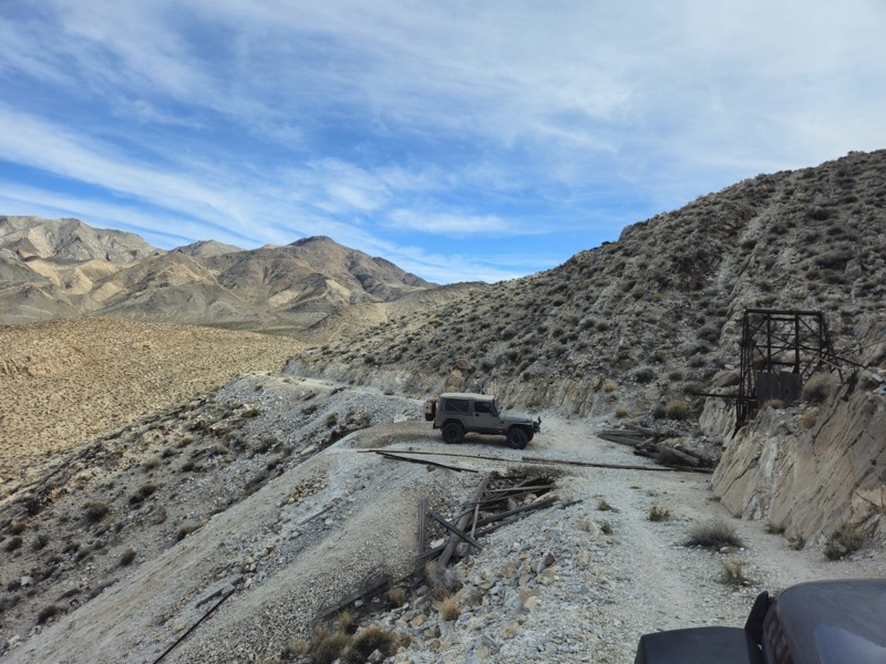
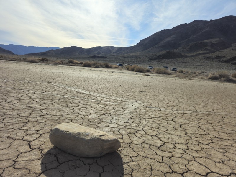
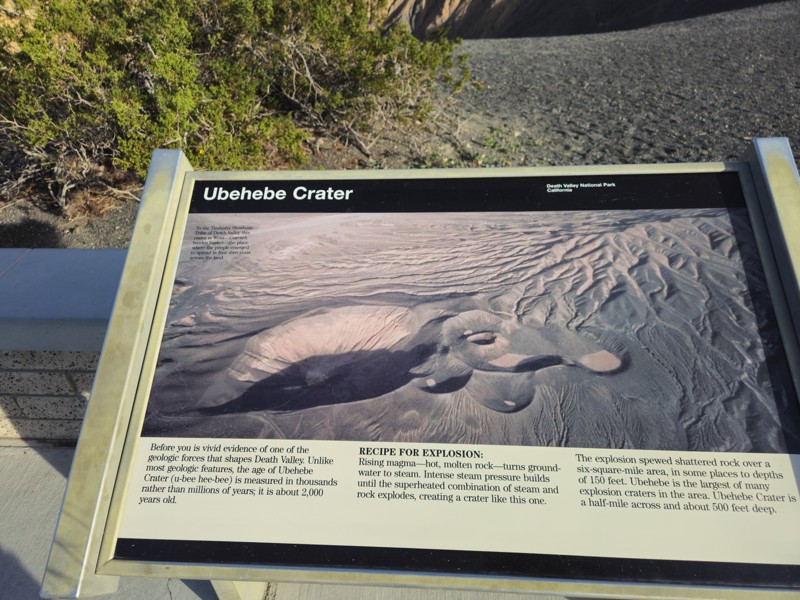
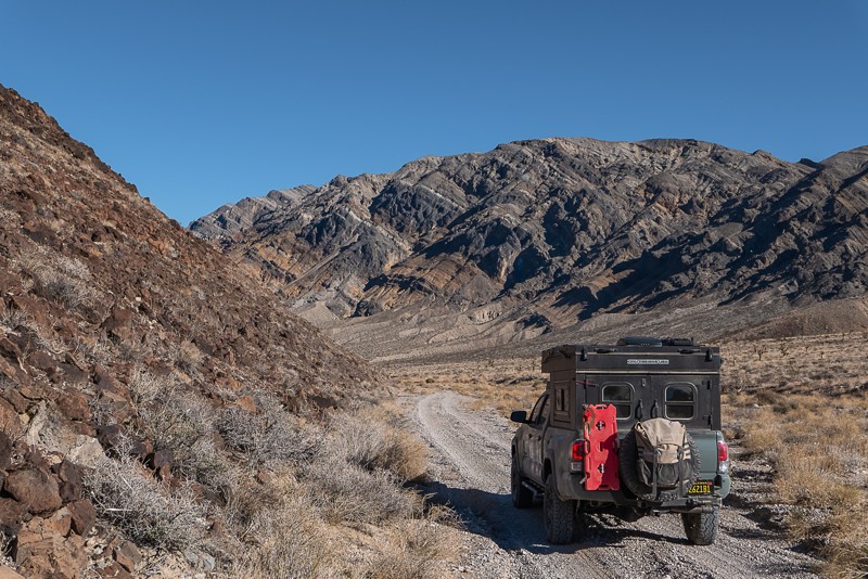
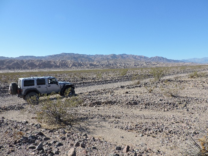
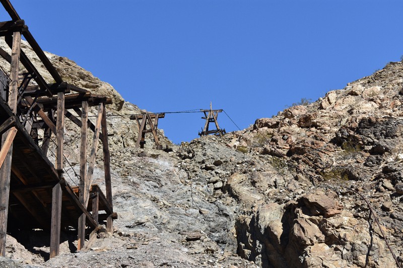
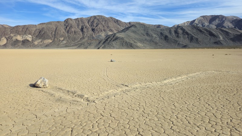
Racetrack Valley Road

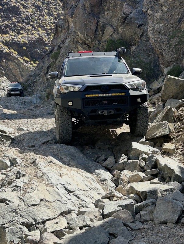
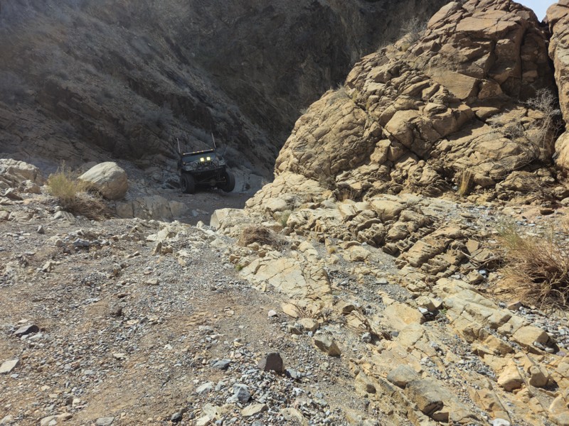
Known for the mysterious sailing stones of Racetrack Playa, this 27-mile road from Ubehebe Crater is extremely rocky and remote. High-clearance 4WD is a must. Bring a spare and watch those tires—this road is notorious for sharp rocks.
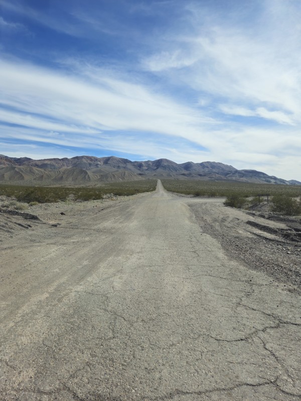
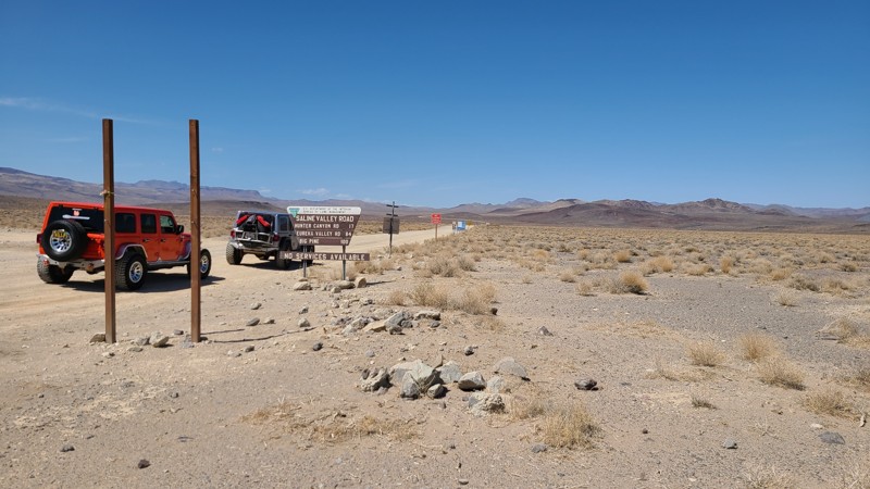
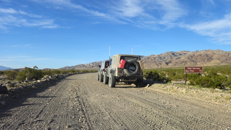
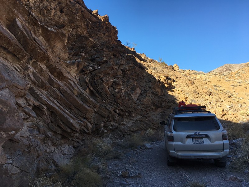
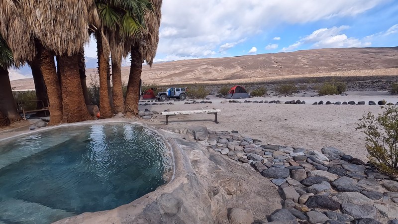
Saline Valley Road

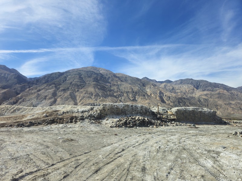
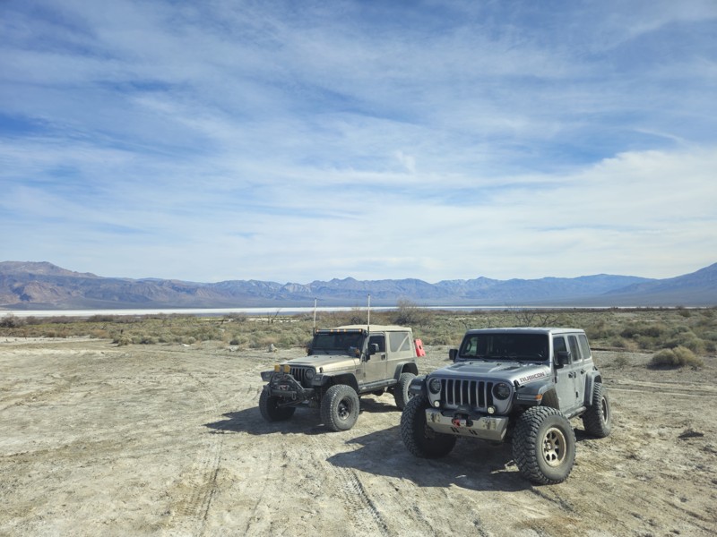
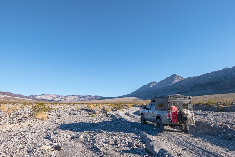
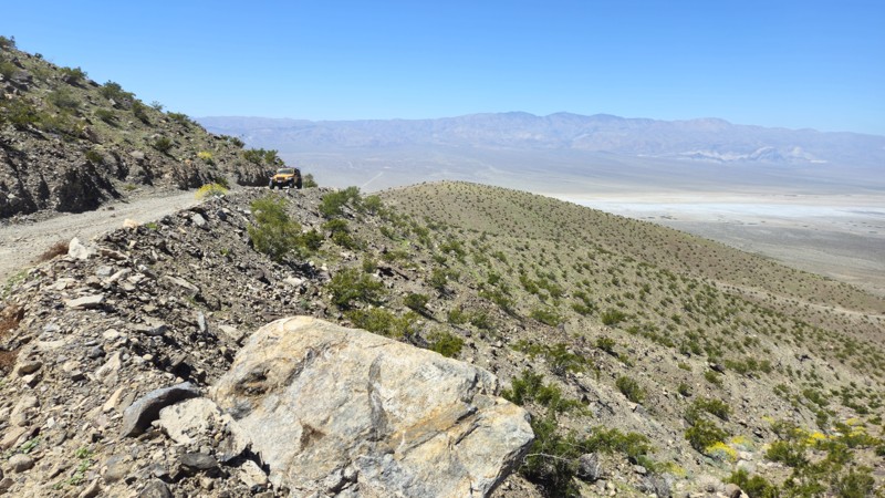
An iconic route leading to Saline Valley Warm Springs, this road travels through salt flats, mountains, and washboard terrain. Conditions vary seasonally and can become impassable after storms. Plan for self-sufficiency.
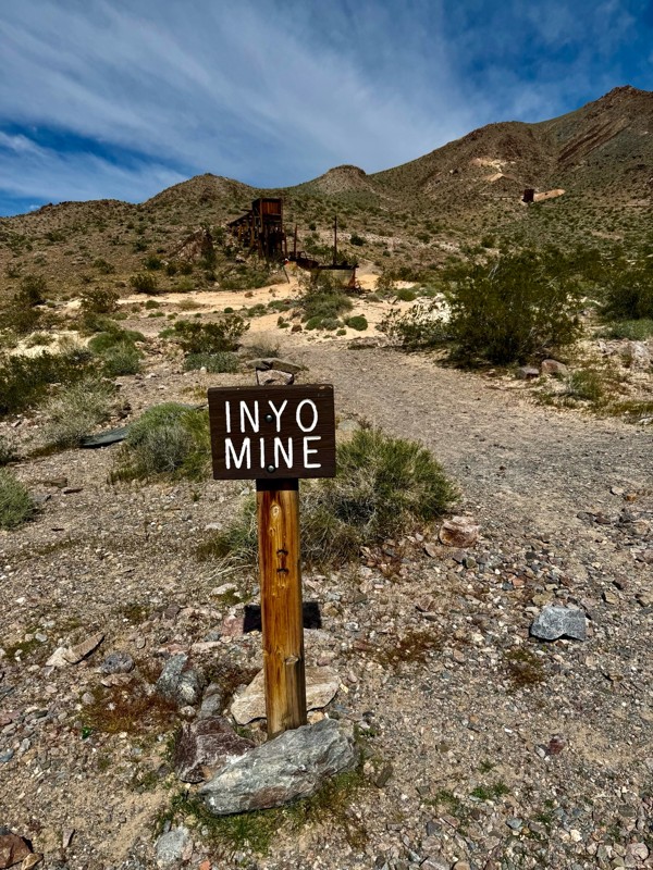
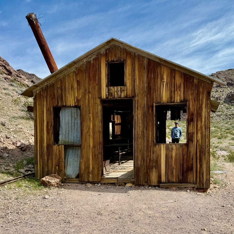
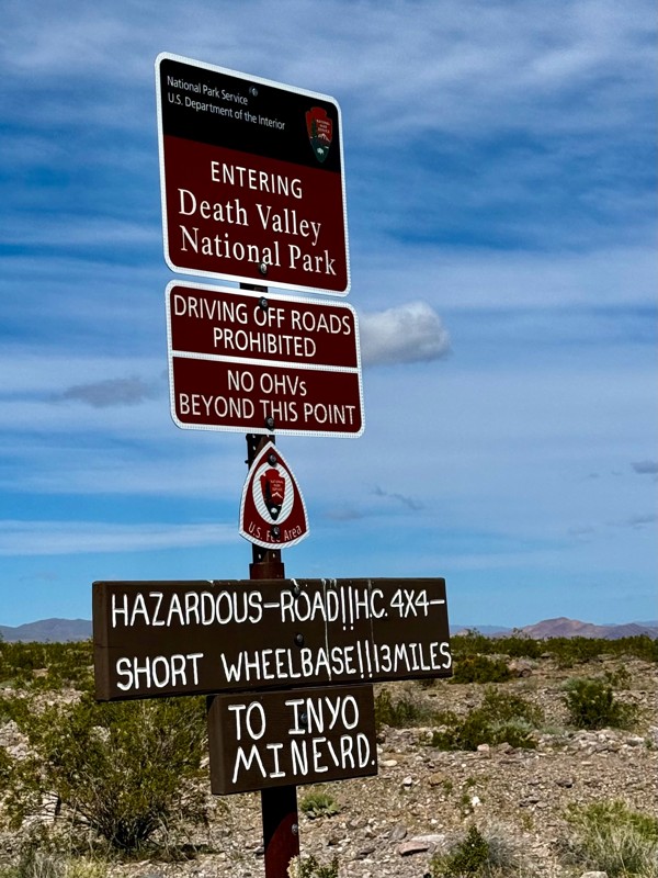
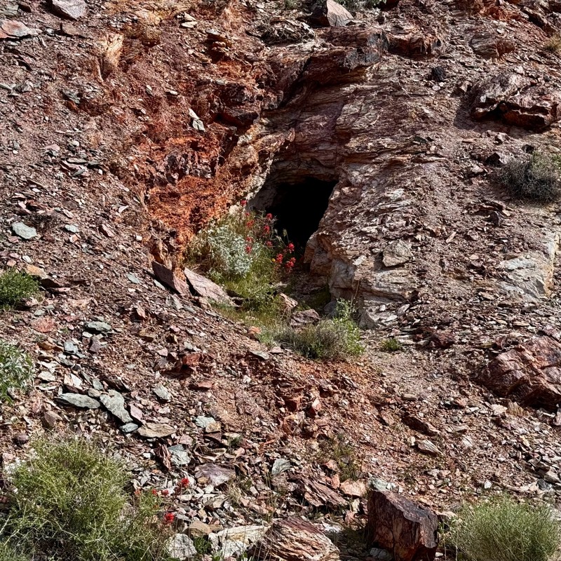
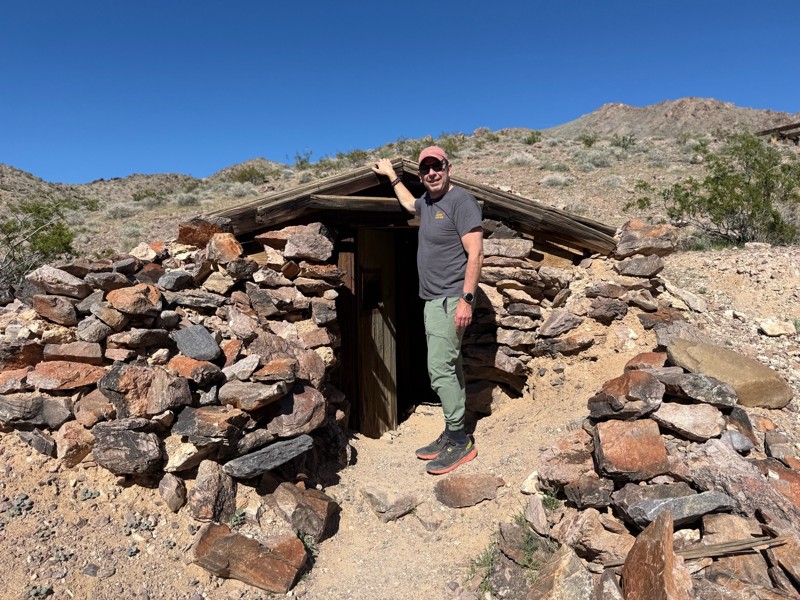
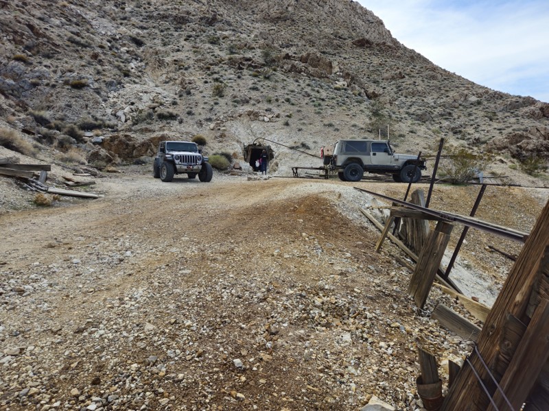
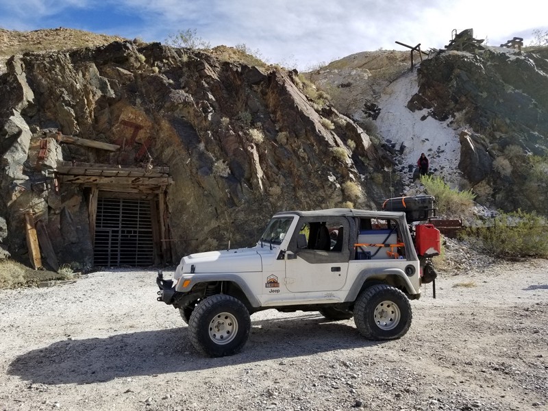
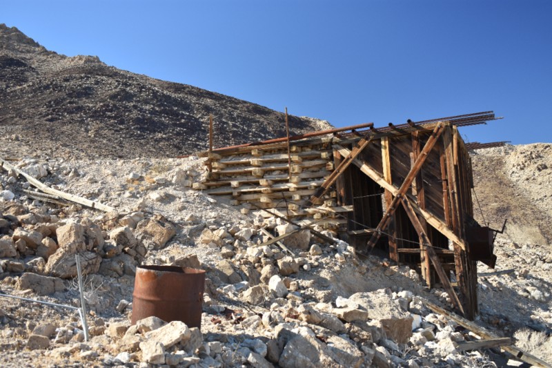
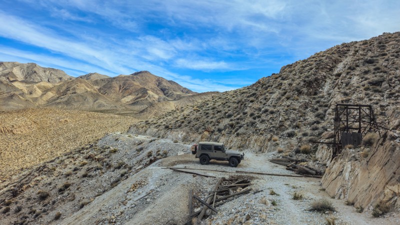
Echo Canyon Road

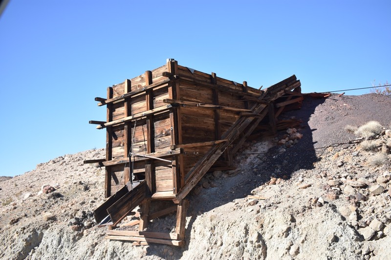
Just east of Furnace Creek, this steep, narrow trail heads into Echo Canyon and past Inyo Mine. It’s rough but doable with a high-clearance vehicle. A great intro to Death Valley’s off-pavement offerings.

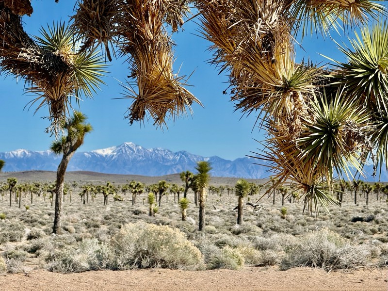
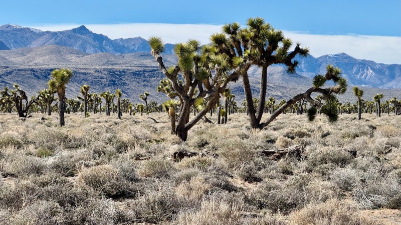
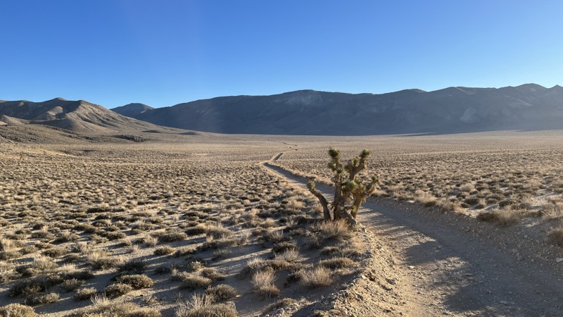
Hidden Valley and Hunter Mountain Roads

Located on the park’s west side, these roads pass through remote Joshua tree forests and up to Hunter Mountain. Winter brings mud and snow, so check conditions. Incredible views reward the effort.
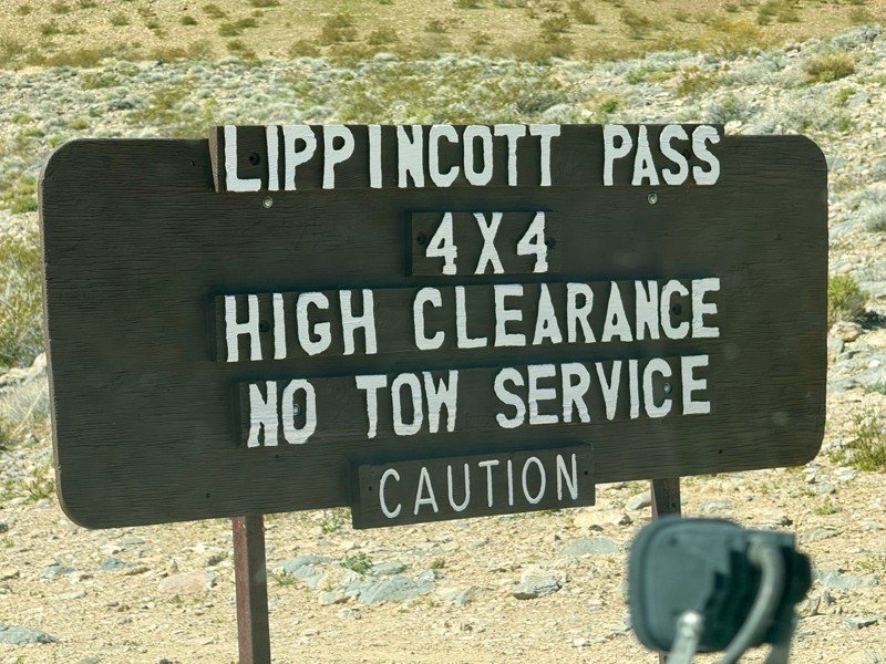
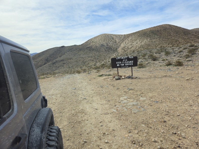
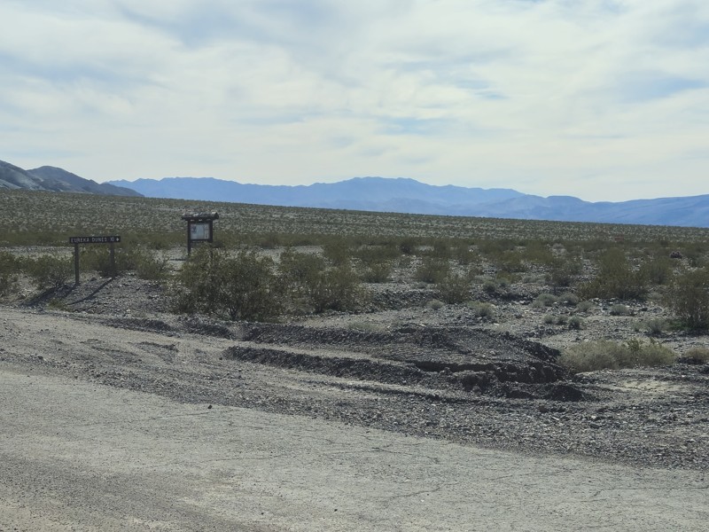
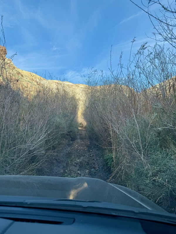
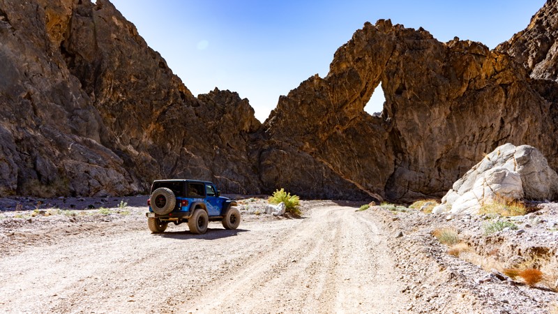
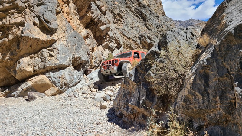
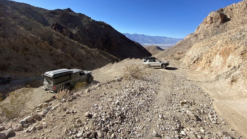
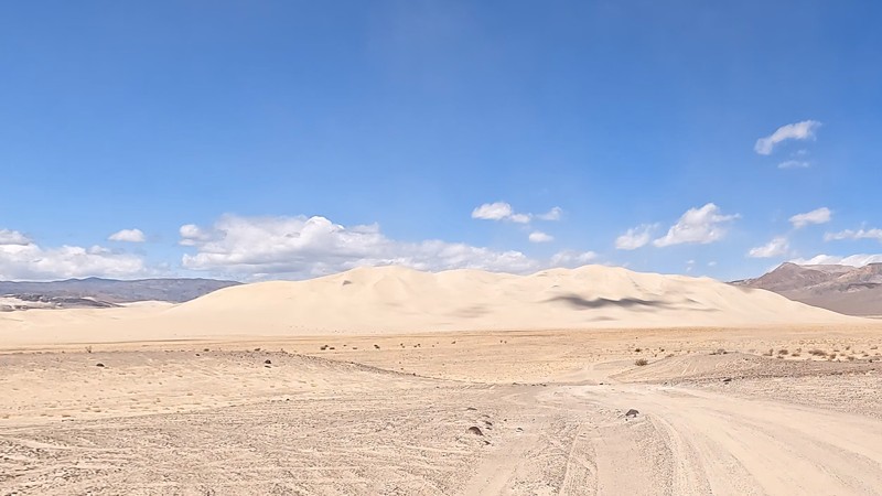
Steel Pass

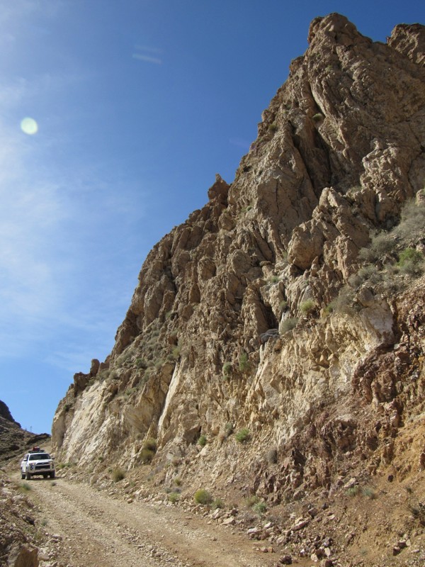
Connecting Saline Valley to Eureka Dunes, this is one of the park’s most technical trails. Deep sand, steep climbs, and rocky sections require offroad experience and a well-equipped vehicle. Don’t go solo.

Check Road Conditions Before You Go

Death Valley’s backcountry is unpredictable. Flash floods, washouts, and rockslides can close trails with little notice. Always verify conditions before heading out:

  • Official NPS road open/close status
  • Call the Death Valley Visitor Center: (760) 786-3200
  • Check Death Valley NP social media or talk with park rangers

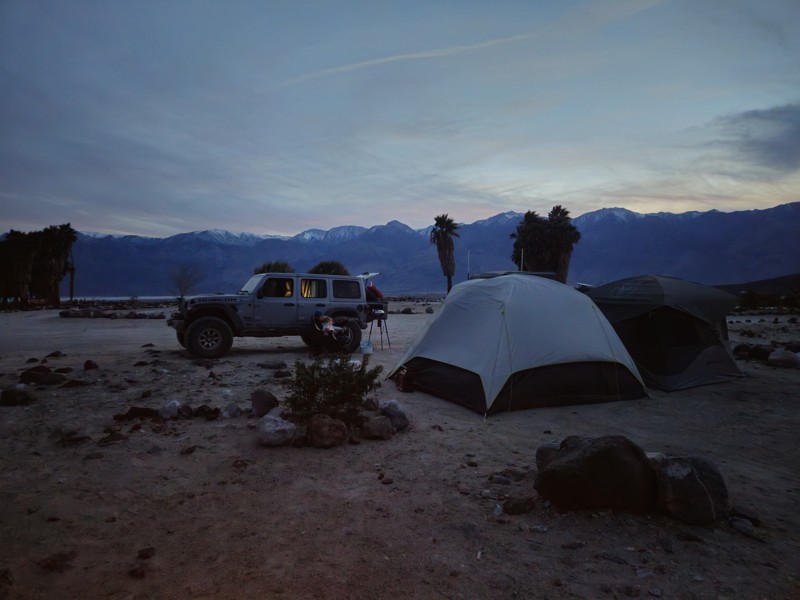
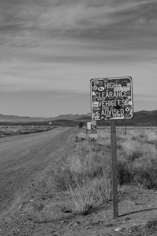
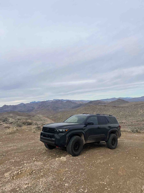
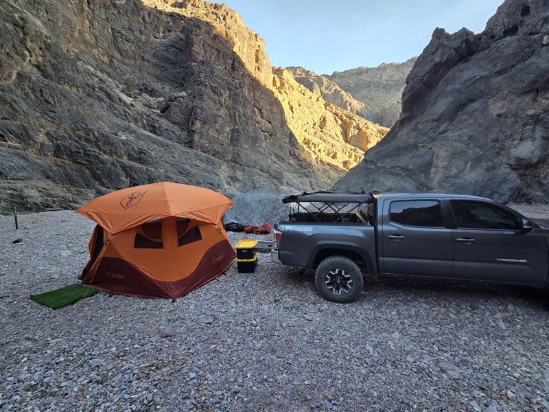
Offroad Travel Tips for Death Valley

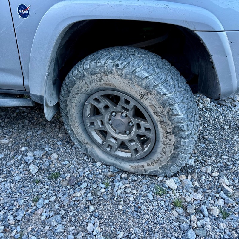
  • High-clearance 4WD strongly recommended for most routes
  • Carry extra water, food, and fuel—services are rare
  • Check weather for flash flood risk
  • Bring a full-size spare, jack, and tire repair tools
  • Let someone know your plan—cell service is unreliable

Whether you're heading for the solitude of Saline Valley or chasing ghost towns in Echo Canyon, Death Valley’s backcountry roads offer unmatched offroad adventure. Use Trails Offroad to plan, navigate, and stay safe out there.

Top Reasons to Explore Here
Altitude Category IconAltitude
Beginner Category IconBeginner
Camping Category IconCamping
Desert Category IconDesert
Forest Category IconForest
Ghost Town Category IconGhost Town
Iconic Category IconIconic
Mine Category IconMine
Mud Category IconMud
Overland Category IconOverland
Rock Category IconRock
Sand Category IconSand
Scenic Category IconScenic
Snow Wheeling Category IconSnow Wheeling
Wash Category IconWash
Water Category IconWater
Trail Types
Scout Route
Full Trail Guide

Preview Trail Icon
Preview Trails
easy
moderate
difficult
severe
extreme

All-Access
Scout Route
Start a 7-day Free Trial

Most Recent Trail Reviews

Most Popular

Search for Trails
California: Pleasant Canyon Loop Trail Hero Photo
All-Access Icon
4.8/5 (20 reviews)
Updated: 09/24/2024
Pleasant Canyon Loop Trail
Ballarat, California

For the overlander who truly wants to explore the best of Death Valley, the Pleasant Canyon Loop Trail offers a little bit of everything. Mines, cabins, steep mountain ascents and descents, epic views, rocks, cliffs, wood bridges, and more. The loop begins and ends in the Panamint Valley and explores Pleasant Canyon, Middle Park, and South Park. Some of the many sites to visit are Claire Camp, World Beater Mine Cabin, Cooper Mine, Mormon Gulch, Rita's Cabin, Roger's Pass, Chicken Rock (see photo), Chicken Bridge, and Briggs Cabin. Chicken Rock is a downward-tilting, narrow section of the trail which tips your vehicle precariously towards a 200' vertical drop. Once past this obstacle, you face the famous 3-ton limit wooden bridge before descending back into the Panamint Valley to complete the loop.

California: Saline Valley Alternate Route Hero Photo
Scout Route Icon
4.8/5 (8 reviews)
Updated: 09/13/2025
Saline Valley Alternate Route
Monola, California

This is the only trail that runs north to south on the northern side of Death Valley. This is also the easiest way into the Saline Valley. The trail has amazing views of the mountains towering over the salt flats. The area is a very remote desert with no resources. Never travel alone. Dispersed camping is abundant along Saline Valley. For warmer days, check out Boxcar Cabin on the southern side up in the mountains. With cooler weather, plenty of camping is available in the Saline Valley, the center area of this trail. All camping is dispersed and remote. Prepare accordingly.

California: Goler Wash / Canyon Hero Photo
All-Access Icon
4.8/5 (20 reviews)
Updated: 09/24/2024
Goler Wash / Canyon
Furnace Creek, California

Goler Wash, also known as Goler Canyon, is an enjoyable off-road cut through over the Panamint Mountain Range from Ballarat near Trona to Death Valley National Park in California. The trial is popular for being the home of Barker Ranch, aka Manson Ranch. In 1969 the FBI raided the ranch when they found out the Manson Family was living there. But don't think this is an easy 4x4 pass through. The trail is known to get washed out making it a go-to place for a mild offroad trail to wild overland adventures. Along the route expect beautiful scenery of the canyons that seem to tower above you while the old mines placed up on the side of the cliffs seem to have no way for people to ever access them. If the trail is washed out, expect an intermediate waterfall that is slick with running water on over it. Today, the park service spends a lot of time maintaining this trail, trying to keep the trail easily passable for even a 2wd. To spice things up, make this into a weekend overland adventure including off-roading Warm Springs Road, Butte Valley, Mengel Pass, and Goler Wash. This just might be the best 4wd Jeep Trails you have or will ever take and the dispersed camping is top notch.

California: Mengel Pass Hero Photo
All-Access Icon
4.9/5 (29 reviews)
Updated: 09/24/2024
Mengel Pass
Ballarat, California

Mengel Pass is a popular trail within Death Valley National Park as it connects Panamint Valley on the west end of Death Valley to beautiful Butte Valley on the east side. Along the trail are an overlook of Butte Valley and Striped Butte plus the gravesite of Carl Mengel, a historic prospector from the early 20th century. The trail is no easy feat with its constant changing terrain and difficulty. Some days the trail is a mild path while other days, it can damage any vehicle that attempts the crossing. Due to the changing landscape of the obstacles, Mengel Pass is a fun and challenging run for all comers!

California: West Side Road - Death Valley National Park Hero Photo
All-Access Icon
4.2/5 (19 reviews)
Updated: 09/24/2024
West Side Road - Death Valley National Park
Furnace Creek, California

Don't be fooled by the easy 4x4 trail rating, this Death Valley National Park backcountry route has a history of being deadly for the unprepared. Almost every year some unfortunate gets stuck, breaks down, and in some cases just wander off and perish along this road. This 37-mile backcountry route runs below sea level for its entire length. It was the original route of the 20 Mule Team Borax wagons out of Death Valley and offers the only access to the east side of the Panamint Mountains south of Furnace Creek. Along the route, mining was active at the Queen of Sheba mine as recently as 1970, Hungry Bill had a small farm and mining operation in Johnson Canyon that he supplied miners with fresh vegetables. The infamous Charles Manson and his followers were captured at Barker Ranch which is on the west side of the Panamint Mountains and accessible from the Butte Valley Road that intersects West Side Road. Death Valley Shorty, a former Buffalo Bill Wild West Show performer and famous flim-flam man for which Scotty's Castle is named, is buried along the road. There are the remains of old borax works and the nearly impassable Devil's Golf Course geologic formation is comprised of evaporated salt.

California: Death Valley Road Hero Photo
Scout Route Icon
5/5 (8 reviews)
Updated: 02/06/2025
Death Valley Road
Old Camp, California

Death Valley Road takes you from Big Pine to close to Furrance Creek Death Valley. This is a common path for people to travel while exploring Death Valley, as this takes you out of the park's exit from the northwest side. People often use this road to access Saline Valley, Steel Pass, and other popular areas on the park's north side. While few people choose to camp along this road, there are several areas big enough for a small group. Check out the mine near the northern turn on the east side for larger groups.

California: Warm Springs Road - Death Valley Hero Photo
All-Access Icon
5/5 (16 reviews)
Updated: 09/24/2024
Warm Springs Road - Death Valley
Furnace Creek, California

When thinking overland, there is nothing more exciting and scary sounding than the words, "Death Valley." This is only a couple of the reasons Warm Springs Road makes many different top 5 or top 10 offroad / overland trails lists. That is, Death Valley National Park might just be one of the best overland and 4x4 trips in all of California and possibly the United States. This unique off-road trip takes you down the historic and scenic backcountry of what might be one of the worlds most famous locations. Along this offroad trail, you will come across many abandoned mines, abandoned cabins, trickling streams, and even water crossings. Did we mention an abandoned swimming pool? Yes, that is right, a swimming pool in Death Valley. Warm Springs trail itself is rather tame and easy to navigate for even the newest of offroad drivers. The trail is perfect for stock Toyota 4Runners, Tacoma's, Jeep Wranglers, and pickup trucks. But if you would like to make this trip into an exciting camping and overland trip, many offroad enthusiasts take this Jeep Trail all the way through the mountain range to Panamint Valley. To do this you take Warm Springs, to Butte Valley, then continue through Mengal Pass, to Goler Wash stopping at the Barker Ranch aka Manson Ranch, and dropping to Panamint Valley. Please note, the trail through Mengal Pass is much more difficult then Warm Springs Road. Stock vehicles are still capable of completing Mengel Pass but might need spotting or rock stacking to complete the trail. More equipped vehicles like the Jeep Rubicon, Toyota's TRD platform and P/U's like the Colorado ZR2 will be better suited for that section of the adventure. If you plan on this extended overland trip, plan this over a weekend because this trip takes about 2 days with all the scenic and historic stops along the trail. There is ample dispersed camping along the route and which the abandon cabins make for an awesome night of camping. Thus, when planning your next epic off-road vacation, think nothing less then Warm Springs Road / Canyon because this 4wd enthusiast overland trip is something everyone should experience at least once in their life.

Nevada: Titus Canyon Road Hero Photo
All-Access Icon
4.5/5 (26 reviews)
Updated: 09/24/2024
Titus Canyon Road
Beatty, Nevada

Titus Canyon Road is a spectacular off-road trail within Death Valley National Park guaranteed to please. It is no wonder this one-way trail attracts thousands of globetrotting visitors each year. The 27-mile long road plunges visitors into fossil-rich canyons, over mile-high passes on rocky shelf roads, through a ghost town, along petroglyph-filled walls, and culminates in the grand finale. Titus Canyon Road shrinks to one vehicle-wide and takes the driver and passengers through a 1.5-mile twisty bobsled-like run through its Narrows before dumping everyone out into a wide vista of northern Death Valley. This gem of a trail is truly one of the most satisfying roads in southern California and is on par with many of the iconic trails in the United States.

California: Echo Canyon Trail Hero Photo
All-Access Icon
4.2/5 (16 reviews)
Updated: 03/05/2025
Echo Canyon Trail
Furnace Creek, California

Echo Canyon boasts Death Valley's best qualities with its spectacular scenery, twisty canyons, rock arches, and mining history. It leads to the once famed "Inyo Mine," which was one of the earliest gold discoveries on the west side of the Funeral Range and also the only mine on that side, that produced more than an occasional sack of gold. The drive is peaceful through the sometimes tight canyon and is complete with an arch named the "Eye of the Needle" that you can't miss. With its nine designated and reserved campsites, scenery, and history, it's the perfect stop for a night on the way in or out of Death Valley.

California: Funeral Range Trail Hero Photo
All-Access Icon
4.7/5 (10 reviews)
Updated: 11/04/2024
Funeral Range Trail
Furnace Creek, California

The Funeral Range Trail joins a long list of Death Valley areas with morbid names: Coffin Peak, Hell's Gate, Starvation Canyon and Dead Man Pass. The trail runs through the Funeral Mountains along Upper Echo Canyon and offers one of the few difficult trail runs within the national park. Tight canyon walls and rock ledges up to 3' in height will test a vehicle's articulation and a driver's skill level. In addition, the trail lies along the eastern edge of the park and starts and stops in two different states: California and Nevada.

California: Harry Wade Road Hero Photo
All-Access Icon
4/5 (9 reviews)
Updated: 09/20/2024
Harry Wade Road
Shoshone, California

The Harry Wade Road (aka Badwater Road) is an easy backcountry route in Death Valley National Park and was first pioneered in 1849 by the Harry Wade family on their way to the California gold fields. Today this remote area of Death Valley National Park sees few visitors but offers spectacular views, and a dramatic water crossing of the Amargosa River, if there is water present.

California: Butte Valley Hero Photo
All-Access Icon
5/5 (7 reviews)
Updated: 09/24/2024
Butte Valley
Furnace Creek, California

In the middle of nowhere on the backside of the Panamint Mountain Range lays a secret of the desert. Even though it is extremely remote (60+ miles to the nearest town) this gem of the desert is a popular place for overlanders and off-road enthusiast to visit. Butte Valley, on the southeastern corner of Death Valley, is a unique and exciting place only accessible by 4wd on very old Jeep Trails. While visiting the area be prepared for some amazing views of lands where very few humans have ever been. You will dive into the old mining days of Panamint Mountains as you enter an area that was constructed back in the late 1800's. Becuase of the immense history, offroad enthusiasts have been visiting this unique wonderland for a long time, both enjoying its beauty and preserving it for future generations. Thus, the next time you are visiting Southern California or looking for something near Las Vegas, plan a trip to Death Valley and check out Butte Valley. To spice things up, make this into a weekend overland adventure including Warm Springs Road, Butte Valley, Mengel Pass, and Goler Wash. This just might be the best 4wd trip you have or will ever take.

California: Saline Valley Trail Hero Photo
Scout Route Icon
4.4/5 (6 reviews)
Updated: 04/25/2025
Saline Valley Trail
Beveridge, California

Perhaps the most remote trail in the lower 48, Saline Valley Road, has virtually nothing around it. But what brings people to this desert is a small natural hot spring, an interesting life-giving oasis in his remote, desolate area. The best place for camping is at the hot springs. There is plenty of places for any sized group to camp. Some choose to camp close to the hot springs, while others prefer to be further away. Note: There is natural spring water at this location, meaning you can take a shower and clean up a little. 2nd Note: Prior to visiting the hot springs, it would be wise to understand the culture around hot springs in California.

California: Hunter Mountain Road Hero Photo
Scout Route Icon
5/5 (3 reviews)
Updated: 04/21/2025
Hunter Mountain Road
Teakettle Junction, California

Hunter Mountain Road, also known as Hidden Valley Road, begins at Teakettle Junction, just north of Racetrack Playa, then passes through Lost Burro Gap and into Hidden Valley. While not the largest empty expanse you’ll come across in Death Valley National Park, Hidden Valley reminds you just how isolated you are. Then, in a dramatic change of scenery, Hunter Mountain Road takes you from the floor of Hidden Valley Dry Lake at 4,626 feet all the way past 7,100 feet of elevation. The only real challenges posed by this road are the sandy lake bed. In the colder months, expect snow and ice on the trail once you reach higher elevations. There are no designated campsites along the trail, but plenty of places along the route could accommodate a few vehicles for the night.

California: Papoose Flats Hero Photo
Scout Route Icon
4.4/5 (5 reviews)
Updated: 02/19/2025
Papoose Flats
Blackrock, California

Papoose Flats trail is a scenic dirt road traverses a dense cedar forest as it ascends to higher elevations on the north end of the Inyo Mountains. The route offers breathtaking views of the majestic Sierra Nevada Mountains with their unique rock formations. This hidden gem is a haven for outdoor enthusiasts seeking solace in the quiet beauty of nature. Dispersed camping is permitted all along the trail, making it a perfect spot for an overnight stay under the stars. A trip to Papoose Flats trail is an unforgettable experience for anyone looking to escape the hustle and bustle of city life and immerse themselves in the serene wilderness of California.

California: Owls Head Mountains / Microwave Tower Road Hero Photo
All-Access Icon
0/5 (2 reviews)
Updated: 09/24/2024
Owls Head Mountains / Microwave Tower Road
Shoshone, California

This easy 4x4 backcountry route is the only access to the remote Owlshead Mountains in the extreme southwestern corner of Death Valley National Park. It is perhaps the most remote backcountry road in the Park and far from much else. Wide open vistas with unusual geologic formations and the possibility of observing military aircraft training await you. You will climb nearly 4000 feet in elevation with stunning scenery along the route with the possibility of spotting wild burros and desert bighorn sheep.

California: Fish Canyon Escape Trail Hero Photo
Scout Route Icon
4/5 (5 reviews)
Updated: 05/25/2025
Fish Canyon Escape Trail
Valley Wells, California
The Fish Canyon Escape Trail is a moderate 4x4 trail twisting, turning and climbing it's way through the hills as it connects Panamint Valley and Searles Valley at Trona, California. This moderate trail includes some steep and narrow sections on the Panamint Valley side and smooth sand washes on the Searles Valley side as it travels through Goff Canyon. Wheelers who don't mind the steep hills and are looking to enjoy the valley views will like this trail while rock crawlers will find it a necessary escape route from the more technical Isham Canyon.
California: Lippincott Pass Hero Photo
Scout Route Icon
4.7/5 (7 reviews)
Updated: 04/21/2025
Lippincott Pass
Teakettle Junction, California

Lippincott Pass is an iconic trail in the heart of Death Valley that takes you from Saline Valley to the even more iconic destination of Racetrack Playa. The trail is incessantly rocky and jarring. Combine that with the steep shelf road, and you are sure to give your passenger an uneasy stomach. The beginning of the road passes through one deep wash that requires careful line choice and low range. Then, multiple partial washouts bring you even closer to the edge coming through the pass. Between the narrow road and the rocks, it’s best to be accompanied by a functioning 4WD system and an experienced driver. There are no campsites along Lippincott Pass.

California: Queen of Sheba Mine - Death Valley National Park Hero Photo
All-Access Icon
5/5 (4 reviews)
Updated: 09/24/2024
Queen of Sheba Mine - Death Valley National Park
Furnace Creek, California

This easy 4x4 route to the Queen of Sheba Mine follows the original haul road and was in limited commercial use as recently as the 1970's. Total production of the Queen of Sheba has reportedly been 5,000,000 lbs. of lead, 100,000 ozs. of silver, 1,500 ozs. of gold, and 146,000 lbs. of copper. There are extensive mine ruins, and several 2 track trails to explore around the Queen of Sheba Mine. The town and camp of Carbonite sprang up around 1900 near the Carbonite Mine site which is a short distance away. There are no ruins of the town visible.

California: Eureka Valley Road Southside Hero Photo
Scout Route Icon
4.8/5 (6 reviews)
Updated: 04/25/2025
Eureka Valley Road Southside
Crater, California

This scenic road takes you from Death Valley Road to the Eureka Sand Dune where you will find plenty of areas to camp. The Eureka sand dune is the largest sand dune in Death Valley. If you continue down the trail, it turns into Steel Pass.

California: Chloride Cliff Road Hero Photo
All-Access Icon
4.2/5 (6 reviews)
Updated: 03/25/2025
Chloride Cliff Road
Beatty, California

Situated on the east side of Death Valley National Park, within the Funeral Range Mountains, lies one of the oldest mines in the entire park, and the highest point gives unparalleled views as it overlooks Badwater Valley. The original mine was discovered by August J. Franklin in 1871. The story is told that he picked up a rock to crown a rattlesnake and found silver ore. He founded the Chloride Cliff mining company with the first claims he staked. The mine could not produce enough revenue and mostly stopped operations until the Bull Frog mining boom in 1905. With towns like Rhyolite nearby to help support the mine, a permanent camp was established to ramp up operations and was called Chloride City. Not much remains today except for adits, tailing piles, and the grave of James McKay, an unknown man with no known story to tell. It's the perfect trail to add to your Death Valley list.

Nevada: Rhyolite Railroad Loop & Ghost Town Hero Photo
All-Access Icon
3/5 (5 reviews)
Updated: 06/05/2022
Rhyolite Railroad Loop & Ghost Town
Beatty, Nevada
This easy 4x4 route follows a portion of the Bullfrog Goldfield Railroad's standard gauge spur route into Rhyolite, Nevada, the most photographed ghost town in the west. At its peak, nearly 5000 people lived here, one building was 3 stories tall and cost $90,000 to build. A stock exchange and Board of Trade were formed. The red light district drew women from as far away as San Francisco. There were hotels, stores, a school for 250 children, an ice plant, two electric plants, foundries and machine shops and even a miner’s union hospital. You'll cross over grade fills and pass through grade cuts. You'll pass the historic Montgomery-Shoshone Mine site, the old Rhyolite train station that is slowly being restored, and Tom Kelly's bottle house, made of over 50,000 bottles. The other remaining buildings are all concrete hulks as wood is scarce in Nevada, and was reclaimed to help build new facilities somewhere else. Be sure to visit the Goldwell Open Air Museum at Waypoint 7 of the trail guide. The free museum displays old artifacts and modern art, and the last shot in the video was taken there.
California: Black Magic Mine Road Hero Photo
All-Access Icon
0/5 (2 reviews)
Updated: 09/20/2024
Black Magic Mine Road
Shoshone, California

The Black Magic Mine backcountry 4x4 route is located in perhaps the most remote area of Death Valley National Park. You will likely see wild burros in the area, and lucky travelers may spot desert bighorn sheep. The road to the Black Magic Mine frequently floods during the rainy season, and unless you know there actually is a road, the mine could be difficult to find. There are no signs, and due to water running down the sand wash, previous vehicle tracks may be obliterated making you wonder where you are headed. Prior to WWII, 20 mule team borax wagon trains followed the Owl Hole Spring Road that accesses the road to the Black Magic Mine. These wagon trains would stop at Owl Hole Spring at the Black Magic Mine trailhead on their way to and from the railroad terminal at Mojave, California. Created originally as a national monument, Death Valley was substantially expanded and became a national park in 1994, but the history of the Black Magic Mine goes back to its discovery in 1916. Early ore prices made hauling the magnesium ore out of Death Valley too expensive to develop the mine until WWII when the demand for magnesium drove prices up.

California: Lotus Mine Road Hero Photo
All-Access Icon
4/5 (4 reviews)
Updated: 04/09/2024
Lotus Mine Road
Ballarat, California
Just outside of Death Valley National Park and within Goler Canyon, a short, twisty mining road leads to an expansive view of the Panamint Valley to the west. This nicely graded road snakes its way up the mountainside, much like Shafer Trail in Utah, passing by decrepit cabins, active mines, and a massive, craggy 4000' monolith.
California: Keane Wonder Mine Hero Photo
All-Access Icon
3/5 (2 reviews)
Updated: 09/24/2024
Keane Wonder Mine
Furnace Creek, California

This well-maintained gravel road goes into Death Valley's backcountry for access to one of the parks most successful mining areas, the Keane Wonder Mine and Mill. The mine and mill are one of the best examples of a historical gold mining operation in the national park. What is unique about this site is the well-preserved aerial tramway that still has the cables attached. The mine was first prospected in 1903 and was opened and closed at least twice before successful operations began. It was bought and sold several times after it was closed in 1912, but it never was commercially viable again.

California: Wood Canyon Hero Photo
All-Access Icon
5/5 (4 reviews)
Updated: 03/24/2023
Wood Canyon
Furnace Creek, California

Woods Canyon, situated on the west side of Butte Valley, is this rarely visited mining camp from the early mining area of Death Valley. Because of its remote location, many of the items left behind by the miners remain today, making this a must-stop when exploring the area. At the end of this scenic canyon is Wood Camp, with its cabin and artifacts.

California: Greenwater Valley Road Hero Photo
Scout Route Icon
4.5/5 (3 reviews)
Updated: 04/21/2025
Greenwater Valley Road
Ryan, California

This incredible drive starts at the southern end of Death Valley National Park, just off the road to Dante’s View, which is epic! The arid desert climate provides spectacular views of the Black Mountains to the west, and Greenwater Range to the east!

Camping is allowed along the dirt roads, however, you will need a permit click here for the link to the permit. The road itself is well maintained with a few small rocky sections, but any high-clearance vehicle can make it, 4WD is not necessary.

In case you didn’t know, Death Valley is the hottest place on Earth! So stay away from this region during the summer months, and always check the conditions before you go as the temperature can get up to 130 degrees.

California: Steel Pass aka Dedeckera Canyon Hero Photo
All-Access Preview Icon
5/5 (12 reviews)
Updated: 08/12/2025
Steel Pass aka Dedeckera Canyon
Open
/
Teakettle Junction, California/
8.25 miles/
About 3 hours

Steel Pass is one of Death Valley’s crown-jewel backcountry routes. It is remote, rugged, and strikingly beautiful. Connecting Saline Valley to the Eureka Dunes, this trail carries you through an ever-changing landscape of salt flats, colorful canyons, volcanic rock, and endless desert horizons. Drivers can expect a steady climb from the warm springs in Saline Valley up through the narrows of Dedeckera Canyon, where tight rock walls and a few mild ledge obstacles add just enough technical flavor to keep things exciting without requiring an extreme rock crawler.

California: Lower Pleasant Canyon Bypass Hero Photo
Scout Route Icon
5/5 (3 reviews)
Updated: 06/19/2025
Lower Pleasant Canyon Bypass
Ballarat, California

Look no further than this road when looking for a bypass for the lower section of Pleasent Canyon. Recently graded in 2024, this extremely easy dirt road that snakes its way up the side of the mountains can be done in any high-ground clearance vehicle. Starting at 1,084 feet above sea level and rising to over 2,880 feet, this easy bypass takes you around the lower section of Pleasent Canyon, which is known to get eroded by flowing water and be insanely overgrown. This trail drops you where Pleasant Canyon opens up and is no longer overgrown. Along the route, you will see similar terrain to the lower Jackpot Canyon, a sparse desert terrain. This trail is graded, so all 2WD vehicles should be able to drive this trail.

Due to the nature of this trail being on the side of the hill, there are no suitable locations to camp.