Region

Beasley Knob

Georgia

Offroad Trails in Beasley Knob

A Region within Georgia
4.2/5 (27)

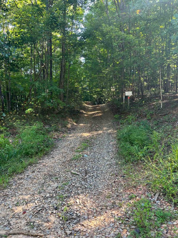
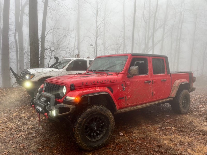
The Beasley Knob OHV Trail System is located in Georgia’s Chattahoochee National Forest, near Blairsville. It features 13.4 miles of interconnected dirt trails, rock hill climbs, and gravel roads, designed for off-highway vehicles (OHVs) such as four-wheel drive vehicles, motorcycles, UTVs, and ATVs.

Terrain & Difficulty
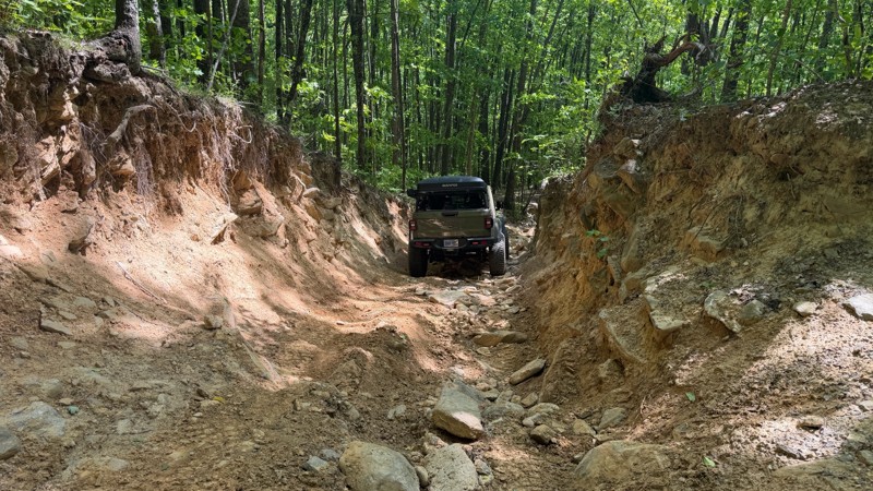
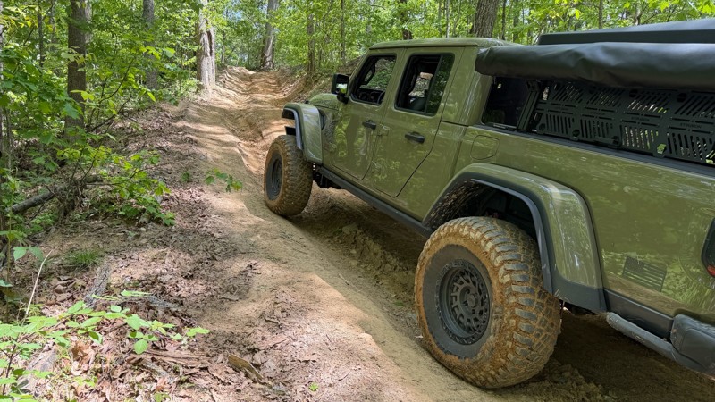
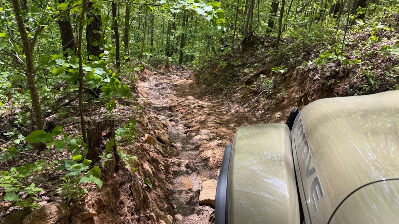
Beasley Knob is known for its steep inclines, off-camber turns, rocky sections, and slick Georgia clay, which becomes especially treacherous when wet. The significant elevation changes create both uphill and downhill challenges, requiring technical skill and a capable vehicle. Due to the demanding conditions, this trail system is recommended for experienced riders.

Access & Fees
The trail system has two access points:

  • Satterfield Trailhead (off Old Satterfield Road)
  • Blue Rock Trailhead (off Rosemary Drive)
  • A 1-Day Pass costs $5 per operator and can be purchased online at Recreation.gov or at the Blue Ridge Ranger District Office. Riders can also opt for an OHV Annual Pass ($50), which is valid for multiple Georgia OHV trails, including Beasley Knob.

    Closures & Restrictions
    The trail system is closed from January 1 to March 31 to protect natural resources during wet and freezing conditions. It may close at any time throughout the rest of the year due to wet weather. Before visiting, call the Blue Ridge Ranger District to confirm trail conditions. Night riding is not permitted.

    Preparation & Caution
    Given the challenging terrain, drivers should ensure their vehicles are well-equipped for off-road conditions. Less experienced riders should build proficiency on easier trails before attempting Beasley Knob.

    Top Reasons to Explore Here
    Beginner Category IconBeginner
    Camping Category IconCamping
    Forest Category IconForest
    Mud Category IconMud
    Rock Category IconRock
    Trail Types
    Scout Route
    Full Trail Guide

    Preview Trail Icon
    Preview Trails
    easy
    moderate
    difficult
    severe
    extreme

    All-Access
    Scout Route
    Start a 7-day Free Trial

    Most Recent Trail Reviews

    Most Popular

    Search for Trails
    Georgia: 93C - Nicholson Gap Hero Photo
    All-Access Preview Icon
    4.5/5 (22 reviews)
    Updated: 06/15/2024
    93C - Nicholson Gap
    Open
    /
    Blairsville, Georgia/
    2.53 miles/
    About an hour

    Located just east of Blairsville, in the Chattahoochee National Forest of north Georgia, Nicholson Gap is one of the main trails into the heart of the infamous Beasley Knob OHV Trail System. This narrow, single-lane trail will get the blood pumping like an amusement park ride as you twist and turn through the dense foliage, climb up and down steep grades, and sling bright orange Georgia mud down the sides of your vehicle. Combine this trail with several others in the network to fully complete the only Jeep Badge of Honor in the state of Georgia.

    Georgia: 93A - Access Hero Photo
    All-Access Preview Icon
    3.5/5 (12 reviews)
    Updated: 06/15/2024
    93A - Access
    Open
    /
    Blairsville, Georgia/
    1.81 miles/
    About 20 minutes

    Situated in the Chattahoochee National Forest of north Georgia, 93A is the simplest and easiest road within the Beasley Knob OHV Trail System. Known simply as "Access," this trail leads to several of the most intense Beasley Knob trails. It offers a few great camping opportunities that are sometimes used as impromptu camps after a long, eventful day tackling other trails in the network. Come explore for a day or a weekend, but combine this trail with several others in the network to complete the only Jeep Badge of Honor trail in Georgia.

    Georgia: 93D - Bridge Gap Hero Photo
    All-Access Preview Icon
    4.3/5 (16 reviews)
    Updated: 06/15/2024
    93D - Bridge Gap
    Open
    /
    Blairsville, Georgia/
    2.5 miles/
    About 40 minutes

    Located a few miles east of Blairsville, in the Chattahoochee National Forest, Bridge Gap is a mid-level trail within the infamous Beasley Knob OHV Trail System. This trail will have you white-knuckling the steering wheel as you descend steep grades, maneuver through intense rock gardens, and pray you find a pull-out before meeting oncoming traffic. Whether you come for the rocks, the Jeep Badge of Honor designation, or just good off-road fun in the forests of north Georgia, Bridge Gap is a must-do trail.

    Georgia: 93G - Nelson Cove Hero Photo
    All-Access Preview Icon
    4.7/5 (12 reviews)
    Updated: 05/24/2024
    93G - Nelson Cove
    Open
    /
    Blairsville, Georgia/
    2.71 miles/
    About an hour

    Located in the Chattahoochee National Forest, Nelson Cove is one of the more difficult trails within the Beasley Knob OHV Trail System. Deep trenches, steep climbs, and sticky mud holes await those brave enough to attempt the drive. Spinning tires and roaring engines will leave mud splattered across windows like abstract art. With perseverance, determination, and in some cases, a little luck, you can conquer this trail and proudly earn a portion of the Badge of Honor designation. Combine trail 93G with several others in the network to fully complete the Jeep Badge of Honor.

    Georgia: 93B - Blue Rock Mountain Hero Photo
    All-Access Preview Icon
    4/5 (12 reviews)
    Updated: 06/15/2024
    93B - Blue Rock Mountain
    Open
    /
    Blairsville, Georgia/
    0.53 miles/
    About 3 hours

    Rightfully earning the designation as the most challenging trail within the Beasley Knob OHV Trail System, Blue Rock Mountain is a legendary trail with a fearsome reputation for holding hostage any mortal who dares cross its sacred domain. If spending multiple hours traveling half a mile up treacherous terrain sounds like an acceptable challenge, 93B is the trail of your dreams or can easily become your nightmare. This Jeep Badge of Honor trail will not go gently into the night, but rest assured, conquering Blue Rock Mountain will leave you feeling like you just conquered Mount Everest.

    Georgia: Old Satterfield Road Hero Photo
    Scout Route Icon
    4/5 (5 reviews)
    Updated: 12/16/2024
    Old Satterfield Road
    Blairsville, Georgia

    Old Satterfield Road is an easy dirt road topped with crushed rock and used to access the western trailhead of the Chattahoochee National Forest's Beasley Knob OHV Trail System. The road is 1.5-2 vehicles wide and travels just over a half mile before ending at the Satterfield Trailhead, a large parking area. This trailhead has two vault toilets and is scheduled for additional improvements, including picnic tables. The road is suitable for any passenger vehicle, including trucks and trailers. A gate near the beginning of the road is seasonally closed from January until Mid-March and is also subject to closure during periods of wet weather.

    For the most current, up-to-date gate information, call the Blue Ridge Ranger District Office, Monday through Friday, 8:00 am - 4:30 pm, at 706 745-6928.

    Georgia: Rosemary Drive Hero Photo
    Scout Route Icon
    3/5 (4 reviews)
    Updated: 12/16/2024
    Rosemary Drive
    Blairsville, Georgia

    Rosemary Drive is an easy dirt road topped with crushed rock and used to access the northern Blue Rock Trailhead of the Beasley Knob OHV Trail System. The narrow road, at only a single lane in width, winds through the thick forest for 1.2 miles, ending at a large parking area with a raised OHV loading ramp. This road is suitable for any passenger vehicle. However, due to the narrowness and endless blind corners, trucks towing trailers would find a more convenient access point from the western trailhead off Old Satterfield Road, FS-851. Be aware that the road passes several private drives, and users should always abide by posted signage. A gate along this road is seasonally closed from January until Mid-March and is also subject to closure during periods of wet weather.

    For the most current, up-to-date gate information, users should call the Blue Ridge Ranger District Office, Monday through Friday, 8:00 am - 4:30 pm, at 706 745-6928.

    Georgia: 93F - Connector Hero Photo
    Scout Route Icon
    4/5 (6 reviews)
    Updated: 03/17/2025
    93F - Connector
    Blairsville, Georgia

    93F is a hill climb trail within the Beasley Knob OHV Trail System. This short and steep climb connects 93D to 93C along the western edge of Jones Knob. The trail is mainly packed clay peppered with softball and dinner plate-sized rocks. Deep ruts the entire trail length require larger tires to avoid dragging differentials. The trail is one vehicle wide the whole length, with one cut-in water bar that could be used to pass oncoming traffic. This pull-out is only large enough to accommodate one or two vehicles, so be sure to scout for oncoming traffic before attempting the trail in either direction. The preferred direction of travel is uphill, driving south to north. This trail is best suited for modified vehicles with larger tires. Traction aid devices such as lockers will come in handy during wet conditions.

    This trail is seasonally closed from January until Mid-March and is also subject to closure during periods of wet weather.

    For the most current, up-to-date gate information, call the Blue Ridge Ranger District Office, Monday through Friday, 8:00 am - 4:30 pm, at 706-745-6928.

    Georgia: 93E - Hill Climb Hero Photo
    Scout Route Icon
    4/5 (7 reviews)
    Updated: 03/17/2025
    93E - Hill Climb
    Blairsville, Georgia

    93E, as the Forest Service name suggests, is a hill climb trail within the Beasley Knob OHV Trail System. This short climb connects 93D to 93C along the northern edge of Jones Knob. The trail is mainly packed clay with sporadic, fist-sized rocks. The climb is steep but relatively smooth, making for extremely slick conditions if moisture is present. The trail is two-way but only wide enough for one vehicle. Be sure to scout for oncoming traffic before attempting the trail in either direction. The preferred direction of travel is uphill, driving east to west. This trail is suitable for any high clearance 4x4.

    This trail is seasonally closed from January until Mid-March and is also subject to closure during periods of wet weather.

    For the most current, up-to-date gate information, call the Blue Ridge Ranger District Office, Monday through Friday, 8:00 am - 4:30 pm, at 706-745-6928.