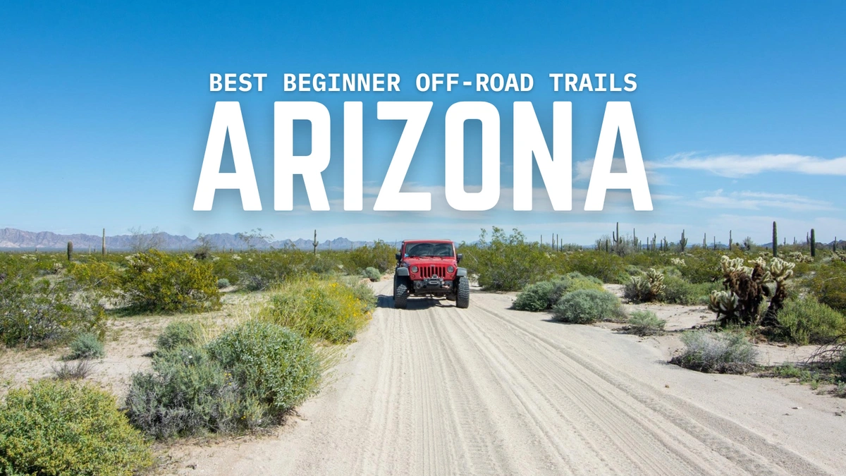
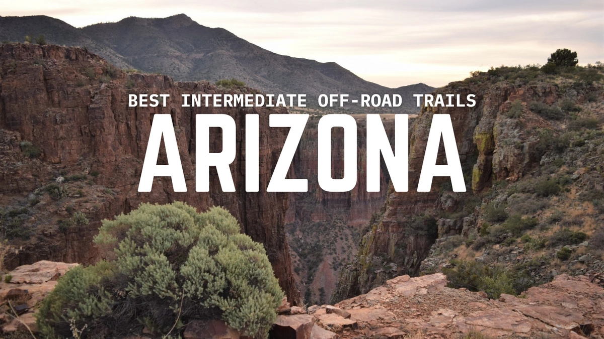
Best Beginner Off-Road Trails in Arizona for 2025
April 25, 2025
Tags: Arizona, Easy, Jeep, Off-Road, Overland, Trails
Welcome to the first post in our Arizona Trail Series! Over the next few weeks, we’ll be exploring some of the best off-road trails the state has to offer, from scenic drives to challenging off-road routes.
Today we’ll be covering some of the easiest trails you can explore around the state. If you’re looking for something a bit more challenging, stay tuned for more as we dive into the heart of the Grand Canyon State!
Off-Road Trails Featured
- Maggie's Slot Canyon - Yucca, AZ
- Figure Four Canyon - Beaver Dam, AZ
- Four Peaks Trail - Fountain Hills, AZ
- El Camino del Diablo - Ajo, AZ
- Loy Butte Road - Sedona, AZ
- Mount Lemmon Control Road - Oracle, AZ
- Whitmore Overlook - Saint George, AZ
- Sycamore Canyon Cliff Dwellings (Henderson Road) - Williams, AZ
- Cinder Hills OHV - Flagstaff, AZ
- Rim Road - Payson, AZ
Top Beginner Off-Road Trails in Arizona
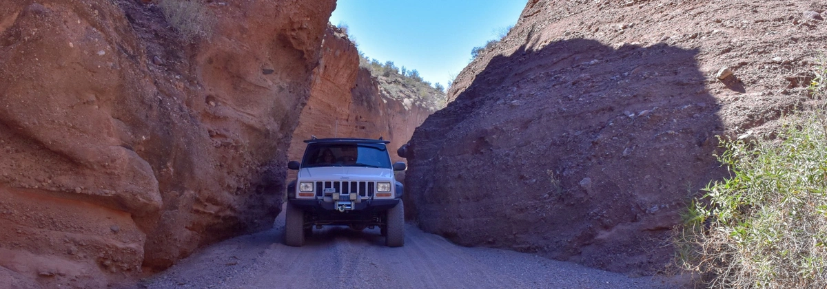
Maggie's Slot Canyon - Yucca
- Length and Duration: 6 miles, taking about 30 minutes one-way
- Best Time to Visit: Open year round
- Vehicle Requirements: Stock SUV with High Clearance and 4 Low
Less than two hours from Lake Havasu, Maggie’s Slot Canyon—also called Red Canyon—cuts through the red desert landscape, surrounded by saguaros, ocotillo, and palo verde trees. The trail starts on historic mining roads before dropping into a sandy wash that gradually narrows into a deep slot canyon. Along the way, there are several side canyons to explore, but none compare to the stunning Rawhide Wash.
This route has a few boulders to navigate and some tight sections, but most high-clearance SUVs can handle it. If you have a longer vehicle, you may need a spotter in certain areas.
Figure Four Canyon - Beaver Dam

- Length and Duration: 2 miles, taking about 30 minutes one-way
- Best Time to Visit: Open year round
- Vehicle Requirements: Stock SUV with High Clearance and 4 Low
Figure Four Canyon is a short, easy drive to a quiet stretch of the Virgin River, a rare spot in the Arizona desert where you can cool off in the water. The trail ends at a bend in the river with a sandy beach—great for a break, fishing, or setting up camp.
The trail is mostly easy, but there are some washouts, deep ruts, and soft sand near the river that might require four-wheel drive. Airing down your tires is a good idea, especially for low-clearance vehicles.
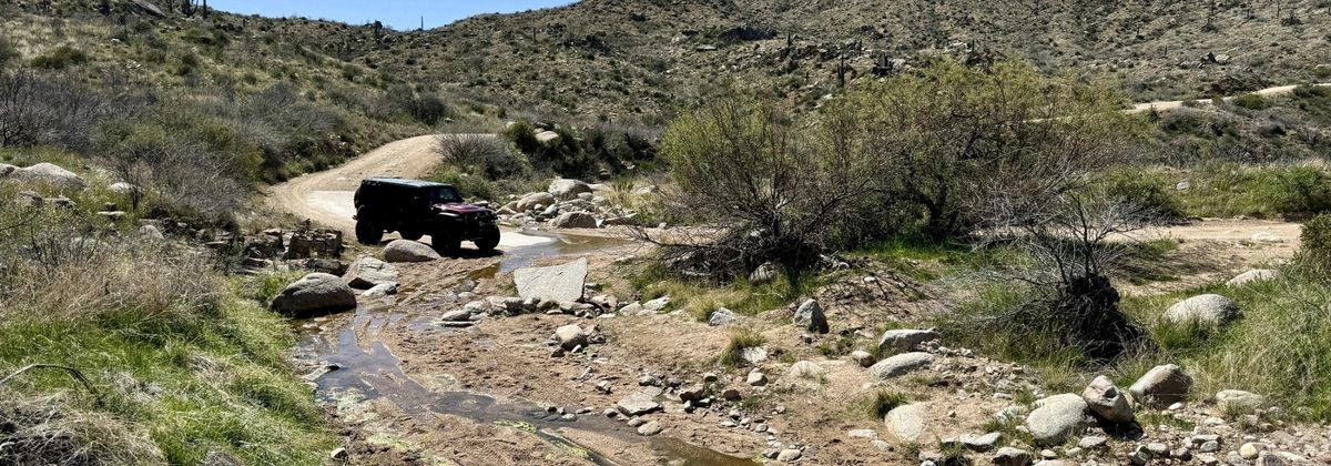
Four Peaks Trail - Fountain Hills
- Length and Duration: 28 miles, taking about 4 hours one-way
- Best Time to Visit: Open year round
- Vehicle Requirements: 2WD Vehicle with High Clearance
Four Peaks Trail is a classic route with beautiful views of the Mazatzal Mountains and Roosevelt Lake. The drive takes you through a mix of desert terrain, with plenty of scenic pull-offs and camping spots.
The road is generally easy, but there are some narrow shelf sections and blind corners at higher elevations. Snow and ice are common in winter, and spring runoff can create a few shallow water crossings.
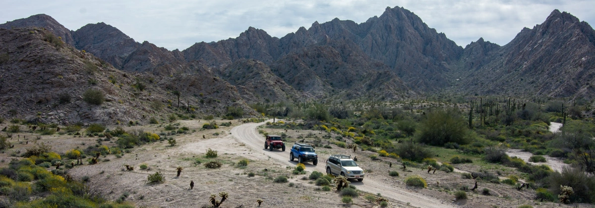
El Camino del Diablo - Ajo
- Length and Duration: 127 miles, taking about 2 days one-way
- Best Time to Visit: Open year round
- Vehicle Requirements: Stock SUV with High Clearance and 4 Low
Once a historic route for Spanish explorers and gold rush pioneers, El Camino del Diablo (or “The Devil’s Highway”) crosses some of the most remote and unforgiving desert in Arizona. The route winds through Organ Pipe Cactus National Monument, Cabeza Prieta Wildlife Refuge, and the Barry Goldwater Gunnery Range.
It’s a rugged, beautiful stretch of Sonoran Desert but keep in mind there are little to no resources—no gas, no cell service, and no room for mistakes. Deep sand, dry lake beds, and washed-out sections can make travel unpredictable, especially after rain.
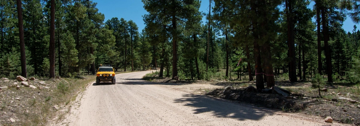
Loy Butte Road - Sedona
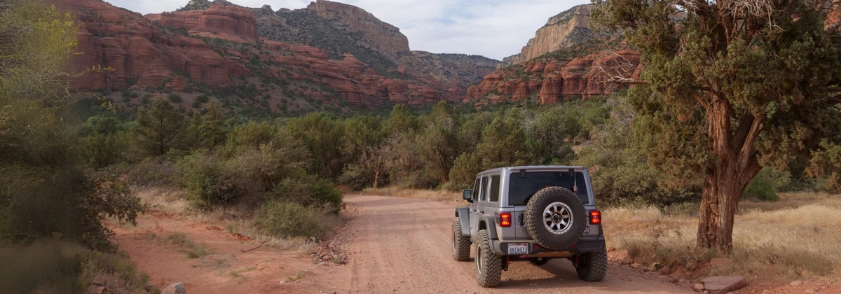
- Length and Duration: 11 miles, taking about an hour one-way
- Best Time to Visit: Open year round
- Vehicle Requirements: 2WD Vehicle with High Clearance
Loy Butte Road offers some of the best red rock views near Sedona, running along the edge of the Red Rock Secret Mountain Wilderness and Sycamore Canyon Wilderness.
This easy road connects to several popular off-road trails like Outlaw OHV and Diamondback Gulch, making it a great starting point for exploring the area. The road itself is well-graded dirt and gravel with no major obstacles, suitable for many different vehicles.
Mount Lemmon Control Road - Oracle
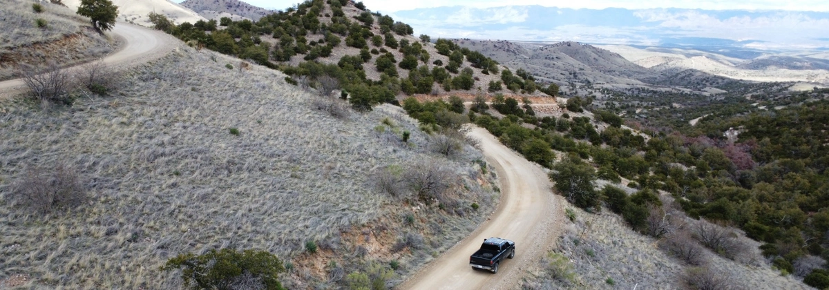
- Length and Duration: 31 miles, taking 2 hours one-way
- Best Time to Visit: Open from April - November
- Vehicle Requirements: 2WD Vehicle with High Clearance
Once the only way up Mount Lemmon, this historic dirt road winds through the Santa Catalina Mountains, offering incredible desert and forest views along the way.
It’s mostly graded but has steep climbs, tight switchbacks, and occasional washouts that can make for a bumpy ride. While most vehicles can handle it in dry conditions, a high-clearance vehicle is recommended, especially after heavy rains. Winter closures are common, so check conditions before heading out.
Whitmore Overlook - Saint George
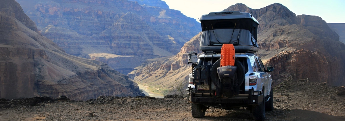
- Length and Duration: 23 miles, taking 4 hours one-way
- Best Time to Visit: Open year round
- Vehicle Requirements: 2WD Vehicle with High Clearance
This remote trail in the Arizona Strip leads to one of the most breathtaking overlooks of the Grand Canyon, sitting 500 feet above the Colorado River.
The drive starts near the historic Mount Trumbull Schoolhouse, passing through a mix of sagebrush flats and juniper forests before reaching the canyon’s edge. The last few miles are rough and steep, requiring a high-clearance vehicle with good off-road tires.
It’s a prime spot for dispersed camping, with stunning sunrise and sunset views over the canyon. Given how remote it is, make sure to bring plenty of fuel, water, and emergency supplies—there’s no cell service or nearby help.
Sycamore Canyon Cliff Dwellings (Henderson Road) - Williams
- Length and Duration: 14 miles, taking 2 hours one-way
- Best Time to Visit: Open year round
- Vehicle Requirements: 2WD Vehicle with High Clearance
This scenic dirt road takes you deep into the Sycamore Canyon Wilderness, leading to an ancient cliff dwelling perched above the canyon.
The road is mostly maintained but has some rocky and rutted sections that can get tricky after rain, making high-clearance and off-road tires a good idea.
At the end of the route, a short hike takes you up to the ruins, where you can explore the remains of the ancient dwellings. There’s no cell service out here, so plan accordingly and enjoy the quiet beauty of this hidden gem.
Cinder Hills OHV - Flagstaff
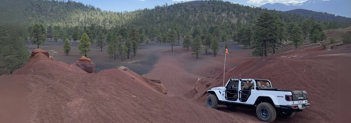
- Length and Duration: 6 miles, taking 3 hours one-way
- Best Time to Visit: Open year round
- Vehicle Requirements: Lightly Modified 4X4
Located just outside Flagstaff, Cinder Hills is a massive off-road playground with rolling volcanic cinder dunes and miles of trails. The loose, deep cinders make for a unique driving experience.
There are trails for all skill levels, from gentle slopes to steep, challenging climbs that put both driver and vehicle to the test. It’s a popular area for dirt bikes, ATVs, and full-size vehicles, with plenty of open space for exploring.
The views of the San Francisco Peaks in the background add to the scenery, making it a great spot for both adventure and if you’re into photography.
Rim Road - Payson
- Length and Duration: 44 miles, taking 3 hours one-way
- Best Time to Visit: Open from May to November
- Vehicle Requirements: 2WD Vehicle with High Clearance
Rim Road stretches across the Mogollon Rim in central Arizona, offering some of the best high-country views in the state.
The road is mostly gravel and well-maintained, though sections can be rocky and uneven, so a high-clearance vehicle is recommended. It’s a great spot for camping, hiking, and wildlife viewing, especially in the cooler months when the area is quieter.
The road also connects to a variety of other trails and forest service roads, so you can easily extend your adventure with some exploration.

Marie is a Washington State native who loves to explore the great outdoors with her partner and son. They typically explore in her 2021 4Runner out on trails but recently added a 2023 Tacoma to the build list. When she is not behind the wheel, Marie enjoys capturing moments with her camera, spending time with friends and family, and gardening! Marie is also the founder of PNW Overlanders, a local group in Washington that organizes trail rides and campouts across the state.

Community
Partners