


By clicking "ACCEPT", you agree to be the terms and conditions of each policy linked to above. You also agree to the storing of cookies on your device to facilitate the operation and functionality of our site, enhance and customize your user experience, and to analyze how our site is used.
Oregon Off-Road Trails
52
Total Trail Guides 48

409
Detailed Waypoints 127
Try a Free 7-Day Trial and unlock it all
Start a Free Trial Most Recent Trail Reviews
Rated 2/5
Open
Visited: 09/13/2026
I figured this would be boring and it was. This trail has convinced me to stop going for BoH trails.


Francis whitney
Rated 5/5
Open
Visited: 09/06/2026
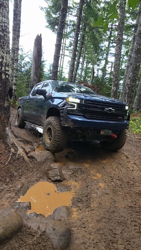
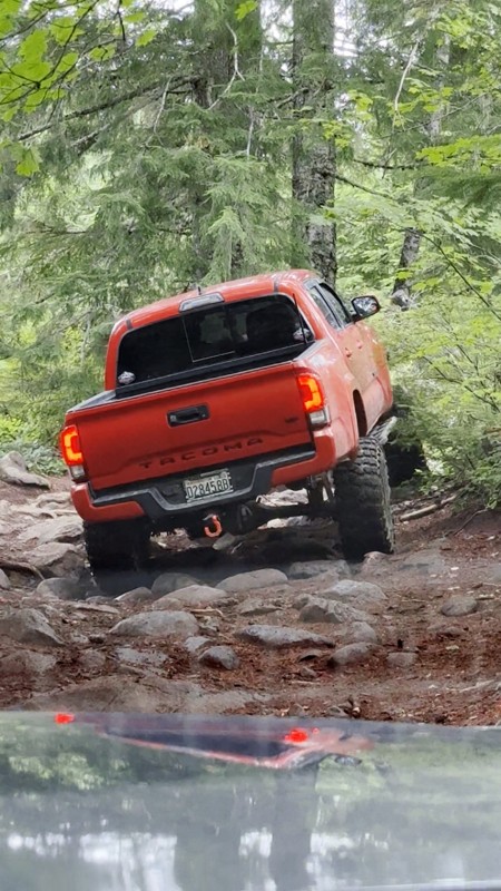
Ran this today. Ground was slick but makes it more dunk I’m in a full-size 1500 on 37s, my buddy is in a Tacoma on 35s, and our other buddy was in a TJ on 33.
Yes it’s tight but we all made it thru ...

Everett Vangsnes
No Rating
Open
Visited: 08/11/2026
Per the MVUM, the trail is seasonally open. As always, check current fire restrictions/closures before venturing out.

Trails Offroad
Official Crew
No Rating
Open
Visited: 08/11/2026
Per the MVUM, the trail is seasonally open. As always, check current fire restrictions/closures before venturing out.

Todd
Official Crew
Todd
Official Crew
No Rating
Open
Visited: 08/11/2026
Per the MVUM, the trail is seasonally open. As always, check current fire restrictions/closures before venturing out.
Trails Offroad
Official Crew
No Rating
Temporary Closure
Visited: 08/07/2026
Closed due to the Fox Fire. https://www.blm.gov/sites/default/files/docs/2026-07/orwa-fpo-val-072626.pdf

Rose Meirs
Official Crew
No Rating
Temporary Closure
Visited: 08/07/2026
Closed due to the Crosswhite Fire. https://www.blm.gov/sites/default/files/docs/2026-08/orwa-fpo-pri-080526.pdf
Rose Meirs
Official Crew
No Rating
Temporary Closure
Visited: 08/07/2026
Closed due to the Crosswhite Fire. https://www.blm.gov/sites/default/files/docs/2026-08/orwa-fpo-pri-080526.pdf
Rose Meirs
Official Crew
No Rating
Temporary Closure
Visited: 08/07/2026
Closed due to the Crosswhite Fire. https://www.blm.gov/sites/default/files/docs/2026-08/orwa-fpo-pri-080526.pdf
Rose Meirs
Official Crew
No Rating
Temporary Closure
Visited: 08/07/2026
Closed due to the Crosswhite Fire. https://www.blm.gov/sites/default/files/docs/2026-08/orwa-fpo-pri-080526.pdf
Rose Meirs
Official Crew
No Rating
Temporary Closure
Visited: 08/07/2026
Closed due to the Big Grass Fire. https://www.blm.gov/sites/default/files/docs/2026-07/orwa-fpo-val-072826.pdf
Rose Meirs
Official Crew
No Rating
Temporary Closure
Visited: 08/07/2026
Closed due to the Big Grass Fire. https://www.blm.gov/sites/default/files/docs/2026-07/orwa-fpo-val-072826.pdf
Rose Meirs
Official Crew
No Rating
Temporary Closure
Visited: 08/07/2026
Closed due to the Big Grassy Fire. https://www.blm.gov/sites/default/files/docs/2026-07/orwa-fpo-val-072826.pdf
Rose Meirs
Official Crew
No Rating
Temporary Closure
Visited: 08/07/2026
Temporary due to the Hat Wildfire. https://www.blm.gov/sites/default/files/docs/2026-07/orwa-fpo-val-072826.pdf
Rose Meirs
Official Crew
No Rating
Temporary Closure
Visited: 08/03/2026
The area is currently closed due to the Grasshopper Fire. More info is available here: https://inciweb.wildfire.gov/incident-information/ormhf-grasshopper

Douglas Van Bossuyt
Official Crew
No Rating
Temporary Closure
Visited: 08/03/2026
The area is currently closed due to the Grasshopper Fire. More info is available here: https://inciweb.wildfire.gov/incident-information/ormhf-grasshopper
Douglas Van Bossuyt
Official Crew
No Rating
Temporary Closure
Visited: 08/03/2026
The area is currently closed due to the Grasshopper Fire. More info is available here: https://inciweb.wildfire.gov/incident-information/ormhf-grasshopper
Douglas Van Bossuyt
Official Crew
No Rating
Temporary Closure
Visited: 08/03/2026
The area is currently closed due to the Grasshopper Fire. More info is available here: https://inciweb.wildfire.gov/incident-information/ormhf-grasshopper
Douglas Van Bossuyt
Official Crew
No Rating
Temporary Closure
Visited: 08/03/2026
The area is currently closed due to the Grasshopper Fire. More info is available here: https://inciweb.wildfire.gov/incident-information/ormhf-grasshopper
Douglas Van Bossuyt
Official Crew
No Rating
Temporary Closure
Visited: 08/03/2026
The area is currently closed due to the Grasshopper Fire. More info is available here: https://inciweb.wildfire.gov/incident-information/ormhf-grasshopper
Douglas Van Bossuyt
Official Crew
No Rating
Temporary Closure
Visited: 08/03/2026
The area is currently closed due to the Grasshopper Fire. More info is available here: https://inciweb.wildfire.gov/incident-information/ormhf-grasshopper
Douglas Van Bossuyt
Official Crew
No Rating
Temporary Closure
Visited: 08/03/2026
The area is currently closed due to the Grasshopper Fire. More info is available here: https://inciweb.wildfire.gov/incident-information/ormhf-grasshopper
Douglas Van Bossuyt
Official Crew
No Rating
Temporary Closure
Visited: 08/03/2026
The area is currently closed due to the Grasshopper Fire. More info is available here: https://inciweb.wildfire.gov/incident-information/ormhf-grasshopper
Douglas Van Bossuyt
Official Crew
No Rating
Temporary Closure
Visited: 08/03/2026
The Grasshopper fire unfortunately burned over the Flag Point Lookout and destroyed the lookout tower. The area is closed for the foreseeable future.
General fire info with links to the specific clo...
Douglas Van Bossuyt
Official Crew
No Rating
Temporary Closure
Visited: 08/01/2026
Trail was closed due to wildfire activity. I was unable to find this out online but maybe try calling Hood River Ranger District at 541-352-6002 before making the drive to confirm if it is open?
MM
Mike Mueller
Open
Visited: 07/12/2026
I ran this backwards (rock quarry entrance to saddle mtn entrance) in my full-size pickup and it was a good time. I didn’t realize I’d taken the rocky bypass until i got to the other side of it (the s...
Everett Vangsnes
No Rating
Open
Visited: 06/26/2026
According to MVUM data, this trail should be open for the season.
Trails Offroad
Official Crew
No Rating
Open
Visited: 06/26/2026
According to MVUM data, this trail should be open for the season.
Trails Offroad
Official Crew
No Rating
Open
Visited: 06/26/2026
According to MVUM data, this trail should be open for the season.
Trails Offroad
Official Crew
No Rating
Open
Visited: 06/26/2026
According to MVUM data, this trail should be open for the season.
Trails Offroad
Official Crew
No Rating
Open
Visited: 06/26/2026
According to MVUM data, this trail should be open for the season.
Trails Offroad
Official Crew
No Rating
Open
Visited: 06/26/2026
According to MVUM data, this trail should be open for the season.
Trails Offroad
Official Crew
No Rating
Open
Visited: 06/26/2026
According to MVUM data, this trail should be open for the season.
Trails Offroad
Official Crew
No Rating
Open
Visited: 06/26/2026
According to MVUM data, this trail should be open for the season.
Trails Offroad
Official Crew
No Rating
Open
Visited: 06/26/2026
According to MVUM data, this trail should be open for the season.
Trails Offroad
Official Crew
Rated 5/5
Open
Visited: 06/19/2026
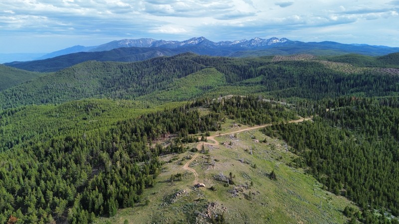
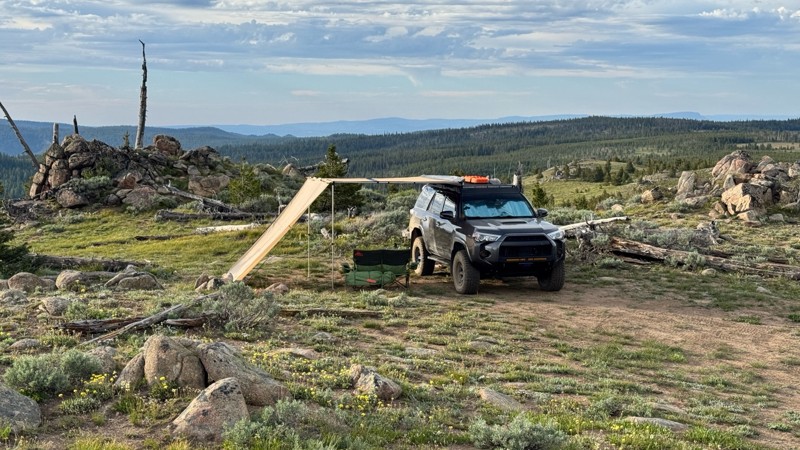
This was an easy dirt road with some logging traffic up until it intersects National Forest Development Road 5125/4350 at 45.06718, -118.21474. After this it becomes noticeably bumpier with larger di...

Andrew T
Open
Visited: 06/05/2026
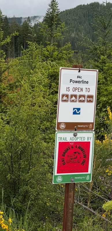
Trail is marked wrong on the map, 4C starts at the end of powerline 4B.
MS
Michael Strange
Rated 5/5
Open
Visited: 05/08/2026
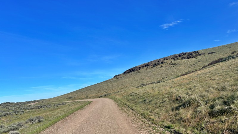
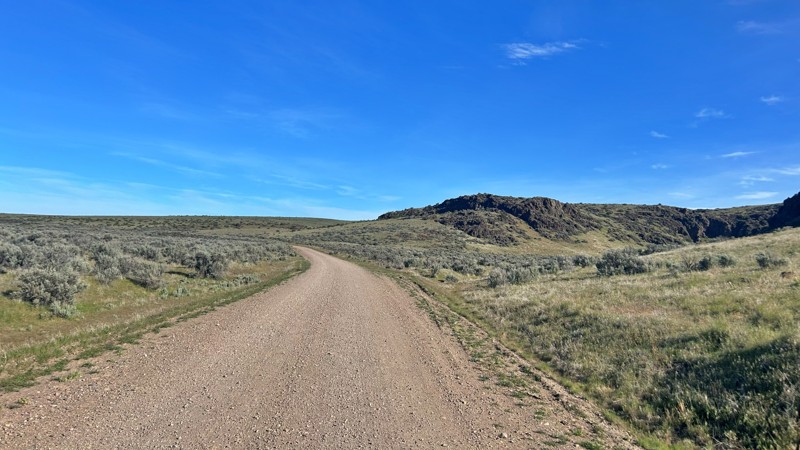
Having visited in May, I can confidently say this is one of the best times to experience the Cow Lakes Recreation Area. The lakes are full, migratory birds fill the marshes, and wildflowers blanket th...
Rose Meirs
Official Crew
Rated 4/5
Open
Visited: 05/07/2026
We tackled Board Corral Trail in our EarthRoamer and found it to be a fun and engaging drive, but one that took considerably longer than we expected. While the trail itself isn't exceptionally difficu...

Wide Open Roams
Official Crew
Rated 5/5
Open
Visited: 05/06/2026
We drove Succor Creek Road as part of our travels through the Owyhee Canyonlands and found it to be one of the easier yet more scenic routes in the region. If you're looking for a relaxing drive that ...
Wide Open Roams
Official Crew
Rated 5/5
Open
Visited: 05/04/2026
Leslie Gulch Road ended up being one of our favorite drives in the Owyhee Canyonlands. The route winds its way down toward Owyhee Lake, passing through some truly unique scenery that feels completely ...
Wide Open Roams
Official Crew
Rated 4/5
Open
Visited: 05/04/2026
We drove Mahogany Gap while exploring the Owyhee region and found it to be a scenic, easy-going route that offers a great introduction to the area. This isn't a trail that challenges your vehicle, but...
Wide Open Roams
Official Crew
Rated 5/5
Open
Visited: 05/03/2026
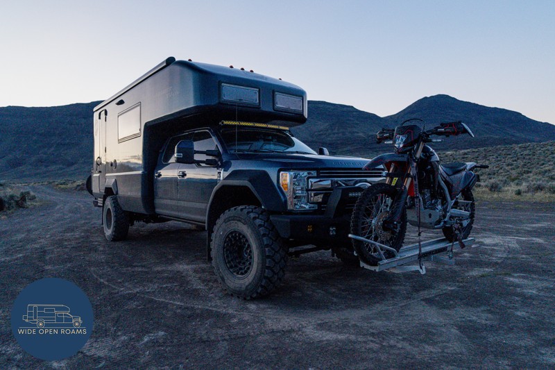
We took the trail out to Mickey Hot Springs while exploring the East Steens area, and it ended up being one of our favorite stops in southeastern Oregon. The drive itself was straightforward and easy ...
Wide Open Roams
Official Crew
Rated 5/5
Open
Visited: 05/03/2026
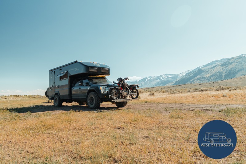
We drove the East Steens Road while making our way through southeastern Oregon and ended up really enjoying this route. Before starting the main stretch along the Steens, we stopped at Borax Lake Hot ...
Wide Open Roams
Official Crew
Rated 4/5
Partially Open
Visited: 04/26/2026
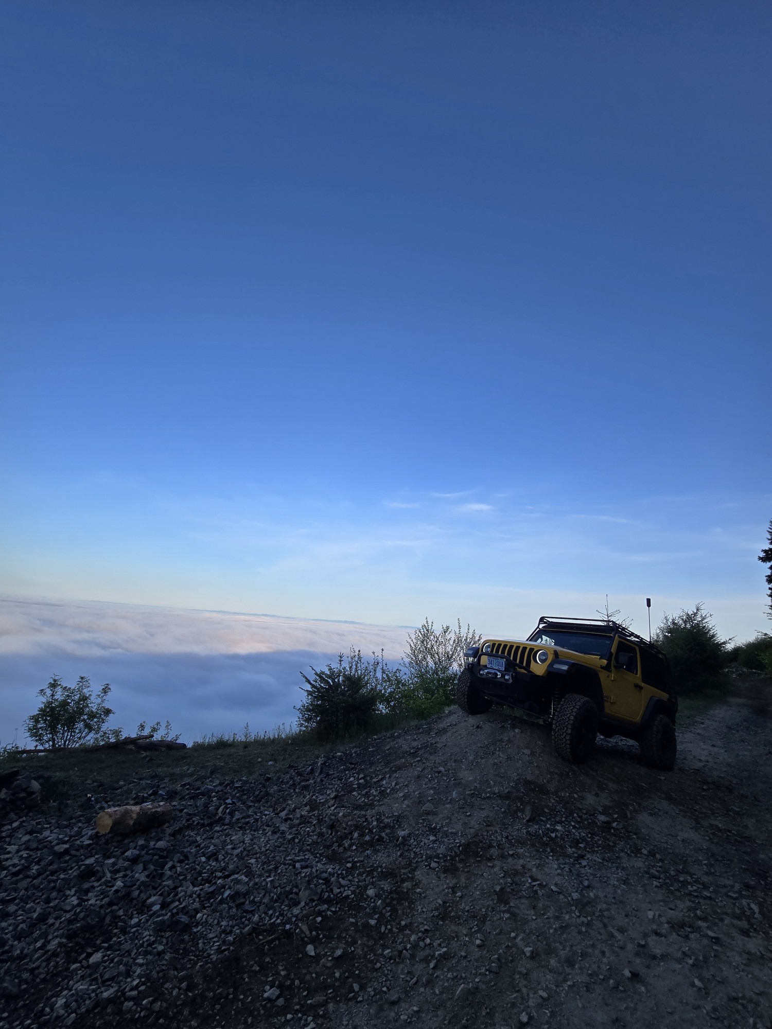
Was a fun and beautiful trail, though not very technical trail from East to West, was only able to get to marker 20? before I had to turn around due to downed trees that would require chainsaw and mor...
Ryan Green
Richard Goins
Rated 4/5
Open
Visited: 01/15/2026
I can see this being an easy trail in good conditions and most of it was pretty tame, but the last big left hand turn near the top is deeply rutted and slick wet clay. Took careful line choice and a l...
A
alhounos
No Rating
Seasonal Closure
Visited: 12/31/2025
According to this trails management agency, the trail is likely closed for the season.
You can reach out to the agency for more details.
Be sure to leave us a report and let us know ...
Trails Offroad
Official Crew
Rated 4/5
Partially Open
Visited: 12/18/2025
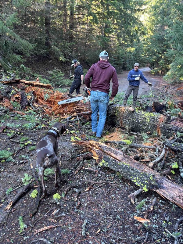
Dozens of trees down on the roads!
My guys and I cleared a dozen or so trees and actually had a good time with our chain saws. Just started running out of daylight. I’m

Steven Ritchie
Most Popular


Updated: 02/05/2025
Cedar Tree
Open
/
Banks, Oregon/
4.21 miles/
About an hour
Cedar Tree is an aptly named trail deep in the Tillamook State Forest, where the highlight is a huge fallen cedar trunk that vehicles used to be able to drive under. The iconic fallen cedar tree at Waypoint 7 is a favorite place for photographs of 4x4 rigs. The trail wanders through the forest's prettiest and most exciting sections along the cedar tree. A significant, deep depression is often filled with water and makes for an exciting challenge to cross. An ancient tree stump hides a shelf that can catch the unsuspecting driver by surprise. Cedar Tree is one of the highlights of Tillamook State Forest and should be one of your must-do trails while visiting the park.

Updated: 06/13/2024
Barlow Trail
Open
/
Wamic, Oregon/
22.12 miles/
About 3 hours
Barlow Trail begins at the edge of the prairies and oak scrublands of Central Oregon before heading into a dense forest of Ponderosa Pines. The pine trees give way to Douglas Firs, Western Larch, and other alpine species of fir, alders, and even a few aspen trees before reaching Barlow Pass on the crest of the Cascades. Anyone who played Oregon Trail or Oregon Trail 2 (popular educational video games in the late 80s and 90s) in grade school remembers the Barlow Road route to Oregon City and the promised land of the Willamette Valley. When the pioneers came to The Dalles, they either chose the water route down the rapids of the Columbia River long before the dams were built, or they turned south along the eastern flank of the Cascades to head over the mountains on the Barlow Road. Avid players of the Oregon Trail games most certainly remember the perils of going down the rapids where many lives were lost over the period of mass migration along the Oregon Trail. The Barlow Road route was not without its perils, especially early in the fall when snow storms could move in with little warning, covering the pass in a thick blanket of cold, wet snow. Many pioneers found it to be the most difficult 100-mile stretch of trail from Nebraska to Oregon. Construction of the Barlow Road was authorized in December 1845 by the Provisional Legislature of Oregon. Sam Barlow, who had scouted the route with a party of several wagons earlier in 1845, got to work in the spring of 1846 clearing timber and building the first crude track through the dense old-growth forests on the southern flanks of Mount Hood. Sam Barlow and his business partners only operated the toll road for two years before the toll concession passed into a succession of other hands. Today the segment of the Barlow Road between the eastern edge of the forests and Barlow Pass is now known as Barlow Trail (NF-3530) and is open to 4x4ers, overlanders, and those with an adventurous spirit.

Updated: 12/19/2025
Bennett Pass Road
Temporary Closure
/
Government Camp, Oregon/
10.87 miles/
About 2 hours
Winding along narrow shelf roads, through alpine forests, and past some of the prettiest views in northern Oregon, Bennett Pass Road is a jewel of the Mount Hood National Forest. The amazing views of Mount Hood will be treasured memories for years to come. In the mid-to-late summer, wildflowers bloom along the many hidden hanging meadows and high prairies. Droves of butterflies can swarm around your vehicle on sunny summer afternoons making you think you're in a fairy tale. On very clear days, you can see from Mount Hood and Mount Adams to the north and all the way down south to the Three Sisters and maybe even Diamond Peak. Views to the east span hundreds of miles of high desert and the Oregon Outback.

Updated: 02/05/2025
Firebreak Five
Open
/
Banks, Oregon/
2.3 miles/
About 2 hours
Firebreak Five is a trail that can go from mild to wild depending on conditions. In dry summer weather, most vehicles can navigate the entire trail by taking the easiest lines and combining good spotting and good driving. In the soggy winter months, certain sections of the trail, such as Waypoint 4, can become incredibly difficult or even impassable for all but trucks rolling on sticky tires, with front and rear lockers, or with little regard for possible drive-train damage. The changing conditions and challenges that voyagers along Firebreak Five face are all part of the adventure. Firebreak Five also has the distinction of being a "Jeep Badge of Honor." For those looking for a big challenge, there is an optional rock garden, and there are very difficult lines to take on the obstacles that will challenge even the most built rigs.

Updated: 01/14/2025
Succor Creek Road
Adrian, Oregon
Succor Creek Road is a mixture of rolling desert grasslands, breathtaking canyons, and agricultural land. Located in eastern Oregon and part of the Bureau of Land Management, Succor Creek Road also runs through the Succor Creek State Natural Area. Coming from the Adrian side, the trail starts alongside sheep ranches that were built and settled by Basque migrants between the 1880s and 1930s. The trail then winds through the grasslands, where you will periodically see free-range cattle grazing. You will then come up by Succor Creek, a burbling stream that drifts beside the road and cuts through the canyon. Then you will start noticing the rising cliffs and rock formations that are part of Succor Creek State Natural Area. This area is ground zero for rockhounders searching for thundereggs which are designated as Oregon's state rock. Succor Creek Road gradually winds back to rolling grasslands, ending with agricultural land once again. There are a number of offroad trails off this road that are great for exploring during dry weather. Succor Creek Road and Leslie Gulch Road are two great trails to combine for an easy scenic day trip.

Updated: 01/06/2024
Gearhart to Warrenton
Gearhart, Oregon
This is the longest section of Oregon beach that is open to vehicles. This trail provides exceptional access to the beach and the ocean. This beach route will take you through Del Rey Beach State Recreation Site, Sunset Beach State Recreation Site and Fort Stevens State Park. You can spend the day beachcombing, hiking, fishing, surfing, horseback riding, watching wildlife, exploring a shipwreck and the adjacent historic military fort.

Updated: 06/03/2025
Lolo Pass Road
Mount Hood, Oregon
Lolo Pass is an iconic mountain pass in Oregon that hugs the northwestern shoulder of Mount Hood. Throughout the Lolo Pass trail, breathtaking views of Mount Hood loom large around every corner. During the snowy season and before the trail closes, Lolo Pass offers some of the best up-close scenic views of Mount Hood without the need to drive up US Highway 26 to Government Camp or Timberline Lodge. The views change drastically during the four seasons giving some of the most iconic views of Mount Hood while requiring low effort to reach the viewpoints.

Updated: 09/20/2023
Leslie Gulch Road
Adrian, Oregon
When you drive along the rock formations of Leslie Gulch , you are reminded of Lord of the Ring's Middle Earth. These captivating, stark, colorful geological formations are the highlights of this trail. Comprised of volcanic ash produced by volcanos millions of years ago, these formations provide a refuge for bighorn sheep, elk, mule deer, numerous birds, and a number of wildflowers, including two rare species.
Leslie Gulch Road is part of the Bureau of Land Management and begins at the junction of Succor Creek Road, another trail that is great to combine for an easy scenic day trip. At the beginning, there is rolling grassland as far as the eye can see, and the wildflowers are beautiful to see in late spring/early summer. The trail then drops into the Upper Leslie Gulch Wilderness Study Area and the Slocum Creek Wilderness Study Area where rock formations towers everywhere. There are a number of hiking trails and climbing opportunities that allows you to explore the rocks even closer. Leslie Gulch dead ends at the boat ramp on Owyhee Lake.

Updated: 12/19/2025
Badger Lake Road
Government Camp, Oregon
Badger Lake Road snakes through a thin ribbon of forest flanked on either side by the Badger Creek Wilderness. After coming around the shoulder of Badger Butte, the trail narrows and plunges down a rocky shelf road toward the lake. Big views of the ridgeline where Bennett Pass Road traverses can be seen across the basin. The palisades in the distance are below Flag Point Lookout. Badger Lake, just after a shallow water crossing, is a wonderful spot to spend an afternoon canoeing, fishing, swimming, or hanging out enjoying the mountain air.

Updated: 05/28/2023
Ginsberg Point Trail
Tillamook, Oregon
The Ginsberg Point Trail is one of only a handful of 4x4 trails in the Trask OHV region of western Tillamook State Forest. Designated as an intermediate trail and comprised of several sections - this is the longest 4x4 trail in the Trask OHV. Although not the most technical of trails, the Ginsberg will provide enough variety of hills, mud, rocks and tree stumps to challenge even the more experienced drivers. As a bonus, there are stunning views of the beautiful forest and surrounding valleys along the way.

Updated: 11/27/2023
Fisherman Road
Adrian, Oregon
Fisherman Road presents breathtaking panoramas of the Owyhee Desert and Canyonlands terrain, showcasing a diverse landscape of grasslands, canyons, and the picturesque Owyhee Lake. Situated in Eastern Oregon, it is under the stewardship of the Bureau of Land Management. As you traverse this trail, see free-ranging cattle and pronghorn gracefully navigating the grasslands against a backdrop of volcanic rock formations. Descend into a charming canyon that unveils striking views of unique rock formations, ultimately leading you to the oasis of Lake Owyhee State Park. This remote haven offers fishing, boating, and camping opportunities, providing a serene escape surrounded by natural beauty.

Updated: 06/05/2022
Bates Road / Tillamook State Forest
Banks, Oregon
Bates Road packs in amazing views of the Oregon Coast Range, a knife-edge ridge to drive along, fun and challenging trails, and the small but real chance of serious vehicle damage. The ridge narrows down to a knife edge in several points with the road running right at the crest. Those who take their eyes off the road are rewarded with views to the north and east across the patchwork of clearcuts and timber. Deep dug out sections of trail make for moments of slipping, moments of unexpected gripping, and occasional heart-pumping moments of a barely controlled descent down steep slopes. This is not a trail that Trails Offroad suggests as a first time 4x4 driving experience for beginners. This is a trail that Trails Offroad recommends for adventure and challenge.

Updated: 06/09/2023
Hoodraiser / Tillamook State Forest
Banks, Oregon
Hoodraiser is a fun romp through the Tillamook State Forest that is perfect for beginner 4x4ers to get a taste of the adventures that await in the Oregon Coast Range. The trail starts near the South Fork of the Wilson River and heads south and west through the forest toward the top of the ridge. The many water bars cut into the trail give Hoodraiser its name. Going up and over the water bars obscures the view of the trail because the hood of the vehicle is pitched up into the air -- hence the name Hoodraiser. Several narrow sections (wide enough for full size vehicles) are a fun challenge for drivers learning the dimensions of their vehicles. A few small mud puddles after rains make for a good place to take videos of overlanders driving through the forest.

Updated: 07/15/2023
University Firepower Part 2 / Tillamook State Forest
Banks, Oregon
University Firepower Part 2 may start out as an easy gravel road but it packs in a few surprises along the way. There are tight, twisty sections in dense forest where it is easy to become disoriented. Never fear though because all dirt paths lead to the end of the trail. Halfway through the trail, explorers are presented with a choice: the high road scrambles up the hill while the low road scuttles around the side. Choose your way wisely based on your vehicle's abilities and the trail conditions because the high road can be unforgiving if a mistake is made. The trail ends near where Cedar Tree trail begins which is an excellent place to head next after finishing University Firepower Part 2.


Updated: 07/07/2026
Board Corral Loop
Rockville, Oregon
Board Corral Loop is an enchanting connector trail that can start from Leslie Gulch , or from Fisherman Road in the north. It is a one-track road less traveled but is becoming more popular with UTVs, ATVs, and 4x4s. Due to grades, the road is done in 2WD or 4HI, but some places are more washed out, especially on grades that will need more concentrated tire placement. It is advisable to avoid this trail when it is muddy and tread lightly. There are free-range cattle in this area, so be aware and remember that they have the right of way. You will no doubt see wild horses from time to time. The rock formations are inspiring, and it is fascinating to see the landscape change from sharp outlines of canyons to the rolling high desert plains.

Updated: 06/04/2026
Mickey Alvord Wells
Andrews, Oregon
Mickey Alvord Wells loop will take you by the Mickey Hot Springs, a geothermal springs area that is too hot for soaking but is a colorful boiling geological marvel. The main access to this trail is from East Steens Road. The Mickey Alvord Wells loop continues past the hot springs and into the high desert going by a cowboy camp and circling back toward East Steens. The trail is relatively easy to the springs. Once past it, you will periodically go over rougher rocky patches. You can also access the Alvord Desert Play on the southern side of the loop. There is one visible dispersed campsite across from the Mickey Hot Springs trailhead.

Updated: 12/19/2025
Lookout Mountain Road
Government Camp, Oregon
People come to Lookout Mountain Road for two reasons: alpine prairies full of flowers and big views of Mount Hood. This road delivers on both accounts. The smooth, well-graded gravel road can be traversed by any sedan as long as there is not snow on the road. In summer, the alpine prairies, wet meadows, and forests are full of insects including wild bees and butterflies. At several points along the road, Mount Hood jumps out from behind a corner in all her splendor. While the majority of the road is in big timber, there are lush alpine prairies, wet meadows, and some outstanding views of the eastern flank of Mount Hood along the way. Running the road south-to-north will give you the best views of Mount Hood.

Updated: 08/11/2026
Steens Mountain Loop
Diamond, Oregon
Steens Mountain Loop includes the highest road in Oregon and is one of Oregon's extraordinary scenic and geologic wonders. The trail comprises deep glacier-carved gorges, wild rivers, a rich diversity of plant and animal species, and alpine lakes with aspen for shade. It is also home to a herd of the famous wild Kiger mustangs featured in the movie "Spirit." A few established campgrounds and dispersed camping sites are along the trail and viewpoints to pull over and take in the breathtaking scenery from wilderness canyons to the Alvord Desert in the east and learn about the formation of this spectacular mountain range.

Updated: 06/10/2023
The Jeep Trail
Tillamook, Oregon
The Jeep Trail is one of only a handful of 4x4 trails in the Trask OHV region of western Tillamook State Forest. This is a purely scenic trail, offering the explorer a narrow, but enjoyable route among huge ferns, moss-covered trees, and stunning views.

Updated: 12/01/2023
Hood River OHV Trail 199
Hood River, Oregon
Just outside of Hood River, Oregon Trail 199 is short in distance but easy and fun to drive. It can be used as a connector to several other OHV Trails and Forest Service Roads in the area around Kingsley Reservoir. This narrow trail is within the forest, with thick trees lining both sides. Amazing views of Mt. Hood and the Hood River Valley can be seen from nearby roads. Typically used as a short section of a longer route – this uphill climb has plenty of decent-sized rocks and ruts to challenge the novice driver.

Updated: 06/05/2022
Saddle Up Part One / Tillamook State Forest
Banks, Oregon
Saddle Up Part One is one of the few trails in the Tillamook State Forest with a shelf-style road where there is big exposure if a driving mistake is made. There is nowhere to turn around once committed to the trail and only one or two places where one or at most two vehicles can get off the road to let others pass. Limited sight lines make for an exciting time wondering what or who is around the next bend. An optional obstacle makes for an interesting puzzle to tackle. The views on a clear day from the section of trail around Waypoint 2 make it all worthwhile though. Expansive panoramas to the south provide a stunning setting to take photos of vehicles seemingly perched on the edge of a cliff. On stormy days, near white-out conditions can frequently occur where visibility is no more than 100 feet at times. Even on bad weather days, Saddle Up Part One is still a worthwhile trail for adventurous explorers in the Tillamook State Forest.

Updated: 10/15/2024
Silent Creek
Beaver Marsh, Oregon
Silent Creek is an easy scenic drive through the Winema National Forest. It's a point-to-point road that connects Highways 97 and 138. You will encounter some washboarding but nothing technical. Ample dispersed camping is available throughout this roadway and is accessible by two-wheel and four-wheel drive vehicles. If you are interested in the history of this area, information boards along the trail highlight logging industry history dating back into the 1920s.

Updated: 04/01/2024
Flag Point Lookout Road
Tygh Valley, Oregon
Sweeping views of Mount Hood, the Badger Creek Wilderness, Central Oregon, and the Cascade range from Mount Adams to The Three Sisters await visitors to Flag Point Lookout Road. The Forest Service fire lookout is staffed during summer months and, if official duties don't take prescience, the lookout staff often invite people up into the lookout tower. A short hike from the lookout to the helipad provides breathtaking views of Badger Creek Basin, The Palisades, and Mount Hood.

Updated: 04/01/2024
Grasshopper Road
Government Camp, Oregon
From dense second growth forest to exposed shelf road to alpine meadow, Grasshopper Road has a little bit of everything. The lower third of the trail is paved and smooth while the upper two thirds become increasingly rocky and narrow. The shelf road affords sweeping vistas of the basin to the south and the White River area where the famed Barlow Trail once brought pioneer wagon trains across the Cascades to the Willamette Valley. At the terminus of Grasshopper Road, expansive alpine meadows tumble down the ridge hiding a small, idyllic Forest Service campground.

Upgrade your Membership
Unlock all of the details on every Trail Guide and Scout Route.
Start a 7-day Free TrialCommunity
Partners

