


By clicking "ACCEPT", you agree to be the terms and conditions of each policy linked to above. You also agree to the storing of cookies on your device to facilitate the operation and functionality of our site, enhance and customize your user experience, and to analyze how our site is used.
North Carolina Off-Road Trails
12
Total Trail Guides 9

147
Detailed Waypoints 33
Try a Free 7-Day Trial and unlock it all
Start a Free Trial Most Recent Trail Reviews
Rated 5/5
Open
Visited: 07/01/2026
Did the top half of the route to get to a camp spot. Steep in areas with some dug up sections of road, but the northern portion of the route was two lanes wide with plenty of room to maneuver. Some so...
Dylan Erickson
Rated 5/5
Open
Visited: 07/01/2026
Easy trail. Very nice views.
T
Tommy
No Rating
Open
Visited: 06/26/2026
According to MVUM data, this trail should be open for the season.

Trails Offroad
No Rating
Open
Visited: 06/26/2026
According to MVUM data, this trail should be open for the season.
Trails Offroad
No Rating
Open
Visited: 06/26/2026
According to MVUM data, this trail should be open for the season.
Trails Offroad
No Rating
Open
Visited: 06/26/2026
According to MVUM data, this trail should be open for the season.
Trails Offroad
Rated 5/5
Open
Visited: 06/19/2026
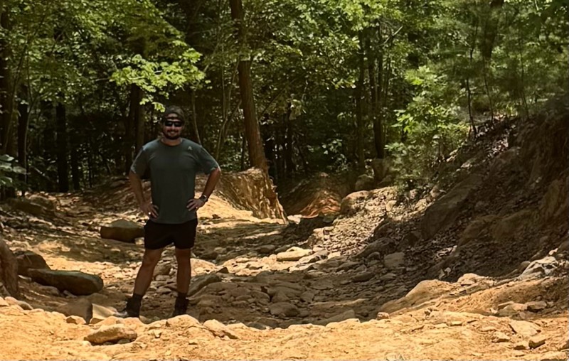
Short but fun trail with a Little Rock garden. I’ve camped at the top of Wolfs den a few times and it’s always been great. This is the perfect trail for beginners provided you don’t try to take on the...

Stacy Grosch
Rated 4/5
Open
Visited: 06/19/2026
From what I've seen, the climb is gradually getting wider, but about halfway up there's a ledge that can kick your rear end sideways and put you uncomfortably close to the tree beside it if you're not...
Stacy Grosch
Rated 5/5
Open
Visited: 06/18/2026
Spent Thursday night at site A12 super nice. Trail was spot on west end was a little ruffer then the east side.
Earl Neisler
No Rating
Open
Visited: 06/14/2026
Ran this trail in the countdown WP direction (11,10,9….), as it was our exit the park route. WP 10 was good stop to watch 2 rigs fight their way up and a built rig cleaned it in his sleep. Stock 4xE...
CS
Carl Sirles
No Rating
Open
Visited: 06/13/2026
This is a amazing trail. Dickey bell helped me push the limits of my truck and was an awesome confidence booster. I highly encourage everyone to try this trail if you are ever in the Uwharrie area of ...
JB
Jason Braswell
Rated 4/5
Open
Visited: 05/12/2026
Numerous no visibility, narrow switchback turns going up and down the mountain. Be aware of animals from yards of houses along the way at the beginning of road (before pavement ends). Road is a pleasa...

Bob Decker
Rated 5/5
Open
Visited: 05/02/2026
This is a perfect example of a moderate trail. With a great combination of terrain and optional hill climbs and obstacles. It’s public land with some private residencies. Don’t let the closed gate foo...
SS
Samuel Shelton
Rated 5/5
Open
Visited: 04/06/2026
Always a fun ride. The main attraction is of course, the short ascent (or descent) that is a true rock climb. It’s a challenge but any decent 4-wheel vehicle can make it. There are three lines you can...
RL
Rodney Lucas

Todd
Official Crew
Open
Visited: 03/07/2026
Old 105 never fails to impress. The views are spectacular, the camping is plentiful and the hiking is great. We stopped at Wisemans View at the northern end of the trail to look out over the gorge, an...

Keegan O'Dell
JW
Jon Williams
Rated 5/5
Open
Visited: 02/20/2026
i completed this trail after completing pinnacle mountain trail! was an easy going trail where you can rip through and not need to use any 4WD, you can also take it slow and take in the views, half wa...
CW
CHRISTOPHER WILLIS
Rated 5/5
Open
Visited: 02/20/2026
as a newer person to this lifestyle, i must say taking this road as my first adventure was one of the greatest experiences ever! it starts off with some good smooth gravel that climbs up and down the ...
CW
CHRISTOPHER WILLIS
No Rating
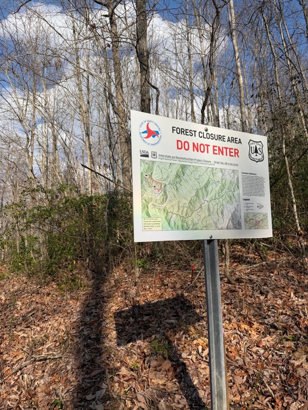
Temporary Closure
Visited: 01/05/2026
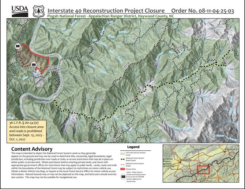
According the Forest, the road is closed until 10/1/2027 per Order No. 08-11-04-25-03,
Todd
Official Crew
No Rating
Seasonal Closure
Visited: 12/31/2025
According to this trails management agency, the trail is likely closed for the season.
You can reach out to the agency for more details.
Be sure to leave us a report and let us know ...
Trails Offroad
No Rating
Seasonal Closure
Visited: 12/31/2025
According to this trails management agency, the trail is likely closed for the season.
You can reach out to the agency for more details.
Be sure to leave us a report and let us know ...
Trails Offroad
No Rating
Seasonal Closure
Visited: 12/15/2025
According to this trails management agency, the trail is likely closed for the season.
You can reach out to the agency for more details.
Be sure to leave us a report and let us know ...
Trails Offroad
No Rating
Seasonal Closure
Visited: 12/15/2025
According to this trails management agency, the trail is likely closed for the season.
You can reach out to the agency for more details.
Be sure to leave us a report and let us know ...
Trails Offroad
No Rating
Seasonal Closure
Visited: 12/15/2025
According to this trails management agency, the trail is likely closed for the season.
You can reach out to the agency for more details.
Be sure to leave us a report and let us know ...
Trails Offroad
No Rating
Seasonal Closure
Visited: 12/15/2025
According to this trails management agency, the trail is likely closed for the season.
You can reach out to the agency for more details.
Be sure to leave us a report and let us know ...
Trails Offroad
No Rating
Seasonal Closure
Visited: 12/15/2025
According to this trails management agency, the trail is likely closed for the season.
You can reach out to the agency for more details.
Be sure to leave us a report and let us know ...
Trails Offroad
No Rating
Seasonal Closure
Visited: 12/15/2025
According to this trails management agency, the trail is likely closed for the season.
You can reach out to the agency for more details.
Be sure to leave us a report and let us know ...
Trails Offroad
No Rating
Seasonal Closure
Visited: 12/15/2025
According to this trails management agency, the trail is likely closed for the season.
You can reach out to the agency for more details.
Be sure to leave us a report and let us know ...
Trails Offroad
No Rating
Seasonal Closure
Visited: 12/15/2025
According to this trails management agency, the trail is likely closed for the season.
You can reach out to the agency for more details.
Be sure to leave us a report and let us know ...
Trails Offroad
Rated 5/5
Open
Visited: 12/09/2025
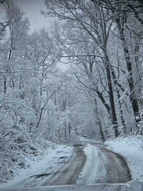
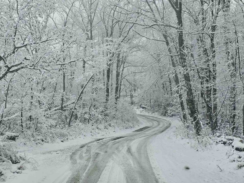
First time on the trail today. Was out looking for some camping spots and I found plenty of them. There was snow on most of the trail today. There were some slick spots. Had to put it in 4x4 twice tod...
BW
Bill Weathers
No Rating
Temporary Closure
Visited: 11/29/2025
The gate to the entrance are locked
DR
Daniel Raynor
Rated 3/5
Open
Visited: 11/28/2025
Trail was decent. Not challenging at all. Completed it without using 4wd in a Gladiator with 3.5” lift on 35s.
MP
Matt Parker
Rated 5/5
Open
Visited: 11/28/2025
The trail notes were pretty spot on but most of the mud pits are filled in pretty good. Had fun doing it in my stock Gladiator.
CL
Christopher Lanois
DR
Daniel Raynor
No Rating
Open
Visited: 11/21/2025
Ran this conjunction with Bent Creek. It's an easy graded trail that you share with bikers and a few hikers. Easy drive.
EF
Eddie Fort
Rated 3/5
Open
Visited: 11/21/2025
Ran Bent Creek today and it is completely open! An easy graded trail done in 2wd. Camping at the beginning and end in designated campground. No camping on most of the trail.
Easy drive.
EF
Eddie Fort
Open
Visited: 11/19/2025
This was my first trip using Trails Offroad and was pleasantly surprised as to the accuracy of the report. Easy drive with many more campsites than mentioned in the description and beautiful scenery.
EF
Eddie Fort
Rated 5/5
Temporary Closure
Visited: 10/15/2025
Because of the influx of out-of-state vehicles to the area the trail has been closed. Only residents are permitted entry until further notice.
SS
Samuel Shelton
No Rating
Open
Visited: 10/01/2025
The previous temporary closure from 01/27/2025 has expired.
Trails Offroad
No Rating
Open
Visited: 10/01/2025
The previous temporary closure from 01/27/2025 has expired.
Trails Offroad
No Rating
Temporary Closure
Visited: 09/23/2025
Drove up to do this trail and it’s still closed.
KC
Kim Conard
Josh Burkett
Rated 5/5
Open
Visited: 08/02/2025
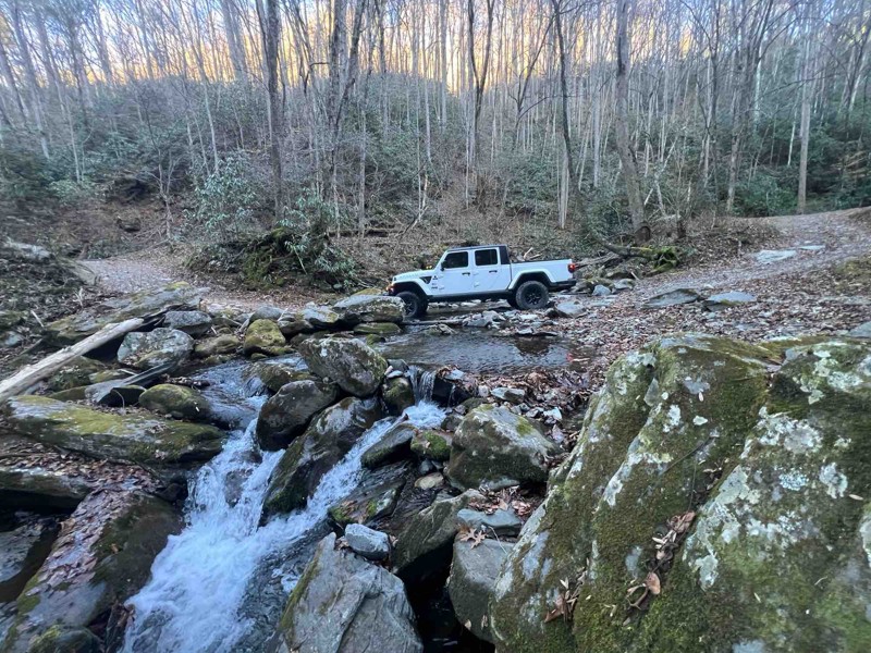
Roses Creek is open all the way from 181 in the south to the top where all the trail heads are. Forest Service Road 496 is closed from the top down, but you don’t need to go that way cause roses Creek...
J
John
No Rating
Open
Visited: 07/27/2025
On this visit, there is still some heavy equipment about, but the trail is back open and smooth enough that a Ford Focus could make it, saw one go by while I was stopped. Nice and wide with pull-ins ...
Happy Owl Off Trail
Most Popular


Updated: 07/25/2024
Dickey Bell
Open
/
Uwharrie, North Carolina/
3.29 miles/
About 2 hours
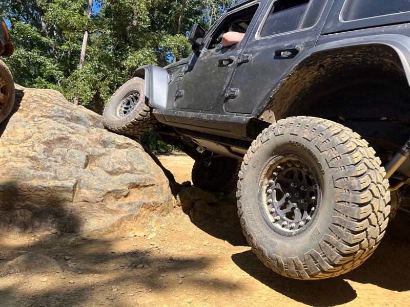
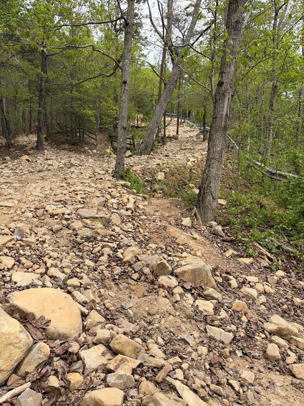
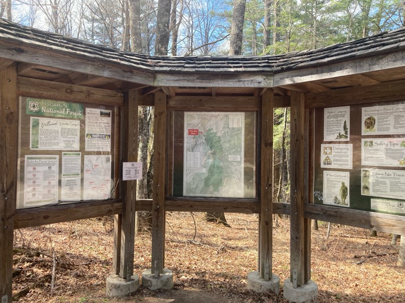
Steep, loose, and rocky are just a few adjectives to describe Dickey Bell. This adrenaline-filled Jeep Badge of Honor trail in the Uwharrie National Forest will test your rig to the fullest, especially if you are mildly built. Stock rigs will have an extreme challenge on their hands. This trail is famous for its one obstacle with many line choices, in which there is no easy way up, and turning around mid-way is not an option. If you have just one day to explore the Uwharrie National Forest and consider yourself an adrenaline junkie, Dickey Bell should be on your shortlist. This trail is great for anyone who wants to take it to the next level of wheeling and loves to challenge themselves and their rigs.

Updated: 05/11/2024
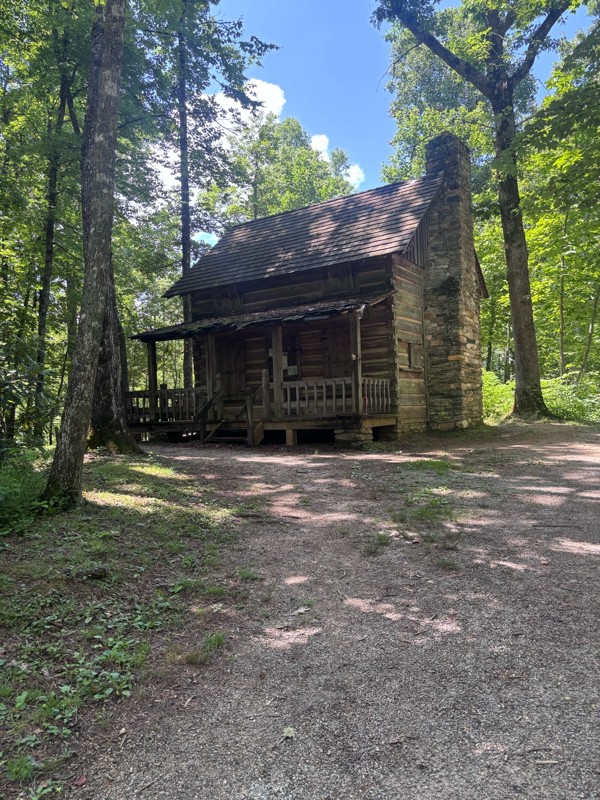
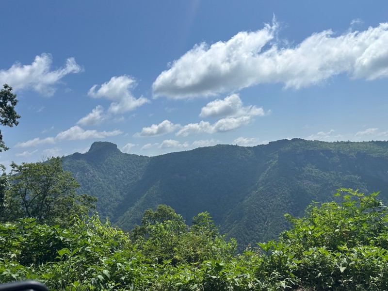
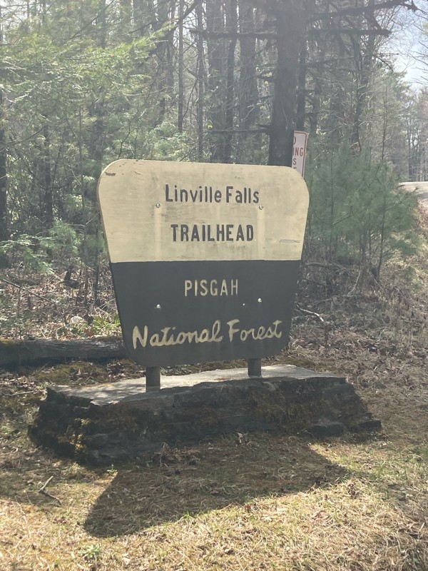
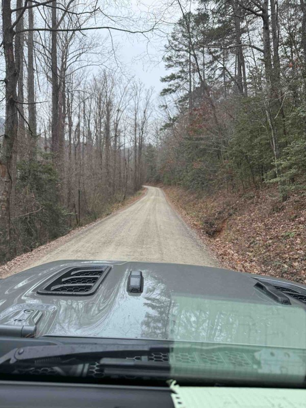
Kistler Memorial Highway (Old NC 105)
Linville, North Carolina
Following along the western edge of the Grand Canyon of North Carolina, the Linville Gorge, Kistler Memorial Highway is an experience not to be missed. Across the gorge, views of Table Rock, Gingercake Mountain, Sitting Bear Mountain, The Chimneys, and Shortoff Mountain provide epic backdrops to a roller coaster road that many refer to as Old NC 105. The views are supported by campsites nestled in rhododendron, pine, and the misty air the Blue Ridge Mountains are known for.

Updated: 07/14/2024
Old Buzzard Roost aka Goat Trail
Newport, North Carolina
Skirting the northwest side of Longarm Mountain in the Pisgah National Forest, Old Buzzard Roost, also known as Goat Trail, is a spirited offroad trail for new and seasoned offroaders alike. Dense dark green laurels line the trail as it winds in and out, following terrain lines and climbing over 900' in total elevation. Each of its many twists provides a new experience, from rocks to climb over or mud to go through. This is no gravel road, and it is not a stand-alone trail either. You can combine this rugged 4WD trail with other trails to turn a short thrill ride into a multi-day overland adventure that should include Hurricane Creek.

Updated: 02/18/2024
Hurricane Creek
Hartford, North Carolina
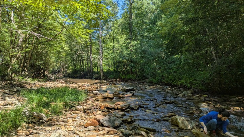
Hurricane Creek is one of the more famous offroad trails in the southeastern United States. It lies within the Pisgah National Forest and is neighbored by the Cherokee National Forest and the nearby Great Smoky Mountain National Park. Enshrouded in mountain laurel, you follow the trail's namesake creek, where you hear its rushing waters through your side windows. The real adventure and memory-making experiences unfold as you cross Hurricane Creek several times and encounter obstacles as you find one of the storybook campsites dotted along the creek. Pack the camping gear and camera for this one!

Updated: 06/19/2024
Dutch John
Uwharrie, North Carolina
Mostly mild with just a dash of wild, Dutch John is a natural addition to the list of trails you should complete when visiting the Uwharrie National Forest OHV area. But do not be fooled, if you're visiting during a particularly wet season, Dutch John could easily up the adrenaline with slick and muddy climbs that will test drivers and rigs alike. Be sure to stop by the Eldorado Outpost to fill up your tank and grab a Uwharrie Ghost Tales book from the gift shop to read from around the campfire at one of the two dispersed sites along the trail. Visiting in the autumn during the leaf change will add extra spooky vibes to your visit.

Updated: 03/15/2024
Cape Lookout
Open
/
Davis, North Carolina/
35.86 miles/
About 4 hours
Fresh salty air, the low rumble of the mighty Atlantic Ocean's surf, and a pristine undeveloped beach await you at Cape Lookout. Uninhabited and reachable only by a small ferry that runs just a few times a day, it is the perfect spot for secluded beachcombing, camping, fishing, bird watching, and shelling. The distance from one end to the other takes all day to drive. There are several historical sights, such as the namesake lighthouse and the Historical Village that once was home to troops staging for their trip to Europe in World War II. It is the perfect location to spend several days relaxing, decompressing, and reconnecting with the most essential things in life.

Updated: 03/12/2024
Rocky Top
Partially Open
/
Newport, North Carolina/
4.73 miles/
About 2 hours
Rocky Top is a rare offroad trail within the Cherokee National Forest of Tennessee. Long stretches of broken rock exposed to midday sun will surely delight anyone used to the mud or gravel roads in darkly shaded hollows that make up most of the trails in the area. As you ascend, and hear the rocks crunch under the tires, the foliage parts, giving you views of the misty-looking Blue Ridge Mountains. Further adding to the rareness factor, continue to Big Fill to give yourself over 9 miles and a full day of an authentic 4WD experience when you are done with this trail.

Updated: 09/19/2023
Big Fill
Newport, North Carolina
Big Fill is located in the Cherokee National in Tennessee. It starts or ends at Rocky Top, giving you an adventurous offroad experience when combined. After coming onto the trail from Rocky Top, the terrain change is startling, with the laurels dwarfing your vehicle, the dark shades of green allowing only small rays of sunshine in, and those "am I going to get stuck?" questionable moments. In an area with mostly gravel roads, this is a must-do trail.

Updated: 04/18/2024
Rocky Mountain Loop
Uwharrie, North Carolina
Are you not quite up for the adventure that is Dickey Bell but still want to hone your skills? Are you looking for excellent dispersed camping in Uwharrie with enough room for several vehicles? Rocky Mountain Loop will check both of those boxes - and then some. Located on the northern end of the Uwharrie National Forest, this trail offers a bit of everything for everyone. There are enough mandatory obstacles for beginners or stock vehicles to keep it interesting and a series of difficult optional obstacles that will test the most built rig. This trail weaves in and out of the lush and diverse forest, offering quite the showcase of colors, especially during the Autumn months.

Updated: 04/01/2024
Falls Dam
Uwharrie, North Carolina
Falls Dam is nestled at the southern end of the Uwharrie National Forest OHV area just north of the flowing Yadkin River. Uwharrie National Forest OHV is home to a network of well-maintained off-roading trails offering options for beginners and experienced drivers alike. Pay a visit to the Eldorado Outpost just outside of the forest on Highway 109 to stock up on supplies and fuel and to purchase your OHV pass. If you plan your visit during autumn, you'll be treated to beautiful changing leaves and vibrant colors during your trail rides. Falls Dam and the Uwharrie National Forest are fun for individuals and families alike, especially if you choose to camp at the improved campgrounds like Badin Lake, where you can enjoy the water after a day on the trails.

Updated: 04/28/2024
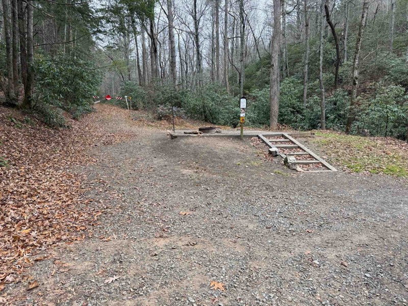
Wolf Den
Uwharrie, North Carolina
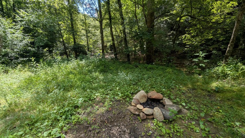
If you are a beginner or are just seeking a relaxing day out on the trails, Wolf Den should be on your Uwharrie shortlist. Several optional obstacles will test a stock rig if you are growing your offroad skillset with the ability to bail out if lines get too hard. One large campsite lies along this trail for those looking to spend a night out in the woods with friends and family. Throw this on your plan for the day, especially if you plan to connect Slab Pile to Dutch John.


Updated: 12/02/2025
Heintooga Round Bottom Road
Maggie Valley, North Carolina
Heintooga Round Bottom Road allows you to find solitude in the Great Smoky Mountains National Park, the nation's busiest national park. The trail travels downhill for over 16 miles and provides a forest view with glimpses of the Smokys for brief moments. The top two-thirds of the route is one-way only before you level out, and then the road becomes two-way travel while parallelling the Straight Fork Raven Fork River. No camping is along the road unless you have reservations for the Round Bottom Horse Camp.

Updated: 07/08/2025
Auger Hole Road
Whitewater Pines, North Carolina
Traveling through Gorges State park via Chestnut Mountain Road leads you to Auger Hole Road. The main gate is open from April 1st through January 1st. You will take a sharp right turn onto Auger Hole Road from Chestnut Mountain. The majority of the trail is single-lane. There are pull-offs for hunting that provides an opportunity to pass. The variety of this trail will engage beginners, casual offroaders, offroaders, or overlanders. Mainly gravel and dirt, there are sections of rocks to flex your suspension. A stock 4-wheel drive vehicle will be able to complete the trail. There may be some areas where the underside could make contact, so pick your line and take your time. Pinstriping is possible on the trail. During hunting season, the trail can be busy.

Updated: 04/28/2024
Slab Pile
Uwharrie, North Carolina
If a nice, easy stroll through the Uwharrie National Forest sounds like your style of offroading, look no further than Slab Pile. This trail meanders through the lush forest, providing a great opportunity for a beginner or a stock vehicle the ability to access the depths of the forest. You will encounter no hard obstacles along this trail, but you will encounter Poser Rock, which will make a great photo for flex shots and to show off your rig's capability to friends and family. This could be your ticket to leaves changing colors in the autumn months, especially for a 2WD or AWD vehicle.

Updated: 03/09/2026
Buzzard Roost
Fines Creek, North Carolina
From I-40, Buzzard Roost can be accessed and connected with the Old Cataloochee Turnpike to enter into the Great Smoky Mountain National Park. The eastern side is narrower than the western side, only one vehicle wide, as it follows a shelf around the mountains. There are plenty of blind turns that require caution since locals use this road as a shortcut over the mountains. This road is impassable during high-water flow as it crosses the Pigeon River over a short cement bridge designed to let high water flow over it, not under it. Thus, your vehicle will be swept down the river if you attempt crossing during high flow. Two campsites are located on the eastern side.

Updated: 08/11/2025
Roses Creek
Worry, North Carolina
Roses Creek is a smooth gravel and hard-packed-dirt mixed road. Mostly one vehicle wide, with plenty of passing spots. North of Table Rock, the road becomes bumpier, but there are also a few small waterfalls. Not a camping road, although a few locations were found. Suitable for any vehicle.

Updated: 10/15/2024
Maple Sally Road
Adako, North Carolina
Certain maps will also depict this road as Maple Grove Church Road, and locals often refer to it as "18-mile Road" since it's about an 18-mile long shelf road. Depending on which end you start from, you will either gain or lose 2,500' in elevation. The very north end is the small town of Maple Grove, and the road will travel through private lands. Who is Maple Sally? We are not sure if Maple Sally was a moniker of a person, but we know that this route skirts around Sally Creek, and there are ever-present maples, pines, and other hardwoods lining the road. The road is not difficult but does have sections of rough dirt and protruding rock, with the south end being the most refined. Towards the top, at Grassy Ridge, which is not grassy, you will drive short sections of exposed shelf road. A few pre-disturbed campsites were found. Avoid this trail in snow and ice.

Updated: 03/09/2026
Pinnacle Mountain Road
Westbridge, North Carolina
Pinnacle Mountain road is located along the edge of the Dupont State Recreational Forest. The original forest was 7600 acres and was expanded in 2000 to 10,400 acres. Pinnacle Mountain road is 1 of 2 gravel roads on the property available to motorized vehicles.
Pinnacle mountain road is well-maintained and wide enough in most places for 2 vehicles, so passing is not an issue. This is a great trail if you are new to offroad driving or overlapping and want dirt under your tires. The road itself is easy, and there are areas off to the side that offer more difficulty, but lead to rewarding views. If you choose to do these optional spurs, 4WD and high clearance are needed as they are not maintained.

Updated: 12/15/2025
Shad Road
Paint Rock, North Carolina
Shad Road is narrow and steep in places. There are also rocky sections, rutted sections, and deep mud holes. Expect pinstriping. Having said all of that, this is a really fun and scenic trail through the mountain laurels and hardwoods! There aren't any areas for camping along this trail. Shad Road is a seasonal trail open from 3/20 to 12/15

Updated: 10/15/2024
Yellow Gap
Mills River, North Carolina
Yellow Gap Road, in the Pisag National Forest, is known for its fishing along the North Fork Mills River on the east end. There are 14 dispersed designated camping scattered along the trail. Not all are drive-ups, meaning you may need to park and walk up to 50 yards to reach the camp. The road offers highly scenic areas, particularly around the North Fork Mill River and the sections where it passes the Bradley and Yellow Gap Creeks. It connects the North Mill Campground to the Blue Ridge Parkway on the west end. The trial is suitable for any vehicle.

Updated: 10/15/2024
Brown Mountain Beach Road
Adako, North Carolina
Brown Mountain Beach Road travels through the popular Wilson Creek Gorge, along Wilson Creek, and past the ghost town of Mortimer, where it terminates at the Mortimer Campground. This easy gravel road is about raging white rapids, lush rhododendrons, and history. The Wilson Creek Gorge offers access to the banks of the wild Wilson Creek, with several rapids and waterfalls. Mortimer was booming in 1904 from the timber industry and incorporated in 1906 with 800 residents. The lumber company had a sprawling railroad and operations throughout the area. In 1916, a forest fire burned from Grandfather Mountain to Wilson Creek. The fire was immediately followed by a flood that wiped out the lumber company operations and, thus, the town. In 1922, United Mills opened a cotton mill that revitalized the town. However, in 1940, a hurricane raged off the coast that dumped tremendous rain in the area, causing Wilson Creek to flood again. The river was 94' above its banks and wiped the town out. For the most part, the town had vacated after the second devastating flood and never came back.
This gravel road is mainly within the Pisgah National Forest but does intersect private property. Dispersed camping is not an option, but if you are not afraid of a potential flood, the Mortimer Campground is open seasonally.

Updated: 05/20/2026
Tellico Road
Oak Grove, North Carolina
Tellico Road is a graded gravel road that takes you from the Little Tennessee River to the Nantahala River through the Tellico Gap, a trailhead for the famed Appalachian Trail. On the eastern side, you wind through amazing farm country. On the western side, you are greeted with the Whiteoak Falls. There isn't any camping along this road.

Updated: 10/15/2024
Chestnut Mountain Road
Whitewater Pines, North Carolina
Gorges State Park is a 7709-acre state park located in Transylvania, North Carolina. In 1916, the Toxaway River dam broke, destroying many houses and communities around the gorge. The land around the gorge was sold by many of the families to the Singer Sewing Company. Eventually, it was sold to Duke Energy and later to North Carolina.
Chestnut Mountain Road winds its way to the visitor center, which is well worth a stop. The visitor center has interactive activities, a small shopping area, and great bathrooms. The views from the deck on the back are amazing any season. The trail is easy, with the most difficult part being the climbs. Chestnut Mountain Road is often combined with Auger Hole Road, where the difficulty level rises a bit. There is a campground in Gorges State Park, but none along this trail.

Updated: 04/25/2025
Max Patch Road
Wasp, North Carolina
Max Patch Road is a gateway into many of the favorite trails within the Cherokee and Pisgah National Forests. The road is entirely gravel and does pass through residential areas. Its namesake, Max Patch, is a grassy summit cleared for pasture land during the 1800s. Today it's a popular hiking area. As a bonus, you will also pass by the quaint Max Patch Pond, supported by a nearby hatchery and filled with Brook Trout. Even though the road does drive through sections of public land, it is not well suited for camping.

Updated: 03/09/2026
Green River Road
Cedar Mountain, North Carolina
Green River Road is an easy winding route that crosses the Green River offering great views of the river. This is a well-traveled route connecting to Pinnacle Mountain Road located in the Dupont State Recreational Forest. The road is good for beginners or sightseers looking for moving water not far from the road.

Updated: 06/29/2026
Upper Santeetlah
Lake Santeetlah, North Carolina
Upper Santeetlah meanders through the Nantahala National Forest along Santeetlah Creek passing several historic homesteads. Multiple large shady designated campsites have fire rings and lantern holders.

Updated: 10/15/2024
Webb Mill
Andrews, North Carolina
Webb Mill is a scenic mountain road through the Nantahala National Forest, offering superb views, especially in the Fall. The narrow track twists through the mountains from Andrews across Porterfield Gap to the community of Denton, which boasts a population of "several." There aren't any campsites along this route.

Updated: 12/15/2025
Sawmill Trail
Uwharrie, North Carolina
Sawmill's best use it as a connector running from the end of Rocky Mountain Loop to Slab Pile. This trail gets its Moderate rating due to the water bars on the trail that require adequate clearance to ensure minimal undercarriage scrape and avoid high centering on them.

Updated: 12/02/2025
Bent Creek
Bent Creek, North Carolina
Bent Creek can be used driving out of Asheville, North Carolina to make your way deeper into the forest. It is suitable for any vehicle. There is no camping. Be wary of the many bicyclists using the trail.

Updated: 10/15/2024
Avery Creek
Wolf Ford, North Carolina
Avery Creek is one of the many forest service roads that connect to the Blue Ridge Parkway. When traveling north to south, the road leaves the Parkway and terminates in the south at the White Pines Group Site and Avery Creek. It travels generally downhill and is thick with rhododendron. There are several designated dispersed campsites on the south end, but they offer little privacy. The road is suitable for any vehicle.

Updated: 10/15/2024
Edgemont Road (North)
Gragg, North Carolina
Edgemont Road is a state/county road traveling through private land and the Pisgah National Forest. It follows a shelf almost the entire way down to where it connects with Watauga Turnpike and it eventually ends at Edgemont. The top half delights with flowing waterfalls from the Linn Cove Branch and the Wilson and Little Wilson Creeks. Rhodendron and rock walls line the top. One small camp was found. This would not classify as a great camping road.

Updated: 10/15/2024
Little Snowbird Road
Woodville, North Carolina
The gravel Little Snowbird Road runs through the quaint little community of Denton, which proudly boasts a population of "several." This route continues the offroad connection of the Smoky Mountain 1000 between Andrews and Snowbird. There are not any campsites on this route.

Updated: 10/15/2024
Edgemont Pinola
Mortimer, North Carolina
Traveling from the small town of Edgemont, this gravel and mixed dirt road ascends 2,200 feet and terminates close to the Blue Ridge Parkway and the town of Pineola. Although spelled somewhat differently than this road name, we can only assume that the road once served as a major route between Edgemont and Pineola. Today it offers access to hiking and views of rhododendron, pines, and hardwoods. No dispersed camping opportunities were found.

Updated: 12/02/2025
Wash Creek
Beaverdam, North Carolina
Wash Creek starts from the Blue Ridge Parkway and travels downhill for almost six miles before it meets the North Fork Mills River and the North Mills River improved campground. As you pass by rhododendron and laurel, the road has plenty of twists and turns. The trail also has nine first come, first serve designated numbered dispersed campsites, complete with a fire ring. The trail is suitable for any vehicle.

Updated: 07/14/2025
Hurricane Gap Road
Hurricane, North Carolina
Hurricane Gap Road is a 2-lane gravel road that leaves US 25 east of Hot Springs to the north, taking you up about 1000 feet in elevation to the Rich Mountain Fire Tower Road in the Pisgah National Forest. There is dispersed camping on Rich Mountain Fire Tower Road. The Rich Mountain Fire Tower is one of only six remaining fire towers along the Appalachian Trail.

Updated: 10/15/2024
Watauga Turnpike
Mortimer, North Carolina
A mix of gravel and hardpacked dirt, Watauga Turnpike connects the small town of Edgemont to Edgement Road, which gets you close to Linville. The road will twist and turn with a handful of blind turns. No camping was found.

Updated: 10/15/2024
Old River Road
Fairview, North Carolina
The Old River Road winds you along the incredible white water of the rushing Nantahala River. This is a hot spot for trout fishing. There are multiple campsites right on the river bank.

Updated: 10/15/2024
Edgemont Road (South)
Mortimer, North Carolina
Maps show Edgemont Road being a combination of this road, Edgemont Road North and Watauga Turnpike. We have separated these to pay more attention to the Forest Service Road, Watauga Turnpike. Also, all three roads are completely different from one another in terms of scenery and road surfaces. This section is also Highway 90. It is a simple gravel road that travels mostly through private land. No camping except for the seasonal Mortimer Campground.

Updated: 10/15/2024
Anthony Creek
Globe, North Carolina
Anthony Creek is a simple gravel state road in the Pisgah National Forest. As the trail runs along Anthony Creek, it is lined with rhododendron. There are two waterfalls, the most significant at the eastern end being the Woodruff Branch flow. The trail begins and ends on private land. No camping was spotted.

Updated: 10/15/2024
Headwater
Sega Lake, North Carolina
When traveling from south the north, the road rises in elevation as you follow Rockhouse Creek. Hiking trails branch off to Transylvania Falls and Slick Rock Falls. The scenic value makes this a busy road. There are four designated dispersed campsites. The most secluded site is #1 on the north end. The trail is suitable for any vehicle.

Updated: 08/11/2025
Weavers Bend Road
Wolf Creek, North Carolina
This graveled/dirt out-and-back road takes you along the beautiful French Broad River. There are active train tracks and a bridge at the south end. Multiple campsites right on the river bank are plenty big enough for several vehicles.

Updated: 08/11/2025
Roseboro Gragg
Gragg, North Carolina
Roseboro Gragg is an out-and-back road that leads to Old House Gap, a popular area to hike. Many roads intersected at the Gap at one time, but they are all gated. There is a decent flowing water feature courtesy of Little Wilson Creek. One very nice campsite was spotted early into the trail, but only one.

Updated: 10/15/2024
Rich Mountain Fire Tower Road
Hurricane, North Carolina
Rich Mountain Fire Tower Road is an out-and-back gravel road that takes you to a very scenic lookout tower in the Pisgah National Forest. The tower is open to the public. You can also camp in it. There are also other campsites along the road.

Updated: 10/15/2024
Table Rock
Ashford, North Carolina
The first 3/4 of the road is hard-packed gravel, and the last 25% is a paved one-lane road leading to the parking lot for the hiking area up to Table Rock. The last 25% is the most challenging portion, with a steady 8% to 10% grade with switchbacks. It is a one-mile hike uphill to the top of Table Rock. Suitable for any vehicle.

Updated: 10/15/2024
148A
Joe, North Carolina
148A connects Cold Springs Creek Road with Brown Gap. It is short and has a moderate grade, suitable for any vehicle. A small number of dispersed campsites are found along the road.

Upgrade your Membership
Unlock all of the details on every Trail Guide and Scout Route.
Start a 7-day Free TrialCommunity
Partners