Overlanding Across Washington
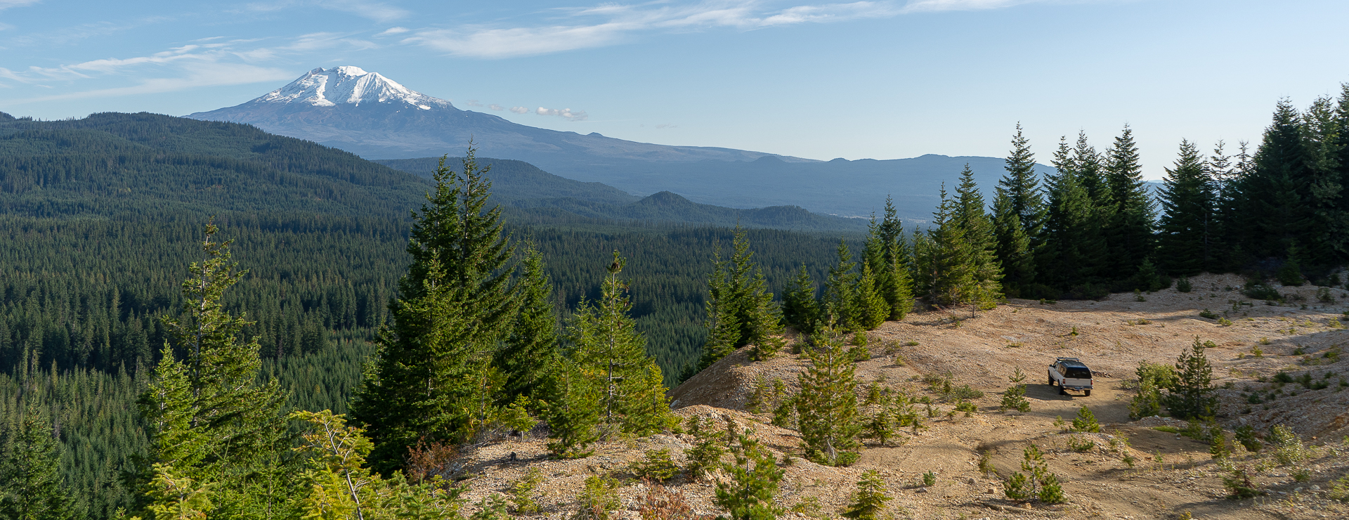
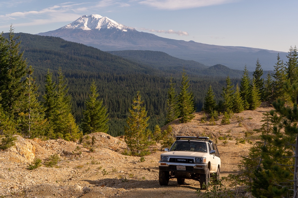
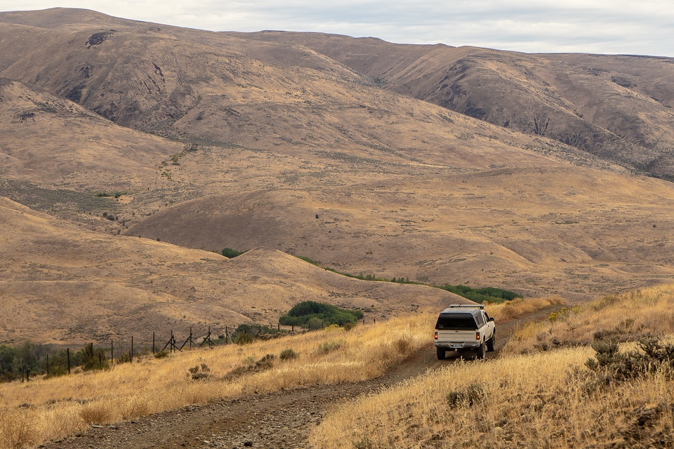
Washington Cascade Overland Route is a 553-mile journey of mostly non-paved roads, that take you from the town of Stevenson, near the Oregon border to Night Hawk which is on the Canadian border. This trip runs through the eastern side of the Cascade Mountain range, which includes views of several peaks, including the massive volcanic mountains Rainier and Adams. Throughout the trip, you’ll see the diversity of Washington, including dense forests, open arid pines, and rocky ridgeline passes, as well as rivers and lakes, including Rimrock and Chelan.
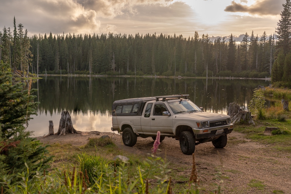
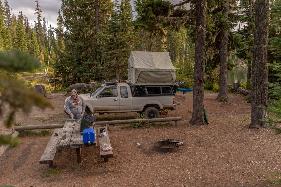
Despite being predominantly off-road, the route does have several paved portions, usually leading into or out of town. Some of these portions, including Highway 12 near White’s Pass, Highway 97 near Leavenworth, and South Lakeshore Road along Lake Chelan, have many beautiful views as well. As you pass through towns, you will be afforded the opportunity to refuel and resupply or stay at a hotel if you desire it. But, with the route passing through or near over two dozen designated campgrounds, and dispersed camping being present on nearly every trail, there will be plenty of locations to camp and stay off-grid.
The best time of year to complete the Washington Cascade Overland Route is June through September, to avoid the rain and residual snow in the mountain passes. It can be completed in as quickly as five days, but depending on road conditions and the stops you make, 7 days is a more appropriate amount of time to take. The course can be run in either direction and given the occasional pavement and town, you can pause your trip at any time and resume later if need be.

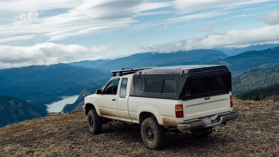
Vehicle requirements vary between each portion. While some areas require only two-wheel drive with moderate clearance, other portions will be far more demanding. If you intend to do the route in its entirety, without pause and changing vehicles or equipment, it is recommended that at a minimum you have a four-wheel-drive SUV with moderate clearance, all-terrain tires, and a full-size spare. Four low, while not absolutely necessary, is very useful in some portions of the trail, particularly between Nile and Ellensburg during the second portion, due to excessively rocky terrain, and some steep climbs and descents. For this reason, RVs and trailers should not be used for the full journey either. A small overlanding trailer may work but will cause difficulties, with the previously mentioned obstacles, and several ridgeline passes. Besides vehicle requirements, it is necessary that you bring traction aiding devices, along with a shovel and tow ropes. Recovery gear including a winch, high lift, come-a-long, and a saw, as well as a GPS, would be rationale as well. Last, even if you intend on using a hotel and restaurant each night, having adequate food, water, and warm, dry clothing, as well as ample fuel, is an absolute must.
Sections
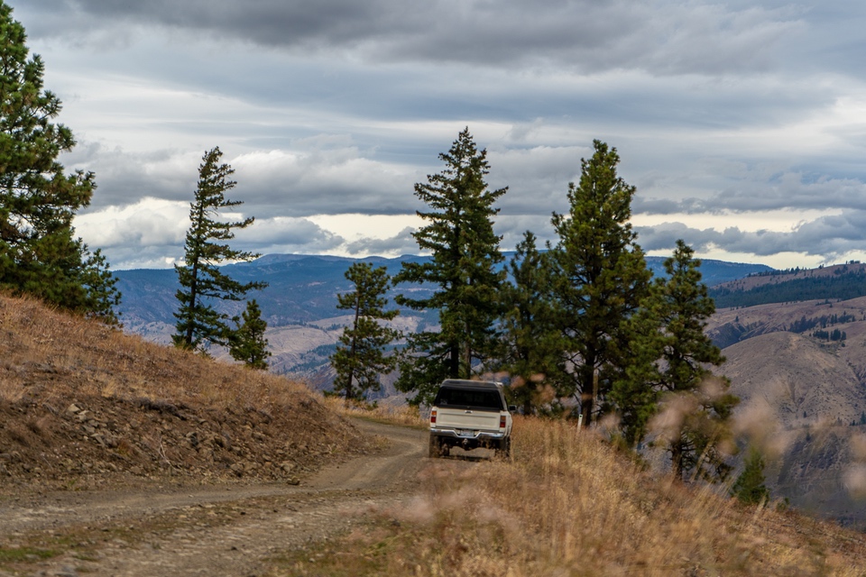
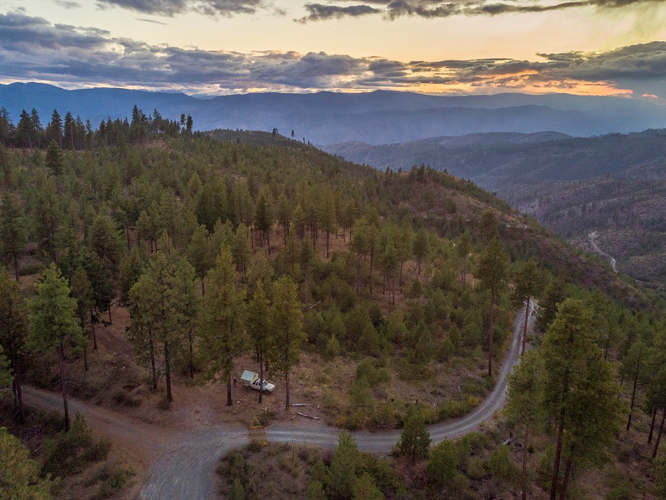
1) Stevenson, WA to Packwood, WA.
The journey officially begins on pavement as you cross into Washington from Oregon over the “Bridge of the Gods” just West of Stevenson, Washington. It is a tolled bridge and is not required to pass if you are already in Washington, or you travel through Portland. The first trail is just the north of Stevenson. This portion of the trip, the first of six, is made of easier dirt and gravel roads, crossing over Triangle Pass and Trail Peak through the Gifford Pinchot National Forest. The route continues over Trout Lake Creek, Grand Meadows, Takh-Takh, and Midway Meadows. After 119 miles (92 off-road), you will ultimately arrive in Packwood, Washington where you can find fuel, groceries, restaurants, and hotels.
Trails in this segment include:
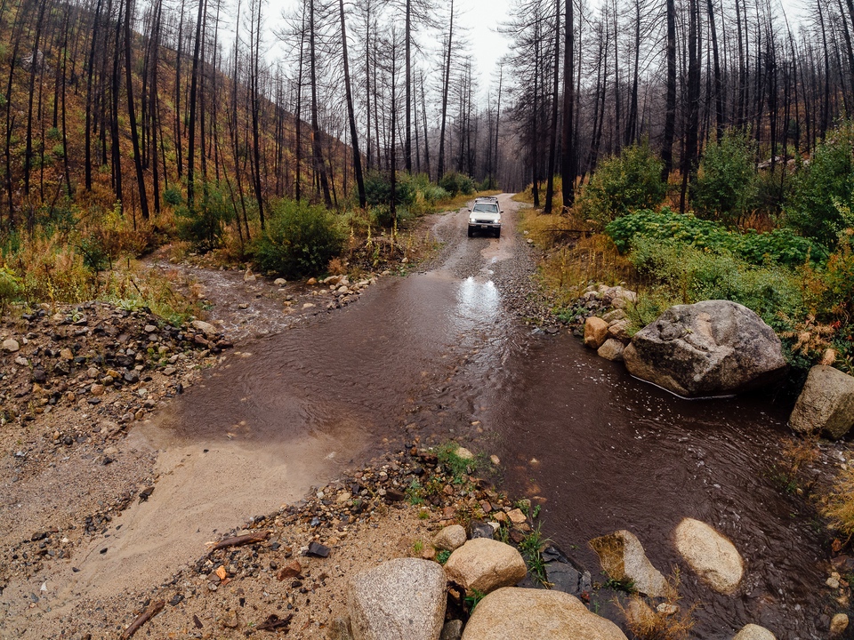
Most of your delays will be from the views of the surrounding mountains, and hiking trails, should you choose to expand your adventure. Mount Hood, Adams, and St. Helens can be observed in this region; weather permitting. Potholes are present as well and can produce large puddles after heavy rain. Though fun to speed through, exercise some caution, as the holes may be deeper than anticipated.
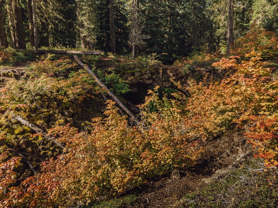
Two places of interest in this region are the Guler Ice Caves and the Natural Bridges; both of which were formed by lava tubes from the nearby Mt. Adams. The cave is cold and filled with moist air, and ice can be present year-round. For this reason, it is recommended that you bring flashlights, warmer clothing, and sturdy footwear when exploring the caves. Though the cave is not directly on the route, it is only a short detour away. The Natural Bridges are the remains of tunnels that were formed over 12,000 years ago, by lava flows from Mt Adams. After the tunnels collapsed, some areas stayed intact, creating these bridges where you can overlook the trenches that remain. The bridges can be reached by walking a short distance through a clearly worn trail, though be cautious that there are no railings present. Snowshoeing and cross-country skiing are also popular attractions in this region during the winter months.
Vehicle requirements for this section are minimal; two-wheel-drive cars with moderate clearance should be fine, though four-wheel drive is recommended. Medium-sized campers and trailers are fine as well since the trail doesn’t get too narrow, nor too steep. This is one of the easiest, and most relaxing portions of the trip.
2) Packwood, WA to Ellensburg, WA.
The second portion of the trip begins with you leaving Packwood, where you’ll spend the first 40 miles on pavement as you drive along Highway 12. Despite being all pavement, this section of the road has breathtaking views as you drive through White Pass and along Rimrock Lake. From there, you’ll exit Highway 12 at your first off-road waypoint; the start of Bethel Ridge.
Trails in this segment include:
Bethel Ridge reaches over 6,000 feet in elevation and is thus not passable during the winter months. Be aware there may be free-range cattle at the lower elevation points. Being a ridgeline road, it can offer amazing views of the surrounding mountain ranges. If ridgeline driving is not something you are after, there is an easier (albeit less impressive) route that can be taken, via National Forest Development Road 1500. Both routes take you through the Okanogan-Wenatchee National Forest, and upon exit, you’ll arrive in the small town of Nile.
After a brief section of pavement, the trails begin again, as you enter the Oak Creek Wildlife Area, passing near Cleman Mountain, followed by Evans Canyon to the small town of Wenas. From there you will traverse Umtanum Ridge, and later descend via Old Durr Road, ultimately arriving in Ellensburg; a larger town with food, fuel, and hotels.
During the 1870s, as roads continued to improve, settlers began claiming land in Eastern Washington. Shushuskin Road was part of that route, carrying mail, freight, and passengers over 150 miles from Dalles, Oregon to Ellensburg, Washington. An alternate route was built by Jacob Durr in 1882, which crossed the Umtanum Ridge from the Wenas Valley, before rejoining the Shushuskin Road. Although the bypass saved travelers 10 miles from their journey, the route was quite steep and required turntables; platforms that allowed a wagon and its horse team to turn at the switchbacks. Between the difficulty and the high cost of $25 annually, the toll road did not see much use. As one stagecoach driver concluded, “There is no hell in the hereafter; it lies between The Dalles and Ellensburg.”
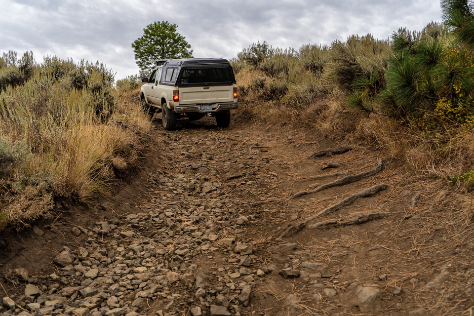
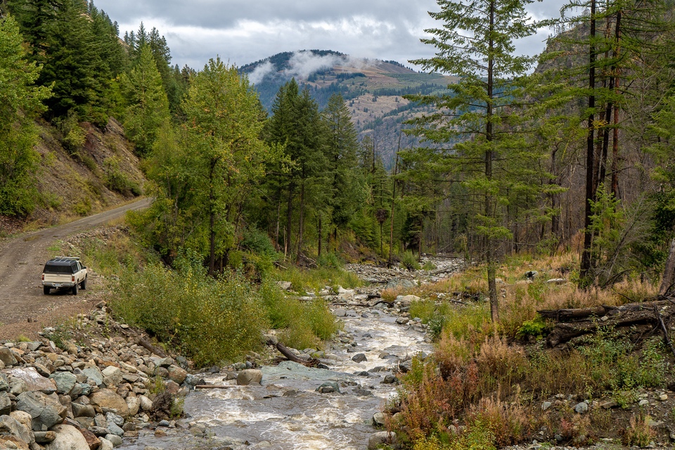
This portion covers 122 miles (68 off-road) and is far more challenging than the first. There are several ridgeline drives, and many steep ascents and descents. The route between Wenas and Ellensburg is quite rocky and will require slow driving, causing delays in your trip. Because of this, four-wheel-drive vehicles equipped with all-terrain tires are required to cover this portion in full. Four-low, while not absolutely necessary, will be very beneficial in both steep climbs, and the slow speed needed for driving over the rocks. An RV should not be taken here, and a trailer will still be challenging. While it is always wise to bring extra food, water, and fuel, this portion will likely take you longer than expected, and will thus be crucial.
3) Ellensburg, WA to Cashmere, WA
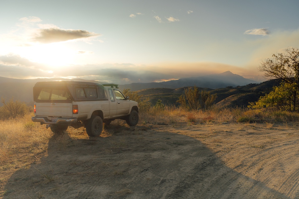
After leaving Ellensburg, you will find another paved portion of road, though not as long as Highway 12, when you left Packwood. While paved, it is unkept with potholes and cracks rampant. The road is narrow and has many twists to it. Before long, gravel begins again with you on your way toward Table Mountain and Lion Rock Lookout in the Wenatchee National Forest. If you can get a campsite at the end of Lion Rock, you may wake up to the sight of mountains emerging as fog leaves the valley below. And, at 6,358 feet in elevation, it is the highest elevation you will reach driving on this trip.
What began with moderately open, rocky terrain, transitions into partially burnt woods, and finally back into dense, thriving trees. As you travel deeper into the forest, the road becomes more rugged and more remote. National Forest Development Road 9712 is a prime example of this. Initially turning east onto this road, nine miles were covered before the road became impassible in our rig. After sliding dangerously close to a rocky edge, traction aids were needed to back out and return the way we came. Following NFDR 9712 in its entirety, you would see Devil’s Gulch and the Columbia River while en route to Beehive Reservoir, before traveling downward into the Mission Creek Valley, into the town of Cashmere, where fuel, food, and hotels await. Though not fully documented, this route will be completed in 2020.
A much shorter, and easier route to take would be turning west on NFDR 9712, lasting only a few more miles before meeting US 97. While not as adventurous or scenic by any means, if you find yourself having a difficult time, this may be the right way for you to go. Plus, like many paved sections on the trip, US 97 is quite pleasing to the eyes, and brings you closer to Leavenworth, offering more options for food and hotels than Cashmere; admittedly at a higher price.
While this portion is arguably easier than the previous, the weather will play a large factor in the quality of the trails. While not particularly steep or rocky for most of it, the route has many undulating portions to it, and you can find yourself off-camber with little traction, due to high rainfall. Traction aiding devices, as well as shovels, should definitely be considered, especially during the rainier months. When dry, a four-wheel-drive SUV is more than adequate. RVs should not be taken, especially while wet. While large trailers were seen, the trucks pulling them did have some difficulty through the mud, and it made passing more of a challenge as well. At 59 miles (13 off-road) in length, portion 3 is one of the shortest, but it can still pose some challenges.
4) Cashmere, WA to Chelan, WA
From Cashmere, you head north up Nahuhum Canyon and are soon greeted by a beautiful 360-degree view at 5,810 feet, atop Chumstick Peak. Following Chumstick, the route takes you up Roaring Ridge and into the Entiat Mountains. At the intersection of USFS 5200 and USFS 5800, you’ll want to take USFS 5800 to continue on with the journey. But, if you’ve got the time for a view, or you’re looking for a remote Airbnb, go ahead and continue on USFS 5200 for a few extra miles.
White Aspen Luxury Camping is a small, one tent campsite equipped with a full-size bed, cookware, toiletries, shower, and toilet. Located atop a ridgeline, you’ll have the entire view all to yourself. It’s a great option if you desire isolation and staying off-grid, but need a shower, and don’t feel like making camp for the night. If this interests you, look them up on Facebook and airbnb.com and check for availability.
Sugarloaf Peak Lookout was first established in 1914 along the eastern ridge of the Entiat Mountains. The station began below the peak, as a tent for the lookout to live, with supplies being delivered twice monthly. With a more developed trail to the lookout completed in 1922, a permanent structure was ultimately created in 1924. At an elevation of 5814 feet, the lookout offers views in all directions and encompasses the Entiat Valley to the east, and the Wenatchee River Valley, Stuart Range, and Glacier Peak to the west. With aerial surveillance becoming more prominent and more cost-effective, many of the outlying lookouts were abandoned in the 1940s, while the more centralized lookouts were upgraded for continued use. Today, Sugarloaf Peak is one of the few lookouts actively used by the Forest Service in Washington. Because it’s still in use, those who wish to visit are asked to only do so between 9 am and 5 pm and to respect the privacy of the lookout on duty there.
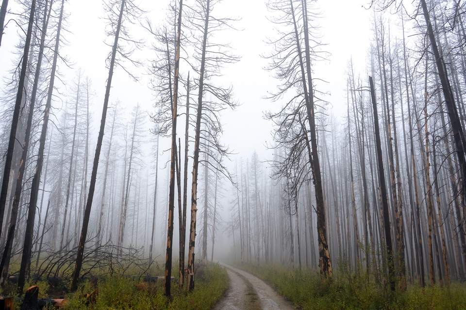
As you continue your journey through the Okanogan-Wenatchee National Forest, you may encounter signs indicating that controlled burns are in progress. If this occurs, follow the designated detour routes posted by the Forest Service; there are many routes that can be taken. The roads are not difficult, though switchbacks and ridgelines should be anticipated. As you exit the forest, you will enter a small town called Ardenvoir, which has a single shop for basic needs.
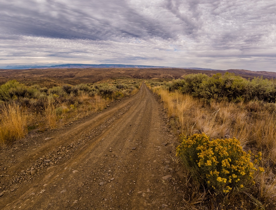
After Ardenvoir, you begin your climb up McKenzie Ridge and the Chelan Mountains, gaining over 4,000 feet. Initially, you’ll see arid, rocky terrain with few trees, on your way to Stormy Mountain. Near there, you’ll reach the third highest driving point of the trip; the trailhead for Devils Backbone, at just over 6,100 feet. After this point, the trees start to become denser as you pass through Slide Ridge. Near this point, you will be able to see Lake Chelan below. There are two routes that can be taken to reach 25 Mile Creek State Park, the easier of the two is the one documented. The other route, nicknamed as “The Jungle”, will be recorded in 2020. A 20-mile drive on the pavement along Lake Chelan takes you into the full-service town of Chelan.
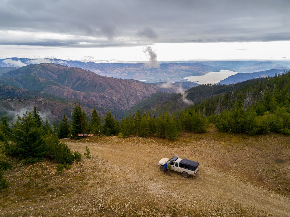
This 100-mile (67 off-road) section will take you through a variety of terrain, and frequent elevation changes. While not particularly challenging, your biggest problem will likely be the need to stay flexible. Driving through National Forests with controlled burns may require you to take alternate routes for your own safety, and for the wellbeing of the forest. For this reason, a reliable GPS would be a great addition to your inventory. Bring plenty of food, water, and fuel, in case you find yourself backtracking. Otherwise, it is a welcome change of pace, being easier than the last few days, but still more engaging than the first. Any vehicle with all-terrain tires and good clearance will be able to handle this section. Trailers of smaller size are fine as well, but with the ridgeline driving, switchbacks, and potential for turnarounds, large trailers and RVs aren’t recommended.
5) Chelan, WA to Conconully, WA
The fifth portion of your trip has you departing Chelan and heading north toward the 5,867-foot Cooper Mountain. Stunning views are said to be there; though, at the time of documenting, we were caught in the middle of a storm. Shortly after you’ll come to pass Fox Peak. At 6,155 feet, it will be the second-highest elevation you reach driving on your journey. It’s a small detour and takes you down a steep and potentially muddy descent back to the main route. Afterward, you’ll hit the pavement on Highway 153, near Meadow River.
If you are in need of fuel or food, the town of Twisp is nearby via a short detour. To reach it, continue north on Highway 153, instead of taking the exit onto Highway 20. After a few miles of pavement, the trails begin again as you near Woody Mountain. There are two obstacles that you may encounter in this region. The first is downed trees. Many of the trees are not particularly large and may be moved by hand, but their branches can easily get tangled in the surrounding trees, causing removal to be more difficult. Tow points and straps are all you should need to get through, but larger trees may require the use of a saw. The other obstacle is cows. From this point on, free-roaming cattle are much more prominent. Though there is usually more than enough room for them to leave the trail, and for you to drive around them, it’s best to drive slowly and give them space to keep it safe for all.
After a short run on Highway 20, you’ll start up again on Loup Loup Canyon Road, in Loup Loup State Forest. In this region, you will find the potential for lots of puddles and a fair bit of mud, depending on recent rain. As always, exercise caution when traveling through the water of unknown depths. There are a few small creek crossings, though not of any significant difficulty.
Several old mining locations can be visited, including China Wall of Loup Loup and the town of Ruby. In 1888, a Portland Lawyer by the name of Jonathan Bourne Jr., stricken with mining fever, bought twenty-seven mining claims near Ruby. In 1889, despite a hired mining engineer reporting no signs of silver present, Bourne began to build on his sites anyway. 400,000 firebricks were ordered in the creation of the furnace and boilers, and massive granite walls were built for support, with China Wall being one of the remaining walls. How it got its name is somewhat of a mystery, with some speculating Chinese workers helped create the wall, though no Chinese names were on the payroll. But the mill was never finished, as Bourne's company had begun to slip into bankruptcy. Ruby was the primary city of the Okanogan County Silver boom, being created in 1886. The main street was packed with shops and cabins were everywhere to accommodate the inflow of miners. However, once the price of silver dropped in 1893, the town was abandoned overnight, and all that remains are a few stone foundations. These remains are reached following a descent with many switchbacks, and afterward, it’s an easy drive into the town of Conconully, where you’ll find a small selection of hotels, fuel, and food.
At 103 miles (67 off-road), the fifth section doesn’t pose many challenges, other than a greater amount of livestock. That, and, the further north you travel, the less frequent resources can be found for you to pick up along your way. While it is possible to resupply each day, it will be more time and cost-effective to bring extra food supplies; even if they’re just snacks. With the sharp descent near Fox Peak and the narrow and muddy roads of Loup Loup Canyon, four-wheel-drive vehicles and good all-terrain tires are needed. Smaller trailers may work, but with fissured roads possible, larger trailers should not be taken.
6) Conconully, WA to Canada
The final leg in your adventure takes you from the small town of Conconully to the Canadian border. The original route, lasting a total of 66 miles, takes you through the Okanogan National Forest, and into Loomis State Forest. From there, you would traverse the eerily named “Skull and Crossbones Road”, to an old homestead cabin. Afterward, you’ll descend steep switchbacks, viewing the valley below, before exiting the trails near Palmer Lake, and taking pavement into Nighthawk.
Regrettably, this was not the course that was taken. Even in September, the weather had started becoming unfavorable. It had been raining the past several days in the region, leaving the roads soaked and muddy. The night before our arrival, a layer of snow had covered much of the route that we intended to take. At the recommendation of a local, we chose to create our own alternate route that stuck to lower elevations, where no snow was present.
Shortly after departing Conconully, you’ll have about 16 miles of off-road driving before arriving in the Sinlahekin Wildlife Area. From there, it’s about 25 miles to the Canadian border. Once you've arrived, you’ll have reached as far as you’ll go on this trip. At 45 miles (21 off-road), the last portion is by far the shortest. As you’re likely nearing the end of your supplies and in desperate need of a shower, the end of the journey will surely be a somewhat welcome occasion. And, since this is the end of your off-road expedition, towns with an abundance of supplies are no more than a few highway hours away. The two takeaways for this portion are the necessity of adequate supplies, and being prepared for inclement weather. Though supplies and comforts are soon available, having to endure the full day without them would be ill-advised; especially if weather conditions are no longer in your favor. Be prepared for both. You’re almost to the end, but you’re not out of the woods yet. Most four-wheel-drive vehicles will handle this portion. But, if it begins to snow, and if the primary route is taken, it will become significantly more challenging.
With no more trails to follow on this journey, it is a great moment to look back at what has been accomplished. Though 600 miles in a week may not seem like a long distance, especially by today's travel standards, speed and efficiency should not be the main goal in this journey. Instead of seeing the conventional Washington highlights, this route takes you through a variety of topography, to several historic points, and of course, along many of the distinguished Washington peaks. The Washington Cascade Overland Route is a fantastic way to escape the city and experience parts of Washington many have never seen, and even more likely never will. There are plenty of ways to reach memorable destinations; why not make an adventure out of it?
Centered in the pinnacle of the Pacific NW and growing up cruising around the small town of Quilcene, Jasmine grew with a fascination and passion for outdoors and travel, many of those adventures fueled by the family's 1998 Jeep Cherokee.
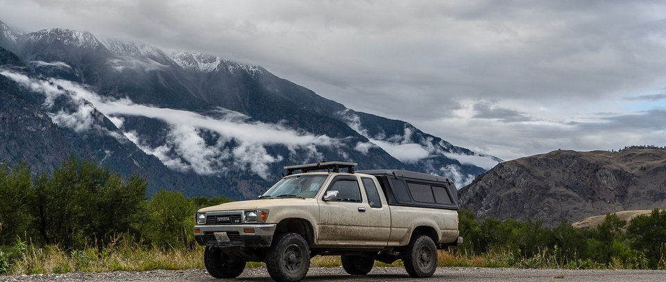
Years later, photography grew as a way to capture and share the adventures being had. After a road trip from Seattle to San Diego in a 1996 Jetta, a 4WD truck would be the next step in going further in photographing the wild places of the West. In December of 2016, a manual 1989 Toyota Pickup was purchased and those dreams would continue to flourish.
Jon grew up in a small Wisconsin town. In 2004, his parents decided to purchase a new Jeep LJ. They picked the LJ because of the additional room, as it would be used for a road trip to Florida. And, though his father wanted a yellow Jeep, being a soft top and a manual was more important.
After joining the navy, the family Jeep followed Jon down to Georgia and became his own. It took him to Virginia, and then Washington. It wasn't until Washington that things started to happen for Jon and his Jeep. Jasmine, now his wife, got him more interested in hiking and ultimately Overlanding. Over time, Jon and Jasmine realized that they wanted to use the Jeep to tackle harder trails and spend weekends in ORV parks. It was through this decision that the mostly stock Jeep received a refreshing upgrade after 15 years of driving.
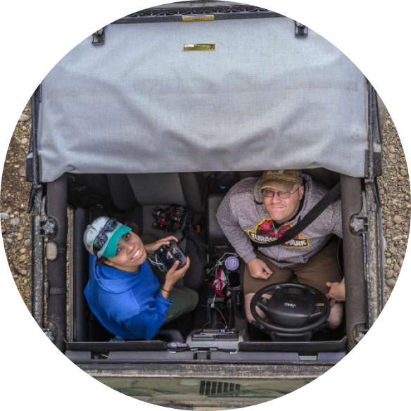
While Jasmine's Toyota pickup is still used for longer trips, Jon usually drives the Jeep when the trail is in question, and to allow Jasmine to document the trails. Currently, Jon has been in 20 states with the Jeep, via family trips and his time in the navy. Jon hopes to travel to every state with his Jeep, including Alaska and Hawaii.
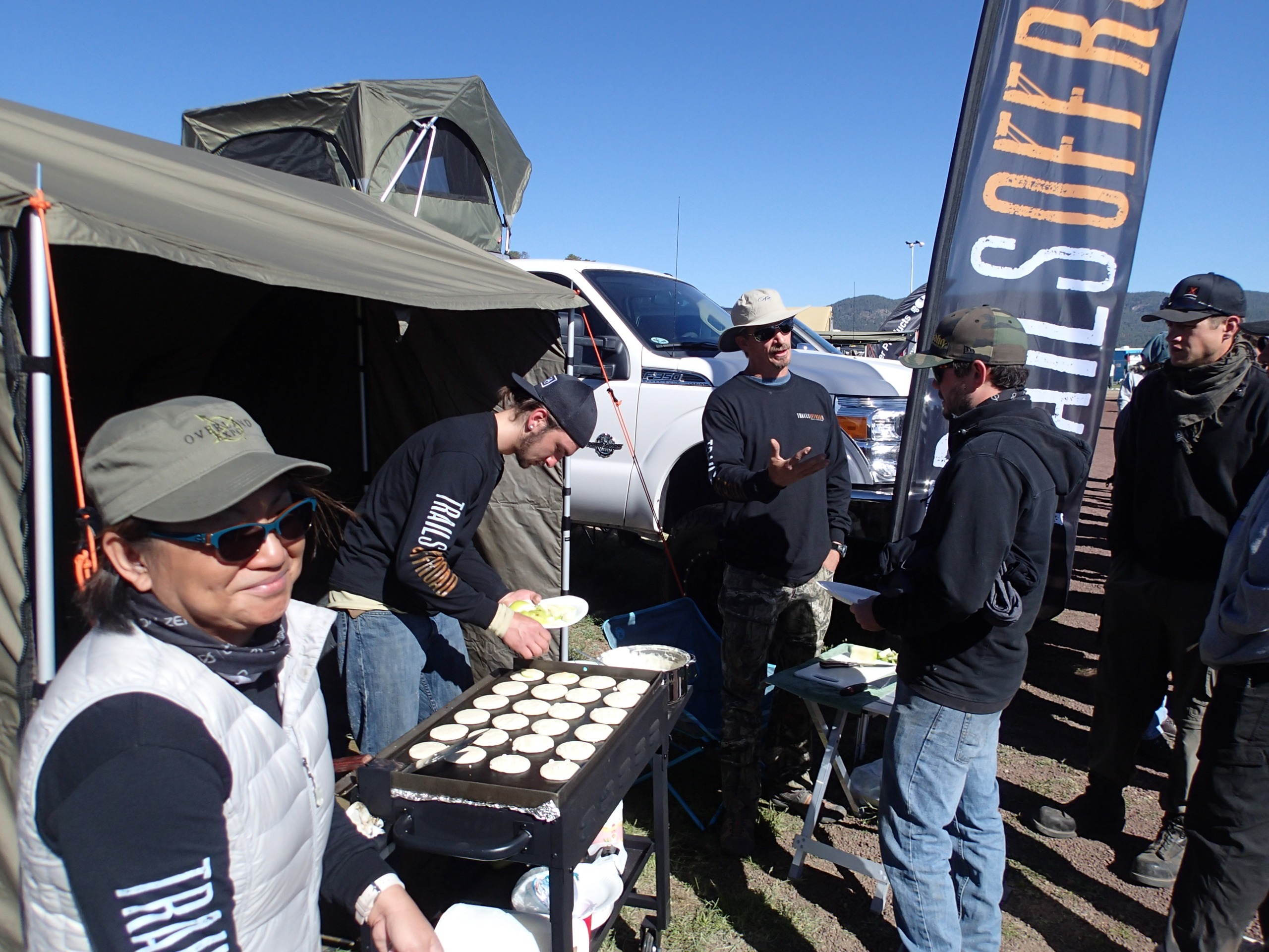

Community
Partners