Region

Alpine Loop

Colorado

Offroad Trails in Alpine Loop

A Region within Colorado
4.6/5 (664)

The Alpine Loop, also referred to as The Alpine Loop Backcountry Byway, is a true gem of stunning, unparalleled natural beauty. Located within the San Juan Mountains of Colorado, this world-renowned area traverses rugged mountain passes that will have you gasping for air at near 13,000 feet of elevation.

The Alpine Loop is a journey through time and nature. It passes through historic mining towns and ghostly remnants of the region's past such as the historic settlement of Animas Forks. Those who dare to enter this remote environment will be rewarded with a spectacular scenery of towering peaks, verdant forests, meandering streams, and vast swaths of wildflowers that devour entire hillsides.

The loop connects the towns of Ouray, Silverton, and Lake City; each offering their own unique charm and amenities for visitors. It is a network of rocky, four-wheel-drive trails first utilized by 19th century miners who used the roads to cart off ore in mule-drawn wagons. The primary trails making up the loop include Engineer Pass, a narrow and steep trail offering panoramic vistas of several 14,000-foot peaks; Cinnamon Pass, known for its breathtaking views, high altitude scenery, and vibrant wildflowers; California Pass, which winds through alpine meadows and past abandoned mining structures; and Corkscrew Pass, famous for its steep, multi-point switchbacks and dramatic elevation changes.

The offroad trails here are generally accessible mid-June through early October, depending on snow levels. The majority of trails are not technical and can be traversed by stock, high-clearance vehicles. However, the mental challenge of navigating single-lane roads with steep drop offs while attempting to squeeze past oncoming traffic can sometimes prove difficult. Additionally, the area is devoid of cell service, so it is important to go in prepared.

With a little cognitive fortitude, these unforgettable roads will give you access to some of the most remote and picturesque areas of Southwest Colorado. The Alpine Loop also provides a glimpse into the area's rich mining history and rugged frontier spirit.

Top Reasons to Explore Here
Altitude Category IconAltitude
Beginner Category IconBeginner
Camping Category IconCamping
Forest Category IconForest
Ghost Town Category IconGhost Town
Iconic Category IconIconic
Mine Category IconMine
Overland Category IconOverland
Rock Category IconRock
Scenic Category IconScenic
Water Category IconWater
Trail Types
Scout Route
Full Trail Guide

Preview Trail Icon
Preview Trails
easy
moderate
difficult
severe
extreme

All-Access
Scout Route
Start a 7-day Free Trial

Most Recent Trail Reviews

Most Popular

Search for Trails
Colorado: Engineer Pass Road Hero Photo
All-Access Preview Icon
4.8/5 (174 reviews)
Updated: 07/20/2024
Engineer Pass Road
Open
/
Lake City, Colorado/
21.02 miles/
About 4 hours

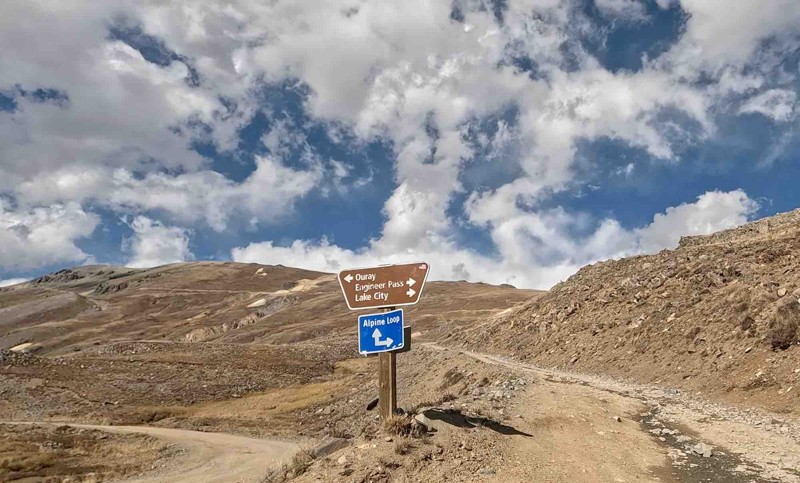
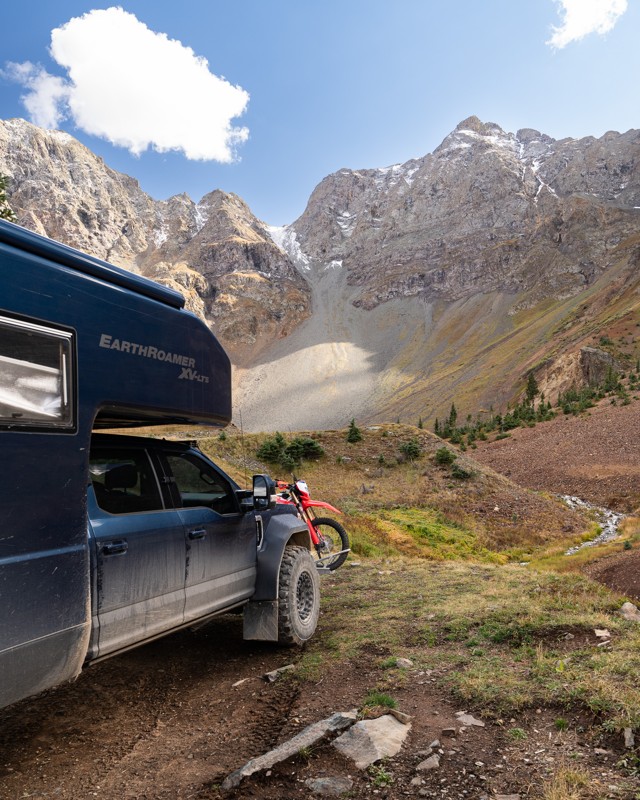
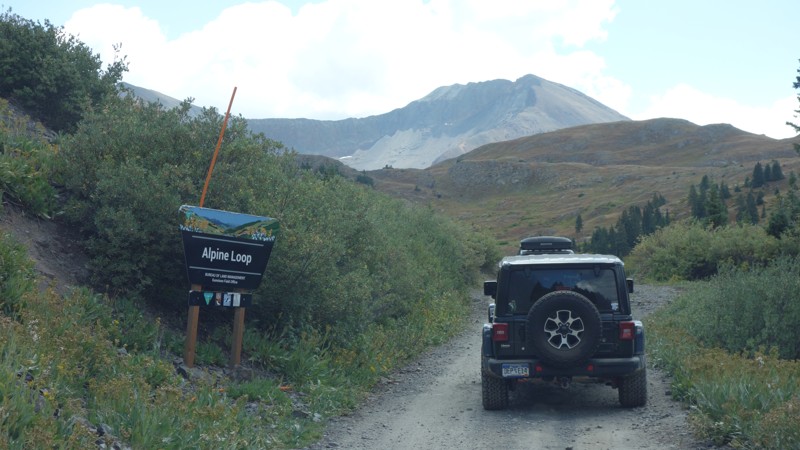
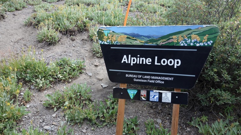
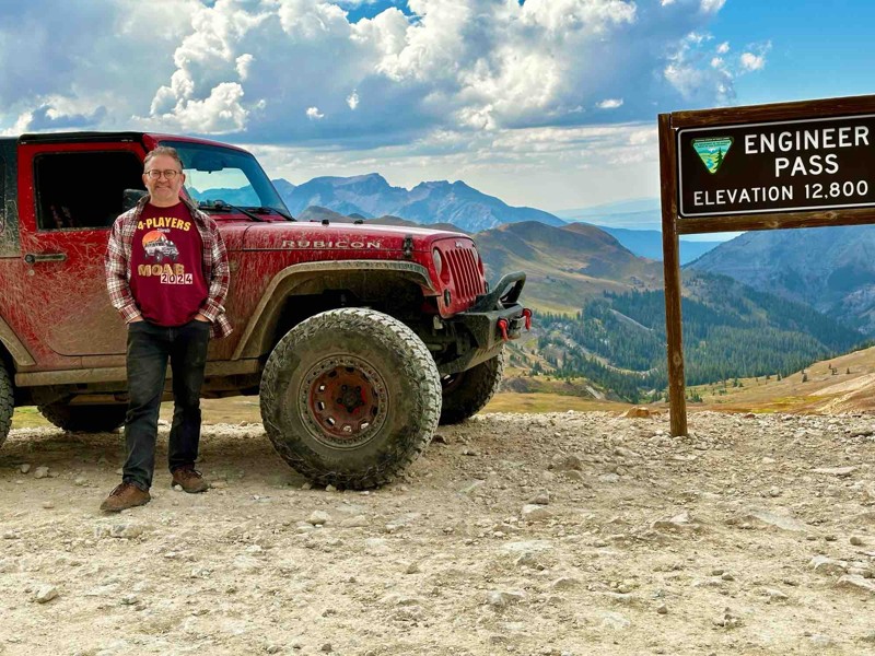
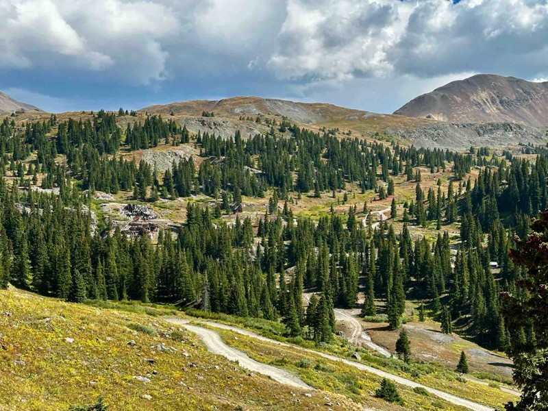
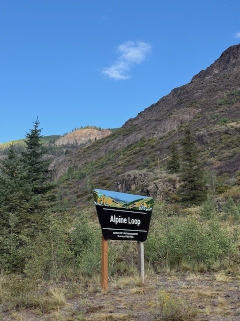
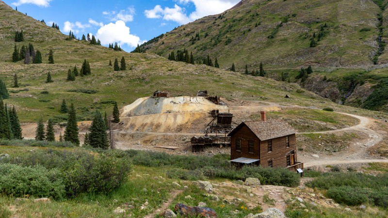
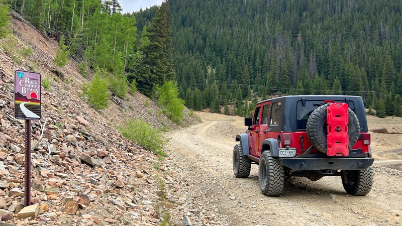
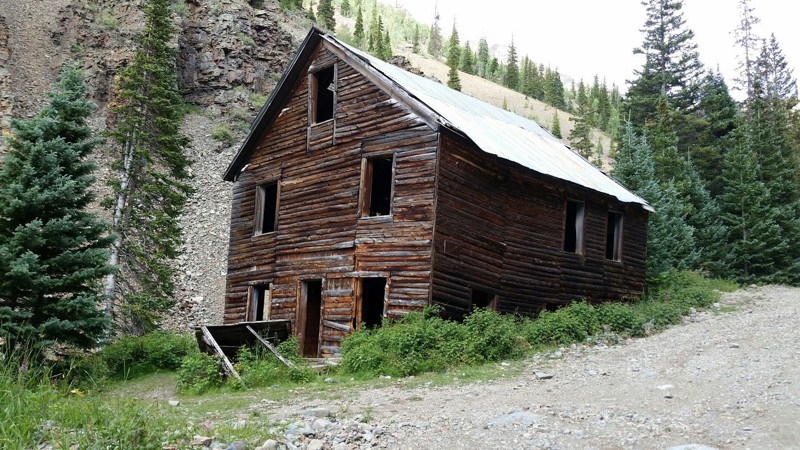
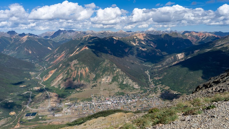
Engineer Pass is well known as part of the iconic Alpine Loop trail network in the high San Juan Mountains. Many roads criss-crossing over the peaks were established during the late 1800s to support mining operations seeking gold, silver, lead, and other ore deposits. These trails provided lifelines to transport ore, people, and supplies between the mines and the nearby towns of Silverton, Ouray, and Lake City.

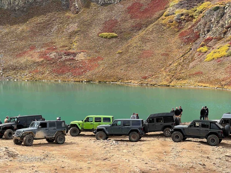
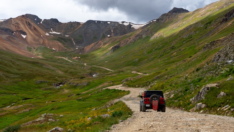
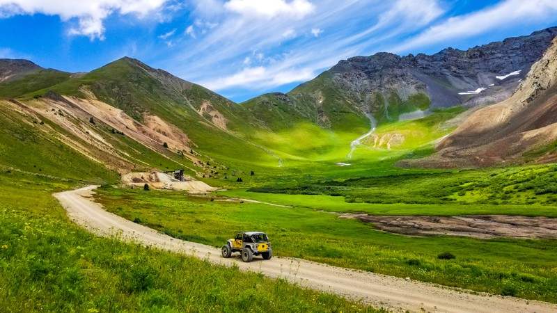
Those looking to have a quintessential Colorado weekend adventure can complete the Alpine Loop, leaving Lake City via Cinnamon Pass and connecting to Engineer Pass Road in the area of the Animas Forks ghost town. Easily extend the adventure by connecting to iconic trails like California Pass, Picayne, Placer Gulch, and more. Regardless of where you start Engineer Pass, opportunities are plentiful to test your skills, explore the backcountry of Colorado, and even touch the skies at mountain summits along the way.

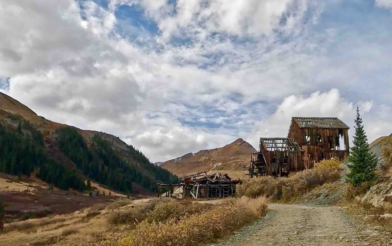
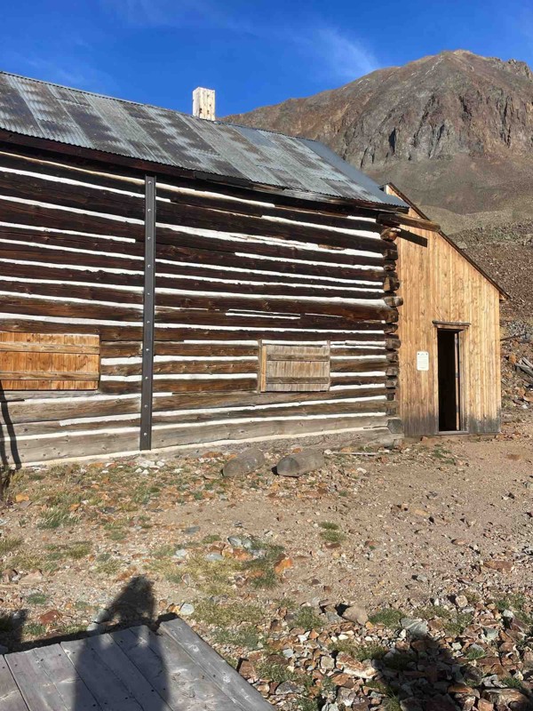
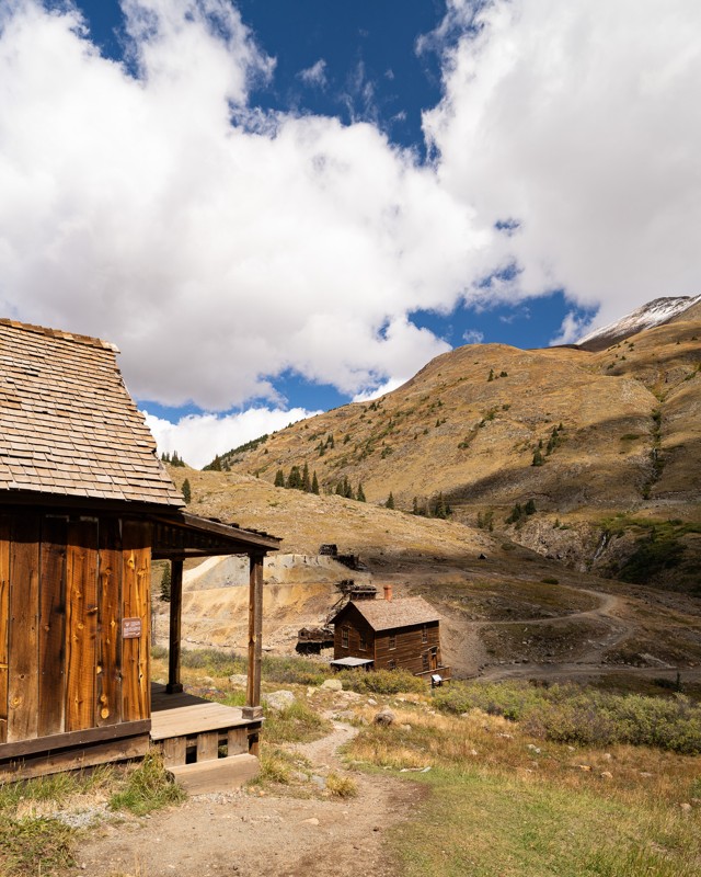
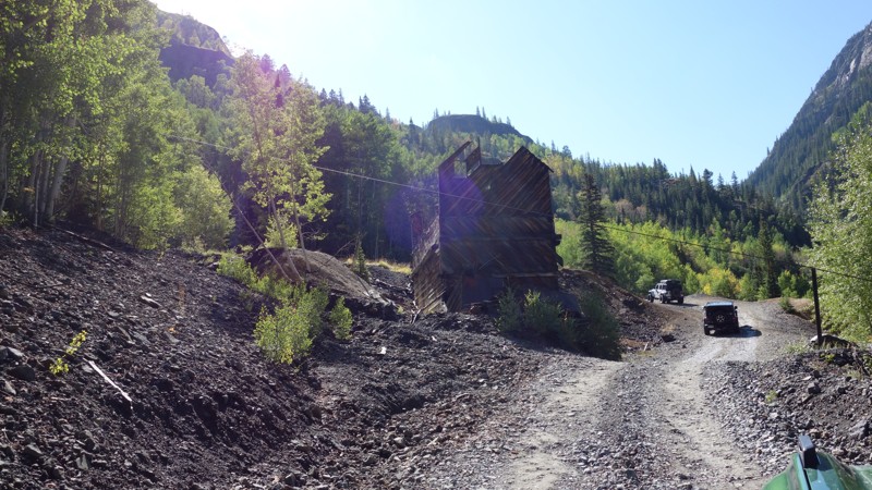
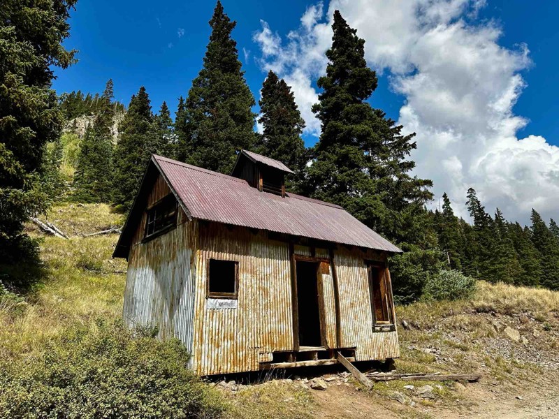
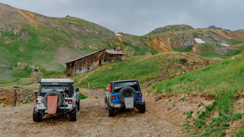
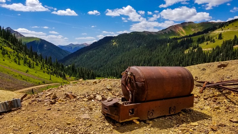
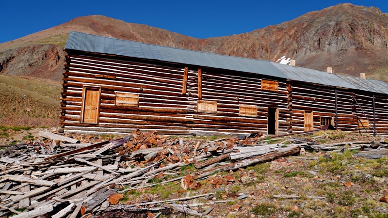
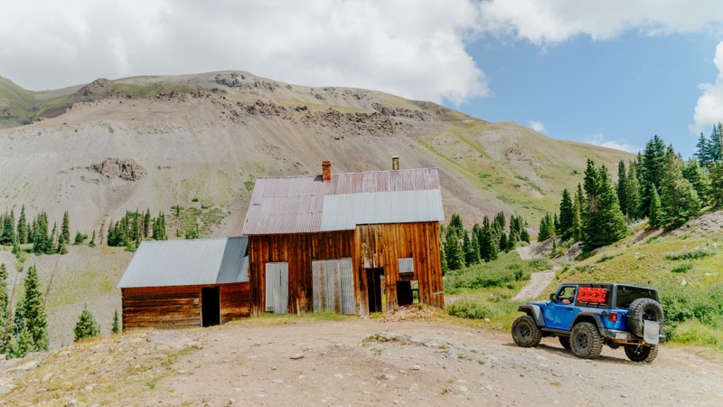
The San Juan Mountain Range is full of mining history and ruins. Some are marked clearly, while others are not. The BLM has worked with local historical societies to restore structures and make them safe to enter. These are typically well-marked with informational signage and placards. Many mining sites have been left to the elements and should be appreciated from afar as they are no longer structurally sound.

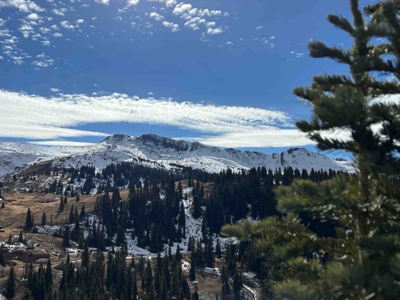
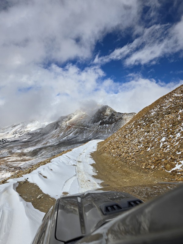
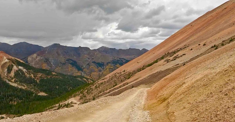
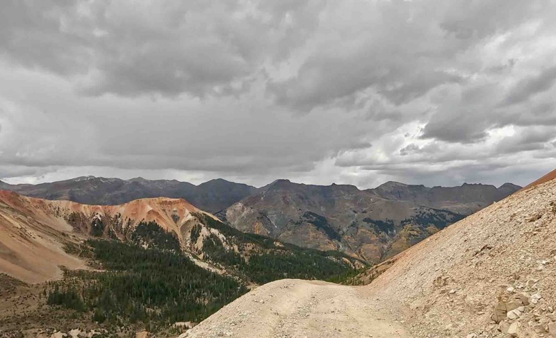
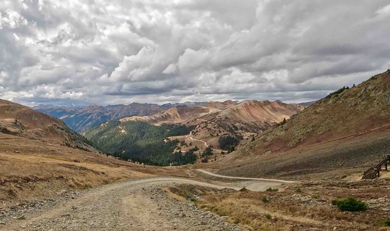
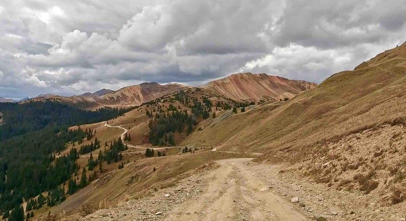
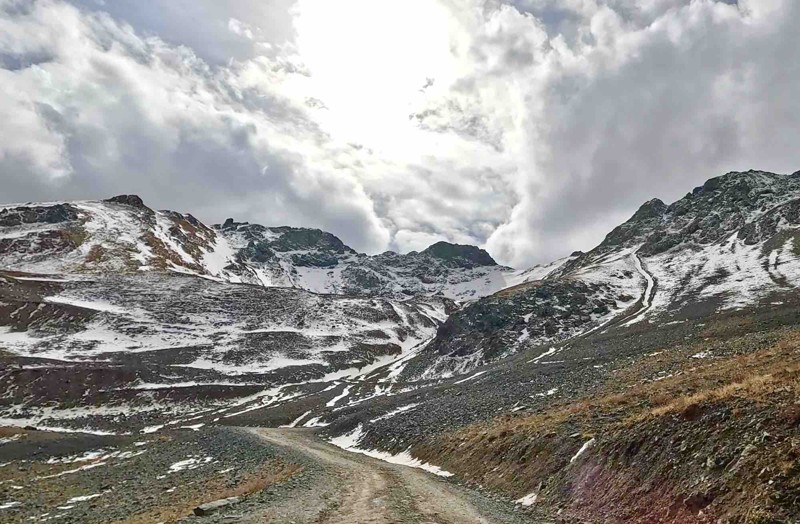
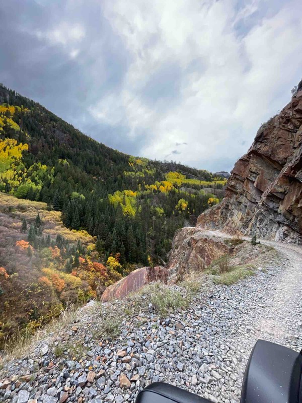
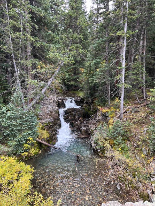
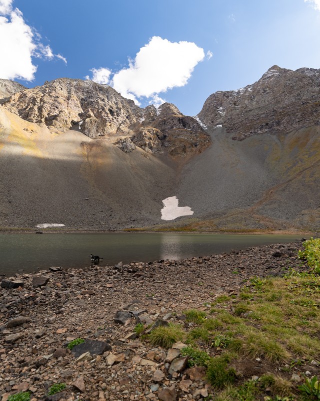
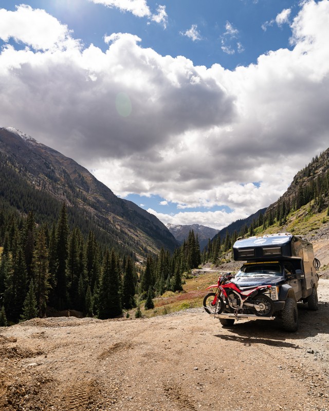
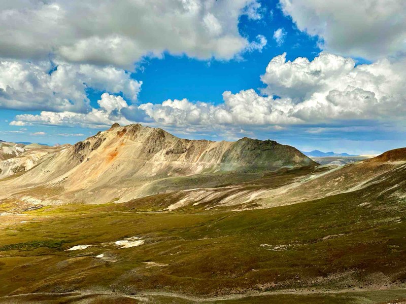
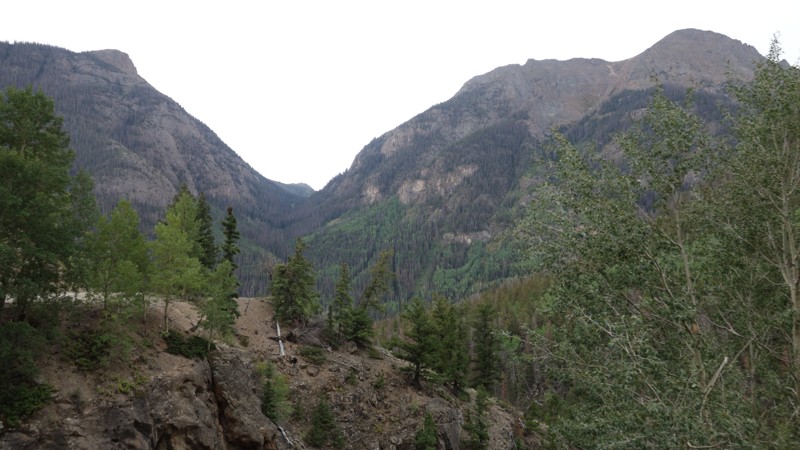
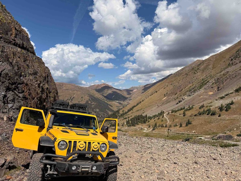
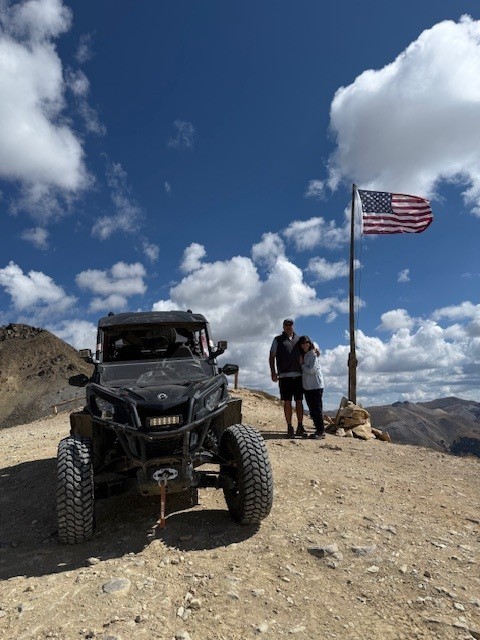
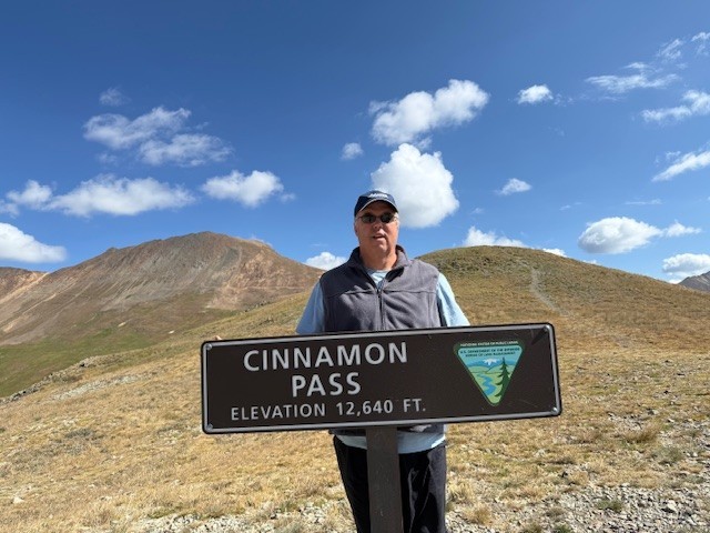
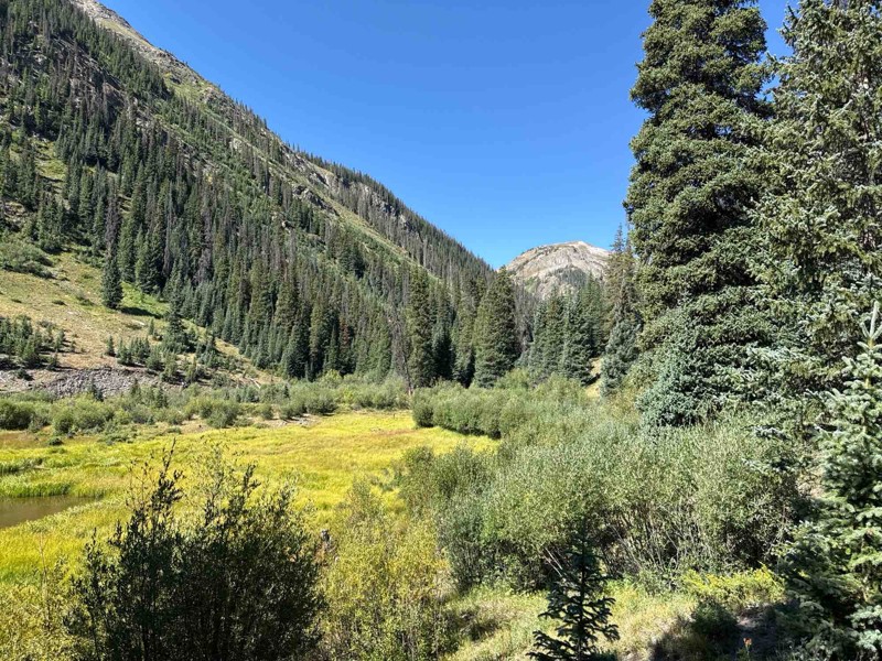
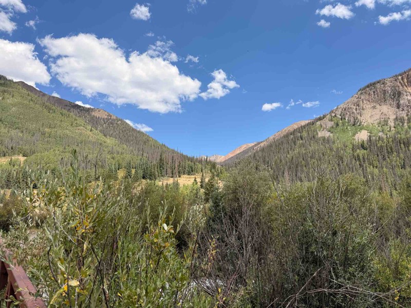
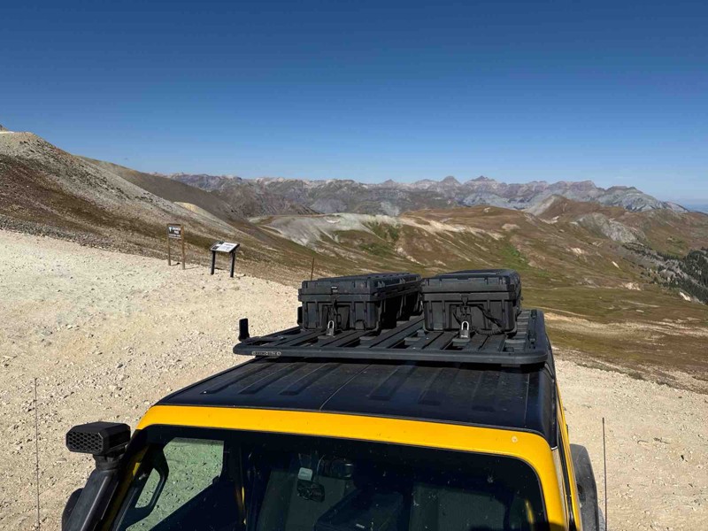
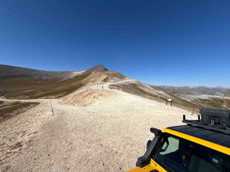
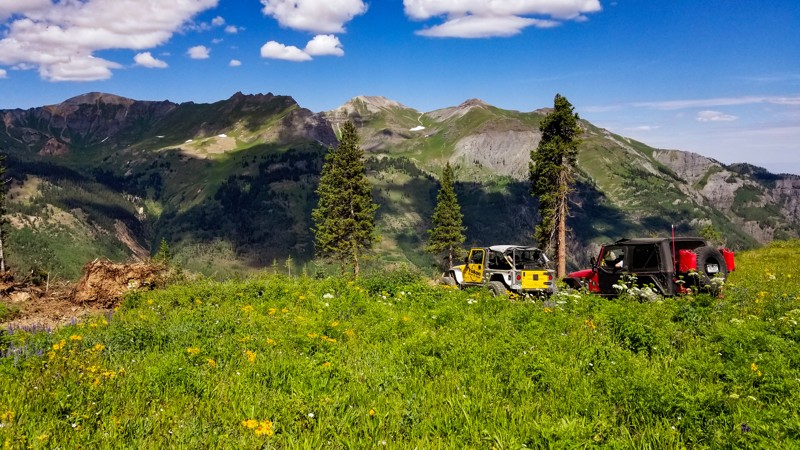
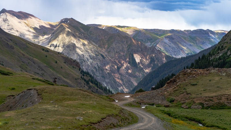
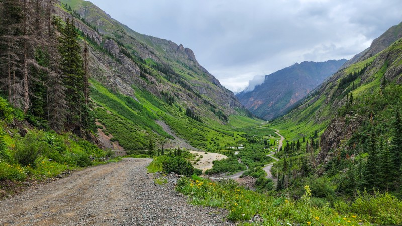
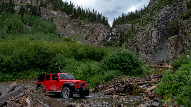
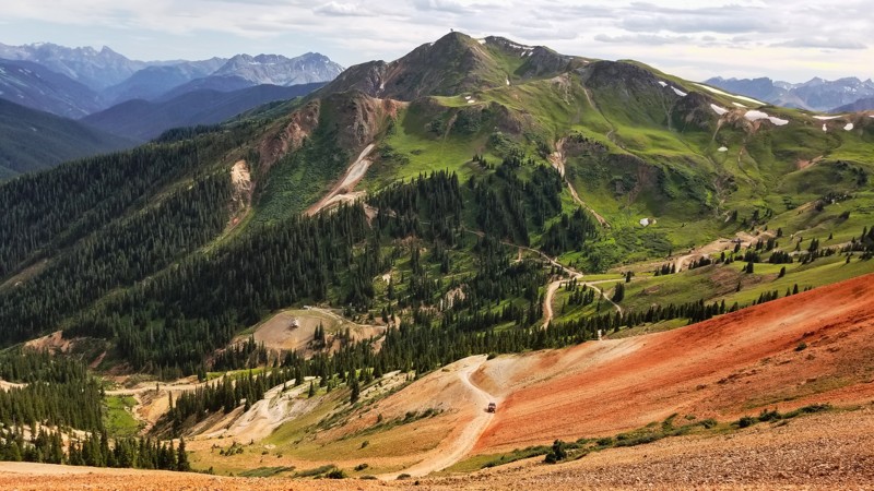
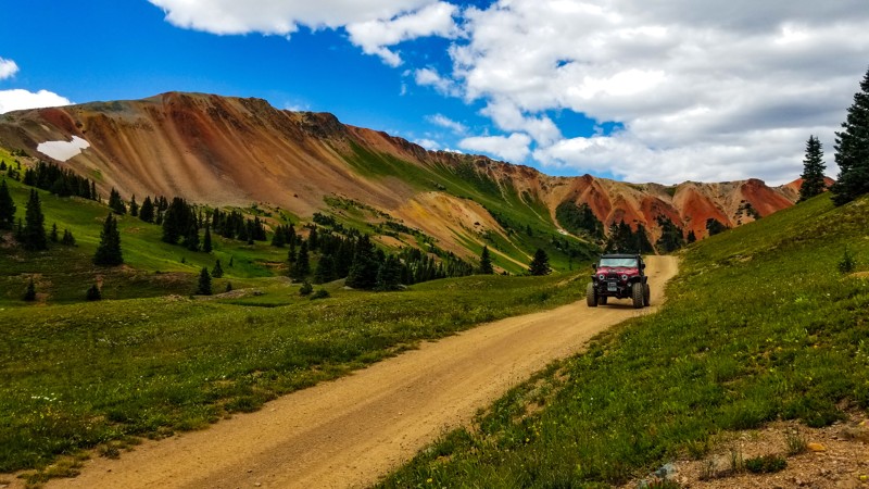
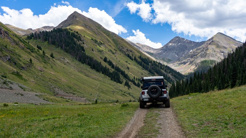
If you are looking for epic scenery, you'll find spots all along the trail worth stopping for. Odem Point and the official summit have breathtaking panoramic views of the surrounding peaks, including the Uncompahgre, Coxcomb, Wetterhorn, and Wildhorse mountain peaks. The view is so expansive at Oh (Odem) Point that on a very clear day, you might see all the way to Utah if you turn your eyes to the west. Whitmore Falls Scenic Overlook at Waypoint 14 offers a beautiful waterfall after a short hike down a well-marked footpath.

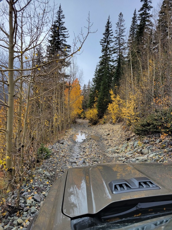
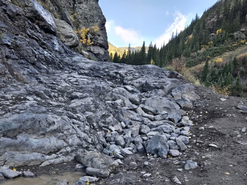
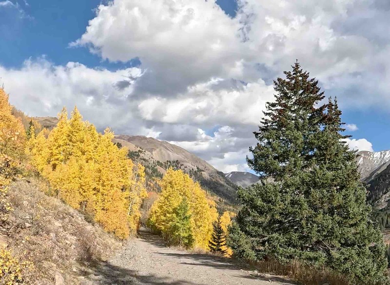
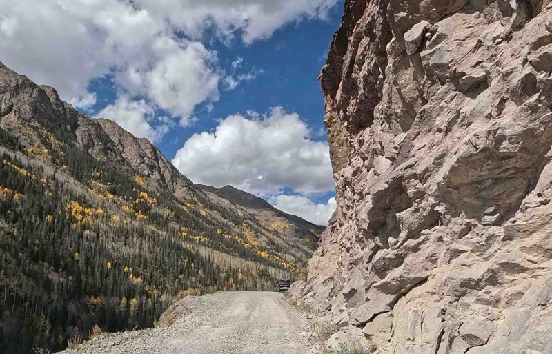
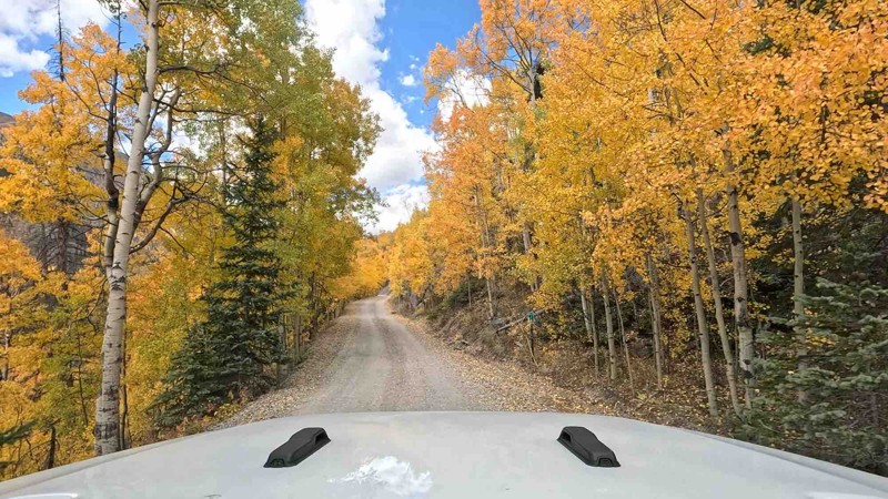
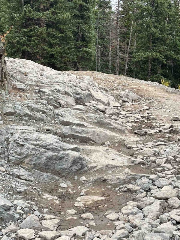
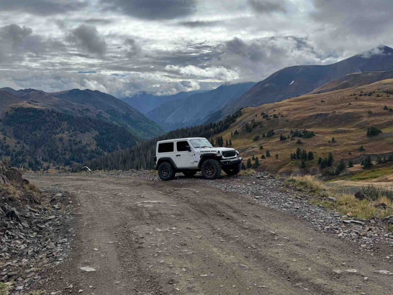
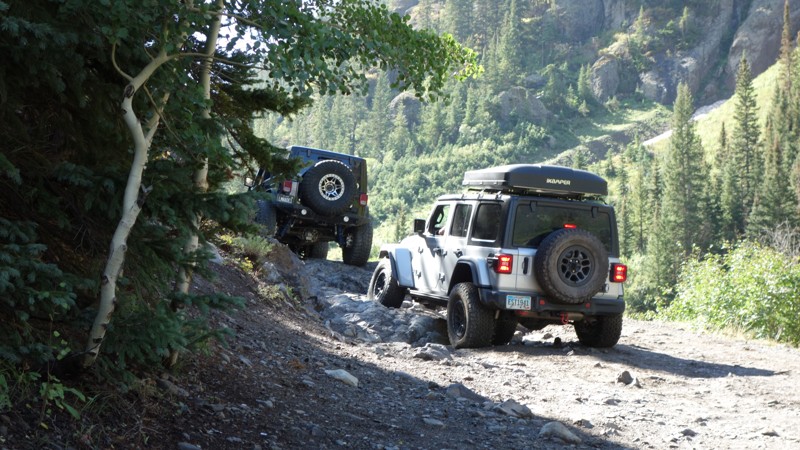
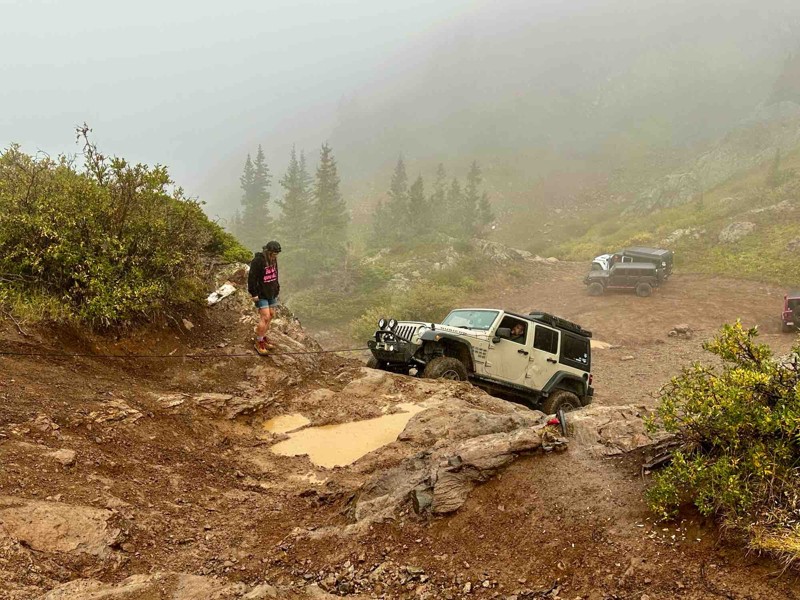
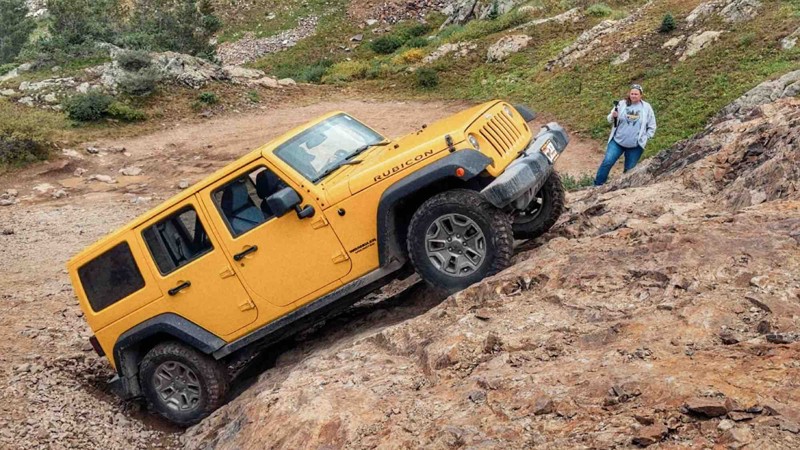
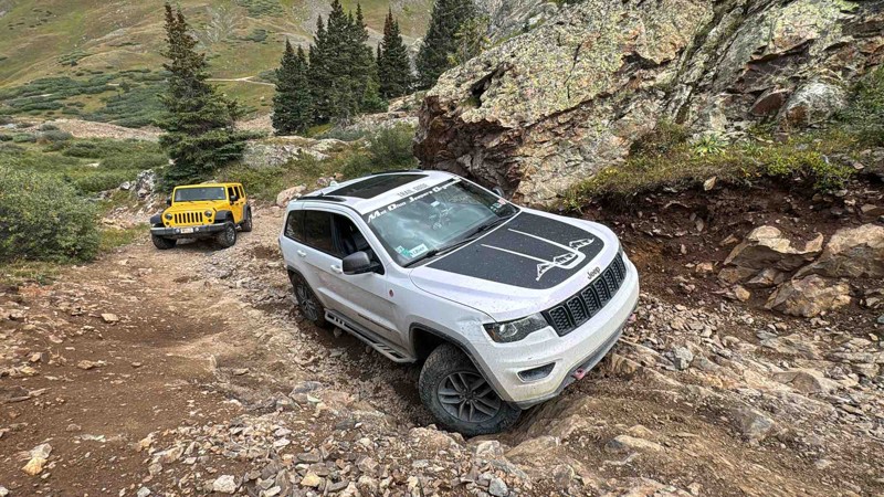
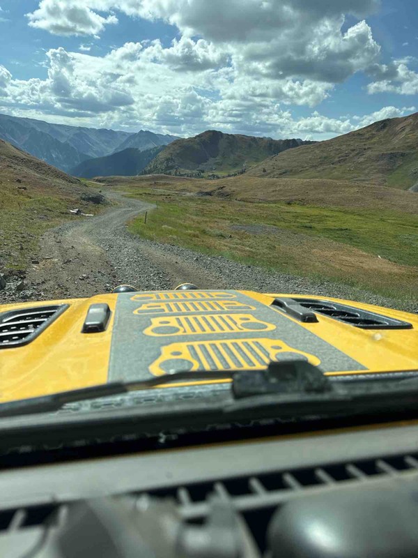
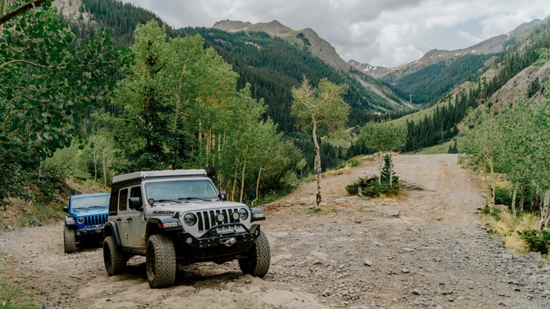
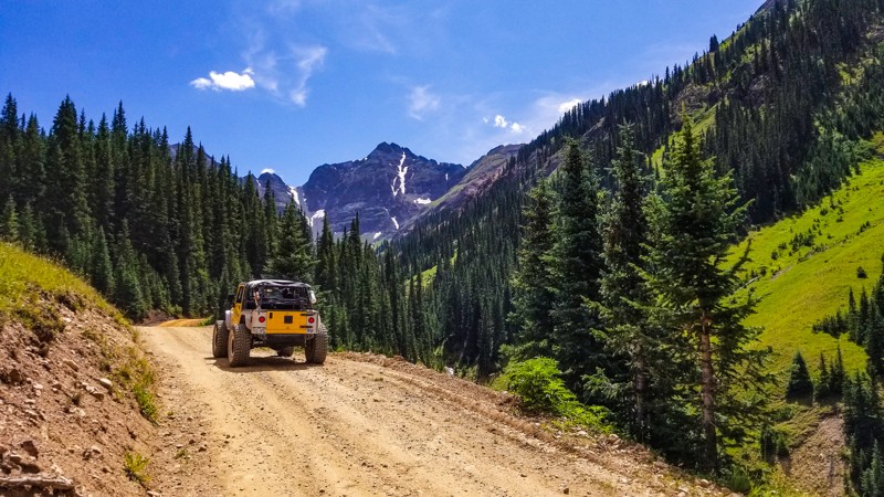
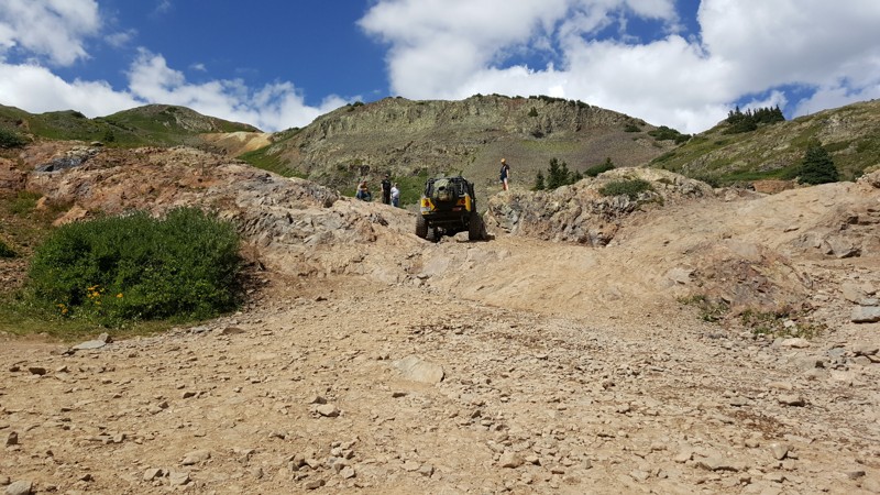
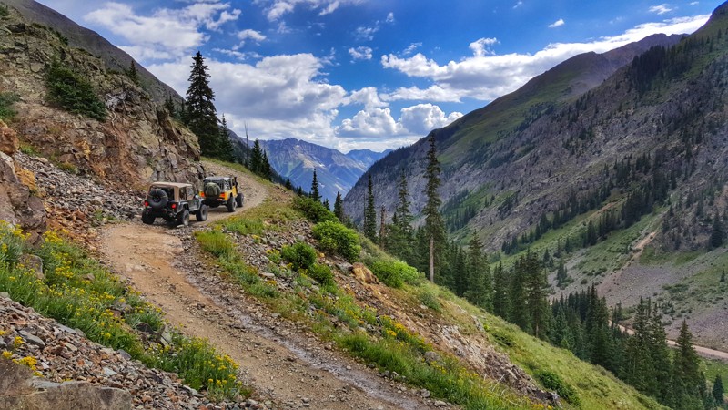
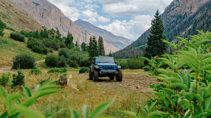
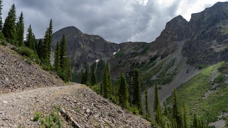
This trail is easily traversable by a stock 4WD and can be enjoyed by all drivers, from the beginner to the experienced, with something for the whole family. While this trail isn't rough, it is a proper offroad trail and will test your fortitude with high-altitude shelf roads subject to quick weather changes.

Jeep® Owners: Engineer Pass Road is a Badge of Honor trail. Visit the Jeep® Badge of Honor mobile app to check in on the trail and earn your official badge.

Colorado: Cinnamon Pass Hero Photo
All-Access Preview Icon
4.7/5 (118 reviews)
Updated: 07/05/2024
Cinnamon Pass
Open
/
Lake City, Colorado/
25.03 miles/
About 4 hours

Winding through the spectacular scenery of the San Juan Mountains, Cinnamon Pass is the southern half of the world-renowned Alpine Loop Scenic Byway. This trail, just outside of Lake City, Colorado, showcases ghost towns and mines from the 1880s while providing epic scenic overlooks and stunningly beautiful wildflowers along the drive. Whether you are a beginner or a seasoned offroad veteran, this trail will easily have a hypnotizing effect on you, and you will find yourself stopping often to take pictures.

Colorado: Poughkeepsie Gulch Hero Photo
All-Access Preview Icon
4.8/5 (74 reviews)
Updated: 10/15/2024
Poughkeepsie Gulch
Open
/
Ouray, Colorado/
3.77 miles/
About 3 hours

Traveled primarily for its technicality rather than its mining history, this 4WD trail has long been considered the hardest in the Ouray, Silverton, and Lake City areas. Although challenging, this jeep trail offers spectacular views along the way as it parallels the Uncompahgre River to its source at the jaw-dropping blue water of Lake Como. Poughkeepsie Gulch is often run for its access to "The Wall," a challenging but optional offshoot to a group of embedded rocks with numerous lines to challenge even built rigs. Camping is also a popular attraction to this trail, as there are several dispersed sites lining the trail in the first few miles. Whether you are here for the thrill or the scenery, this trail will not disappoint.

Colorado: Corkscrew Pass Hero Photo
All-Access Icon
4.8/5 (102 reviews)
Updated: 07/04/2024
Corkscrew Pass
Ouray, Colorado

Corkscrew Pass, located between Ouray and Silverton, Colorado, is one of the more significant four-wheel-drive roads that people from all over the world want to drive, and for good reasons. Most notable is the contrast of colors viewed while driving the trail and the "up-close-to-it" experience in the area. The vibrant rust and reddish mountains contrasted by the dark greens, blues, and bright whites make you want to stop and take it in. There is ample opportunity to find dispersed camping as a basecamp or just a one-night stop while you overland across the San Juan Mountains. All this while giving you a dose of shelf road and switchbacks leading to icy cold glacial ponds filled with Old Man Winter's snow melt. It is perfect for those looking to try shelf roads for the first time and, indeed, anyone who is looking for a stimulating burst of color experience.

Colorado: Mineral Creek Hero Photo
All-Access Icon
4.7/5 (31 reviews)
Updated: 07/23/2024
Mineral Creek
Ouray, Colorado

Located just south of the mountain town of Ouray, Mineral Creek is the go-to for those wanting to start the famous Alpine Loop from west to east. Mineral Creek provides access to both Poughkeepsie Gulch and Engineer Pass, but it comes at a price with multiple rock obstacles that will have you pausing to pick a line and narrow sections where caution should be taken in case of oncoming traffic.

The payoff of Mineral Creek begins quickly as you climb 1,500 feet in just the first 2.5 miles with a picturesque shelf road section, historical point-of-interest at the Michael Breen Mine remnants, stream crossing, and multiple camping opportunities. History buffs will enjoy continuing down Mineral Creek as you're presented with two more historic mining areas. Be sure to have your camera ready!

Mineral Creek will leave even experienced offroaders with a sense of accomplishment while giving the whole family plenty of opportunities to stretch their legs and explore.

Colorado: California Pass Hero Photo
All-Access Icon
4.8/5 (67 reviews)
Updated: 07/04/2024
California Pass
Silverton, Colorado

California Pass is a historic four-wheel-drive road near Silverton, Colorado. It began with a purpose - to find and transport gold. Today, it is a pleasurable route offering scenic vistas of the San Juan Mountains with abundant, deeply rich, and colorful wildflowers. From the top of California Pass at 12,963 feet, look northwest for a fantastic view of the shimmering aquamarine Lake Como. The eastern side of California Pass offers glimpses of one of the most booming mining areas Colorado had to offer in the late 1800s, with the well-preserved ghost town of Animas Forks and the Frisco Mill. It is a perfect trail to combine with so many other trails that southwestern Colorado is known for and for anyone looking to get comfortable driving on shelf roads for the first time.

Colorado: San Juan County Road 2 - Animas Forks Hero Photo
All-Access Icon
3.6/5 (68 reviews)
Updated: 07/04/2024
San Juan County Road 2 - Animas Forks
Silverton, Colorado

San Juan County Road 2 is a historic and scenic route in the San Juan Mountains above the charming mining town of Silverton, Colorado. The picturesque road takes you through stunning and rugged terrain en route to the well-preserved ghost town of Animas Forks. Prepare to immerse yourself in towering mountain peaks and lush alpine meadows and journey back in time to a once bustling hub of mining activity. San Juan County Road 2 is a unique and rewarding adventure for those who appreciate history and the great outdoors.

Colorado: Hurricane Pass Hero Photo
All-Access Icon
4.7/5 (73 reviews)
Updated: 10/15/2024
Hurricane Pass
Silverton, Colorado

Hurricane Pass is a unique trail in the San Juan Mountains above the timberline. High alpine animals are frequently spotted, bringing another feature to attract users to this beautiful area. Climbing steeply up the mountain between Hurricane Peak and Brown Mountain, this mildly technical yet intriguing trail is a common addition to form one of the many takes on the Alpine Loop. Combine this trail with County Road 2, California Pass, and either Corkscrew Pass or County Road 10 to create an epic day-long adventure.

Colorado: State Highway 110 and County Road 10 Hero Photo
Scout Route Icon
3/5 (12 reviews)
Updated: 08/20/2025
State Highway 110 and County Road 10
Silverton, Colorado
From Silverton, the road is part of the famous Alpine Loop and starts off as State Highway 110 which is very wide, well maintained gravel road. It provides access to Velocity Basin, Minnehaha Basin, and Prospect Gulch before turning into County Road 10 where travels completely uphill as wide shelf road and passes Mogul Mine before joining Corkscrew Pass and Hurricane Pass. Suitable for any high clearance vehicle. Limited to almost no camping.
Colorado: Picayne and Placer Gulches Hero Photo
All-Access Icon
4.8/5 (39 reviews)
Updated: 08/08/2025
Picayne and Placer Gulches
Silverton, Colorado

Picayne and Placer Gulch is a gorgeous route offering scenic vistas of the San Juan Mountains and traverses an area rich with mining history. This area is alive with vivid wildflowers in the peak season of late July/early August, painting a colorful pattern across the green alpine meadows and towering stone peaks. The Sound Democrat Mill is one of the best-preserved mine structures in Colorado. Restored by the Bureau of Land Management (BLM) for visitors to tour, it still possesses all of its machinery in place, from the stamp batteries to Wilfley tables. This lets visitors see how precious minerals were processed from the raw ore that entered the mill.

Colorado: Brown Mountain Hero Photo
All-Access Icon
4/5 (10 reviews)
Updated: 07/04/2024
Brown Mountain
Ouray, Colorado
Located in the heart of the San Juan Mountains, just outside of Ironton Park, Brown Mountain is a great out-and-back reprieve from the busy crowds that enjoy complete passes like nearby Corkscrew. This 4wd road provides incredible scenery, unimpeded views of Red Mountain, and is bustling with wildflowers above treeline.
Colorado: Minnehaha Basin Hero Photo
All-Access Icon
5/5 (10 reviews)
Updated: 10/29/2023
Minnehaha Basin
Silverton, Colorado

Minnehaha Basin is an extremely scenic in-and-out trail that provides epic vista views like many others in the Silverton area. Mining history along the road is very prevalent, and this is the only trail in the area that allows you to look down on the Gold King Mine, the epicenter of the 2015 EPA wastewater disaster. This road has three branches making for a fun-filled day of exploring.

Colorado: Velocity Basin Hero Photo
All-Access Icon
4.4/5 (16 reviews)
Updated: 12/01/2023
Velocity Basin
Silverton, Colorado
Known more for its skiing rather than it's 4wheeling, Velocity Basin is an easy dirt road that leads you to a gorgeous glacier-fed lake at the north foot of Storm Mountain. Velocity Basin was formerly known as Colorado Basin and is located on the east-facing slope of Silverton Mountain Ski Area. This may be a short easy trail, but the views and scenery will leave you picking up your jaw from the ground. The beauty of this basin is incredible and it's hard to believe it's so close to town.
Colorado: Eureka Gulch Hero Photo
All-Access Icon
4.9/5 (21 reviews)
Updated: 06/25/2024
Eureka Gulch
Silverton, Colorado

In the early summer, Eureka Gulch's four-wheel-drive road just outside Silverton, Colorado, could be likened to a make-believe land where Ireland meets Switzerland. Dark emerald green grasses with yellow wildflowers combine with jagged mountain peaks and old wooden structures jutting from its edges to create a memorable landscape. On the drive up towards Lake Emma and the infamous Sunnyside Mine, ribbons of rushing whitewater flow down the gulch. While we drive this road today for enjoyment, it was once a mining road. The mine operated from roughly 1874 to 1978. The miners had drilled tunnels under Lake Emma, and on June 4th, 1978, a Sunday, tragedy struck. The tunnels could no longer hold the weight of the lake. Lake Emma burst through, and the entire lake drained into the mine tunnels. Luckily, Sunday was the only day of the week the mine was shut down. Eureka Gulch is the perfect road for those looking for an enjoyable but tame adventure for the entire family.

Colorado: Mogul Mine Hero Photo
All-Access Icon
4.2/5 (7 reviews)
Updated: 10/29/2023
Mogul Mine
Silverton, Colorado

Hidden in plain sight and rarely visited, the Mogul Mine is an incredibly scenic backcountry road in one of the most popular areas of Colorado. Overshadowed by the more popular Corkscrew Pass and Hurricane Pass It follows the eastern side of Cement Creek from the Gladstone area, up towards Ross Basin. The Mogul Mine was known for silver, gold, and lead. The structures of the mine are slowly returning to the earth, but equipment remains to be seen for curios and history buffs.

Colorado: Cunningham Gulch Hero Photo
All-Access Icon
3.8/5 (17 reviews)
Updated: 11/14/2024
Cunningham Gulch
Silverton, Colorado

Only 10 minutes from Silverton, Cunningham Gulch is a popular camping, hiking, and fishing trail that follows Cunningham Creek past many old mines and cascading waterfalls to the bottom of Spencer Basin. This trail offers stunning high alpine valley views and is rich with mining history. This fantastic backcountry trail is one of the quickest ways to access the Continental Divide Trail and incredible fishing at Highland Mary Lakes.

Colorado: Maggie Gulch Hero Photo
All-Access Icon
5/5 (20 reviews)
Updated: 06/25/2024
Maggie Gulch
Silverton, Colorado

Maggie Gulch is a relatively short dead-end trail with very similar scenery and mining history to the area's larger, more well-known trails. Being a dead-end trail, Maggie Gulch does not share the tourist traffic of those other trails. This creates a relaxing journey.

The imposing 13,278-foot Mount Galena looms overhead to the south. Snow is often present late into the summer and never fully melts in a few areas. Maggie Gulch ends at the well-preserved Intersection Mill. Built in the late 1890s, the Intersection Mill is one of the few in the San Juan mountains with its stamps still standing. The boiler and winches can also be seen. Many of the mills in this area were stripped of their iron workings during a scrap metal boom around World War 2. Finding a mill with these workings still intact is truly a unique sight.

Colorado: Prospect Gulch Hero Photo
All-Access Icon
4.8/5 (9 reviews)
Updated: 10/29/2023
Prospect Gulch
Silverton, Colorado

The San Juan mining district produced over $65 million in ores between 1882 and 1918. The hills surrounding Silverton are dotted with hundreds of mines created by prospectors hunting for their fortunes. Prospector Gulch is a hard reminder of the difficulties miners faced. A plethora of mining operations scatter the landscape here with tailings galore, abandoned equipment, and buildings left only to rot in the harsh environment. With serene beauty and spectacular views, it's a surprise this trail is not more widely used.

Colorado: The Wall - Poughkeepsie Gulch Hero Photo
Scout Route Icon
4.9/5 (12 reviews)
Updated: 09/02/2025
The Wall - Poughkeepsie Gulch
Ironton, Colorado

This optional obstacle off of Poughkeepsie Gulch is an absolute backbreaker. Ill-equipped vehicles are often forced to winch or stack rocks to conquer this brutal rock wall. The multiple lines across the face require good suspension articulation. This obstacle can be impossible in wet conditions. Several winch anchors are scattered along the top for those requiring a little help. With a large parking area at the base, this is an excellent opportunity to snag lunch and watch vehicles take on different lines.

Colorado: Minnie Gulch Hero Photo
All-Access Icon
4.9/5 (19 reviews)
Updated: 11/01/2023
Minnie Gulch
Silverton, Colorado
Minnie Gulch trail offers wonderful views with colorful wildflowers contrasted by relics of a bygone age of hard rock mining for precious metals. Many other trails in the San Juan Mountains offer the same views and artifacts, however Minnie Gulch offers something that the more well known trails can't.... solitude! Being a dead end trail, Minnie Gulch does not share the tourist traffic the other trails in the area have. This lends to a relaxing journey that may very well not be shared with any other drivers. Another result of this is that some of the mining structures are so well preserved they look as though they were only recently abandoned. A perfect example of this is the Caledonia Mill Boarding House. Missing only its windows,the structure's stout construction has stood the test of time, making it appear that the nearly 120-year old building could almost be lived in.
Colorado: Burns Gulch Hero Photo
All-Access Icon
4.2/5 (10 reviews)
Updated: 06/16/2024
Burns Gulch
Silverton, Colorado
Burns Gulch is one of the few trail opportunities you get to cross the Animas River and get those dusty tires wet. Like many other roads around Silverton, this 4wd road is relatively easy to drive but provides spectacular views of the endless giant peaks you are surrounded by. The road takes you to the bowl formed by 13,866' Jones Mountain and 13,812' Niagara Peak where you can look back down the valley to see the pristine ghost town of Animas Forks and gaze upon its rustic remains. This trail is popular with hikers looking to scale the two 13ers, or to take the southern route into American Basin.
Colorado: Gray Copper Gulch South Hero Photo
All-Access Icon
5/5 (9 reviews)
Updated: 10/29/2023
Gray Copper Gulch South
Silverton, Colorado

Located along the eastern edge of the Uncompahgre National Forest, this in-and-out trail near the Vernon Mine provides spectacular views of Red Mountain #1 and gives you a real sense of serenity to an area that is otherwise bustling with 4wheel drive vehicles. This trail might not be great if you are looking for wildflowers, but the colors from the nearby hills and the transitions to blue skies will leave you speechless.

Colorado: Kendall Mountain Hero Photo
Scout Route Icon
3.7/5 (3 reviews)
Updated: 07/28/2025
Kendall Mountain
Silverton, Colorado

South of Silverton lies Kendall Mountain, a 13,000-plus peak casting a shadow over the valley. Kendall Mountain trail winds up the western slope, stopping shy of the jagged, barren peak. Titusville and Kendall Group Mines are found along this narrow shelf road before reaching the radio tower. Once at the tower, park and walk the remainder of the trail, as there is virtually no room to turn a vehicle around at the end. Views of Silverton are quite impressive, especially on a clear day when you can see all of the colorful hills that surround this mountain town. Camping was available in dispersed sites along the first mile or two of the trail. If heights or narrow shelf roads aren't your thing, this may not be the trail for you.

Colorado: Nellie Creek Hero Photo
Scout Route Icon
4.4/5 (10 reviews)
Updated: 08/26/2025
Nellie Creek
Henson, Colorado

Typically overshadowed by the popularity of Engineer Pass and other San Juan trails, Nellie Creek is one of the lesser-known trails off the Alpine Loop. This trail offers superb dispersed camping and provides access to one of Colorado's 58 14'ers, the 14321-foot Uncompaghre Peak. Its proximity to the wilderness boundary makes this an excellent trail for viewing wildlife, including deer, moose, and all of the famous wildflowers that high-country Colorado is known for. If you are looking for secluded camping off the Alpine Loop or want to get out and explore the Uncompaghre Wilderness on foot, don't miss Nellie Creek.

Colorado: Golconda Boarding House Hero Photo
Scout Route Icon
4.7/5 (4 reviews)
Updated: 06/23/2025
Golconda Boarding House
Animas Forks, Colorado

The trail to the Golconda Mine and Boarding House is a fun, moderate side trip off of Engineer Pass to excellently preserved mining ruins. It follows County Road 21 up what is a rocky but reasonably wide shelf road to the head of Hurricane Basin, to the Golconda Mine Complex. While the road continues a short distance further up a rougher section of loose shale to a dead end with good views above the main mine complex, a turn-off to the left takes you to the site of the Golconda Mine's blacksmith/compressor house and boarding house.

Originally built in 1920, both structures were restored and partially reconstructed in 2014 by the BLM and Hinsdale County and are now among the best-preserved examples of historic mining buildings in the San Juans. The boarding house is especially interesting, as it has multiple large rooms to explore or look into on two different floors as well as furniture, including bed springs and tables.

The scenery on the trail is first-rate, and the road should be passable to stock SUVs. There is only one small campsite right off the trail that didn't look very level, so this trail is not recommended for camping.

Colorado: American Basin Road Hero Photo
Scout Route Icon
4.8/5 (13 reviews)
Updated: 08/18/2025
American Basin Road
Animas Forks, Colorado

American Basin Road spurs off Cinnamon Pass and makes a short climb up along the Handies Peak Wilderness Study Area to its end at the American Basin Trailhead. Those looking for a place to camp are treated to a handful of stellar spots, all with views of American Peak and Handies Peak. Although the trail may be busy with hiking traffic, this is still a worthwhile trek when you're in the area. The area is renowned for its wildflowers in late summer.

Colorado: Cottonwood Creek Road Hero Photo
Scout Route Icon
4.5/5 (2 reviews)
Updated: 10/15/2024
Cottonwood Creek Road
Henson, Colorado

Cottonwood Creek Road is an out-and-back trail following Cottonwood Creek up through the Handies Peak Wilderness Study Area with access to dispersed campsites and two trailheads. Cataract Gulch Trailhead is located just 1.3 miles into the trail, and the Cuba Gulch Trailhead is found at the very end. Dispersed campsites are scattered along the trail with one featuring a vintage truck cab and others overlooking Cottonwood Creek, where it has carved down the rock. Although the beginning of the road is well-maintained after the first mile and a half, the surface becomes rougher with short climbs. This trail is a great spur for those trying to find camping off the busy Cinnamon Pass.

Colorado: Arrastra Gulch Hero Photo
Scout Route Icon
4/5 (4 reviews)
Updated: 07/28/2025
Arrastra Gulch
Silverton, Colorado

Climbing up its namesake gulch, the Arrastra Gulch offroad trail is a narrow shelf adventure with plenty to see. No significant obstacles block this trail, but its steep grade on a loose talus shelf warrants a confident driver and a vehicle with a low-range transfer case. Cable towers and carts sit above your head, giving a glimpse into the past of how they once transferred the minerals from clear up top in the gulch down into the valley.

Colorado: Mineral Point Townsite Hero Photo
Scout Route Icon
4.7/5 (5 reviews)
Updated: 09/01/2025
Mineral Point Townsite
Animas Forks, Colorado

Mineral Point Townsite, a short loop just off Mineral Creek, is filled with history. The trail climbs up to remnants of the San Juan Chief and British Queen Mines. The entire area was once a mining hotbed with as many as ten operating mines. At least one spacious campsite is available on this trail and can be accessed by stock 4WD vehicles.

Colorado: County Road 26 Hero Photo
Scout Route Icon
4/5 (3 reviews)
Updated: 08/18/2025
County Road 26
Animas Forks, Colorado

County Road 26 is a short out-and-back spur off of County Road 2. The trailhead is relatively hidden in plain sight due to stream rubble, but the road is easily managed by any high-clearance vehicle. It provides four designated camping sites, each able to hold two vehicles, with the largest one at the end able to handle up to four vehicles. The campsites only have a fire ring and no other amenities.