Lost Trail (49.09 miles away)
Melba, Idaho


The Owyhee Desert in southwest Idaho has five designated wilderness areas and at least one wilderness study area. The wilderness areas surround dramatic river canyons and protect them from development and ecological destruction. While it is not possible to drive in the Wilderness Areas, there are corridors and cherry stems that allow vehicle traffic on narrow corridors of non-wilderness into and sometimes through the wilderness. Cherry stems, in particular, allow you to drive across the sagebrush steppe and access the wonderful views of the river canyons and cliffs.
Part of Pipeline Road follows a corridor between Little Jack’s Creek Wilderness and Big Jack’s Creek Wilderness and includes one cherry stem going into each. The views of the canyons at the end of the cherry stems demonstrate the power and grace of Mother Nature at her finest! Pipeline Road also crosses large sections of the sagebrush steppe outside the wilderness areas.
Maps show Pipeline Road continuing south to and across the Owyhee River. At the south end of the route, the road runs into a reservoir. It is possible that the road going southeast from the southern point of the loop is underwater due to spring runoff and will become available for travel later in the season.
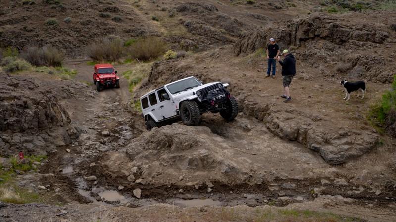
While much of Pipeline and Pipeline Service Road is easy, numerous more challenging areas make the road interesting to drive. The hardest part of this route is the western point of the loop, heading northeast onto the plateau. This short section is steep and with large, loose rocks. Once you enter this section, there is no opportunity to turn around. The best approach to this section is from the bottom by going clockwise around the loop. Before starting this section, you may want to walk it to determine if the driver and vehicle are up to the task. Return to the loop to exit the area if the road looks too intimidating.
Dispersed camping is allowed throughout the area. The ends of the cherry stems are interesting places to camp, but there are also numerous wide spots on the road for a camp.
Owyhee County in Southwest Idaho has over 5,000 square miles of desert, canyons, and mountains. There are no services in the entire area, and cell coverage is spotty. Being properly prepared for any contingency is a must. Because there are multitudes of crisscross trails, many of which look similar, a good navigation system, a backup system, and the knowledge to use them are a must.