
Ophir Pass (35.36 miles away)
Ophir, Colorado
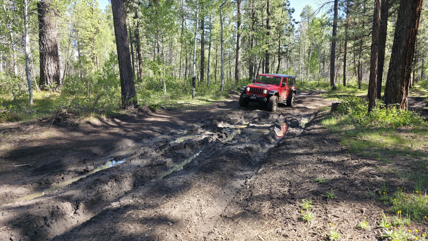

Trekking through the northern end of the Boggy Draw trail system, Bald Hill Reservoir is a 6.5-mile straight-through trail that travels between 8,000 and 8,700 feet along a high-elevation plateau above the West Dolores River. This is the most difficult full-size trail in the Boggy Draw trail system, with continuous trenches, mud holes 12 to 24 inches deep, bowling ball-sized rocks, and steep hills that keep the pace slow from start to finish. The southern end begins at Boggy Draw Reservoir, where you can find a lone, spacious campsite before getting into the difficult terrain. As the trail climbs through mixed ponderosa pine and aspen forest, it crosses extremely soft soils that retain water for long periods of time. Higher up, the pines begin to thin, giving way to open meadows and young aspen groves, but the soft soil and deep mud holes continue across the highest sections of the route. Several rocky hills add to the challenge, even where the trail surface becomes firmer. Be extremely cautious if venturing here alone, as mature trees strong enough for winching are limited in many areas. This trail can become nearly impossible during wet weather due to the soil type.
Bald Hill Reservoir is best suited for modified vehicles with larger tires and a lift. Frame-mounted recovery points are necessary, and lockers and a winch are highly recommended.