Region

Leadville

Colorado

Offroad Trails in Leadville

A Region within Colorado
4.6/5 (471)

Leadville, Colorado – High Elevation, Deep History, and Rugged Trails

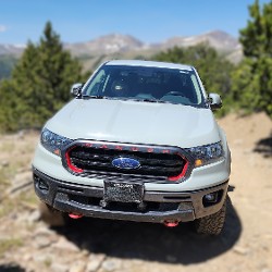
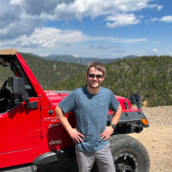
At over 10,150 feet above sea level, Leadville is the highest incorporated city in the United States—and it lives up to its altitude in both scenery and grit. This former silver mining boomtown offers a unique mix of historic charm, alpine adventure, and remote offroad access. Whether you're exploring high mountain passes or tracing the paths of 19th-century prospectors, Leadville is a must-visit for 4WD enthusiasts traveling through Central Colorado.

An Offroad Launchpad at 10,000 Feet

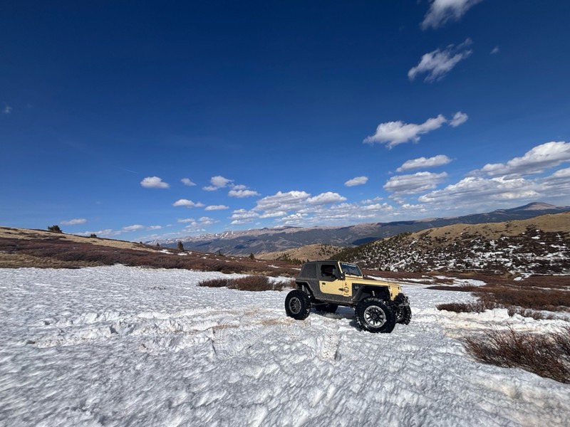
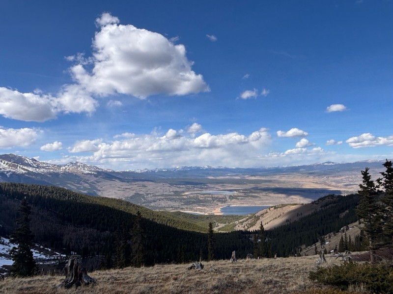
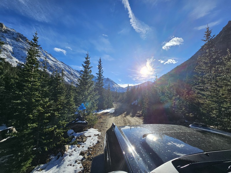
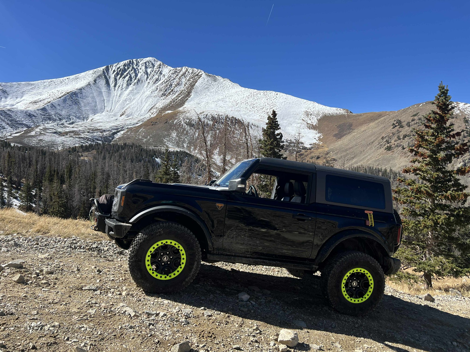
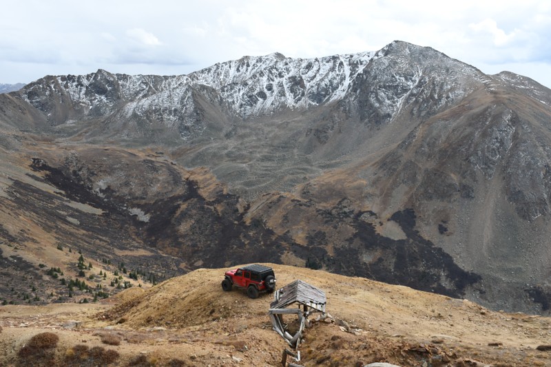
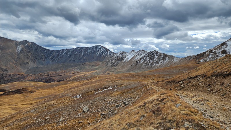
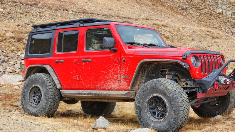
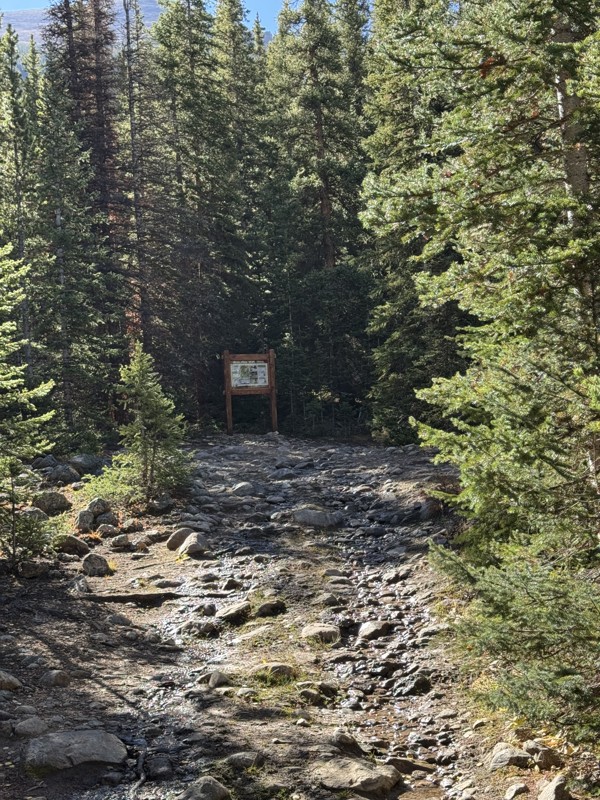
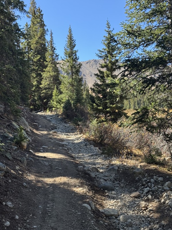
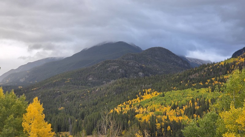
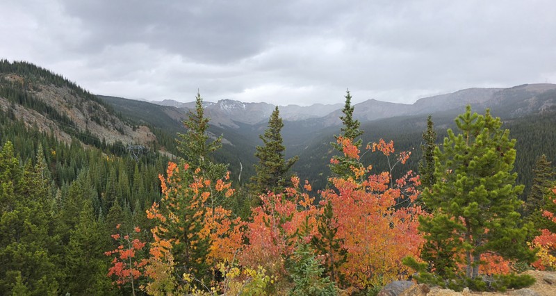
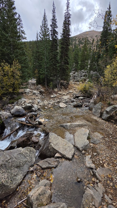
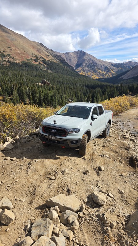
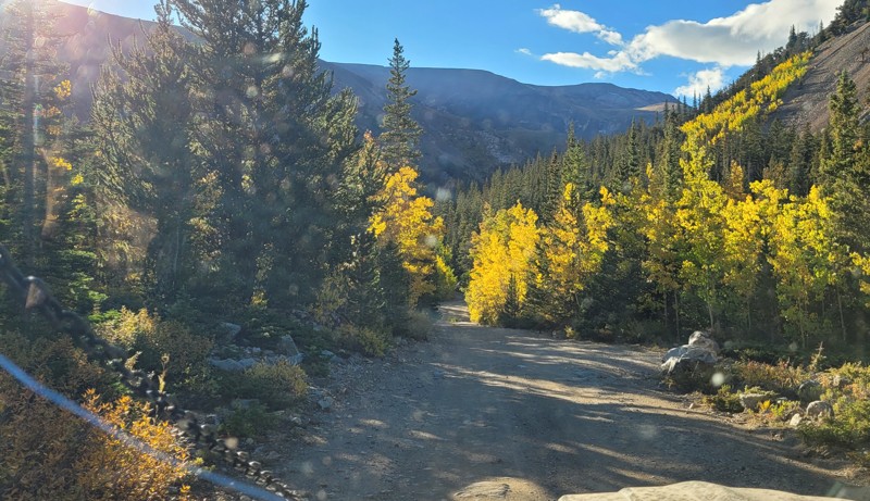
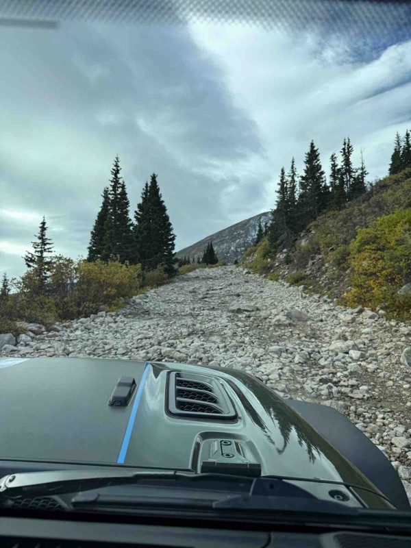
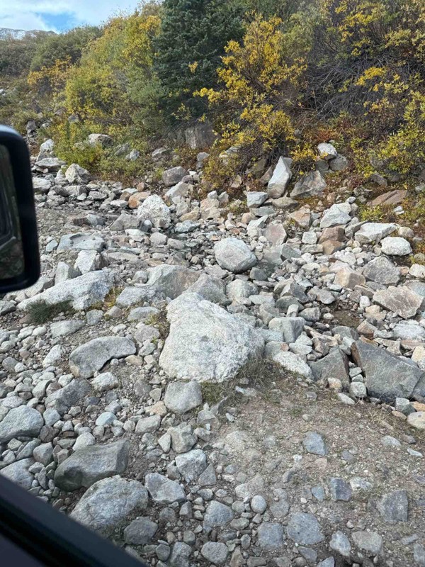
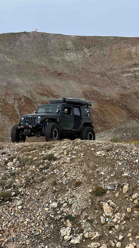
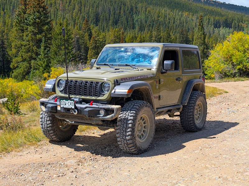
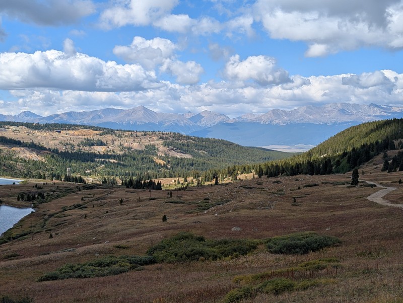
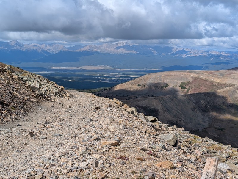
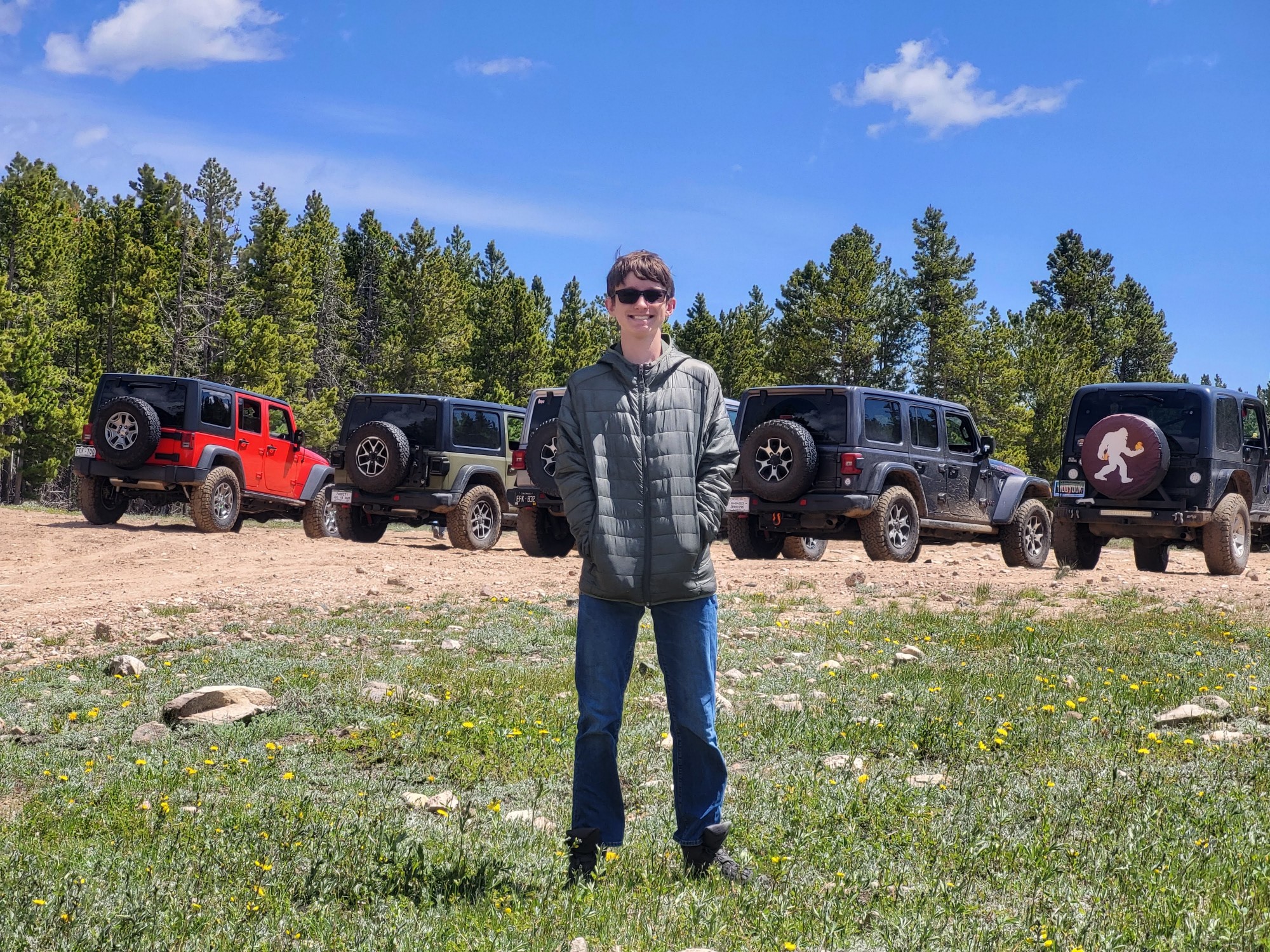
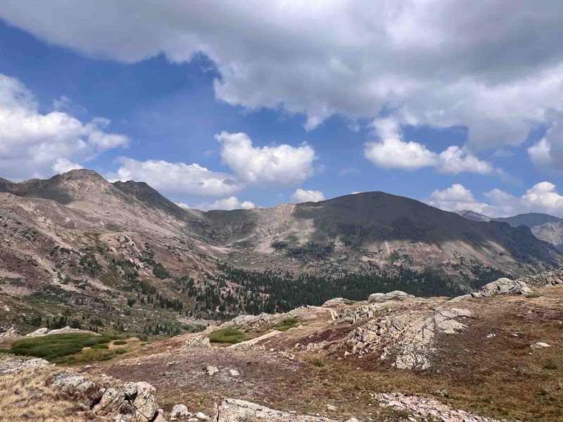
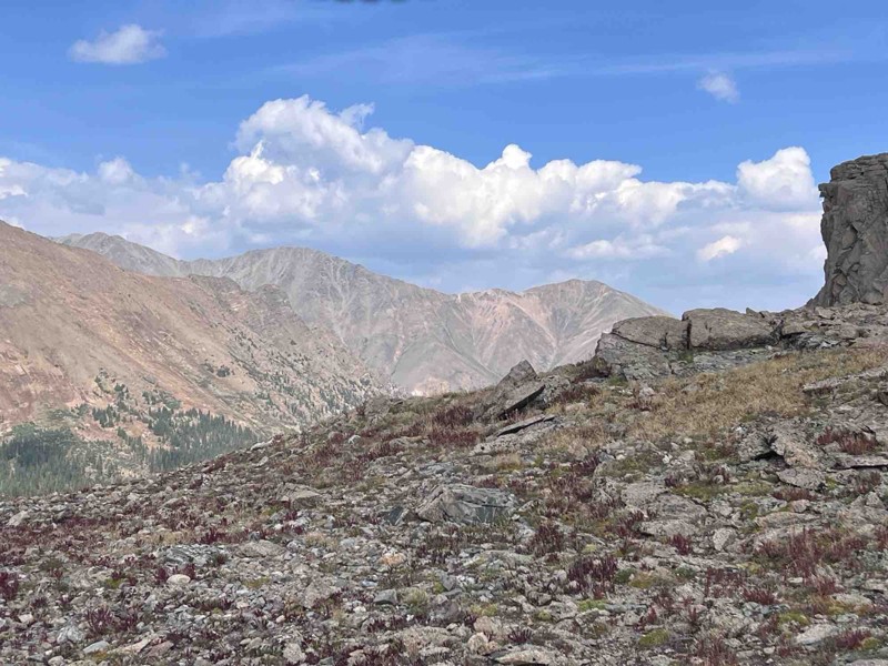
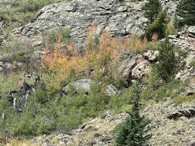
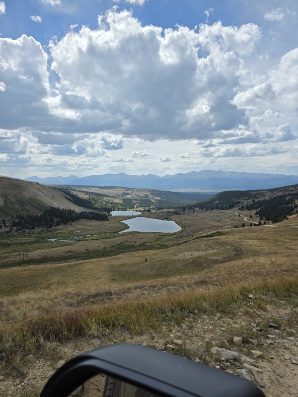
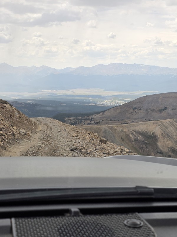
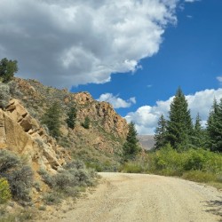
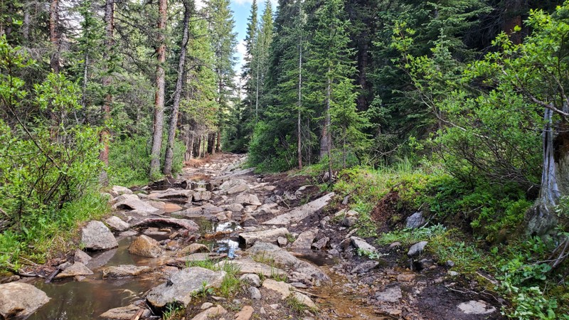
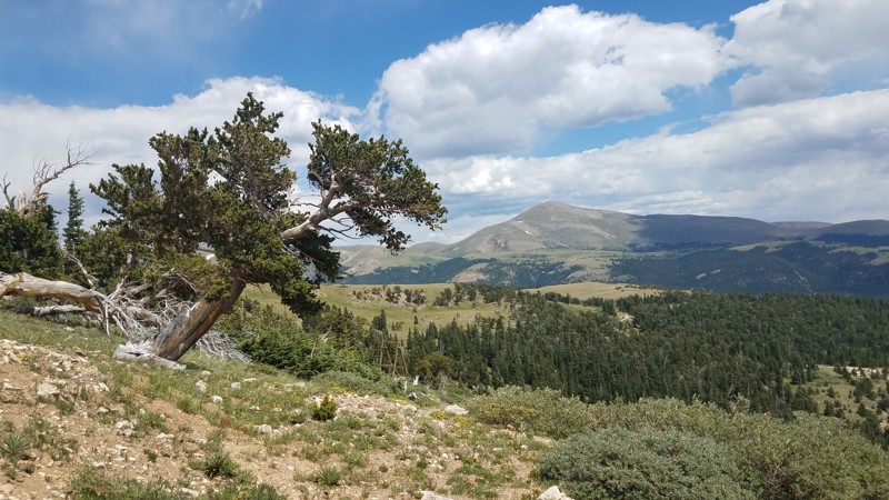
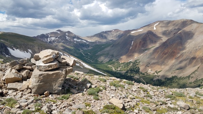
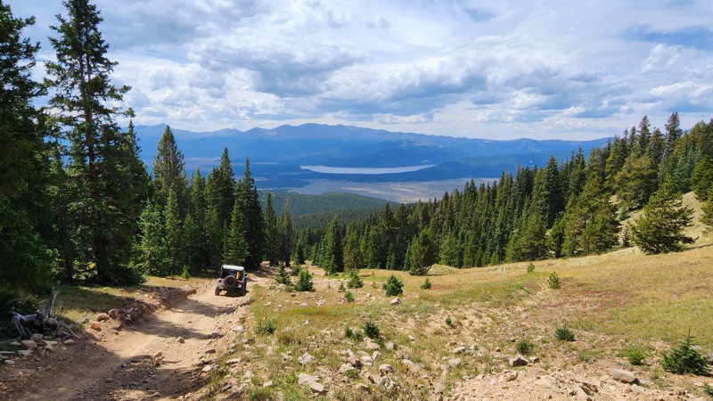
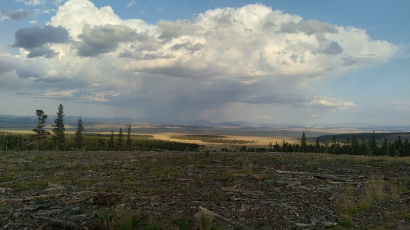
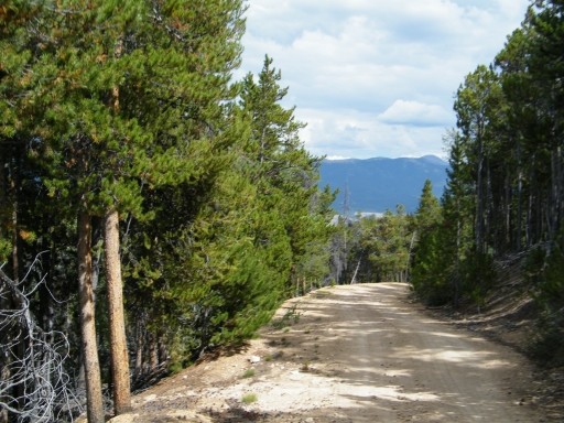
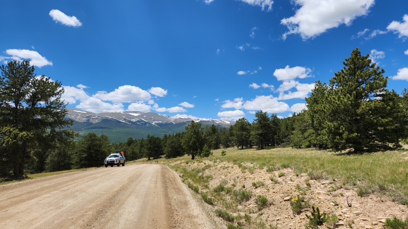
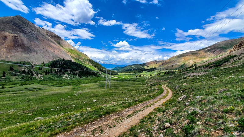
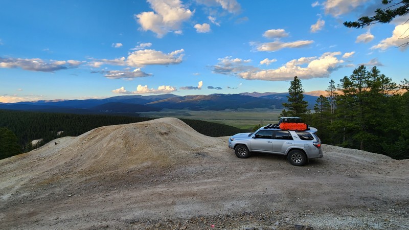
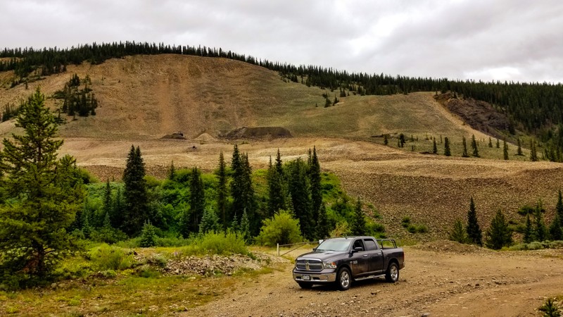
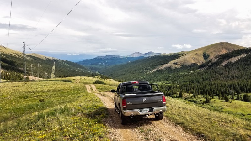
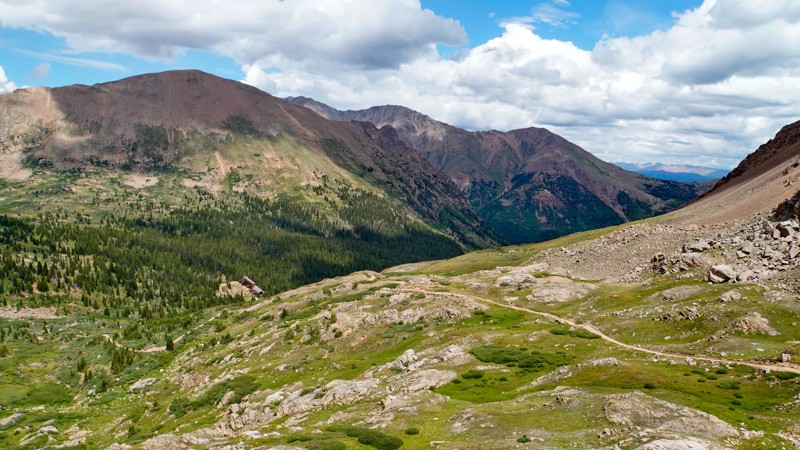
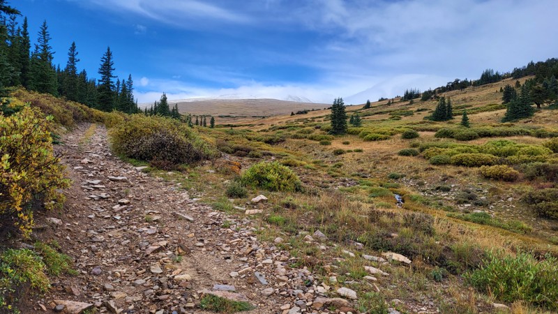
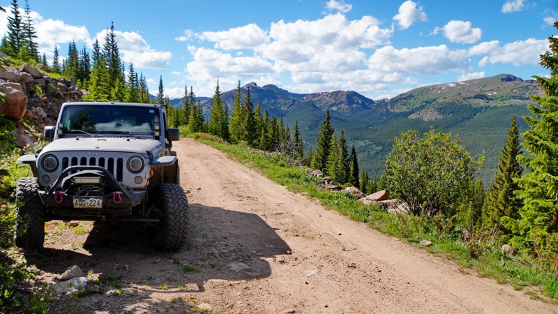
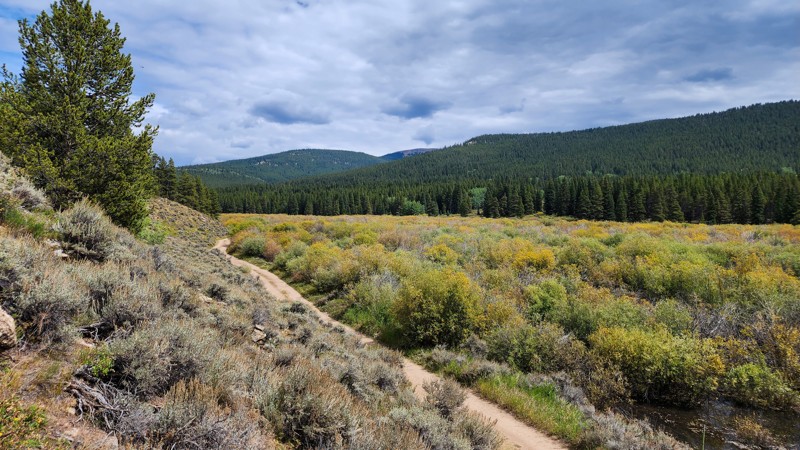
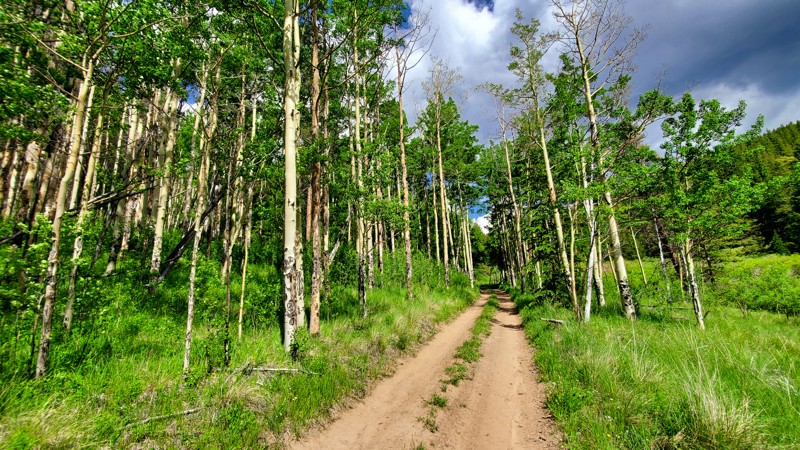
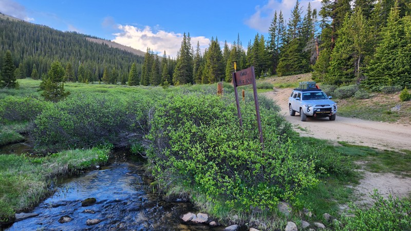
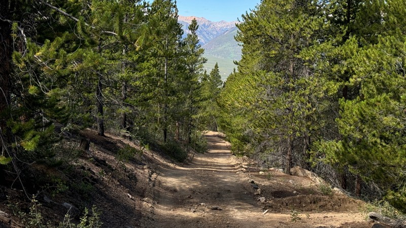
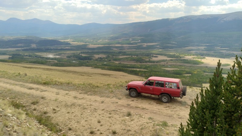
Leadville is surrounded by a network of rugged trails that climb into the Sawatch and Mosquito Ranges. This is the kind of terrain that tests both driver and rig, with high-elevation routes delivering jaw-dropping views and unpredictable conditions.

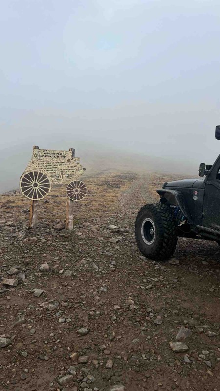
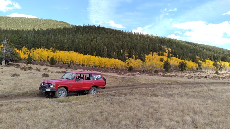
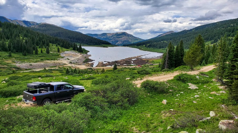
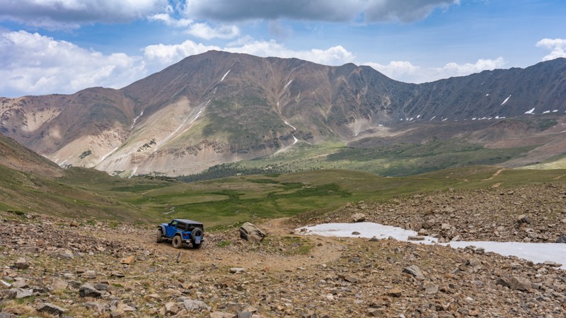
One of the most iconic nearby routes is Mosquito Pass, which climbs to 13,185 feet—making it one of the highest drivable mountain passes in North America. The route connects Leadville to Fairplay and offers a combination of rocky climbs, snowdrifts (even in summer), and a true feeling of isolation.

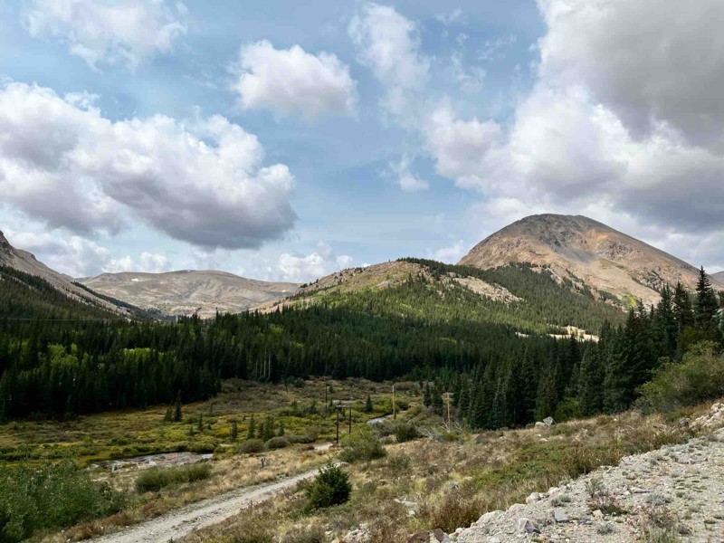
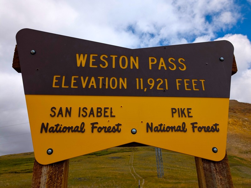
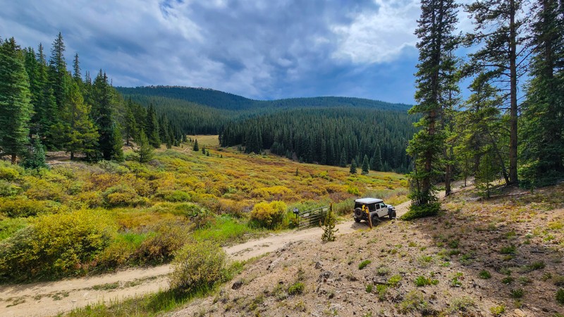
To the southwest lies Mount Zion and Weston Pass, a more moderate but equally scenic alternative that descends into the San Isabel National Forest. Many of these routes connect with others leading into Buena Vista, Aspen, and Pitkin, making Leadville a strategic hub for overlanding routes across the region.

Mining Town with a Story to Tell

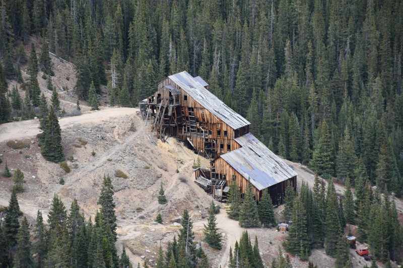
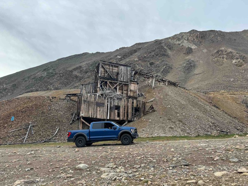
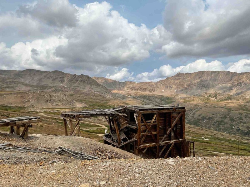
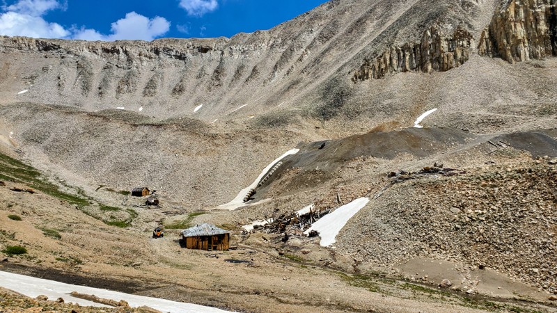
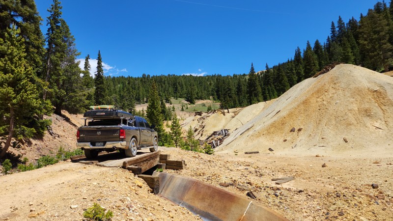
Founded in the late 1800s, Leadville was once one of the richest silver mining towns in the country. Remnants of that boom era still dot the landscape—abandoned shafts, mining relics, and original Victorian architecture line the streets and hillsides.

For history-minded travelers, the Leadville Mining District and the National Mining Hall of Fame provide context for the wild west legacy of this high-mountain town. You can even explore ghost towns like Winfield and St. Elmo nearby, accessible by dirt roads and seasonal 4WD trails.

Seasonal Access and Considerations

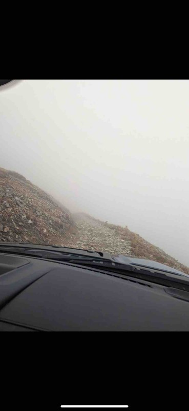
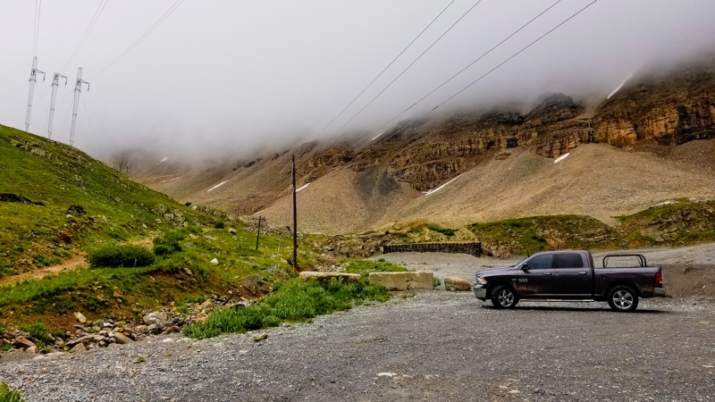
Because of its altitude, trail access around Leadville is highly seasonal. Snow can linger into July on higher passes, and sudden storms are not uncommon well into the fall. Many routes are best attempted from late June through early October, depending on snowfall.

Carry recovery gear, check trail conditions ahead of time, and be aware of rapidly changing weather. The high elevation also means thinner air—both for engines and lungs—so pace yourself and keep an eye on your vehicle’s performance.

A Town that Balances Grit and Charm

Despite its rough-and-ready backdrop, Leadville itself is welcoming, walkable, and packed with character. You’ll find authentic diners, gear shops, and a few locally loved breweries along the historic main street. The annual Leadville 100 endurance races and Skijoring competitions add to the town’s rugged reputation and make it a hub for adventure sports year-round.

Why Leadville Deserves a Spot on Your Route

With its access to high mountain passes, rich mining history, and strategic location between multiple offroad zones, Leadville offers more than just elevation—it offers immersion. It's a town where the past and present meet, where alpine exploration begins, and where every road feels like part of a much larger journey.

Top Reasons to Explore Here
Altitude Category IconAltitude
Beginner Category IconBeginner
Camping Category IconCamping
Forest Category IconForest
Iconic Category IconIconic
Mine Category IconMine
Overland Category IconOverland
Rock Category IconRock
Scenic Category IconScenic
Water Category IconWater
Trail Types
Scout Route
Full Trail Guide

Preview Trail Icon
Preview Trails
easy
moderate
difficult
severe
extreme

All-Access
Scout Route
Start a 7-day Free Trial

Most Recent Trail Reviews

Most Popular

Search for Trails
Colorado: Mosquito Pass Hero Photo
All-Access Icon
4.7/5 (188 reviews)
Updated: 10/15/2024
Mosquito Pass
Leadville, Colorado

Peaking at around 13,185 feet, Mosquito Pass is among the highest North American passes accessible to 4WD vehicles. Connecting the towns of Alma and Leadville, Colorado, this trail offers spectacular views, especially in early autumn when the nearby valley foliage begins to change color. The vibrant gold, amber, and green hues provide a stark contrast to the grey-brown stone and pale grasses covering the high, treeless ridges. Although open for year-round activities, Mosquito Pass can remain locked away in the cold hands of winter until midway through the summer months.

Colorado: Halfmoon Creek Hero Photo
All-Access Icon
4.8/5 (52 reviews)
Updated: 08/12/2025
Halfmoon Creek
Leadville, Colorado

Tucked between two goliath fourteeners, Mount Massive and Mount Elbert, Halfmoon Creek is a popular trail with abundant camping, great water crossings, epic views, and an amazing reward at its finish line. This seasonal Colorado trail winds through dense forests and open meadows, gradually increasing in difficulty as it follows Halfmoon Creek to the edge of the treeline, where you can explore the historic Champion Mill, a silver ore processing mill from the late 19th century. This amazingly well-preserved mill is a fascinating glimpse into Colorado's mining history that Mother Nature is slowly reclaiming.

Colorado: Weston Pass Hero Photo
All-Access Icon
4.4/5 (57 reviews)
Updated: 07/19/2024
Weston Pass
Leadville, Colorado
Once known as the "Road To Riches", Weston Pass was once an extremely busy wagon road traveled by thousands of gold fevered miners, connecting the towns of Fairplay and Leadville. These days it is an easy dirt road that travels through the Pike-San Isabel National Forest connecting Lake County and Park County and traveled by outdoor enthusiasts looking for high alpine views, wilderness hikes, great camping, and spectacular fall colors.
Colorado: Hagerman Pass Hero Photo
All-Access Icon
4.6/5 (53 reviews)
Updated: 07/18/2024
Hagerman Pass
Leadville, Colorado
Located in the Sawatch Range between Leadville and Basalt, Colorado, Hagerman Pass is an incredibly scenic trail that crosses the Continental Divide at 11,925 feet. This high clearance 4x4 trail offers views of majestic mountains, glittering mountain lakes, stunning campsites, and takes you back through the rich history of the areas' early railroad days. This off-road trail is part of section 5 of the Colorado Backcountry Discovery Route (COBDR), which is a mostly off-road route across the entire state of Colorado from New Mexico to Wyoming. There are many hiking trails that start off of Hagerman Pass, even a few used by anglers. Don't miss this high altitude gem if you are looking for some fairly easy trail therapy and a mountain get-a-way reset.
Colorado: Lost Canyon Hero Photo
All-Access Icon
4.6/5 (37 reviews)
Updated: 07/23/2024
Lost Canyon
Buena Vista, Colorado
Situated in the San Isabel National Forest, halfway between Leadville and Buena Vista, Lost Canyon is a fantastic day drive for any 4wd vehicle. Home to some great primitive camping, this off-road trail delivers some of the best overall views you can find in the area. You can observe multiple, 14,000+ foot peaks on this drive and also gaze down on several of the largest bodies of water in the area including Clear Creek Reservoir, Twin Lakes, Mt Elbert Forebay, and even Turquoise Lake. During the fall, this trail provides spectacular aspen viewing because of the plethora of Aspen all along the trail. If scenery really isn't your thing, try your luck at gold panning and hope to strike it rich in the popular Cache Creek.
Colorado: Birdseye Gulch Hero Photo
All-Access Icon
4.8/5 (38 reviews)
Updated: 10/14/2024
Birdseye Gulch
Leadville, Colorado
Located just outside of the highest incorporated city in the US, this off-road trail combines every feature of a classic Jeep road. Birdseye Gulch is narrow, rocky, and steep with standing water in places, creek crossings, gorgeous high alpine views, and even some mud. This trail is a more difficult side trip off of Mosquito Pass and a much more interesting route than taking the county road up from Leadville.
Colorado: Mount Bross Hero Photo
All-Access Icon
4.6/5 (32 reviews)
Updated: 07/22/2024
Mount Bross
Alma, Colorado
The Mount Bross trail will take you high up on the shoulders of this popular "14er" through high-alpine meadows and rocky, narrow, shelf roads. Naturally, this yields truly epic views. If you're hoping to "bag" Mount Bross, this trail provides nice, dispersed campsites that provide an easy approach for hiking to the summit. This trail also offers plenty of mining history. Gold discovered on the slopes and gulches of Mount Bross triggered the first Colorado gold rush in 1859. Why the signs never read Mount Bross or Bust is beyond us.
Colorado: Breakneck Pass Hero Photo
All-Access Icon
4.5/5 (28 reviews)
Updated: 09/22/2025
Breakneck Pass
Fairplay, Colorado

Located just south of Fairplay, Breakneck Pass is one of several hidden gems among Colorado four-wheel drive roads along the U.S. Highway 285 corridor. Breakneck Pass features easy to moderate climbs and descents within Pine and Aspen forests. The stretch that parallels Sheep Creek provides amazing views in all directions. This area of South Park is remote and far less traveled than other passes, making it a desirable destination for weekend overland exploration. Breakneck Pass closes seasonally, December 31st through June 15th.

Colorado: Buckskin Joe Hero Photo
All-Access Icon
4.8/5 (29 reviews)
Updated: 07/22/2024
Buckskin Joe
Alma, Colorado
From the dense pine forest with groves of aspens to the high alpine environments Colorado is known for, Buckskin Joe is a trail you don't want to miss. It climbs to 12,500 feet with epic views of the southern slope of the inspiring 14,177 foot Mount Bross. This area was once home to one of the earliest gold boom towns in Colorado, the Town of Laurette. The Town of Laurette was established in 1859 during the Pike's Peak gold rush. But locals always referred to it as Buckskin Joe, after Buckskin Joe Higginbottom, an early trapper who first discovered gold the valley. Put this trail on your weekend excursion list.
Colorado: Mount Zion Hero Photo
All-Access Icon
4.3/5 (16 reviews)
Updated: 06/27/2024
Mount Zion
Leadville, Colorado

Located only minutes from downtown Leadville, Mount Zion is a scenic, high-alpine trail providing incredible views of the nearby towering mountains. This off-road trail is a great half-day adventure providing viewpoints that cannot be seen by any other trail in the area. Several campsites and good cellular service make this a popular location for mountain boondocking.

Colorado: Brown's Pass Hero Photo
All-Access Icon
4.5/5 (19 reviews)
Updated: 09/23/2025
Brown's Pass
Fairplay, Colorado

Brown’s Pass is situated in the Pike/San Isabel National Forest a few miles south of Fairplay, Colorado. This area of South Park is remote and far less traveled than other passes, making it a desirable destination for weekend overland exploration. Brown’s Pass features moderate climbs and descents, with several connected roads providing spectacular views. Brown's Pass closes seasonally each year from January 1st to June 15th.

Colorado: Ivanhoe Lake Hero Photo
All-Access Icon
4.8/5 (13 reviews)
Updated: 11/23/2023
Ivanhoe Lake
Basalt, Colorado
Located in the Sawatch Range east of Basalt, Colorado, Ivanhoe Lake is an easy trail that welcomes all outdoor enthusiasts. Whether you are a fisherman, a hiker, a camper, a 4wheeler, a backcountry skier, or a history buff, this off-road trail will delight you with its beauty and hidden secrets. Ivanhoe Lake might be the first and the biggest feature along the trail, but there is much more beyond the lake. Great secluded camping, meadows filled with wildflowers, and mountain backdrops that you will want to use as your screensaver, await you throughout the entire trail.
Colorado: Flume Creek Hero Photo
All-Access Icon
3/5 (7 reviews)
Updated: 06/13/2024
Flume Creek
Leadville, Colorado
Part of the Pike-San Isabel National Forest, Flume Creek is a long spur trail off of Lost Canyon. It is an ideal off-road trail for the secluded weekend camper. With a variety of dispersed camping along the route, it is easy to find a quiet spot of seclusion or a large open area for you and your friends. With not much traffic, this dirt road meanders through dense forest with several Aspen Groves on its way to Flume Creek. Although Flume Creek empties into Twin Lakes, you cannot reach Twin Lakes from this trail. However, you can occasionally catch glimpses of it through the trees.
Colorado: South Halfmoon aka Iron Mike Mine Hero Photo
All-Access Icon
5/5 (8 reviews)
Updated: 09/03/2025
South Halfmoon aka Iron Mike Mine
Leadville, Colorado

South Halfmoon Creek, also known as Iron Mike Mine, is a must-do trail known for its natural beauty and technical driving demands.  It is located southwest of Leadville and follows the namesake tributary of the Arkansas River. Trekking along the western shadow of Colorado's tallest peak, Mount Elbert, you will encounter several water crossings, steep climbs, narrow paths, continuous rocky terrain, and one major rock obstacle that takes its job as the gatekeeper seriously. The breathtaking scenery at the end of this trail takes work and is a hard-earned reward.

Colorado: County Road 5 Hero Photo
Scout Route Icon
5/5 (3 reviews)
Updated: 09/09/2025
County Road 5
Fairplay, Colorado

County Road 5 is an easy, mostly graded dirt trail with great views of the Buffalo Peaks Wilderness and San Isabel National Forest. The road provides easy access to a few trail systems between Fairplay and Leadville, CO, and takes you directly to the Weston Pass TH. About halfway down this trail, a few small areas have small ruts and rocks protruding, but these are easy to drive over. While traveling on this road, you may see elk, black bears, moose, and other wildlife that call this area home. A handful of free dispersed camping sites along this trail are large enough for campers and larger groups. As you travel deeper into the mountain, the campsites get smaller and more remote, but dispersed camping is abundant in the surrounding area.

Colorado: Lower Iowa Gulch Hero Photo
All-Access Icon
3.3/5 (7 reviews)
Updated: 12/01/2023
Lower Iowa Gulch
Leadville, Colorado
As a part of the historic Route Of The Silver Kings, Iowa Gulch is rich in mining history. Lower Iowa Gulch traverses along the bottom of the drainage, passing giant mining structures that once brought fame and fortune to many people. This trail rewards you with majestic views from the base of massive peaks such as Mount Sherman and Mount Sheridan and also offers across-the-valley views of Mount Elbert and Mount Massive. Combine this trail with others in the area to make a half-day loop sure to entertain you while you visit the Leadville area, the once home of the Unsinkable Molly Brown and Doc Holliday.
Colorado: Upper Iowa Gulch Hero Photo
All-Access Icon
4.5/5 (6 reviews)
Updated: 12/01/2023
Upper Iowa Gulch
Leadville, Colorado
Southeast of Leadville, in the historic mining district, lays the hidden gem of Iowa Gulch. Located in the Mosquito Range, this trail climbs to the western base of the class-2 14er, Mount Sherman. Dotted with old mine buildings, the entire route provides impressive views of other high-altitude mountains, including Mount Sheridan and Dyer Mountain. Great for the views and scratching another 14er off your list.
Colorado: Round Hill Hero Photo
All-Access Icon
3.8/5 (11 reviews)
Updated: 06/16/2024
Round Hill
Fairplay, Colorado
FS Road 426 is another gem among the 4-wheel drive roads south of Fairplay, Colorado. This seemingly remote section of the Pike National Forest doesn't get the accolades that more popular roads (Mosquito Pass, Weston Pass, Wheeler Lake, etc.) garner. But for panoramic views, quiet forests, and serene meadows, the Sheep Ridge and Sheep Creek area is hard to beat.
Colorado: Saint Kevin Road Hero Photo
Scout Route Icon
3/5 (4 reviews)
Updated: 10/01/2025
Saint Kevin Road
Leadville North, Colorado

Saint Kevin Road connects Turquoise Lake Road to Bear Lake Road and requires a 4WD vehicle. The trail begins as a county road and then enters the San Isabel National Forest. The scenic drive takes you by large mines that are no longer in use. This trail gets narrow, steep, and rocky as it weaves into the forest and further up the mountain. There are a few campsites along this trail closer to the base of the mountain. Additionally, there are several developed campgrounds on the western end of nearby Turquoise Lake.

Colorado: Lake County Road 6A Hero Photo
All-Access Icon
3.5/5 (5 reviews)
Updated: 08/14/2025
Lake County Road 6A
Leadville, Colorado

Lake County Road 6A is a nice, remote connecting road that follows Iowa Gulch to the Julia Fiske Mine. The forest is thick throughout the entire route, but there are a number of good Aspen viewing spots along the road.

Colorado: Ruby Hero Photo
All-Access Icon
4/5 (7 reviews)
Updated: 12/01/2023
Ruby
Fairplay, Colorado
Ruby is the perfect alternative for those traversing Weston Pass and looking for a bit more challenge. Located on the South Park Ranger District side of the pass, Ruby parallels Weston for nearly 2 miles and provides the same views along a more narrow and rough road. Whether you are looking for a more formidable challenge or looking for an "off the path" camping spot closer to the summit, Ruby might just be the trail for you.
Colorado: Champion Mine Hero Photo
Scout Route Icon
4.8/5 (6 reviews)
Updated: 09/08/2025
Champion Mine
Champion Mill, Colorado

The Champion Mine trail is a continuation of the Halfmoon Gulch trail that takes users to a high vantage point overlooking the Champion Mill. The trail is far more challenging than its counterpart. It climbs sharply up an exposed, single-lane, rutty trail with several passing opportunities. Users will encounter a series of small rock obstacles while ascending to the saddle between Mount Champion and French Mountain. These obstacles could be difficult for stock SUVs, and skid plates are highly recommended for stock vehicles as they are nearly guaranteed to scrape the underbelly more than once during the trek. The official trail ends here in the saddle, before circling the backside of Mount Champion. Although a well-worn route continues up the mountain to the old Champion mine site, this is a private parcel and not open for public use.

It is not uncommon for lingering snow to keep this trail impassable well into the summer months. Snow blocks the trail at inconvenient locations, making it difficult to turn around. Users are encouraged to scout the trail for snow before attempting and reminded to always stay on the trail and not attempt to drive around snow drifts.

Since most of this trail is on steep slopes above the timberline, suitable camping is practically non-existent, but plenty of campsites can be found lower down along the Halfmoon Gulch trail.

Colorado: Iowa Amphitheater Hero Photo
All-Access Icon
4.8/5 (6 reviews)
Updated: 09/09/2024
Iowa Amphitheater
Leadville, Colorado

Lurking between the shadows of 14,036' Mount Sherman, 13,951' Gemini Peak, and 13,855' Dyer Mountain, Iowa Amphitheater is one of the most scenic and breathtaking trails you've never heard of. Located southeast of Leadville, along the Route Of The Silver Kings, this trail takes travelers back in time across old mining claims, past desolate structures and finally ends in a once prosperous basin filled with antique equipment that once produced over 10 million ounces of silver. This trail is a perfect escape for the adventure seeker that enjoys mining history and high-altitude views.

Colorado: Thompson Park Hero Photo
Scout Route Icon
5/5 (5 reviews)
Updated: 06/16/2025
Thompson Park
Fairplay, Colorado

Thompson Park begins as a relatively smooth dirt road with some rocks and ruts for a couple of miles. This easier section features some really nice camping. After this, the trail gets narrow and very rocky as it climbs to near the treeline for some spectacular views. The trail ends at a gate with plenty of room to turn around.

Colorado: FSR 189 Hero Photo
All-Access Icon
3/5 (9 reviews)
Updated: 11/30/2023
FSR 189
Leadville, Colorado

Located a short distance north of Leadville, FSR 189 is a straight-through connecting road that offers good Fall color viewing and ideal basecamp locations for hunters. This road snakes its way through dense forest and aspen groves for a short 2 miles. Combine FSR 189 with Mount Zion and give yourself easy access to or from Highway 24 without traveling the same section twice.

Colorado: Sugarloaf Mountain Hero Photo
Scout Route Icon
4/5 (4 reviews)
Updated: 10/07/2025
Sugarloaf Mountain
Leadville North, Colorado

Sugarloaf Mountain (also known as the Powerline Trail) is a scenic, moderate connector trail between Hagerman Pass Road and Leadville that climbs over the ridge above Turquoise Lake. It would be great to combine with Hagerman Pass for those who would like to spend more time on dirt. The trail starts out as a Forest Service road before turning into a combination of county road and private road with public access after exiting the National Forest. This is the only public road in the area, as all connecting roads are either admin only or are private and gated.

Though the trail is mostly in the trees, several open sections near the western end provide panoramic views of Turquoise Lake and the surrounding peaks. Some mining ruins can be seen along the road, though they are not as plentiful as in the East Side Mining District on the other side of the Leadville Valley.

The trail is moderately difficult throughout, with the main challenge being some rocky and rutted sections near the middle. These rocky sections will require a high clearance four-wheel-drive vehicle and could prove difficult for some stock 4x4s . Dispersed campsites are abundant along the trail, and one campsite at an overlook would be spectacular as long as it's not too windy. This road is heavily used by mountain bikers and is part of the Leadville 100 racecourse, so be sure to watch out for bikers and be courteous to them.


Colorado: East Tennessee Hero Photo
Scout Route Icon
4/5 (3 reviews)
Updated: 07/14/2025
East Tennessee
Leadville North, Colorado
East Tennessee is a seasonal hunting and winter road, only open 9/1-5/1. The road is just over 4 miles long and ends at the bottom of the Little Horse chair lift, part of Cooper Ski Resort. The official route ends in what seems like a random location at an open grass clearing in the forest, with no signage. Although a well-traveled road does continue up the hill, that road is not part of the Forest Service MVUM. The road is only one vehicle wide and is very narrow through sections of dense willow brush that threaten to scratch your paint and give you pinstriping. The road starts very smooth and well-maintained and gradually gets rougher and rockier the farther into the trail you go. You will need a high-clearance vehicle for this road, but a 2WD high-clearance vehicle is sufficient. Dispersed camping is allowed along the route, and a handful of sites can be found in the first 2 miles. Most of the sites are large and level, good for hunting groups.
Colorado: Bear Lake Road Hero Photo
Scout Route Icon
3.8/5 (4 reviews)
Updated: 10/01/2025
Bear Lake Road
Leadville North, Colorado

Bear Lake Road is an out-and-back trail that branches off from the north side of Turquoise Lake Road and provides access to the Bear Lake hiking trailhead and Uncle Bud's Hut, one of many 10th Mountain Division Association huts in these mountains. As you climb the mountain further into the forest, this trail takes you past a few destroyed gold and silver mines that helped put the nearby city of Leadville, CO, on the map. Overall, this trail is easy, but a few steep grades and loose rocks require a 4-wheel drive vehicle. While there aren't any good campsites on this trail, quite a few are scattered around nearby Turquoise Lake.

Colorado: Cooper Loop Hero Photo
Scout Route Icon
4/5 (2 reviews)
Updated: 07/14/2025
Cooper Loop
Leadville North, Colorado
Starting at the Cooper Ski Resort and connecting to East Tennessee, Cooper Loop is a 2.3-mile long mountain road that loops halfway around Cooper Hill. The road travels through thick forest and ends at a breathtaking meadow as you cross over East Tennessee Creek and converge with East Tennessee Road. There is no camping along this road, but the road does travel past the Tennessee Pass Sleep Yurts, which can be rented through their website. This road also accesses the Tennessee Pass Cookhouse. The road is rough, rocky, and bouncy on the western half, with small rocks and abundant potholes. A stock-clearance SUV or pickup truck is highly recommended.
Colorado: Granite Burn Hero Photo
Scout Route Icon
3/5 (3 reviews)
Updated: 05/16/2025
Granite Burn
Granite, Colorado

Granite Burn is a short, steep trail that climbs 2000 feet above the town of Granite to the edge of the Buffalo Peaks Wilderness. This trail ends at a small Hayden Gulch hiking trail parking area.

There are no notable obstacles on this trail; however, several steep sections reach a maximum of 15 degrees incline. The last third of this trail also has limited passing spots for opposing traffic, so look ahead and keep track of any spots suitable for passing.

Camping is limited to about three small spots on this trail.

Colorado: Lake County Road 1C Hero Photo
Scout Route Icon
4/5 (2 reviews)
Updated: 09/22/2025
Lake County Road 1C
Leadville, Colorado

Located within the Leadville Mining District, southeast of town, Lake County 1C is a moderately rough 4-wheel-drive road that climbs sharply through Pigtail Gulch, connecting County Road 2 to County Roads 1A and 1B. The first half mile, traveling west to east, follows a single-lane dirt road next to a water culvert, passing several abandoned mines, including Modest Barrel, Garibaldi Tunnel, and the New England Mine. The trail then travels through two tight switchbacks that can be traversed in one go with careful tire placement and then continues in a northerly direction up a steep and loose hill, peppered with baseball-sized rocks and an occasional larger rock just breaking the trail's surface. The trail can be driven in either direction and is a good final trail if completing the Route of The Silver Kings Driving Tour and having an appropriate vehicle. This trail requires a high-clearance 4WD vehicle with selectable low-range gearing.

No camping is available along this trail.