Region

Mendocino National Forest Area

California

Offroad Trails in Mendocino National Forest Area

A Region within California
4.1/5 (27)

Exploring Mendocino National Forest’s Motorized Roads

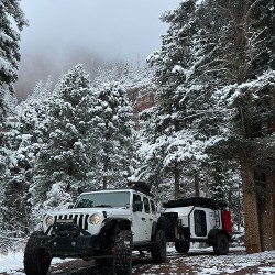
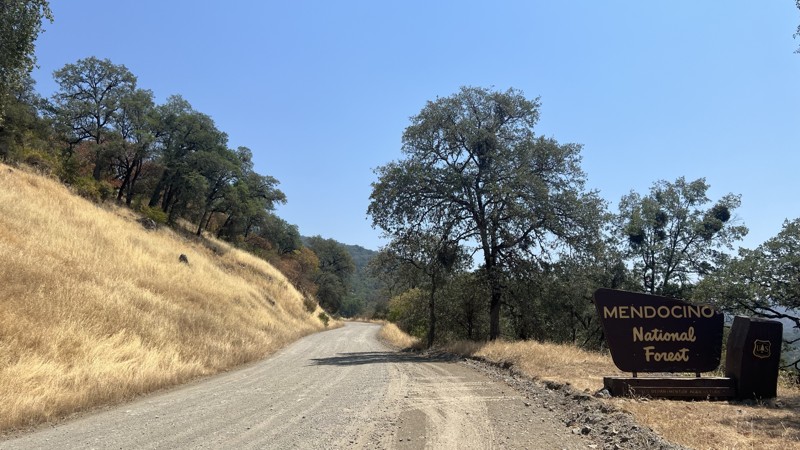
Mendocino National Forest, spanning over 900,000 rugged acres in Northern California, is a haven for off-highway vehicle (OHV) enthusiasts. As California’s only national forest without a paved through-road, it offers solitude, scenic beauty, and a vast network of trails open to street-legal and non-street-legal vehicles alike.

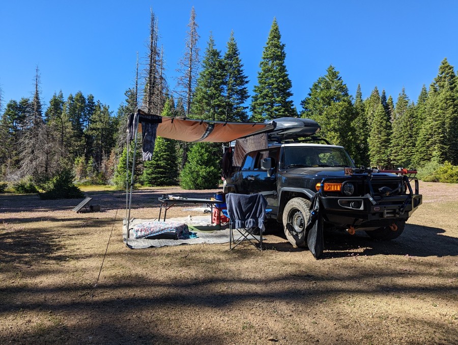
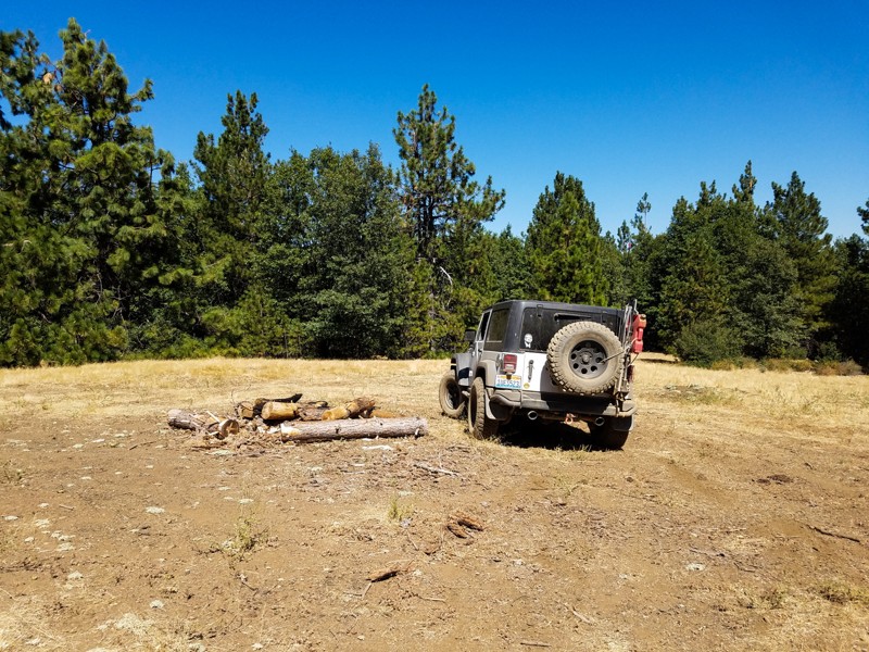
One standout route is Horse Mountain, an easy yet exciting 4WD trail dotted with dispersed campsites and forest clearings. Its smooth sections and scenic fire-ring camps make it a favorite for relaxed overnights or casual weekend drives.

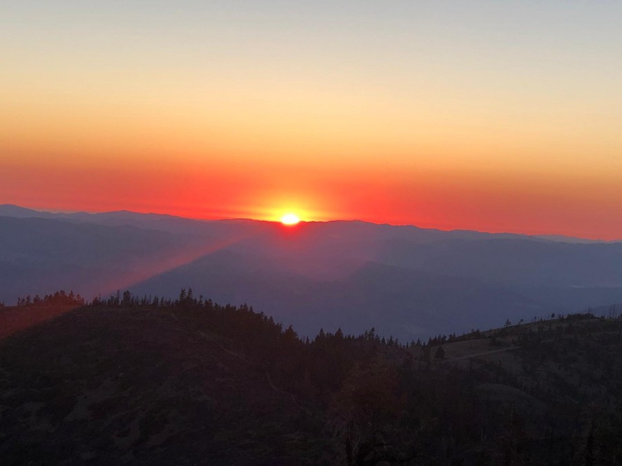
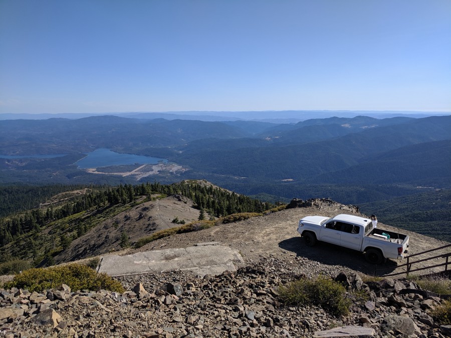
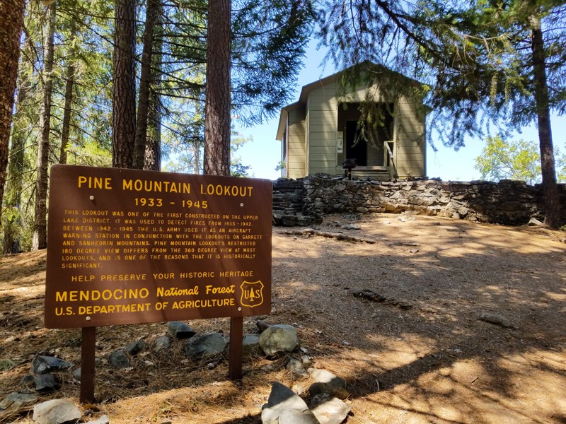
For panoramic views and history, head to Pine Mountain Lookout. Built in 1933, this 180-degree fire lookout once served WWII aircraft defense duties and now rewards visitors with views and wildlife sightings—from eagles to jackrabbits.

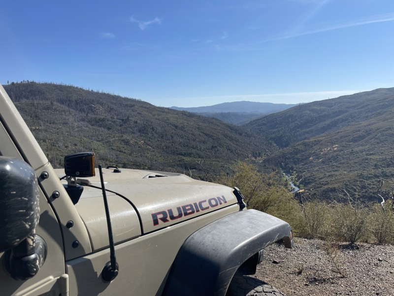
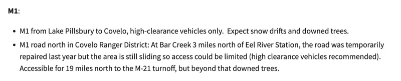
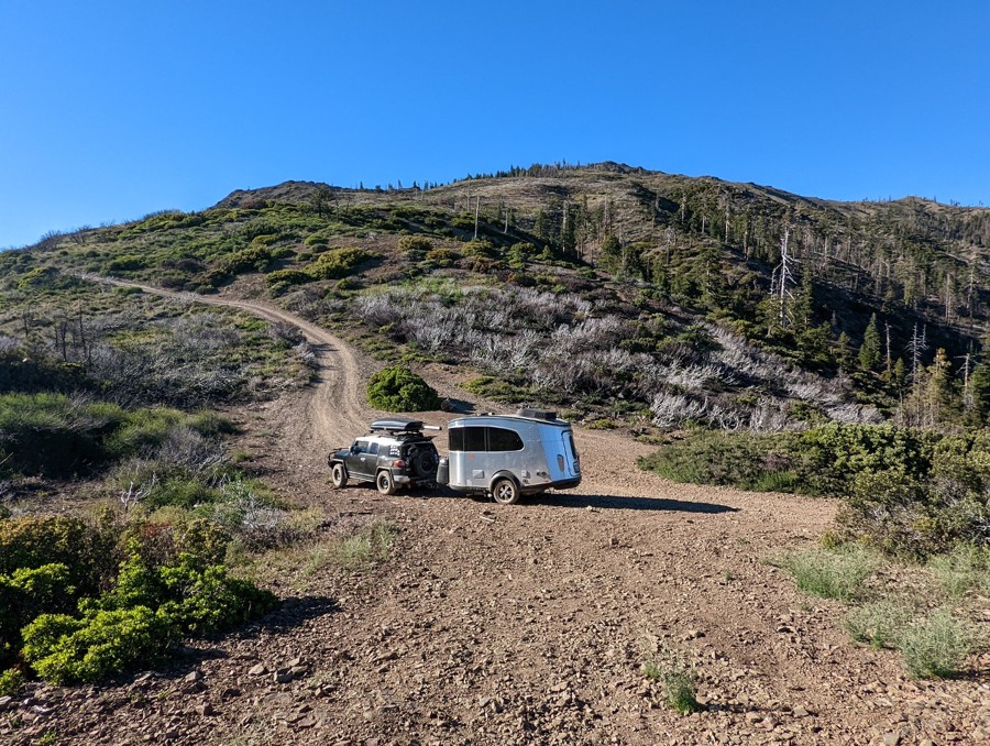
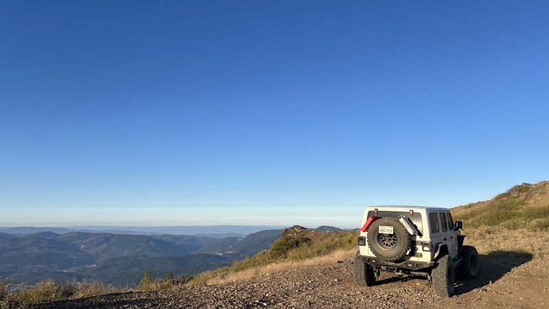
M1 (Elk Mountain Road) is the backbone of the forest, running north-south and connecting countless side trails. Street-legal 4WD roads and narrow single-tracks regularly branch off this central artery, making it a must-drive for anyone looking to explore the forest’s breadth.

Pillsbury–Indian Dick Road begins at Lake Pillsbury with calm lakeside views and transitions into remote forest terrain. With optional detours, dispersed campsites, and access to the Black Butte River Ranch for supplies, it offers a full day’s journey and connection to Mendocino Pass.

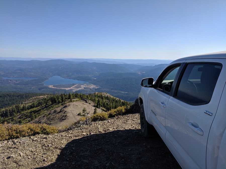
High Valley Road climbs into the forest with frequent views of Clear Lake and Mount Konocti, offering a picturesque ascent toward deeper trail networks like Bartlett Springs Road.

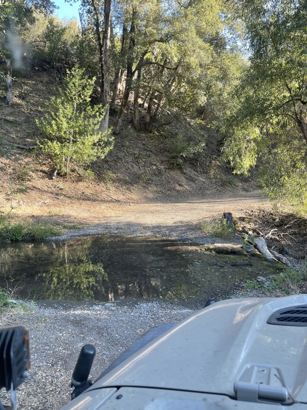
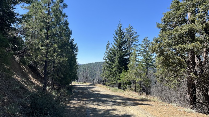
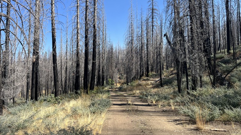
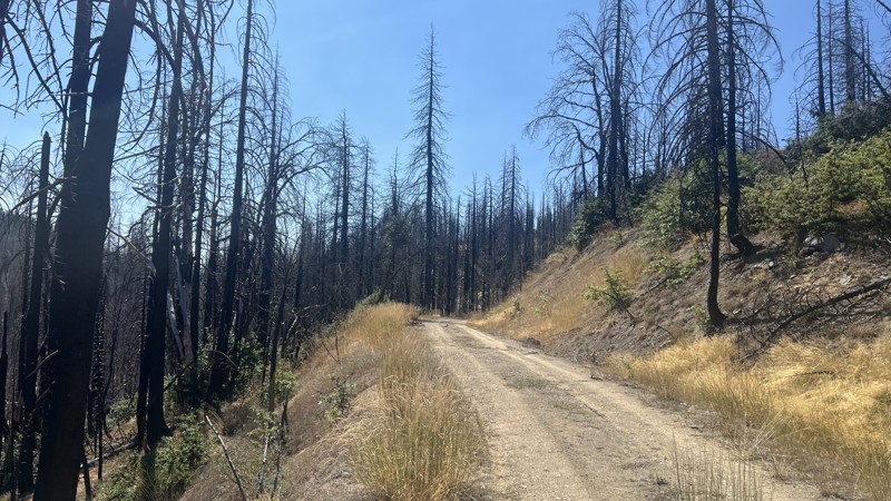
Finally, Forest Road M3 is perfect for beginners testing stock 4WDs. The road winds through diverse ecosystems, including wildfire recovery zones, and offers both creekside campsites and a gentle introduction to backcountry driving.

Always check MVUMs and current conditions before heading out—and leave no trace to preserve these wild, wonderful roads for others.

Top Reasons to Explore Here

Altitude Category IconAltitude
Beginner Category IconBeginner
Camping Category IconCamping
Forest Category IconForest
Iconic Category IconIconic
Mine Category IconMine
Overland Category IconOverland
Scenic Category IconScenic
Snow Wheeling Category IconSnow Wheeling
Basemap Styles

Content Type
Guide Types
Scout Route
Full Trail Guide

Difficulty Rating
easy
moderate
difficult
severe
extreme

Waypoints
Camping
Staging Area
Bathroom
Obstacle
Point of Interest
Directional

Most Recent Trail Reviews

Most Popular

Search for Trails
California: Walker Ridge Road Hero Photo
All-Access Icon
3.7/5 (8 reviews)
Updated: 04/29/2023

Walker Ridge Road

Williams, California
Walker Ridge Road is a fun ridge run with fantastic views down to Indian Valley Reservoir to the west and Bear Valley to the east. Beyond that are the seemingly endless scalloped ridgelines of the geological fault zone that lies between Clear Lake and the Sacramento Valley. Located entirely on BLM land, It is popular with offroaders, hunters, and target shooters. There is a nearby campground situated alongside the reservoir, on which fishing, boating, and swimming are encouraged.
California: M1 - Elk Mountain Road to Lake Pillsbury Hero Photo
All-Access Icon
4.2/5 (7 reviews)
Updated: 04/15/2023

M1 - Elk Mountain Road to Lake Pillsbury

Upper Lake, California
National Forest route M1 (also known as Elk Mountain Road) is the main south-to-north arterial that acts as the "spine" of the Mendocino National Forest. Seemingly endless single-track OHV trails (bikes and quads only) and double-track trails wide enough (and signed for) street-legal 4WD vehicles branch off regularly as you travel along the M1. For this reason we have documented its many intersections as comprehensively as possible, with a waypoint for each one. Note that the "Ranch" fire of 2018 closed many of the trails in this area; the BLM has been working hard to get them reopened, but many of the single-track OHV-only trails are still closed for repair.
California: High Valley Road Hero Photo
All-Access Icon
4.5/5 (4 reviews)
Updated: 07/01/2023

High Valley Road

Clearlake Oaks, California
The High Valley Road climbs through very pretty pine forest and provides frequent peekaboo views of Clear Lake, which at 68 square miles is the largest natural freshwater lake in California (remember that Lake Tahoe is partially in California and partially in Nevada). You'll also see 4,305 foot tall Mount Konocti, which is still classified as an active volcano-- although it last erupted over 11,000 years ago. High Valley Road is a great way to climb up to the intersection with Bartlett Springs Road, which leads deep into the Mendocino National Forest.
California: Pillsbury-Indian Dick Road Hero Photo
Scout Route Icon
4.6/5 (11 reviews)
Updated: 09/29/2025

Pillsbury-Indian Dick Road

Rice Fork Summer Homes, California

Pillsbury-Indian Dick Road has a lot to offer all levels of explorers, providing all forms of camping, including designated dispersed sites with cement pads and limitless trials in the area. Pillsbury-Indian Dick Road starts as a scenic drive around Mendocino National Forest's largest lake, Lake Pillsbury. The initial trip around the lake is a slow, mostly paved drive, allowing for beautiful views, including ample wildlife, mountains, and vegetation. Once past the lake, the trail turns to rough dirt, so high clearance will be needed. Thanks to the maintenance of the Forest Service, this trail has no technical sections, allowing for an easy, relaxing drive during the dry months. Due to past wildfires, downed trees are likely to block the road. Pillsbury-Indian Dick Road transitions from high-elevation shelf roads to rolling hills. You will cross the Mendocino Pass/Alder Springs Road at the Black Butte River Ranch approximately halfway through. Black Butte River Ranch has a small, seasonal store to restock basic supplies and offers designated campsites with basic facilities and clean water. This crossing provides an excellent opportunity to switch trails or return to pavement, allowing easy access to multiple highways. Choosing to continue Pillsbury-Indian Dick Road results in a there-and-back trail, with the northern half leading to The Yolla Bolly-Middle Eel Wilderness.


Camping is abundant along Pilsbury-Indian Dick Road. There are multiple designated campsites with facilities and ample dispersed camping locations with year-round water access. A few of the designated camping areas even include concrete pads. This trail allows for endless options for dispersed camping with and without fire rings already established.

California: Grouse Springs - Bear Creek Hero Photo
Scout Route Icon
4/5 (2 reviews)
Updated: 10/15/2024

Grouse Springs - Bear Creek

Alder Springs, California

Forest Road M3 in Mendocino National Forest is a great trail for all levels of experience, especially beginners wanting to test out stock, four-wheel drive high clearance vehicles. Most of this trail is a smooth graded road with the occasional large pothole and steep climb on sharp corners, requiring good tire placement for stock rigs. This trail will take you through deeply wooded areas, burned clearings from wildfires that occurred between 2018-2020, and multiple other ecosystems. Due to the wildfires, downed trees and roadblocks are possible. M3 and the surrounding area allow ample dispersed camping near year-round creeks and multiple designated campsites with fire rings and vaulted toilets. Completing M3 requires one water crossing, depending on the time of year.

California: Mendocino Pass/Alder Springs Road Hero Photo
Scout Route Icon
3/5 (1 reviews)
Updated: 10/15/2024

Mendocino Pass/Alder Springs Road

McClure Place, California

Alder Springs Road, also known as FH7, is a main forest road found in Mendocino National Forest. FH7 runs from the small town of Covelo, CA, to Elk Creek, CA. Starting in Covelo, you will pass through rolling hills with Heritage Oak Trees. As the elevation climes, you find yourself in dense Conifer groves with birds-eye views of the surrounding mountains. While never officially closed, FH7 becomes impassable due to higher elevations and snowfall; However, it remains a great place to test your snow wheeling abilities or enjoy a quiet winter camping trip. During the warmer months, this trail is easily passable with all stock, high clearance vehicles, or vans. This road is well traveled in both directions, making the hardest part of being aware of oncoming vehicles. Spanning 35 miles, with limitless side trails to explore, this area has something for everyone. As you explore, there will be endless dispersed camping and a few designated camping locations with primitive amenities.

California: 18N25 - Packsaddle Trail Hero Photo
All-Access Icon
4/5 (1 reviews)
Updated: 06/05/2022

18N25 - Packsaddle Trail

Upper Lake, California
Packsaddle Trail, near Lake Pillsbury in the southwest part of the Mendocino National Forest in Northern California, starts and ends at intersections with M1 - Elk Mountain Road, and thus presents an opportunity to bypass a good portion of the heavily washboarded Elk Mountain Road. It is a quieter, smoother, more peaceful route with one exceptional lookout spot, and spends much of its time winding through deep Ponderosa Pine forest. The lookout spot presents a fine 180 degree view towards the east, with seemingly endless rolling, forested hills disappearing forever into the distance. Hull Mountain is prominent to the northeast.
California: Horse Mountain Hero Photo
All-Access Icon
0/5 (1 reviews)
Updated: 01/15/2019

Horse Mountain

Upper Lake, California
This is one of the most fun easy 4WD routes in the southern Mendocino National Forest. A perennial favorite with fans of dispersed camping, it passes quite a few cleared level spots in the forest, many with simple fire rings and some with views. This trail is simply a blast to drive; although it has occasional erosion gullies that need to be navigated with care, much of the rest of the route is surprisingly smooth, and lacks the punishing washboard bumps that are so common elsewhere in the MNF. After the final short, steep hill to the top of Horse Mountain, you'll find that trees around the summit clearing block views down to the valley; however it is still a great spot for a picnic lunch.
California: Pine Mountain Lookout Hero Photo
All-Access Icon
0/5 (1 reviews)
Updated: 01/15/2019

Pine Mountain Lookout

Upper Lake, California
An easy dirt road winds through mixed douglas fir and ponderosa pine forest to reach a rustic former fire lookout which can be rented for two nights at a time. The lookout is perched on a stone outcropping at an elevation of 4,400 feet. There are 180-degree views of endless mountain peaks and verdant forest. A variety of bird species inhabit the forest, and visitors may spot eagles, owls, hawks and osprey. Black-tailed deer, jackrabbits, quail, and wild turkey are also often encountered. Pine Mountain Lookout was constructed in 1933 and used for fire detection until 1942. During World War II, the lookout served as part of an aircraft defense monitoring system that extended throughout California. This lookout is historically significant because it only offers 180-degree views of the surrounding terrain, while other lookouts have 360-degree views.
California: 17N37 - Little Round Mountain Road Hero Photo
All-Access Icon
0/5 (1 reviews)
Updated: 01/15/2019

17N37 - Little Round Mountain Road

Upper Lake, California
Little Round Mountain Road goes only 1.5 miles before narrowing to single track. However, it passes through some lovely pine forest, with peakaboo views down to Bucknell Creek (seasonal) which it runs parallel to. Keep your eyes open for Red-tailed Hawks, as they are frequently seen here in springtime and summer. The trail intersects with two single-track OHV routes. When out exploring the Mendocino National Forest, it is a fun, short side trip.
California: Sunflower Glade Road Hero Photo
Scout Route Icon
3/5 (1 reviews)
Updated: 10/15/2024

Sunflower Glade Road

Reeves Place, California

Sunflower Glade Road is a short trail located on the border of The Mendocino National Forest and Yolla Bolly-Middle Eel Wilderness. The surrounding area is mostly burned due to recent wildfires, so there is a high chance of downed trees blocking the road. This trail is an easy, there-and-back trail with a few dispersed camping locations offering no amenities or fire rings. Sunflower Glade Road is a good trail for Overlanders of all skills and vehicles.

California: Georges Valley Road Hero Photo
Scout Route Icon
0/5 (1 reviews)
Updated: 10/15/2024

Georges Valley Road

Reeves Place, California

Georges Valley Road is a short trail at the end of the Pillsbury-Indian Dick trail located in the Mendocino National Forest. This trail is a there-and-back trail with a couple of dispersed camping sites. Georges Valley Road is a one-lane, narrow trail that any stock offroad vehicle can travel, providing no real challenges except for a few potholes that will make stock vehicles choose a careful line. The end of the trail is a decent location for bigger groups to set up a dispersed camping site for a night, providing shade and ample space for multiple vehicles.