
Schnebly Hill Road (36.2 miles away)
Sedona, Arizona
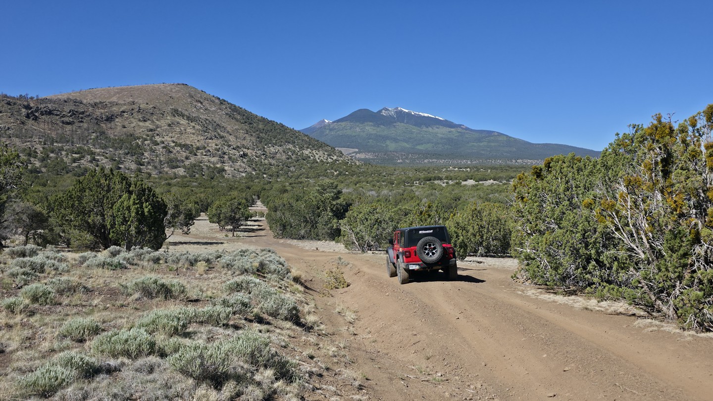

Sunset Crater Pit, FS 545B, is a straight-through forest road that parallels Highway 89 just outside Sunset Crater Volcano National Monument. Popular with campers and overlanders, the route follows a hard-packed dirt surface scattered with small volcanic rock and offers numerous dispersed campsites with outstanding views of O'Leary Peak, Robinson Mountain, and Humphreys Peak. The southern half of the trail is generally smoother and more shaded, with several larger campsites suitable for travel trailers, RVs, and extended camp setups. Conditions become rougher on the northern half, where a 2022 wildfire removed much of the vegetation and left the area more susceptible to erosion. Here, drivers can expect sections of exposed volcanic rock up to 8–10 inches in size and washout ruts reaching 10–16 inches deep. While the route remains manageable for most high-clearance vehicles in dry conditions, the roughest campsites and obstacles may challenge lower-clearance SUVs. Campsites in the burn area are large and open but offer little protection from wind, dust, or sun. Whether you're looking for a quick overnight stop or a basecamp for exploring the Sunset Crater region, this trail provides easy access to scenic high-desert camping with mountain views in every direction.