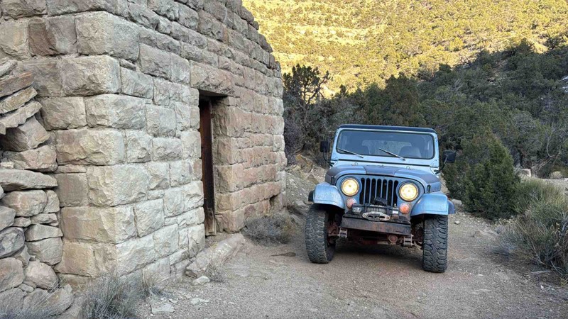
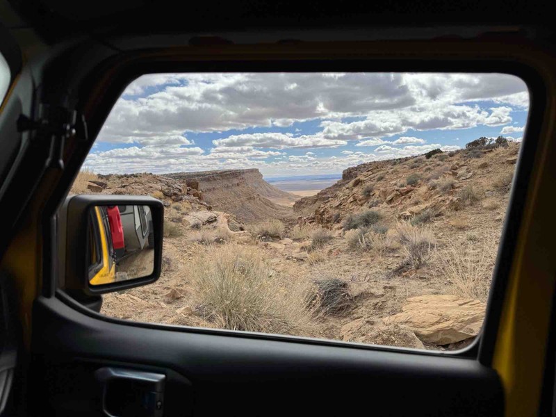
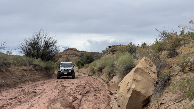
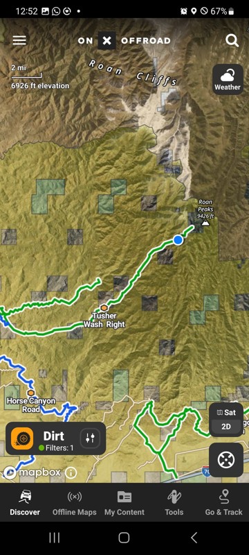
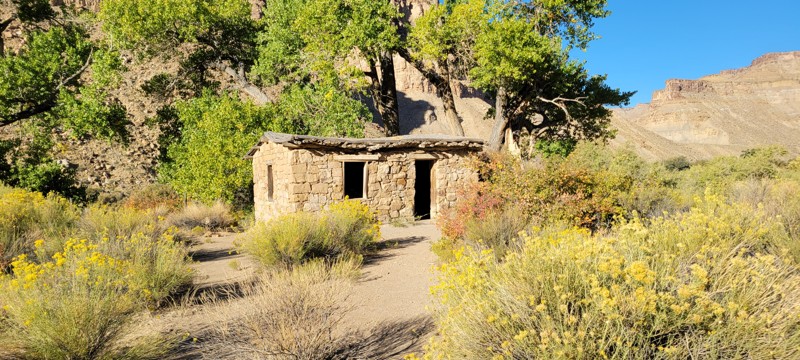
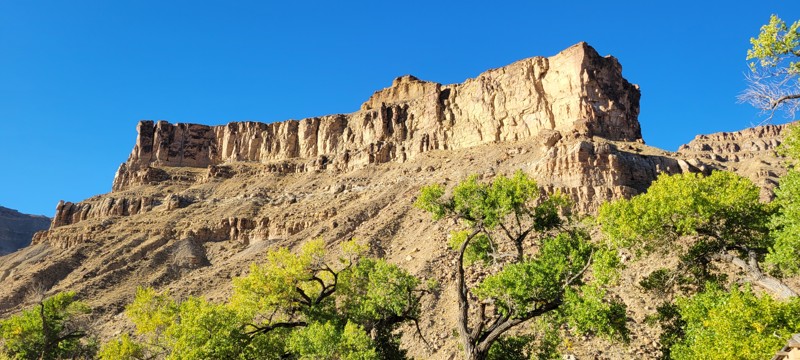
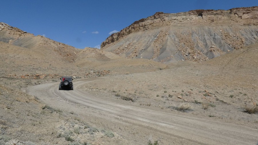
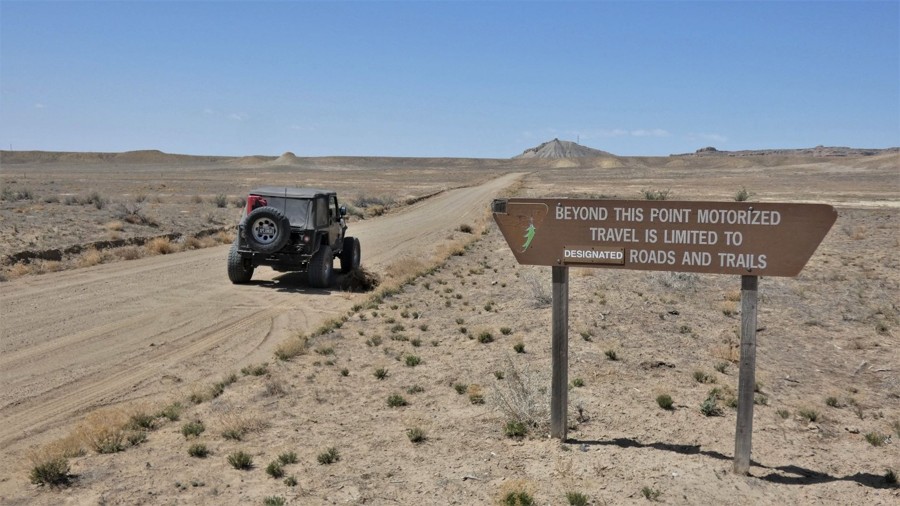
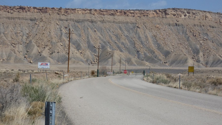
Region

The Book Cliffs

Utah

Offroad Trails in The Book Cliffs

A Region within Utah
4/5 (51)

Eastern Utah is home to many diverse regions, from high-elevation alpine mountains to the red rock desert of Moab. Between these vastly different landscapes lie the Book Cliffs, a unique combination of flora and fauna, conveniently located off of I-70 between Green River, Utah, and Grand Junction, Colorado. Although they are often overlooked for more popular destinations, consider exploring what this special region has to offer.

The Book Cliffs combines a multitude of unique features into a vast and usually neglected area. At the base of the Book Cliffs, one can expect central Utah desert-type terrain, with jagged rocks and junipers dotting the landscape. As the trails wind up the numerous canyons, the scenery quickly changes to a moderately thick forest lined with towering pines, firs, and shrubs.

The trails within the network consist of bumpy packed dirt and the occasional rocky patch that will slow most users down. Rock crawling is not the popular feature here; however, overlanders will enjoy the mild challenges as they explore the miles of trails webbing their way around the mountains. Sight-seers will also be fond of the many historic artifacts that this region boasts, from petroglyphs to old buildings and mining machinery.

Rather than driving by this unique region, consider planning a weekend trip to explore the seemingly endless interconnected routes. Whether you are looking for easy single-day trails to historic sites or moderate trails to guide you on an adventure-packed overlanding excursion, there is something here for everyone. Often times, the less explored locations are holding hidden treasures that will surely surprise you!

Top Reasons to Explore Here
Altitude Category IconAltitude
Beginner Category IconBeginner
Camping Category IconCamping
Desert Category IconDesert
Forest Category IconForest
Ghost Town Category IconGhost Town
Iconic Category IconIconic
Overland Category IconOverland
Rock Category IconRock
Sand Category IconSand
Scenic Category IconScenic
Wash Category IconWash
Trail Types
Scout Route
Full Trail Guide

Preview Trail Icon
Preview Trails
easy
moderate
difficult
severe
extreme

All-Access
Scout Route
Start a 7-day Free Trial

Most Recent Trail Reviews

Most Popular

Search for Trails
Utah: Horse Canyon Road Hero Photo
All-Access Icon
4.7/5 (3 reviews)
Updated: 02/17/2024
Horse Canyon Road
Green River, Utah
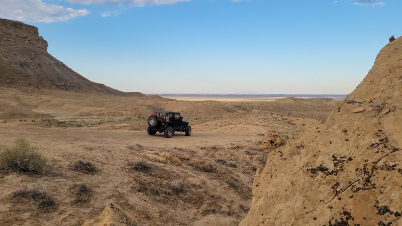
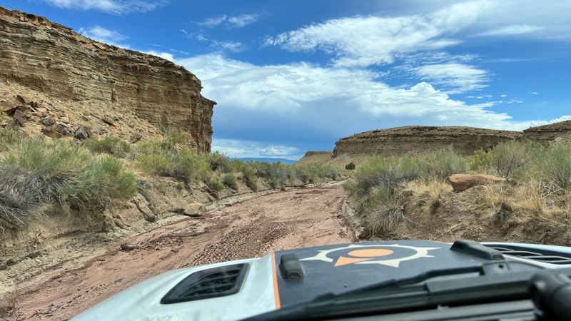
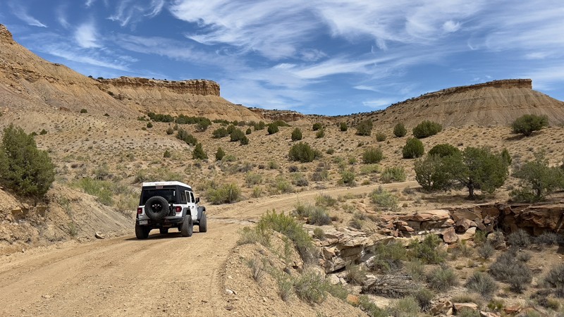
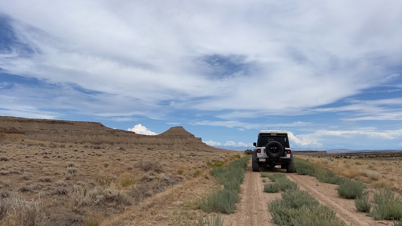
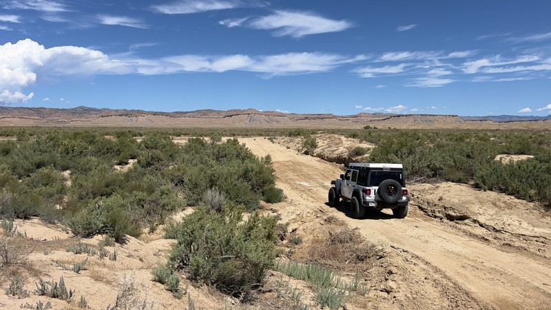
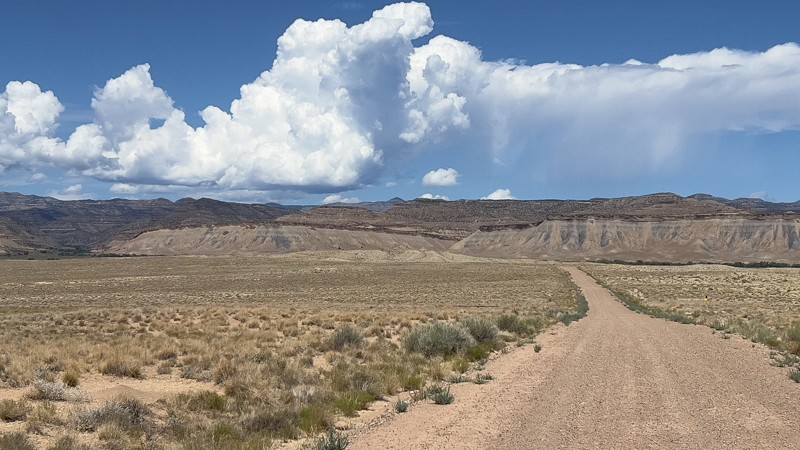
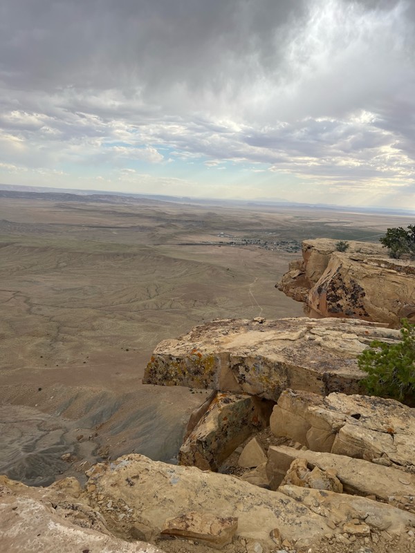
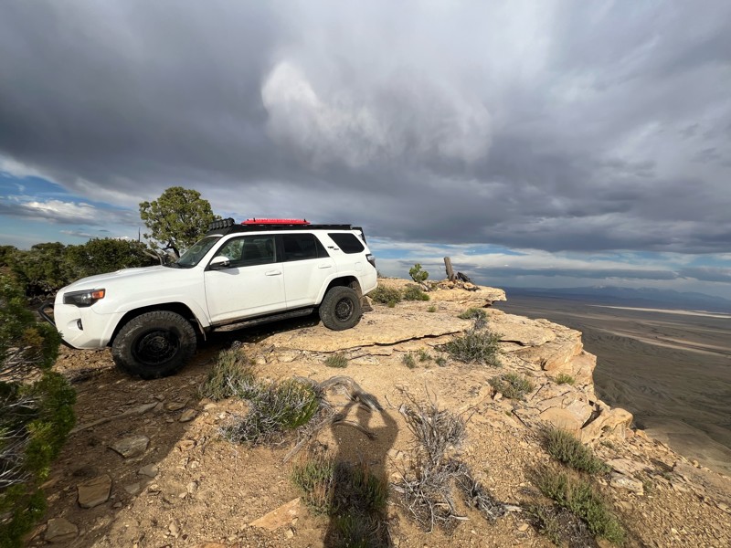
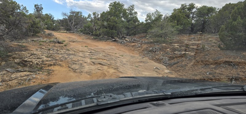
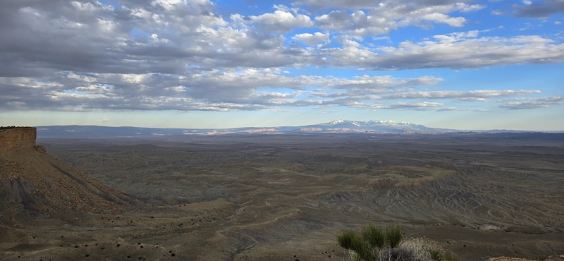
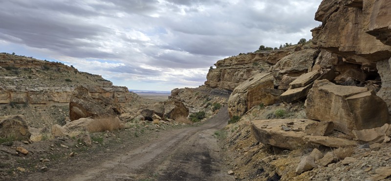
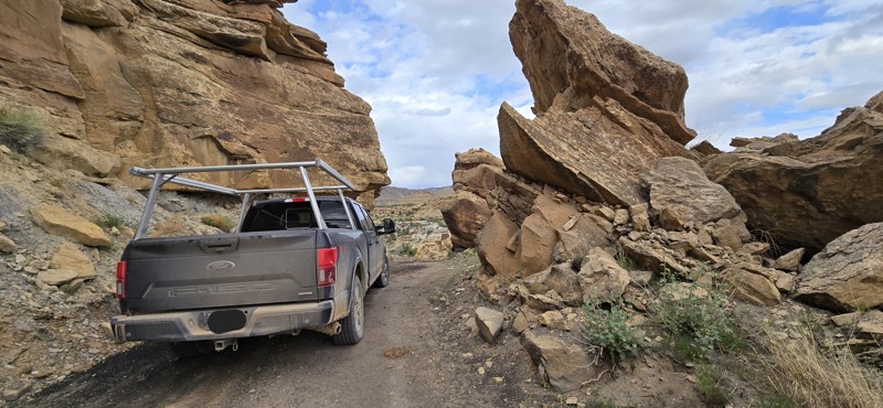
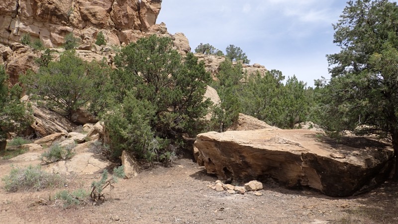
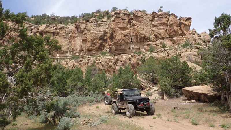
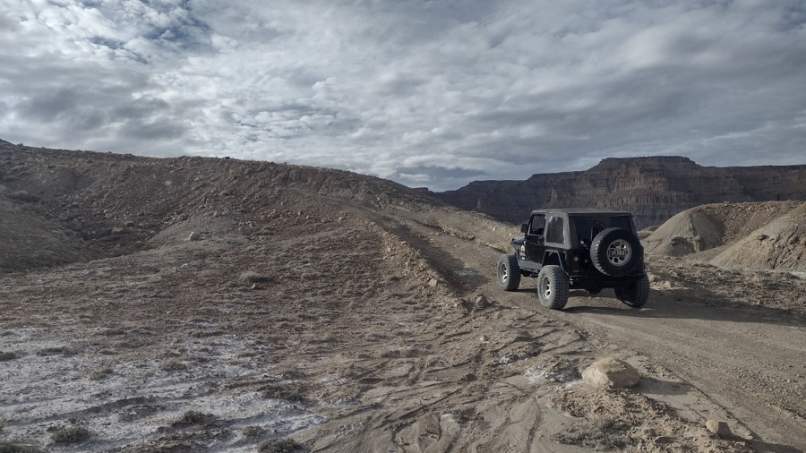
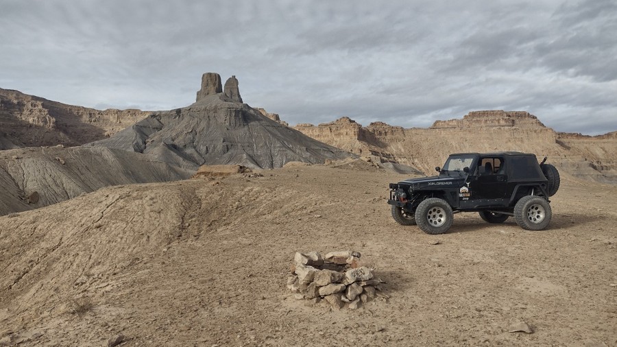
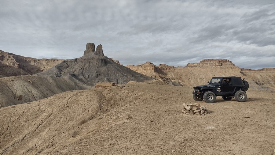
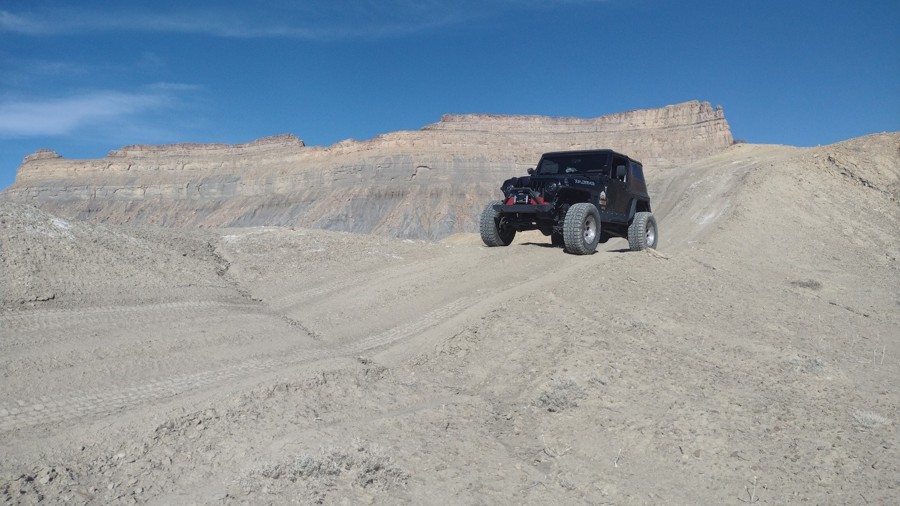
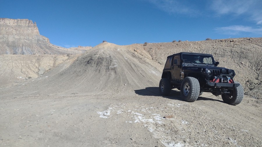
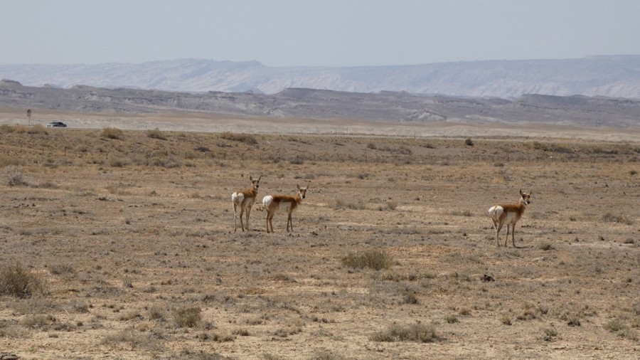
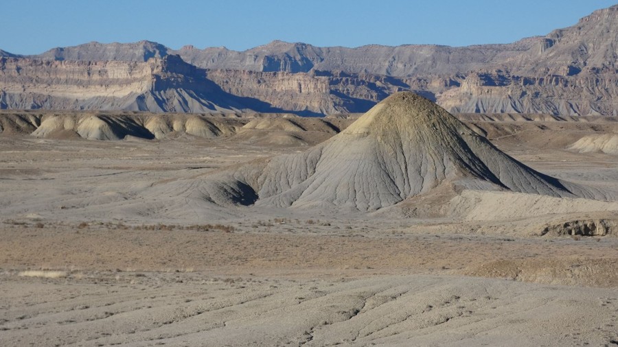
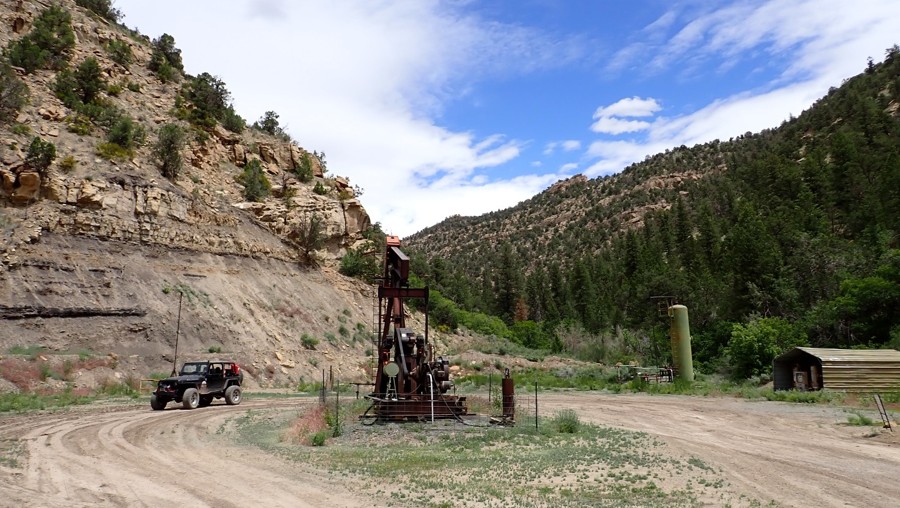
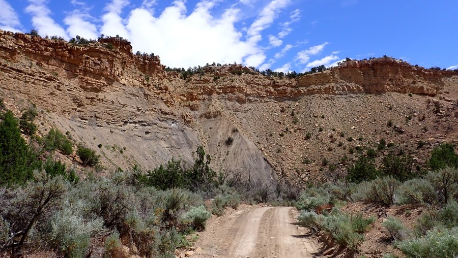
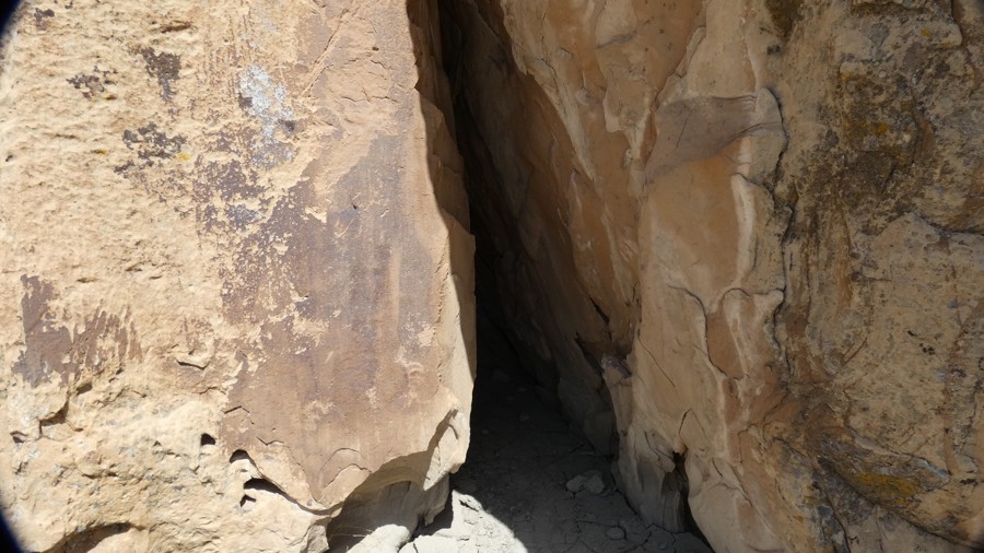
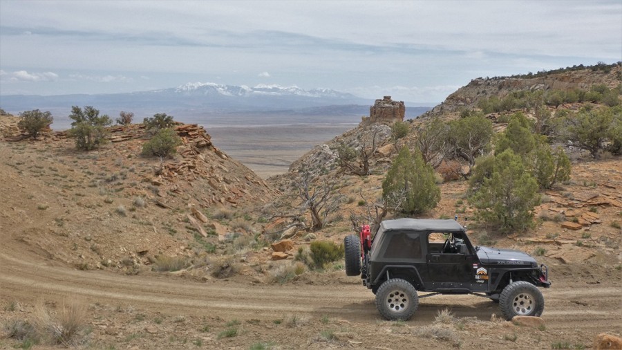
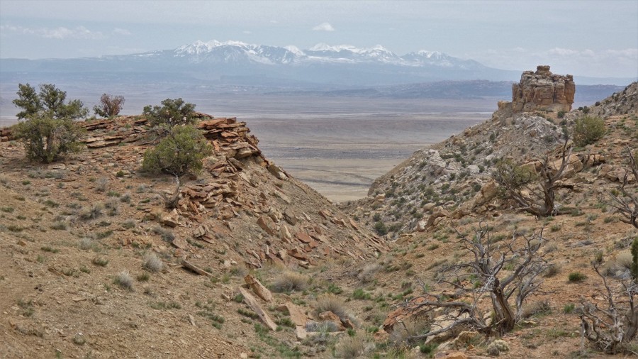
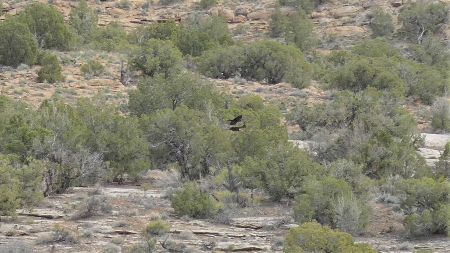
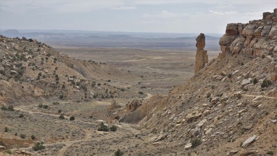
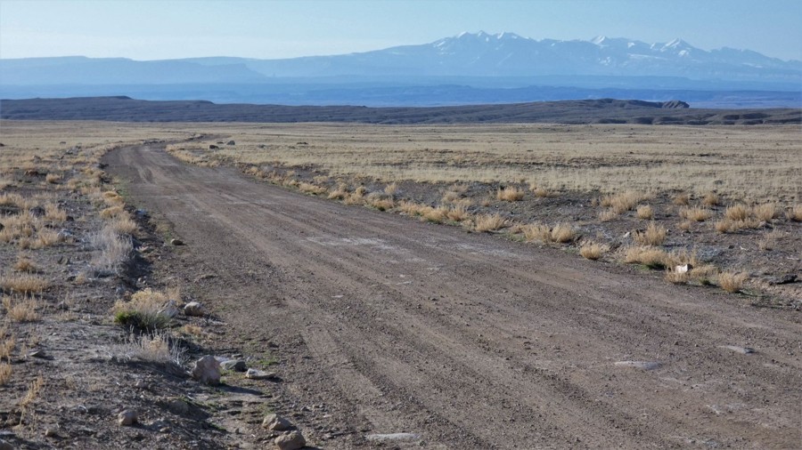
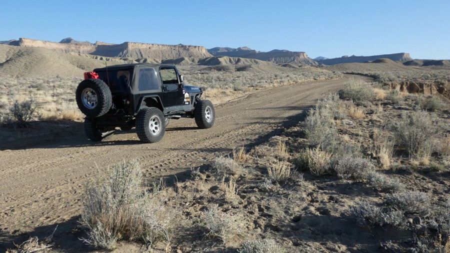
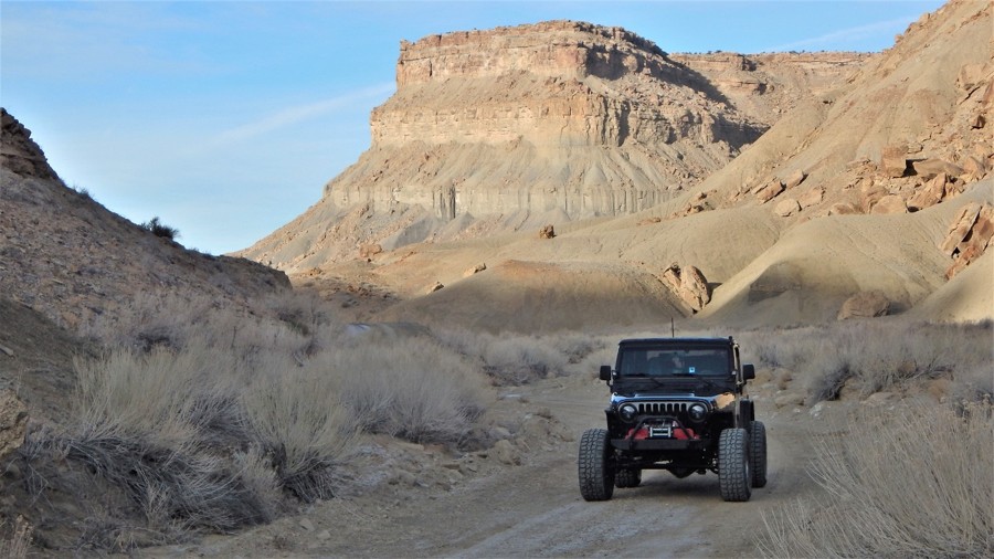
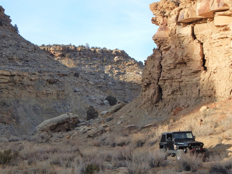
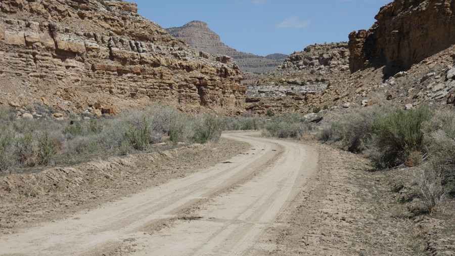
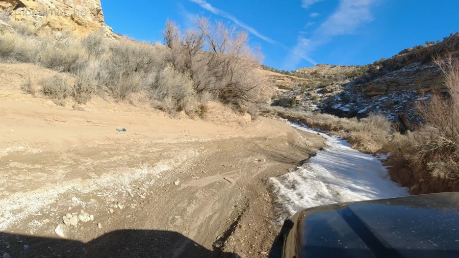
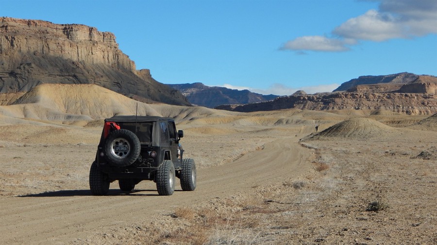
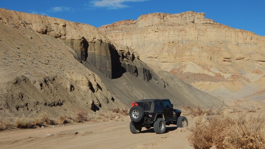
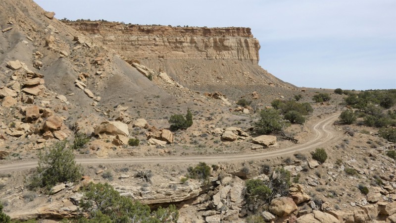
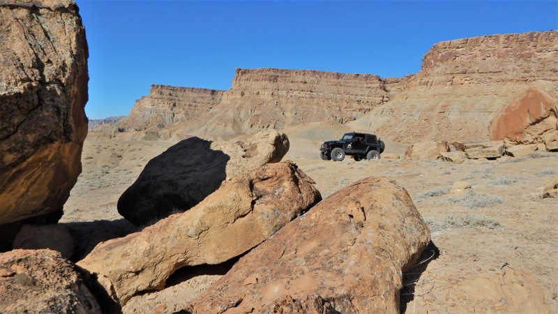
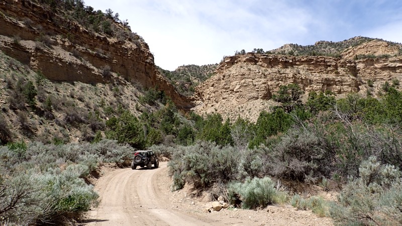
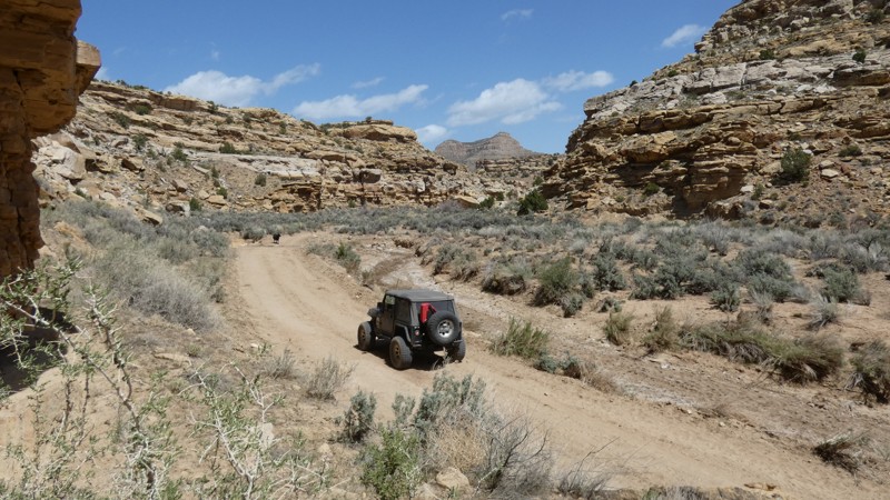
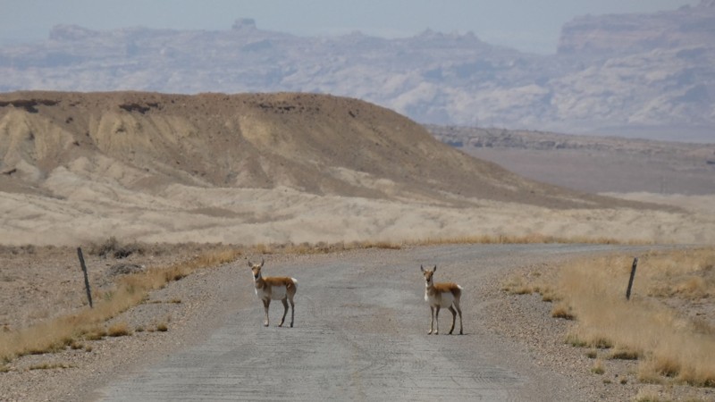
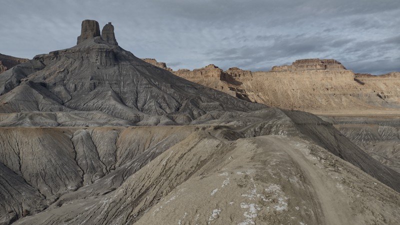
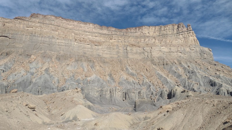
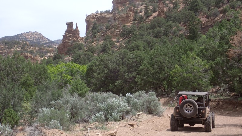
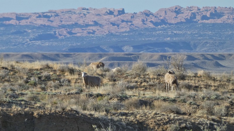
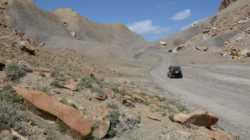
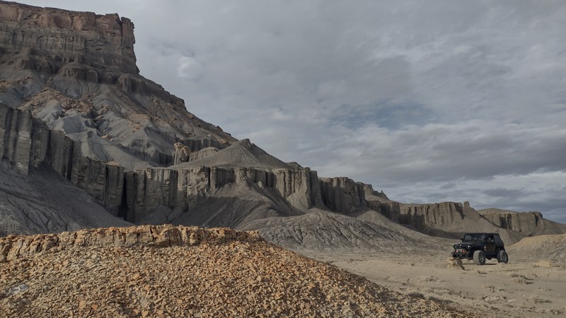
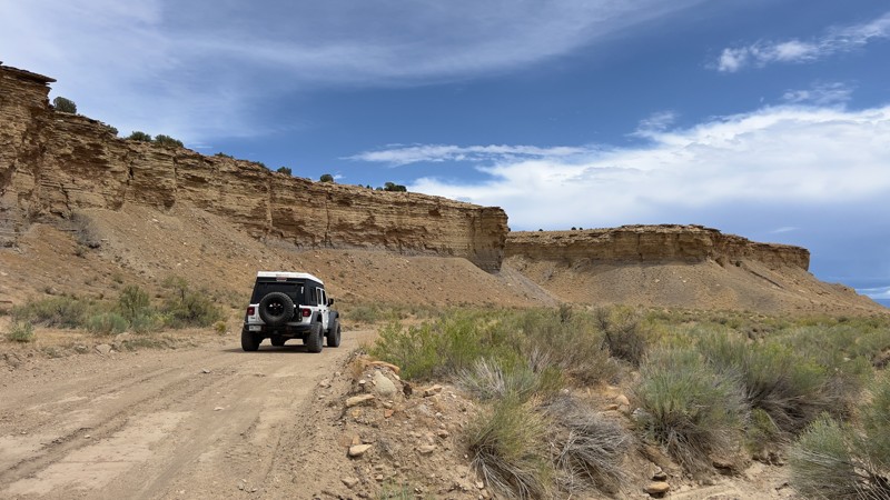
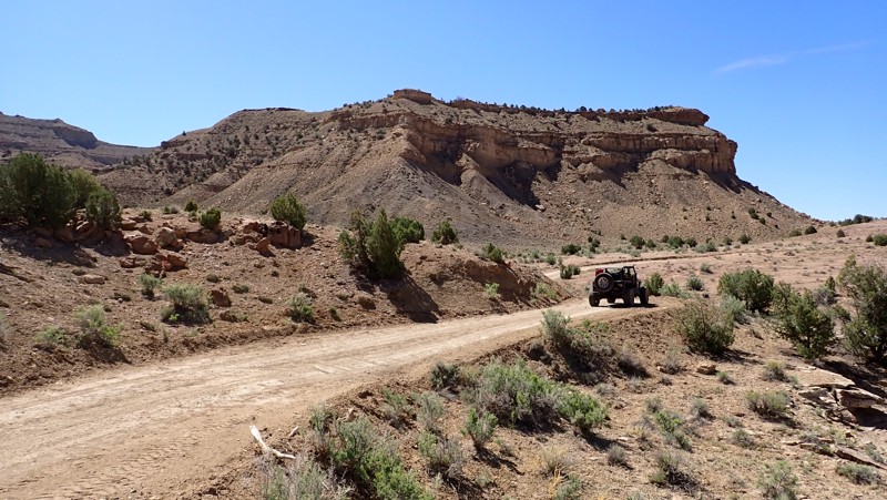
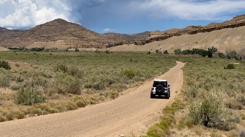
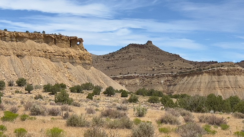
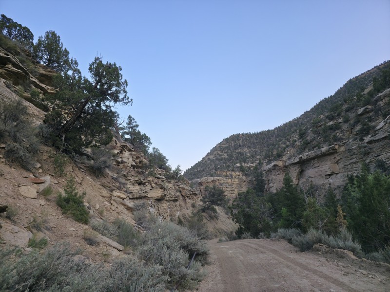
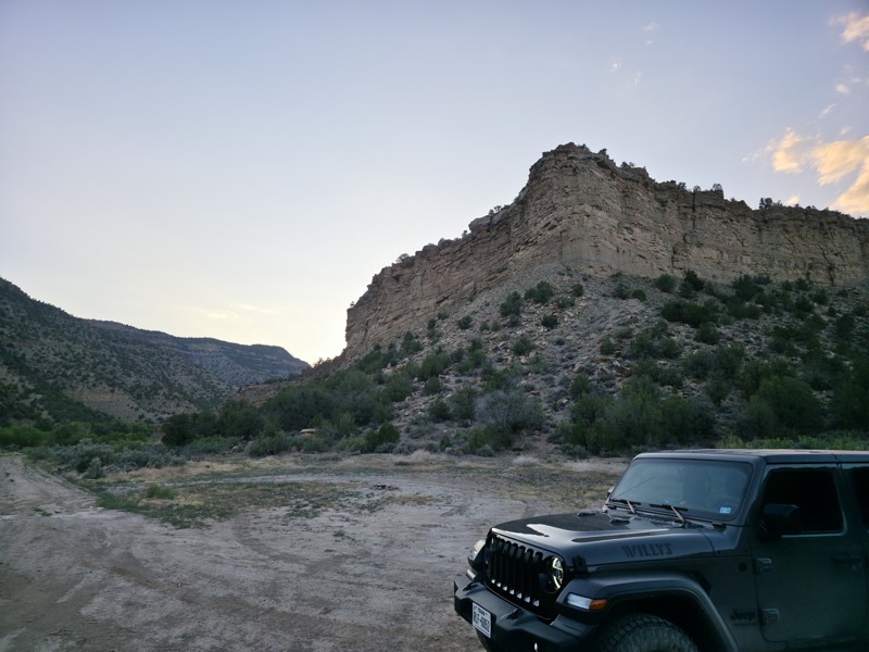
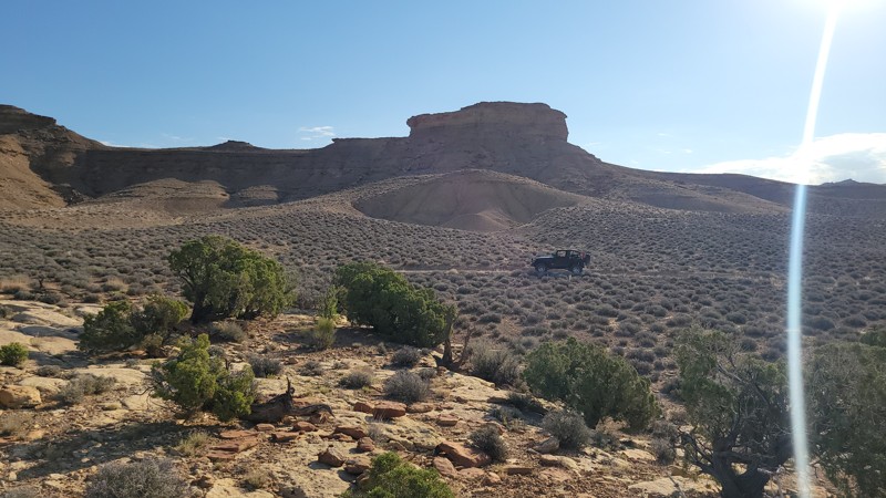
Isolation, desolation, and solitude can all describe the Book Cliffs region in eastern Utah. The 230-mile-long Book Cliffs run along the Highways from Price, UT to Grand Junction, CO, calling out to the adventurous traveler. Horse Canyon Road will deliver you to the doorstep of an area very few have ventured. It winds through a scenic canyon before climbing to the first tier along these towering cliffs. Once you're up on top, you'll zigzag along the edge of the Floy Canyon Wilderness Study Area, all while soaking in how pristine the terrain is, seemingly undisturbed by modern man. While linking this trail with others in the area, you will experience addictive isolation.
Utah: Book Cliff Ridge Road Hero Photo
Scout Route Icon
4/5 (1 reviews)
Updated: 05/14/2025
Book Cliff Ridge Road
Mack, Utah

The Book Cliffs in Central Eastern Utah is a treasure trove of winding dirt roads providing explorers with nearly endless directions to travel. Book Cliff Ridge Road is a 67-mile-long gateway to the southern end of the Book Cliffs, climbing quickly from the valley below to the top ridgeline. Since this trail serves plenty of drilling and oil sites, it is well-maintained and suitable for just about any vehicle in optimal conditions. There are a few great camping opportunities at the top of the eastern climb, with designated sites tucked away in the trees providing plenty of room for 8-plus vehicles and all the passengers you can carry.

Utah: Sego Canyon Hero Photo
All-Access Icon
4.3/5 (6 reviews)
Updated: 01/24/2024
Sego Canyon
Green River, Utah

Whether passing through on I-70 or exploring the Book Cliff trails, this historic and immersive drive through Sego Canyon will elevate your opinion of this desolate landscape. Starting at 5,500' and ending at 8,500', this easy trail packs a bunch of history and scenery in just over 10 miles. The trail slowly begins to leave the rugged flat desert after a short stop at the Sego Cemetery, where some of the town's residents were laid to rest. Continuing up into the cliffs, you will see signs of an abandoned railroad spur built in 1914 to retrieve coal from the town of Sego. An impressive 13 bridges had to be constructed to crisscross the creek. As you approach the ghost town, you will see the small stone buildings being overtaken by nature, but one structure still stands tall. The American Fuel Company Store was built in 1911 and still has all four walls standing today. The now crumbling town reached its peak in the 1930s when the mine employed 125 miners, and the town had approximately 500 residents. Continuing through a seemingly hypnotizing canyon, you'll have more opportunities to see how the early settlers lived when you stop at the stone and log cabins. The now vertical cliffs become much tighter while precariously balanced rock spires threaten to tumble down at any moment. The vegetation changes dramatically as you switch back to the top, where you enter a dense pine and aspen forest, ripe with memorable camping on the rim.

Utah: Nefertiti Point Hero Photo
Scout Route Icon
4.7/5 (3 reviews)
Updated: 10/15/2024
Nefertiti Point
Green River, Utah
Nefertiti, queen of the 18th Dynasty of Ancient Egypt, has been immortalized by nature. At the end of this easy but very scenic canyon drive is a rock spire that looks like the queen. Although this is the trail's highlight, it by no means is the only worthy stop along the route. The trail travels along and above the mighty Green River. After the pavement ends, the trail is a well-maintained gravel road that accesses an organized campground with sites along the river. At least ten more primitive campsites can be found further back in the canyon. You will also need to plan for a short stop at the remarkably well-preserved Smith Cabin and the petroglyphs at the end. Pack for a day along the river or settle in for a week of epic camping in this remarkable recreation area.
Utah: Thompson Canyon Hero Photo
All-Access Icon
3/5 (2 reviews)
Updated: 06/05/2022
Thompson Canyon
Thompson Springs, Utah
Located within the Book Cliff Mountains of Central Utah, Thompson Canyon Road is a nice, short drive that offers the beauty and serenity of the Floy Canyon Wilderness Study Area, one of the many wilderness study areas managed by the Bureau of Land Management in Utah. The lands surrounding the Thompson Canyon area protected so remaining on the designated roadway is important. Relics of a time decades ago can be seen along this trail.
Utah: Coal Canyon Road Hero Photo
All-Access Icon
4.5/5 (3 reviews)
Updated: 06/05/2022
Coal Canyon Road
Green River, Utah
Disappear into the Book Cliffs with this gateway into Utah's most isolated protected wilderness. The Book Cliffs are the longest continuous cliffs on the continent. They loom just out of reach along the highways from Price, Utah, east to Grand Junction, CO. This region has been protected from development for decades and lays claim to being one of the least explored regions in the United States. There are still undocumented cliff dwellings and petroglyphs being found to this day in the Desolation Canyon Wilderness Study Area. The cliff system is comprised of multiple tiers, each acting as a natural barrier to reaching the uninhabited interior. Coal Canyon Road is one of the few roads that quickly transports you to the first tier of these towering cliffs. The trail travels through an ever tighter canyon before rapidly climbing up a narrow ledge to the wilderness area above. Be sure to stop at the petroglyphs to try to interpret what they may mean.
Utah: Thompson Bench Road Hero Photo
All-Access Icon
5/5 (2 reviews)
Updated: 06/05/2022
Thompson Bench Road
Thompson Springs, Utah
Traverse along the Book Cliffs with this remote gateway into Utah's most isolated wilderness. The Book Cliffs are the longest continuous cliffs on the continent. Thompson Bench Road transports you along the first tier of these towering cliffs. The trail travels along the edge of numerous canyon overlooks and epic campsites perched on the rim. The Book Cliffs loom just out of reach along the highways from Price, Utah, east to Grand Junction, CO. This region has been protected from development for decades. It lays claim to being one of the least explored regions in the United States. There are still undocumented cliff dwellings and petroglyphs being found to this day in the Floy, Flume, Coal, Desolation Canyons, and other Wilderness Study Areas that make up this region. The cliff system is comprised of multiple tiers of dramatic geological layers acting as a natural barrier to reaching the uninhabited interior.
Utah: Sagers Bench Hero Photo
All-Access Icon
4.2/5 (4 reviews)
Updated: 05/27/2023
Sagers Bench
Thompson Springs, Utah
Take a memorable tour along a stretch of the 230-mile-long Book Cliffs spanning from Price, UT to Grand Junction, CO. Sagers Bench will deliver you to the doorstep of a wilderness area where very few have ventured. Sagers Bench borders the Floy Canyon Wilderness Study Area, an isolated and rugged environment. The trail easily winds through a scenic canyon before climbing to the first tier along these towering cliffs. Once you're up on top, you'll zigzag along the edge of the Wilderness Study Area, all while soaking in how pristine the terrain is, seemingly undisturbed by modern man. Linking this trail with others in the area provides a fantastic isolated experience in a landscape that begs to be explored.
Utah: Tusher Canyon Hero Photo
All-Access Icon
4.3/5 (3 reviews)
Updated: 06/05/2022
Tusher Canyon
Green River, Utah
East of the Green River, Tusher Canyon is the first trail used to access the expansive Book Cliffs. As you approach the mountains from the river basin, the trail leads through towering cliffs that continually close in on you. The Book Cliffs are the longest continuous cliffs on the continent. They loom just out of reach along the highways from Price, Utah, east to Grand Junction, CO. This region has been protected from development for decades and lays claim to being one of the least explored regions in the United States. There are still undocumented cliff dwellings and petroglyphs being found to this day in the Desolation Canyon Wilderness Study Area. The cliff system is comprised of multiple tiers, each acting as a natural barrier to reaching the uninhabited interior. Tusher Canyon travels up to the first tier of this geographic wonder.
Utah: Hog Canyon Hero Photo
Scout Route Icon
2.5/5 (2 reviews)
Updated: 06/27/2025
Hog Canyon
Cisco, Utah
Hog Canyon is a continuation of Nash Road that leads across Windy Mesa and eventually dead ends in the Book Cliffs. The trail starts by traveling under I-70 on a beat-up old gravel road. After several miles, the trail begins to wind its way up a narrow cliff-walled canyon. There can be large trucks on the road; there is only room for a single vehicle to travel at several points. The further you travel, the rougher the trail becomes. In dry conditions, the entire route can be completed in 2wd with high clearance. The route's endpoint is a drilling platform, but the drive getting there is very scenic. The only established campsite was out in the open on Windy Mesa. Be aware of very high winds in the springtime, May-June.
Utah: Crescent Canyon Hero Photo
All-Access Icon
4.5/5 (2 reviews)
Updated: 04/29/2024
Crescent Canyon
Thompson Springs, Utah
Nestled in the foothills of the Book Cliffs is the little-known Crescent Canyon, which travels through and above a very colorful desert landscape. At the base of the ledge road, a towering spire marks the entrance to a region rarely visited by tourists. As you wind your way through the picturesque canyon, you'll be driven to stop along the trail's edge and get out of the vehicle to enjoy the pristine wilderness. The trail climbs up to the first tier of the ominous and expansive Book Cliffs within the Floy Canyon Wilderness Study Area. There are very few visitors or signs of civilization within this seemingly undisturbed part of Utah. Connect this trail with many others that traverse across the cliffs to the east toward Colorado.
Utah: Floy Canyon Loop Hero Photo
Scout Route Icon
3/5 (2 reviews)
Updated: 03/11/2025
Floy Canyon Loop
Crescent Junction, Utah
Floy Canyon is an easy access point onto the Books Cliffs of Utah. The route easily travels across graded dirt and rock the entire way. You'll travel through a scenic canyon with towering rocky cliffs before reaching the first level along the Book Cliffs. You will need high clearance and durable tires for the random washout and rocks on the road. In dry conditions, the trail can be easily traveled in 2wd. The views through the canyon and above are very dramatic and best during the spring bloom. Camping is limited to almost non-existent along this specific trail. A large open area at the junction with Thompson Pass could be used for camping.
Utah: Thompson Crossover Hero Photo
Scout Route Icon
3.5/5 (2 reviews)
Updated: 03/11/2025
Thompson Crossover
Crescent Junction, Utah
Thompson Crossover is part of old Highway 10 that was replaced with I-70 in the 1960s. All year long, early in the morning, you are guaranteed to see pronghorns along this route. They graze daily between the interstate and the Book Cliffs to the north. The road is beat-up old asphalt and gravel. There are potholes like you find on any county road, so be cautious at high speeds. There is little to no traffic, so you can go slow or stop to take pictures of the wildlife and the many remnants of the old highway. The camping is wide open along this route. You can put down stakes just about anywhere, but the noise from I-70 and the trains might be a deterrent. There is excellent camping on the Book Cliffs or organized campgrounds in Green River.
Utah: Blue Castle Hero Photo
Scout Route Icon
3/5 (1 reviews)
Updated: 10/15/2024
Blue Castle
Green River, Utah
Blue Castle is a scenic and unique natural grey-colored butte that you can ride your bike on. The towering cliffs north of the small town of Green River, UT, are a freeride mountain bikers' paradise. The area is an open E-Bike area. Many pros have visited the area cliffs to launch down the treacherous spines of Battleship Butte. The Semenuk Drop is the most famous of these lines that can be found on a nearby trail. This route begins as a gravel route but becomes rocky with washouts. You can travel the entire route in 2WD with high clearance and durable tires. The camping is wide open and exposed. It can get very windy in the area and cold at night. A few flat areas had old rock campfire rings along the trail. This trail is impassable when wet and not where you want to be when it's raining.
Utah: Battleship Butte Hero Photo
Scout Route Icon
2/5 (1 reviews)
Updated: 10/15/2024
Battleship Butte
Green River, Utah
The towering cliffs north of the small town of Green River, UT, are a freeride mountain bikers' paradise. The area is an open E-Bike area. Many pros have visited the area cliffs to launch down the treacherous spines of Battleship Butte. The Semenuk Drop is the most famous of these lines that can be found on a nearby trail. This route begins as a well-maintained gravel road. It turns into a soft dirt two-track with very deep ruts and washouts. You will need a 4x4 and high clearance to make it to the cliffs. There are steep loose climbs, but they can be completed in stock 4x4s with good tires. The camping is wide open and very exposed. It can get very windy in the area and cold at night. A few flat areas had old rock campfire rings along the trail. This trail is impassable and not where you want to be when it's raining.
Utah: Upper Tusher Canyon Hero Photo
Scout Route Icon
3/5 (2 reviews)
Updated: 10/15/2024
Upper Tusher Canyon
Green River, Utah

Upper Tusher Canyon is an entirely different experience than rugged lower Tusher Canyon. Your adventure begins in the sandy wash below the towering Book Cliffs, the longest continuous cliffs on the continent. The trail winds through a dense desert vegetation landscape with unique rock formations poking out of the trees. You will climb to over 7500 feet and the border of the Uintah/Ouray Indian Reservation, where a natural spring has created a shady oasis to set up camp. The trail ends at an old drill platform that makes a wonderful group campsite. Individual campsites are under the trees in the tall grass. The trail is well-maintained but can change after a rainstorm. In dry conditions, the trail can be completed in 2WD. The trail follows a canyon. Do not drive the trail in rainy conditions.

Utah: Thompson Overlook Hero Photo
All-Access Icon
5/5 (4 reviews)
Updated: 06/08/2024
Thompson Overlook
Thompson Springs, Utah
Take this short but memorable trail to one of the best overlook campsites along the Book Cliffs. Thompson Overlook is accessible by following the scenic Sagers Bench to Waypoint 09 and then driving out to the cliffs. The trail winds its way through the tight brush before emerging right along the cliff's edge. The views are 400+ feet above I-70 and the small community of Thompson Springs. There are numerous small campsites pockmarked along the ridge, each with its own vertigo-inducing views and spectacular sunrises.
Utah: Sagers Wash Hero Photo
Scout Route Icon
3/5 (2 reviews)
Updated: 10/15/2024
Sagers Wash
Thompson Springs, Utah

Sager Wash Road is a short grated dirt road used for accessing Sagers Bench and numerous other trails along the seemingly impenetrable Book Cliffs. The trail is easy enough for all stock SUVs and high clearance passenger cars with durable tires. You will travel through a wash under the railroad tracks before entering the annual sheep lambing area for local ranchers. Please be respectful and patient with the massive herds crossing the roadway. No camping was found along this short route because of the rolling terrain and sheep grazing. Remote primitive camping with incredible views can be found along Sagers Bench.

Utah: Thompson Pass Hero Photo
Scout Route Icon
3/5 (1 reviews)
Updated: 10/15/2024
Thompson Pass
Crescent Junction, Utah
Short but sweet best describes this scenic pass on the edge of the Book Cliffs. Floy Canyon Road quickly travels from the interstate over Thompson Pass. You'll easily travel to the colorful cliffs, climbing over the photogenic grey landscape of Thompson Pass leading to Floy Canyon. The route is all grated dirt without any big rocks or deep washouts. This trail is easily driven in 2wd with high clearance in dry conditions. The route does have a couple of spots where you could set up camp for the night or the week. These camping spots are open areas along the route with room for a few vehicles with tents.
Utah: Semenuk Drop Hero Photo
Scout Route Icon
4/5 (1 reviews)
Updated: 10/15/2024
Semenuk Drop
Green River, Utah
The towering cliffs north of the small town of Green River, UT, are very colorful and a freeride mountain bikers' paradise. The entire region around the cliffs is an open E-Bike area. Many pros have visited the area cliffs to launch down the treacherous spines of Battleship Butte. The Semenuk Drop is the most famous of these lines that can be found at the end of this trail. This route begins as a well-maintained gravel road. It turns into a soft dirt two-track with very deep ruts and washouts. You will need 4x4 and high clearance to make it to the cliffs. There are steep loose climbs, but they can be completed in stock 4x4s with good tires. The camping is wide open and exposed. It can get very windy in the area and cold at night. A few flat areas had old rock campfire rings along the trail. This trail is impassable when wet and not where you want to be when it's raining.
Utah: Sulphur Road Hero Photo
Scout Route Icon
4/5 (1 reviews)
Updated: 10/15/2024
Sulphur Road
Westwater, Utah

Sulphur Road is designated as a "B" road by the Bureau of Land Management and will receive maintenance from time to time. It is a diverse road from its start to its finish, with its southern end being just off I-70 and its northern end reaching the first bench of the Book Cliffs. On the north end it follows a wash and would quickly become impassable when wet. While there are plenty of places to set up camp, nothing is pre-disturbed. It is suitable for any high-clearance vehicle in dry conditions.

Utah: Floy Bench Hero Photo
Scout Route Icon
4/5 (2 reviews)
Updated: 03/11/2025
Floy Bench
Crescent Junction, Utah
Floy Bench is a continuation of the service roads that run along the edge of the seemingly endless Book Cliffs. The route is a semi-maintained dirt service road. It can be easily completed in 2wd with high-clearance and durable tires. The trail is impassable in wet conditions. There are a few free primitive campsites found along the route. The best camp is at the optional out-and-back scenic overlook. The ground at the vista is rocky and has limited space for tent camping. A rooftop tent on the edge of the cliff would be incredible. Connecting this trail with the others along the Book Cliffs range creates a very isolated 4x4 experience.
Utah: Cottonwood Road Hero Photo
Scout Route Icon
3/5 (1 reviews)
Updated: 10/15/2024
Cottonwood Road
Agate, Utah

Cottonwood Road lies between the Book Cliffs and I-70. The Bureau of Land Management classifies it as a B road, and it will receive maintenance from time to time, making it suitable for any vehicle during dry conditions. You can drive it in any direction, depending on your chosen routes. Traveling from the south to the north, you will have incredible views of the beginning of the Book Cliffs and cross an area called "The Grassies," which is aptly named with most of the vegetation being high desert grasses and brush. Towards the northern end, Cottonwood trees will come into view, and eventually, the road will intersect at a sheep ranch, which is on private land. While plenty of spots exist to pull over and camp, nothing is pre-disturbed.

Utah: Crescent Canyon Petroglyphs Hero Photo
Scout Route Icon
5/5 (1 reviews)
Updated: 10/15/2024
Crescent Canyon Petroglyphs
Crescent Junction, Utah
This very short out and back trail bordering a nuclear waste disposal site leads to several massive boulders covered in Native American artwork. The trail is a washed-out and rutted two-track across very flat dirt. The deep ruts may require 4WD or careful tire placement if you have a high clearance truck or SUV. This trail is not recommended for passenger cars. Do not drive this route in wet conditions. There are numerous rocks at the base of the cliffs with cracks barely large enough to fit inside. There are various petroglyphs within these cracks and on the face of other huge rocks. They depict humans, animals, and symbols thought to be celestial in origin. It has been written about this site that many human figures at the site seem to be produced by the Fremont people, which date around AD 1 to 1300. There is no camping along this route since it's a protected site next to a nuclear waste landfill. There is wonderful free camping along Thompson Bench Road.
Utah: BLM 186 Hero Photo
Scout Route Icon
4/5 (1 reviews)
Updated: 10/15/2024
BLM 186
Agate, Utah

BLM 186 has no official name. The Bureau of Land Management designates it a "B" road, which receives maintenance from time to time. It is suitable for any high-clearance vehicle in dry conditions. It follows along the top contour of the first bench that starts to form the famed Book Cliffs. On the north side of the road are towering cliffs, and on the south side, erosion canyons give a short and quick glimpse of the lowlands and provide a unique experience and contrast compared to the roads that access them. At each end of the road is private ranch land, and while there are several areas to pull over and camp, nothing is pre-disturbed.